Browse Houses
Search Results: Returned 5927 records. Displaying results 1301 – 1400
| House name | Description | |
|---|---|---|
| Carrigrohane | The sale rental of 1856 describes the house as a "good residence" occupied by Noble Parker MD. | |
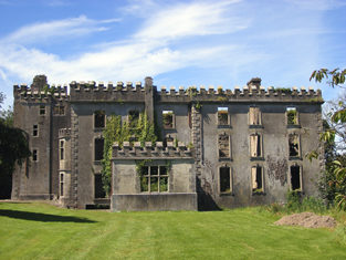
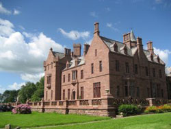
| Carrigrohane Castle | A fortified house that came into the possession of the Hoare family through marriage with a member of the Baker family in the 1770s. In 1786 Wilson refers to Carrigrohan as the seat of Mr. Colthurst. Reconstructed in the 1830s by Augustus Robert McSweeny, a corn merchant, who also leased the floor mills nearby. At the time of Griffith's Valuation Jane McSweeny was resident. The Castle later reverted back to the Hoares who owned it until the 1940s. They are mentioned by the Irish Tourist Association survey as resident there. It is still extant. |

|
| Carrigshane | Thomas Smithwick held a house valued at £15 with 44 acres from the representatives of Viscount Midleton at the time of Griffith's Valuation. This may be the property mentioned by Wilson as "Carrig" in 1786, a seat of the Uniacke family. Buildings are still extant at this site. | |
| Carrolton House | The house known as Beagh Lodge, an O'Carroll house, is shown on the First Edition Ordnance Survey . It is not visible on the 25-inch Ordnance Map of the 1890s. A house on a nearby site is labelled Carrolton House on the latter map. The original house is not extant though there are later buildings. |

|
| Carrowbarra House | In 1798 ‘Carrowbarragh’ was associated with William Campbell an attorney-at-law who immigrated to Canada. In the 1830s Lewis records Carrowbarrow as the home of the Reverend Michael Fox Dudgeon who married Mary Moore of Moore Fort, Ballymoney, Co Antrim. Later he was vicar of Cratfield, Surrey. Henry Dudgeon occupied a house valued at £1.10.0. in Carrowbarra Island at the time of Griffith’s Valuation. He held the property from Owen B. Cole and Olivia Lucas. Owen B. Cole and Olivia Lucas were the lessor of the townlands of Carrowbarra and Carrowbarra Island. Mary Johnston occupied a house valued at £6 in Carrowbarra townland in the 1850s. A substantial house named Carrowbarra House is marked on the 25 inch map in Carrowbarra Island. | |
| Carrowbeg | Occupied by Patrick Sweeney in 1814 and by Richard O'Grady at the time of Griffith's Valuation. The house has been renovated and modernized and is still inhabited. |
|
| Carrowbeg House | A former Bodkin house, the home of the Lynch family in the second half of the 19th century and early part of the 20th century. It was held in fee by Dominick Lynch at the time of Griffith's Valuation when it was valued at £8. It is still extant and in use. |
|
| Carrowbrowne Castle | In 1786 Wilson refers to Carrowbrowne as the seat of Mr. Blake. This may refer to Walter Blake as family history records suggest some of his children were born at Carrowbrowne. The castle is shown and labelled on the 1st edition Ordnance Survey map of 1842. The townland is part of Lord Oranmore and Browne's estate at the time of Griffith's Valuation. By the time of the 25-inch edition of the 1890s it is shown as "in ruins". Some ruins still remain at the site. | |
| Carrowcanon House | Thomas Olpherts was occupying the property at Carrowcanon at the time of Griffiths Valuation when it was valued at £15. Lewis had recorded it as the seat of T. Olpherts in 1837. This property seems to have developed at what was the site of a formal garden in Carrowcanon townland as shown on the 1st edition Ordnance Survey map of the 1830s. Buildings still exist at the site | |
| Carrowcrin | The Census of Elphin records Robert Burrowes as resident at Caracin in 1749. Johnston Burrowes was leasing a property valued at £3 to the Beatty family at Carrowcrin, barony of Tirerrill at the time of Griffith's Valuation. McTernan states that the property remained in the Burrows family until the early 1900s. It became vacant after the last of the family died and was eventually converted into farm-buildings. | |
| Carrowculleen House | At the time of Griffith's Valuation, Lecarrow was the property of Thomas Guilfoyle and was valued at £14. In 1906 Anthony Guilfoyle was the owner of the house at Lecarrow, valued at £31. McTernan notes that the property was purchased by Anthony Gilfoyle, a leading Sligo merchant, c.1806. It was extended in the 1840s. From the 1920s until the 1990s it was owned by the Mercy Order. The house is now part of the Holy Hill Hermitage complex. |
|
| Carrowdotia House | A house on the Vandeleur estate, it was the residence of William Daxon in 1814 and of R.D.Daxon in 1837. Valued at £17 at the time of Griffith's Valuation and occupied by James Cathro. This house now appears to be the centre of a working farm. |

|
| Carrowduff | Two houses are marked in the townland of Carrowduff on the first Ordnance Survey map. One was 'in ruins', R055 764. The other was named Emma Ville. At the time of Griffith's Valuation John Gray held a house valued at £15 and 56 acres from the Wyndham estate in this townland. Carrowduff House appears to have been renovated as it is labelled on both the 25-inch 1890s and the 1942 edition of the Ordnance Survey map. Neither house is extant now. | |
| Carrowgarriff | At the time of Griffith's Valuation, Edward Power was leasing this property from the Osborne estate when it was valued at £11 10s. The site is now occupied by farm buildings. | |
| Carrowgarry | In 1906 Alexander Crichton was the owner of Carrowgarry House, valued at £37. At the time of Griffith's Valuation, a herd's house, valued at £3 and part of the Crichton estate, was located here. |
|
| Carrowgowan | From at least 1814 the house was occupied by the Deanes who held it from Colonel McAlpine, who held from John Knox of Castlereagh. The house was described as in good repair, with offices, orchard and garden. Daniel H. Mellet occupied the house at the time of Griffith's Valuation. It is now demolished. | |
| Carrowkeel | At the time of Griffith's Valuation John F. MacDonagh held property valued at £12 at Carrowkeel, barony of Corran, from the Gore Booth estate. Lewis also records this as a MacDonagh property, describing it as a "fine modern residence". McTernan notes that Carrowkeel was probably built by Francis MacDonagh at the beginning of the nineteenth century. It remained in the family until its sale in the Landed Estates Court. It is still extant and occupied. | |
| Carrowkeel | In the Ordnance Survey Name Books of the 1830s Carrowkeel House, the residence of Walter Bourke, is described as "in good repair". The house was valued at £6 at the time of Griffith's Valuation. It is labelled Carrowkeel House on the 1st edition Ordnance Survey map of 1838 but is not shown on the 25-inch edition of the 1890s. | |
| Carrowkeel | James U. Burke was leasing the house at Carrowkeel from Charles Farrell at the time of Griffith's Valuation when it was valued at £9. In the 1830s the Ordnance Survey Name Books mention "a good dwelling and ornamental grounds" in the townland of Carrowkeel. It is still extant and occupied. |
|
| Carrowleana House | At the time of Griffith's Valuation occupied by Andrew W. Irwin and valued at £15. The house has been demolished but the stables are still extant. | |
| Carrowmanagh Cottage | Carrowmanagh Cottage was the residence of Rev. Edward Hartigan in 1814. In 1837 Lewis records it as the seat of Thomas Bermingham. It was included in the sale of the Ashtown estate in the Encumbered Estates court in 1851. At the time of Griffith's Valuation it was leased by Rev. Frederick Trench to Crawford Allen. Some ruins remain at the site. | |
| Carrowmore | An early 19th century Palmer house, the home of a member of the Palmer family from the late 18th century. Wilson refers to it as the seat of Mr. Palmer in 1786. In the 1850s it was occupied by Captain Arthur Wade and valued at £20. A McCormick home in the 20th century. A house still exists at the site. |
|
| Carrowmore | Carrowmore was occupied by John Davis at the time of Griffith's Valuation, when it was valued at £8 and leased from the Gunning estate. It is labelled Carrowmore House on the 25-inch Ordnance Survey map of the 1890s. A house still exists at the site. | |
| Carrowmore/Carramore | Wilson notes "Keromore" as the seat of Mr. Vaughan in 1786. The Ordnance Survey Name Books refer to the house as "a modern structure built in 1819". At the time of Griffith's Valuation it was held in fee by Captain O. Jackson and valued at £30. The Irish Tourist Association File states it was a guest house in the 1940s run by Mrs Reid. Bence Jones writes that it is now a ruin. | |
| Carrownacregg West | Originally a Concannon house, sold to the Brownes in 1851 when it was in need of repair and to the Hughes family in the early 20th century. The original house is no longer extant. |
|
| Carrownacroagh | Home of William Skerrett in the 1830s. By the time of Griffith's Valuation, the townland was in the possession of Dominick O'Flaherty but there was no house with a valuation greater than £2. |
|
| Carrownaff Cottage | A house labelled Carrownaff Cottage appears in Carrownaff townland on the 25-inch edition Ordnance Survey Map. John Barr was leasing a property from the Hazlett estate at the time of Griffith’s Valuation, which was valued at £14. | |
| Carrownaff Lodge | Newspaper reports from the 1860s describe William Hazlett as of “Carrownaff Lodge”, Moville. This house appears on the 25-inch edition Ordnance Survey map of the early 20th century. The National Inventory of Architectural Heritage suggests a date of c.1860 for the construction of buildings at the site of Carrownaff Lodge, which is now demolished. | |
| Carrownamaddy (Burt) | At the time of Griffiths Valuation in the 1850s, Joseph Dysart was leasing this property from Lord Templemore (Chichester) estate, when it was valued at £15. A house and substantial farm remain at the site. | |
| Carrownea | At the time of Griffith's Valuation, William Evans was leasing a property valued at £10 at Carrownea, parish of Ballymacward, from the Clancarty estate. Earlier in 1837, Lewis had recorded Carrownea as the seat of J. Fitzsimons. Flynn writes that, in 1850, the lease of Carrownea House and lands passed to William Evans, brother of John Cannon Evans of Cross House. There is still an extant house at Carrownea. | |
| Carrowneden | Jon Treston was leasing this house, valued at £4, from the O'Farrell estate at the time of Griffith's Valuation. A house is still extant at the site. | |
| Carrowntryla | Occupied by Henry esq in the 1770s and in 1786. It was the home of the Handcock family in the 19th century, sold to Captain Dick in 1897 and occupied by him in the early years of the 20th century. Bought by Major Gerald Stratford Handcock in 1928 and inherited by his niece, Mrs Voss, who sold the house to Hector McDonnell, a Galway building contractor. The house is no longer extant. |
|
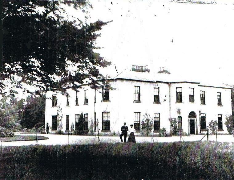
| Carrownure House | In the mid 1850s valued at £20 and owned by Richard Bond in fee, who advertised it for sale in 1856. Described as a modern edifice on the shore of Lough Ree. The sale rental includes a lithograph. Bought by Bernard William Bagot in 1858 from Edward John Irwin. Sold by the Bagots to Samuel Auchmuty in 1903. Owned by the Auchmutys in the 20th century and known as Carnure House. |

|
| Carrowpadden | Carrowpadden House is marked on the Taylor and Skinner map of 1778. In 1786 Wilson refers to it as the seat of Mr. Higgins. A herd's house occupied by Thomas Higgins who held it from James Higgins is recorded in the townland of Carrowpadden East at the time of Griffith's Valuation. It was valued at almost £5. This property appears to have been built after the first Ordnance Survey map was published. There is still a house extant at the site. | |
| Carrowreagh | Richard O'Farrell Caddell was leasing a "herd's" house valued at £8, together with over 350 acres, at Carrowreagh, barony of Boyle, to Thomas Boylan, at the time of Griffith's Valuation. A house and farm are still extant at the site. Patrick Fox was leasing a mill property from the Caddell estate in the same townland. Some stone buildings remain at the site though the mill was described as "in ruins" on the 25-inch Ordnance Survey map of the 1890s. | |
| Carrowroe House | In 1786, Wilson refers to "Carrorowe, at present uninhabited". At the time of Griffith's Valuation, John Dennis was leasing a property at Carrowroe North, barony of Athenry, valued at £15, from Lord Dunsandle's estate. Buildings remain at the site. |
|
| Carrowroe Lodge | Sir Thomas Burke's estate held a house valued at £8 at Carrowroe in the parish of Ballynakill, barony of Leitrim, in 1856. Lewis records Carrowroe Lodge as the residence of H. Clarke in 1837. It was the property of Sir Henry Burke in 1906 when it was valued at just over £8. This house is still extant and occupied though it has been modernised. |
|
| Carrowroe Park | The home of the Goff family in the 19th century. Described by Lewis as a substantial and handsome mansion of limestone with a Doric portico, the residence of R. Goff. In the 1850s occupied by the Reverend William Battersby, who held the property from the Earl of Essex. Reverend Battersby was married to Mary Maud Caulfield, a daughter of John Caulfield, Archdeacon of Kilmore. The house was valued at £65. By the 1870s the residence of John Burke and the seat of Lt-Col. Michael A. Burke in 1894. Still extant and offered for sale in 2008 (Irish Times, 5 June 2008). |
|
| Carthage House (Inishowen) | Thomas Jackson was leasing this property from the Young estate at the time of Griffith’s Valuation, in the 1850s, when it was valued at £13. In 1837 Lewis referred to it as the seat of Reverend James Knox. The National Inventory of Architectural Heritage suggests it was built around 1775. It is still extant and occupied. |
|
| Cartown | Built in 1763 Cartown was the residence of Mr Baldwin in 1826 and of John Edward Langford in 1837. In the early 1850s Griffith's Valuation records the vacant house as valued at £24, William Sheedy holding the whole townland from General James Caulfeild. By the late 19th century the house was in the possession of the Westropp family. This house is still extant and occupied. |
|
| Cartown | In 1783 Taylor and Skinner recorded Cartown, close to the town of Carrick-on-Shannon, as a seat of the Cunningham family and Wilson, writing in 1786, also refers to it as the seat of Mr. Cunningham. At the time of Griffith's Valuation George Church was in possession of a property in this townland, valued at £12, described as "unfinished". The house shown on the 25-inch Ordnance Survey map of the 1890s is substantially larger than the 18th century house. The house now at this site has had commercial premises attached to it but is still extant. |
|
| Cartron | Occupied by Francis Flanagan at the time of Griffith's Valuation, who held it from James Murphy. | |
| Cartron | A 19th century house used as a summer residence by the Brady/Brady Browne family, now a ruin. | |
| Cartron | Built by Joseph Reville at a cost of nearly £1,000, Cartron was held by the Revilles under a lease dated 31 Oct 1856 from Robert Graham to Richard Reville for 3 lives and 87 years. The home of a member of the Lushington Tulloch family in 1906 and still remains in the possession of a descendent of this family. |
|
| Cartron (Duniry) | In 1906 Lawrence Egan owned a property valued at £5 at Cartron, barony of Leitrim, county Galway. Patrick Egan had held almost 200 acres here at the time of Griffith's Valuation but the buildings valuation at that time was less than £1. A house still occupies the site. | |
| Cartron (King) | The home of the Waldron family in the 18th and early 19th centuries. Occupied by Gilbert Hogg in 1837. Valued at £10 and occupied by John B. Hogg at the time of Griffith's Valuation who held the house from Sir Gilbert King. A substantial farm is still extant at the site. | |
| Cartron House (Ballymahon) | At the time of Griffiths Valuation in the 1850s, Thomas Wright was leasing this property from the King Harman estate when it was valued at £10. In 1837 it was noted by Lewis as the seat of J. Wright. It is still extant. |
|
| Cartron House (Ballynakill) | On the first-edition Ordance Survey map this building is labelled "police barracks" but is shown on the 25-inch map of hte 1890s as Cartron House. At the time of Griffith's Valuation it was still a police barracks and valued at over £12, when it was part of the estate of Sir Thomas Burke of Marble Hill. Madden states that evictions on this estate had resulted in buildings in the area being attacked. Cartron House is still extant and occupied. |

|
| Cartroncar House | Richard Taylor was leasing this property from Thomas Bond’s estate at the time of Griffiths Valuation, when it was valued at £25. In 1835 James Bond was recorded by the valuers as the occupier and the house had a valuation of £32. The Ordnance Survey Name Books note the existence of the house and demesne of Cartroncar in the townland, 'the seat of J.W. Bond'. It is still extant but disused. |
|
| Cashel | Built by Thomas Hazell for his agent. Hazell was leasing land from the Law Life Assurance Society at the time of Griffith's Valuation, when the house was valued at £6. Bought by James O'Mara (1873-1948) circa 1924, who was a Home Rule supporter and later a member of Sinn Fein. He represented South Kilkenny in the House of Commons and in the first Dáil Éireann. In 1952 the house became the home of Lieutenant Colonel and Mrs Browne Clayton. The house is now run as a hotel by the McEvilly family. |
|
| Cashel House | Built before 1838, this house was the residence of the Blakes of 'Tully' and was occupied by James Blake, nephew and agent, to his uncle Patrick Blake in the mid 19th century. Arthur Blake, succeeded his father at Cashel and lived there until about the 1870s. The Blakes were very unpopular landlords and the house is now in ruins. | |
| Cashel House (Kilmacabea) | William Wolfe was leasing this property, then valued at £12, from Miss Wheeler, at the time of Griffith's Valuation. Local records suggest the family were associated with this house since the eighteenth century. The original house is no longer extant and a modern house exists at the site now. | |
| Cashelmore House | In 1851 Thomas Beamish was leasing this property from Richard Longfield O'Connor when it was valued at £18. Lewis refers to it as the seat of J. Beamish in 1837. It was the residence of John Beamish in 1814. Buildings are still extant at the site. | |
| Cashlieve House | Lewis describes a house at Cashla in the parish of Kiltullagh as a sporting lodge belonging to W.R. Wills in 1837. In the 1850s William Sandford owned a property valued at £24 at Cashlieve, barony of Castlereagh. The house now known as Cashlieve House was built in the later nineteenth century. |
|
| Casino | Mrs Hyde was residing at Cassina, Castlemartyr in 1814 and in the early 1850s it was occupied by Wallace Adam Walker who held the property from the Earl of Shannon. The buildings were valued at £20. W.A. Walker was still resident in the 1870s. This house is still in use as a residence. |
|
| Casino House | At the time of Griffith's Valuation, Eliza Sealy was leasing this property to Sidney Howe, when it was valued at almost £7. Casino House is now a gourmet restaurant. See www.casinohouse.ie. |
|
| Castle (Newtowncunningham) | Henry McCoy was leasing this property from John S. Law at the time of Griffiths Valuation in the 1850s, when it was valued at £17 10s. The lease also included two flaxmills. This property is labelled Castle on all editions of the Ordnance Survey maps. Campbell records that in the 1790s, the Castle in Newtowncunningham was the home of Lady Hamilton, widow of Sir Henry Hamilton and that the McFarland family were the last occupants. | |
| Castle Bellew | Occupied by Peter Geraghty in the mid 1850s when it was valued at almost £9, this house is labelled as Castle Bellew House on the 25-inch Ordnance Survey map of the 1890s. It is no longer extant with some ruins remaining at the site. | |
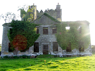
| Castle Bernard | Described by Lewis in 1837 as " a stately mansion, built in 1806, adjacent to the site of the former castle" and originally known as Castle Mahon. It was the seat of the Bernard family in the late 1770s and 1780s and then known as Castlebernard. Occupied by Viscount Bernard at the time of Griffith's Valuation and valued at £120. It was burnt in June 1921 and is now a ruin adjacent to Bandon Golf Club. |

|
| Castle Biggs/Drominagh | The Smythe sale rental of July 1870 states that the original lease (1711) was from Godfrey Boate and Benjamin Friend to William Biggs. Built by the Biggs family on the shore of Lough Derg this house was occupied by William L. Biggs in 1814 and by Dr W. Biggs in 1837. In 1840 the Ordnance Survey Name Books refer to Castle Biggs as "a most commodious house". Edward Biggs was resident in the mid 19th century, holding the property from Sir John Power. The house was valued at £22. The sale rental of November 1853 describes this "3-storey mansion containing every necessity and a range of out offices". It was in the possession of Edward Biggs, the owner, and was bought by Captain William Tuthill. William Tuthill sold the property to Frederick Smythe in 1859. It was for sale again in July 1870. At this time the Esmondes of county Wexford bought it from Frederick Smythe. In the early 1940s owned by Owen Esmonde but purchased by the Moss family in the 1940s. It is still extant. |
|
| Castle Cooke | A house was located here from the 17th century. Originally home of the Cooke family it was altered and expanded in the succeeding centuries by the Collis family. William Collis was resident for much of the 19th century. The house was valued at £32 in the early 1850s and at £34 when occupied by Colonel William Cooke Collis in 1906. It was burnt in June 1921 during the War of Independence when it was the residence of Col. William Cooke-Collis. This house is no longer extant. | |
| Castle Cosby | Castle Cosby was situated close to a small lough of the same name. A number of other country houses were located in close proximity, such as Lismore. J. Whitethorne was resident at Castle Cosby in the 1830s and 1840s. By the mid-1850s Andrew Smith was the occupant holding the property from John E. Vernon. It was valued at £16. In 1876, Philip Smith of Castlecosby owned 77 acres in co Cavan. He married Delia Mary daughter of Corney Banahan of Renny, Co Roscommon and had a number of sons who became doctors. His third son Frederick Paul married in 1905 Isabella Ann daughter of Edward Smith of Bellamont Forest. Castlecosby was mainly known as Kevit Castle under Smith ownership. The house is now demolished but a gate lodge is still extant. |
|
| Castle Cove | Thomas Jermyn was leasing a house valued at £10 10s to John Jermyn at the time of Griffith’s Valuation. Lewis describes Castle Cove as the seat of Mr. O'Sullivan in 1837 though he may have been referring to West Cove House. Leet, in 1814, mentions "Cooe Castle" as the seat of David Jermyn, Bary notes that Castle Cove was in the possession of the Jermyn family in the nineteenth century. They were agents for the Bland estate. It is no longer extant. | |
| Castle Dargan | At the time of Griffith's Valuation, Castle Dargan was the property of John Ormsby and was valued at £14. McTernan writes that the Ormsbys had been in possession of the lands since the seventeenth century and had lived at the "old" castle before the building of the house. In 1906 it was owned by John Hosie. It continued in the Hosie family until c.2004 when it was converted into a hotel and golf course. The house has been refurbished and is in use. See www.castledargan.com |
|
| Castle Downeen | James Courcey was leasing Castle Downeen from Rev. John Smyth in 1851 when it was valued at £23 10s. Lewis refers to the house as the seat of R. Smith in 1837. Shown as a Smith residence on Taylor and Skinner's 1783 map. In 1944 the Irish Tourist Association Survey refers to "Duneen" as "now a farmer's dwelling". It is now a ruin. | |
| Castle Ellen | Castle Ellen was built in 1810. It is described as the property of Captain Lambert in the Ordnance Survey Name Books. At the time of Griffith's Valuation it was owned by Walter Lambert and was valued at £21. In 1906 it was owned by the representatives of Peter F. Lambert at which time it was valued at £35. It is still extant and occupied. For more information see www.castleellen.com. For more information on the genealogy of the Lambert family see http://www.familylambert.net/History/index.htm |
|
| Castle Eyre/Listarkin | At the time of Griffith's Valuation, Colonel W. French was leasing this property to William Lowth, when it was valued at £9 15s. It is labelled Castle Eyre on the 1st Edition Ordnance Survey Map but as Listarkin on the 25-inch map of the 1890s. It is still extant and occupied. |

|
| Castle Farm | IN 1851 the farmhouse at Castlelands was held in fee by the Devonshire estate and valued at £27. The farm house is still extant and occupied. A large farmyard complex was located at X035986. In 1906 the buildings at this location had a valuation of £15 10s. |

|
| Castle Fogarty | Lewis writes that Castle Fogarty was "the ancient seat of the O'Fogarty family from whom it descended to the present proprietor J. Lanigan". He describes it as a "square castellated mansion, with embattled towers at the angles". The seat of the Lenigan family in the 18th and 19th centuries [held from the Earls of Portarlington until the fee was purchased in the mid 19th century]. Noted by Slater as the seat of Captain Vivian Ryan-Lanigan in 1894. A ruin since it was burnt in 1922. |
|
| Castle Freke | At the time of Griffith's Valuation, it was held in fee by Lady Carbery and valued at £90. In 1906 it was held by the trustees of Lord Carbery and valued at £136 . The existing building at Castlefreke was constructed at the end of the eighteenth century, replacing an earlier castle which had belonged to the Barry family, the original owners of the estate. It was modified in the late nineteenth century but subsequently gutted by fire in 1910 and restored by 1913. It was sold by John, 10th Lord Carbery, after WWI. In the early 1940s the Irish Tourist Association survey reported that it was unoccupied but in good repair and owned by the Land Commission. Castlefreke fell into ruin throughout the twentieth century but a portion of it has since been restored |
|
| Castle Garde | The seat of Hugh M. O'Grady at the time of Griffith's Valuation, held by him in fee. Powell writes in his list of Jurors that it was built by Hugh's father the Honourable Waller O'Grady circa 1830. Valued at £38 in 1906. It is still extant. |
|
| Castle Gore | The old Bourke Castle on the river Deel was granted to the Gores at the end of 17th century. They added a large wing to the old castle in the 18th century and renamed it Castle Gore. The castle along with other lands was leased to James Cuff, Lord Tyrawley towards the end of the 18th century. Wilson refers to it as "the pleasant old seat of the Earl of Arran, now occupied by Rt. Hon. James Cuffe" in 1786. Occupied by the Cuff's steward for part of the 19th century. At the time of Griffith's Valuation it was occupied by Captain St. George Cuffe and valued at £60. In 1894 Slater refers to it as a seat of the Earls of Arran though this may refer to the late eighteenth century house nearby. |

|
| Castle Grove (Kilmacrenan) | Castlegrove House, parish of Aghanunshin, barony of Kilmacrenan, was held in fee by James Grove Wood in the 1850s. The National Inventory of Architectural Heritage suggests it was built c.1750 but modified in the nineteenth century. By 1906 it was owned by John W.C. Grove and valued at £40. It is now a luxury country house hotel. |
|
| Castle Hamilton | In the mid-18th century Castle Hamilton came into the possession of the Southwell family through marriage with a Hamilton co-heiress. It remained in Southwell ownership until about the 1840s. Both Leet and Lewis record members of the Southwell family as resident. Lewis describes the house as ‘a spacious mansion surrounded by an extensive and highly embellished demesne’ adjoining the town of Killeshandra. The buildings were valued at £50 in the mid-19th century, by which time James Hamilton was owner and occupier. The Hamiltons were still resident at the time of the censuses of 1901 and 1911. The house was accidentally destroyed by fire in 1911 but a fine farm yard survives. |

|
| Castle Harrison | An early 18th century house, the seat of the Harrison family until the 1950s. According to Lewis it was built on the site of Castle Dod, an old Fitzgerald castle and was inhabited by Standish Harrison in 1837. A map dated 1736 in the National Library includes a drawing of the house then known as Castle Dodd. In the 1940s the Irish Tourist Association Survey noted that it was the residence of Mrs. Harrison, widow of General Harrison. It provides a description of the great hall which contained artefacts that had been unearthed on the estate during the construction of the nearby railway. Castle Harrison was inherited by five sisters in 1951 and the estate was sold to the Land Commission in 1956. The house was subsequently demolished. | |
| Castle Hewson | The seat of the Hewson family of county Limerick. William Hewson was in residence at the time of Griffith's Valuation when the buildings were valued at £23. Castle Hewson is no longer occupied but William Hewson, a descendant of George Hewson, resides in a building closeby and is restoring the property. A tower house stands beside the house. |

|
| Castle House (Baltimore) | William Cuthbert was leasing this property from Lady Carbery's estate at the time of Griffith's Valuation, when it was valued at £12 5s. In 1837 Lewis noted Baltimore House as the seat of Jno. Collins. This house is no longer extant and modern buildings occupy the site. | |
| Castle House (Inishowen) | Catherine Chichester held this property in fee at the time of Griffiths Valuation in the 1850s when it was valued at £23. The house remained until the mid 20th century but modern buildings now occupy the site. | |
| Castle Hyde | A late 18th century house, which was the home of the Hyde family. In 1786 Wilson describes it as "a beautiful house, magnificent demesne, highly cultivated, the seat of Arthur Hyde". At the time of the sale of Castle Hyde in 1851 the house was occupied by Spencer Cosby Price, the brother-in-law of John Hyde. The house was valued at £115. Castle Hyde was bought by John Sadleir MP in trust [for Vincent Scully]. Major Chichester was the tenant from year to year in 1861. John Wrixon Becher, second son of Sir William Wrixon Becher of Ballygiblin, county Cork, subsequently lived at Castle Hyde. in the 1870s John R. Wrixon of Castle Hyde is recorded as the owner of 1,263 acres in county Cork. He was resident in 1906 when the buildings were valued at £96. The Irish Tourist Association Survey of 1942 indicated that the house was then "occupied by the military". Castle Hyde is now the home of dancer, Michael Flatley. |

|
| Castle Ievers | The Ievers were living at Castle Ievers, originally known as Tullerboy, from the mid 18th century. Bence Jones dates this house from the early 19th century. Robert Ivers was resident in 1814, 1837 and at the time of Griffith's Valuation when the buildings were valued at £32. The property was held from William Maunsell. The Irish Tourist Association surveyor wrote in 1943 that much of Tullerboy Castle was demolished in the 1860s to make way for the present building. The owner in the 1940s was Roderic Haines. |

|
| Castle Ishen | Castle Ishen was the seat of the Fitzgerald family from the mid 17th century until the late 19th century. In the late 18th century the castle was replaced by the house which stands today. In the 19th century the house was occupied by the estate agents, members of the Hannigan and O'Leary families although Lady Fitzgerald, widow of the 8th Baronet, is recorded as the occupier at the time of Griffith's Valuation. She held the house valued at £10+ in fee. Her sons were both minors at the time. Hajba writes that the O'Learys purchased the house in the early 20th century. In 1944 the Irish Tourist Association Survey noted that they had first come there in the 1790s. Castle Ishen is still extant. | |
| Castle Island | Also known locally as the Rock of Lough Key, at the time of Griffith's Valuation Viscount Lorton's estate owned a house on Castle Island valued at £14. The original building on the island was a medieval stronghold of the McDermott family to which additions were made in the early 19th century. Renovation work was taking place on these buildings in 2007. |
|
| Castle Lackan | Wilson refers to Castle Lackan as" the fine seat" of Sir R. Palmer in 1786. It was occupied by James Cuff, Lord Tyrawley, early in the 19th century and later by his daughter and son-in-law, Jane and Charles Knox. It was held in fee by Colonel Charles Knox at the time of Griffith's Valuation, when it was valued at £50. It is now a ruin. |
|
| Castle Lambert | Castle Lambert was built in the later 18th century. At the time of Griffith's Valuation it was owned by Walter Lambert and was valued at £20. It is no longer extant, only the bell tower in the yard remains. |
|
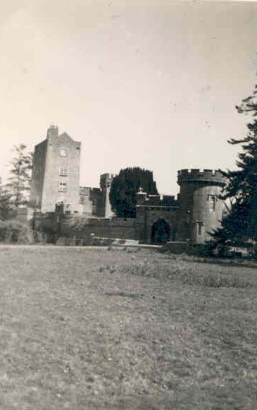
| Castle Leslie | The area around Glaslough was part of the MacMahon territory granted to Sir Thomas Ridgeway in 1608, who built a castle on his newly acquired lands. In 1665, Glaslough was bought from the Ridgeway trustees by Bishop Leslie and the castle became the home of the Leslie family. By the 1830s, Castle Leslie ‘situated about 6 chains to the north of the town of Glasslough’ was described as ‘a poor building and in a dilapidated state’. The present house, a Victorian edifice, sometimes known as Glaslough House, is described in the National Inventory of Architectural Heritage as ‘undoubtedly the finest country house in County Monaghan’. It was built for John Leslie in the 1870s to the design of Sir Charles Lanyon and William Henry Lynn. Located close to the site of the original Castle Leslie which it would appear from Shirley’s ‘History of the County of Monaghan’ was still extant in 1877 (page 147, includes drawing) but was demolished soon afterwards. In the mid-19th century the building was valued at £55 and held by Charles P. Leslie in fee. A caretaker’s house and farm buildings valued at £60 were located in the townland of Kiltybegs to the north east. By 1906, the rateable valuation of this mansion was £300. It was occupied by a butler and other servants in 1901 and by Sir John Leslie in 1911. Castle Leslie now functions as a hotel run by Sammy Leslie, see https://www.castleleslie.com/ |
|
| Castle Lloyd | The seat of the Lloyd family in the 19th century, the sale rental of 1855 records that the original lease was from Robert Bradshaw to the Reverend Richard Lloyd, 8 Nov 1760. IN 1786 Wilson refers to Castle Lloyd as the seat of Rev. Mr. Lloyd. It was occupied by the Reverend Michael Foster in 1814 and by Thomas Lloyd in 1837. Although described by Lewis in 1837 as the handsome residence of Thomas Lloyd, the Ordnance Survey Field Name Book states that the house was in a neglected and decayed state in 1840 due to the death of "the Captain this year". By the time of Griffith's Valuation the house was leased to the Guardians of the Tipperary Union who were using it as a Workhouse. The buildings were valued at £44. Castle Lloyd was advertised for sale in November 1881 on 93 acres. It belonged to Patrick Daly who held it under a fee farm grant dated 12 July 1869 from Letitia Anne Bradshaw to William Daly. The Irish Tourist Association Survey of the early 1940s refers to the demolition of this house about 70 years previously and that only the circular tower remained of the extensive 18th century dwelling built by Captain Lloyd. |
|
| Castle Lodge | At the time of Griffith's Valuation, Richard Beatty was leasing a property valued at £6 from the Fury estate at Ballinphull, barony of Tireragh. McTernan notes that the Fury/Furey family owned this property up to the end of the nineteenth century but did not live there. The Ordnance Survey Field Name Books refer to Castle Lodge as "a handsome cottage in good repair". The house was burned during the Civil War but subsequently repaired. It is still extant but in disrepair. | |
| Castle Lodge/Fiddane House | At the time of Griffith's Valuation the property at Fiddaun was occupied by Edward Blacquiere and was valued at £10. Castle Lodge is recorded as the home of Charles Lopdell in 1814. In 1837 Lewis also recorded it as a seat of the Lopdell family. It is labelled Castle Lodge on the 1st edition Ordnance Survey map but as Fiddane House on the later 25-inch map of the 1890s. It is still extant and occupied. |
|
| Castle Lough | Martin Lawlor was leasing a property valued at £55 to Thomas Cotter at the time of Griffith’s Valuation. It is described by Lewis as the seat of D.S. Lawlor in 1837. Bary states that there was an earlier house, belonging to the Madden family, at this site. In the later 19th century, Thomas Cotter ran the property as an hotel. It has been incorporated into the Lake Hotel complex. See www.lakehotel.com. |

|
| Castle Lyons | Wilson, writing in 176, refers to the accidental burning of the seat of the Earls of Barrymore. "The mansion house, with the furniture and a valuable collection of pictures, were entirely destroyed by an accidental fire". Some ruins remain at the site. A dower house, built by the Barry family towards the end of the 18th century, is still extant and known as Berryhill. . | |
| Castle Mary | Lewis describes Ashgrove Castle or Castle Mary, the residence of the Reverend Trevor Lloyd Ashe, Lord of the Manor of Bansha, as a "castellated mansion in the Italian style of architecture, situated at the base of the Galtee mountains, 4,000 acres of which are attached to the estate". This house is marked on the first edition Ordnance Survey map. In 1840 the Ordnance Survey Name Books refer to it as the property of T.L. Ashe "of modern construction but in very bad repair". It is recorded as "in ruins" in the later 25 inch map of the 1890s. Land clearance has taken place in the area and nothing remains of Castle Mary. | |
| Castle Mary | An 18th century house, remodelled as a castle in the 19th century, home of a branch of the Longfield family. In 1786 Wilson give a description of the house including that "the west front of this mansion presents a view of Cork Harbour". Valued at £85 in the mid 19th century and held by Mountifort Longfield in fee. Bence Jones writes that this house was burnt in the early 1920s and is now a ruin. A new house was constructed from the old stable courtyard and the family continued to live there for periods of time during the 20th century until Castle Mary was acquired by the Hurley family in 1978. |
|
| Castle Matrix | In 1837 Lewis writes that the flour mill at Castle Matrix ''has been fitted up by the proprietor J. Southwell Brown esq in the most complete manner'' and that the Elizabethan square castle was being repaired. The Ordnance Survey Field Name Book records Castlematrix as a large 2 storey house ''with a new castle 6 stories high adjoining''. John S. Brown held Castle Matrix from Lord Southwell. In the mid 19th century the buildings including the flour mills were valued at £90. In the 1853 sale rental which includes a lithograph, the castle is described as having been repaired and added to "regardless of expense. There are 9 bedrooms in the Castle, besides dressing closets, bathrooms, water closets, a large dining room, drawing room and library with extensive suites of servants' apartments, and the entire fitted up in elegant and substanial style". Castle Matrix was the headquarters of the International Institute of Military History and of the Heraldy Society of Ireland until 1991. |
|
| Castle Neynoe/Ballysumaghan House | At the time of Griffith's Valuation, Richard B. Neynoe was leasing property at Ballysumaghan, barony of Tirerrill, to Henry Griffith, when it was valued at £30. Johnston states that Griffith changed its name to Ballysumaghan House. In 1906 it was the property of M.F.B. Stack. The house was stripped and the contents auctioned in the 1930s. Castle Neynoe was a ruin for many years but began to be restored in 2007. |
|
| Castle Nugent | At the time of Griffiths Valuation in the 1850s, William Webb was leasing this property from Arthur Kingston, when it was valued at £18. It was also recorded by Lewis as the seat of W. Webb in 1837. IN 1814 Leet referred to it as the residence of John West. The National Built Heritage Service suggests it was built c.1775. It is still extant but disused. |
|
| Castle Oliver | The original Castle Oliver or Clonodfoy was the home of the Oliver family in the 18th and early 19th centuries. It was replaced by the present building in the mid 19th century. In 1814 Castle Oliver was occupied by George Fosbery who may have been employed by the Olivers. In 1837 Lewis described the castle as being in a very dilapidated state. It then belonged to R. O. Gascoigne of the county of York whose bailiff resided in it. The new building was designed by George Fowler Jones and built in the Scottish baronial style for the Oliver Gascoignes. At the time of Griffith's Valuation the castle was valued at £75 and the house at £48 and both were in the possession of Elizabeth O. Gascoigne and her brother-in-law, Frederick Charles Trench. The house was eventually inherited by Elizabeth's step-grandson, William Cosby Trench. He was the occupier in 1906 when it was valued at £125. Restored in the early 21st century it now provides self catering accommodation and is a venue for functions such as weddings. |
|
| Castle Otway | Castle Otway was the seat of the Otway family in the 18th and 19th centuries. It was a mid 18th century house with a tower house attached, altered and renovated in the 19th century. In the mid 19th century the castle, valued at £47.17 shillings, was held by the Honourable Mrs Otway Cave in fee. The sale rental includes a lithograph of the house. Slater refers to it as the seat of William Otway Ruthven in 1894. The representatives of Robert J. Otway occupied this house in 1906. It is now a ruin. |
|
| Castle Park | At the time of Griffith's Valuation this house, valued at £41, was held by Sir Edward Tierney in fee. Still in use as a private residence, in 2014 it was offered for sale. |

|
| Castle Park House | William Kelly was occupying a house valued at £23, at Cuilleen, barony of Moycarn, at the time of Griffith's Valuation. It is described as "in ruins" on the 25-inch Ordnance Survey map of the 1890s. | |
| Castle Salem | This property had formerly belonged to the McCarthys but was acquired by William Morris and re-named Castle Salem. In 1786 Wilson refers to it as the seat of the Morris family but by the publication of the first Ordnance Survey Map it is labelled "Benduff Castle or Castle Salem, in ruins". This property, developed over several centuries, is still extant and occupied. |
|