Browse Houses
Search Results: Returned 5927 records. Displaying results 1001 – 1100
| House name | Description | |
|---|---|---|
| Brees/Brize | The original castle was the home of the Moore family in the 17th century. A house was later built which was the home of the Coghlan family in the early 19th century and was occupied by John and Mathew Anderson at the time of Griffith's Valuation, see http://familyhistory.oram.ca/burrishoole/?page_id=1345 . A house is still extant at this site. |
|
| Bregoge House | A house reputed to incorporate the remains of an old castle. Bregoge Castle was occupied by J. Rogers in 1837 and by John Rogers in the early 1850s. The property was held from the Earl of Egmont and the buildings were valued at £7. The Irish Tourist Association survey in the 1940s notes it as the residence of "Mr.Ryan, a commercial traveller". The house is still a family home. |

|
| Brewsterfield House | Daniel Reardon was leasing Brewsterfield House from the representatives of Rev. B. Herbert at the time of Griffith’s Valuation, when it was valued at £13 10s. Lewis notes it as the seat of Rev. B. Herbert in 1837. Bary suggests that it was built by Sir Francis Brewster in the early 18th century but may have been added to later by the Herberts. It later passed to the Orpen family through marriage and may have been resided in by their agent. The original house was demolished in 1985. There are modern buildings on the site including holiday cottages. | |
| Brianstown House | In 1837 Lewis refers to Brianstown as the seat of Thomas G. Auchmuty. At the time of Griffiths Valuation in the early 1850s, it was held in fee by Henry Musters when it was valued at £22. The earlier Valuation Office books from 1840 note Auchmuty as the owner and the Valuation as £24. In 1814 Leet referred to it as the residence of Samuel Auhmuty. Brianstown is still extant and occupied. |
|
| Brick Field | At the time of Griffith's Valuation William Phibbs held a property valued at £6 at Knockbrack, barony of Corran. In 1906 this property was valued at £11. | |
| Brickhill | The home of the Maghlin family in the early 18th century, it passed by marriage to the Blood family. Occupied by the Lysaght family in the mid 18th century. Edward Lysaght, songwriter and lawyer, known as 'Pleasant Ned' was born at Brickhill in 1763. The house is not named on the first Ordnance Survey map and a 20th century house now occupies the site. [Grid reference is approximate]. | |
| Bride Park | Hajba writes that the Reverend Stephen Rolleston built this house in the 1770s. In 1814 it was inhabited by the Reverend Spread and in the mid 19th century by Thomas Power who held it from Mrs Elina Greaves and others. The buildings were valued at £20+. Bride Park remained the home of the Power family until the early 20th century. This house has recently been renovated and restored. |

|
| Bride View | Occupied by Samuel Hawkes and held from the representatives of William Hawkes at the time of Griffith's Valuation. The buildings were valued at £13.10 shillings. The property at this location is labelled Knockanemore House on the 25-inch Ordnance Survey map of the 1890s. There is still an extant house at the site. | |
| Bride Villa | Hajba writes that this building was originally a coach inn. By the time of Griffith's Valuation Edward Barry a doctor was resident. He held the property valued at £14.15 shillings from Viscount Riversdale. This house is stil inhabited. |
|
| Bridestown | Leet records the Reverend Edward Carleton as resident at Bride-town, Rathcormack. E. Morgan was the proprietor in 1837 and at the time of Griffith's Valuation, holding the property in fee. The buildings were valued at £42. Bence Jones writes that the Morgans sold the property in the second half of the 19th century having been ruined by the gambling of Lady Louisa Morgan, known as "Unlimited Loo". Later the home of the Lindsay and Horgan families and still occupied. |

|
| Bridge Cottage (Inishowen) | Micah Cary Rankin was leasing this property to Mary Thompson at the time of Girffith’s Valuation, when it was valued at £10. This property was built after the publication of the 1st edition Ordnance Survey map and is labelled Bridge Cottage on subsequent maps. The local Carndonagh Heritage Society has a record of a diary (held at PRONI) kept by John Norris Thompson recounting repairs to the house in the mid-1850s. Buildings are still extant at the site. | |
| Bridgemount House (Drum) | The home of the Acton family in the 19th century and the seat of G.H.Acton in 1894. At the time of Griffith's Valuation it was held in fee by George Acton and valued at £10. It was later the home of the Coyne family and is still extant and occupied. |
|
| Bridgemount House (Dunmanway) | Leased by Daniel Connor Jun. from Daniel O'Sullivan at the time of Griffith's Valuation when it was valued at £10 10s. A house still occupies the site. | |
| Bridgetown (Burt) | At the time of Griffiths Valuation in the 1850s, John Scott was leasing this property from Lord Templemore’s estate when it was valued at £23 with an additional mill complex. Bridgetown is still extant and occupied. | |
| Bridgeview | Sir T. Herbert was leasing a property to Capt. W. Dalton at the time of Griffith’s valuation, when it was valued at £17. Bary states that this house was also occupied by the Misses Herbert and by Lady Godfrey at different times in the 19th century. It is no longer extant and modern houses have been built on the site. | |
| Bridgeville Park | Richard Orpen was leasing this property to Henry Orpen at the time of Griffith's Valuation, when it was valued at £7 15s. Capt. H. Orpen was recorded by Lewis in this property in 1837. In 1814, Leet mentions it as the seat of Henry Orpen. It is described as "in ruins" on the 1895 map. | |
| Brierfield | The Hawkes family built a chapel of ease at Brierfield in 1720. Brierfield was their main residence in the 18th and 19th centuries. Sold to Cox Cotton in the late 19th century, no longer extant. | |
| Brinny House | Brinny House was being leased by J.H. Wheatley to Rev. George Nash at the time of Griffith's Valuation, when it was valued at £30. In October 1854, it, together with the rest of Nash's property at Brinny, was offered for sale in the Encumbered Estates Court. The house is described in the sale notice as "in good repair". Lewis refers to it as the seat of J. Nash in 1837. In the late 1770s and 1780s it was the residence of Nash esq. In 1942 the Irish Tourist Association Survey referred to "a semi-derelict old mansion near Brinny Bridge, the reputed residence of Seán Dearg Nash, tyrannical provost of Bandon, 1690-1724". The original house is no longer extant. | |
| Brinny Rectory | Brinny Rectory was held in fee by Rev. James Gollock at the time of Griffith's Valuation, when it was valued at £25. The house is still extant and occupied. |
|
| Briska House | Leased by Robert Acheson from Col. Palliser in 1851 when it was valued at £11. On the 25-inch Ordnance Survey map of the 1890s it is named Briska House. A house is still extant at the site. | |
| Britfieldstown | The seat of the Roberts family in the 18th and 19th centuries. A small lithograph of the house is included in the sale rental of 1851. It was being leased by Sir Thomas Roberts to Michael Roberts at the time of Griffith's Valuation, when it was valued at £40. A second Roberts property in the same townland, valued at almost £8, was being leased to James D. Barry. Lewis refers to Britfieldstown as the seat of Sir T. Roberts in 1837. In 1854 Britfieldstown was purchased by Luke J. Shea in the Encumbered Estates Court. Bence Jones writes that it later became the home of the MacDonald family, sold by them in 1958 and derelict in the 1970s. It is no longer extant though several other estate buildings survive. |

|
| Brittas Castle | The original castle was burnt circa 1820 (Bence Jones) when the owner was Henry Grace Langley. His nephew Major Henry Langley began to build a Medieval Revival castle to the design of William V. Morrison but died when only the gate tower was completed. The Irish Tourist Association surveyor wrote that it was to be a replica of Warwick Castle. In 1840 the Ordnance Survey Name Books commented that Brittas Castle was "a modern unfurnished building on a most magnificent scale but in all probability it will never be finished"! In the mid 19th century Henry Langley held the castle valued at £30 from the Court of Chancery. The sale rental of December 1853 records Thomas Kirwan as the tenant of the castle and 464 acres for 7 years from 25 March 1851 pending the cause of Langley v Langley. From 1853 Brittas belonged to the Knox family who lived in a single storey house located behind the gate tower. This house was described as a mansion house in 1906, valued at £25 and occupied by Fitzroy Knox. |

|
| Brittas House | Built in the late 19th century by James O'Heney/Heney of Cashel and valued at £25 in 1906. Brittas House is now a stud farm belonging to Peter Magnier. | |
| Broadlands | The home of the Knox Gore family, let to Patrick C Howley in the 1830s. It was leased by John Knox, of the Rappa Castle family, at the time of Griffith's Valuation when the house was valued at £15 10s. . A house is still extant at this site. | |
| Brook Lodge | The Lord Chancellor is given as the occupier of this house at the time of Griffith's Valuation. The Court of Chancery may have held the property from John Denehy at this time. The buildings were valued at £13. In 1942 the Irish Tourist Association Survey notes that it was once the residence of General Sir Thomas Dennehy and was then owned and occupied by James Scannell. A new house is now located on the site. | |
| Brook Lodge | The Ordnance Survey Name Books refer to Brook Lodge in the south of this townland. The house is labelled Brook Lodge on the 1st edition Ordnance Survey map but seems to have disappeared by the time the 25-inch edition was published in the 1890s. Modern buildings occupy the site now. | |
| Brook Lodge/Dangan Ville | Occupied by William O'Connell in 1814 and by Pierce O'Brien who held it from Pierce Creagh in the mid 19th century, when the house was valued at over £13. By the 1870s this house, which is labelled Brooke Lodge on the 25-inch map of the 1890s, was the residence of Nicholas Henry Martin. A house is still extant at this site. | |
| Brook Ville (Kilmacabea) | Leased by John Morris to John Hungerford at the time of Griffith's Valuation, when it was valued at almost £8, Marriage records for the area record it was later the residence of the Wolfe family. On the 25-inch Ordnance Survey map the building at the site is labelled Corran House. The National Inventory of Architectural Heritage describes the property as a miller's house. |

|
| Brook Watson | Feltham Watson occupied Brook Watson in 1837 and at the time of Griffith's Valuation when the house was valued at £26 and held from the representatives of Peter Holmes. By 1870 in the hands of the Brereton family. |

|
| Brookdale House | A house occupied by Mr Robert Atkins in 1814 and described by Lewis in 1837 as the seat of A. Ormsby. Arthur Ormsby was married to Margaret the sister of Robert Atkins (of Firville). Margaret Ormsby was the immediate lessor of the house in the early 1850s when it was valued at £32 and occupied by John Bull. William Welland was tenant when the property part of the estate of Henry Wigmore was advertised for sale in 1871. | |
| Brooke Lodge | In 1848,Rev. Henry Bolton was leasing this property from Lord Waterford's estate when it was valued at over £29. The National Inventory of Architectural Heritage states that this house was built in the nineteenth century on the site of an earlier house owned by the Penrose family. It is still extant and occupied. |

|
| Brookfield | D. Cambie is recorded as the proprietor of Brookfield, Nenagh in 1814. The Ordnance Survey Name Books refer to Brookfield as the residence of E. Talbot but "Couns. Geddy [Grady] was the proprietor. In the mid 19th century John Parker was resident, holding the property from Henry D. Grady. The Parkers and Gradys were related. The house was valued at £17 and is still in use as a residence. John Parker was still resident in the 1870s. John's only daughter, Annie, married William James Reeves in 1892 and their eldest son was Henry Parker Reeves. This family is documented in the archive at Damer House, Roscrea. |
|
| Brookfield (Bandon) | Godfrey Baldwin was leasing this house from the representatives of Hugh Levinge at the time of Griffith's Valuation, when it was valued at £15. It is still extant though in need of refurbishment. |
|
| Brookfield (Carrigaline) | James Morgan was leasing this property valued at £24 from the Earl of Shannon's estate at the time of Griffith's Valuation. The house is no longer extant. | |
| Brookfield House | Arthur Loftus Tottenham was leasing a house valued at £14 to James Tate here in 1856. |
|
| Brookhill | Brookhill was situated on church land held by the Gonnes, who leased the house to the Kirwans in the late 1770s. Occupied by the Lambert family from the 1790s to the 1940s when it was sold to Gerald Maguire, a solicitor in Claremorris. Now the home of the Noone family. |
|
| Brookhill (Rossinver) | Brookhill is described as the residence of Capt. Johnston in 1835. At the time of Griffith's Valuation, it was occupied by Johnston Sharpe and valued at £10. In 1894 Slater notes that it was the seat of Capt. Forbes Johnston. It is the only Johnston residence still extant. |
|
| Brookhill House | In 1786 Wilson refers to Brookhill as the seat of Mr. Lowe. The 1st edition Ordnance Survey map shows Brookhill house, "in ruins", in Farranshea townland, parish of Peppardstown. An old manor house, also in ruins, is shown as well. The Ordnance Survey Name Books, in 1840, describe the site as "two large houses, one having its eastern end and the other, its eastern side, joining the ruins of the Old Manor House". At the time of Griffiths' Valuation, the townland was in the possession of the Hackett estate and the houses are described as "in ruins". The ruins are not shown on the later 25-inch map of the 1890s. | |
| Brooklawn | A Blake home occupied by John Griffin in 1814. At the time of Griffith's Valuation Charles Blake held the townland of Fartamore from James Lynch. A house valued at £10 was being leased from him by the Bord of Works. Fartamore is still extant but unoccupied. |
|
| Brooklawn | Occupied by James Taaffe in 1814. The residence of the Roman Catholic Bishop of Achonry in the mid 19th century. Still extant but not occupied. This house is now situated in county Roscommon. |
|
| Brooklawn | Labelled Brooklawn House on both the First and 25-inch editions of the Ordnance Survey map though the buildings are slightly apart. In 1837 this house was the residence of a branch of the Blake family. At the time of Griffith's Valuation the house was leased to Michael McDermott by Thomas J. Blakely [sic]. It is no longer extant. | |
| Brooklodge | This property was leased to Christopher French by Ambrose Deane on 16 June 1775 for 1 life and 99 years. He built a house which later became a Blake residence held from the Skerretts, who had inherited it from the Deanes. It was occupied by Martin J. Blake at the time of Griffith's Valuation, when it was valued at £40. The house is now a ruin. |
|
| Brooklodge | This house situated in the 6 acre townland of Brooklodge was the residence of Henry Marsden and his wife in the first part of the 19th century. By the time of Griffith's Valuation the Reverend Pierse Drew was resident. He was rector of Youghal and a member of the family of Drew of Mocollop Castle, county Waterford. The Reverend Drew held the property from John Pollock and it was valued at £40. | |
| Brooklodge House | A house and paper mill valued at £30 held by Mary Eliza Phair from the Reverend Robert Bury at the time of Griffith's Valuation. This Phair family were involved in paper mills in a number of townlands in this locality. | |
| Brookpark House (Dunmanway) | A property in the town of Dunmanway leased by Martha and Catherine Cox to John Hamilton in 1851 when it was valued at £16. It is still extant and well-maintained. |
|
| Brookvale | Sometime in the early 18th century Alexander Brooke, second son of William Brooke who purchased Drumavanagh from the Saundersons in 1685 (Burke’s), settled at Drumavanagh with his wife Catherine a daughter of Richard Young of Drumgoon. The present house known as Brookvale, was built in 1845 by William Hague, a successful building contractor. It was located on the outskirts of Cavan town near the train station. By the mid-19th century the Reverend Andrew Hogg was resident holding the buildings valued at £24 from William Hague, junior. This house is still a fine residence. It was advertised for sale in 2000 for £500,000 (Irish Times, 8 June 2000). | |
| Brookville | In 1840, the Ordnance Survey Name Books describe Brookville as "of very large dimensions, in very good repair, the residence of James Sadlier". He still lived at Brookville in the mid 19th century when the house was valued at £30 and held from James H. Smith Barry. This house, located on the south side of Tipperary town, is still a residence. |

|
| Brookville | Home of Cornelius O'Callaghan who held it from the Reverend Robert Bury in the mid 19th century. The buildings were valued at £35. |

|
| Brookville | Lewis records Brookville as the seat of Martin White in 1837. | |
| Brookville | Occupied by Charles Janns in 1814, by J. Mahon in 1837 and by Luke Brady who held the property from Anne and Eliza Griffin at the time of Griffith's Valuation when it was valued at £16. | |
| Brookville (Ballygowan) | Lewis records Brookville as the seat of Martin White in 1837. He was leasing the property from the Aylward estate at the time of Griffith's Valuation. The estate was "in Chancery" at the time when the buildings were valued at £7. A house still exists at the site. | |
| Broomfield | Both Lewis and the Ordnance Survey Field Name Book record Broomfield as the residence of W. Henry. It was located on the estate of the Marquess of Bath. By the time of Griffith’s Valuation (circa 1860) it was the home of the Reverend A. W. Campbell. The house alters somewhat in shape between the 1st edition 6 inch Ordnance Survey map (1836) and the 25 inch map (surveyed 1908). It was marked as a rectory on this map. This house was recently under reconstruction. | |
| Broomfield | A home of the Garde family in the second half of the 18th century. The residence of D. Humphreys in 1837 and of William Humphreys in the early 1850s. At this time the house was valued at £30 and held from the representatives of Viscount Midleton. This house is still in use as a residence. |
|
| Broomfield (Raphoe North) | John Humphreys was leasing this property from Robert Keys at the time of Griffiths Valuation, when it was valued at £20. It is labelled Broomfield on all editions of the Ordnance Survey maps. A house is still extant at this site. A second house, labelled Cumberland Lodge [C310024], is shown in this townland on the 25-inch Ordnance Survey map of the early 20th century. A house is still extant at this site. | |
| Broomfield Cottage | This house was located on the Leslie estate and dates from about the mid-19th century. At the time of Griffith’s Valuation it was occupied by George Scott and its buildings were valued at £12. Home of the McKenna family at the beginning of the 20th century. |
|
| Broomhill | Valued at £11, occupied by James Geran and held from James N. Cronin at the time of Griffith's Valuation. Later the home of a member of the Montgomery family and still inhabited. | |
| Broomhill House | Situated just north of Kilrush. Weir writes that this was an old house built before the town of Kilrush. It was occupied by Robert Parkinson in 1814 and by John Kelly at the time of Griffith's Valuation who held it from Colonel Crofton M. Vandeleur. A house is still extant at the site. | |
| Broomley | George Daunt was leasing Broomley from Reverend Thomas Townsend at the time of Griffith's Valuation, when it was valued at £18. Lewis refers to it as his seat in 1837. In 1942 the Irish Tourist Association Survey also noted it as a residence of the Daunt family. It is now a ruin. | |
| Brosna Rectory | In the 1830s, the Ordnance Survey Name Books record Rev. Joshua Jones as the proprietor of Brosna Glebe. Maurice Sandes was leasing the property to Rev. Edward Norman at the time of Griffith's Valuation when it was valued at £9. In 1906 it was the property of Falkiner Sandes and valued at £6. | |
| Brothersfort House | William Whiting held this property from the Devonshire estate in 1851 when it had a valuation of £18. Lewis also records it as his seat in 1837. The original house is not extant. | |
| Brown Hall | The house at Brownhall was valued at £35 at the time of Griffith’s Valuation, when it was occupied by James Hamilton, junior who held it in fee. Brownhall is still extant and occupied. In 1837 Lewis recorded it as the seat of Edward Hamilton.The house is labelled Brownhall on all editions of Ordnance Survey maps and a house remains at the site. The National Inventory of Architectural Heritage suggests the original part was constructed in the late seventeenth or early eighteenth century but the house currently in use is later than that. | |
| Brown Hall (Tirhugh) | James Hamilton held Brownhall in fee at the time of Griffith’s Valuation, when it was valued at £35. In 1837 Lewis recorded Brown Hall as the seat of Reverend Edward Hamilton. The house is labelled Brownhall on all editions of Ordnance Survey maps and a house remains at the site. The National Inventory of Architectural Heritage suggests the original part was constructed in the late seventeenth or early eighteenth century but the house currently in use is later than that. | |
| Brownhall | In 1786 Wilson refers to Brownehall as the seat of George Browne. Described in the Ordnance Survey Name Books of the 1830s as "a handsome, commodious building" . It was held in fee by James Browne at the time of Griffith's Valuation, when the house was valued at £25. It is no longer extant. | |
| Brownsmills | The representatives of T. Kearney held this property in fee at the time of Griffith's Valuation, when it was valued at £14 10s and included a mill complex. Portions of the mill complex have been converted into apartments. |
|
| Brownstown | In 1786 Wilson refers to Brownstown as the seat of Mr. Browne. This house is shown on the 1st edition Ordnance Survey map but marked 'in ruins' on the later 25-inch edition. The townland was in the possession of George Browne at the time of Griffith's Valuation. The Irish Tourist Association file describes the house as a 3-storey T shaped plain residence, uninhabited for about 60 years. |
|
| Brownstown | A house valued at £22 in the early 1850s occupied by Samuel Cooke and held from Captain Gould, original lease dated 31 May 1782. The present house at Brownstown is located slightly to the north east of the original house which is marked on the first edition Ordnance Survey map. | |
| Brownville | This house was originally known as Eyreville and was leased by the Martins to the Eyres in the latter half of the 18th century. Wilson refers to it as the seat of Mr. Eyre in 1786. In 1808 it was sold to James Valentine Browne and the name of the house was changed to Brownville. In the later 19th century it was the home of Dr McCormack, the Bishop of Galway. Portions of the original house may have been incorporated into out-buildings at the rear of the site. | |
| Bruce Hall | Thomas Hinds of Prussia Street, Dublin and previously of Bruce Hall, county Cavan, died in 1794. Henry B. Wilson was resident at Bruice-hall, Arva, in 1814. Bruce Hall was the home of John Warren in the mid-19th century. John Warren married Isabella, daughter of Captain James Blakely of Lake View, county Cavan, in 1856 (Anglo-Celt, 28 August 1856). He held Bruce Hall from Robert Burrowes and it was valued at £10 for rates. | |
| Bruckless | Andrew Cassidy was leasing Bruckless from the Tredennick estate at the time of Griffith’s Valuation in the 1850s, when it was valued at £18. The complex also included a tannery. In 1837 Lewis had referred to Cassidy's having a seat in Bruckless though he also notes a house there owned by Captain Nesbit. Bruckless was still occupied by the Cassidy family in 1911. The house is still extant and occupied. | |
| Bruckless Cottage | At the time of Griffith’s Valuation Bruckless Cottage was occupied by Lindsay Barrett, leasing from the Tredennick estate, when the house was valued at £15. It is labelled Bruckless Cottage on all editions of the Ordnance Survey maps. It is no longer extant. | |
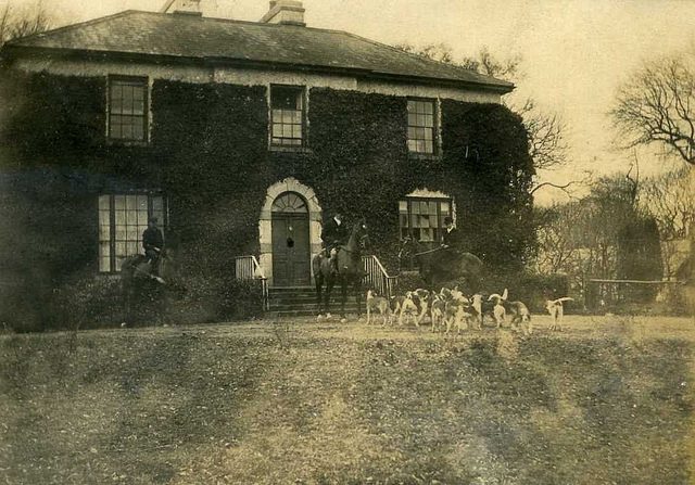
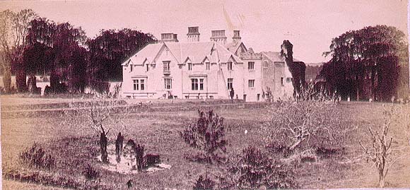
| Bruree House | Bruree House was also located on the Langton estate although at the time of the first Ordnance Survey the property was in the hands of Robert Fetherston who held a number of townlands in the parish, possibly from the Langtons. At the time of Griffith's Valuation the house was in use as an auxiliary workhouse. In 1853 Bruree House was sold to a member of the Shelton family and in 1868 it was sold to John Gubbins of the Kilfrush family. He was a successful racehorse owner and in 1884 built the present Bruree House. When he died in 1906 the property passed to his nephew John Norris Browning. The house was valued at £92 at this time. Owned by the Sheehans and Vernons in the 20th century. Now function as as a rehabilitation centre, known as Cuan Mhuire. A print entitled "The Lawn Meet" by Patrick Hennessy depicts this house. See www.museum.limerick.ie |

|
| Bruree Lodge | Bruree was the home of the Langton family in the 18th century. The house was occupied by Michael Ryan at the time of Griffith's Valuation and held from Michael Shaughnessy, it was valued at £13+. |
|
| Bulgaden Hall | An early residence of the Lords Carbery in county Limerick. Described by Lewis in 1830s as in a "ruinous condition". The site of Bulgaden Hall is noted on both the 1st and 25-edition Ordnance Survey maps. | |
| Bunalunn or Mount Music | At the time of Griffith's Valuation, Rev. Richard Webb was leasing this property from Col. Clarke's estate, when it was valued at £10. Lewis had noted it as the seat of R.F. Webb. Leet refers to it as the seat of Alex O'Driscoll in 1814. In 1906 Capt. Anthony Morgan was the owner of this property, then valued at £26 5s. The house is named Mount Music on the 1st edition Ordnance Survey map but as Bunalunn on the 25-inch edition of the 1890s. AS Mount Music it gave its name to a novel by the celebrated Anglo-Irish writers, Somerville and Ross. The house is still extant and was offered for sale in recent years. | |
| Bunavory | A house on the Molony estate, occupied by William Scanlan in the 1850s. The house is now divided into two residences. | |
| Bunbeg | Daniel Keon was leasing a property valued at £25 from the Hill estate at Bunbeg at the time of Griffiths Valuation in the late 1850s. | |
| Buncar House | The representatives of Rev. Denis Mahony were leasing this property to John O'Dowd at the time of Griffith's Valuation, when it was valued at £9 15s. Bary states that the Mahonys may orginally have built the house as a hunting lodge, perhaps at the beginning of the nineteenth century. It was enlarged several times afterwards and had several different owners. It is still extant though in need of renovation. | |
| Buncraggy | A home of the Burton family in the 18th century though Wilson refers to it as the seat of Mr. Armstrong in 1786. It was held by James O'Gorman from the Marquess of Conyngham at the time of Griffith's Valuation. The house remained in the possession of the O'Gorman family until the end of the 19th century when it became the property of the Caher family. The house is still occupied and the yard buildings are the centre of a farming enterprise. |

|
| Buncrana Castle | In 1837 Lewis noted Buncrana Castle as the seat of Mrs. Todd. At the time of Griffith’s Valuation, in 1857, it held in fee by Jonathan Richardson and valued at £20. Richardson was also the occupier of a spinning factory in the area, valued at £120. Local sources suggest that it was built by the Vaughan family and that the Todds bought it through the Court of Chancery in the early 19th century. By 1906 it was owned by Alexander R. Richardson and still valued at £20. Buncrana Castle is still extant. |
|
| Bungeggan | The 1906 Untenanted Demesnes survey records a valuation of £12 for this property then in the ownership of Joseph Dooner. At the time of Griffiths Valuation in the early 1850s this was a herd’s house, leased from William Wilson’s estate by Joseph Slevin and valued at almost £3. A stud farm occupies the site now. | |
| Bunkers Hill | A mid 19th century house, the home of James Forost (1827-1907), author of ''The History and Topography of the County of Clare'' (1893), who held the house and 139 acres from Lord George Quin. He was the eldest son of William Frost and his wife Mary Ryan and he married Bedelia daughter of Augustine Moran of Willbrook. He left the house to the Dundon family who sold it to the Ryans circa 1917. Members of the Ryan family still live at Bunkers Hill. | |
| Bunnacranagh House | Luke Colleran was leasing a property valued at £12 at Bunnacrannagh, barony of Leyny, from the Knox estate at the time of Griffith's Valuation. This house was built after the publication of the 1st edition Ordnance Survey map. It is labelled Bunnnacranagh House on the 25-inch edition of the 1890s. In the twentieth century part of this premises served as the post office for the village of Curry nearby. There is still an extant house at this site together with other remains of estate architecture. Part of the property was offered for sale in 2007. |
|
| Bunnahow | The home of a branch of the Butler family in the 18th and 19th centuries, which Weir writes was rebuilt in 1808. Occupied by William Butler in 1814, 1837 and at the time of Griffith's Valuation when the house was valued at £35. The property was conveyed to Robert T. Lattey in May 1896. The house no longer exists. | |
| Bunnanier | Francis Bland held a house valued at almost £4 together with 500 acres at the time of Griffith’s Valuation. Bary states that it was built in the late 1830s, probably as a shooting lodge. The Ordnance Survey Name Books describe it as "a handsome cottage". The National Inventory of Architectural Heritage consider it as a Glebe House. It is still extant. | |
| Bunnybeg House | Lewis records Bonnybeg as a seat of the Lawder family in 1837. At the time of Griffith's Valuation it was owned by William Lawder and was valued at £10. A modern house and farm exist at the site now. | |
| Bunow Mill | John Palmer was leasing a property, including a flour mill, valued at £51 from the estate of Olivia Donovan at the time of Griffith's Valuation. | |
| Bunowen Castle | Originally the site of an O'Flaherty castle and occupied by the Geoghegans. Their descendant John Augustus O'Neill built a new castle residence at the foot of the Hill of Doon which he was unable to complete. Bought by the Blakes of Towerhill in 1852 and used as a summer residence. It is now a ruin. |

|
| Bunowna | In 1906 John L. Brinkley was the owner of a property at Bunowna, barony of Tireragh, valued at £7. At the time of Griffith's Valuation, James McMunn, MD, had been leasing this property from the Brinkley estate, when it was valued at £8. The property is labelled Bridge House on the 25-inch Ordnance Survey map of the 1890s. It is still extant. |
|
| Bunratty | Built in 1804 for Thomas Studdert, it was a Studdert home throughout the 19th century and for part of the 20th century. The house was used by Shannon Development as their offices for some time and it is now part of the Bunratty Folk Park. | |
| Bunratty Castle | In the 1680s Bunratty was the principal seat of the Earl of Thomond. In the early 18th century the castle and demesne were leased to Thomas Studdert by the Earl of Thomond and the castle became a Studdert residence. In 1786 Wilson refer to a seat of Mr. Studdert at Bunratty. For some time in the mid 19th century it served as an Royal Irish Constabulary barracks. In 1894 it was the seat of Capt. Richard Studdert. |

|
| Bunratty Lodge | Originally a Spaight home, inhabited by Richard Dawson and his wife Ellen Studdert. Richard Dawson was the third son of Charles Dawson of Charlesfort, county Wexford and left an only son also named Richard who lived in this house at the time of Griffith's Valuation, holding it from Thomas Studdert. In 1837 Lewis wrote that this house immediately adjoined the village of Bunratty and was the residence of Mrs Paliser. | |
| Burgatia House | Leased by Robert Starkey from the estate of the Bishop of Cork at the time of Griffith's Valuation when it was valued at £12. Donnelly indicates that this house was occupied by Thomas Kingston when it was burnt in February 1921 during the War of Independence. It is no longer extant. | |
| Burges House | This house, valued at £14, was occupied by William Hall at the time of Griffith's Valuation and held from Lord Ponsonby. | |
| Burgesland House | In 1841 the Ordnance Survey Name Books refer to Burgesland House as "a gentleman's place, the residence of Thomas Mulcahy". The house was valued at £16+ in the mid 19th century. It was occupied by Thomas Mulcahy and held from Edward Pennefather. Some ruined buildings are extant at the site. | |
| Burke's Court | In 1846, Slater refers to Mrs. Bedelia Burke, resident at Clondagoff. At the time of Griffith's Valuation, Garrett Burke was leasing a house valued at £7 at Cloondadauv, parish of Ballinakill, barony of Leitrim, from the Clanricarde estate. The house is labelled Burke's Court on both the 1st and 25-inch edition Ordnance Survey maps. A house still exists at the site. An ancient Burke castle is also sited in this townland. |
|
| Burkeville | Burkeville was offered for sale in the Encumbered estates court in July 1852. At the time, Maurice Bennett was the tenant of this "fine commodious dwelling house". At the time of Griffith's Valuation it was held by Nicholas Coolaghan and valued at almost £10. It was still in the possession of Nicholas Coolaghan in 1906. A house still exists at the site. | |
| Burnbrook | A house with mills closeby on the river. | |
| Burnfort | Burnfort valued at £7 was occupied by the representatives of Richard Harris Purcell at the time of Griffith's Valuation and held by them in fee. A house is still extant at the site. | |
| Burnham | Lord Ventry held a house valued at £49 at Burnham East, barony of Corkaguiny, at the time of Griffith’s Valuation. Lewis mentions that the family lived for much of the time in England and the house was occupied by their agent, David Thompson. The Ordnance Survey Name Books indicate that the house had been built c.1790 at a cost of £4000. Wilson, however, refers to Burnham as the seat of Thomas Mullins in 1786. Later, members of Lord Ventry’s family resided there. It was still owned by Lord Ventry in 1906 when the house was valued at £80 and ancillary buildings at Burnham West valued at £28. The property was sold to the Land Commission in the 1920s and the house became an Irish speaking secondary school for girls, Coláiste Íde, which is still in operation. |
|
| Burrane | The Hodges lived here for over a hundred years following a marriage in 1754 with a Monsell of Burrane though Wilson still refers to it as the seat of Mr. Monsell in 1786. It was held from the Reeves family of nearby Besborough who came to hold the head rent through an 18th century marriage with a Spaight of Burrane. Weir writes that the house was demolished in the early 20th century. |