Browse Houses
Search Results: Returned 5927 records. Displaying results 1101 – 1200
| House name | Description | |
|---|---|---|
| Burren House | Richard Sealy was leasing this property to Mrs. Hestor Sealy at the time of Griffith's Valuation, when it was valued at £13 10s. In 1906 it was owned by the representatives of Ludlow Sealy and valued at £21 10s. According to the current owners, Burren House was built on the site of a McCarthy Castle in the 1790s. It has now been completely restored. See www.burrenhouse.net. |
|
| Burrishoole Lodge | At the time of Griffith's Valuation this property was owned by Captain Alex Wyndham and valued at £5. It is recorded as a"steward's house". Described by the Irish Tourist Association surveyor in 1942 as a house of no more than 100 years old, an "example of pseudo or imitation Tudor architecture" and the home of Ernie O'Malley, author and freedom fighter. It is still extant. | |
| Burrow House | At the time of Griffith's Valuation, Mrs. Mary Fitzgerald was leasing this property from the Carew estate when it was valued at £13 11s. It is labelled Burrow House on the 25-inch Ordnance Survey map of the 1890s. A house is still extant in the area. | |
| Burt House | At the time of Griffiths Valuation in the 1850s, James G. Bowen was leasing this property from Lord Templemore’s estate when it was valued at £28. The National Inventory of Architectural Heritage suggests the house at the site represents a major remodelling of an earlier house and associates Burt House with the Ferguson family. | |
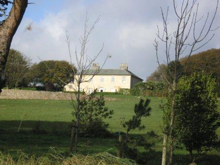
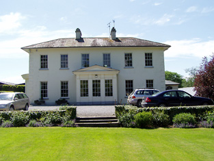
| Burton Park | The original house built by Sir John Perceval and his descendants was burnt down in the Jacobite War 1689-1691. A late Georgian house was built to replace it by the [3rd or 4th] Earl of Egmont which was remodelled in the late 19th century. Burton Park was leased to the Purcells in the 19th century. It was occupied by the Reverend Matthew Purcell in 1814 and 1837 and by his son John in the early 1850s when the house was valued at £34. Passed to the Ryans of Scarteen, county Limerick by marriage in the early 20th century. In the 1940s the Irish Tourist Association Survey noted Burton Park as one of the best examples of eighteenth century domestic architecture in county Cork. Still the home of the Ryan Purcell family. |

|
| Burtonhill House | Weir writes that this house was probably built by the Carrigaholt Burtons as a sporting lodge. It is marked on the first edition Ordnance Survey map. The Burton Conynghams had a large estate in the parish of Killeely so there can be no doubt that the house was named after them. By the time of Griffith's Valuation it was valued at £11 and Edward H. Goggin was in residence. He held the property from Mrs Taylor. William B. Goggin of Burton Hill married Frances Maria Whitestone in the second half of the 19th century. see http://brew.clients.ch/RichardClare.htm | |
| Bushfield | In 1786, Wilson refers to Bushfield as the seat of Mr. Cashell. Francis W. Cashell was living at Bushfield, Nenagh, in 1814 and J. Philips in 1837. Henry Phillips was the occupant at the time of Griffith's Valuation when the house was valued at £14 and held from Henry Cashin [Cashel]. This house appears to be still extant. see http://humphrysfamilytree.com/Cashel/henry.bushfield.html | |
| Bushfield | The original house, now a ruin, was sometimes known as Creaghduff. Creaghduff was occupied by Burke esq in the 1770s. Thomas Ruttledge of Bloomfield made his will at Bushfield in 1797 and died there in 1805. Bushfield was the home of Arthur Knox and his wife Barbara, nee Lambert. Their daughter, Elizabeth, married Annesley Knox of Rappa Castle. Barbara married Charles White as her second husband and sublet the house to Robert Fair, son of Robert Fair of Fortville. It was valued at £15 the time of Griffith's Valuation. Robert Fair of Bushfield had an only daughter, Jane, who married Thomas Ruttledge of Bloomfield and their second son took the surname Ruttledge Fair. A new house was built in the 1920s and is the home of the Delaney family. Extensive remains of the original Bushfield farmyard survive at the site. |
|
| Bushford | Humphry Thomson was living at Bushford in the mid-18th century. In 1814 Henry Thomson is described as resident at Bushford by Ambrose Leet. 'Robert Thompson' was the occupier holding the property in fee from the 1830s at least. The buildings had a rateable valuation of £5 at the time of Griffith's Valuation. [His son] Colonel Robert Thomson was resident in a new building on the other side of the road in the early 20th century. The new house (H657179) had a rateable valuation of £60 in 1906. His widow, Elizabeth Catherine, and her two daughters lived there in 1911. There were two substantial houses in Clossagh Beg by this time, one inhabited at the time of the censuses, by John Forster and later Joseph Ferris Forster and the other by the Thomsons. Walford's (1918) records Robert George Thomson, only son of Major Frith Thomson and nephew of Lieut. Col. Robert Thomson, died 1911, of Bushford. | |
| Bushmount | Wilson Gun was leasing this property to Dominick Rice at the time of Griffith's Valuation, when it was valued at £16 10s. In 1837 Lewis refers to it as the seat of Dominick Rice. In 1814 Leet had recorded Dominick Rice as resident at Ballymaquin. Bary states that Bushmount was possibly built in the early years of the nineteenth century by Dominick Rice. The house is still extant and occupied. | |
| Bushmount | Not visible on the 1st edition Ordnance Survey map but named as Bushmount on the 25-inch edition of the 1890s. Johanna Deasy was leasing this property from the Earl of Shannon's estate at the time of Griffith's Valuation, when it was valued at £22 10s. The Deasy family were brewers in the town of Clonakilty. [Now the site of St. Paul's Nursing Home.] | |
| Bushy Park | Hajba writes that Gifford Campion, born at Leitrim, acquired the lands of Bushy Park in the mid 18th century and that his son Richard Gifford Campion possibly built the house in the late 18th century. Bushy Park, Rathcormack, was occupied by John Walsh in 1814 and by Richard G. Campion in the early 1850s. The buildings were valued at £18.15 shillings and held from Major Heliger Lloyd. Occupied by William Moore Hodder in 1906. This house is still a residence. |

|
| Bushy Park | In 1786 Wilson refer to Bushy Park as the seat of Mr. Burke. Occupied by Edward McDonnell in 1814. Two generations of the Martins lived in this house in the 19th century. At the time of Griffith's Valuation, it was occupied by Robert J. Martin and was valued at £12. It is still extant and occupied. |
|
| Bushy Park | Early 18th century house, used as a school for the sons of Protestant clergymen. Occupied by Andrew Lyster in 1814. The residence of James Barlow in the 1830s and in the mid 1850s. Bushy Park became the home of the ffrench family in the 1860s, who bought out the property in the early 20th century. Dr Noelle Davies, author and poet, was a 20th century member of the ffrench family. This house is now the home of Laurence and Helga Mullins. |
|
| Bushy Park | Bushy Park was the home of Thomas Towers in 1814 and in 1837. In 1840, the Ordnance Survey Name Books refer to it as " a comfortable house, the residence of Thomas Towers" and also include reference to a letter written by Mr. Towers in which he expressed the wish that the house would revert to the name Shesharaghmore house though this does not seem to have happened. Sarah Cambie was occupying the house valued at £15 and held from Thomas Towers in the mid 19th century. David Clarke is described as "of Bushy Park, Borrisokane and Macclesfield" in the 1870s. Still valued at £15 this house was held by the representatives of David Clarke in 1906. A building is still extant at the site. | |
| Bushyisland | This house was the residence of Peter Lowe in 1814 and in 1837. John Peppard MD was the occupier at the time of the first Ordnance Survey and of Griffith's Valuation. He held the property from Bolton Waller and had converted the house into an asylum. | |
| Bushypark | A house located to the west of the town of Ennis which belonged to the Macnamaras of Ennistymon for most of the 18th and 19th centuries. Occupied by David Power in 1814. The house and 68 acres were leased to Thomas Cullinan in the 1850s. Buildings at Bushypark were valued at £18 where William J. MacNamara held 68 acres of untenanted land. The house is still occupied. | |
| Butler's Gift | Wilson, writing in 1786, refers to Butler's-Gift as the seat of Mr. O'Callaghan. Local sources suggest that the name came from the bequest of the lands of Baurnahulla to Richard Tonson from Major Anthony Butler in the early 18th century. | |
| Butler's Lodge | In 1840 the Ordnance Survey Name Books refer to Butler's Lodge as "a gentleman's seat" in the townland of the same name. The house is labelled as Butler's Lodge on the 1st edition Ordnance Survey map but is not labelled on the 25-inch edition of the 1890s. At the time of Griffith's Valuation it was valued at over £5 and part of the estate of Edward Cambie. A modern house occupies the site now. | |
| Butlerstown | Nathaniel C. Martin held a house, offices, foreman's house and spade factory valued at £25 from Francis Beamish. The property is labelled Butlerstown House on the 25-inch Ordnance Survey map of the 1890s when the spade factory is no longer visible. There is still an extant house at the site. | |
| Butlerstown | Daniel Keane lived at Butlerstown in the early 1850s. The buildings were valued at £15 and held from the representatives of Viscount Midleton. This house is now a ruin. | |
| Butlerstown Castle | The Sherlock family had been in possession of Butlerstown Castle and estate since the 1560s. Wilson, writing in 1786, refers to Butlerstown as the seat of Thomas Sherlock. In the 1790s a disastrous fire saw much of the property destroyed and subsequently the family moved to county Kilkenny although they continued to hold estates in the area. At the time of Griffith's Valuation, it was the property of Robert Backas, three generations of whose family lived at Butlerstown, before departing at the end of the 1850s. Between then and the 1880s Butlerstown was occupied by Samuel Ferguson. In 1894 Slater refers to the property as the seat of Thomas Prendergast. Only the ruin of the castle survives but the Coachhouse is in use as Guest Accomodation. | |
| Butlerstown House | Jonas Travers held Butlerstown House in fee at the time of Griffith's Valuation, when it was valued at £32. Lewis refers to it as the seat of J.Travers in 1837. The history of the house indicates that he had commissioned its building sometime in the early nineteenth century. It was still a Travers seat in 1894. See www.butlerstownhouse.com In 2009 it was for sale. |
|
| Butlerstown House (Middlethird) | Edward T. Power was leasing this house from Richard Duckett at the time of Griffith's Valuation when it was valued at £11 15s. This house is longer extant. | |
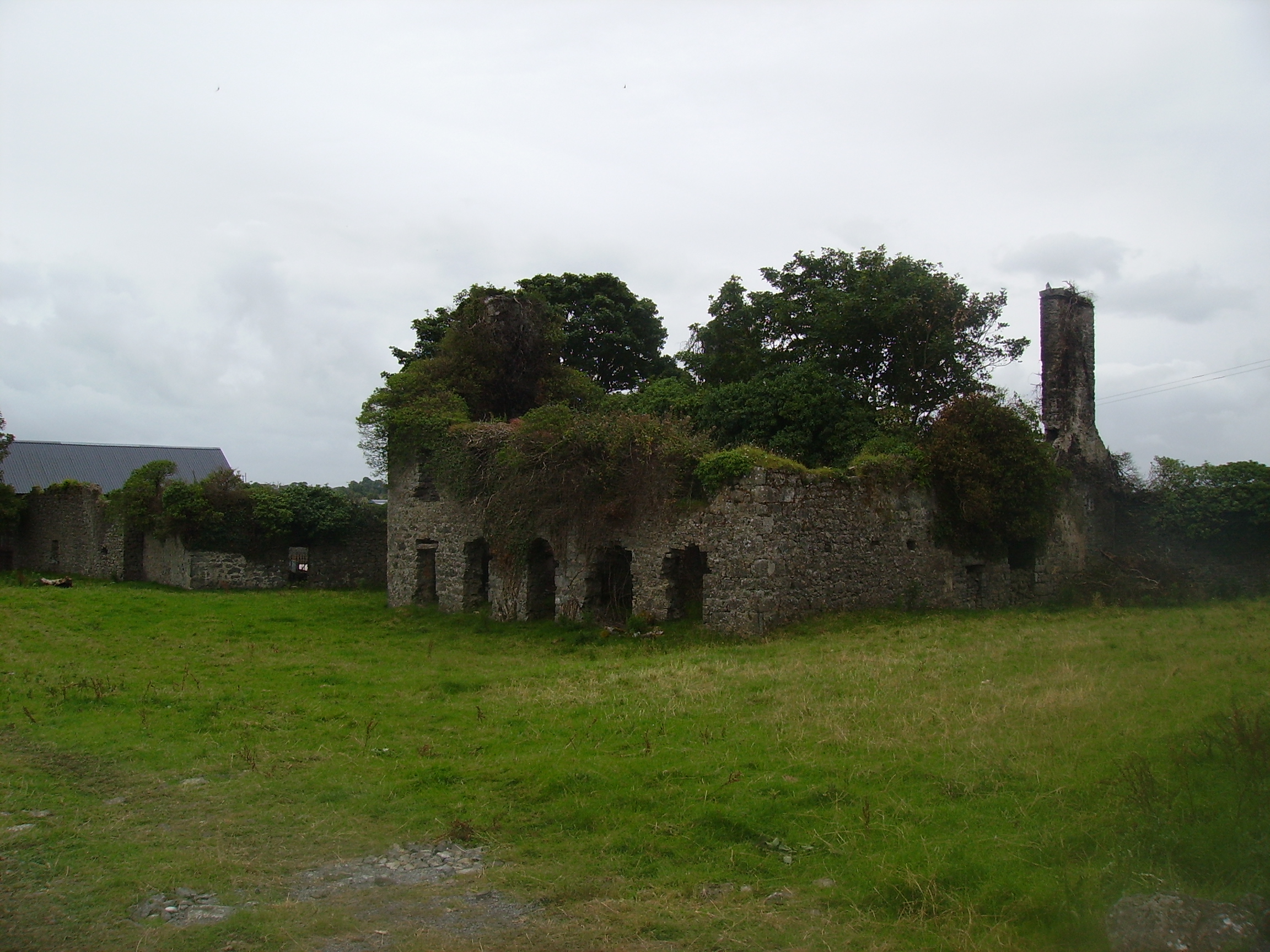
| Buttevant Castle | Originally a castle of the Barry family, Earls of Barrymore, sold by them in the early 19th century to John Anderson of Fermoy, who restored it as a castellated house and gave it to his eldest son Sir James Anderson. Sir James lived there until the mid 1840s. William Roche occupied the building valued at £37 in the early 1850s. He held the property from Viscount Doneraile and D.R. Browning held a house, flour mill and offices valued at £120 from Roche. The castle had various occupants in the later 19th century and was last occupied in the early 20th century. It is now a ruin. |

|
| Byblox | Burke's Landed Gentry of Ireland (1904) traces the Ross family of Dunmoyle from the Mann family of Byblox in the first half of the 18th century. Hajba writes that the original house was occupied by the Langley family in the 18th century. At the end of that century Roger Langley leased Byblox to Robert Fennel Crone who built a new house to replace the original which had been accidentally burnt. It was valued at £70 in the mid 19th century. The descendants of Robert F. Crone, including members of the Croker family, inhabited this six bay, three-storied house until the beginning of the 20th century when it was bought by the Morrogh Bernards. In the 1940s the Irish Tourist Association Survey noted that the house was then in the possession of Mrs. Drake Brockman but it was unoccupied with John Roche acting as agent. Byblox was demolished in the 1960s. |
|
| Cabra Castle | The second Cabra Castle, probably incorporating the old Cormey Castle, was complete by the late 1830s. It is located on the county border between Cavan and Meath. A castellated building of Gothic appearance Cabra Castle had a rateable valuation of £70 in the mid-19th century when occupied and owned by Colonel Pratt. It continued to be the main residence of the Pratts until the mid -0th century when it was inherited by a relative, Mervyn Sheppard, who sold it in the mid-1960s. It now functions as a hotel. https://www.cabracastle.com/ |
|
| Cabra Cottage | This house was the home of the Pratt family until Cormey Castle was purchased in 1813 and was renamed Cabra Castle. Cabra Cottage is shown on the first edition six inch Ordnance Survey map (publ. 1837) as a substantial building close to a mill race, quarry and the ruins of the first Cabra Castle. Bence Jones describes this building as an early 18th century villa possibly designed by Sir Edward Lovett Pearce. He writes that it was used as a ballroom following the Pratts move to live in their new home in Cormey. In the mid-19th century it was valued at £20 for rates and Colonel Joseph Pratt was the owner and occupier. The 25 inch map shows the building much reduced in size. Bence Jones writes that it was destroyed by fire in the 1950s. | |
| Cabragh Castle | The home of James Fogarty in 1814. In 1840 the Ordnance Survey Name Books refer to P. Fogarty as the proprietor of "Cabra House". Denis Leahy was the occupier in the mid 19th century when the castle was valued at £16+ and held from the Court of Chancery. | |
| Caharagh House | Occupied by R.Q. Sleeman in 1837 and by Frederick Alms in the early 1850s who held the property from the Knight of Glin. This house was in the possession of George Fitzgerald Hartigan Putland in 1865 when it was advertised for sale on 107 acres and held under an accepted proposal for life of G.F.H. Putland from the Knight of Glin. Caheragh House is still extant. |
|
| Caher | Situated close to the shore of Lough Graney, sheltered by trees this house is well maintained and occupied. It was leased by the O'Haras to the Studderts in the 1830s. At the time of Griffith's Valuation William O'Hara, one of the seven sons of Robert O'Hara of Raheen, was the occupier. He held the house valued at £24 and surrounding 255 acres from [his mother] Frances O'Hara. Purchased by the O'Dwyers in the early 20th century. |
|
| Caher | At the time of Griffith's Valuation, Harriett Dickson and Maria Squirl were leasing a property valued at £5 together with 235 acres at Caher, barony of Castlereagh, to Bernard Sweeney. | |
| Caher | Charles French was leasing the house at Caher, barony of Frenchpark, valued at £16, from Lord de Freyne's estate, at the time of Griffith's Valuation. Lewis also records the house as the residence of C. French in 1837. In the same year the Ordnance Survey Name books record Caher as a "dwelling house of three stories and slated". In the 1749 Census of Elphin F. Elwood was recorded as residing at Caher. By 1894 it was the residence of the Dowager Lady de Freyne. The building is still extant. | |
| Caher | Lewis records Caher as the seat of J. Dillon in 1837. The house at Caher, with a demesne, the property of James Dillon, were offered for sale in the Encumbered Estates court in July 1854. Samuel Wade was leasing a property valued at £17 at Caher, in the parish of Kilcloony, barony of Clonmacnowen, from the Clancarty estate at the time of Griffith's Valuation. The ruins of the house and stable block are still visible. |
|
| Caher House | A house lived in by the Butler family when they ceased to use Caher Castle as a residence. Wilson mentions the seat of Lord Caher in the town. Located in the town square of Caher it now functions as a hotel. Leet records Lord Cahir as resident at Cahir Castle in 1814 but by 1837 Lewis writes that Cahir House was the seat of the Earl of Glengall. He held this house in fee at the time of Griffith's Valuation when it was valued at £100. |

|
| Caher Park | Bence Jones writes that this house was built by Lady Margaret Charteris in the early 1860s to the design of Lanyon, Lynn and Lanyon. Valued at £45 in 1906, the house burnt down in the 1960s after being sold following the death of Lieutenant Colonel R.B. Charteris in 1961. Also known as Cahir Lodge. |
|
| Caherabbey House | Occupied by John Fennell in 1814 and by Richard Grubb in 1837. Montgomery records that Richard Grubb built a house at Cahirabbey circa 1833. Richard Grubb held the property in fee at the time of Griffith's Valuation when the buildings were valued at £70. He also had a flour mill closeby valued at £200. In 1894 Slater notes it as the seat of Rev. George Grubb. This house continues to be a family home. In 2013 it was offered for sale. |
|
| Caherabbey House Upper | Joshua Fennell occupied a house known as Caher-abbey-villa in 1814 and in the early 1850s Joshua Fennell (Joseph) was occupying a house in Caherabbey Upper, valued at £29 and held from Ponsonby Barker. | |
| Caheratrant | In 1906 Lord Ventry's estate owned a property valued at £5 5s at Caheratrant. This may refer to the Coastguard Station. At the time of Griffith's Valuation, much of this area was held by David Thompson, Lord Ventry's agent. | |
| Caherbrack House | Mrs. Osborne's trustees were leasing this property to Mary Hanrahan in 1850 when it was valued at £11 10s. It is still extant and occupied. |
|
| Cahercon/Cahiracon | A house situated on the bank of the Shannon, the seat of the Scott family until at least the 1850s. The sale rental of 1854 gives a detailed description of the house which included 16 bedrooms. By the mid 19th century James Kelly held the house in fee. The buildings were valued at over £53. The Honourable Charles William White, second surviving son of Baron Annally, was living at Cahiracon in the mid 1870s and it was a seat of that family in 1894. The Vandeleurs lived here for a short time at the beginning of the 20th century. Bought by the Maynooth Mission to China in 1920 and sold by them to the Salesian Sisters of St John Bosco in 1962. The house later became the centre of Cahercon Community College. Cahercon is now owned by Clareman Paddy Whelan of Limestone Quarries. |

|
| Caherconlish House | Lewis describes this house in the following terms "Near the town stands Cahirconlish House, a handsome modern residence, erected near the site of the old family mansion, by the proprietor, Major Wm Wilson." The Ordnance Survey Name Book dates this house to about 1789 and it was three storeys high. Wilson, writing in 1786, refers to a residence of Mr. Wilson at Caherconlish. A small drawing of the house is to be found on Map 16 H 32 (13) in the National Library of Ireland. This house was valued at £40 at the time of Griffith's Valuation and was held by Charles Monck Wilson in fee. Daniel Fitzgerald Gabbett, MP, was recorded as the owner in 1906, though he himself had died in 1898. At the time of the Irish Tourist Association survey 1942 Caherconlish House is described as a Creamery. The surveyor writes that a fine Adams ceiling in the house was destroyed by an accidental fire in 1925. Caherconlish is no longer extant. | |
| Caherconway House | Leased by Nicholas Cummins to Daniel Bechinor [or Buchinor] at the time of Griffith's Valuation, when it was valued at almost £8. | |
| Cahercorney | Not named on the the 1st edition Ordnance Survey map, this house was the residence of Henry Croker at the time of Griffith's Valuation. It was valued at £10+ and was held from John Croker. Earlier, in 1786, Wilson refers to it as the seat of Mr. White. A farm is extant at this site now. | |
| Caherdaniel House (Bantry) | Leased from the Bantry estate by John Cotter at the time of Griffith's Valuation, when it was valued at almost £9. Occupied buildings still survive at the site. | |
| Caherdean House | Charles Daly was leasing Caherdean House from Henry Herbert at the time of Griffith’s Valuation, when it was valued at £11 10s. Bary suggests that the Lawlors may have had connections with Caherdean House around 1800 but later in the 19th century the Herberts were the landlords. The house is still extant and part of a large farm. . |

|
| Caherduggan | In 1786, Wilson refers to "Carduggan" as the seat of Mr. Davis. Denis O'Callaghan was living at Cadogan (Caherduggan) by 1837. He held the property in fee at the time of Griffith's Valuation when it was valued at £48. This house remained in the possession of the O'Callaghan family until the 20th century. It is still extant but unoccupied. |

|
| Caherelly Castle/Coole House | Lewis refers to Mrs Furnell’s residence as "a neat building in the cottage style" situated near Longford bridge. The substantial house marked at this location on the first Ordnance Survey map is named Caherelly Castle but on later maps is recorded as Coole House. The Ordnance Survey Field Name Book call it Cahir Elly Castle or Coole House. It was valued at £30 and occupied by Michael Furnell who held it in fee at the time of Griffith's Valuation. This house may have been known as Caherelly Grange in the last decades of the 19th century (see ''Burke's Irish Family Records''). The house is no longer extant but the outbuildings still remain. | |
| Caherelly Cottage/Caherelly Castle | A plaque records the building of this house in 1800 by William Hannan. Lewis refers to the residence of Mr Hannan in well planted grounds. The Ordnance Field Name Book refers to Cahir Elly Cottage as the residence of William Hannan. Marked as Caherelly Cottage on the first Ordnance Survey map, this house was located close to the ruins of an old castle and is now known as Caherelly Castle. Valued at £12 in the early 1850s and occupied by Michael Furnell who held it in fee. It later became the home of Michael Furnell's brother Frederick, an army surgeon. David O'Shaughnessy's interest in this house was advertised for sale in October 1853. |

|
| Caherhugh | Occupied by John Lynch in 1814, by Mrs Martin in the 1830s and by Michael Cullinane at the time of Griffith's Valuation. The home of Mark Killilea (Member of the European Parliament) in the 1970s. The house no longer exists but a walled garden is still extant. |
|
| Caherline | [The seat of the Gabbett family in the 18th and early 19th centuries]. Lewis refers to its occupation by a farmer and Griffith's Valuation records Thomas Barry as resident in the early 1850s when the buildings were valued at £16. The original house is still extant though with some modifications. It is now the home of the O'Grady family. | |
| Caherline House | The home of the Gabbett family in the 19th century, held by the Gabbetts from John Brown in the mid 19th century and valued at £38. The Brown interest in this house was advertised for sale in July 1862. Recorded as the seat of Richard J. Gabbett in 1894. | |
| Cahermee | A late 17th century house belonging to the Freeman family, passed by marriage to the Hewson family. A Hewson relative John Milward was resident in 1814. Occupied by John Kearney and held from John Hewson at the time of Griffith's Valuation, when the buildings were valued at £8.5 shillings. Hajba writes that Margaret, daughter of William Hewson Kearney, inherited the house and she married Michael Carroll. This house is no longer occupied. |
|
| Cahermone | Wilson, writing in 1786, refers to Cahermone as the seat of Charles Broderick. The house was the residence of Thomas Poole in 1814 and in 1837. Lewis states that Poole was agent to the Midleton estates. Laurence Smithwick occupied the house at the time of Griffith's Valuation when it was valued at £8. Though buildings there were vallued at £19 in 1906 the original house is not shown on the 25-inch Ordance Survey map of the 1890s. Farm buildings occupy the site now. | |
| Cahermore House | In 1851 Thomas Hungerford was leasing Cahermore House from the Bishop of Cork's estate,when it was valued at £32. It was owned by Henry Hungerford in 1906 and valued at over £44. Taylor and Skinner's map of 1783 as well as Wilson in 1786 also mention Cahermore as a Hungerford residence. In 1944 the Irish Tourist Association Survey noted that Cahermore had been burnt during the War of Independence and was then derelict. Donnelly indicates that it was burnt in June 1921. It is no longer extant. | |
| Cahermorris | Occupied by Cecil Crampton in the mid 19th century. Two generations of Cramptons were rectors of Headford in the 18th century. A house still exists at the site as well as a fine entrance gateway. |
|
| Cahermoyle/Cahirmoyle | The present house was built in the early 1870s by Edward O'Brien, son of William Smith O'Brien replacing an earlier house which was the home of his grandmother the Dowager Lady O'Brien in the early 1850s. The Ordnance Survey Field Name Book states that Cahermoyle was held from Lord Southwell. The house was valued at £81+ in 1906 and sold by the O'Briens in 1919. In 1988 Cahermoyle and 200 acres were offered for sale by the Oblate Fathers who had had a Novitate there since the early 20th century. The house is now a nursing home. |
|
| Cahernane | Cahernane House was the property of Rev. Richard Herbert at the time of Griffith’s Valuation, when it was valued at £22. Lewis mentions it as the seat of H. Herbert in 1837. Bary indicates that this house, originally built in the early 18th century, was replaced in the 1870s when the present building was constructed. The property was sold by the Herbert family at the end of the 19th century and is now a luxury hotel. In the 1940s though, the Irish Tourist Association reported that the gardens were well-maintained by Miss Herbert. See www.cahernane.com. |

|
| Cahernarry House | Originally a Cripps residence, occupied by a member of the Crips family in the 1770s and 1780s and by J. Cripps in 1837. By the time of Griffith's Valuation Henry Watson was in residence. The house was valued at £8. It is not visible on the 25-inch Ordnance Survey map of the 1890s. Modern farm buildings occupy the site now. | |
| Cahervillahowe | A house built post Griffith's Valuation by the Massy family. Cahervillahowe was sold to Mr Harris in the early 20th century. It is now a stud. |

|
| Caherwisheen | Robert A. Thompson was in possession of this property at the time of Griffith's Valuation, when it was valued at £15. | |
| Cahir Guillamore | The seat of the O'Grady family from the mid 18th century acquired through marriage with a member of the Hayes family. Held by the Viscount Guillamores in fee and valued at £50 in the early 1850s. Viscount Guillamore was recorded as the occupier in 1906 when the house was valued at £48. The Irish Tourist Association surveyor in 1942 refers to this house as been unused since 1922 when the estate was divided by the Land Commission. All the fittings has been removed and only the shell of the house remained. The house is now a ruin. |

|
| Cahirbane | Home of the Creagh family throughout most of the 18th and 19th centuries. It was occupied by Captain James Creagh at the time of Griffith's Valuation when it was valued at £25. The original house was larger than the 20th century construction now in existance. | |
| Cahircalla House | Occupied in the 18th century by the Crofts, England and Maguire families. The residence of David A. England in 1814 and of Charles Mahon in 1837. Griffith's Valuation shows that he held it from John Clancy. By the end of the 1860s Wainwright Crowe was in residence. Cahircalla Hospital now occupies the site, incorporating some of the earlier buildings. |
|
| Cahirdown | In 1906 Denis Gun Browne owned a house valued at £20 at Dromin Upper, barony of Iraghticonnor. At the time of Griffith's Valuation, this had been been part of Rev. George Browne's estate, let to the Collins family, though the house was then valued at £1 10s. It is labelled Cahirdown on the 1895 map. | |
| Cairnsfoot | McTernan indicates that Maj. De Bromhead is the reputed builder of Cairnsfoot, probably in the early decades of the nineteenth century, when he leased the lands from the Cooper estate. He had married Judith Wood in 1823. In the 1840s he returned to England and the house was let to a number of different families, notably the O'Connors. In 2004 it was partially destroyed by fire and subsequently demolished. | |
| Caldragh | Eliza Lawder was leasing a house valued at £7 10s at Caldragh, parish of Kiltoghert, from George Muntz at the time of Griffith's Valuation. In 1837 Lewis recorded it as the seat of the McDermott family. This house is still extant and run as a guesthouse by the Jackson family. |
|
| Callanafersy House | Richard J. Leeson-Marshall built Callanafersy House around 1861 and the family continued to own the house until well into the twentieth century. It is still extant and occupied. |
|
| Callanafersy House A | Robert Leeson was leasing Callanafersy House to Ephraim Williams at the time of Griffith's Valuation, when it was valued at £12 5s. Bary indicates that this house was leased by the Williams family and probably had been built by them earlier in the nineteenth century. It is still extant and occupied. | |
| Callatrim Retreat/Callatrim House | Held by Jacob Biggs from the Devonshire estate in 1851 when it had a valuation of £10. It is labelled Callatrim Retreat on the 1st edition Ordnance Survey map but as Callatrim House on the later 25-inch map of the 1890s. A house and extensive farm buildings are extant at the site. | |
| Caltra Lodge | The home of P.J.Joyce in the late 1830s and of Mary Joyce in the 1850s. The Joyces held this house from the Bellews of Mount Bellew. On the 25-inch map of the 1890s it is labelled as Caltra Park. The ruin of the original house was visible until the end of the twentieth century, | |
| Calverstown | Named on the first edition OS map, Calverstown House is a three-bay two-storey over basement house, built about 1800. Originally a Rochfort home it was occupied by Charles Rochfort in 1814. Calverstown House was the home of J. Hornidge in 1837. At the time of Griffith’s Valuation (publ. 1854) it was valued at £10, occupied by George Hornidge and held from Pilkington. Hornidge family members continued to live here until the mid-20th century. |
|
| Camas | The seat of the Bevan family located on the estate of the Earl of Limerick. At the time of Griffith's Valuation, it was held by Frederick Bevan from the Earl of Limerick and valued at £29. The house is now demolished but the farm buildings remain. |
|
| Cametringane House | In use at the time of Griffith's Valuation, as an Auxiliary Workhouse, on lease from the Earl of Bantry's estate. The house was then valued at almost £18. Lewis referred to it as the seat of J. O'Sullivan in 1837. In use as a hotel towards the end of the twentieth century. | |
| Camira | Occupied by the Reverend P. Bolton in 1837 and by William Jackson in the early 1850s, when the house valued at £11.14 shillings was held from Anne Crawford. In the possession of the Cole Bowen family in the later 19th century. This house no longer exists although a building is still located at the site. http://www.askaboutireland.ie/reading-room/history-heritage/big-houses-of-ireland/the-cole-bowen-estate/bowen-family-history/ | |
| Camla | Described by Bence Jones as a late Georgian house of one storey over a high basement, situated close to Rossmore Park. Lewis records Lieutenant Colonel Henry Westenra as resident. He left the property to his nephew the 3rd Baron Rossmore. At the time of Griffith’s Valuation occupied by Jesse Lloyd, Lord Rossmore’s brother-in-law, who soon moved to another Rossmore property nearby, Ballyleck House. The buildings were valued at £85 and a steward’s house was also located in this townland. By 1906, the buildings at Camla were valued at £55 with 118 acres of untenanted land. Occupied by James Pollock, land steward in 1901 and Fred Millard, estate agent, in 1911. Camla became the home of the 6th Lord Rossmore after World War II. It was sold in 1962. The building has been demolished and the site is now a green field. | |
| Camlagh | The Newcomens resided at Camlagh in the mid 18th century and then leased the property to the Keoghs. Occupied by a Cruise in 1814 and described as a house of small dimensions at the time of the first Ordnance Survey. Occupied by E. Kilkenny in 1837 and by James Kelly and James Naughton in the 1850s. | |
| Camlin | The representatives of John Irwin, a minor, were leasing a house at Camlin, valued at £14, to James Badger, at the time of Griffith's Valuation. In 1837 Lewis also recorded Camlin as the seat of the Irwin family. At the time of the 1st Ordnance Survey, Camlin was being leased by John Irwin from the estate of Guy Lloyd and was described as "a good house of three stories". In 1814 it was the seat of John Irwin. At the time of the 1749 Census of Elphin a John Irwin lived at Camlin. |
|
| Camlin Castle | Camlin was held in fee by John A. Tredennick at the time of Griffith’s Valuation, when it was valued at £65. It is largely demolished owning to the expectation, unfounded as it turned out, that the site would be flooded by the Erne Hydro Electric scheme in the 1940s. | |
| Camma Lodge | A home of the St George family in the 19th century. A house is still occupied at the site. |

|
| Camp Lodge | At the time of Griffith's Valuation, Richard Chute was leasing this property to George Hewson, when it was valued at £5 10s and part of a farm of 350 acres. In the 1830s, the Ordnance Survey Name Books describe it as "a small cottage, one story high, the residence of John Hussey". It was offered for sale in the Land Judges' Court in 1883 when it was described as a "comfortable dwelling house, suitable for a gentleman's family". Bary indicates that it had been the home of the Twiss family earlier in the nineteenth century. It is still extant. | |
| Camphire House | Held in fee by Christopher Ussher in 1851 when it was valued at £28. It was the residence of Christopher M. Ussher in the 1870s. Buildings at this location were in the possession of the Ussher family in 1906 and valued at almost £6. In the 1940s the ITA survey noted that it was occupied by Mrs. Chearnley but owned by the Dobbs family and had formerly been a residence of the Ussher family. The Irish Army also seemed to have occupied part of the building during World War II. Camphire is still extant and occupied. |
|
| Camus | A house occupied by James Chadwick and held from the representatives of Eustin [Austin] Cooper at the time of Griffith's Valuation. The buildings were valued at £28.18 shillings. |
|
| Camus House | George Hungerford was leasing Camus House from the Smith-Barry estate at the time of Griffith's Valuation, when it was valued at £19. It does not appear on the 6-inch Ordnance Survey map but is labelled Camus House on the 25-inch map of the 1890s. There is still a house at this site. | |
| Capeen | Richard Hungerford was leasing this property to Henry Hungerford in 1851 when it was valued at almost £10. Labelled Cappeen on the 1st edition Ordnance Survey Map. An enlarged building is named Cappeen House on the 25-inch map of the 1890s. A house still exists at the site. | |
| Cappagh | Eyre Lloyd of Wales and William Hammond of Dublin were proprietors of this townland circa 1840. At that time Robert Peppard lived at Cappagh House which is described as an irregular two storied house, part of it built 120 years previously with later additions. Robert Peppard was still resident at the time of Griffith's Valuation when the house was valued at £14+. Robert Peppard was married to Anne Brown of nearby Mount Brown. Whelan writes that the Peppards had lived at Cappagh from the early 18th century. The last family member to live at Cappagh died in 1938. The house has had a number of owners in the 20th century and the interior was badly burnt by fire in 1983 but has since been restored. |

|
| Cappagh | Occupied by Dillon Hughes at the time of Griffith's Valuation, when it was valued at £11 10s. He was leasing the property from Alexander Beatty. The National Inventory of Architectural Heritage suggests that this is originally a seventeenth century house with later additions. It is still extant and well-maintained. |
|
| Cappagh | Cappagh was occupied by James Tighe at the time of Griffith's Valuation when the house, valued at £4, is described as a herd's house. It was built some time before the publication of the 1st edition Ordnance Survey map of 1838 and is still extant and well-maintained. |
|
| Cappagh (Clanwilliam) | In 1786 Wilson refers to Cappagh as the seat of Mr. Massey. At the time of Griffith's Valuation, this townland was the property of estate of Reverend John Massey Dawson. [Grid Reference is approximate]. | |
| Cappagh (Decies-within-Drum) | In 1851 James Gee was leasing this property from Lord Decies estate when it was valued at £19. This area has been subjected to severe coastal erosion and these buildings are no longer extant. | |
| Cappagh A | John Morrissy was leasing this property from the Ussher estate in 1851 when it was valued at £13. An extensive farm property still exists at the site. | |
| Cappagh Folly | William Newman held property valued at almost £10 at Cappagh, Kinsale at the time of Griffith;s Valuation. It included a dairy and orchard. The 6-inch Ordnance Survey map also shows a turret on the property. | |
| Cappagh House | At the time of Griffith's Valuation occupied by John Curtin, valued at £12+ and held from the representatives of Stratford Kirwan. The house is no longer extant. | |
| Cappagh House | A house constructed in the later nineteenth century by Richard J. Ussher. In 1906 it was owned by him and valued at over £52. In 1942 the ITA survey notes it as the property of Percy Arnold Ussher. It is still extant and occupied. |
|
| Cappagh House | Vere Hunt was living at Cappa in 1814 and Mrs [Fitzmaurice] Hunt in 1837. Arthur Hewlett was the occupier in the mid 19th century holding the property from De Vere Hunt. The buildings were valued at £26.25 shillings. Godfrey Massy Hunt of the Friarstown family was resident in the later 19th century. This house belonged to Mr Griserood in the early 1940s. A house is still extant at this location. | |
| Cappagh House (Kilrush) | Occupied by John Trousdell in 1814. Later the home of the Blairs who intermarried with the Persses of Moyode, county Galway. At the time of Griffith's Valuation it was occupied by William Blair leasing from the Vandeleur estate when the house was valued at £14. The property was labelled Cappagh House on the 25-inch Ordnance Survey map of the 1890s. Modern building has taken place in the area. | |
| Cappagh House (Old) | Richard Ussher held this property in fee in 1851 when it was valued at £41. This is the original Cappagh House, built by the Ussher family in the late eighteenth century and referred to in 1774 by Smith as the seat of John Usher. It is still extant, though replaced, in the late nineteenth century, by the modern Cappagh House. |
|
| Cappagh House (Skull) | Thomas S. Cave held this property in fee at the time of Griffith's Valuation, when it was valued at £20. Named as Cappagh House on the 1st edition Ordnance Map but not shown on the later 25-inch map. |
|
| Cappagh Lodge | Another larger house in Ballynote West townland, valued at £18 at the time of Griffith's Valuation and occupied by Robert H. Borough, who held it from Nicholas S. O'Gorman. This house is labelled Cappagh Lodge on the 25-inch Ordnance Survey map of the 1890s. Local sources indicate it was later occupied by the Butler family. Later in the twentieth century it was taken over by the Ryan family whose descendants still live there. | |
| Cappaghlodge | A property in the possession of the Spaight family from the early 18th century. The house named "Lodge" was the residence of Samuel Spaight in 1814. James Kelly held the property from the representatives of Edward Spaight Ferreter at the time of Griffith's Valuation, when the house was valued at £18. It was in the hands of the Court of Chancery at this time. In 1906 the house valued at £11 was in the possession of James Frost. Weir writes that the house is now demolished. |