Browse Houses
Search Results: Returned 5927 records. Displaying results 5401 – 5500
| House name | Description | |
|---|---|---|
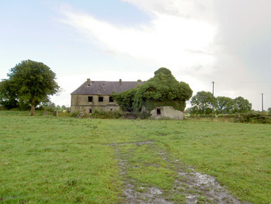
| Streamstown House(Tynagh) | Michael McDermott was the occupier of Streamstown House at the time of Griffith's Valuation when it was valued at £12. In 1783 Taylor and Skinner recorded a house at Ballindrimney as the seat of the Lambert family. The house is still standing but derelict. |

|
| Streedagh | It is likely that Thomas Jones built a house at Streedagh c 1725. However, the present house dates from the early years of the nineteenth century. In 1906 it was the property of Richard W. Jones and was valued at £18. It is still extant and occupied. |
|
| Strokestown (Mullingar) | Stokestown, located beside the railway line and marked but not named on either the first six inch of 25 inch OS maps. At the time of Griffith’s Valuation (publ. 1854) the house was valued at £14, occupied by John McKeown and held from Lord Vaux. In September 1862 John McKeon was selling Stokestown and 145 acres in the Landed Estates Court, held under a lease from Lord Vaux, dated 6 August 1853. William Mullen, shepherd, and his family were living in a first class house in Stokestown in 1901, held from W H Middleton. A building remains on this site. | |
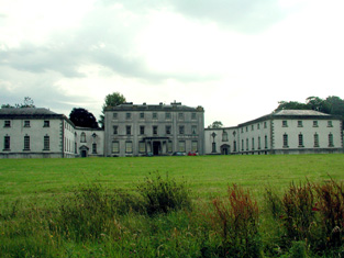
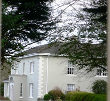
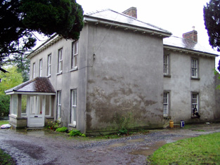
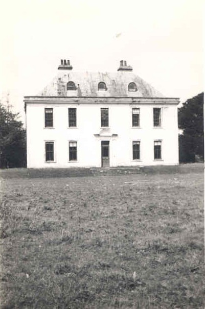
| Strokestown House | Late 17th century house altered in the early 19th century and home of the Mahon family for three centuries. In 1786 Wilson described it as "fine mansion house with ample and beautiful demesne". Referred to as "Bawn House", the mansion of Lord Hartland, by Lewis in 1837. Valued at £70 in the mid 19th century. Now a major tourist attraction containing the Famine Museum. http://www.strokestownpark.ie/ |
|
| Stumphill | This house was the home of William Mc O'Boy in the first half of the 19th century. The house was valued at £25 at the time of Griffith's Valuation and held from Henry Newenham. |
|
| Subulter | Leased at the end of the 18th century to James Leahy by the Lloyds. Occupied by John Leahy in 1837 and by Richard Leahy in the early 1850s who held the house valued at £18+ from Thomas Lloyd. Later owned by the Warrens of Codrum House. A new house now stands on the site. | |
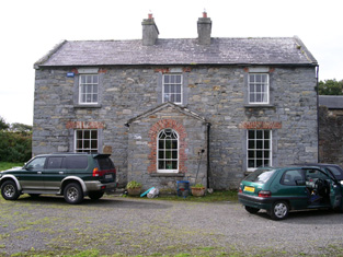
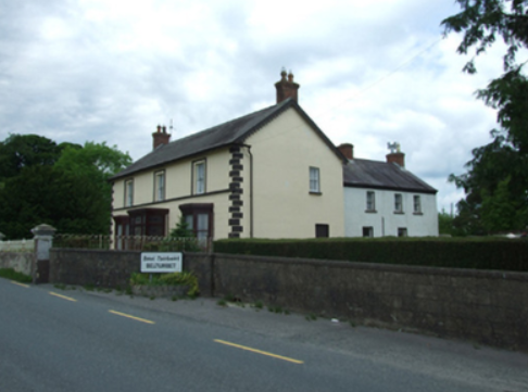
| Sugarloaf | John Gumley of Sugarloaf died in 1794 (gravestone inscription Belturbet COI). Sugarloaf was located south east of Belturbet. In 1835 Theophilus Brinsley Butler of Dublin leased the house and gardens to Mary Finlay of Sugarloaf house, county Cavan, widow, for the lives of her son Sir Thomas Finlay and her daughter Elizabeth Lake Finlay. By the 1850s Samuel Knipe was resident holding the property from Captain Humphry Butler. It had a rateable valuation of £10.10.0. |
|
| Suir Castle House | Suir Castle was the home of a branch of the Massy family in the latter part of the 18th century. Two buildings are marked on the first edition Ordnance Survey map Suir Castle and Suir Castle House. The Inventory of National Architectural Heritage dates the house from circa 1820. Suir Castle [Grid Ref. S004 352] was occupied by Joseph Robbins in 1814 and in 1837. In the mid 19th century Suir Castle House was held by Francis Massey in fee and the buildings were valued at £21. The Massys were still resident in the 1870s. Occupied in the 20th century by Major Harold O'Malley. For sale in 2003. |

|
| Suir Mount | The representatives of James Fitzpatrick were leasing this property to John Egan in 1850 when it was valued at £13 11s. The house was included in the sale of the estate in May 1850 when it was described as " a good substantial dwelling house". | |
| Suirville | This house was the home of Peter Smithwick in the early 19th century. Suirville was held by Richard Butler from Michael Gavin at the time of Griffith's Valuation and the house, valued at £10, was occupied by Miss Alice O'Connor. The sale rental of 1873 shows William Roche as tenant, trustee for Mr Butler. The Irish Tourist Association Survey records Suirville as the birthplace of Sir William Butler in 1838. The house was a ruin in the early 1940s. | |
| Summer Hill | ||
| Summer Hill (Inishowen) | A house labelled Summer Hill appears in Carrownaff townland on the 1st edition Ordnance Survey map. Reverend Stewart Marks occupied a house at Carrownaff at the time of Griffiths Valuation, which was valued at £11. | |
| Summer Lodge | Part of the Studdert estate held from the Marquis of Conyngham, the buildings were valued at £12+ at the time of Griffith's Valuation and the house was in the occupation of Jonas Studdert. A house still exists at the site. | |
| Summer Ville | Griffith's Valuation records that the house valued at £3 was leased to James Foley by James R. Dunne. It is labelled Summer Ville on both the 1st and 25-inch edition Ordnance Survey maps. A new house appears to have been constructed at the site in the last decade. | |
| Summerfield | John Hall held a house valued at £15 and 175 acres in fee at Summerfield in the early 1850s. No house of this size is marked on the first Ordnance Survey Map for this townland. Grid Reference is approximate. | |
| Summerhill | Originally a Stawell home, Wilson refers to Summer-Hill as the seat of Mr. Stawell in 1786. It was occupied by John Stawell in the early 1850s and held from John Guinness. The buildings were valued at £18.10 shillings. Sold in 1853 to Major General Usher Williamson. The house remained in Williamson possession until the 20th century. The Irish Tourist Association Survey in 1942 recorded that it had been purchased and was resided in, by the Buckley family at that time. It is still a family residence. |
|
| Summerhill | Richard Bourke was resident at Summer-hill, Burris-o-leagh, in 1814 but by 1837 J.H. Harden was the proprietor. At the time of Griffith's Valuation Charles F. Harden held the house, valued at £11, from John H. Harden. Buildings are still extant at this site. | |
| Summerhill | Summer-hill, Clonmel, was the residence of the Reverend George Mills (sic) in 1814. The house was valued at £15+ in the mid 19th century, occupied by Mrs Dorothea Moore and held from the representatives of the Reverend Miles. In the 1870s Dorothea Moore of Dublin owned 288 acres and Henry Moore of Summerhill, Clonmel owned 247 acres in county Tipperary. Lewis refers to the handsome residence of R. Moore in 1837. |
|
| Summerhill | The house in the townland of Cartown, property of George Church, is described as "unfinished" in Griffith's Valuation. | |
| Summerhill | An 18th century house, home of the Palmer family. Wilson refers to it as the seat of Thomas Palmer in 1786. Blake records that it was leased to John Bourke at the time of the 1798 rebellion. At the time of Griffith's Valuation, it was occupied by Thomas Palmer, leasing from Ernest Knox, and valued at £15. Later sold by the Palmers to the McCormack family who owned it until the 1920s. it is now a ruin. |
|
| Summerhill | A large 18th century house close to the River Shannon on the Massy estate. Occupied by the Reverend Charles Massey in 1814, Hugh Dillon Massy in 1837 and by Berkeley Vincent in the mid 19th century, when it was valued at £35. It remained the home of this branch of the Vincent family until the early 20th century. The Irish Tourist Association survey of 1942 refers to the demolition of this house "a few years ago". | |
| Summerhill (Bandon) | A house built after the publication of the first Ordnance Survey. At the time of Griffith's Valuation, Mrs. Eliza Baldwin was leasing a property at Knockbrogan from the representatives of J. Lovell. It was then valued at £8. Summerhill House is still extant. |
|
| Summerhill (Carbury) | At the time of Griffith's Valuation, John Gowan was leasing a house valued at £6 at Lisnalurg, from the Wynne estate. This is the house known as Summerhill which, in the 1870s, was acquired by the Anderson family who remained in possession until 1922. It is still extant. | |
| Summerhill (Mount Meredith) | In 1786 Wilson refers to Mount Meredith as a gentleman's seat close to Killarney. Bary writes that this is the property that later became known as Summerhill, held by The O’Donoghue. The Ordnance Survey Name Books note that this townland was leased by St. John Mason to Richard McGillycuddy and Madam O'Donoghue in the 1830s. The house is described as "formerly a handsome house but is now suffering to go to ruin". At the time of Griffith’s Valuation it was valued at £3 and leased to James Donovan. A substantial modern farm exists at the site now. | |
| Summerhill (Raphoe South) | James Johnston was leasing this property from the Conyngham estate at the time of Griffiths Valuaiton in the 1850s, when it was valued at £20. It is now a ruin. | |
| Summerhill House | Built on the Marquess of Conyngham's estate by the time of the first Ordnance Survey, this house valued at £10 was occupied by John Frost in the mid 19th century and it continued to be the home of the Frosts until the 1970s. A substantial farm still exists at the site. | |
| Summerhill House (Kilmaine) | The residence of Parsons Persse, agent to Lord Clanmorris, at the time of Griffith's Valuation when the house was valued at £8. Summerhill no longer exists but the yard buildings still remain. |
|
| Summerhill House (Loughrea) | In 1786 Wilson writes that Summerhill House, on the outskirts of Loughrea, was the seat of Mr. Persse. By the time of Griffith's Valuation in the 1850s, the property was occupied by Henry Dolpin, leasing from the Clanricarde estate, when it was valued at almost £8. Parts of the building have disappeared by the 1890s and the site is now part of a school. | |
| Summerland | Leased by the Corporation of Waterford to Samuel Strangeman in 1850 when it was valued at almost £40. A building is still extant at the site. | |
| Summerville | In 1840 the Ordnance Survey Name Books describe Summerville as "a commodious dwelling house, the residence of O'Brien Dillon" but Major Laurence is noted as the proprietor. At the time of Griffith's Valuation, the house was occupied by the representatives of Wills Bennett and held from John Bennett. The buildings were valued at £24. This house no longer exists. | |
| Summerville | Occupied by the Reverend Joseph Gabbett, fifth son of Daniel Gabbett of Strand House, Chancellor of Limerick and Prebendary of Effin and held by him from Alcock Otley. The buildings were valued at £23+. In 1786 Wilson refers to a house at Uregare as the seat of General Gabett. A house is still extant at the site. | |
| Summerville | Originally a Purdon house situated on the Coote estate and described by Smith as a "neat lodge" in 1750. It was home to members of the Chapman and Nason families. Occupied by John Nicholas Wrixon in 1837. Valued at £14 in the early 1850s when it was occupied by Kenny Herbert. Still occupied and surrounded by mature woodland. |
|
| Summerville | Described by Lewis as an ancient seat of Lord Charleville "now occupied by an agent". In the early 1850s Patrick and Michael O'Donnell were resident and they held the property from General James Caulfeild. | |
| Summerville | Built in the 1780s by Joseph Massey Harvey, a Quaker merchant, who married Rebecca Fisher and still occupied by him in 1814. Joseph and Rebecca were the parents of William Henry Harvey, a distinguished botanist. At the time of Griffith's Valuation Summerville was valued at £33 and occupied by James T. Fisher who held the property from Eliza Harvey. The house is now an accommodation and conference centre of the Mary Immaculate College for training primary teachers. The college was founded in 1898. |

|
| Summerville (Cavan) | Another house located on the west shore of Lough Sheelin. In 1814 James H. Cottingham was the proprietor of Summerville, Mount Nugent. The house was unoccupied at the time of Griffith’s Valuation but in the possession of William Webb. It was valued at £15.10.0. for rates. It was much reduced in size by the time the 25 inch map was compiled. A building still occupies the site. | |
| Summerville/Corbally More | In 1848, Lord Fortescue was leasing this property to Thomas Dillon when it was valued at £38. In 1774, Smith refers to Somerville as the seat of Thomas Wyse. The National Inventory of Architectural Heritage indicates that the Scottish-Baronial style mansion now extant was built in the late 1870s. The property is labelled as Summerville on the 6-inch Ordnance Survey map but on the later 25-inch map the new house is labelled Corbally More. It was severely damaged by fire in the twentieth century but re-built and is still extant though now in poor repair. In 2015 it was offered for sale. |
|
| Summerville/Thomastown | Home of Dominick G. Bodkin in 1814. The Bodkins intermarried with the Kilkellys. In 1855 the mansion house was described as 3 storeys high and in good repair. By the 1870s John Lyons of Summerville, Moylough, owned 218 acres in county Galway. In 1906 another source records Summerville, valued at £13.10 shillings, as occupied by John Lyons. Renovated in 2006 by its present owner Pat Lyons. |
|
| Summerville/Villa Lodge | A house orginally built for a member of the Browne family, it was leased by the 2nd Marquess of Sligo to Courtney Kenny of Ballinrobe in 1830 and was used by the Kennys as a summer residence. Courtney Kenny leased the property to John Sidney Smith, agent to the Westport estate in 1855. The house was valued at £14 at this time. A drawing, map and 20th century accounts re this property are included in the Kenny Papers. |
|
| Sun Lodge | Sun Lodge is marked on the first Ordnance Survey map and was occupied by Denis Hanan in the mid 19th century and held from Henry Peard. It was valued at £30+. Hanan's interest was advertised for sale in 1870. Hajba records various other occupants and this house is still occupied and well maintained. |
|
| Sun Lodge/Hoe Lodge | Sun Lodge was being leased by James Hallinane from the Poole estate in the 1850s when it was valued at £13 10s. Lewis refers to it as the seat of W. McCarty in 1837. It is labelled Hoe Lodge on the 25-inch Ordnance Survey map of the 1890s, the name by which it is still known. |
|
| Sunfield House | George Gamerson was leasing this property from the King Harman estate in the 1850s when it was valued at £12. The valuers' original valuation, which also includes a description of all buildings on the site, was over £20. The house is not named on the 1st edition OS map but is labelled Sunfield House on the 25” ed. A substantial farm occupies the site including the original buildings |
|
| Sunmount | George Beamish was leasing Sunmount to Rev. W. John Day at the time of Griffith's Valuation, when it was valued at £20 5s. Lewis refers to Ballyvackey as the seat of G. Beamish in 1837. In 1906 it was owned by William Hungerford and valued at £23. It is no longer extant. | |
| Sunning Hill | Richard Quinn was leasing this property to Amelia Quinn at the time of Griffith's Valuation, when it was valued at £18. Lewis refers to its as the seat of Mrs. Quinn in 1837.The original house is no longer extant. | |
| Sunny Hill | In 1786 Wilson refers to a seat of Mr. Cotter in the town of Mallow. James Delacour, second son of Robert Delacour of Beare Forest, was residing at Sunny Hill in the mid 19th century. He held the property from Henry Braddle and it was valued at £36. He was still described as "of Sunny Hill" in 1886. The house became a rectory for about fifty years in the 20th century. In 1942 the Irish Tourist Association Survey referred to it as "a fine well kept residence built by J. Carmichael". It is now a private residence named Duarrigle. | |
| Sunnyside | Richard Barrett occupied a house valued at £15 which he held in fee. Hajba writes that Charles H. Haines built this house named Sunnyside in 1862. He was leasing the townland from Richard Barrett. The National Inventory of Architectural Heritage dates the house circa 1820. The home of the Cashman family in the 20th century. |
|
| Sunville | This house was the residence of Captain Durdin in 1814 and of Major Kane in the early 1850s who held it with 2 acres from Michael Connor who was leasing from Thomas G. Durdin. The house was valued at £12.10 shillings. This house was included in the Durdin estate sale of June 1855. The ruins of this house and a walled garden are situated behind a modern house. | |
| Sunville | A property held from Francis Wise in the mid 19th century by Thomas Donovan. The buildings were valued at £15.10 shillings. In the 1870s Thomas Donovan of Sunville, Johnstown owned 174 acres in county Cork. | |
| Sunville | Sun-Ville, Pallas-Green was the residence of Thomas Apjohn at the end of the 18th century and of John Ryan esquire in 1814. In the early 1850s it was occupied by Thomas Kearney and held from Michael Apjohn. The buildings were valued at £33. Thomas Kearney was County Surveyor for the East Riding of county Limerick, 1837-1862 and for Limerick city 1852-1853. His daughter Olivia married in 1854 Michael Marshall Lloyd Apjohn of Linfield. see http://www.dia.ie/architects/view/2903. It is still extant. |

|
| Sunville | A residence of the Godsell family in the 18th century, it was still in the possession of James Godsill in 1814. Lewis writes that Sunville anciently belonged to the Godsall family but was "now" (1837) the residence of E. Sayers. Edward Sayers held it in fee at the time of Griffith's Valuation. Sunville/Sunvale was afterwards a residence of the Low family, being occupied in 1906 by Colonel John Low. Lithographs of this house and mill are included in the sale rental of 1853. The Irish Tourist Association surveyor wrote in 1943 that the house was owned by Mr John O'Donnell. He says that it was built in the early 18th century by the Cosby family from whom it passed to the Lowes. It is labelled Sunvale on the 25-inch Ordnance Survey map of the 1890s. The house is no longer extant. |
|
| Sunville | Occupied by T. Studdert in 1837 and by Robert Hanley at the time of Grifftith's Valuation who held the property from Thomas Prosser. Also known as Sion Ville. A building is still extant at the site. | |
| Sunville | Described as the seat of Thomas Wallnutt in the Ordnance Survey Field Name Book and built in 1821 for £900. It was occupied by Margaret Wallnutt in the early 1850s and held from William F. Taverner and valued at £24. | |
| Sunville (Kilbrittain) | James F. Sweeney was leasing this property from William B. Bernard's estate at the time of Griffith's Valuation, when it was valued at £10. It included Knockavortelig Mill which does not appear on the 25-inch map of the 1890s. A house still exists at the site. | |
| Surgeview | A house beside the sea on the Gamble estate. Arthur Gamble held the townland in fee at the time of Griffith's Valuation when the buildings were valued at £1 10s. There are modern houses in the area now. | |
| Surmount/Sirmount | Sirmount was the residence of Emmanuel Moor in 1750. In 1786 Wilson refers to it as the seat of Mr. Hawkes. This house was occupied by G. Hawkes in 1837 and by Quaile Hawkes in the early 1850s. The property was held from Lady Carbery. The buildings were valued at £8.15 shillings. It is no longer extant. | |
| Swilly Mount | Thomas Paterson was described as "of Plaister and Swillymount" in the ''Visitation of Ireland'', published in 1897. At the time of Griffiths Valuation in the 1850s, this property was leased by Mathew Mitchell from Anne Kilpatrick and had a valuation of £8. A more extensive property is visible on the 25-inch edition Ordnance Survey map of the early 1900s. Farm buildings are extant at the site. | |
| Swilly View | Francis Gallagher was leasing this property from the Hayes estate at the time of Griffiths Valuation in the 1850s, when it was valued at almost £13. The house at this site has been named Swilly View since at least the 1s edition Ordnance Survey map of the 1830s. It is still extant. | |
| Swinford | ||
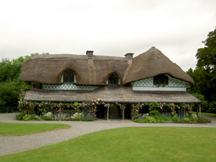
| Swiss Cottage | A thatched house built in a wooded area early in the 19th century and "probably designed by John Nash" (Bence Jones p.53). In the mid 19th century it was valued at £9 and held by the Earl of Glengall in fee. A lithograph of this building is included in the Glengall sale rental of November 1853 and the Burmester, Law and Sadlier sale rental of November 1857. Now in use as a heritage centre. |
|
| Sycamorehill | At the time of Griffith's Valuation, Allan Pollok held a property at Sycamorehill, parish of Clonfert, valued at £16. Molloy states that this house was burned during land agitation on the Pollok estate in the 1850s but it was subsequently re-built. Sycamorehill is still extant and part of a large farm. |

|
| Sylaun | Descriptions indicate that Sylaun House, which was valued at £7 at the time of Griffith's Valuation, was a single storey, thatched structure. No trace now remains of the house though other estate architecture is visible. | |
| Synone | A house built in the second half of the 19th century, still extant and lived in. |
|
| Taghboy House | Built in the 1860s by the O'Rorkes and home to Mary O'Rorke for the rest of the 19th century. Valued at £9.5s in 1906. The last occupants were the Kelly family who were still in residence in the 1930s. | |
| Tallagh | At the time of Griffith's Valuation Denis Godley was leasing this house from the Clive estate, when it was valued at £10. Some farm buildings occupy the site. | |
| Tallagh Cottage | At the time of Griffith's Valuation the house was occupied by Anthony Wood, who held it from Andrew Caldwell. It is labelled Tallagh Cottage on the 25-inch edition Ordnance Survey map of the 1890s. This house is no longer extant. | |
| Tallyho | Tallyho is a five-bay two-storey country house, built in the late 18th century by Thomas Gerard or possibly the Hon R Rochfort as Taylor and Skinner’s map of the late 1770s indicates he was resident there. Thomas Gerrard was resident in 1814 and it was the residence of Mrs. Gerard in 1837. Valued at £15 it was occupied by Michael Hevey who held it in fee. Agnes Duthie, a dairy teacher, lived here in 1901 and George Orr, a land steward and family in 1911 holding the property from J B Marley. This house is now the centre of a stud farm. |
|
| Tallyho Lodge | Tallyho Lodge was the home of Burton Persse, Sen, in the 19th century. The house is no longer extant but traces of the walled garden remain. |

|
| Tanavalla or Garrantanvally House | Alexander Elliott was leasing this property from William Monsell at the time of Griffith's Valuation, when it was valued at £22 10s. While it is labelled Garrantanavally House on the 1st editon Ordnance Survey map, it seems to have been generally known as Tanavalla House. Lewis states Tannavalla was the seat of A. Elliott in 1837. Bary states that the original house was destroyed by fire in the 1820s and rebuilt in Regency style. The Elliotts owned the property until at least the 1870s after which it was the occupied by the Cooke family. It was burned in 1920. |

|
| Tangier | Caleb Robertson is recorded as occupying the house known at the time of the first Ordnance Survey. He is noted as the immediate lessor at the time of Griffith's Valuation though the house was unocciped and valued at £28. Tangier House was occupied by Harward O'Farrell, a doctor, in the second half of the 19th century. His third son, Sir George Plunkett O'Farrell, was granted arms in 1909. A house is still extant at the site. | |
| Tankardstown Mine House | In 1851 John Petherick wsa leasing this property from Mrs. Barron's estate when it was valued at £9. A house still exists at the site. Petherick was the mine manager of the Tankardstown Copper Mine. |
|
| Tanrego | In 1786 Wilson writes that Mr. Irwin's property was situated "on the right of Strandhouse Inn" and nearby was Tanrago, the seat of Mr. Dodwell. At the time of Griffith's Valuation, Capt.Richard Olpherts was occupying a house at Tanrego, barony of Tireragh. In 1894 Slater refers to Tanregoe as the seat of Richard Verschoyle. In 1906 Tanrego was the property of Richard J. Verschoyle and was valued at £25. It is still extant and occupied. |

|
| Tanzyfort | Tanzyfort House was built by the Cooper family in the mid-17th century and occupied by them until the completion of Coopershill House in 1774. Wilson, however, still refers to it as the seat of Arthur Cooper in 1786. Orser provides a detailed description of the layout of Tanzyfort House. | |
| Tarbert House | Tarbert House was owned by Robert Leslie at the time of Griffith's Valuation when it was valued at £24 10s. Both Leet in 1814 and Lewis, in 1837, note it as the seat of R. Leslie. In 1906 it was valued at £25. The National Inventory of Architectural Heritage suggests the house was built c.1720. In 1786 Wilson describes it as "happily situated on an eminence commanding an extensive view". The house has remained in the Leslie family since that time though the estate was sold to the tenants c.1904. It is open to the public during the summer months. |
|
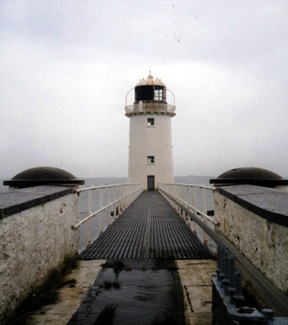
| Tarbert Lighthouse & Keepers House | At the time of Griffith's Valuation, Robert Leslie was leasing this property to the Board of Ordnance, when it included the lighthouse and lightkeeper's house and associated buildings, valued at £22. The lighthouse is still extant and operational. |
|
| Tavraun House | A home of the O'Grady family in the 19th century, this house is still lived in and well maintained. In 1944 the Irish Tourist Association surveyor recorded Tavraun House as a plain, two-storey house, owned by Mr Walsh. Sir Henry Doran of the Congested Districts' Board lived in the house at the beginning of the 20th century. The family vault of the O'Gradys is in Urlaur Abbey. |
|
| Tawnahoney | At the time of Griffith's Valuation, Patrick Buchan, agent to the Creevlea Iron Works, was leasing buildings valued at £17 at Tawnahoney, barony of Dromahaire, from John Johnston. This property does not appear to be extant at the time of the 25-inch Ordnance Survey map in the 1890s. In 1786 Wilson had noted a property in the nearby townland of Gortermone as a seat of Mr. Johnston. It is not shown on the Ordnance Survey maps. | |
| Teehill Cottage | The National Inventory of Architectural Heritage dates this house circa 1820. It was built on the Barrett-Lennard estate before the nearby Ulster Canal was constructed. Valued at £10 at the time of Griffith’s Valuation it was occupied by Henry Brown who held it from Thomas Robinson. Home of Edward Scott at the beginning of the 20th century. |
|
| Teermaclane | Home of the Woulfe family in the 18th century, it became a ruin in the early part of the 19th century. |
|
| Teernea | Hewitt Bridgeman, Member of Parliament for county Clare, lived here in 1837. By the time of Griffith's Valuation Myles O'Brien was leasing the house from Henry Dwyer. It was then valued at £8.10 shillings. | |
| Teeveeny House | A house valued at £14 held by Michael Cagney from Richard and Jonas Morris in the mid 19th century. His widow Johanna Cagney was still resident in the 1870s. In 1943 the Irish Tourist Association Survey reported that the house had was then occupied by the Condron family. Buildings are still extant at the site. | |
| Teevmore | A two-storey house occupied by James Stuart in 1837 and owned by Nathaniel P.Simes at the time of Griffith's Valuation but unoccupied. Substantial buildings are shown at the site on the 1st edition Ordnance Survey map but these have all but disappeared by the publication of the 25-inch edition of the 1890s. Some of the old outbuildings have been converted into a house. |
|
| Temp House | A house called Tempe was occupied by Charles O'Connor in 1814. IN the 1850s it was leased by Tobias Kelly from Catherine Mennons and valued at £13. A house is still extant at the site. | |
| Temple | This property is labelled Temple House on the 25-inch Ordnance Survey map having been built after the publicaiton of the 1st edition maps. In the 1850s William Poole was leasing the property from the Graves estate when the buildings were valued at £10. Substantial ruins still exist at the site. |
|
| Temple House | The Temple House estate extended into the Civil parishes of Cloonoghill and Emlaghfad as well as in the parish of Kilvarnet where the house is located. In 1786 Wilson refer to Temple-house as the seat of Mr. Perceval. The present house was built c.1820 but was subsequently modified. In 1894 the house was noted by Slater as the seat of Mrs. Perceval. Remains of earlier Perceval houses are to be seen in the demesne. |
|
| Temple House | Temple House, Templemacateer, is located on an old abbey site and very close to the border with County Offaly, it is named on the first edition OS map. This three-bay two-storey house was built in the mid-18th century and altered c.1840 (boi). It was originally the home of the Handy family. Dennis Kelly was the occupant in 1814. Marcus Kelly was resident in 1837 and at the time of Griffith’s Valuation (publ. 1854) when the house was valued at £12 and held from the representatives of Samuel B Handy. It was the home of John Mark Kelly, a farmer, magistrate and land commissioner and his wife in 1901. Now in use as a guesthouse run by the Fagan family, see https://templemacateer.booking.site/en | |
| Temple View | The house now known as Temple View was built in the later 19th century. At the time of Griffith's Valuation there was a building at this location owned by Peter Hale and leased to George Fenton. In 1906 Temple View was the property of James Hale and was valued at £32 as well as other buildings in the townland. McTernan states that it had a succession of owners through the twentieth century but has been vacant for long periods. In 2005 it was derelict and for sale. |
|
| Templemary | A house located on the Purcell estate, occupied by Purcell esq in the 1770s and 1780s, by John Purcell in 1814, by J. O'Leary in 1837 and by Kilner R. Woods in the early 1850s who held it from Wills George Crofts. The house was valued at £23+ at this time. The Fuges occupied the house in the late 19th century and early 20th century. The house was valued at £26 in 1906. The Irish Tourist Association survey in the 1940s described it as "a spacious three-storey house with a cellar". A new house now stands on the site. | |
| Templemichael Rectory | At the time of Griffiths Valuation in the early 1850s, Reverend John le Poer Trench was leasing this property from the Ecclesiastical Commissioners, when it was valued at £32. The National Built Heritage Service suggests it was built c.1840 on the site of an earlier house. In 1777 Taylor and Skinner indicated that the house at Templemichael was occupied by Dean Ryder. The later house is still extant and in use as a house. | |
| Templemore Abbey/The Priory | In 1837 Lewis refers to the Castle at Templemore being the residence of the Carden family "up to about a century ago" when it was accidentially burnt by fire. He states that more recently the Carden family had lived at the Priory, a house marked on the first edition Ordnance Survey map and valued at £96+ at the time of Griffith's Valuation. This house was rebuilt in the 1860s and was burnt in the early 1920s. The stableyard is still extant. In 1894 Slater had referred to Templemore Abbey as the seat of Sir John C. Carden. |
|
| Templenew House | James Thornly was leasing this property from the Conolly estate at the time of Griffith’s Valuation when it was valued at £16. It is still extant. |
|
| Templenoe | Hajba writes that this house, on the banks of the River Blackwater, was built in 1761 by the Hydes of Castle Hyde. William Hyde (died 1790) of Templenoe was the son of John Hyde of Creg Castle and grandson of Arthur Hyde of Castle Hyde. He married Catherine Lane. William Lane Hyde was resident in 1837 and at the time of Griffith's Valuation. He held the property valued at £20 from John Phipps. His estate of 584 acres was advertised for sale in July 1850. The present Templenoe House was the residence of the Mounteagles in the latter half of the 20th century. |
|
| Templeoran House | Templeoran House, named on the first edition OS map, this was a two-storey, five-bay late 18th century house which O’Brien states has been an ivy covered ruin for many years. In 1837 Mrs Johnson was resident and at the time of Griffith’s Valuation (publ. 1854) the house was the home of Edward Fetherstonhaugh, valued at £8.10 and held from George A Boyd. | |
| Templeport House | Templeport House was built about 1860 on part of the Dobbin estate. It is situated north east of Templeport Lough and may occupy the site of a former herd’s house. Robert Roycroft of Templeport House died in 1881, aged 64 and was buried in Templeport graveyard. |
|
| Templevally | The home of the O'Mahony family in the 19th century, occupied by William O'Mahoney at the time of Griffith's Valuation, valued at £26+ and held from Cooper Penrose. Late this house was home to the Condons. The original house is demolished and a later house is now inhabited. |
|
| Templevanny | McTernan notes that Templevanny House was commenced in 1846 but not completed until after the Famine. At the time of Griffith's Valuation, it was held by Margaret and Henry Gorman from Viscount Lorton's estate with a valuation of £2. It continued in the Gorman family until the 1920s. The building is still extant though derelict. | |
| Tenessee | This house is labelled Tenessee House on both the First and 25-inch edition Ordnance Survey map. In 1841 the Ordnance Survey Name Books suggest that it was the property of Lord Dunally. In the mid 19th century it was occupied by Thomas R. Barnes and held from Joseph Falkiner. The buildings were valued at £14. 15 shillings. The house is still in use as a residence. |

|
| Tennalick House | Tennalick House was associated with the nearby mill complex. At the time of Griffiths Valuation, it was leased by Stephen Cullen to Robert Diamond and was valued at £10. The mill complex was leased by John McCann & Co. also from Stephen Cullen and valued at £130. The Valuation Office House Books indicate that the house occupied by Robert Diamond was valued at £12 in 1840, while the mills, then held by William McCann, were valued at £62. The National Built Heritage Service suggests that the now-ruinous house at Tennalick dates from the early 18th century and may incorporate the remains of a 17th century house. It associates the site with the O’Farrell and Sankey families and later with the Gore estate, 1st Barons Annaly, before its acquisition by the White family, third Barons Annaly, in the early 19th century. Both the house and mills at Tennalick are now ruinous. |
|
| Termonbeg | Charles Broderick was leasing a property valued at £10 at Termonbeg, barony of Castlereagh, from the Sandford estate at the time of Griffith's Valuation. The house is not marked on the 1st edition of the Ordnance Survey. | |
| Terramount | A mid 19th century house, home of John G. Nason in the early 1850s. Held by him in fee and valued at £24.25 shillings. The Nasons owned this property until the early 20th century. The famous race horse Dawn Run was bred at Terramount in the 1970s. |
|
| Tervoe | Bence Jones writes that the house was built in 1776 by Colonel W.T. Monsell MP on the site of an earlier house. Wilson refers to it in 1786 as "the pleasant seat of W.T. Monsell". In 1894 Slater notes it as a residence of Lord Emly. A De La Poer grandson of the 1st Baron Emly succeeded to Tervoe in the 20th century and it was demolished in the 1950s. A detailed description of the interior of the house is given by the Irish Tourist Association surveyor in 1943. |

|
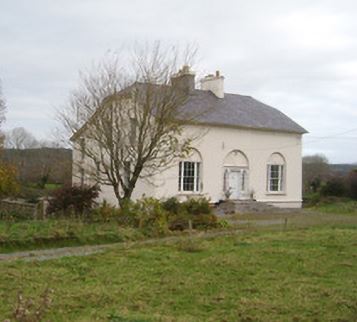
| The Cottage | A house built after the first Ordnance Survey. Thomas Gillman was leasing this property from George Wiseman at the time of Griffith's Valuation, when it was valued at £11 5s, It is still extant and known as Grove House. |
|