Browse Houses
Search Results: Returned 5926 records. Displaying results 5501 – 5600
| House name | Description | |
|---|---|---|
| The Cottage | The Cottage, Gallstown, is named on both the first edition OS map and the 25 inch. This was the seat of the North family at the end of the 18th century (O’Brien). By 1814 Hugh Sheil was resident and Lewis records Mrs Sheil of The Cottage. This family was related to the Sheils of Gortlumly. The house was occupied by Margaret Sheil at the time of Griffith’s Valuation (publ. 1854), valued at £10 and held from Lord Kilmaine. Home of employees of Lord Kilmaine in the early 20th century. The house is no longer extant. | |
| The Cottage | This house is located close to Lough Sheelin and on the roadside. In the mid-19th century it was valued at £12, occupied by James Sneyd and held from Andrew Booth Bell. In 1906, the townland of Bellsgrove was in the occupation of Matthew William Webb and The Cottage had a rateable valuation of £7. It appears to be still extant. | |
| The Cottage | The home of William O'Donnell in 1837 and in the early 1850s held from the representatives of Michael D. Keating. The building were valued at £18+ in the mid 19th century. Richard O'Donnell of Carrick on Suir owned 359 acres in the 1870s. | |
| The Cottage (Kenmare) | At the time of Griffith's Valuation, Francis Downing was a leasing a property at Mucksna, Kenmare, to Agnes Godfrey, when it was valued at £9. This may be the property which Bary refers to as Tom Moore's cottage, still extant and occupied. | |
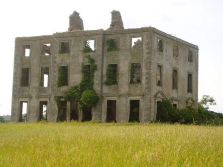
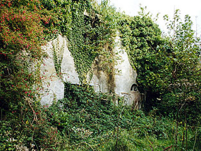
| The Grange | The home of the Grady/O'Grady family in the 18th and 19th century. In 1786 Wilson describes it as "the beautiful and well-improved seat of Standish O'Grady". It was inherited by the Crokers in 1861. Occupied by Standish [O'] Grady in 1814 and Henry O'Grady in 1837 and at the time of Griffith's Valuation. The buildings were valued at £77 and the property was held in fee. In 1894 it was noted by Slater as the seat of Captain Edward Croker. This house was described as in very good repair even though it had not been occupied for a number of years preceding the Irish Tourist Association survey of 1942. The house is now a ruin. |
|
| The Green | At the time of Griffiths Valuation in the 1850s James Watt was leasing this property from the Stewart estate when it was valued at £50 and included a mill. It is still extant. |

|
| The Grove | A house on the outskirts of the town of Tuam, occupied by Mrs Cheevers in 1814 and by Patrick Kelly at the time of Griffith's Valuation, who held it from Martin S. Kirwan. Earlier, in 1786, Wilson refers to it as the seat of Martin Kirwan. The house was described in the sale rental of the early 1860s as having two large reception rooms, eight bedrooms and two water closets. Run as a hospital by the Bon Secour Sisters 1945-2001. | |
| The Grove | At the time of the first Ordnance Survey the house was described as the former residence of Captain Bourke. It became the home of James Faulkner in the late 1860s until his death in 1911. It was used as a nursing home from 1926. In 1993 it was sold and rebuilt as luxury apartments. |
|
| The Grove | At the time of Griffith’s Valuation, Mrs. John Hickson was leasing this house, valued at over £27, from Reverend Maurice Townsend. 1n 1837, Lewis describes the property as formerly belonging to the Knight of Kerry. It is most likely the property at Dingle referred to by Wilson in 1786. It is no longer extant. A new community school for Dingle has been constructed near the site. | |
| The Hall (Inver) | This property was held in fee by the Marquis of Conyngham’s estate at the time of Griffith’s Valuation, when it was valued at £38. Lewis records that it was occupied by a Colonel Pratt in 1837, though notes that it was a seat of the Conyngham family. The National Inventory of Architectural Heritage suggests the house was built some time in the 1750s. It is still extant. |
|
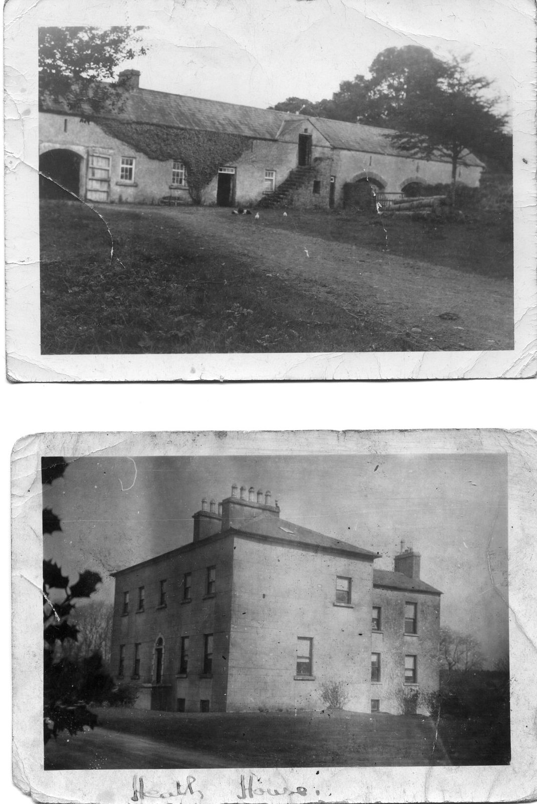
| The Heath | At the time of Griffith's Valuation, it was the property of Henry Blake and valued at £10. Described in 1863, when sold by the Blakes to the Tighes, as a substantial dwelling house with two reception rooms and six bedrooms, all in good repair. It is now a ruin. |
|
| The Hermitage | At the time of Griffith's Valuation, Harper Campbell was leasing a property at The Mall, Sligo, valued at £41. It had been purchased by him in the Encumbered Estates Court in 1855, having previously been the property of a member of the Wynne family. McTernan notes that it was destroyed by fire in 1976 and the site is now occupied by educational buildings. | |
| The Hermitage | The original house, named Hamlet Cottage, was beside the road and is marked on the 1838 Ordnance Survey map. A new house was later built and is labelled The Hermitage on the 25-inch Ordnance Map of the 1890s. A house is still extant at the site. |
|
| The Hermitage | Hajba states that this single storey house was built by the Reverend John Bagwell Creagh before 1814. Located on the Creagh estate it was occupied by J. Norcott in 1837 and by Samuel Morton Tuckey in the early 1850s, when the buildings were valued at £15.10 shillings. Later inhabitants included William Stawell. Home of the Broderick family in the 20th century. |
|
| The Hermitage (Clongesh) | In 1906 Tobias Peyton owned a property at Breanrisk valued at almost £15. This had been the family home of his mother, Frances Ellis. At the time of Griffiths Valuation in the early 1850s it was occupied by Thomas H. Ellis and valued at £8. The National Built Heritage Service suggests the original house dates from c.1780. It is labelled The Hermitage on the 25-inch Ordnance Survey map of the early 20th century, the name by which it is still known. |
|
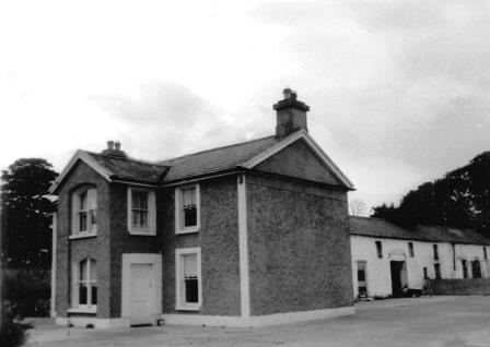
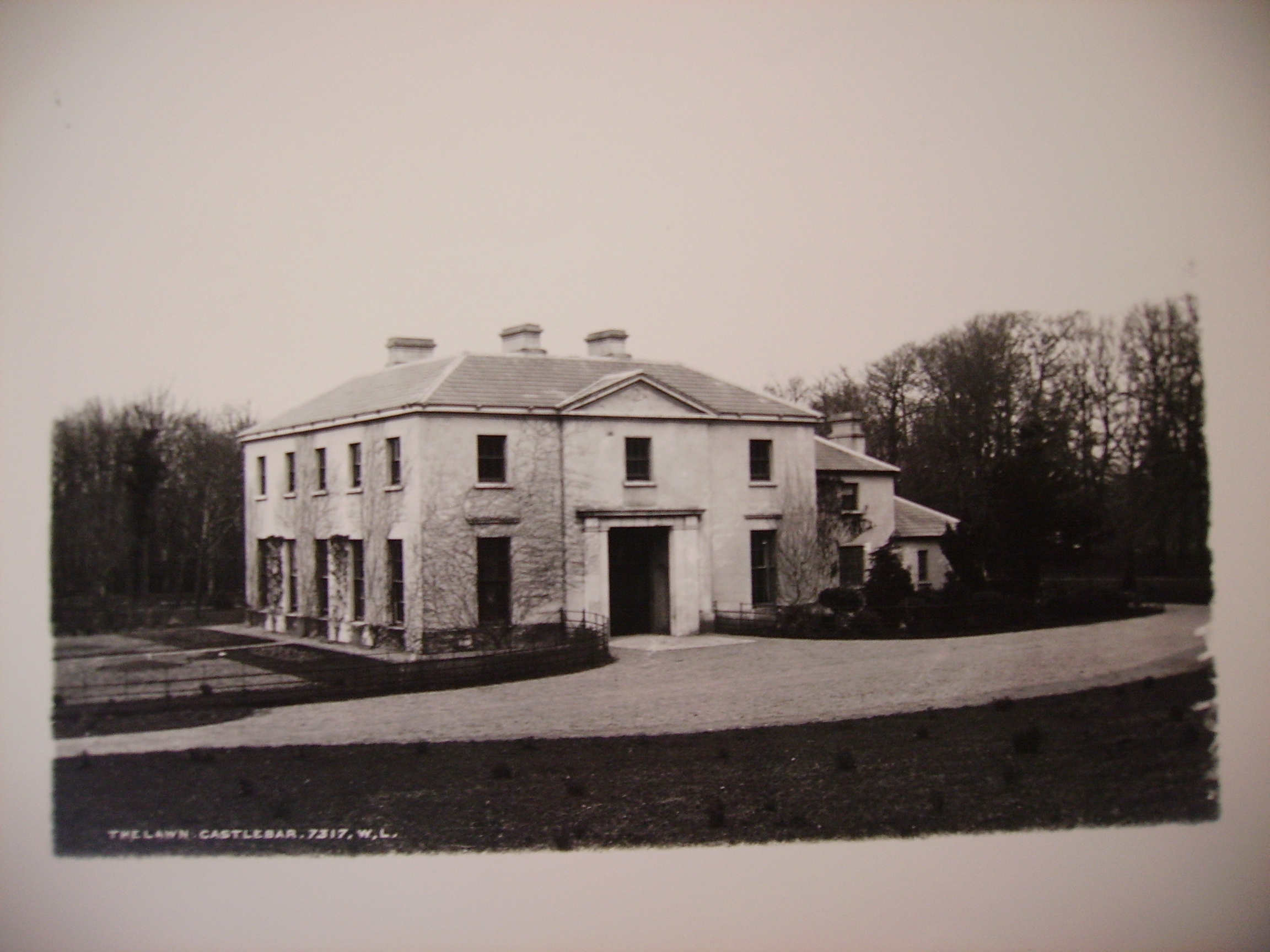
| The Lawn | Castlebar House was burnt in 1798. When resident in Castlebar in the 19th century the Earls of Lucan lived in the lodge known as 'The Lawn', described in the Ordnance Survey Name Books as the residence of St Clair O'Malley, who was agent to the Earls of Lucan in the 1830s. Castlebar House is referred to as the seat of the Earls of Lucan in 1894. This building is now part of a school complex. |
|
| The Lodge | The Lodge on Hare island was a hunting/fishing lodge built c 1814 for William Handcock, 1st Lord Castlemaine of Moydrum to designs by Sir Richard Morrison (1767 - 1849), having a veranda supported on cast-iron pillars to the entrance front (boi). In 1837 Lewis describes it as a ‘Beautiful cottage’ belonging to Lord Castlemaine. On Hare Island he engaged in fishing, shooting and boating on Lough Ree and hosted many social events on the island during the first half of the nineteenth century. In 1906 the buildings on Hare Island were valued at £18, occupied by Lord Castlemaine who held 110 acres of untenanted land there. It is now derelict. |
|
| The Lodge | A sporting lodge built by the Taylour family before 1800 and originally known as Cottage. It was extending circa 1820 and again circa 1860. It is situated close to Lough Ramor and on the outskirts of the town of Virginia. The Lodge was valued at £37 in the 1850s when the Earl of Bective was recorded as the occupant. By 1906, the rateable valuation had risen to £105. The building now functions as a hotel, see http://www.virginiaparklodge.com/ |

|
| The Lodge | A house with foundations dating from the 17th century, visited by Mary Delaney in the 1730s and occupied by the French in 1798. By 1837 it was the home of T. Kirkwood and, in the mid 19th century, of the Very Reverend J. Collins who held the property valued at £20 from the Ecclesiastical Commissioners. In the late 19th century this house was the home of Captain Alfred Charles Knox, a younger son of John Knox of Castlerea, Killala. Bence Jones writes that the house was enlarged circa 1820 by the addition of a bow shaped wing and that for a time it was the home of the Pery Knox Gore family. In the later 19th century the house was the home of the Timony family who owned a substantial import business in Killala. In the later 20th century owned by Lord Rathcaven and now the Irish home of Noeleen Farrell. |

|
| The Lodge (Bridgend) | Anne Scott was leasing this property from the Stewart estate at the time of Griffiths Valuation in the 1850s, when it was valued at almost £15. The property is labelled "The Cottage" on the 1st edition Ordnance Survey map but as "The Lodge" on the 25-inch map of the early twentieth century. It is still extant. |
|
| The Lodge (Buncrana) | James Boyle was the occupier of this property at the time of Griffiths Valuation when it was valued at £14 and leased from Sarah McClintock. Lewis referred to it as unoccupied in 1837. It is labelled The Lodge on all editions of the Ordnance Survey maps. A house is still extant at the site. | |
| The Manor House (Dunmanway) | Noted by Lewis in 1837 as " a handsome building, erected by the late H. Cox and now the residence of his family" In 1851 occupied by Martha and Catherine Cox and valued at £18. It replaced an earlier house built by Sir Richard Cox, Lord Chancellor of Ireland, at the end of the seventeenth century. Wilson describes this earlier property in 1786 as "adorned with handsome avenues and good plantations". Later the property of the Lucas family, In 1944 the Irish Tourist Authority Survey reported that it was the residence of Mr. T. O'Sullivan. |
|
| The Moor | This house is labelled "The Moor" on the 1st edition Ordnance Survey map of the 1830s. Reverend William Ewing was leasing this property from the Arran estate at the time of Griffith’s Valuation in the 1850s, when it was valued at £20. On the 25-inch Ordnance Survey map the house at this site is labelled “Vicarage”. A house is still extant at the site. | |
| The Mount | Nicholas Mahon Power held this unocupied property at the time of Griffith's Valuation when it was described as a "herd's house" and valued at £10 12s. A ruined folly still exists adjacent to the site. | |
| The Neale | An early 18th century house, with a number of follies designed by Lord Charlemont. Wilson refers to it as "the superb and beautiful seat of Sir John Browne" in 1786. It was occupied by the Reverend James Cromie, brother-in-law of the 2nd Baron and his family, for most of the first half of the 19th century. The house was valued at £25 at the time of Griffith's Valuation. It was sold in the 1930s and most of the house is now demolished. |
|
| The Palace | Built as the residence of the Protestant Bishop of Elphin in 1685 from money bequeathed by Bishop Hudson. Altered in the mid 18th century and remained as the Bishop's residence until 1845. At the time of Griffith's Valuation the home of Arthur O'Conor, younger brother of Denis O'Conor of Mount Druid. Valued then at £55 and held from the Ecclesiastical Commissioners. Accidentally burnt in 1911, the main block is now demolished. | |
| The Pines (Darrigal) | Alexander Sherlock was leasing this property to Michael Nowlan in 1850 when it was valued at £13 10s. It appears to have become known as The PInes by the end of the nineteenth century. Recorded as the seat of Patrick Power by Leet in 1814. There is still a house at this site. | |
| The Priory | A house valuled at £17+ at the time of Griffith's Valuation and held by the Reverend Francis Newport from Joseph H. Bennett. The Reverend Newport's daughter married J. H. Bennett's nephew in 1865 and they eventually inherited Bennett's Court. |

|
| The Reeks or Baunclune | The McGillycuddy was in possession of the property at Whitefield at the time of Griffith’s Valuation when it was valued at £24 10s. Lewis and Leet also refer to Whitefield as a seat of The McGillycuddy in 1837 and 1814 respectively. Leet, however, also notes McGillycuddy Reeks as the address of McGillycuddy esq. In 1906 it was McGillycuddy property and valued at £24. Bary states that the house was originally known as The Reeks after the family title but that it was changed to Whitefield in the early 19th century by Richard McGillycuddy. However, on both the 1st and 25-edition Ordnance Survey maps it is labelled Baunclune. In more recent times it is known as The Reeks. This is how it is referred to by the Irish Tourist Association surveyor in the early 1940s who states that it was the the home of "Ross Kinloch, the MacGillycuddy of the Reeks and a member of Seanad Eireann". The house is still extant and occupied. |
|
| The Retreat (Island) | Richard Beamish was leasing this property from Winspur Toye at the time of Griffith's Valuation, when it was valued at £20. A house is still extant at the site. | |
| The Retreat (River View House) | In 1851 Thomas K. Sullivan was leasing this property from the Devonshire estate when it had a valuation of £38. It is labeled Riverview House on the 1st-edition Ordnance Survey map but has changed to The Retreat by the 1890s. It is still extant. |

|
| The Shrubberies (Kenmare) | At the time of Griffith's Valuation, Kenmare Board of Poor Law Guardians were leasing this property from Nathaniel Irvine as an Auxiliary workhouse, when it was valued at £37. On the 1st edition Ordnance Survey map it is labelled Monastery but on the later 25-inch Map of the 1890s it appears as The Shrubberies. It is still extant. | |
| The Turret | Lewis writes that the Turret was erected by a branch of the De Lacy family and repaired by Colonel O’Dell in 1683 and was "lately the residence of Major O’Dell". The Ordnance Survey Name Books refer to an inscription on the wall of the building which recorded the O'Dell family inhabiting the building in 1683. It was reputed to incorporate a turret from an old house of the Knights Hospitallers. Thomas O'Dell was resident in 1814 and Mrs O'Dell of the Turret, Ballingarry, died in 1818 according to the church records of that parish. Fitzgerald in 1826 refers to Jackson's Turret, built on a hill and "now nearly in ruins". Bence Jones writes that a porch and wing were added to the building in the late 19th century and that it became a presbytery. Grid reference is approximate. | |
| The Vicarage (Bantry) | Rev. John Murphy was leasing the Vicarage from the Bantry estate at the time of Griffith's Valuation, when it was valued at almost £21. The house is still extant and occupied. |

|
| The Warren | Caleb Robertson is recorded as the lessor of a property in the townland of Warren or Drum at the time of Griffith's Valuation. It was valued at £25 and leased to a Captain Butler. A house at this site is labelled The Warren on the 25-inch map of the 1890s and a house still exists there. | |
| Thomastown | Thomastown was originally leased by Christopher Bowen to Francis Lambert in 1777. It was the residence of Thomas Valentine Clendining in the first half of the 19th century. The unoccupied house was held by Charles G. Mahon at the time of Griffith's Valuation when it was valued at £30. Some buildings survive at the site. | |
| Thomastown | At the time of Griffith's Valuation, Thomastown House, barony of Clare, was occupied by James Clarke and valued at over £10. The National Inventory of Architectural Heritage indicates that this is a two-phase house, the original part dating from the early eighteenth century. It is still extant and occupied. |
|
| Thomastown Castle | The original building was a two storey house of pink brick built in the 1670s by George Mathew with early 18th additions. Wilson decribed it in 1786 as "an ancient but handsome edifice". In the second decade of the 19th century it was enlarged and transformed into a Gothic castle, designed by Richard Morrison for the 2nd Earl of Llandaff. Viscount Chabot is recorded as the occupier in the mid 19th century. He held the property in fee and the buildings were valued at £100. Bence Jones writes that it later was in the possession of the Daly family but from the mid 1870s it began to decay. William Daly was the occupier in 1906 when the buildings were valued at £61. |
|
| Thomastown Park | Built in the 18th century and home of the Naghten family for over 200 years, valued at £35 in the 1850s. Wilson refers to it as the seat of Mr. Naghten in 1786. In 1894 Slater mentions Thomastown park as the seat of Mrs. Naghten. It is no longer extant. | |
| Thornberry House | Originally a Brew family home, then a rectory and by the mid 19th century in the possession of the Studdert family held from Jane Robinson. Later the home of Colonel Thomas Lloyd. The house was demolished in 1949. | |
| Thornfield | Leet records Thorn-field as the residence of Thomas Thornley in 1814. By the mid 19th century it was the residence of Sir Richard Bourke held by him in fee and valued at £25. The Ordnance Survey Field Name Book refers to Sir Richard Bourke repairing the house circa 1840. It was 2 storeys high, 60x50 feet. This house has remained in the possession of Sir Richard's descendants into the 21st century. |

|
| Thornfield | Slater refers to Thornfield as the seat of John Davis in 1846. In 1856 Thomas Galbraith was leasing a property valued at £7 in the townland of Thornfield, parish of Lickmolassy, barony of Longford, from the Clanricarde estate. It is no longer extant. | |
| Thornfield | Occupied by John Mahon at the time of Griffith's Valuation and held from the Kellys. The sales rental of 1863 includes a lithograph of Thornfield which was sold privately to Christopher Bagot. It continued to be occupied by the Mahon family until 1917, when it was taken over by the Land Commission, Henry English inhabited the house until the 1950s. This house on the Galway/Roscommon border now appears to be a ruin, with a substantial garden wall still intact. |
|
| Thornford | This house located on the estate of the Marquess of Bath was associated with the nearby mill complex. Hamilton McMath was the proprietor in the mid-19th century, when the house was valued at £26 and the mill buildings (corn and flax) at £60. Buildings are still extant at this site. |
|
| Thornhill | ||
| Thornhill | Home of Charles Burke Jordan in the 19th century. At the time of Griffith's Valuation, he was leasing this property to James Jordan when it was valued at £5. The building labelled Thornhill on the 1st edition Ordnance Survey map is not the same as that on the later 25-inch edition published in the 1890s. The latter is no longer extant but some buildings remain at the original site. | |
| Thornhill | A Nason home, first occupied by John William Washington Nason. His widow Mrs Barbara Nason is recorded as resident at the time of Griffith's Valuation. Valued at £18.11 shillings the house was held from the Duke of Devonshire. The Nason family continued to live here until the mid 20th century. The house is still an occupied residence. | |
| Thornhill (Ballinacarrow) | At the time of Griffith's Valuation, Charles Gilbert was leasing a house and bleach mill at Ballinacarrow North, from the Hall Dare (earlier and later the Perceval) Estate. The combined valuation of the buildings was over £21. McTernan states that this is Thornhill House and mills. The mills had ceased to operate in the early twentieth century but the house is still extant. | |
| Thornhill (Drumsnat) | John Johnston is described in the Ordnance Survey Field Name Book as the only gentleman resident in the parish. He lived at Thornhill. On 13 June June 1854, this house and a demesne of about 40 acres was for sale in the Encumbered Estates Court. The owners and petitioners were Mary Johnson, widow, Maria and Jane Johnson and Martha Dudgeon, formerly Johnson. The property was held under a lease (1738) for 999 years. By the time of Griffith’s Valuation Robert Thomson was the occupant holding the property from Owen B. Cole & Olivia Lucas. The buildings were valued at £25. Home of Felix P. Smith and family in 1911. |

|
| Thornhill House | Wilson, writing in 1786, refers to Thornhill as the seat of Mr. Townsend. Two prooerties are shown in the townland of Derreendangan on the 1st edition Ordnance Survey map of the 1830s. One, Thornhill House, is described as "in ruins" while the other property, Thornhill Cottage, is located nearby. The townland was part of the estate of Thomas Uniacke at the time of Griffith's Valuation. The 25-inch map of the 1890s indicates Thornhill House again in use and there is a still a substantial farm at this site. Thornhill Cottage is no longer extant. | |
| Thornpark | At the time of Griffith's Valuation the property at Carrowmoneash, parish of Oranmore, was leased by the representatives of H. Butler to Anne Butler/K.H. Blake. Burke's Landed Gentry (1958) states that Xaverius Henry Blake Butler purchased Thornpark, part of his mother's dowry, in the Landed Estates' Court in April 1860. Sir Henry Blackall states that Xaverius Blake Butler bought Mount Vernon, which he renamed Thornpark, from his nephew Henry.By 1906 the house at Carrowmoneash was owned by James Blake Butler and was valued at £26. Thornpark House is now the Oranmore Lodge Hotel. See www.oranmorelodge.ie for more information. |
|
| Thornville Lodge | O'Connell states that this house was built by the Bricknell or Bucknell family in the later 18th century. It was later occupied by the Bishop of Kilmacduagh, Dr. Ffrench. Kinvara parish records also indicate that Arthur and Clare Ireland lived here in the 1830s. This may be the same Arthur Ireland who held the post of Burser at Queen's College, Galway in the 1850s. The house is still extant. | |
| Tiaquin | At the time of the Burke sale in 1851 the house was described as an 'old fashioned cottage style' type of building. A gable end of the house still stands with the nearby farm buildings still in use. |
|
| Ticooly/Tycooly | Occupied by the O'Kellys in the 18th and early 19th centuries. By the time of Griffith's Valuation it was part of the Clonbrock estate and was valued at £16. A building on a slightly different site, is noted as Tycooly House on the 25-inch Ordnance map of the 1890s. There is still an extant property at this site. |
|
| Tieraclea Lodge | At the time of Griffith's Valuation, Tieraclea was occupied by Stephen Collis, when it was valued at £42. An extensive farmyard is recorded here on the First Edition Ordnance Survey map. The house is labelled as Tieraclea on the later 25-inch map and by 1906 Tieraclea was valued at £45. Bary writes that it had been a residence of the Collis family since the eighteenth century and they continued there until the 1920s. In the early years of the twentieth century the house was destroyed by fire but was re-built and is still extant. | |
| Tiermoyle House | In 1786 Wilson refers to Tiermoyle as the seat of Mr. Crawford. In 1840 the Ordnance Survey Name books refers toTiermoyle as a residence of Cooper Crawford and "about 20 years ago it was then a place of some account but it is now in a state of dilapidation". By the time of Griffith's Valuation, this house was occupied by Mrs. Costelloe, leasing from Countess Norbury's estate and valued at almost £4. A farm is still extant at the site. | |
| Tikincor Castle | Tickincor Castle, a fortified house, is described as "in ruins" on the first edition Ordnance Survey map in 1840. Buildings at the site were valued at £7 18s at the time of Griffith's Valuation in the 1850s when they were owned by Ralph B. Osborne and leased to Thomas Prendergast. In 1777 Smith notes that Tickencore was the property of Sir William Osborne. |
|
| Timoleague House | In 1837 Lewis refers to Timoleague House as the seat of G. Travers. At the time of Griffith's Valuation, it was held in fee by Robert Travers and valued at £21. This house was burnt in December 1920 along with the ancient castle nearby. The Travers family built another house close by which is still extant and occupied. |
|
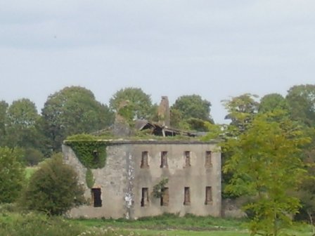
| Timoney Park | This house was the seat of the Hutchinson family in the 19th century. Lewis refers to the great improvements made by J.D. Hutchinson at Timoney. By the mid 19th century the house was valued at £51 and was held in fee. It was occupied by Standish Grady J. Hutchinson in 1906. It is now a roofless ruin. |
|
| Tincurry House | Abraham Jackson was residing at Tincurry in 1814. The Ordnance Survey Name Books refer to Tincurry as the residence of Stephen Moore in 1840. The building appears to have been in use as a workhouse at the time of Griffith's Valuation. In 1906 Wiliam Jackson Pigott was resident at Tincurry in a house valued at £23+. The National Inventory of Architectural Heritage states that the present house was built in 1932 on the same site as the original house which was blown up by British Forces in 1921. |

|
| Tinerana | The Purdon family, originally from Cumberland, held this property on the shore of Lough Derg from the mid 17th century. In the ownership of Simon George Purdon at the time of Griffith's Valuation when the buildings were valued at £30. The Irish Tourist Association Survey File of the 1940s states that the house was built "about 70 years ago", contains about 60 rooms and the original residence of the Purdons stands adjacent to the new house. The estate was sold to the Gleeson family who owned the Athlone Woollen Mills in 1901 and the house later became the property of Dr Carmody who opened a health centre. The property was offered for sale in 2012. |
|
| Tinnascart House | In 1851 this property was leased by Robert Dower from William C. Poole when it was valued at £14 10s.The 1874 Dower estate sale notice indicates that the house had been built within the previous 15 years at a cost of £2000. It is labelled as Tinnascart House on the 25-inch Ordnance Survey map of the later nineteenth century. The location is now a racehorse training enterprise. | |
| Tinny Park | Occupied by T.T. Byrne in 1837 and held in fee by Hugh Burns in the mid 1850s when it was valued at £11. It is still extant. It was offered for sale in 2016 and again in 2022. |
|
| Tintrim | Up to 1898 this house was in the barony of Leitrim, county Galway. It is now in the barony of Tulla Upper, county Clare. At the time of Griffith's Valuation, John A. Burke was occuping the house valued at £11, at Tintrim, parish of Clonrush, barony of Leitrim, county Galway. Weir states that the house at Tintrim was probably built by John Anthony Burke of Clondegoff Castle nearby. He was most likely a member of the Burke family who lived at Meelick House, Whitegate at the same time. Tintrim continued in the possession of the Burke family as John Anthony Burke moved out to allow his son, Edmund, and his family to live there until the house was sold in 1867. The house later passed to the Madden family and is still extant and occupied. The Irish Tourist Association file records state that John A. Burke died in 1857 though the family history suggests he died in 1863. The Tourist Association file also notes that in 1933 there was a search for the heirs of his reputed son, Martin Edward Burke, in Australia. |
|
| Tinvane | This house was the home of the Briscoe family in the 19th century. In 1841 The Ordnance Survey Name Books described it as "handsomely situated...having plantations, gardens, orchard and ornamental grounds". Henry Briscoe was the occupier at the time of Griffith's Valuation when the buildings were valued at £26 and in the 1870s Henry W. Briscoe of Tinvane owned 127 acres. The property was held from the Earl of Bessborough. Now function as a guest house known as Cedarfield House. For an older image of this house, see http://www.waterfordcountyimages.org/exhibit/web/DisplayWAIImage/K0fV5VPbSPSwE/ |
|
| Tiraloughan | In 1906 Lord Gough owned a property valued at almost £4 at Tiraloughin, parish of Beagh as well as over 100 acres of untenanted land. A house still exists at this location. | |
| Tircahan Lodge | Francis Hassard of Tircahan Lodge, also known as Rockwood, is recorded in a sale rental of the Encumbered Estates Court in 1852. He sold part of his estate to Robert Hutton. In the mid-19th century Tircahan Lodge, a building named on the first edition six inch Ordnance Survey map (publ. 1837), was occupied by Henry Breen, who held the house, valued at £8, from Robert Hutton. It is located south of Swanlinbar. In the 1890s the original lodge was replaced by a larger more compact building which still stands today although now derelict. Robert Hutton JP lived here with his family in the early 20th century. In 1906, Georgina Hutton was recorded as the occupier when the 'mansion' house was valued at £17 for rates. | |
| Tirkeenan House | This house is named on the 1st edition 6 inch Ordnance Survey map (1836). It was located on the Rossmore estate and very close to the town of Monaghan. It was occupied by John M’Dowell circa 1860 when the buildings were valued at £32. A third storey was added to this house in the 20th century. |

|
| Tirnaleague House | At the time of Griffiths Valuation n the 1850s, Samuel Rankin was leasing this property from the Lord Bishop of Derry’s estate when it was valued at £15. By 1906 it had the same valuation but was in the ownership of John C. McClintock. The National Inventory of Architectural Heritage suggests it was built by the Cary family but passed to the Rankins through marriage. It is still extant, surrounded by modern housing development. |
|
| Tirnaleague House | In the 1860s, Samuel Rankin was leasing this property from the Lord Bishop of Derry’s estate at the time of Griffith’s Valuation, when it was valued at £15. It is sill extant, now surrounded by modern housing development. |

|
| Tivoli | Marked on the first Ordnance Survey map, Tivoli Cottage valued at £48 was occupied by Major Wheeler and held from Sir Matthew Barrington at the time of Griffith's Valuation. Since 1952 it has been the centre of a boys' secondary school known as Villiers School. |

|
| Tivoli (Cappoquin) | Tivoli was being leased by Henry Dennehy from the Keane estate at the time of Griffith's Valuation, when it was valued at £17. It was included in the sale of Dennehy's estate in the Encumbered Estates Court in 1857 when it was in the owner's possession. The house is still extant and occupied. |
|
| Toanreagh | This house seems to have been constructed after the publication of the 1st edition Ordnance Survey Map but it appears on the 25-inch edition of the 1890s. Richard Oliver was leasing this property to Francis Creagh at the time of Griffith's Valuation, when it was valued at £9 10s. A house and substantial farm are still extant at the site. | |
| Tobercurry | John Brett was leasing a house in the town of Tobercurry to the value of £17 from the Irwin estate at the time of Griffith's Valuation. Much development has taken place in the vicinity since then. | |
| Tobermaing House | Robert Chambers was leasing a property which included a mill to James Chambers at the time of Griffith's Valuation, when it was valued at £26 15s. In the 1830s the Ordnance Survey Field Name Books record Lady Franks as the proprietor of this townland and William Bailey as resident in the house. Bary states that the mill was run by the Bailey family and that the property was later owned by the Roche family. In the 1990s it had been converted into a bar and restaurant. | |
| Toberoneill | At the time of Griffiths Valuation in the 1850s, Joseph Henderson was leasing this property from the Earl of Erne's estate when it was valued at £12. The National Inventory of Architectural Heritage suggests the large scale outbuildings date from c.1860. There is an altered house at the site. |
|
| Toberpatrick | Originally a Wynne property, occupied by Mulloy McDermott in 1837. In the 1830s the townland is recorded as including the ruins of Clooncaface House. The residence of Alonzo Lawder in the mid 19th century, held in fee and valued at £20. Occupied by B. F. McDonnell in 1906. A later house is extant at the site now. | |
| Toberpatrick (Skreen) | Wilson, writing in 1786, refers to "Tubberpatrick" as the seat of Captain Jones. In 1837 Lewis recorded Tubberpatrick House as a seat of the Jones family. At the time of the estate sale in the Encumbered Estates court in April 1852, the house at Tubberpatrick was described as "a dwelling house fit for the reception of a gentleman, with offices and garden on the demesne". At the time of Griffith's Valuation it was the property of Peter O'Connor and was valued at £15. Toberpatrick House is still extant and occupied. In 2008 it was offered for sale through Knight Frank estate agents [Irish Times, 13 March 2008]. |
|
| Toberscanavan House | At the time of Griffith's Valuation, James Noble was leasing this property, valued at £3 from the Cooper estate. McTernan notes that it remained in the Noble family until the later twentieth century. It is still extant but derelict. |
|
| Tobervaddy | The Ordnance Survey Field Name Books record the ruins of an old castle. The Discovery map mark a fortified house. A branch of the Ormsby family resided at Tobervaddy in the 18th century. and Wilson, writing in 1786 refers to Tobervaddy as the seat of Mr. Ormsby. Robert Irwin held the townland at the time of Griffith's Valuation. |
|
| Toberville House | Toberville House is named on the first edition OS map. At the time of Griffith’s Valuation (publ. 1854) it was occupied by Thomas Murtagh, valued at £12 and held from Captain H Boyd Gamble. A building is still located at this site. | |
| Togher | Originally a Lambert residence but occupied by George Ruttledge by 1837. It was held in fee by John Hood at the time of Griffith's Valuation when it was valued at £13.. It became the home of his fourth son, Charles Ralph Hood. This house is now completely demolished. | |
| Toghermore | Held in fee by Hugh Henry at the time of Griffith's Valuation, when it was valued at £16. Toghermore is now a training centre for persons with disabilities run by the Health Service Executive. |
|
| Togherstown | Togherstown House, named The Lodge on the first edition OS map with a small demesne. This is a three-bay two-storey over basement house, built before 1837 possibly incorporating the remains of an earlier house c.1700 built by Thomas Magan, High Sheriff of Co Westmeath. By 1837 Togherstown House was in the occupation of William Thomas Dillon (d. 1870). It was valued at £22 at the time of Griffith’s Valuation (publ. 1854), William T Dillon holding it from William H Magan MP. William Thomas Dillon was the son of Thomas Dillon of Lung, county Mayo and was married to Teresa daughter of Edmund Count Nugent of Ballinacor, county Westmeath. Margaret Treddin, widow and caretaker, and her family were resident in 1901 and 1911 holding the property from Julia Dillon of Dublin. The house was restored in the 21st century. |
|
| Tomies | In 1837 Lewis mentions Tomies as the seat of D.J. O'Sullivan. At the time of Griffith's Valuation, the property, valued at £5, was being leased by Daniel O'Sullivan from the Herbert estate. Bary states that this house was more usually associated with the O'Donoghue estate, citing references to "O'Donoghue of Tomies" in the local press. In 1906 Lord Ardilaun owned the property at Tomies East valued at £8 15s. It is now in ruins. | |
| Toneen | Captain Geoffrey Power was leasing this property from the Slator estate at the time of Griffiths Valuation in the early 1850s, when it was valued at over £13. In 1837 Lewis referred to “Towend” as the seat of “Jeffrey Keating Power”. The extant house at Toneen dates from the later 19th century. |
|
| Toneen Lodge | At the time of Griffiths Valuation in the early 1850s, Nathaniel Callwell held this property in fee when it was valued at £25. A house labelled Toneen lodge is shown on the 1st edition Ordnance survey map at N343782. It is described as a small house in the Ordnance Survey Name Books. The current house, situated a short distance away, is labelled Toneen Lodge on the 25-inch edition of the early 20th century and is still extant. |

|
| Tonnagh House | Lewis records Captain C. Dawson as the proprietor of ‘Tanagh’ in the 1830s. Charles Boyle held the property in fee at the time of Griffith’s Valuation when the buildings were valued at £17.5.0. Home of a branch of the Lucas Clements family in 1901 and of Dr Arthur Robert Moore and family in 1911. The National Inventory of Architectural Heritage states that this house has also been an army barracks and seminary (1948) and that it is now used as an outdoor education centre. http://www.tanaghoutdooreducation.com/ |
|
| Tonroe | Another Gardiner house in the parish of Rathreagh. At the time of the Ordnance Survey in the 1830s it was described as being in bad repair and occupied by a herd. P Ruane described the dilapidated state of the house in the mid 1990s but writes that the setting was very attractive. | |
| Tooloobaun House | At the time of Griffith's Valuation, Henry Hudson was leasing this house, then valued at almost £4, from John R. Hudson/Hodson. It is not shown on the later 25-inch Ordnance Survey map of the 1890s. | |
| Toomaline House | The Ordnance Survey Field Name Book refers to the building of this house by the Marshalls in 1829 and that it was the seat of William Bennet in 1839. "It is of a decayed appearance owing to the decease of the proprietor". The home of Mrs Marshall in 1837 and of Lawrence Marshall in the early 1850s, valued at £16 and held from the representatives of D. Barrington. It is still extant and occupied. |

|
| Toomona | The home of Michael Connor, a gentleman in 1749, just outside Tulsk. The residence of Michael's grandson Peter O'Connor in 1814 and 1837. At the time of Griffith's Valuation Toomona was valued at £10 and was occupied by Maria French who held it from Lord Crofton. Later occupants included Colonel Lynham, Matt Flanagan, the Murphy and Fallon families. Accidently burnt in the 1970s. | |
| Toonagh | A home of a branch of the Miller family, probably descended from Henry Miller, uncle to Sir John Riggs Miller. By the mid 19th century Toonagh was unoccupied and the surrounding land was in the possession of John Blood Smyth who held it from William C. Judd. The house is still a residence. | |
| Toonagh House | A late 18th century house, occupied by Mr J. O'Brien in 1814 and by C. O'Brien in 1837. By the time of Griffith's Valuation Cornelius O'Brien was leasing the house to Henry William Lucas and it was valued at £19. By the mid 1870s Cornelius O'Brien's son in law William Henry McGrath owned Toonagh. The house was demolished in the mid 20th century. | |
| Tooreen | Originally a residence of Augustine Fitzgerald, occupied by John Kerin in 1814 and by W. O'Connell in 1837. James Hynes was in possession of the house in the mid 19th century. He held it from Maurice O'Connell and it was valued at £10. It is now a ruin. | |
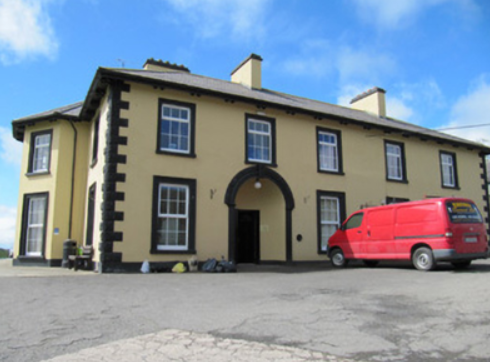
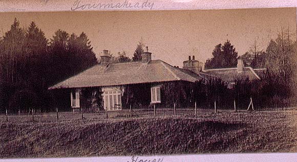
| Toormakeady Lodge | Robert Graham in 1836 refers to "Mr Plunket's cottage residence" while in 1837 Lewis describes it as a summer lodge of Dean Plunkets. Sold in 1876 to the Mitchell family of Bradford. Restored in the 1960s and used as a guest house. |
|
| Toormore Cottage | Rev. William Fisher held this property in fee at the time of Griffith's Valuation, when it was valued at £12 10s. Lewis had recorded it as the seat of J. Baillie in 1837. | |
| Toortane House | In 1851 Thomas Foley was leasing this property from the Devonshire estate when it was valued at £33 10s. Lewis refers to it as his seat in 1837. It is still extant and occupied, having been restored. |

|
| Tops (Raphoe) | John Wilson was leasing this property from the Ecclesiastical Commissioners estate at the time of Griffiths Valuation in the 1850s, when it was valued at £18. The National Inventory of Architectural Heritage suggests the current house was built c.1852 possibly on the site of an earlier house. Eliza Wilson was also leasing property at this location in the 1850s. |
|
| Torboy House | Phillip McCutcheon was leasing Torboy from Colonel Palliser’s estate from at least the early 1840s, as shown in the Valuation Office House books. At the time of Griffiths Valuation in the early 1850s the house was valued at over £12. The Landed Estates Court sale notice of 1862 indicates Philip McCutcheon had renewed his lease on this property in 1848. Torboy House is still extant and occupied. |
|