Browse Houses
Search Results: Returned 5926 records. Displaying results 4001 – 4100
| House name | Description | |
|---|---|---|
| Meanus House | Sir David Roche was leasing the property at Meanus to Michael Neligan at the time of Griffith's Valuation, when it was valued at £9 10s. In the 1830s, the Ordnance Survey Field Name Books describe it as "a large house, two stories high with offices attached at present occupied by a farmer". In 1786 Wilson had noted Menus as the seat of Dr. Drew. Bary states that it has been in the Neligan family for many generations and is still extant. | |
| Meanus House (Kiltallagh) | Lady Anne Headley's estate was leasing this property to Charlotte Walker at the time of Griffith's Valuation, when it was valued at £9 15s. Bary writes that it was leased by the Winn estate in the early part of the nineteenth century to the Walkers and later to the Spring family. It is still extant and was renovated in the twentieth century. |
|
| Mearescourt | Named on the first edition OS map, this five-bay three-storey over basement Palladian country house was built about 1760, possibly incorporating the remains of earlier buildings, including a Medieval tower house. John Meares died in 1790 leaving his estate to his nephew, William Devenish. In 1814 William Devenish Meares was resident and in 1837 it was the seat of J Devenish Meares, as it was at the time of Griffith’s Valuation (publ. 1854) when the house was valued at £35. It remained a Meares home until the 1930s. In use as a guesthouse in the early 21st century. |
|
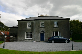
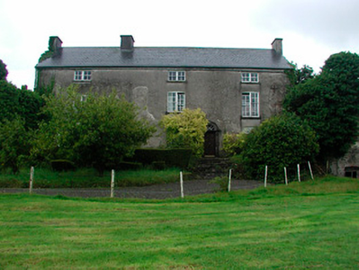
| Meeldrum | Meeldrum is a three-bay three-storey house, possibly built by Malachy Tracy. The third storey may have been added in the 1880s. A Mr M Tracy was resident in 1814. Malachy’s daughter Catherine married Thomas Clarke in 1798 (O’Brien). Lewis records Mrs Clarke as resident in 1837. Mrs James Clarke occupied the house at the time of Griffith’s Valuation (publ. 1854) when it was valued at £14 and held in fee. Mrs Maria Clarke lived here in the 1870s. The house appears to be unoccupied in 1901 but held by Thomas Clarke. In 1906 Martin and James Larkin were in residence and they are recorded in the 1911 census as the occupiers the house with their niece. The house remains a family home. |
|
| Meelick | Weir states that Meelick was a Burke house in the seventeenth century when Burkes, originally from Clondegoff Castle, in the barony of Longford, settled here. At the time of Griffith's Valuation Walter Blake was occupying the house at Meelick, parish of Clonrush, barony of Leitrim, valued at £17. In 1814 this property was the residence of Matthew Yelverton. The OS Name Books record Meelick as the home of Mr. Gilbertson. Lewis recorded it as "uninhabited" in 1837. There is still an occupied house at Meelick. The Irish Tourist Association file for the parish of Clonrush refers to Meelick as a substantial house with a concrete roof, ancestral home of the Burkes. |
|
| Meelick House | A house built by the time of the first Ordnance Survey on the Marquess of Conyngham's estate and occupied by William Roche at the time of Griffith's Valuation, when it was valued at £11. This house is no longer extant. | |
| Meenglass | Meenglass was constructed after the publication of the 1st Ordnance Survey. At the time of Griffiths Valuation it was held in fee by Viscount Lifford's estate and valued at £40. In 1906 it was still held by Viscount Lifford's estate and valued at £40. The National Inventory of Architectural Heritage suggests it was demolished around 1930. | |
| Meenvane | John Limerick was leasing a property to Nathaniel Lannon (?) at the time of Griffith's Valuation, when it was vaued at £13. This property appears to have been situated on the main street in the village of Skull. | |
| Meeshal House | In 1837 Lewis describes the work done at Myshell by Dr Barter “whose demesne of 200 acres, formerly an unprofitable waste, has, since 1826, been reclaimed and brought into a state of high cultivation.” The house valued at £36 was occupied by Thomas Kenyon at the time of Griffith's Valuation and held from Henry Lindsey. In the 1940s the Irish Tourist Association survey noted that it was "formerly a Hydro before the enterprise transferred to St. Ann’s in Blarney". The National Inventory of Architectural Heritage suggests that the current house incorporates portions of the original. |
|
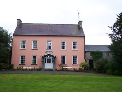
| Meldrum | The Sall family were located at Meldrum in the early 17th century and through marriage the property passed to the Latham family who were resident in the 1780s. . A mainly 18th century house built onto part of a 17th century house Meldrum was a Lloyd residence in the 19th century. It was the home of Richard Lloyd in 1814 and of the Reverend Richard Lloyd in 1837 and at the time of Griffith's Valuation, when it was valued at £26+ and held from Oliver Latham. The Lethams were resident in the 1770s. In 1894 Slater notes it as the seat of David Tennant. A house and large farm now occupy the site. |
|
| Mellefontstown | The main residence of the Nason family in the 18th century, John Nason was resident in 1814 and Pierce Cotter in the early 1850s. Cotter held the property from Thomas Wise and the buildings were valued at £19+. In May 1863 Pierce Joseph Cotter's estate at Mellifontstown, containing the house, demesne and 246 acres was advertised for sale. It was held on a lease dated 1852 from Francis Wise to Pierce Cotter for 185 years. A new house now stands on the site. | |
| Mellon | The Westropp family are recorded as "of Mellon" from the early 18th century. Bence Jones dates the present house from circa 1780, the Ordnance Survey Field Name Books from 1812. Inhabited by Mrs Jane Westropp (nee Dawson) in the early 1850s. It was valued at £36. This 3 storied house was still in Westropp possession in the late 20th century. It is now run as a stud. |
|
| Melview | A house on the outskirts of Clonmel, occupied by Robert Malcomson in the mid 19th century, held from John Bagwell and valued at £52. This building now functions as a nursing home. |

|
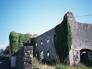
| Menlo/Menlough Castle | A 17th century tower house with substantial additions. In 1786 Wilson refers to it as the seat of Sir Thomas Blake. Menlo Castle was occupied by Thomas Blake at the time of Griffith's Valuation when it was valued at £30. It continued to be the home of the Blake family until the house was burnt by an accidental fire in 1910 and has been a ruin ever since. |
|
| Merlin | In 1850 Abraham Grubb held this property in fee when it was valued at £54. Merlin is still extant and occupied. |

|
| Merlin Park | A house on the outskirts of Galway, built by Charles Blake in the first decade of the 19th century. Bought by Henry Hodgson in the Encumbered Estates' Court in 1852. It was held in fee by him at the time of Griffith's Valuation and valued at £65. Merlin Park was purchased by the Waithman family in 1876 and in their ownership until 1945. Thereafter it was compulsorily acquired for the building of a TB sanitorium. The house no longer exists and Merlin Park Hospital now occupies the site. |
|
| Mertonhall | Merton, Cloghjordan, was the home of T.G. Fitzgibbon in 1814. It was purchased by Robert Hall in 1828 and he was the proprietor in 1837. The Ordnance Survey Name Books noted in 1841 that it was formerly known as "Litty Ville House". The house was valued at £55 at the time of Griffith's Valuation and held by Robert Hall in fee. The Hall family continued to use Merton as a residence in the 1870s. By 1906 the representatives of De Courcy P. Ireland were occupying Mertonhall. He was married to Ada Hall. This house is now demolished. | |
| Merville House | Occupied by John Carroll in 1837 and held by him in fee at the time of Griffith' s Valuation. Weir writes that the house was in ruins by 1904. |
|
| Mervue/Merview | Built circa 1777 by the Joyces. In 1786 Wilson refers to a house near Galway as the seat of Dr. "Joice". The house was sold by them to Royal Tara China in 1953. This company occupied the building for over 50 years, closing down at the end of 2003, though the shop premises still operates from this building. A fire badly damaged the original building in 1957. |

|
| Middlequarter | Occupied by Henry P. Hildebrand at the time of Griffith's Valuation, who was Wilberforce's agent. The property was then valued at £10. | |
| Middleton House | Michael Quinn held Middlton in fee at the time of Griffiths Valuation in the early 1850s, when it was valued at almost £13. In 1837 Lewis referred to Middleton as the seat of H. Montfort while in 1814 Leet notes it as the residence of W.B. Montfort. It is still extant. |
|
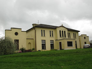
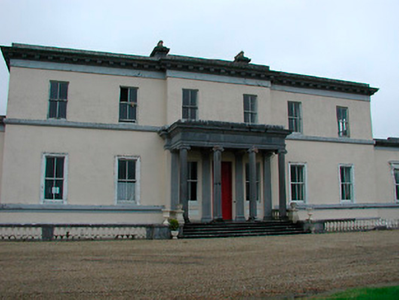
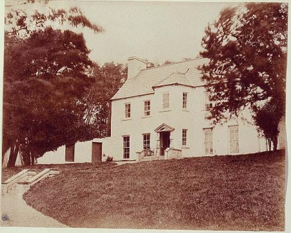
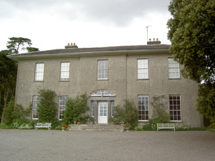
| Middleton Park | Middleton House is marked on the first edition OS map (1838), with extensive gardens to the south east. The present house is a six-bay two-storey over basement country house, built c.1850, in an Italianate style to designs by George Papworth (1781-1855) for George Augustus Boyd. He was resident at the time of Griffith’s Valuation (publ. 1854) when the building was valued at £100. It replaced an earlier smaller-scale house on the site, the property of James M Berry, who was resident in 1814 while W Hudson was the occupant in 1837 holding it from Berry. The present house remained in the Boyd-Rochfort family until 1958 and has had a number of owners since then, one of whom Barney Curly sold it through conducting a raffle. It has since been a hotel and was on the market again in 2023. |
|
| Midfield House | Occupied by Anthony Kelly in 1814 and by P. Kelly in 1837. There is no house with a significant valuation in this townland at the time of Griffith's Valuation. Farm buildings appear to occupy the site now. | |
| Mighnawn Cottage | Labelled as Mighnawn Cottage on the 25-inch Ordnance Survey Map of the 1890s, this property was leased by Miss Mary Owens from the Power estate at the time of Griffith's Valuation. It was valued at £20 8s. | |
| Milane House | Leased from Rev. John D. Beecher by Thomas Gilman at the time of Griffith's Valuation, when it was valued at £11 15s. A house still exists at this site. | |
| Milcum House | Ruane states that this house was built in 1754 by the Browne family [of Westport] and that it was first known as 'Seamount'. There was another Milcum house, built in the small townland of Milcum by the Binghams in the early 18th century, which was the house marked 'in ruins' on the first Ordnance Survey map. Seamount was occupied by Connell O'Donel in 1837. At the time of Griffith's Valuation it was unoccupied but in the possession of Nathaniel P. Simes. In the 20th century it was the home of Miss Laprimandaye, Sir Anthony Beever, the Brittains, the Percivals and Mr and Mrs Peter Mullowney. Milcum is still extant and occupied. |
|
| Milford | Early 18th century house with some 20th century alterations. |
|
| Milford | Lewis records Milford as the occasional residence of Ralph Smith. By the early 1850s it was occupied by Thomas Bunbury and held from William Woods. Bence Jones writes that it was the home of Edmond Murphy who died in 1882. In 1840, he Ordnance Survey Name Books refer to the house as the residence of John Monsell and describe the demesne as "principally composed of plantation and ornamental grounds". |

|
| Milford | A Morony residence located on the Fitzgerald of Carrigoran estate. Occupied by James Fitzgerald in 1814 and by Edward Morony at the time of Griffith's Valuation. It is labelled Millford House on the 1st and subsequent edition Ordnance Survey maps. A house is still extant at the site. | |
| Milford | Built by George Maunsell, fourth son of Richard Maunsell of Ballywilliam, in the late 18th century. Occupied by the Reverend M. Widenham in the late 1770s, and 1786, by Lord Kiltarton [John Prendergast Smyth became Viscount Gort in 1816] in 1814, by T. Fitzgerald in 1837, by Captain Stackpool circa 1840 and by Henry Allen in the early 1850s, this house was situated on the Maunsell estate. It was valued at £28 at the time of Griffith's Valuation. Referred to as the "splendid residence" of the Dowager Lady Massy in the sale rental of 1868. Tracy writes that the 5th Baron Massy bought it for his mother in 1850 from the Maunsells. Later sold to the Russell family and bought by the religious order, the Little Company of Mary, in 1923. Now part of a nursing home for the terminally ill. |

|
| Milford House | In 1850, Mrs. Anne O'Brien was leasing this property from the Medlicott estate when it was valued at £10 15s. Morris refers to a Rogers family "of Coolroe" in the mid eighteenth century. This house is no longer extant. | |
| Milford/Millview | Lewis refers to "Millview" as the seat of Kerry Supple in 1837. A house named Millford is shown in the parish of Rattoo on the 1st edition Ordnance Survey map, adjacent to a building labelled Millford Tuck Mill. The house is present on the 25-inch map of the 1890s but the mill is not labelled. At the time of Griffith's Valuation, Justice Rice held this property from the Provost and Fellows of Trinity College when it was valued at £2 15s. Bary writes that it burned down in the 1970s and is now a ruin. | |
| Milfort/Milford House (Portlaw) | Milfort House was another property held by the Malcomson family in Portlaw. It was part of a complex designed by the well-known architect John Skipton Mullvaney. Milfort was demolished in the mid-twentieth century but some estate architecture survives. |
|
| Mill Cove (Bear) | Leased by Patrick O'Sullivan from the Earl of Bantry's estate in 1852 when it was valued at £14. Local sources suggest O'Sullivan worked as an agent for the White estate. The house has been demolished though traces of the stone work can still be seen in the gardens which are now part of an art gallery and sculpture display. | |
| Mill Grove House | In 1841, the Ordnance Survey Name Books describe Mill Grove House as " a good house with demesne and plantations, the residence of Mr. Kennedy". At the time of Griffith's Valuation, Edward Kennedy was leasing a substantial milling complex and a house at this location from the Stoney estate. The buildings had a value of £46+. It is labelled Millgrove House on the 25-inch map of the 1890s but is no longer extant. | |
| Mill House (Ballinascarty) | William G. Harris was leasing this property to Charles Connell at the time of Griffith's Valuation, when it was valued at £7 15s and the adjacent mill valued at £41. It is labelled Mill House on the 25-inch Ordnance Survey map of the 1890s, though the corn mills are labelled disused at that time. A house is still extant at the site though the mills are now ruinous. | |
| Mill Mount House/Carrickaderry | The house in the village of Clontibret on this site is recorded on the 1st edition 6 inch Ordnance Survey map (1836) as Mill Mount House. It was located on the Blayney (Hope) estate and was the home of the Swanzy family. Lewis refers to the ‘handsome residence’ of A. Swanzy while the Ordnance Survey Field Name Book describes it as a two storey slated house. There was a corn mill nearby. The house was extended and was valued at £24 in the mid-19th century when Humphry Jones, son-in-law of Andrew Swanzy, was the occupant. On the 25 inch map it is named Carrickaderry House. McSkane writes that Carrickaderry was built for the Coote family from Cootehill, Co Roscommon and inherited by a cousin Humphrey Jones. The old house was demolished and a new one built which passed to the McQuade/McQuaid family following the death of Humphrey and his wife. House demolished in the early 1970s. | |
| Mill View | A five bay three storey house built about 1800, with some modern additions. At the time of Griffith's Valuation held by Sir Edward Tierney in fee, the buildings were valued at £19+. |

|
| Mill View | This house was the home of the Sargent family in the 19th century, inhabited by Henry Sargent in 1814 and at the time of Griffith's Valuation. It was held from the Earl of Glengall and valued at £30 in the early 1850s. This house is no longer extant. | |
| Mill-Land | William Meade was leasing this property to Thomas R. Leane at the time of Griffith's Valuation, when it was valued at almost £9. | |
| Millbank House | At the time of Griffith's Valuation, the Allingham family were leasing this house, valued at £8, from the Lane Fox estate. It is still extant and occupied. |
|
| Millbrook | A 19th century house occupied by the families that ran the mill. At the time of Griffith's Valuation the occupier was Peter Macmillan who held the property from Thomas Arthur. The buildings were valued at £40. A house is still extant in the area but on an adjacent site. | |
| Millbrook | Millbrook House was held in fee by John Bermingham at the time of Griffith's Valuation when the house was valued at £11 and the nearby mill (M412635) at £12. Both buildings are now in ruins. |
|
| Millbrook | Described by Wilson as the seat of Mr. Hawkshaw in 1786, Millbrok was also the home of the Hawkeshaw family in the 19th century, occupied by Richard Hawkshaw in 1814 and of his representatives in the early 1850s, when it was held from George Armstrong and valued at £19+. Millbrook House was included in the sale of the Earl of Listowel's estate in 1861. Michael Dwyer was the tenant. A building is still located at this site. | |
| Millbrook (Granard) | Patrick Flynn was leasing this house and milling complex from the Greville estate at the time of Griffiths Valuation in the early 1850s, when it was valued at over £13. | |
| Millbrook House | There is a lithograph of this house attached to the sales rental of Lord Oranmore and Browne's estate in 1854. The sale rental states that the late tenant [Lawrence Glynn] recently expended a large sum in building a residence on this lot. This later building is labelled Millbrook House on the 25-inch Ordnance Survey map of the 1890s. It is no longer extant. | |
| Millbrook House (Castleisland) | The Ordnance Survey Name Books record Millbrook House, in Knockrower East townland, as the residence of William Fitzgerald, on perpetual lease from the O'Connells of Grenagh. | |
| Millbrook House(Drumcliff) | Edward Simpson was leasing a house, mill and associated buildings at Ballincar, barony of Carbury valued at £16 from the Wynne estate at the time of Griffith's Valuation. He offered the property for sale in the Landed Estate's Court in April 1873. The sale notice indicates that he held it on a Fee Farm Grant from Owen Wynne dated 1868. The original house is no longer extant. | |
| Milleen | Rev.William Jennings was leasing this property from the Hungerford estate at the time of Griffith's Valuation, when it was valued at £19 15s. In 1944 the Irish Tourist Association Survey lists Milleen among the houses in the area which had been burnt during the War of Independence and were then derelict. It is no longer extant. | |
| Millfield House (Inishowen) | Millfield House and adjacent mill buildings was leased from Sarah McClintock by George H. Mitchell at the time of Griffiths Valuation, when it was valued at over £17. It is still extant. The National Inventory of Architectural Heritage includes a detailed account of the now-derelict mill complex and notes its association with the Swan family in the latter decades of the 19th century. |
|
| Millfield House (Ross) | This house, with a mill valued at £40, was leased by William Limerick to Henry Morrow in 1851, when the house was valued at £12 5s. Lewis notes Millfield as the seat of Lieut. Lloyd, RN, in 1837 while it is noted by Leet as the residence of Roger Sweeny in 1814. The mill is labelled Ross Mill on the 25-inch map of the 1890s. There is still an extant house at the site as well as the remains of some mill buildings. | |
| Millford | Allen Pollok held a steward's house and offices valued at £16 at Millford at the time of Griffith's Valuation. Extensive buildings remain at the site. | |
| Millfort | This house was the home of the Foote family in the 18th century as Wilson refers to it as the seat of Mr. Foote in 1786. At the time of Griffith's Valuation the house was valued at £4.10 shillings, occupied by William Upplington and held from the representatives of George Foot. It appears to have fallen into ruin by the time the 25-inch Ordnance map was published in the 1890s and no trace remains now. | |
| Millgrove House | Thomas Jackson occupied this house in 1814 and William Walpole in the 1850s. Walpole held the property from Lord Waterpark and the house, office and corn mill were valued at £38. This house has recently been renovated. |
|
| Millmount | Occupied by the Reverend Joseph Gabbett and held from Daniel Gabbett at the time of Griffith's Valuation, when the buildings were valued at £16. It is labelled Millmount on the First Edition Ordnance Survey Map and as Ardvullen on the later 25-inch edition of the 1890s. A house is still extant at the site. | |
| Millmount | Viscount Lorton was leasing a house valued at £18 at Macmoyne, parish of Boyle, to Nicholas Mulhall, at the time of Griffith's Valuation. This may be the still extant Millmount House, associated with the milling complex. |
|
| Millmount House | Thomas Phayre was leasing this property from the Earl of Clancarty's estate at the time of Griffith's Valuation. It also included a mill, herd's house and 150 acres. The National Inventory of Architectural Heritage suggests it was built in the 1760s. It is still extant and occupied. |
|
| Millpark House | At the time of Griffith's Valuation, Adam Acres is recorded as the occupier of Millpark House, which he was leasing from the Vaughan estate. The house was valued at £18. It is still extant. | |
| Millpark Mill Cottage | In 1840 the Ordnance Survey Name Books refer to Millpark House as the residence of Mr. Lyster. At the time of Griffith's Valuation Hamilton Lyster was leasing a property in the townland of Millpark from Robert Acres. It included a house and mill and was valued at £53. Some ruins of the mils still remain. A building is still extant on the site of Millpark Cottage. | |
| Milltown | In the 18th century Miltown was the residence of a branch of the De Lacy family. Mill-town, Bruff, was the residence of Mrs Bevan in 1814. George Gubbins was the occupier in 1837 and at the time of Griffith's Valuation. He held the property valued at £40+ from Edward B. Hartopp. In 1831 George Gubbins married Elizabeth Blood nee Hartopp. This house is named Milltown George on the first Ordnance Survey map. |

|
| Milltown | The Reverend Champagne was resident at Milltown from at least 1837. He is recorded as the occupier of this house in the early 1850s when he held the house valued at £28 from the Reverend Tyrell Evans. | |
| Milltown | Roderick O'Conor/O'Connor occupied the property at Milltown, barony of Castlerea, valued at £36, at the time of Griffith's Valuation. It was also recorded as his seat in both 1814 and 1837. Gormley states that nothing of the house now remains save for traces of the mile long avenue. | |
| Milltown Castle | Originally the home of Thomas Evans, a younger brother of the 1st Baron Carbery, and of his son Eyre Evans. Mary, sister of Eyre Evans, married George Bruce in the mid 18th century. The Castle was subsequently leased by the Evans to the Bruces and it remained the home of the Bruces until the late 19th century. Described by Lewis as “a handsome castellated mansion in the later English style”. Reduced in size in the early 20th century. The Irish Tourist Association Survey of the 1940s noted that the buildings, at that time the residence of the Keane family, were not in good repair. However, the building continues to be occupied. |
|
| Milltown House | At the time of Griffiths Valuation, Thomas Witheroe was leasing this property from the Marquis of Donegall’s estate when it was valued at £25 and had an adjacent mill. It appears not to be extant now. | |
| Milltown House | In the mid 19th century Henry Briscoe was occupying a house valued at £10.19 shillings and held from Captain Richard Long. This house is still extant. | |
| Milltown House | At the time of Griffith’s Valuation, Robert Hickson was leasing a house & mill, valued at almost £29, from the representatives of Walter Hussey. A large house, now functioning as a guesthouse, is located at the site. |
|
| Milltown House (Killymard) | William Graham was leasing this property from the Murray Stewart estate at the time of Griffiths Valuation in the 1850s when it was valued at £30. The house was built after the publication of the 1st edition Ordnance Survey map when the site was occupied by a spade foundry. Buildings are still extant at the site. | |
| Milltown Place | Arthur Aylmer was leasing this property from Lady Carbery at the time of Griffith's Valuation, when it was valued at £17 5s. Aylmer was a younger son of the Aylmer, Donadea, county Kildare, family. His mother was Jane Evans-Freke, a daugher of the 1st Lord Carbery. He was later to succeed to the title of Baron Aylmer. By the 1890s the building at the site has been divided into a school and the Constabulary barracks. A smaller building exists at the site now. | |
| Millview | In 1840 the Ordnance Survey Name Books describe Mill view as "a good dwelling house, the residence of Mr. Short" though noting S. Pepper as the proprietor. At the time of Griffith's Valuation it was leased by Richard Brandley from Mary O'Leary when it was valued at £11. A house is still extant at the site. | |
| Millville | Thomas and James Allen were leasing this property from the Earl of Shannon's estate at the time of Griffith's Valuation, when it was valued at £15 and the adjacent mills at £37. The house is still extant. Modern housing now occupies the site of the mill. | |
| Milmore/Millmore | A home of the Breakey family in the early 19th century. The Ordnance Survey Field Name Book refers to a gentleman’s seat in the north of the townland of Derry and the house is marked on the first edition 6 inch Ordnance Survey map. Lewis refers to Milmore as the home of ‘the late T. Brunker’. It was occupied by John F. Johnston in the mid-19th century, valued at £22 and held from John Leslie. In 1876, John F. Johnston of Australia owned 143 acres in county Monaghan. Captain Francis Johnston of Milmore House, a veteran of the Peninsular War, died in 1862. A house is still extant at this site. | |
| Milton House (Bandon) | Elizabeth Swete was leasing Milltown from Miss McCarthy at the time of Griffith's Valuation, when it was valued at £22. It is labelled Miltown House on the 1st edition Ordnance Survey map but as Milton House on the 25-inch ediiton of the 1890s, the name by which it is still known. The National Inventory of Architectural Heritage suggests it was built for the Allman family. |
|
| Miltown House | Built in the early 1780s by Thomas J. Morony, who developed the town of Miltown Malbay and the main Morony home throughout the 19th century. Slater refers to it as the residence of Mrs Eleanor Lucinda Moroney in 1894. It was sold about 1919 to the Sisters of Mercy and became a school. |
|
| Milverton | Thomas Hunt was leasing a property valued at £20 from the Mahon estate at the time of Griffith's Valuation. Extensive corn mills are shown at this site at the time of the First Ordnance Survey but by the 1890s it is occupied by a house labelled Milverton which is still extant. |

|
| Minard House | At the time of Griffiths Valuation in the early 1850s the house at Minard was occupied by George Evers, leasing from the Douglas estate and valued at almost £9. The 1906 Untenanted Demesnes survey records a valuation of £13 for this property when it was still in the possession of the Douglas estate. The Longford Leader reported extensive damage by fire to the house in 2019. | |
| Minehill | Home of a branch of the Wallis family in the early 19th century. Occupied by Denis McCarthy in 1814 and by John Cooke Wallis in 1837. By the time of Griffith's Valuation it was the residence of Francis Burton. The house was still home to the Burton family in the early 21st century. | |
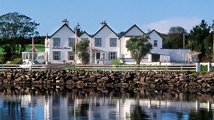
| Minella | This house was built by the Malcomsons in 1863, now a hotel located in county Waterford. http://www.hotelminella.ie/ |
|
| Minore | Named on the 1st edition 6 inch Ordnance Survey map (1836), Lewis records Minore as the residence of Captain ‘Cottnam’. The Encumbered Estates sale rental of 2 June 1853 states that the house was erected by Thomas Cottnam, deceased. The owner at the time of the sale was Mrs Grace Cottnam, widow and she was entitled to a jointure out of the lands. The petitioners were Rutherfords and Brunkers. By the time of Griffith’s Valuation it was occupied by Thomas Leary who held it from Dr Brunker. Home of Hester Parkhill in 1901 and of the Reverend Thomas Brennan, parish priest, in 1911. In more recent times the home of the Clegg family. | |
| Mirehill | Home of Thomas Redington in 1814, Stepney St George in the 1820s and occupied by Michael Kelly in the 1850s, when it was valued at £4 and by Stephen R. Roche in 1906. It is no longer extant. | |
| Mishells House | In 1851 being leased by William A. O'Connor from the Devonshire estate and valued at£16. There is an extant house at the site. | |
| Mission settlement | The Reverend Edward Nangle established his mission settlement here. | |
| Mistletoe Castle | Marked as Eustace's Castle on the first Ordnance Survey map and apparently straddling the boundary between Cooperalley and Greencloyne, this house was the residence of John Conroy Browne in the second half of the 19th century. At the time of Griffith's Valuation the buildings were valued at £25 and held from William Fitzgerald. J.C. Browne of Mistletoe Castle owned 16 acres in county Cork in the 1870s. The house is stated to have been built in the 1770s as a summer residence for the Villiers-Stuart [Stuart] family. |
|
| Mitchellsfort/Fellfort | This house was the home of Mitchell Esq in the 1770s and 1780s. Occupied by Brooke Brazier in 1814 and by his son Henry B. Mitchell in the early 1850s. Henry B. Mitchell owned the property in fee and the buildings were valued at £52+. Slater noted it as the residence of R.L. Fell in 1894, now demolished. | |
| Mitchelstown | Mitchelstown House was a home of the Tighe family in the early 19th century. Robert S Tighe was the occupant in 1814. Home of G Hinds in 1837 and at the time of Griffith’s Valuation (publ. 1854) of Captain John Roden who held the house, valued at £24 from Robert Howard. The house appears to be a ruin on the 25 inch map. | |
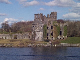
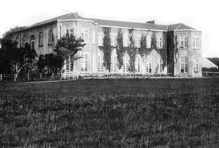
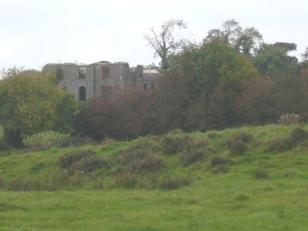
| Mitchelstown Castle | The original castle belonged to the FitzGibbons, the White Knight. It passed through the marriage of Margaret FitzGibbon and Sir William Fenton to the heirs of their daughter, Catherine, and her husband, Sir John King. By the mid 18th century the Kings had replaced the castle by a house which was altered and extended over the years. In 1786 Wilson refers to it as "the very magnificent seat of Lord Kingsborough". In the 1820s the 3rd Earl built a new castle in anticipation of a visit from George IV which never happened. This was a huge building in the Gothic Revival style, valued at £180 in the mid 19th century. It remained in the possession of the Kings until the death of Lady Kingston, widow of the 5th Earl. In 1922 the castle was looted and burnt and the stones were later used to build a church at Mount Melleray. In 1943 the Irish Tourist Association Survey provided a detailed description of the castle and its history and noted that portion of the cellars and foundations were still visible. |

|
| Moat | A property in the townland of Moat, parish of Killimorbologue, valued at £9 was being leased from the Clanricarde estate by John Donnelly in 1856. The house was demolished in the later half of the twentieth century and no traces remain. | |
| Moat Lodge | Built by the Digby family in the mid 19th century. Home of the Gilmores in the mid 20th century and now of Mr and Mrs Jarlath Donnellon. In the Blake of Ballyglunin Papers Thomas Murphy in a letter to Martin J. Blake dated 1837, refers to his involvement in the building of a house at Moate for Mr Digby, National Archives M6936/38/29. |
|
| Moate Castle | A complex structure, of at least three periods of construction, which dominates the centre of the town. It is a two-bay three-storey former fortified house/tower house, built 1550, having a three-bay three-storey wing to the west end, built c.1720 and a two-storey bowed extension to the east end, built c.1760, acquired by Captain John Clibborn in 1659 (boi). In 1814 Thomas C Clibborn occupied Moate-castle and in 1837 Moate Castle was the seat of Cuthbert J Clibborn. At the time of Griffith’s Valuation (publ. 1854) Gilbert Nugent was resident holding the property valued at £23 from the representatives of Cuthbert J Clibborn. Moate Castle has remained a private residence and was for sale in 2023. |
|
| Moate View | Moate View is situated on the outskirts of the town of Moate and predates much of the town. It is a detached five-bay two-storey house, built 1762, verified by a cut stone date stone inscribed ‘James Clibborn built this house anno domini 1762’. O’Brien writes that James Clibborn was the son of Joshua Clibborn and his wife Sarah Lecky. His second son William Cooper Clibborn inherited the house and was the occupant at the time of Griffith’s Valuation (publ. 1854) holding the building valued at £32 from Thomas H Mulock MP. It is still the home of Clibborn family members. |
|
| Moatfarrell House | At the time of Griffiths Valuation in the early 1850s, Moatfarrell was leased by William F. Ryan from the estate of Edward Murphy when it was valued at £18. In the early 1840 it had been occupied by Laurence O'Rourke. The National Built Heritage Survey suggests the extensive outbuildings were constructed in the mid-nineteenth century and notes that the property was occupied by the Fegan family in the 1890s. The building is still extant. | |
| Moatville | Located on the outskirts of Charleville this house was occupied by Mrs Ryan in 1837 and of Michael Ryan at the time of Griffith's Valuation. Moatville was later the birthplace of Dr Reeves, Bishop of Down, Connor and Dromore. In the 1940s the Irish Tourist Association Survey described it as "a quaint high house, the residence of Mr. Ball". It is still extant. |

|
| Mobarnan | Mobarnan was the seat of the Jacob family in the 18th and 19th centuries. Occupied by Samuel Jacob in 1814, M. Jacob in 1837 and by Samuel Jacob at the time of Griffith's Valuation. He held the property in fee and the buildings were valued at £37+. Later the home of the Tennant family. This house was enlarged in the early 19th century and is still in use as a residence. In the 1970s it was owned by Major Marcus William Keane, formerly of Beech Park, and his wife, Anne R. Armitage of Noan, Co Tipperary. |
|
| Mocollop Castle | Mocollop Castle was in ruins by the time of Griffith's Valuation, though buildings at the site were valued at £31. They were held in fee by Captain James Barry. In 1786, Wilson refers to it as the seat of Dr. Drew. In 1906 the buildings at this location were in the possession of Henry Drew, MD, and valued at £32. The National Inventory of Architectural Heritage reports that the buildings there were in ruins in the early part of the 21st century. |

|
| Modreeny | Lewis records W. H. Head as the proprietor of Modreeny House in 1837. He was still resident at the time of Griffith's Valuation and held the house valued at £35 in fee. Burke's ''Landed Gentry of Ireland'' (1904) records William Henry Head's father as "of Modreeny House". In 1906 the representatives of George Whitfield were the occupiers and the house was valued at £36.10 shillings. George Whitfield of Modreeny owned 443 acres in the 1870s. In 1890 his daughter Kathleen married Sir Francis Osborne, Baronet. This house was bought by Donald Swan in 1965 and Charlie Swan, champion jockey, was born at Modreeny in 1968. |
|
| Modreeny House | In 1786 Wilson refers to "Moderenny" as the seat of Sir Amyrald Dancer. The Ordnance Survey Name Books refer to the house as Eminisky House in 1841 but it is marked on the first edition map as Modreeny House and was the home of the Dancer family. It was replaced by a new house circa 1920s. The outbuildings, gates and gatelodge of the original house still remain. At the time of Griffith's Valuation Sir Thomas B. Dancer held this property in fee. The buildings were valued at £21. Hussey gives Modreeny House as the address of Sir Thomas Dancer in 1878. |
|
| Mogeely House | A house on the Devonshire estate, occupied by Charles H. Walsh in the mid 19th century and valued at £25.18 shillings. Later the home of the Des Barres and Kent families. Slater refers to it as the seat of Lt-Col. Des Barres in 1894. Still a family residence. It is labelled Mogeely Castle on the 1st edition Ordnance Survey map but as Mogeely House on the later editions, |
|
| Moglass House | Moglass valued at £11 was held by John Riall from George Riall at the time of Griffith's Valuation. It is described as "in ruins" on the 25-inch Ordnance Survey map of the 1890s. | |
| Mohanagh Lodge | Andrew McGill was leasing this property from Lady Carbery's estate at the time of Griffith's Valuation, when it was valued at £10 15s. In 1814 Leet referred to it as the seat of Richard Marmion. A house still exists at the site, | |
| Moher House | A Macnamara property, occupied by James Gorman in 1814 and by Peter Scales at the time of Griffith's Valuation when the house was valued at £7. J. Macnamara was residing at Moher in 1837 but it is not clear whether this was Moher House or Lodge. John Macnamara of Moher, younger brother of William N. Macnamara of Doolin, is well documented in the Stacpoole Kenny Papers. A house is still extant at this site. | |
| Moher Lodge | A Macnamara property, occupied by Patrick E. O'Reilly at the time of Griffith's Valuation. Some ruined buildings remain at the site. |