Browse Houses
Search Results: Returned 5926 records. Displaying results 4201 – 4300
| House name | Description | |
|---|---|---|
| Mount Judkin House | In 1786 Wilson refers to the seat of Mr. Judkin, located half a mile byond Cashel on the right. At the time of Griffith's Valuation, the townland was leased by Richard Jordan to Edmund Cusack and the house was valued at almost £8. Buildings are still extant at the site. | |
| Mount Justice | This was a home of the Justice family from at least the late 18th century. By the time of Griffith's Valuation the house was valued at £3.15 shillings and was occupied by John Bolton Justice who held it from Charles D. Purcell. Hajba writes that members of the Justice family continued to occupy the house until the 1920s. It is now demolished. | |
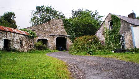
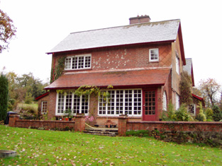
| Mount Keeffe | This house dates from the 1770s and was the home of the O'Keeffe family, occupied by Maurice O'Keeffe in 1814. The property was held from the Aldworths. Manus O'Keeffe was resident in the mid 19th century, when the buildings were valued at £14+. In 1943 the Irish Tourist Association Survey noted it as the home of the Guerin family. It is still extant and well maintained. |
|
| Mount Kelly | A Kelly property in the mid 18th century, which passed to a branch of the Bellew family through marriage. The original house was known as Drum House but was in ruins by the 1820s. Mount Kelly was owned by John William Browne at the time of Griffith's Valuation. The 19th century house appears as Lakeview.on the 1st edition Ordnance Survey map but as Mount Kelly on the 25-inch edition of the 1890s. A house still exists at the site. |
|
| Mount Kennedy | At the time of Griffith's Valuation, John Power was leasing this property from Margaret Power when it was valued at £13 10s. It is still extant and occupied. |
|
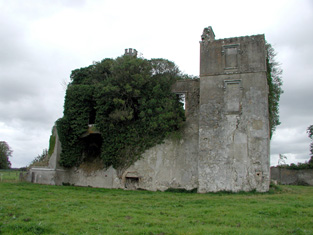
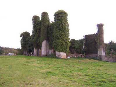
| Mount Leader | Seat of the Leader family in the 18th and 19th centuries, Wilson refers to it as the seat of Mr. Leader in 1786. It was occupied by Henry Leader in 1837 and in the early 1850s, held by him in fee and valued at £48. In 1944 the Irish Tourist Association Survey noted that it was owned by Nicholas Pomeroy who had bought it from the Kellehers. This house is now a ruin. |
|
| Mount Mary | W. Fortune was resident at Mount Mary in 1837. The house was valued at £28 and occupied by Daniel Lombard at the time of Griffith's Valuation. It was held from William Austin. A house is still extant at the site. | |
| Mount Massy | This house was the residence of Hutchinson esq in the 1770s. Occupied by Hubert [Herbert?] Baldwin in 1814 and by M.H. Massey in 1837. Mount Massy appears to be in use as an auxiliary workhouse at the time of Griffith's Valuation, when the buildings were valued at £50. At the time of the sale in 1861 Mount Massy was in the owner's possession and was held under a fee farm grant from the Earl of Bandon, dated 2 Feb 1859. It was burnt in December 1920 during the War of Independence and is now a ruin. | |
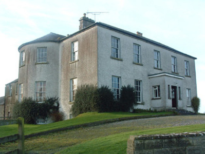
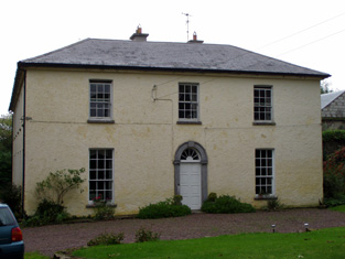
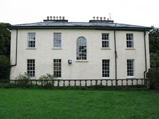
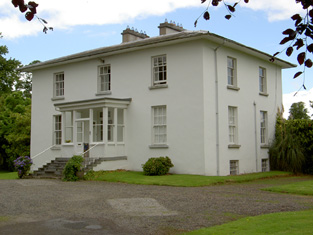
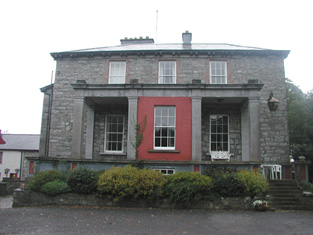
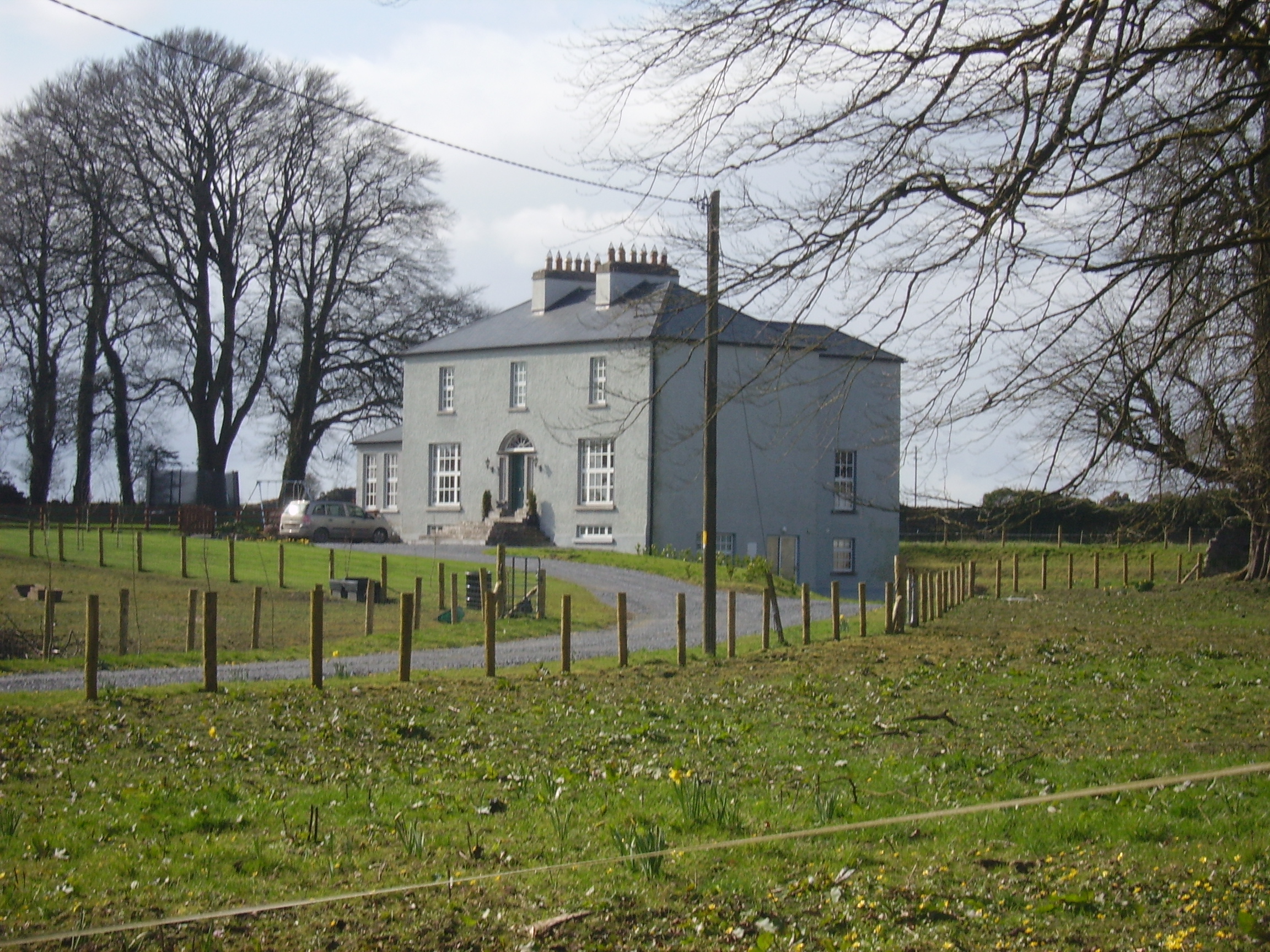
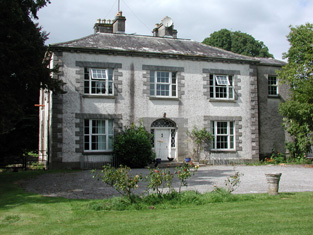
| Mount Murray | Mount Murray House is situated facing the western shore of Lough Owel and is named on both the first edition OS and 25 inch maps. The Murray family have been resident here since the mid-17th century and remain in residence today. The present house is a five-bay two-storey over basement country house, built about 1780 and remodelled c.1820 with the addition of a semi-circular bow to the southeast façade (boi). It was built by Alexander Murray in the late eighteenth-century to replace an earlier Murray house or castle close to the same site. Occupied by Alexander Murray in 1814 and 1837 and by Henry Murray at the time of Griffith’s Valuation (publ. 1854) who held the house valued at £46 in fee. William Murray was resident in 1906. |
|
| Mount Nagle | An early Nagle home which by the mid 18th century appears to have become the residence of the Linehan family. Hajba records a Mrs Linehan dying there in 1755 and at the time of Griffith's Valuation Myles Linehan occupied the house. He held it from Reverend William Nash and it was valued at £10. This house is still extant and occupied. | |
| Mount Pleasant | Held in fee by Henry Baldwin in 1851 when it was valued at £30. Lewis described it in 1837 as " a handsome mansion on a commanding eminence in a highly improved demesne". Also the seat of Henry Baldwin in 1814 and referred to by Wilson in 1786 as "Curravordrie, the fine seat of Walter Baldwin". In 1943 the Irish Tourist Association survey noted that it was owned by the Russell family but that it was possible some of the building would have to be demolished. The house is still extant but in poor repair. |

|
| Mount Pleasant | Home of George Mahon in 1814 and of Charles G. Mahon in the 1850s when the house was valued at over £22. It is no longer extant. | |
| Mount Pleasant | The Ordnance Survey Name Books record that this house was built in the mid 18th century by a Mr Star. It was a neat farm house occupied by Mrs Hill in 1837 and by Thomas Hill at the time of Griffith's Valuation. He held the property from Daniel Leahy and the buildings were valued at over £11. This house is still extant and occupied. |
|
| Mount Pleasant | The residence of John Devenish in the mid 19th century. In 1894 Slater noted it as the seat of Michael Murray. It does not appear to be extant. On the first Ordnance Survey map another house known as Riverdale is also located at M907 775 within the Mount Pleasant demesne. Buildings are still present at this site. | |
| Mount Pleasant | An 18th century house that was the home of Richard Bury, son of John Bury of Shannon Grove, county Limerick. In the 19th century it was the residence of the Cox family. Griffith's Valuation shows that Captain J. Cox held the property from the representatives of Anthony Hickman. The house was valued at £22. Two other houses in the townland of Clarefield were also occupied by members of the Cox family, Kate Ville and Mary Ville. This house is now a ruin. |
|
| Mount Pleasant | The main home of the Jackson family in the 19th century, occupied by John Short in 1814, by Captain Jackson in the 1830s and by Major Jackson in the early 1850s. The house with 448 acres was held from John Willington. The buildings were valued at £29+. Francis Freeman was the tenant in 1870. This house no longer exists. | |
| Mount Pleasant (Duhallow) | At the time of Griffith's Valuation, James L. O'Keeffe was leasing a property valued at almost £4 from Manus O'Keeffe. This appears to be the house shown on the 25-inch Ordnance Survey map of the 1890s as Mount Pleasant. It is still extant and in 2014 was offered for sale. |

|
| Mount Pleasant (Gaultiere) | Samuel King was leasing this property from the Grant estate in 1848 when it was valued at £74. Lewis had also noted it as his seat in 1837. Samuel King, residing at Mountpleasant, owned over 70 acres in county Waterford in the 1870s. This house is no longer extant. The site is now occupied by modern housing. | |
| Mount Pleasant (Loughrea) | In 1786 Wilson writes that Mount Pleasant was the seat of Mr. Daly. At the time of Griffith's Valuation, the townland was in the possession of the Clanricarde estate but the only building with substantial valuation was the militia barracks. The house is no longer extant though the area is still known as Mountpleasant. |
|
| Mount Pleasant Cottage | Leased by Mathew Belsange from the Baldwin estate in 1851 when it was valued at £10 10s. This property no longer exists. | |
| Mount Plummer | This house was the home of the Plummer family in the 19th century, occupied by B. Plummer in 1814, by Brudenell Plummer in 1837 and by the Reverend Richard Plummer in the early 1850s. The Reverend R. Plummer held the property from the Dowager Lady O'Brien and the buildings were valued at £10. | |
| Mount Prospect | Walter Murphy, MD, is noted as the lessor of a property at Ballynamaunagh, Kilcummin at the time of Griffith’s Valuation when it was valued at £16. The townland was part of Lord Kenmare’s estate. Bary states that the house may have built by the Murphy family in the late 18th century. No trace exists of it in the area now. | |
| Mount Prospect | This house was the residence of John Browne in 1814. Recorded as the seat of Mr Fallon at the time of the first Ordnance Survey in the 1830s but in ruins by the mid 1850s. though a small portion of the house is labelled Mount Prospect on the 25-inch Ordnance Survey map of the 1890s. Small fragments of the building remain at the site. | |
| Mount Prospect | At the time of Griffith's Valuation, William Johnston was leasing a house valued at £14 to Glasgon Connolly at Aghaderrard West, barony of Rosclogher. This is the house known as Mount Prospect. Both the Ordnance Survey Field Name Books and Lewis record Mount Prospect as a seat of the Connolly family in 1837. In 1894 and 1906 it was the property of St. George Robert Johnston and was also valued at £14. The remains of various buildings still exist although a new house seems to have been constructed at the site near the lake shore. |
|
| Mount Prospect | A Bowles family home, occupied by George Bowles third son of Robert Bowles of Springfield and father of Spotswood Bowles of Ahern. George was resident in 1814 and his widow was living there in 1837. His son George was resident at the time of Griffith's Valuation holding the property from Minor Cormack. The buildings were valued at £28+. Later the residence of Lieutenant Colonel George Eyre Massy [son of Hugh]. |
|
| Mount Prospect (Bandon) | William Lane was leasing this property from the Allman estate at the time of Griffith's Valuation, when it was valued at £37. Lewis refers to Mount Prospect as the residence of Mrs. Bradshaw in 1837. A house still exists at this site. |
|
| Mount Prospect (Kiltormer) | In 1856 Rev. David Seymour was leasing a house valued at £12 in the townland of Kiltormer East, barony of Longford, from Thomas Stratford Eyre. In 1837 Lewis mentions a residence of the Seymour family known as "Mount Pleasant" in this area. On the 25-inch Ordnance Survey map of the 1890s, however, this house is labelled Mount Prospect. It is no longer extant. | |
| Mount Richard | Mount Richard was the residence of John Power in 1837 and in the early 1850s when the buildings were valued at £30.10 shillings and held from the Earl of Bessborough. This house is still in use as a residence. |
|
| Mount Rivers | The seat of the Phillips family, occupied by Richard Philips in the first half of the 19th century and held by him in fee. The house was valued at £30 at the time of Griffith's Valuation. The sale rental of 1874 describes Mount Rivers as "a fine modern country mansion in thorough repair" and gives a description of the rooms and out houses. Wyndham Gabbett occupied the mansion house valued at £27 in 1906. In 2013 the property was offered for sale. |

|
| Mount Rivers (Carrigaline) | Michael Roberts was leasing Mount Rivers from the representatives of Daniel Morrison at the time of Griffith's Valuation, when it was valued at £45+. The sale rental of 1863 records Michael Hodder Joseph Roberts as the tenant of Mount Rivers. The house is still extent and the National Inventory of Architectural Heritage states that it is still owned by the Roberts family. |

|
| Mount Rivers (Killorglin) | This property at Annagarry is mentioned by Lewis in 1837 and Leet in 1814 as a residence of R. Blennerhassett, though the latter refers to the house as Mount Rivers. It is named on the 1st edition OS Map as Mount Rivers. At the time of Griffith’s Valuation it was being leased by Robert Blennerhassett but was in the Court of Chancery. It was then valued at £17 15s. Bary states that there is no trace of it now. | |
| Mount Ruby | In 1942 the Irish Tourist Association Survey noted a house known as Mount Ruby which had been built by Arthur Gethin Creagh, c.1903-04. Its title echoes the name of another house in the same townland which has been known since the eighteenth century as Killetra House but which was originally called Mount Ruby. The twentieth century house, built in the Arts-and-Crafts style, is also still extant and occupied. |
|
| Mount Russell | The home of James Russell in 1837 and at the time of Griffith's Valuation. The buildings were valued at £30 and James Russell held the property and 750 acres in fee. It is labelled as "in ruins" on the 25-inch Ordnance Survey map of the 1890s and nothing now remains. | |
| Mount Salem | Mount Salem situated on the Barrett-Lennard estate was marked on the 1st edition 6 inch Ordnance Survey map (1836) and on the later 25 inch map. It was located close to the border with county Fermanagh, just west of the town of Clones. The Reverend Adam Averell, a Methodist minister, died at Mount Salem on 10 January 1847, aged 93. Griffith’s Valuation records Amelia J. Conts as the occupant, holding the property from James Gregg. The buildings were valued at £13. In the early 20th century the McKenna family were resident but the house is now demolished. | |
| Mount Shannon | At the time of Griffith's Valuation, Francis Olpherts was leasing Mount Shannon, barony of Carbury from John Wynne. The house was then valued at £35. McTernan states that Olpherts had recently been appointed agent to the Wynne estate and later married Marianna Wynne of Ardaghowen. The house is still recorded by Slater as being in his possession in 1894. It has had a number of owners since the early twentieth century but is still extant and occupied. |
|
| Mount Shannon | An 18th century house, bought from the White family by John FitzGibbon before 1780. Mount Shannon appears to be named Ballingown on the Taylor and Skinner map of the late 1770s. Wilson, however, refers to Mount Shannon, "where taste and elegance are united" as the residence of the Hon. Silver Oliver in 1786. Bence Jones writes that it was enlarged by the 1st Earl of Clare and remodelled by the 2nd Earl. In the early 1850s the house was valued at £179 and was held by the Earl in fee. The contents of the house were sold in 1888 and the house itself to the Nevin family circa 1893 (Bence Jones). Burnt in the early 1920s Mount Shannon is now a ruin. |

|
| Mount Southwell House | Situated near the town of Rathkeale this house was the residence of Francis Brown in 1837 and was still in his possession in the early 1850s but leased to Edward John Collins. It was valued at £24. This house passed to the Hill family of Graig through marriage. | |
| Mount St Lawrence | Joseph Hannan held a house valued at £17 and a demesne of 94 acres from Edward B. Hartopp at the time of Griffith's Valuation. The Ordnance Survey Name Books record Joseph Harman as the resident circa 1840. A house is still located at this site. | |
| Mount St. Annagh | St. John Mason was leasing this property to Johanna O'Connor at the time of Griffith's Valuation, when the house, valued at £3 10s, stood on 800 acres. Johanna O'Connor was one of the principal lessors in the parish of Annagh at that time. The original house is no longer extant. | |
| Mount Talbot | Built circa 1750, Mount Talbot is recorded by Wilson as "the fine seat of William J. Talbot" in 1786. It was enlarged by William Talbot in the 1820s. The house was valued at £70 at the time of Griffith's Valuation. A nursery business operated in the gardens in the 1890s. Burnt in 1922 and now a ruin. |
|
| Mount Temple | Viscount Palmerston was leasing a property valued at £3 15s to Edward Parke in this townland at the time of Griffith's Valuation. It is estimated that the house now at Mount Temple was built c.1860. McTernan notes that the property was originally part of the Soden estate but was leased to the Parkes in the 1830s. They were to continue in occupation until the 1940s after which Mount Temple was acquired by the Land Commission. The house is still extant but derelict. |
|
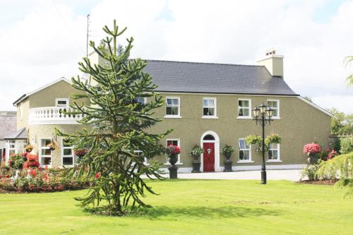
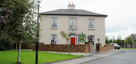
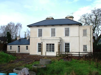
| Mount Temple House | Mount Temple House is marked on the first edition OS map, south of Holy Trinity Church and named on the 25 inch map. Leet records Richard Telford as resident at Mount Temple. At the time of Griffith’s Valuation (publ. 1854) Sarah Russell held the house and 182 acres from the Hon R T H Temple, the buildings were valued at £12. This house now provides accommodation for guests. See lodging-world.com/ei/hotels/mount-temple-house-in-moate-91944640. |
|
| Mount Trenchard | Lewis described this mansion formerly called Cappa as "beautifully situated on the banks of the Shannon". Marked as "Cappo" on the Taylor and Skinner map of the 1770s. Home of the Rice/Spring Rice family in the 19th century, valued at £40 in the 1850s and at £54 in 1906. Occupied by the Military in 1944, sold to Lady Holland in 1947 and to the Sisters of Mercy in 1953 who opened a school. |
|
| Mount Uniacke | A home of the Uniacke family in the 18th and 19th centuries, occupied by three generations of persons named Norman Uniacke in the 19th century. Earlier, in 1786, Wilson refers to it as the seat of James Uniacke. In the mid 19th century it was held by Norman Uniacke in fee and the house was valued at £30. The Irish Tourist Association Survey of the 1940s reported that it had been burnt in 1921 and it is no longer extant. | |
| Mount Vernon | The 1882 sale notice for the Burke estate mentions that Mount Vernon cost over £5000 to build a short time before. | |
| Mount Vernon Lodge | Marked on the first edition Ordnance Survey map this house belonged to William Joseph Skerrett who held it in fee at the time of Griffith's Valuation. It later became the holiday home of Sir Hugh Lane's parents and then of Lady Gregory who entertained well known literary figures at the house. Mount Vernon is still extant and used as holiday accommodation. |
|
| Mountain Castle | In 1851 James O'Keeffe was leasing this property from the Chearnley estate when it was valued at £17 10s. An 1834 document in the National Library of Ireland suggests it was formerly in the possession of the Barron family The property is still extant. |

|
| Mountain Lodge | In the mid 19th century Viscount Lismore owned a house/hunting lodge valued at £7 in the townland of Cullenagh (2,740 acres) which he also owned. This building has since been extended and is still in use as a youth hostel. |

|
| Mountain Lodge | Originally a shooting lodge of the Devonshers, it was the home of Abraham John Devonsher in the mid 19th century. He held the property valued at £3 in fee. It is now a ruin. | |
| Mountain Lodge/Farmoyle House | This house was originally known as Mountain Lodge but in more recent times the name Farmoyle House has been used. In the 1830s it was the residence of Colonel John Ker, who was succeeded by his nephew William Alexander Williams. In January 1851 the Mountain Lodge estate of W. A. Williams Ker was advertised for sale in the Encumbered Estates Court, with an estate in county Meath. The mansion house was at the time occupied by Mrs Ann Ker, aged 83 years, widow of the Colonel. It was purchased by George Bennie, who held it in fee at the time of Griffith’s Valuation but was selling it in 1865. By the time the 25 inch Ordnance Survey map was compiled the building was reduced in size and has been further altered in more recent times. The National Inventory of Architectural Heritage records the building as unoccupied. |

|
| Mountain View (Waterford) | Held in fee by Josiah Pope at the time of Griffith's Valuation when it was valued at £37 10s. His address is given as Rockshire, Waterford, in the 1870s. A hoiuse is still extant at this site. | |
| Mountain View Cottage | This building is named as Mount View Cottage on the first edition OS map and Mount View on the 25 inch map. O’Brien writes that Mount View on the Moate road is a two-storey, three-bay Victorian house built by a Mr Vaughan in 1866. At the time of Griffith’s Valuation (publ. 1854) the previous house on this site, valued at £10, was occupied by Mrs Diana Sproule, who held the property from Robert Jameson. The present house was a McNamara home in the 20th century and is still extant. | |
| Mountain View House (Dungarvan) | At the time of Griffith's Valuation, John Dower was leasing several substantial premises in the area of Fairlane, Dungarvan, from the estate of the Marquis of Waterford. Local sources suggest the Dower family built Mountain View House c.1815. The house remained in the Dower family until the twentieth century. In more recent time it offered guest accommodation and in 2014 was offered for sale. |
|
| Mountalt | Occupied by Martin Ryan in 1814 and in 1837 and held from J. Lenigan. James Lenigan is recorded as the occupier at the time of Griffith's Valuation, holding the property in fee, when the farm house and offices were valued at £7. | |
| Mountbell | In 1786 Wilson refers to Mount Bell as a residence of the Garde family. It was ccupied by Edmund MacKey in 1814 and by Edward Lane in the early 1850s. Lane held the house valued at £10 from Sir Arthur De Capell Brooke. A house and large farm are still extant at the site. | |
| Mountbellew | A three storey house built in the 18th century. In 1786 Wilson refers to it as the seat of Michael Belew. Extensively renovated in the mid 19th century and valued at £80 at the time of Griffith's Valuation. It was demolished in the late 1930s. |

|
| Mountbernard | Home of Bernard Browne in the 1830s. Occupied by James C. [Leslie] Foster at the time of Griffith's Valuation, leasing from Andrew Browne, when the house was valued at £35 Foster was married to Henrietta, daughter of Sir Ross Mahon of Castlegar. The house is now in ruins. |
|
| Mountbolton | Pierce Henebery was leasing this property from Jane Bolton at the time of Griffith's Valuation, when it was valued at £12 15s. In 1786 Wilson states that Mount Bolton was the seat of John Bolton. The original house was not extant by the time the 25-inch Ordnance Survey map was published in the 1890s and the site is now occupied by farm buildings. | |
| Mountcoal | In 1906 Robert G. Gentleman owned a house at Mountcoal, barony of Clanmaurice, valued at £5 15s as well as 100 acres. At the time of Griffith's Valuation, there was no house with this valuation at Mountcoal.[Grid Reference approximate]. | |
| Mounteagle Cottage | Hajba writes that this was a sporting lodge of the Earls of Kingston. In the early 1850s it was occupied by Thomas O'Brien and valued at £14.10 shillings. It is still a residence. | |
| Mountfrisco | Mount-fresco was occupied by Thomas Lloyd in 1814 and by Horatio Lloyd in 1837 and in the early 1850s. The house was then valued at £10 and held in fee. This house is no longer extant. | |
| Mounthazel | Occupied by Catherine Mahon at the time of Griffith's Valuation when the house was valued at £45. Mounthazel may be the property referred to by Wilson in 1786 as Bunrea, the seat of Mr. Davies. Demolished in 1945 though traces of the walled garden remain. |

|
| Mounthovel House | In 1786 Wilson refers to Mounthovel as the seat of Mr. Farmer. At the time of Griffith's Valuation, Mout Hovel House was occupied by Edward Newenham leasing from the Atkins estate and valued at £8. It is no longer extant and the area is now occupied by modern housing. | |
| Mounthussey | The home of the Hussey Walsh family, valued at £4 at the time of Griffith's Valuation. The later 25-inch map of the 1890s shows a much larger house at Moynure. A house still exists on the site. | |
| Mountminnett | Mountminnett was the location of the Minnitt family at the end of the 17th century. This house was the home of a branch of the Gabbett family in the first half of the 19th century. It was occupied by William Gabbett in the early 1850s when the buildings were valued at £11 and the Gabbetts held the property from Sir Richard Bourke. William Gabbett of Mountminnett owned 397 acres in county Limerick in the 1870s. | |
| Mountnorth Court | Described by Smith in the mid 18th century as a square building with two wings and fine plantations. In 1786 Wilson refers to it as "the fine and magnificent seat of Lord Lisle, with ample demesnes". This house is described as "in ruins" on the first Ordnance Survey map and modern farm buildings exist at the site now. | |
| Mountodell | In 1851 this property was being leased by Rev. Edward Ellis from the Odell estate when it was valued at £9. In 1774 Charles Smith stated it was a seat of the Odell family as did Wilson in 1786. The property is still extant. | |
| Mountpatrick | Rev. James Veale was leasing from the Power O'Shee estate in 1851 when it was valued at £12. It is still extant and occupied. |
|
| Mountphilips | In 1786 Wilson refers to Mount-Phillips as the seat of Counsellor Phillips. Mount-philips was the home of William Philips in the first half of the 19th century. In the early 1850s the house was valued at £21+ and held in fee. By 1906 it was valued at £17 and occupied by John P. Phillips. This house no longer exists. Wilson also makes reference to another Phillips residence, at Killeen, nearby. | |
| Mountplunkett | Built in 1806 by George Plunkett and home of the Plunkett family until the mid 19th century when it became the property of Patrick Grehan. Described in the Crotty sale rental of 1851 as a 'superb mansion' repaired by Mr Crotty at a cost of upwards of £2,000. Grehan held the house, valued at £30, in fee, at the time of Griffith's Valuation. Samuel Richard Prosser lived in Mount Plunkett in the 1860s. The entrance gates are still in use but only walls remain of the house and outbuildings. Robert Adamson was apparently living at Mount Plunkett in the 1870s. |
|
| Mountprospect | A Nugent family home until the mid-19th century when it passed into the possession of Richard Dempsey. Eliza Dempsey, a widow, was resident in 1901. This house no longer exists. | |
| Mountrivers | This house was a Hendley home in the 18th and 19th centuries, occupied by Mathers Hendley in 1814 and Mattias Hendley in 1837. Mattias C. Hendley was resident in the early 1850s. He held the property in fee and the buildings were valued at £27. The Hendleys contined to reside at Mountrivers until the 1930s and the house is still occupied. |
|
| Mountrivers | The proprietors of this house were John Whiting in 1750, George Whiting in 1814 and N. Whiting in 1837. By the time of Griffith's Valuation Denis Leary was the occupier, holding the property valued at £13+ from the representatives of Nicholas Whiting. The Irish Tourist Authority survey in the early 1940s reported that it was then owned by a farming family named O'Rourke. A house is still extant at the site. | |
| Mountrivers (Affane) | In 1851, Sir Charles Shaw was leasing this property from the Gumbleton estate when it was valued at £27. The Villiers Stuart Papers in PRONI suggest Shaw was the head agent for that estate from the late 1840s.Lewis refers to it as the seat of Rev. G. Gumbleton in 1837. Mountrivers was demolished in the 1990s. A nearby property [X104975]. valued at £15, was held by Shaw from the Musgrave estate and used as a fever hospital. |

|
| Mountshannon | This house was located in county Galway until 1898. Weir states that the original house at Mountshannon was a single-storey building which was enlarged to two storeys in the nineteenth century. At the time of Griffith's Valuation it was occupied by Mary Tandy and was valued at £12. In 1906 it was the property of James Wakely and was valued at £17. The house was damaged by fire in June 1921. It later came into the possession of the Talbots of Malahaide who presented it to An Óige (IYHA) for use as a youth hostel in 1956. It was offered for sale in 2007. |
|
| Mountsilk | This property was held in fee by Michael O'Kelly at the time of Griffith's Valuation, when it was valued at £6. A later house seems to have been constructed by the time the 25-inch Ordnance map was published in the 1890s. This house is no longer extant though a farm still exists at Mount Silk. |
|
| Mountsion | Occupied by Robert Bradshaw in 1814 and by Helenus White in the early 1850s. The buildings were valued at almost £9 and were held in fee. | |
| Mountventure | Occupied by John Evans in 1814. James Raftery was leasing it from the Clancarty estate at the time of Griffith's Valuation when it was valued at almost £10. The house is no longer extant though some walls remain. | |
| Mountvideo House | ||
| Mountwilliam | This house was a Bunbury home in the late 18th century. Wilson refers to Mount-William as the seat of Mr. Bunbury in 1786. Jeremiah Scully was living at Mount-william in 1814. James Mahon was resident in 1837 and Denis Dwyer in the early 1850s. The property was held from the representatives of Benjamin Bunbury and the house was valued at £14. This house no longer exists. | |
| Movena | A house on the Roche estate occupied by Bridget Farrell in the early 1850s when the buildings were valued at £11. Movena is marked on the first edition Ordnance Survey map. It is now a ruin. |
|
| Moy Lodge | Also known as Carrowgar House, this early 19th century house was built by Sir Augustine Fitzgerald. Possibly the house named 'Moy' occupied by John Finucane in 1814. Lewis describes Moy as the occasional residence of Sir W. Fitzgerald. Weir writes that it was purchased by George Studdert, sixth son of Charles Fitzgerald Studdert of Newmarket House in the mid 19th century. It was still in the possession of Sir Edward Fitzgerald at the time of Griffith's Valuation. In 1894 Slater refers to it as the seat of Major George Studdert but Lady C.E. Fitzgerald was resident in 1906 when the mansion house was valued at £25. Now functions as a guesthouse, a member of 'The Blue Book'. |
|
| Moyagh | At the time of Griffiths Valuation in the 1850s, John H. Swiney was leasing this property from the Ecclesiastical Commissioners, when it was valued at £7 10s. The National Inventory of Architectural Heritage suggests much of the current building was constructed in the later nineteenth century but adjoins an earlier house. It is still extant and occupied. |
|
| Moyaliff | Mealiffe was the residence of the Reverend William Armstrong in 1837 (the Chancellor) and of John Armstrong in the early 1850s. John Armstrong held the property from Colonel Pennefather and the buildings were valued at £29.10 shillings. Moyaliff was the residence of Edward Marcus Armstrong in the 1880s. Mark Armstrong occupied this house in 1906. This house, which incorporates building from the 18th and 19th century, is still a residence. |

|
| Moyaliff | ||
| Moycashel | Located on a side road south west of Kilbeggan, Moycashel was the home of the Holmes family from the mid-19th century. It is not marked on the first edition OS map. At the time of Griffith’s Valuation (publ. 1854) Robert Holmes held the house valued at £16.10 in fee. It appears to have been occupied by William Serviss and family in 1901. A building remains on this site. |
|
| Moycullen Lodge | Home of the French family in the 18th century. Wilson refers to it as the seat of Mr. French "situated on the side of a small lake". The Ordnance Survey Name Books mention it as the residence of Peter Lynch in the 1830s. It was leased by James Darcy or Thomas Fitzgerald from Lord Campbell's estate at the time of Griffith's Valuation when it was valued at £1+. A more substantial house was afterwards constructed at the site and is labelled Moycullen Lodge on the 25-inch map of the 1890s. It is no longer extant. | |
| Moydilliga/Modeligo | In the mid 19th century this house was the home of Henry Braddell. It was valued at £16 and held by him in perpetuity. Wilson, writing in 1786, refers to it as the seat of Mr. Armstead. By 1906 the mansion house at Moydilliga was valued at £42 and occupied by Henry Braddell. In the early 20th century the property passed to the Haskins-Braddells. Sold by them in 1950, this house is still a family home. |
|
| Moydow Glebe | In 1837 Lewis noted Moydow Glebe as the residence of Reverend Armstrong. At the time of Griffiths Valuation in the 1850s it was held in fee by Reverend William C. Armstrong when it was valued at over £20. The house is extant but disused. |
|
| Moydrum Castle | The National Built Heritage Service states that Moydrum Castle is a Gothic Revival castellated country house built circa 1812 to designs by Sir Richard Morrison (1767-1849), who was commissioned by William Handcock to rebuild an existing house befitting of his new status as Lord Castlemaine. Lewis describes it as ‘a handsome castellated mansion, erected in 1814’. It was valued at £75 in the mid-19th century. The building remained the home of the Castlemaines until it was burnt down on 3 July 1921. A photograph of the remains featured on the cover of the U2 album ‘The Unforgettable Fire'. |
|
| Moyge | Richard Boles was granted Moyge in 1666. Sir Bernard Burke records the Boles of Devon as still having an interest in Moyge in 1850. At the time of Griffith's Valuation Maurice Newman [Nunan] was the occupier holding the property from the Earl of Bandon. The buildings were valued at £10. 10 shillings. This house no longer exists. | |
| Moygh House | John Shuldham held this property in fee at the time of Griffiths Valuation, when it was valued at £35. In 1837 Lewis referred to Moigh as the seat of M. Shuldham. It is labelled Moygh House on all OS editions. It is still extant. |
|
| Moyglass | Lewis records Moyglass as the seat of J. Burke in 1837. It was occupied by Andrew O'Hare at the time of Griffith's Valuation. In 1906 it was the property of the representatives of James Haig and was valued at £8. Buildings are still extant at the site. | |
| Moyle Moss | Henry Thompson was leasing this property from John S. Law at the time of Griffiths Valuation in the 1850s, when it was valued at £11. Labelled Moyle Moss on all editions of Ordnance Survey. The National Inventory of Architectural Heritage suggests the house at the site now is not the original but outbuildings date from the mid 19th century. |
|
| Moyles Mill House | A house built in front of the corn mill after the first Ordnance Survey took place in the early 1830s as it is not marked on the first 6 inch map. It was occupied circa 1860 by Thomas Lennan, who held the property valued at £20, from Joseph Plunkett. In 1901 occupied by Thomas McKenna, a miller and farmer, and in 1911 by the Murphy family. The house is no longer extant. | |
| Moylish | The Ordnance Survey Name Book shows Arthur Gloster as proprietor of this townland circa 1840 and Moylish House is marked on the first Ordnance Survey map. By the time of Griffith's Valuation Moylish valued at £24 was occupied by Lawrence Kelly who held the property from John Judde. Moylish is now the site of the Limerick Institute of Technology. | |
| Moyloughmore | The O'Rorkes lived in the rectory at Moylough. At the time of Griffith's Valuation, Reverend John O'Rorke was leasing a property valued at £11 from Charles O'Rorke. The rectory is still extant. |
|
| Moylurg House | In 1837 Lewis records Moylurg house as the seat of the Dick family. Rev. William Robertson was leasing a property valued at £25 to John Johnston, at Clogher, parish of Eastersnow, at the time of Griffith's Valuation. This appears to be Moylurg House which is still extant. Moylurg was the home of Major Henry Taaffe Ferrall in the 1870s. |
|
| Moymore | This house was occupied by a member of the Stackpoole family in 1837. The townland was held by James R. Dunne in the mid 19th century and the house occupied by John B. McNamara. By the mid 1870s Mrs Mary Louisa Ryding was resident at Moymore. Her daughter Louisa married Thomas Kenny and in 1906 Moymore belonged to Thomas H. Kenny. A house is still extant at the site. | |
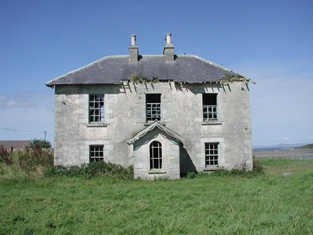
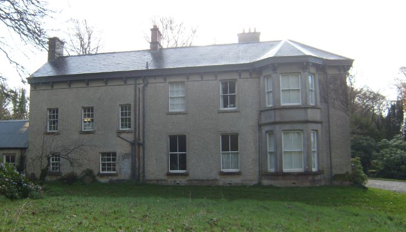
| Moyne | Built in the first half of the 19th century by Michael J. Browne who was forced to sell his estate in the mid 1850s when the house was described as ‘a magnificent pile of Grecian architecture of the Doric order’. John Stratford Kirwan bought the house and demesne in 1857 from Edward Browne who had purchased it in 1855. Kirwan advertised it for sale again in 1865. It was eventually sold to the Waithmans who later purchased Merlin Park. In 1912 the house became a hospice for infirm priests and in the 1930s was taken over by the Sacred Heart Missionaries. Since 1972 it has been the home of a number of people, including the broadcaster and poet George MacBeth and the singer Donovan. A floor plan and lithographs of the house are included in the various sale rentals. |

|