Browse Houses
Search Results: Returned 5926 records. Displaying results 4101 – 4200
| House name | Description | |
|---|---|---|
| Mohera | Hajba writes that Michael Mackay was recorded as resident here in 1824. By 1837 John O'Sullivan was resident and was still the occupier at the time of Griffith's Valuation. The buildings were then valued at £14 and the property was held from Major General Conyers. Home of the McAuliffes in the 20th century. |
|
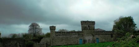
| Mohill Castle | At the time of Griffith's Valuation John Kane was leasing a property valued at £20 from Sir M. Crofton in the town of Mohill. |
|
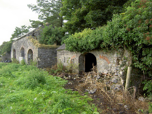
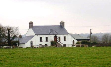
| Mohober | Mohober was occupied by Scott Esq in the 1770s and 1780s. It was the home of the Cormick family in the 19th century. Richard Cormick was resident in the early 1850s holding the property from the Earl of Clonmel. The buildings were valued at £14.15 shillings. In the 1870s Daniel Cormack of Mohober owned 189 acres in county Tipperary. The sale rental of the interest of James P. Welply in the house and demesne of Mohober dated July 1868 records that the property was conveyed to Daniel Welply by the Encumbered Estates Commissioners in May 1856. The original lease dated 1766 was from William Cane to Mark Scott. The Cormac interest in this property was advertised for sale in June 1876. Buildings are still extant at this site. | |
| Molahiffe Castle | At the time of Griffith's Valuation, Maurice de Coursey was leasing a property in the townland of Castlefarm from the Kenmare estate which had a valuation of almost £6. It is likely to have been the house labelled on both the 1st and later 25-inch edition Ordnance Survey Maps as Molahiffe Castle. The National Inventory of Architectural Heritage states that this house was built in the mid-eighteenth century. In 1943 the Irish Tourist Association Survey highlights the close links between Molahiffe and the Browne family, who, it says, resided in the area until the building of the first Killarney House. The remains of the original Molahiffe castle are located a short distance from the present house, now known as Castlefarm House. |
|
| Molahiffe House | Eliza Griffin was the lessor of this property at the time of Griffith's Valuation, when it was valued at almost £6 and vacant. In 1837 Lewis mentions "Boucheens" as the residence of Montague Griffin. Bary states that this is a very old house and is widely believed to be one of the earliest homes of the Browne family, later Lords Kenmare. It is still extant and occupied. |
|
| Mollaneen House | Weir writes that this was an 18th century house. "Dysert" was occupied by Thady Brew in 1814. At the time of Griffith's Valuation George Fitzgerald held a house valued at £5 from Francis H. Synge in the townland of Mollaneen. Local sources suggest that this house was frequently occupied by the agent to the Synge estate. Weir writes that the roof of the house was removed in the mid 20th century. It has, however, since been restored and is now known again as Mollaneen House. | |
| Monaincha | Lewis describes Monaincha in 1837 as "an elegant villa in the Italianate style" the residence of G. Birch. Mrs G. Birch was living at Monaincha in the early 1850s whens the buildings were valued at £22.10 shillings. Occuppied by Harriet F. Miller in 1906. The house is still a fine residence close to Roscrea. |
|
| Monaloo | This house was built post Griffith's Valuation. In the 1870s Charles Nason of Monaloo House, Tallow, owned 797 acres in county Cork. It is still extant. |
|
| Monalty House | This house, located on the Marquess of Bath’s estate, dates from the 18th century and was the residence of the agent, Norman Steele, in 1798. In the 19th century Monalty House was the home of the Gartlan family. It was purchased by James Gartlan, a wealthy distiller in the town of Carrickmacross. Lewis records his son Thomas McEvoy Gartlan as the proprietor in the 1830s. The house is named on the 1st edition 6 inch Ordnance Survey Map (1836). Thomas M. Gartlan was recorded as the occupier in Griffith’s Valuation when the buildings were valued at £26. Members of the Gartlan family were still resident in the early 20th century. https://pdeanisland.wordpress.com/places/carrickmacross/monalty-house/ | |
| Monamintra | Mrs. Johanna Lyons was leasing this property from Lord Fortescue's estate at the time of Griffith's Valuation, when it was valued at £10. An extensive farm occupies the site now. | |
| Monanimy Castle | In the mid 19th century William Barry occupied Monanimy Castle which was valued at £15.10 shilllings and held from George Bennett. Hajba writes that Barry restored the castle and that he was related to the Nagles who had originally owned the castle. The Barrys remained as residents of the castle until the 1940s when the castle was damaged by a fire. It has been restored and is now a family home. | |
| Monaquil | Burke's ''Landed Gentry of Ireland'' (1904) records Philip Going of Monaquil, sixth son of Robert and Jane Going. In 1767 Philip married Grace Bernard. Their grandson, Reverend Philip Going Atkins Going, succeeded to the Monaquil property by the will of his maternal grandfather, who died in 1820. Monaquil was occupied by the Atkins family in 1837. In 1840 the Ordnance Survey Name Books record that "Mr. O'Shea, proprietor, states that he has nothing to do now ith Monaquil, it is under the Courts" and that the house was then occupied by a Mrs. Bennett. It was vacant at the time of Griffith's Valuation. when Reverend Hastings Atkins was the immediate lessor and the house was valued at £19. The Butler sale rental of 1866 records a fee farm grant dated 19 May 1859, John Butler to Reverend Philip Going Atkins Going. The Atkins sale rental of 1877 records the leasing of Monaquil to Robert William Henry Roe in 1864. The original house marked on the first edition Ordnance Survey Map was replaced by another house slightly to the north in the late 19th century. | |
| Monascallaghan House | This property was described as a herd’s house belonging to the Palliser estate at the time of Griffiths Valuation in the early 1850s, when it was valued at £2 5s. The Ordnance Survey Name Books noted that the townland was part of the Jessop estate. In 1906 it was the property of Dr. J. McCutcheon and valued at almost £3. A house is still extant at the site. | |
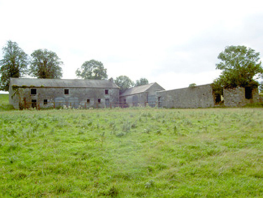
| Monaster House | This house was the home of Michael Furnell in 1803. By 1814 the house on the Vandeleur estate, was leased to John Cantillon Heffernan . At the time of Griffith's Valuation, the buildings at Monaster were valued at £35 and leased by John Cantillon from the Vandeleur estate. In 1943 the Irish Tourist Association surveyor refers to a story concerning ghostly activities and that the house had been "pulled down" a short time previously. Much of the farmyard building complex survives. |
|
| Monatray | In 1851 Pierce S. Smith [Smyth), a minor, held Monatray in fee when it was valued at £35. In 2013 it was offered for sale. The sale details suggest it was built by Percy Smyth of Headborough as a summer residence in the 1830s. In the twentieth century it was occupied by a religious order and later a country house club before returning to private ownership in the 1980s. In recent years the house name is spelt Monatrae. In 2014 Monatrae was offered for sale. |
|
| Mondellihy | Occupied by George Fosberry at the time of Griffith's Valuation, held from the Earl of Dunraven and valued at £15. By the end of the 19th century this house was the home of Peter David Fitzgerald (1855-1935), a younger son of George Fitzgerald 1st Baron Fitzgerald of Valencia and grandson of the Knight of Kerry. |

|
| Moneen | Richard Splaine was leasing this property in 1851 from the Baldwin estate when it was valued at £18. | |
| Moneenroe/Drummaan House | At the time of Griffith's Valuation Anthony Holland was leasing a property valued at £6 from James Egan, at Drummaan East, barony of Leitrim, county Galway. This seems to correspond to the property labelled Moneenroe on the 1st edition OS map. Other members of the Holland family were leasing lands from Egan in the same townland. On the 25-inch Ordnance Survey map of the 1890s this house is labelled Drummaan, the previous house of that name having disappeared. There is still an extant house at this site which is now located in county Clare. | |
| Monellan | A house described as "unfinished" was held in fee at Monellan by Robert Delap at the time of Griffiths Valuation in the 1850s. The buildings were valued at £45. A house is shown at this location on the 1st edition Ordnance Survey map of the 1830s but has been greatly extended by the early twentieth century. In 1906 it was owned by James B. Delap and valued at £56. It appears to have been demolished by the mid-twentieth century and the site is now occupied by forestry. | |
| Moneygold | At the time of Griffith's Valuation, Moneygold was leased by the Fawcett family from Viscount Palmerston's estate and was valued at £13. Lewis records it as the residence of the Soden family in 1837. McTernan notes that it was the seat of the family from the early eighteenth century when James Soden leased almost 1000 acres from the Temple estate. In 1906 it was the property of Major G.M. Eccles whose mother was Isabella Soden. The house was damaged in a storm in the early 1960s and subsequently demolished. | |
| Moneyhoolaghan House | Benjamin Lloyd was leasing Moneyhoolaghan from the Blackall estate at the time of Griffiths Valuation in the early 1850s, when it was valued at £16. The National Built Heritage Service suggests the current house was built c.1880. It is still extant. |
|
| Moneylagan Cottage | In 1837 Lewis referred to Moneylagan as the seat of Dr. Forbes Crawford. At the time of Griffiths Valuation in the early 1850s it was leased by General James Hey from John Crawford when it was valued at almost £14. The 1840 Valuation Office books show a £15 valuation. An altered house is extant at the site now. | |
| Monglass | Caldwell Motherwell was leasing this property from the Earl of Wicklow's estate at the time of Griffith's Valuation in the 1850s when it was valued at £13. The house at the site now is of late 19th century construction. | |
| Monintown/Mornington | Monintown or Mornington House, straddles the border between the parishes of Mutlyfarnham and Stonehall as shown on the first edition six inch OS and the 25 inch maps as Moninton. The original two-storey house was built in the mid-18th century and was the home of the Daly family. It was the seat of Owen Daly in 1837 and Edward Daly held it in fee at the time of Griffith’s Valuation (publ. 1854). It was valued at £7.10, while a building he held in the parish of Stonehall was valued at £8. In the late 19th century a five-bay two-storey house was built to the front of the original house by the O’Hara family who acquired the property in 1858. In 1906 the house was valued at £43.13 and was in the possession of Patrick O’Hara. Still in the ownership of the O’Haras, who run it as a guest house. |
|
| Monivea | An O'Kelly tower house, acquired by the ffrenches in the early 17th century, who made additions in the 18th century. Held in fee by Robert French at the time of Griffith's Valuation when it was valued at £40. In 1894 Slater refers to it as the seat of Acheson French. In 1938 it was bequeathed by Kathleen French to the State as a home for artists, subsequently demolished and now only the original tower remains. A mausoleum, modelled on the tower house and constructed at the end of the nineteenth century, is located in the adjacent woodland. |

|
| Monksfield | The house at Monksfield had originally belonged to the Morgan family who were of Welsh origin. Evidence from the 17th century records shows that they acquired land in this area in the later 17th century. In 1837 Lewis recorded Monksfield as the seat of Capt. Morgan. It had to be sold in the mid-19th century due to debts. By the 1850s it was the residence of Thomas Shawe-Taylor.In 1906 it was owned by Walter Shawe Taylor and was valued at £14. Kelly, writing in 1976, indicated that the estate was sold to the tenants around 1908. After the estate was divided, the house continued to be occupied well into the twentieth century but is now a ruin surrounded by farmland. |
|
| Monkstown Castle | Built by a Mrs Archdeacon in the 17th century, Monkstown Castle was the home of the Shaw family in the 19th century and held from the de Vesci family. In the early 1850s Robert Bernard Shaw was resident and the buildings were valued at £54. In the possession of the Monkstown Golf Club for much of the 20th century, Further information on the building's construction is available at https://www.logainm.ie/ga/9588. |
|
| Monroe | Monroe was the residence of Robert Young in 1814 and Lewis describes it as the "neat cottage residence" of R. Power. Pierce Power held the property in fee at the time of Griffith's Valuation when the house was valued at £37+. Occupied by Hamo Massy Power in 1906. Yard buildings remain at this site. | |
| Monroe Glebe House | In 1851 Rev. William Giles was leasing this property from the Devonshire estate when it was valued at £28. Recorded as "rectory" on the 25-inch map of the 1890s. There is still a house at this site. | |
| Monroe House | Charles Browne was occupying this house in the early 1850s. He held it from the Earl of Glengall and the buildings were valued at £10. A house and farm are still extant at the site. | |
| Mont Louise | Home of the Evatt family in the 19th century, R. Evatt was resident in the 1830s. Samuel Evatt was the occupier circa 1860. He held the property in fee and the buildings were valued at £9. Home of George F. Evatt at the beginning of the 20th century. A building is still located at this site. | |
| Monte Video/Prospect | This house was named Monte Video on the first edition OS map and as Prospect on the 25 inch map. A doctor’s residence at the time of Griffith’s Valuation (publ. 1854) when Dr Ferguson was in occupation. Valued at £13 it was held from Anne Cowper or Cooper. It was originally located on the outskirts of Mullingar but is now surrounded by a housing estate |
|
| Montevideo House | A house marked on the first edition Ordnance Survey map and occupied by Francis Smallman in the mid 19th century, when the buildings were valued at £20 and held from the Earl of Portarlington. The National Inventory of Architectural Heritage names this house Beechmount. |
|
| Montpellier | A house occupied by the Reverend Morgan O'Donovan in 1837 and by Morgan O'Donovan in the early 1850s. The house was held in fee by the O'Donovans and was valued at £55. There is no trace of this house now as modern development has taken place in the area. | |
| Monyvroe | In 1851 Edmund Power held this property from Lord Decies estate when it was valued at £11 10s. There are still extant buildings at the site. | |
| Moor Park | Occupied by Giles Eyre Lambert at the time of Griffith's Valuation when he was leasing it from Walter Lambert. It was valued at £20. Later the seat of Frank Shawe Taylor who was assassinated nearby in 1920. There is still a large house at Moor Park though the National Inventory of Architectural Heritage indicates that this is not the original house. |
|
| Moorbrook | In 1786 Wilson refers to "Moore-field" as the seat of Mr. Moore. Leet's Directory records 'Moorfield' as an 'unoccupied seat' in 1814. The house appears, however, to have become known as Moorbrook as it is thus labelled on the Ordnance Survey maps. Henry Wills held Moorbrook at the time of the sale in 1854. At the time of Griffith's Valuation, it is described as a "herd's house" and occupied by Francis O'Grady. It is labelled as "in ruins" on the 25-inch Ordnance survey map of the 1890s. A modern house has been constructed near the site. | |
| Moore Hall | Built in 1795 and burnt down in 1923. The residence of George Henry Moore, MP, at the time of Griffith's Valuation, when it was valued at £45. Slater refers to it as the seat of George A. Moore in 1894. The ruin is now owned by Coillte Teoranta. |
|
| Moorehill | Held in fee by William Moore at the time of Griffith's Valuation, when it was valued at £55. Lewis also refers to it as his seat in 1837. Wilson, writing in 1786, notes it a the seat of Rev. Mr. Moore. In 1894 and 1906 it was the property of Captain William Perceval Maxwell and valued at over £70. In 1943 the ITA survey noted it as the residence of Captain Maxwell and mentioned that it was an eighteenth century house. It is still extant and occupied. | |
| Moorepark | A large Georgian house, the seat of the Earls of Mountcashell, extended in the 19th century. In 1786 Wilson describes it as "a superb and noble seat". It was held in fee at the time of Griffith's Valuation when it was valued at £87. Bought by the War Department in 1903 and accidentally burnt in 1908. In 1944 the Irish Tourist Association Survey noted that the remains of the kitchen were still visible then. Nothing remains of the original house and the site now belongs to Teagasc, the Agricultural and Food Development Authority. | |
| Mooresfort | The home of the Crosbie Moore family in the 18th and early 19th century, Wilson refers to Moore's-fort as "the handsome seat of Edward Moore" in 1786. Lewis records Maurice Crosbie Moore as resident in 1837. At the time of Griffith's Valuation Edward C. Moore was still in possession of Mooresfort. However it was advertised for sale in 1852 and sold to Charles Moore of county Antrim, who altered and remodelled the house, reducing it from a 3 storey to a 2 storey house. The house remained in the possession of this family into the 20th century. It is now the main residence on a working farm. |

|
| Moorfield Cottage | Jeremiah Rogers, a steward on the Gore-Booth estate, was occupying this property at the time of Griffith's Valuation, when it was valued at £5 10s. McTernan states that it remained in the Rogers family until the early decades of the twentieth century. It is still extant and occupied. | |
| Moorfield House | In 1778and 1786, this house was the residence of the Blake family. Moorfield was a steward's house on the Eyre estate at the time of Griffith's Valuation. In April 1869 the Eyre's Moorfield estate, including the house, was offered for sale in the Landed Estates court. In 1906 it was owned by James Howard Jnr and was valued at £28. The National Inventory of Architectural Heritage suggests that the extant house at Moorfield is of late nineteenth century date. |
|
| Moorhill House | At the time of Griffiths Valuation in the 1850s, John Simpson was leasing this property from Major Blackall’s estate, when it was valued at £26. It is still extant. |

|
| Morgans North | The Rose family were resident here in the early 18th century. Later a residence of the Sandes family of Queen's county, occupied by William Sands at the time of Griffith's Valuation who held the property from Charles L. Sands. The buildings were valued at £15+. This house was also known as Mount Pleasant, Lewis records Mrs Morgan as the resident in 1837. Hone of the O'Dells in the early 20th century and later bought by the Keane family. |
|
| Mortlestown Castle | Captain James G. Jacob was the occupant of Mortlestown Castle in 1814. By the time of Griffith's Valuation Thomas P. Lloyd was resident holding the property from Robert Jacob. The house was valued at £29. Buildings are still located at this site. | |
| Mosestown | In 1786 Wilson notes a house on the left of Whitegate as the seat of Charles Allen. This may refer to the house labelled "Mosestown House" on the 1st edition Ordnance Survey map. At the time of Griffith's Valuation it was occupied by Edmund Roche, son of Francis Roche of Rochemount. The house was valued at £21 and held from Edmond B. Roche. Edmund was a distinguished soldier rising to the rank of Major General and married Anna Matilda, daughter of the Reverend Austen, of Hadwell Lodge. In 1894 Slater recorded a house known as Ballymonis as the seat of General Edmund Roche. Mosestown is labelled Ballymonis on the 25-inch Ordnance Survey map of the 1890s. It is no longer extant. | |
| Moss Hill | Occupied by Peter Conry in 1814 and by Captain Conry in 1837. | |
| Mossfort | A house labelled Caherakeeny is shown here on the First ediiton Ordnance Survey map. It was valued at £12 and occupied by John Kilkelly at the time of Griffith's Valuation. The present house was constructed in the late nineteenth century and is labelled Mossfort on the 25-inch Ordnance Survey map of the 1890s. |
|
| Mossgrove | Held in fee by Samuel Baldwin in 1851 when it had a valuation of £20. Also noted as his residence by Lewis in 1837. Mossgrove seems to have pre-dated Mount Pleasant as the Baldwin residence in this area. There is still an extant house at this site. | |
| Mossgrove Lower | Mossgrove Lower appears on the 1st edition Ordnance Survey map close to the site of a fortified house dating from the early modern period which is recorded as "in ruins" by the 1830s. In 1851 Henry Baldwin was leasing the property here to Thomas Barter when it was valued at £9. Leet notes a property at Mossgrove as the residence of Robert Popham in 1814. It was no longer extant by the publication of the 25-inch map of the 1890s, | |
| Mosstown | Mosstown House named on both the first edition OS map and the 25 inch map. O’Brien writes that Mosstown was originally a property belonging to the Judge family and was sold to Cuthbert Fetherstonhaugh in 1790 and he was recorded as occupant in 1814. In 1837 it was recorded as ‘the principal seat’ of the parish ‘the handsome residence of Theobald Fetherston H.’ It remained a Fethetstonhaugh property until sold to William Dargan in the Encumbered Estates Court in 1851 (O’Brien). At the time of Griffith’s Valuation (publ. 1854) it was valued at £40 and occupied by Thomas Smith who held it from William Dargan. Later this house was occupied by members of the Fosberry and Adamson families. In 1906 George A G Adamson was the occupant. The house was destroyed by fire in 1938 and is now a green field site. | |
| Mosstown (Ballymahon) | At the time of Griffiths Valuation, in the 1850s, this property was leased by Arthur Kingston from the King-Harman estate. The property was valued at £30 with a mill valued at £50. Lewis referred to Mosstown as the seat of Arthur Kingston in 1837. Mosstown has been demolished but the ruins of the mill and some estate architecture remains. |
|
| Mossvale | The Ordnance Survey Name books of the 1830s noted Mossvale as the seat of J. Barber. At the time of Griffiths Valuation. in the early 1850s, it was being leased from the Hamilton estate by William Lewis, when it was valued at £20. It was later demolished but the stables and other estate architecture survives. |
|
| Mota | This house dates from about 1800. Edward Cambie was resident at Mota in 1814 and T. Pepper Roberts in 1837 and afterwards. The Ornance Survvey Name Books mention that it was his residence in 1840 and that Thomas Sadlier was the proprietor. Mota and 478 acres, the estate of Theobald Pepper Roberts, was advertised for sale in May 1850. George Taylor occupied the house valued at £15.10 shillings in the mid 19th century. He held it from Peter Byrne. Marcus Tuthill lived here later. This house is still occupied. |

|
| Mote Park | The home of the Crofton family from the 17th century, valued at £140 in 1906. ''Saunders Newsletter'' dated 17 May 1865 refers to a fire at Mote Park which badly burnt the house. The house was demolished in the 1960s. Roscommon Golf Club occupies part of the original Mote Park demesne. |

|
| Mough | Mough was one of the original properties held by the Lawder family from their arrival in the Leitrim area. Burke suggests that Mough afterwards became Lawderdale but map evidence would suggest that they were separate though adjacent properties. At the time of Griffith's Valuation the house was valued at £18. | |
| Mount Allen House/Lough Allen Cottage | Lewis records "Lough Allen Cottage" as the seat of Hugh McTernan in 1837. At the time of Griffith's Valuation, this townland was leased by Richard H. Gorghes from Arthur O'Conor. It included a house valued at £7 10s. This building is labelled Mount Allen House on the 25-inch Ordnance Survey map of the 1890s. | |
| Mount Alto | Mrs. Hannah Paul was leasing this property from Lord Carew's estate in 1848 when it was valued at almost £36. It is still extant and has been refubished while the coach house has been converted into self-catering accommodation. See www.mountalto.com. |
|
| Mount Anketell/Spring Mount | Located on the Anketell estate and marked on the 1st edition 6 inch Ordnance Survey Map (1836), this house was the residence of George Olpherts and valued at £10 circa 1860. The house appears to have been unoccupied at the time of the censuses in 1901 and 1911 but was in the possession of the Moutray family of Fort Singleton. The 25 inch map (surveyed in 1908) records the name of this house as Spring Mount. It is no longer extant. | |
| Mount Baylee | In 1837 the residence of H. Bayley. Occupied by Susannah Baylee at the time of Griffith's Valuation, who held it from Henry Thomas Baylee. The buildings were valued at £8. Weir writes that in the 20th century Miss Edie Baylee married the father of the architect Percy le Clerc. The house is still lived in. | |
| Mount Beamish | John Beamish was leasing this property to Rev. John Baldwin at the time of Griffith's Valuation, when it was valued at £15. In 1837 Lewis records it as the seat of J. Beamish. Leet noted it as the seat of Rev. Samuel Beamish in 1814. Farm buildings exist at the site now. | |
| Mount Beresford | In 1848 William Manning was leasing this property from Lord Waterford's estate when it was valued at almost £10. There is still an extant house at the site. Shaw Mason's "Parochial Survey" notes it as the seat of Mr. Maguire. A house is still extant at the site. | |
| Mount Bernard | William Bernard was leasing this property from the Devonshire estate at the time of Griffith's Valuation, when it was valued at £15 10s. A house is still extant at this site. |

|
| Mount Blakeney | Mount Blakeney is south west of the town of Kilmallock and very close to the border between counties Limerick and Cork. No large house is marked in the townland of Mount Blakeney on the first Ordnance Survey map (Sheet 47). In 1786 Wilson refers to Mount Blakeney as the seat of Mr. Blakeney. At the time of Griffith's Valuation the townland was in the possession of Mrs. Blakeney Fitzgerald. In 2022 Mount Blakeney was offered for sale. |

|
| Mount Brown | The main residence of the Brown family of Rathkeale until Castle Matrix was restored in the 1830s. Held by them in fee, the buildings were valued at £23 at the time of Griffith's Valuation. The mansion house at Dromard was occupied by John Walker circa 1840. In 1906 the house was occupied by the representatives of Col Edward Browne. |

|
| Mount Browne | At the time of Griffith's Valuation occupied by George Browne who held the property from James G.Plunkett, valued at £25. The sale rental of the Gunning Plunkett estate in June 1857 states that Mount Browne was held by a fee farm grant from Jane Plunkett, mother and guardian of the owner, to George Browne, dated 30 Oct 1852. Occupied by the representatives of Arthur Browne in 1894 and 1906. | |
| Mount Browne | A house built in the early 18th century and used by the first generations of Brownes at Westport. Wilson describes it as the seat of Mr. Browne in 1786. It was later occupied by Denis Browne, Member of Parliament, brother of the 1st Marquess of Sligo, and other family members. It was leased by John D. Browne from the Marquess of Sligo's estate at the time of Griffith's Valuation, when it was valued at £30. The Irish Tourist Association file of the 1940s states that the mansion had been demolished. | |
| Mount Browne | The home of the Cullinane family for about the last 200 years and still occupied by them. The house is reputed to be about 300 years old and was undergoing renovation in 2007. The outbuildings are well maintained. |
|
| Mount Bruis | The Inventory of Irish Architectural Heritage dates this house from the mid 18th century. It was occupied by Doherty Esq in the 1770s and in 1786. The residence of Edmund Scully in 1814, Mrs Doherty in 1837 and Thomas Dwyer in the early 1850s. Dwyer held the property from Irwing Bagnell and the buildings were valued at £25. In 1840 the Ordnance Survey Name Books described it as "a very old building and in middling repair". It is still extant. |

|
| Mount Callan | The original house was built by Lieutenant Colonel Charles Synge in the early 19th century but the present house was built in the 1870s. The property passed to the Tottenham family by the marriage of his daughter Mary to Robert Tottenham of Ballycurry, county Wicklow and is still in the possession of this family. The buildings were valued at £30 in 1906. | |
| Mount Campbell | Josias Rowley was leasing the property at Mount Campbell, valued at £35, to William A. Lawder at the time of Griffith's Valuation. Slater refers to it as the seat of William S. Lawder in 1894. In 1906 William Rowley owned the mansion at Mount Campbell valued at £40. The house is no longer extant. |
|
| Mount Carmel | A house built in the early 19th century; the Tithe Applotment Book 1829 records the occupant as John Ker while the Ordnance Survey Field Name Book records Miss Kerr as resident. William Alexander Williams of Mount Carmel, a nephew of Colonel John Ker of Mountain Lodge, took the additional name of Ker in 1846. Mount Carmel was advertised for sale in 1854. It was unoccupied at the time. By the time of Griffith’s Valuation the buildings had a rateable valuation of £7 and the house was occupied by George Bennie and held from Samuel Moorhead. This house continues to be a well maintained residence. |

|
| Mount Catherine | A house on the Lloyd Apjohn estate, the home of the Smithwick family from about the mid 18th century and occupied by Michael Smithwick in the early 1850s, when the house was valued at £24. The Smithwicks of Mount Catherine and the Lloyd Apjohns were related through at least one marriage. |

|
| Mount Congreve | Built and owned by the Congreve family from the mid-eighteenth century. Wilson states that it was "the pleasant seat of John Congreve" in 1786. Leet refers to it as the seat of Captain Fleming in 1814. At the time of Griffith's Valuation, in 1850, Mount Congreve was held in fee by John Congreve, when it was valued at £68 10s. It is still extant though a sale of the house contents took place on the premises in July 2012. |
|
| Mount Coote | The county Limerick seat of the Coote family in the 18th and 19th centuries. Wilson refers to it as "the pleasant seat of Mr. Coote" in 1786. It was occupied by Chidley Coote in 1814. Lewis refers to it as the former seat of Chidley Coote in 1837. Charles Coote was resident at the time of Griffith's Valuation and held the property in fee. The buildings were valued at £53. Their value had increased to £65 by 1906. The Irish Tourist Association surveyor wrote in 1943 that the house was bought by Sir Gilbert Greenall, who became 1st Lord Daresbury, who spent about £200,000 setting up a Model Farm. [Lord Daresbury also owned Clonshire]. Following his death three years previously it was sold and then run as a stud farm. Bence Jones writes that this house was demolished circa 1960 and a new house built in the Georgian style. |

|
| Mount Corbitt | Home of the Glover family in the first half of the 19th century. Hajba writes that the Glover's sold their lease to the Anderson family in the early 1850s. In the early 20th century it became the home of the O'Brien family and is still occupied. |

|
| Mount Cross | This was the home of the Pearson family, held from Edward Townsend, inhabited by Mrs Pearson in 1837 and John Pearson in the early 1850s, when the buildings were valued at £11. Mary Pearson of Mount Cross owned 199 acres in county Cork in the 1870s. Archives relating to the Pearson family are located in Leeds University Library. The National Inventory of Architectural Heritage suggests the house was originally built by a Mr. Godfrey, a local mill owner, in the early eighteenth century. |
|
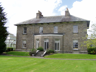
| Mount Dalton | Mount Dalton, named on the first edition OS map but on the 25 inch map (c 1914) as Loughazon Hall. It is a six-bay two-storey over basement country house, built 1784, on a rectangular plan. Erected by Count Richard D'Alton (d. 1790) on his return to Ireland following a distinguished career in the Austrian Service but subsequently vacated by him when he took up the post of Governor of the Austrian Netherlands (Lewis 1837 II, 491-2). Lewis describes the house as standing 'on the banks of a fine sheet of water ... formerly the seat of the ancient family of D'Alton ... the house which is now the residence of O W C Begg was built in 1784 by Count Richard D'Alton'. Valued at £16, it was unoccupied at the time of Griffith’s Valuation (publ. 1854) and the immediate lessor was Thomas Babington. Historic connections with the D'Alton family including Count Oliver D'Alton (d. 1799); Ignatius Dillon Begg (d. 1813) and Countess Elizabeth Begg (née D'Alton) (d. 1832); Oliver William Costello Dillon Begg (d. 1848) [of] Mount Dalton Rathconrath (Lewis 1837 xi); and the Brabazon family. Mount Dalton is the home of the Brabazon Gibson family. | |
| Mount Desert | The home of the Dunscombe family in the 18th and 19th centuries, it was noted by Wilson as the seat of Mr. Dunscombe in 1786. The house was occupied by George Dunscombe in 1814 and by Nicholas Dunscombe in the early 1850s when it was valued at £55. Still valued at the same amount in 1906 when it was occupied by Robert Dunscombe. The house is no longer extant and the Bon Secours Health Care unit is now located at this site. |
|
| Mount Dillon | Lewis writes that the house was situated on an isolated hill and formed "a conspicuous object in the surrounding scenery". Valued at £15 in the mid 19th century. Wilson, in 1786, refers to it as the seat of Mr. Dillon. In the possession of Samuel Russell in 1906 when the buildings were valued at £3. It is no longer extant. | |
| Mount Dodwell | Henry Crichton was the owner of a property valued at almost £7 at Ballinvoher, barony of Corran, in 1906. This may be the cottage which is still extant and was possibly a steward's house. At the time of Griffith's Valuation, it was being leased by Samuel Gilmore from the Creighton estate and was valued at £5. Lewis records Mount Dodwell as the residence of Charles Thompson, who was related to the Dodwell family. This was the original house, which had stood here since the eighteenth century. It ceased to be a residence in the mid-nineteenth century and was subsequently demolished. |
|
| Mount Druid | Denis O'Conor's house at Mount Druid, barony of Castlereagh, was valued at £35 at the time of Griffith's Valuation. In 1814 and 1837 the house was the seat of Matthew O'Conor. Slater refers to it as the seat of Charles M. O'Conor in 1894. A modest house survives at the site of Mount Druid but the stable yard remains are more elaborate. Fine trees still exist in the former demesne land. |
|
| Mount Druid (Gaultiere) | William Roberts was leasing this property from the Marquis of Waterford's estate in 1848, when it was valued at £14. In 1837 Lewis noted it as the seat of Mr. Reynett. There is still an extant house at the site. | |
| Mount Dudley | A house close to the town of Roscrea and marked on the first edition Ordnance Survey map. In the mid 19th century occupied by Samuel Dudley, valued at £17 and held with 29 acres from the Earl of Portarlington. The home of Thomas Ely in the 1870s. This house is extant and occupied. |
|
| Mount Eagle Lodge | Major Fairfield was the owner of Mount Eagle at the time of Griffith's Valuation when it was valued at £10 15s. Bary writes that it was built by him in 1830 and Lewis recorded it as his residence in 1837.The Ordnance Survey Name Books describe it as "a handsome cottage". It was most frequently used as a hunting lodge. Later in the nineteenth century it was the property of Colonel Drummond and resided in by his agent, Mr. Black. In 1906 it was owned by Charles Drummond and valued at £12. The property was eventually sold to the Forestry service in the mid-twentieth century when the house was demolished. | |
| Mount Edward Cottage | Both the Ordnance Survey Field Name Books and Griffith's Valuation record a property at Mount Edward as belonging to Capt. James Jones. It had a valuation of £2 in the 1850s. This would appear to be the property named as Mount Edward Cottage on the 1st edition OS map. McTernan states that it was occupied by the Hood family from the mid-nineteenth century until the 1980s. It is now in a dilapidated state. | |
| Mount Elva | Built in 1848, Pierce Creagh came to live here from Rathbaun. It was held in fee by him at the time of Griffith's Valuation, when the buildings were valued at £12 10s. The house is now a ruin. | |
| Mount Erris | At the time of Griffith's Valuation William Duckworth was leasing this house valued at £26 from Viscount Lorton's estate. There is still an inhabited house at this site. |
|
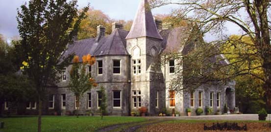
| Mount Falcon | A lodge and offices were built in 1826. In 1876 the building of Mount Falcon Castle was completed. Bought by the Aldridges in 1932 the Castle was run as a country guest house in the latter part of the 20th century. Following the death of Mrs Aldridge in 2003 the property was bought by the Maloney brothers and is now run as a luxury hotel. See www.mountfalcon.com |
|
| Mount Falcon | Bence Jones writes that this house was built in 1720 by Richard Falkiner. It was the seat of the Falkiner family in the 18th and 19th centuries. The Ordnance Survey Name Books refer to it as the seat of Richard Fitzpatrick Falkiner (a minor) in 1840 and that it was occupied by Obediah Holan. At the time of Griffith's Valuation the house was valued at £15. It is still extant. |

|
| Mount Florence | This house originally known as the 'Whitehouse' and later as 'Mount Florence' was the home of the O'Sullivan family from the mid 18th century. In 1883 it was sold to the Greene family from the Ballinasloe area. It is now a ruin. | |
| Mount Gordon | An 18th century house, occupied in the 1770s by 'Garden' [Gardiner]. Wilson refers to it as the seat of Mr. Garden [Gardiner] in 1786. It was occupied by Mary Boyd at the time of Griffith's Valuation, when the house was valued at £43. It is still extant and occupied. |
|
| Mount Hall (Raphoe South) | Reverend William Young held this property in fee at the time of Griffiths Valuation in the 1850 when it was valued at £28. The National Inventory of Architectural Heritage suggests it remained in the Young family until the 1890s. The buildings are now ruinous but a foundation stone, dated 1840, survives. |
|
| Mount Hawk | In 1906 Mounthawk was owned by Elizabeth Stokes and valued at £18 5s. The townland was in the possession of George Stokes at the time of Griffith's Valuation. Bary states that it was built by George Stokes on lands purchased from the McCarthy family and remained in the Stokes family well into the twentieth century. It was later used as a clubhouse by Tralee Golf Club. | |
| Mount Hedges | Mount Hedges, formerly a family residence, had by the time of Griffith's Valuation become the steward's house, valued at £15. In 1786 Wilson had referred to it as "the beautiful seat of Captain Robert Hedges". There are some ruins remaining at the site. | |
| Mount Ievers | A house built in the 1730s by Henry Ievers to the design of John Rothery. Wilson refers to it as the seat of Mr. J.A. Ievers in 1786. Occupied by Robert Ievers in 1814 and by W. Ivers in 1837. Eyre Ievers was resident at the time of Griffith's Valuation, holding the property from James Ievers. The Ievers family still live in the house. |

|
| Mount Irvine or Mount Irwin | At the time of Griffith's Valuation Edward B. Thornhill held over 300 acres including the townland of Mount Irvine and a property described as offices, valued at £3. Lewis had recorded Mount Irvine as the seat of William T. Sherlock in 1837. This house is more usually known as Mount Irwin and was a seat of the Irwin family in the eighteenth century. It passed by marriage to the Thompsons and then to William Theophilus Sherlock. It was later sold in the Encumbered Estates Court and the Thornhills continued to own it until 1907 when it was sold to the Land Commission. Nothing remains of the original house. | |
| Mount Jennings | Home of the Jenings family in the 18th and 19th centuries. Mount Jennings was held in fee by Benjamin Jenings at the time of Griffith's Valuation when the house was valued at £20. It was the childhood home of the ballad singer, Delia Murphy. Her parents still resided in the house in the 1940s. The roof was taken off the house in the 1970s and it is now demolished. | |
| Mount Jessop | In 1837 Lewis referred to Mount Jessop as the seat of F. Jessop. At the time of Griffiths Valuation in the early 1850s it was leased by the representatives of Thomas Conroy to Henry Crawford, when it was valued at almost £19. This is the same valuation assigned to it by the original Valuation Office books in 1839 when the occupier was John Jessop. The National Built Heritage Service suggests it was demolished c.1980. A substantial stable block and other estate architecture survives. |
|