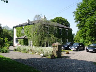
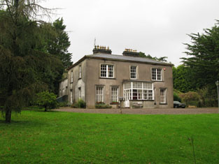
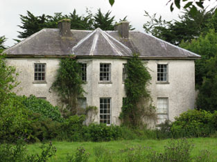
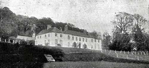
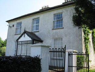
Ballinphellic
Houses within 15km of this house
Displaying 214 houses.
Houses within 15km of Ballinphellic
Displaying 214 houses.
| House name | Description | |
|---|---|---|
| Vernon Mount | Built by Atwell Hayes in the 1780s, Vernon Mount was the residence of John Leslie in 1814 and of O. Hayes in 1837. Soon afterwards it was leased to William Lane and he was the occupier at the time of Griffith's Valuation, holding the house valued at £55 from Attiwell Hayes. The Hayes sale rental of 1851 describes this house as "a large handsome building erected by the present owner's father at a cost of £5000". It was leased by the Hayes family to William Lane in 1839. A building still exists at this site. | |
| Annsville House | The representatives of Simon Davis were holding this property in fee at the time of Griffith's Valuation when it and the adjacent mills were valued at £45. The latter is labelled Ballinadee Mills and is described as disused on the 25-inch Ordnance survey map of the 1890s. Some buildings still remain at the site. | |
| Oak Hill | At the time of Griffith's Valuation, Henry Westropp was leasing this property to Geoffrey Rawlins, when it was valued at £9 5s. It is labelled Oak Hill on the 1st edition Ordnance Survey map but as Oakfield on the 25-inch edition of the 1890s. A house is still extant at the site. | |
| Peafield | George H. Rawlins was the proprietor of Peafield at the time of Griffith's Valuation, though it was unoccupied. Lewis distinguishes between Peafield and Peafield House which he indicates was the seat of the Minton family. | |
| Cloncouse | Thomas Lucas, MD, held this property in fee at the time of Griffith's Valuation, when the house was valued at £7 5s. It is not named on the Ordnance Survey maps and is no longer extant. | |
| Wood Hill/Knocknacurra House | Benjamin Gillman was leasing this property to William McCrate at the time of Griffith's Valuation when it was valued at £14 5s. Lewis refers to the house as Knocknacurra, seat of Benjamin Gillman in 1837. It is labelled Knocknacurra House on the 25-inch Ordnance Survey map of the 1890s. Farm builidngs appear to occupy the site now. | |
| Upland | William Spiller was leasing this property from Benjamin Gillman at the time of Griffith's Valuation when it was valued at £5 5s. There is still an extant house at this site. | |
| Knocknagappul House | The representatives of Robert Belcher were leasing this property to Francis Croker at the time of Griffith's Valuation when it was valued at £8 10s. There is still an extant house at this site. |
|
| Rock House | Edward Gillman held this property in fee at the time of Griffith's Valuation when it was valued at £24. Lewis records the property as the seat of J. Gillman in 1837. It was offered for sale in the Encumbered Estates Court in June 1851. In the late 1770s it was occupied by a member of the Baker family. There is still an extant house at this site. | |
| Tullyland | This property was held in fee by the representatives of Messers. Cornwall at the time of Griffith's Valuation, when it was valued at £8. A house still exists at the site. |
|
| Still View House (Cottage) | Robert Allman was leasing this property from the Earl of Shannon's estate at the time of Griffith's Valuation, when it was valued at £17 and had a mill adjacent. It is labelled Still View Cottage on the 1st edition Ordnance Survey map but an enlarged property at the site has become known as Still View House by the 1890s. A house still exists at the site. Allman was also leasing a mill, described as a flour mill on the 1st edition map. This site had expanded into an extensive woollen mill by the 1890s. Extensive industrial buildings still remain at the site. | |
| Distillery House | Richard Allman was leasing this property and the adjacent distillery from the Earl of Shannon's estate at the time of Griffith's Valuation. The properties were valued at £200. Distillery House is labelled on the 25-inch map of the 1890s. The distillery is labelled Allman's Distillery on the 1st edition Ordnance Survey map but as Bandon Distillery on the 25-inch edition of the 1890s. It is still extant and serves as a public house. |
|
| Belleview (Bandon) | William Seymour was leasing this property from the Earl of Shannon's estate at the time of Griffith's Valuation, when it was valued at £14. A house still exists at this site. |

|
| Brookfield (Bandon) | Godfrey Baldwin was leasing this house from the representatives of Hugh Levinge at the time of Griffith's Valuation, when it was valued at £15. It is still extant though in need of refurbishment. |
|
| Tullyland House | William Westropp and others were leasing this property to Nicholas Thomas at the time of Griffith's Valuation, when it was valued at £7 10s. There is still a house named as Tullyland House, at this site. | |
| Rockfort House | This house was the property of John Hornibrook at the time of Griffith's Valuation when it was valued at almost £9 and unoccupied. The house is still extant. He was also the owner of the nearby Rockfort Mill [W526587], valued at almost £13 and leased to Johanna Hurley. The latter property is labelled "disused" on the 25-inch Ordnance Survey map of the 1890s. |
|
| Highfort | Reverend Somers Payne was leasing this property from Anne Nash at the time of Griffith's Valuation, when it was valued at £12. There is an extant house at the site which the National Inventory of Architectural Heritage asserts was built c.1880. |
|
| Cor Castle | Thomas Frewen was leasing this property to James Corker at the time of Griffith's Valuation, when it was valued at £16 10s. In 1837 it was the seat of Chambre Corker. Cor Castle was in ruins for many years following its burning in June 1921 during the War of Independence. At the time it was the residence of Mrs. Carolne Stephenson, who, Donnelly indicates, had inherited it from her mother, Sophia Corker. It has recently been restored. |
|
| Cliff Fort | Thomas Frewen held this property in fee at the time of Griffith's Valuation, when it was valued at almost £7. There is still a house at this site. | |
| Belmont (Inishannon) | James Corker was leasing this property to Frederick Meade at the time of Griffith's Valuation, when it was valued at £16 10s. Lewis refers to it as the seat of Major Meade in 1837. It is still extant and occupied. |

|
| Downdaniel | The representatives of Chambre Corker were leasing this property to Rev. Richard Lane Connor at the time of Griffith's Valuation, when it was valued at £40. Lewis records it as the seat of Rev. Connor in 1837 when he describes it as a "modern mansion near the old castle". In the 1870s Downdaniel is recorded as the address of James Young Sandys. It is still extant. |
|
| Firgrove | At the time of Griffith's Valuation, the representatives of Chambre Corker were leasing this property to Richard Quinn when it was valued at £18. In 1837 Lewis notes it as the seat of R. Quin. In 1906 it was held by the representatives of Mary Quinn and valued at £7 10s. A house still exists at this site. | |
| Hawthorn Villa | At the time of Griffith's Valuation, Thomas Frewen was leasing this property to Robert Edwards, when it was valued at £10. Buildings still exist at the site where a stud farm operates. | |
| Ballymountain House | John Wheeler was leasing this property from the Earl of Bandon's estate at the time of Griffith's Valuation, when it was valued at £15. There is still an extant house at Ballymountain, on a large farm and run as a guesthouse. |

|
| Sunning Hill | Richard Quinn was leasing this property to Amelia Quinn at the time of Griffith's Valuation, when it was valued at £18. Lewis refers to its as the seat of Mrs. Quinn in 1837.The original house is no longer extant. | |
| Castle Bernard | Described by Lewis in 1837 as " a stately mansion, built in 1806, adjacent to the site of the former castle" and originally known as Castle Mahon. It was the seat of the Bernard family in the late 1770s and 1780s and then known as Castlebernard. Occupied by Viscount Bernard at the time of Griffith's Valuation and valued at £120. It was burnt in June 1921 and is now a ruin adjacent to Bandon Golf Club. |

|
| Ballinacurra House (Kinsale) | Ballinacurra House was held in fee by Mary Bleazby at the time of Griffith's Valuation, when it was valued at £18 5s. In 1786, Wilson refers to "Balnacurragh" as trhe seat of Mr. Swete. It is still extant and sometimes let as holiday accommodation. |

|
| Knockrobin | Mary Anne Bolton held this property in fee at the time of Griffith's Valuation, when it was valued at 17 10s. Lewis records it as the seat of Captain E. Bolton in 1837. A house is still extant at the site. | |
| Pallacetown House | Pallacetown House was held in fee by Samuel P. Townsend at the time of Griffith's Valuation, when it was valued at £14. On the 25-inch map, published in the 1890s, it is labelled Pallastown. In the 1940s the Irish Tourist Association Survey stated that it had previously been a residence of the Heard family but was then occupied by the Jagoes. It is still extant. | |
| Doon (Kinsale) | Rev. John Webb was leasing this property from the representatives of John Kearney at the time of Griffith's Valuation, when it was valued at £13 10s. An Encumbered Estates Sale notice of January 1851 indicates the mansion house at Doon was originally part of the Sullivan estate. Doon is still extant. |
|
| Blackhorsefield | Rev. Francis Stawell was leasing this property to Eugene Sweeney at the time of Griffith's Valuation, when it was valued at £16. Changes seem to have taken place at the site by the time of the 25-inch Ordnance Survey map of the 1890s. A school occupies this location now. | |
| Brownsmills | The representatives of T. Kearney held this property in fee at the time of Griffith's Valuation, when it was valued at £14 10s and included a mill complex. Portions of the mill complex have been converted into apartments. |
|
| Cappagh Folly | William Newman held property valued at almost £10 at Cappagh, Kinsale at the time of Griffith;s Valuation. It included a dairy and orchard. The 6-inch Ordnance Survey map also shows a turret on the property. | |
| Ballywilliam | Ballywilliam House was being leased by Benjamin Barter to a member of the Bowen family at the time of Griffith's Valuation, when it was valued at £20. In 1837 Lewis referred to is as the seat of B. Barter. It is still extant. |
|
| Hollyhill House | Lewis refers to Hollyhill House as the seat of C. Newman in 1837. Leet recorded it as the seat of Thomas Newman in 1814. At the time of Griffith's Valuation, it was being leased by James Radcliff to Mary Anne Collis. Mrs. Collis was the owner of almost 1000 acres in county Tipperary in the 1870s. It does not appear on the 25-inch map of the 1890s and there is no evidence of it now. | |
| Ballinaboy House | In 1837 Lewis describes this house as a "handsome modern mansion surrounded with young and thriving plantations". John Moloney held Ballinaboy House in fee at the time of Griffith's Valuation, when it was valued at £40. Lewis described it as "a handsome modern mansion, the seat of J. Moloney" in 1837. In the early 1940s the Irish Tourist Association survey described it as being "in a good state of preservation" and occupied by a Mr.Tuttle. It is still extant and occupied. |
|
| Sheep Glen | John H. Wheatley was leasing this property to Michael Roberts at the time of Griffith's Valuation, when it was valued at £7 10s. It is still extant and occupied, situated on a large farm. | |
| Arlinstown House | James Gillman was leasing Arlinstown House to Thomas Richardson Leane at the time of Griffith's Valuation, when it was valued at £15. A house and extensive farm buildings are extant at this site now. | |
| Ballindresrough Mills | William R. Meade was leasing this property to Daniel Keller at the time of Griffith's Valuation, when it was valued at £25, including a flour mills. It is not marked on the later 25-inch map, suggesting it was no longer operational in the 1890s. Extensive farm buildings occupy the site now. | |
| Ballintober House | Sir John Meade, Knight, was located at Ballintober at the beginning of the 18th century. In 1777 and 1786 it was the seat of Reverend Mr. Meade. Ballintober House was held in fee by Reverend John Meade at the time of Griffith's Valuation, when it was valued at £30. Lewis refers to it as the seat of J. Meade in 1837. In the 1870s it was the property of Reverend Mr. Meade. In the 1940s the Irish Tourist Association Survey stated that it was the property of John Meade whose family had held it since the reign of Elizabeth I. The National Inventory of Architectural Heritage indicates that the original house is now ruinous but there are later buildings at the site. |

|
| Ballymartle | William R. Meade held Ballymartle in fee at the time of Griffith's Valuation, when it was valued at £35. It was also noted by Lewis as the seat of W.R. Meade in 1837. In the 1770s it was the property of Rev. W, Meade. In the 1940s the Irish Tourist Association Survey described it as "an imposing residence in a finely wooded estate, occupied by Major Meade". It is now a roofless ruin. |
|
| Mill-Land | William Meade was leasing this property to Thomas R. Leane at the time of Griffith's Valuation, when it was valued at almost £9. | |
| Mullagh or Rock Hill House | William R. Meade was leasing this property to Thomas R. Leane at the time of Griffith's Valuation, when it was valued at £8 10s. It is labelled as Rock Hill House on the 6-inch Ordnance Survey map but appears on the 25-inch map of the 1890s as Mullagh House. A possibly later house and large farm occupy the site now. | |
| Coolkirky | The representatives of Gresham Herrick held this property in fee at the time of Griffith's Valuation, when it was valued at £25. The house burned down in the late 1990s. | |
| Glendoneen | Jeremiah Roberts was leasing this property to Rev. John Stoytt at the time of Griffith's Valuation, when it was valued at £45. Lewis refers to Glendoneen as the seat of Rev. J. Stoyte in 1837. It is still extant and occupied. |

|
| Grange (Athnowen) | Smith records Mr Onesiphorus Phaire as resident at Grange, Ovens, in 1750. Wilson, writing in 1786, refers to it as the seat of Mr. Whyte. This house was the home of the Hawkes family in the 19th century, occupied by J. Hawkes in 1814 and 1837 and by John Hawkes in the early 1850s, when the house was valued at £12 and held from Sir John Walsh. A house is still extant at the site. | |
| Brinny House | Brinny House was being leased by J.H. Wheatley to Rev. George Nash at the time of Griffith's Valuation, when it was valued at £30. In October 1854, it, together with the rest of Nash's property at Brinny, was offered for sale in the Encumbered Estates Court. The house is described in the sale notice as "in good repair". Lewis refers to it as the seat of J. Nash in 1837. In the late 1770s and 1780s it was the residence of Nash esq. In 1942 the Irish Tourist Association Survey referred to "a semi-derelict old mansion near Brinny Bridge, the reputed residence of Seán Dearg Nash, tyrannical provost of Bandon, 1690-1724". The original house is no longer extant. | |
| Clashanimud Cottage or Glenview House | Rev. George Nash was leasing this property to Henry Nash at the time of Griffith's Valuation, when it was valued at £10. It is labelled on the 25-inch Ordnance Map, published in the 1890s, as Glenview House. There is no house at this site now. | |
| Brinny Rectory | Brinny Rectory was held in fee by Rev. James Gollock at the time of Griffith's Valuation, when it was valued at £25. The house is still extant and occupied. |
|
| Glinny House | George Dunne was leasing Glinny House from Thomas Daunt at the time of Griffith's Valuation, when it was valued at £25. Lewis refers to it as the seat of G.N. Dunne in 1837. The Daunt family also owned Glinny Cottage [W669595] in the same townland, then valued at £8 and occupied by Elizabeth Walsh. Though altered Glinny House is still extant. |
|
| Heathburn Hall | George Daunt held this property in fee at the time of Griffith's Valuation, when it was valued at £35. The National Inventory of Architectural Heritage notes that it was later associated with the Shaw familiy who made additions to the house in the early twentieth century. In the 1940s the Irish Tourist Association Survey noted it a the residence of Mr. Bateman. There is still an extant property at the site. | |
| Dunderrow House | The building at this site is recorded as a Glebe house on the 1st edition Ordnance Survey Map.A different building at the site is labelled as Dunderrow House on the 25-inch edition of the 1890s. John C. Kearney was leasing this property to Blayney Calnane at the time of Griffith's Valuation, when it was valued at £8. There is still an extant house at the site. Lewis refers to "Dunderrow Cottage" as the seat of Rev. R. Halburd in 1837 but this is a different property in the townland of Horse Hill Beg. Local sources also suggest that Thomas Adderley lived "at Dunderrow" before moving to a house in the centre of Inishannon village. In 1786, Wilson writes that Thomas Adderley had a seat at Inishannon. |
|
| Leighmoney House | Lewis records E. Gillman of Leoffney [Leighmoney?], parish of Dunderrow in 1837. John C. Kearney held this property in fee at the time of Griffith's Valuation when it was valued at £15. There is still an extant house at the site. | |
| Rigsdale House | Not named on the 1st edition Ordnance Survey map but labelled Rigsdale House on the 25-inch map, published in 1899. At the time of Griffith's Valuation it was described as "herd's house" and being leased by the Wheatley estate to the representatives of Benjamin Roberts. It was valued at £10 at the time. In the early 1940s the Irish Tourist Association survey noted that " there is no trace of the old residence of the family. Richard Bird lives in modern residence of Rigsdale". It is still extant and part of a farming enterprise. |

|
| Annagh More House (Cork) | In 1786 Wilson refers to Anagh as the seat of Mr. Barter. The representatives of Benjamin Roberts were leasing this property from Rev. W.C. Brent and others at the time of Griffith's Valuation, when it was valued at £18. In the late 1870s, it was the seat of the Barter family. It is no longer extant. | |
| Frankfort | Francis Sealy was leasing this property from F. Westcott at the time of Griffith's Valuation when it was valued at £19 though Lewis refers to "Woodview" as the seat of F. Sealy in 1837 and occupied by Oliver Ellard in 1814. Local sources indicate that this house was built by the Hodder family. See www.bandon-genealogy.com. More recently the Inishannon House Hotel. |

|
| Danesfort (Inishannon) | Rev. Somers Payne was leasing this house from John Phibbs at the time of Griffith's Valuation, when it was valued at £10. Now a care facility run by Brothers of Charity services. | |
| Dunkeeran Cottage | Matthew B. Hornibrook was leasing this property to Thomas Hornibrook at the time of Griffith's Valuation, when it was valued at £10. The house is still extant and occupied. |
|
| Riverview | Rev. Michael Field was leasing this property from the Frewen estate at the time of Griffith's Valuation, when it was valued at £10. It was burnt in June 1921 during the War of Independence when it was the residence of Col. Francis Godley. Now a ruin. | |
| Innishannon House or Castle View | Rev. Robert Maunsell was leasing this property from the Frewen estate at the time of Griffith's Valuation, when it was valued at £22 10s. It is labelled Castle View on the 1st edition Ordnance Survey Map but named Inishannon House on the 25-inch map of the 1890s. It was burnt in June 1921 during the War of Independence. | |
| Ballindeenisk House | Mrs. Charlotte Harrison held this property in fee at the time of Griffith's Valuation, when it was valued at £8. It is one of two houses labelled Ballindeenisk House on the 1st edition Ordnance Survey map and it also appears under this name on the later 25-inch edition of the 1890s. It is no longer extant. | |
| Belgooly Cottage | At the time of Griffith's Valuation, Belgooly Cottage was being leased to William Gash by several lessors including Mrs, Charlotte Harrison, members of the Daunt family and the Earl of Bandon's estate. It was then valued at £9. It is labelled Belgooly Cottage on the 1st edition Ordnance Survey map but is not labelled on the 25-inch edition of the 1890s. | |
| Cramer's Court or Ballindeenisk | Labelled as Ballindeenisk on the 1st edition Ordnance Map and as Cramer's Court on the 25-inch series published in the 1890s. It was being leased by Benjamin Jeffers from the Earl of Bandon's estate at the time of Griffith's Valuation, when it was valued at £11. It is now a Nursing Home. |

|
| Aglish | The Hingstons were resident at Aglish from the early 18th century. At the time of Griffith's Valuation James Hingston owned a house valued at £21 in fee. An "old mansion house" is marked on the first Ordnance Survey map at the Grid Reference W469715. The current Aglish House was built after that and appears on the 25-inch map of the 1890s. It is still extant. | |
| Fort William [Kinalea] | Charles L. Bernard held Fort William in fee at the time of Griffith's Valuation, when it was valued at almost £9. Lewis refers to it as the seat of William Penrose in 1837. Buildings remain at the site. | |
| Upton | Reverend Somers Payne held this property in fee at the time of Griffith's Valuation, when it was valued at £45. Lewis names the seat of Reverend Payne as "Upton" in 1837. Noted by Leet as the seat of W.L. Beaufort in 1814. James Welply was resident in the 1870s. In 1942 the Irish Tourist Association survey noted that a sister of the Sheares brothers, executed as United Irishmen, was married into the Payne family and that the brothers were in the habit of visiting Upton. This property is still extant and run as a facility providing nursing care services. |
|
| Beechmount | Mary Nash was leasing this property to John Hornibrook at the time of Griffith's Valuation, when it was valued at £18. Lewis refers to it as the seat of J.Hornibrook in 1837. Still extant and now the site of Garryhankard Stud. In 2013 it was offered for sale. |

|
| Garryhankardmore | Mary Nash and Howard Wiseman were leasing this property to Robert Biggs at the time of Griffith's Valuation when it was valued at £35. In 1837 Lewis referred to as the seat of T. Biggs. There are still extant buildings at the site. | |
| Castleview or Inishannon House | Abraham Bazly was leasing this property from Sir Riggs Falkiner at the time of Griffith's Valuation when it was valued at £9. It is named Castleview on the 1st edition Ordnance Survey map but as Inishannon House on the later 25-inch edition of the 1890s. Modern housing exists at the site now. | |
| Ship-pool | Lewis refers to Shippool as the seat of Captain Herrick in 1837 when he describes it as " a handsome residence in a wooded demesne". At the time of Griffith's Valuation, it was being leased by Thomas Herrick to William Herrick and valued at £50. Local sources suggest it was built in the later eighteenth century when the family moved from Shippool Castle, but the house burned down later in the nineteenth century. It is recorded in the late 1770s as the residence of Herrick esq. and by Leet in 1814 as the seat of Wm. M.H. Herrick. A later house, also called Shippool, was built at the site in the early twentieth century and is still extant. Note: townland spelt as Skanagore in the Townlands Index but as Shanagore in other sources |
|
| Farran | This house was owned by Samuel Penrose at the time of Griffith's Valuation when it was valued at £24. It was also occupied by him in 1837. In 1868 Farran was bought by William Clarke and three generations of the Clarke family lived at Farran until 1970. In 1906 the buildings were valued at £226 and Thomas Clarke was the occupier. The Irish Tourist Association Survey in the 1940s describes it as "the splendid residence of Captain Clarke, living in the Channel Islands but occupied by his relatives". The present owners offer self catering accommodation for groups. see http://www.farranhouse.com/history.htm |

|
| Forest House | In 1750 William Spread was living at Forest and in the 1770s and 1780s Spread Esq is recorded as resident at Forest. In 1814 Leet records this "seat" as unoccupied. T. Gollock was resident in 1837 and Thomas Gollock held the property in fee at the time of Griffith's Valuation when it was valued at £38. Slater records it as the seat of Rev. T.H. Gollock in 1894. Forest was burnt in July 1921 just before the end of the War of Independence when it was the property of James Gollock and occupied by Lt. Col. Isaac Burns-Ludlow. The Irish Tourist Association survey refers to this in the 1940s as it having been burnt "as a military precaution". It is no longer extant. | |
| Upper Forest | A house valued at £20.10 shillings at the time of Griffith's Valuation, held by John Hassett from Thomas Gollock. It is still extant and occupied. |
|
| Leemount | Leemount was the home of Thomas Coppinger in 1814 and of Thomas Gollock in 1837. In the early 1850s this house was occupied by Thomas H. Broderick, valued at £30, and held from Thomas Gollock. In 1894 Slater refers to it as the residence of Albert Beamish. Leemount is recorded as one of the residences of John Lindsay, eldest son of George Crawford Lindsay of Moorlands, county Down in Walfords (1910). This original house was burnt in March 1921 during the War of Independence when it was the residence of Maria Lindsay, later executed as an informer by the IRA. It was replaced by the existing house. |

|
| Fivemilebridge Mill House | Joseph Coghlan was leasing this property to William Herrick at the time of Griffith's Valuation, when it and the adjacent mill were valued at £53. The mill buildings are no longer visible on the 25-inch map of the 1890s. The house is still extant. |
|
| Myrtle Hill | Richard Barter was leasing this house to Denis Ahern at the time of Griffith's Valuation, when it was valued at £12. Myrtlehill Farm is still extant at the site. | |
| Ballygarvan House | Joseph B. Coghlan held this property in fee at the time of Griffith's Valuation, when it was valued at £30. It is still extant. | |
| Ravenswood or Monroe House | Michael Roberts was leasing this property to Ralph Westropp at the time of Griffith's Valuation, when it was valued at £38. On the 1st edition Ordnance Survey map it is labelled Monroe House but later came to be known as Ravenswood House. Monroe House appears at a different location (W715627) on the 25-inch Ordnance Survey Map of the 1890s. Ravenswood was occupied by the Westropp family until the twentieth century. |

|
| Carrigaline West | At the time of Griffith's Valuation, Rev. Charles McCormack was leasing this property from Michael Roberts when it was valued at £10. This may be the property which afterwards became known as Monroe House. Later in the century, Carrigaline Rectory was located in the townland of Carrigaline Middle (W730630) | |
| Killanully | Rev. Edward Newenham was leasing this property to Michael Donegan at the time of Griffith's Valuation, when it was valued at £9. | |
| Kilmoney Abbey | At the time of Griffith's Valuation, Michael Roberts was leasing this property from Thomas R. Sarsfield, when it was valued at £50. Lewis referred to it as the "handsome residence" of Michael Roberts in 1837. It is stil extant and well maintained. Thomas Sarsfield was leasing a smaller propertyin the same townland, valued at £9, to Eugene McCarthy. There are two properties shown on the 25-inch Ordnance Survey map of the 1890s, Kilmoney House and Kilmoney Cottage. Buildings are still extant at these sites though extensive urban development has occurred in the area. |

|
| Ballea Castle | Francis Hodder held this property in fee at the time of Griffith's Valuation, when it was valued at £24 10s. Lewis also refers to it as his seat in 1837. Local sources suggest that It was originally built by the McCarthy family and later acquired by the Hodders. In the 1940s the Irish Tourist Association survey refers to it as being occupied by F. Dorman, retired engineer, and that it was the oldest occupied castle in Éire. Though much altered over the years, it is still extant and occupied. |

|
| Ballea Mill | Thomas Hewitt was leasing this property to Thomas Sullivan at the time of Griffith's Valuation, when it was valued at £20, including the adjacent mill. The latter property is labelled "in ruins" on the 25-inch Ordnance Survey map of the 1890s. | |
| Ballea A | At the time of Griffith's Valuation, Thomas Hewitt was leasing this property to Shaw Busteed, when it was valued at almost £10. Buildings are still extant at the site. | |
| Shanagraigue | Richard Woodley held this property in fee at the time of Griffith's Valuation, when it was valued at £13 10s. Buildings are still extant at the site. | |
| Nadrid | A house occupied at the beginning of the 19th century by Joseph Woodley, who married Anne Baldwin in 1799 but died a few years later. By 1814 Samuel Galway was residing at Nadrid. In 1837 Henry O'Callaghan was the occupier and he was still resident at the time of Griffith's Valuation. He held the house valued at £42 from the representatives of Abraham Cross. The Irish Tourist Association survey of the 1940s refers to Nadrid as the residence of Captain Matthews. A house still remains at the site. |

|
| Rosemount | A house occupied by S. Penrose in 1814, by W. Hawkes in 1837 and Joseph R. Harding at the time of Griffith's Valuation. He held the property from John L. Westropp and the buildings were valued at £25. There is still an extant house at the site. |
|
| Upper Forest | Occupied by John Hassett at the time of Griffith's Valuation and held from Thomas Gollock. The house was valued at £20+. The representatives of John Hassett still lived at Forest in the 1870s. | |
| Kilcrea House | In 1750 Smith wrote that Kilcrea was formerly the seat of the Earls of Clancarty, purchased by Captain Hedges from the Trustees of the Hollow Blade Company. In 1786 Wilson mentions the ruins of the castle and abbey of Kilcrea, near to which was a house named Snugborough, the residence of Mr. Keeffe. At the time of Griffith's Valuation Robert Gibbons was the occupier of Kilcrea House. He held the house valued at £20 from John Hawkes [who was leasing from Richard T. Rye]. This house is now a ruin. In March 1851 and July 1853 the estate of William Edward Ellis at Kilcrea, Desart, including Kilcrea House and 422 acres was advertised for sale. It was held on a lease dated 1740 Jonathan Ashe to Jeremiah Sullivan. William E. Ellis was the tenant of the house in 1853. William Sullivan Ellis of Kilcrea was issued with a certificate with respect to the killing of game in 1799 (see "The New Cork Evening Post" 24 March 1800). | |
| Dripsey Castle | This house was the home of the descendants of John Colthurst and his wife Jane Bowen from the late 18th to the early 20th century. It is still extant though it was damaged by fire in June 1920. The Irish Tourist Association survey in the early 1940s recounts the boycotting of the family following the Sheehy-Skeffington murder in 1916 and their subsequent departure to live in England. In the early 1940s it was the property of John O'Shaughnessy who also owned Dripsey Woollen Mills. In 2014 it was offered for sale. |

|
| Beechmount | Occupied by Dr Godfrey in 1837 and by Thomas Batten who held the property from Henry Lindsey in the early 1850s. A house is still extant at the site. | |
| Hayfield | A house, offices and mill valued at £22+ was occupied by Henry Lindsey at the time of Griffith's Valuation and held from Charles Connell. In the 1940s the Irish Tourist Association survey noted that it was then occupied by the Carroll family and had been built "about 150 years ago". The original house is not extant now. | |
| Meeshal House | In 1837 Lewis describes the work done at Myshell by Dr Barter “whose demesne of 200 acres, formerly an unprofitable waste, has, since 1826, been reclaimed and brought into a state of high cultivation.” The house valued at £36 was occupied by Thomas Kenyon at the time of Griffith's Valuation and held from Henry Lindsey. In the 1940s the Irish Tourist Association survey noted that it was "formerly a Hydro before the enterprise transferred to St. Ann’s in Blarney". The National Inventory of Architectural Heritage suggests that the current house incorporates portions of the original. |
|
| Derreen | A Crooke family home in the 19th century, occupied by William Crooke in the early 1850s and held from William Furlong. The buildings were valued at £12.15 shillings. [This may possibly be the house known as Broomhill, a residence of the Cross family. Epenetus Cross of Broomhill made his will in 1776, see http://www.radleysofcork.bigpondhosting.com/My_Homepage_Files/Page2.html].) This house was offered for sale in 2010. |
|
| Shandy Hall | The Crosses were living at Shandy from at least the late 18th century. Lewis records P. Cross as the proprietor of Shandy Hall in 1837 and Philip Cross held the house valued at £33 and 106 acres from Colonel [Mair] at the time of Griffith's Valuation. Philip Cross of Shandy Hall is recorded in 1876. The Irish Tourist Association noted that a stone inscribed with the date 1758 existed at the house and also referred to its being "the home of Phillip Cross who murdered his wife and was hanged in Cork Jail" Shandy Hall is still extant and occupied. |
|
| Nadrid | Daniel Connor held a house in the townland of Nadrid valued at £31+ from the representatives of Abraham Cross. This may be the house known as Riversdale marked on the first Ordnance Map. In 1894 Slater refers to Nadrid House as the residence of William O'Sullivan Galgey. A house still exists at the site. | |
| Classas | A house occupied by H. Minhear in 1837 and by Lewis Gollock at the time of Griffith's Valuation when it was valued at £26 and held from William Crooke. In 1894 Slater notes it as the seat of A. McCall. In the 1940s the Irish Tourist Association survey noted that it was then being run by Mrs. Agnes Leader as a guesthouse "for relatives". It is still extant and occupied. |
|
| Old Town | S. Crooke was residing at Old Town in 1837 and Simon D. Crooke in the early 1850s when the house was valued at £14.10 shillings and held from William Furlong. It is no longer extant. | |
| Elm Park | Garyhasty was described by Smith in 1750 as the "pleasant country house" of Mr Riggs Faulkner. I A house located on the Riggs Falkiner estate, Wilson notes it as the seat of Rev. Mr. Kenney in 1786. It was occupied by Valentine Barry in 1837 and by Thomas Barry at the time of Griffith's Valuation and valued at £36. Home of Richard Ashe Orpen in the 1870s. Elm Park is still extant and occupied. |
|
| Ryecourt | Seat of the Rye family in the 18th, 19th and 20th centuries, In 1786 Wilson refers to it as the seat of Colonel Rye. Lewis writes in 1837 that “the plantations around Rye Court are very extensive and beautiful”. The buildings were valued at £66 in the early 1850s. Ryecourt was burnt in June 1921 during the War of Independence. The family built a smaller house in the garden and continued in residence at Ryecourt into the 1970s. Ryecourt House was demolished but some of the farmyard complex remains. |
|
| Cronody | In the mid 18th century Smith refers to the seat and improvements of Mr Cross at Coronody. At the time of Griffith's Valuation James Cross occupied a house valued at £10.10 shillings which he held from Viscount Midleton and John H. Colthurst. This would appear to be the house marked Crondybeg on the first Ordnance Survey map. Cronodymore was in ruins. Gillman writes that Cronodymore was inherited from Richard Hawes by the late 17th century marriage of Philip Cross to Mary Ellard, step daughter of Richard Hawes. A house and farm building are still extant at the site. | |
| Ellen Ville | This appears to be the house known as Broomhill which was a Radley residence. The house is named Ellen Ville on the first Ordnance Survey map. At the time of Griffith's Valuation Dr Thomas Godfrey was occupying Ellen Ville, valued at £14.15 shillings and held from William Furlong. | |
| Aherla Cottage | A residence valued at £11 and held by William Good in fee at the time of Griffith's Valuation. | |
| Lirias | Mrs Ellard was resident at this house in 1837 and in the early 1850s it was occupied by Benjamin Barter who held it from Sophia Ellard. It was valued at £20. The house shown as Lirias on the 1st edition Ordnance Survey map is not visible on the later 25-inch map of the 1890s though a nearby group of buildings has the same name. Some of these now form part of a farmyard complex. | |
| Aherla | Occupied by the Reverend John Madras at the time of Griffith's Valuation and held from Richard Goode, the buildings were valued at £11.10 shillings. | |
| Bellmount | Bellmount, Innishannon was the residence of the Reverend James Crowley in 1814. T. Herrick was the proprietor of Bellmount in 1837 along with a large flour mill. The mill and house were in the possession of Patrick Howard at the time of Griffith's Valuation and held from John E. Herrick. The house was valued at £18 and the mill at £65. The mill building, though now disused, is still extant. |
|
| Springmount | In 1837 and at the time of Griffith's Valuation this property was occupied by Samuel McCarthy. Valued at £19.10 shillings it was held from Lady Carbery's estate. There is still an extant house at the site. | |
| Clashanure | Home of a number of generations of the Allen family in the 18th and 19th centuries. Occupied by the representatives of Kyrle Allen at the time of Griffith's Valuation and held from Robert Meade. The buildings were valued at £15 and the Allens also had a mill valued at £13. Still extant and occupied. |
|
| Classes | Classes was occupied by William O'Callaghan in the early 1850s and held from John Stevely. The buildings were valued at £11. There are two houses at Classes on the 1st edition Ordnance Survey map. Classes House is located at W562705 while the second is labelled Classes House East and located at the site of the current Classes House which bears a date label of 1823. |
|
| Lisheens | The residence of Richard Donovan at the time of Griffith's Valuation, held from the representatives of John Stevely and valued at £16. | |
| Oriel House | Built in the first decade of the 19th century by the Board of Ordnance. The house was occupied by Charles Wilkes, the superintendant of the gunpowder mills until purchased by the Tobins of Liverpool in the mid 1830s. Mrs Tobin was a painter and their residence became known as Oriel House under Tobin ownership. The house has been a hotel since 1983. |

|
| Woodside | Wilson refers to Wood-side as the seat of Mr. Carleton in 1786. It was occupied by John Carleton in 1814 and by the Reverend E.M. Carleton in 1837. By the early 1850s the house was occupied by Horace Townsend and held by him in fee. It was valued at £40. It had become known as Kilcrenagh by the publication of the 25-inch Ordnance Survey map in the 1890s. Donnelly states that it was burnt in May 1921 during the War of Independence when it was the residence of the family of Ebenezer Pike. The National Inventory of Architectural Heritage notes that it is now in ruins. | |
| Rock Lodge | A house on the Donoughmore estate, occupied by R. Carleton in 1837 and by Henry Osborne Seward at the time of Griffith's Valuation when it was valued at £25. A house is still extant at the site. | |
| Coolyduff House | At the time of Griffith's Valuation this house valued at £16 was occupied by Alfred Parnell and held from Richard Beamish. Labelled as Coolyduff House on the 25-inch Ordnance Survey map of the 1890s. There is still an extant house at the site. | |
| Lackenshoneen | Benjamin Cross occupied this house in the mid 19th century. He held it from Philip Cross and the buildings were valued at £12. The buildings have all but disappeared on the 25-inch edition Ordnance Survey map of the 1890s and nothing remains at the site now. | |
| St Anne's Hill | Richard Barter occupied a house valued at £55 in the townland of Kilnamucky at the time of Griffith's Valuation. St Anne's Hill is marked on the first Ordnance Survey map in this townland. By the 1890s this property had become absorbed into a complex of buildings labelled Hydropathic Establishment. The National Inventory of Architectural Heritage notes that most of the complex is now in ruins though Maranatha House survives as a residence. |

|
| Ardrum | The seat of the Colthurst family, baronets, valued at £85 in the mid 19th century. The Colthursts moved from here to Blarney in the 1870s. However Sir George St John Colthurst is still given as the occupier in 1906 when the house was valued at £45. In 1944 the Irish Tourist Association survey noted it as originally the seat of the Colthursts and still owned by the family. The house is now demolished. | |
| Surmount/Sirmount | Sirmount was the residence of Emmanuel Moor in 1750. In 1786 Wilson refers to it as the seat of Mr. Hawkes. This house was occupied by G. Hawkes in 1837 and by Quaile Hawkes in the early 1850s. The property was held from Lady Carbery. The buildings were valued at £8.15 shillings. It is no longer extant. | |
| Bride View | Occupied by Samuel Hawkes and held from the representatives of William Hawkes at the time of Griffith's Valuation. The buildings were valued at £13.10 shillings. The property at this location is labelled Knockanemore House on the 25-inch Ordnance Survey map of the 1890s. There is still an extant house at the site. | |
| Mount Mary | W. Fortune was resident at Mount Mary in 1837. The house was valued at £28 and occupied by Daniel Lombard at the time of Griffith's Valuation. It was held from William Austin. A house is still extant at the site. | |
| Ballyshoneen | A house valued at £13.10 shillings at the time of Griffith's Valuation, occupied by James Cross and held from Anthony Morgan. It is labelled Ballyshoneen on both the 1st and 25-inch edition Ordnance Survey maps. A house and substantial farm still exist at the site. | |
| Blarney Castle | The original 15th century castle belonged to the McCarthys of Muskerry. In 1786 Wilson describes Blarney as the "very fine seat, with ample and beautiful demesnes, of Mr. Jeffreys". Lewis wrote in 1837 that Blarney Castle was purchased in 1701 by Sir James Jefferyes, Governor of Cork [from the Hollow Sword Blades Company] who “ soon after erected a large and handsome house in front of it, which was the family residence for many years, but is now a picturesque ruin”. A new house was built in 1874 on the demesne lands by the Colthurst family and is still occupied by them. |

|
| Bawnnafinny | Described at the time of Griffith's Valuation as a caretaker's house, valued at £12 and held by St John Jefferyes in fee. | |
| Woodview | A house named Wood-view near Cork was occupied by Thomas Cuthbert in 1814. The Reverend William Spedding occupied Woodview in the early 1850s. He held it from Sir George Colthurst and the buildings were valued at £12. A house is still extant at the site. | |
| Inishleena | Located on the Devonshire estate, Inishlenna Abbey was occupied by Cross Fitzgibbon at the time of Griffith's Valuation and in the 1870s. The buildings were valued at £10. The location of the Abbey is now under water as part of a reservoir. | |
| Greybrook | A house occupied by Samuel Harrison at the time of Griffith's Valuation and held from Ambrose Hickey. It was valued at £15.10 shillings. Greybrook Villa and 50 acres was held on a lease dated 1857 from Samuel Harrison to William Edward Leche and occupied by Edward Corah. Leche's interest was advertised for sale in March 1863 and Corah's in August 1865. | |
| Cloghroe House | In 1786 Wilson refers to Cloghroe as the seat of Mr. Capel. In the late 18th century this house passed by marriage from the Capel family to the Fitzgerald family. J. C. Fitzgerald was resident at Cloghroe in 1814. The house, valued at £28, was occupied by Thomas Keogh in the early 1850s and held from Thomas Fitzgerald. In 1944 the Irish Tourist Association Survey referred to it as the residence of Major O'Mahony of Blarney Mills. A house is still extant at Cloghroe. | |
| Inchbeg | Located on the Fitzgerald estate, this house was occupied by Henry Young, at the time of Griffith's Valuation. The buildings were valued at £11.15 shillings and he also held a mlll valued at £84. A house is still extant at the site. |
|
| Carrigrohane Castle | A fortified house that came into the possession of the Hoare family through marriage with a member of the Baker family in the 1770s. In 1786 Wilson refers to Carrigrohan as the seat of Mr. Colthurst. Reconstructed in the 1830s by Augustus Robert McSweeny, a corn merchant, who also leased the floor mills nearby. At the time of Griffith's Valuation Jane McSweeny was resident. The Castle later reverted back to the Hoares who owned it until the 1940s. They are mentioned by the Irish Tourist Association survey as resident there. It is still extant. |

|
| Roundhill | The house and demesne at Roundhill were offered for sale in the Encumbered Estates Court in 1855. The sale notice indicates that the property was being leased by the Bowens to the Earl of Bandon's estate. Leet refers to Roundhill as the residence of Rev. Kenny in 1814. The building is now in use as part of Bandon Grammer School. |
|
| Roughwood | Leased by Joseph Bullen to William Bullen at the time of Griffith's Valuation, when it was valued at £2 10s. Offered for sale in the Encumbered Estates Court in August 1855, when the sale notice indicated the property was on lease from the Kearney estate. This house is no longer extant. | |
| Richmount | Richard Sealy held this property in perpetuity in the early 1850s when it was valued at £45.Lewis also notes it as his seat in 1837. It had been a residence of the Sealy family since the early eighteenth century. The site is now occupied by Bandon Grammer School. | |
| Clancool House | Held in fee by Thomas W. Hewitt at the time of Griffith's Valuation, when it was valued at £25. Lewis refers to Clancool as the seat of Mrs. Gillman in 1837. This house is still extant. |
|
| Mount Prospect (Bandon) | William Lane was leasing this property from the Allman estate at the time of Griffith's Valuation, when it was valued at £37. Lewis refers to Mount Prospect as the residence of Mrs. Bradshaw in 1837. A house still exists at this site. |
|
| Milton House (Bandon) | Elizabeth Swete was leasing Milltown from Miss McCarthy at the time of Griffith's Valuation, when it was valued at £22. It is labelled Miltown House on the 1st edition Ordnance Survey map but as Milton House on the 25-inch ediiton of the 1890s, the name by which it is still known. The National Inventory of Architectural Heritage suggests it was built for the Allman family. |
|
| Overton | Overton House was held by Miss McCarthy at the time of Griffith's Valuation, when it was valued at £32. Lewis notes it as the residence of Col. Clerke in 1837. it is a house principally associated with the Allman family. The adjacent cotton mill is described as "disused" on the 25-inch Ordnance Survey map of the 1890s. Both buildings are now in ruins. |
|
| Roundhill House | This house was the home of Travers Esq in the 1770s. The representatives of Robert Travers were leasing this property to Timothy Crowley at the time of Griffith's Valuation, when it was valued at £198 including the nearby mill complex. Both buildings are still extant. |
|
| Castlenalact | William Keyes held this property from the Devonshire estate in 1851 when it was valued at £35. This house is still extant. |

|
| Finnis | Thomas Gash was leasing offices from the Devonshire estate in 1851 when the buildings were valued at £11. A house and extensive farm buildings exist at the site now. | |
| Kilmore House (Bandon) | Michael Curtin was leasing this property from the Devonshire estate in 1851 when it was valued at almost £19. Noted by Lewis, in 1837, and Leet, in 1814, as the seat of William Popham. Local tradition associates this house with Maj. Daniel O'Mahony, participant in the Battle of Cremona, 1702. The original house is not extant. | |
| Ballinacurra House (Bandon) | In1851 this house was being leased by Joseph Nash from the Devonshire estate, when it had a valuation of £14. There is still an extant house at the site. | |
| Kilnagnady House | Leased by John Popham from the Devonshire estate in 1851 when it was valued at £10. There is still an extant house at this site. | |
| Brothersfort House | William Whiting held this property from the Devonshire estate in 1851 when it had a valuation of £18. Lewis also records it as his seat in 1837. The original house is not extant. | |
| Kilpatrick House | Henry Herrick was leasing Kilpatrick House from the Devonshire estate at the time of Griffith's Valuation, when it was valued at £45. A house still exists here. | |
| Callatrim Retreat/Callatrim House | Held by Jacob Biggs from the Devonshire estate in 1851 when it had a valuation of £10. It is labelled Callatrim Retreat on the 1st edition Ordnance Survey map but as Callatrim House on the later 25-inch map of the 1890s. A house and extensive farm buildings are extant at the site. | |
| Keamagaragh House | Rev. Samuel Hornibrooke was leasing this property to Rev. John Pratt in 1851 when it was valued at £12. It is still extant. | |
| Coolfadda House | Alexander Swanston was leasing Coolfadda House from the Devonshire estate in 1851 when it had a valuation of £30. Lewis refers to it as the seat of B.Popham in 1837. A house still exists at the site. |
|
| The Retreat (River View House) | In 1851 Thomas K. Sullivan was leasing this property from the Devonshire estate when it had a valuation of £38. It is labeled Riverview House on the 1st-edition Ordnance Survey map but has changed to The Retreat by the 1890s. It is still extant. |

|
| Hill House (Bandon) | William C. Sullivan was leasing this house from the Devonshire estate in 1851 when it was valued at £20. It is labelled Barrett's Hill House on the 1st edition Ordnance Survey map but as Hill House on the 25-inch edition of the 1890s. It does not appear to be extant now. | |
| Kilbrogan Glebe | Held by Rev. Charles B. Bernard from the Ecclesiastical Commissioners in 1851 when it had a valuation of £34. It is still extant and now known as Mount Grellan House. |

|
| Park View (Bandon) | In 1851 Henry Cornwall held a property valued at £22 in perpetuity. It is also recorded as his residence by Lewis in 1837. By the publication of the 25-inch Ordnance Survey map of the 1890s it has become known as Ardnacarrig. It is still extant and occupied. |
|
| Janeville (Bandon) | Rev. Henry Gillman was leasing this property from the Cornwall family in 1851 when it had a valuation of £33. It is labelled Janeville on both the 1st and 25-inch Ordnance Survey maps. The house is still extant and now known as Eversleigh House. |
|
| Laragh House | In 1851 Edmund Murphy was leasing this property, then valued at £28, from the Devonshire estate. There was a mill adjacent. Lewis records it as the residence of I. Swanton in 1837. It is still extant and part of a large farming enterprise. |

|
| Littlesilver House | Leased by Edmund B. Gash from the Devonshire estate at the time of Griffith's Valuation, when it was valued at £16. IN 1814 the residence of William Gash. A house still exists at the site. | |
| River View (Bandon) | Held by Thomas Gash from the Devonshire estate at the time of Griffith's Valuation, when it was valued at £30. A house still exists at the site. |

|
| Mishells House | In 1851 being leased by William A. O'Connor from the Devonshire estate and valued at£16. There is an extant house at the site. | |
| Shinagh House | Leased by Thomas Banfield from the Devonshire estate in 1851 when it was valued at £18. Local sources suggest that the Banfields had resided there since at least the 1690s. This building is labelled Shinagh House on the 1st edition Ordnance Survey map but has disappeared by the 1890s when Shinagh House is shown some distance north-east of the original site at W457555. A business centre now occupies the site. | |
| Woodfort (Bandon) | John Ottley was leasing Woodford from the Alcock family in 1851 when it was valued at £25. It is still extant. | |
| Roughgrove | Leased by Benjamin Hosford from the Alcock estate at the time of Grifith's Valuation, when it was valued at £30. It was included in the sale of Hosford's estate in the Encumbered Estates Court in January 1851, when it was noted that it was "a handsome mansion house, occupied by John Ottley who had spent considerable sums on improvement". Both Lewis, in 1837, and Leet, in 1814, refer to it as the seat of Maskelyne Alcock. This is possibly also the property noted by Wilson in 1786 as Ballygarvy. It is no longer extant. | |
| Mount Pleasant | Held in fee by Henry Baldwin in 1851 when it was valued at £30. Lewis described it in 1837 as " a handsome mansion on a commanding eminence in a highly improved demesne". Also the seat of Henry Baldwin in 1814 and referred to by Wilson in 1786 as "Curravordrie, the fine seat of Walter Baldwin". In 1943 the Irish Tourist Association survey noted that it was owned by the Russell family but that it was possible some of the building would have to be demolished. The house is still extant but in poor repair. |

|
| Mount Pleasant Cottage | Leased by Mathew Belsange from the Baldwin estate in 1851 when it was valued at £10 10s. This property no longer exists. | |
| Farranhavane House | Leased by John Smith Wood from the representatives of Maskelyne Alcock in 1851 when it had a valuation of £10. It is still extant and part of a large farming enterprise. | |
| Mossgrove | Held in fee by Samuel Baldwin in 1851 when it had a valuation of £20. Also noted as his residence by Lewis in 1837. Mossgrove seems to have pre-dated Mount Pleasant as the Baldwin residence in this area. There is still an extant house at this site. | |
| Mossgrove Lower | Mossgrove Lower appears on the 1st edition Ordnance Survey map close to the site of a fortified house dating from the early modern period which is recorded as "in ruins" by the 1830s. In 1851 Henry Baldwin was leasing the property here to Thomas Barter when it was valued at £9. Leet notes a property at Mossgrove as the residence of Robert Popham in 1814. It was no longer extant by the publication of the 25-inch map of the 1890s, | |
| Scartnamuck House | Benjamin Popham was leasing this house from the Devonshire estate at the time of Griffith's Valuation, when it was valued at £25. It is also noted by Lewis as his residence in 1837. The house is still extant. |

|
| Old Park House (Templemartin) | Leased by Benjamin Hosford from the Devonshire estate at the time of Griffith's Valuation, when it was valued at £13. Lewis refers to Old Park as the seat of H.Gillman in 1837. A house still exists at the site. | |
| Garranes (Templemartin) | In 1837 Lewis describes Garranes as "a newly erected and handsome house, near the old family mansion, the residence of J. Splaine". At the time of Griffith's Valuation, it was held by James Splaine from the Duke of Devonshire's estate and valued at £28. It is still extant. |
|
| Moneen | Richard Splaine was leasing this property in 1851 from the Baldwin estate when it was valued at £18. | |
| Lisnagat | James Dawson was leasing a property valued at £10 from the representatives of James Baldwin at Lisnagat in 1851. It is still extant part of an extensive farm complex. | |
| Lisnagat Mills | John Wheeler held this property from the Baldwin estate at the time of Griffith's Valuation when it was valued at £26+. It is labelled Lisnagat cotton mill on the 1st edition Ordnance Survey map but does not feature on the 25-inch map of the 1890s. | |
| Garranes House | Leased by James Splaine from the Devonshire estate in 1851 when it was valued at £28. Described by Lewis in 1837 as a "newly erected and handsome house, near the old family mansion, the residence of J. Splaine". |

|
| Rock Castle | Frederick Oldham was leasing this property from Godfrey Baldwin at the time of Griffith's Valuation, when it was valued at £12. By 1865, it was part of the estate of Robert Forster, an insolvent, and was offered for sale in the Landed Estates Court in July of that year and again in January and November, 1866. The sale notice indicates that the lands were held on a lease, dated 1858, from the Earl of Bandon's estate to Thomas Poole. Noted by Leet as the seat of Edward Beecher in 1814. Though there are buildings extant at the site they do not appear to be occupied. | |
| Doughcloyne | Originally the home of the Ronayne family, it passed by marriage to the Sarsfields. Occupied by Dr Sarsfield in the 1770s and 1780s, by Mr Haynes in 1814, by D. Sarsfield in 1837 and by Thomas R. Sarsfield in the early 1850s, who held it in fee, value £43. In 1894 Slater notes it as the seat of Capt. T.R. Sarsfield. This house is no longer extant. | |
| Turret Farm House | At the time of Griffith's Valuation occupied by St John Jeffreys and held by him in fee, the buildings were valued at £26. | |
| Leemount | The residence of John T. Hartnell in 1814 and of Nicholas C. Brabazon at the time of Griffith's Valuation. Brabazon held the house valued at £72 from St John Jeffreys with 118 acres. The 1870s landowners' records indicate it as owned by Henry Lindsey Young and Slater records it as his residence in 1894. Leemount is still extant. |

|
| Mount Desert | The home of the Dunscombe family in the 18th and 19th centuries, it was noted by Wilson as the seat of Mr. Dunscombe in 1786. The house was occupied by George Dunscombe in 1814 and by Nicholas Dunscombe in the early 1850s when it was valued at £55. Still valued at the same amount in 1906 when it was occupied by Robert Dunscombe. The house is no longer extant and the Bon Secours Health Care unit is now located at this site. |
|
| Montpellier | A house occupied by the Reverend Morgan O'Donovan in 1837 and by Morgan O'Donovan in the early 1850s. The house was held in fee by the O'Donovans and was valued at £55. There is no trace of this house now as modern development has taken place in the area. | |
| Waterfall | Occupied by Austin Esq in the 1770s and 1780s and by T. Austin in 1837. Leased by Edward Austen who held from the representatives of Viscount Midleton in the mid 19th century. The buildings were valued at £14. The house shown at this location on the 1st edition Ordnance Survey map has disappeared by the time of the publication of the 25-inch edition in the 1890s. Buildings do still exist at the site. | |
| Castle White | Occupied by Whyte Esq in the 1770s Wilson refers to this property as Rochfordstown in 1786. George M. White was the owner in 1837 and held by him in fee at the time of Griffith's Valuation when the house was valued at £35. Lucia P. Hawkes was recorded as the occupier of two mansion houses in this townland in 1906, one valued at £27 and the other at £53. Castle White is still extant. In 2023 it was offered for sale by Sothebys International. |
|
| Chetwynd | The Pigotts were established at Chetwynd in the early 18th century and Wilson refers to it as their seat in 1786. By the end of the century they were resident in county Laois. In 1837 J. Forrest was the proprietor of Chetwin and in the mid 19th century William Bateman occupied the house, valued at £25, which he held from John Dennis. Two houses are marked on the first Ordnance Survey map for Chetwynd. It is not clear which one was the Pigott house. | |
| Willsfort | Occupied by William Harris in 1814 and by Mrs Dowman in 1837. Francis Clancy was the occupier at the time of Griffith's Valuation holding the house valued at £26 from Jane Dowman. A house is still extant at the site. | |
| Ballincurrig | W.C. Logan occupied Ballincurrig Cottage in 1837 and William Coppinger occupied a house at Ballincurrig valued at £33 and held by him in fee at the time of Griffith's Valuation. | |
| Cleve Hill | Samuel Perrott was residing at Cleve Hill in 1837 and in the early 1850s when the house was valued at £68 and held from Alexander McCarthy. Cleve Hill a modern family mansion on 13 acres was advertised for sale in October 1873, the estate of Joseph Gadsden Nash and Arthur Power Harty, bankrupts. | |
| Hampstead | The residence of G. Britton in 1814 and of Lieutenant Boyle Hill in 1837. Occupied by John H. Bainbridge at the time of Griffith's Valuation. He held the property in fee and the house was valued at £22. The house is not labelled on the 25-inch Ordnance Survey map of the 1890s and is no longer extant. | |
| Ballygaggin | Occupied by Edmond Murphy at the time of Griffith's Valuation, valued at £30 and held from the Duke of Devonshire. | |
| Frankfield | Located on the side of what is now the Frankfield Golf Club, Frankfield House was occupied by S. Lane in 1837 and by the Very Reverend H. J. Newman in the mid 19th century. Reverend Newman held it from William Lane and the buildings were valued at £60. | |
| Lee Cottage | Marked on the first Ordnance Survey map this house was occupied by Henry O. Seward in the early 1850s when it was valued at £52 and held from the Ecclesiastical Commissioners. Now incorporated into the university. | |
| Garrane | In the early 1850s Francis Hennis occupied a house valued at £30 from William Howe Hennis. A building still exists at this site. | |
| Grange | H. Conron occupied Grange in 1837 and at the time of Griffith's Valuation when the buildings were valued at £40 and held from J.D.C. Beamish. Hatton Condon was still living at Grange in the 1870s. In 1894 Slater records Grange as the seat of E.R. Conron. This house no longer exists. | |
| Lehenaghbeg | A house valued at £14 in the mid 19th century and held by Edward Casey from James H. S. Barry. Edward Casey was the owner of 121 acres at Lehenaghbeg in the 1870s. | |
| Lehenagh | Occupied by T. Curtis in 1837. By the early 1850s Mary Curtis was resident holding the house valued at £28 from the Reverend Edward H. Newinham. | |
| Lehenagh House | A home of a member of the Newingham family in 1814 and of Charles Mathew in the mid 19th century.James Mathews of Lehenagh owned 107 acres in the 1870s. This house no longer exists. | |
| Ashton | A house occupied by John Cotter from at least 1814 until his death in 1864 and by Mrs Catherine Cotter until at least 1871. It is not clear if John Cotter was a member of the Cotter family, baronets. The house is now part of the Ashton School complex. | |
| Gawsworth | In the mid 19th century this house valued at £19 was occupied by Russell Fitton and held from the representatives of Robert Hedges and Mr Pratt. | |
| Ballycannon | The home of the Spread family in the 18th century, by the time of Griffith's Valuation the buildings were valued at £7 and occupied by Michael and John Daly who held the property from the representatives of William Spread. A building is still extant at this location. | |
| Golden Bush | A house located between Inishannon and Kinsale which was in the possession of the Wilmot family in the 1770s and 1780s. In 1814 Leet noted it as the seat of William H. Herrick and it was occupied by Thomas Herrick at the time of Griffith's Valuation when it was valued at £5. Gibson had noted it as the residence of Henry Sheares in the 1760s. | |
| Deeshart | Denis Fielding held a house, office and mills valued at £28 from John H. Colthurst at the time of Griffith's Valuation. This may be the premises labelled "Carding Mill" on the 1st edition Ordnance Survey map and as "Dripsey Woollen Mills" on the 25-inch edition of the 1890s. Industrial buildings still exist at the site. | |
| Wilton | In 1786 Wilson refers to "Willtown" as the seat of Mr. Izod. Charles H. Leslie occupied Wilton in 1814 and in 1837. By the mid 19th century Matthew Leslie was resident, holding the house valued at £55 from John Craig and H. Mitchell. A college is now located at this site. | |
| Ballynora | A house valued at £14 and held by Thomas Magner in the mid 19th century from the representatives of John McSweeny. | |
| Shanakiel | Daniel Leahy is recorded as the occupier of Shanakiel House in the first half of the 19th century. The house was valued at £85 in the early 1850s and held from the Earl of Cork and Orrery. This house no longer exists and its site is located in the grounds of a hospital. | |
| Kilcrea House Upper | At the time of Griffith's Valuation, Corliss Hawkes held a house in Kilcrea townland valued at almost £10. This property is labelled Kilcrea House (Upper) on both the 1st and 25-inch edition Ordnance Survey Maps. A building still exists at the site. | |
| Maglin | A house valued at £15 and held by James Barry [Berry] from John Popham and others at the time of Griffith's Valuation. Buildings are still extant at this location. | |
| Rosanna | Rosanna was the home of the Webb family in the 19th century, occupied at the time of Griffith's Valuation by Hannah (widow of the Reverend Dr John Webb) valued at £75 and held from St John Jeffreys. A building is still located at this site. | |
| Spud Villa | This house is marked on the first edition Ordnance survey map. Anne and Jane Wise occupied a house in the townland of Mount Desert valued at £38 and held from Thomas Wise in the mid 19th century. | |
| Rathpeacon House | At the time of Griffith's Valuation, Rathpeacon House was occupied by William le Fanu leasing from Richard Thomas when the house was valued at £27. In the 1870s it is recorded as the residence of John Davis. | |
| Dromkeen House (Inishannon) | This house was built after the publication of the 1st edition Ordnance map as it does not appear there. It is labelled Dromkeen House on the 25-inch edition of the 1890s. At the time of Griffith's Valuation it was leased from the representatives of John Sweeney by Christopher Dowden and was valued at £20. It is still extant. The Dowden family were business partners of the Allman family in their milling enterprises in Bandon during the mid-nineteenth century. | |
| Belrose | A house which, according to the National Inventory of Architectural Heritage, was built c.1860. The land was owned by John Hawkes at the time of Griffith's Valuation. It is still extant and occupied. |
|
| Cornwall's Brewery | Henry Cornwall held this property in perpetuity at the time of Griffith's Valuation when it was valued at £180. It is labelled Watergate Brewery on the 25-inch Ordnance Survey map of the 1890s. The former miller's house is still extant and now known as The Haven. |
|
| Dripsey Lodge | At the time of Griffith's Valuation this property was occupied by Alfred Greer, leasing from Sir William Magny. The house was valued at £26 while the adjacent paper mills had a valuation of £120. It is named as Dripsey House on the 25-inch Ordnance Survey map of the 1890s. The house is no longer extant. | |
| Hill House (Bandon) | William C. Sullivan was leasing this house from the Devonshire estate in 1851 when it was valued at £20. It is labelled Barrett's Hill House on the 1st edition Ordnance Survey map but as Hill House on the 25-inch edition of the 1890s. It does not appear to be extant now. | |
| Summerhill (Bandon) | A house built after the publication of the first Ordnance Survey. At the time of Griffith's Valuation, Mrs. Eliza Baldwin was leasing a property at Knockbrogan from the representatives of J. Lovell. It was then valued at £8. Summerhill House is still extant. |
|
| Ballincollig | In 1786, Wilson mentions a seat of Mr.Lloyd at Ballincollig, "near the ruins of the castle". By the time of Griffith's Valuation, this area appears to have been in the possession of Thomas Tobin and the house may have been that leased by Rev. David Horgan, when the buildings were valued at £14. A substantial farm still exists at this site. | |
| Greenfield (Ballincollig) | In 1786, Wilson refers to Greenfield, near Ballincollig, as the seat of Mr. Carleton with another house, the seat of Mr. Wetheral, opposite. Greenfield House is labelled on the 1st edition Ordnance Survey map but is not shown on the 25-inch edition of the 1890s. Greenfield Upper, across the road, is shown on both maps. At the time of Griffith's Valuation this townland was in the possession of Francis Carleton. Greenfield House was valued at £11 while the second house in the townland was valued at almost £10. Neither were occupied. A building is still extant at the Greenfield Upper site though extensive modern housing has been built in the surrounding area. | |
| Prospect Villa (Inishannon) | At the time of Griffith's Valuation, Richard Denehy was leasing this property from the Erasmus Smith trustees when it was valued at £25. It was burnt in June 1921 during the War of Independence when it was the residence of Michael Dennehy, JP. A house still exists at the site. |