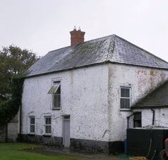
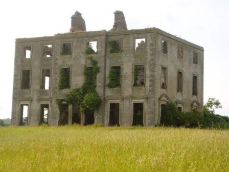
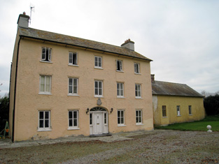
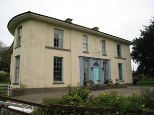
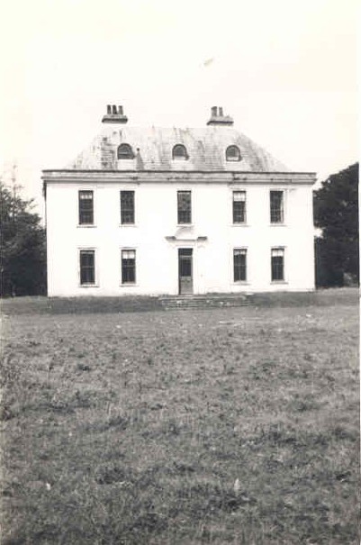
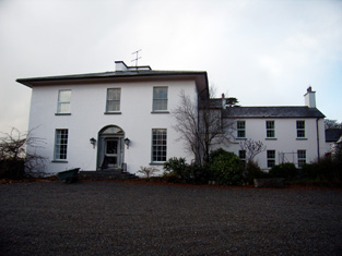
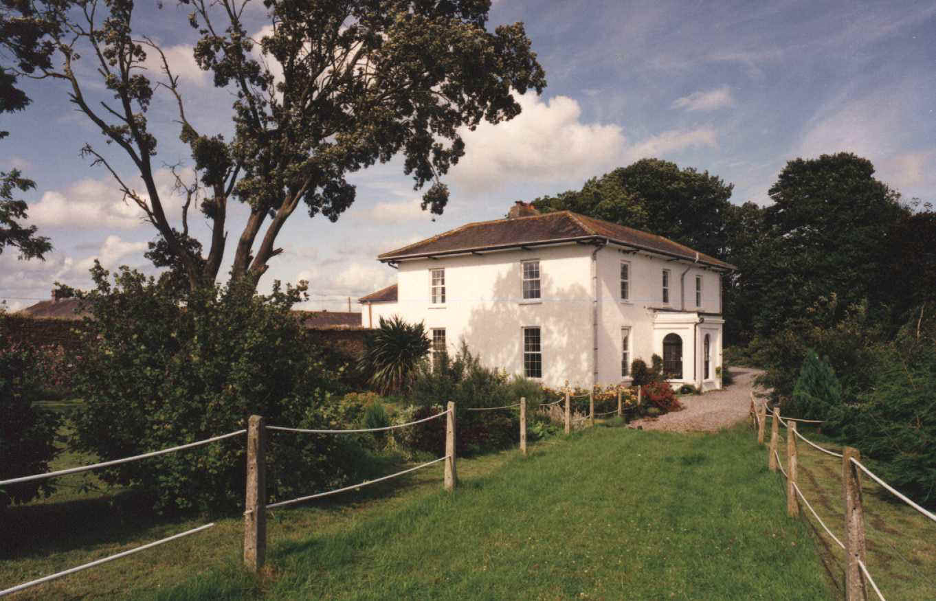
Ballincolloo
Houses within 15km of this house
Displaying 87 houses.
Houses within 15km of Ballincolloo
Displaying 87 houses.
| House name | Description | |
|---|---|---|
| Maryville | Built in 1790 and located on the Monsell estate the residence of Hugh F. Finch in 1837 and of Mrs Finch at the time of Griffith's Valuation when the buildings were valued at £28. In 1906 Captain G.W. Finch occupied the mansion house at Maryville valued at £35. Still in the ownership of the Finch family at the time of the Irish Tourist Association survey 1943. This property is now known as Maryville stud. |

|
| Fort Elizabeth | Occupied by John Cripps in 1814 and the residence of the Reverend John Croker in 1837. William Croker was the occupier at the time of Griffith's Valuation when it was held from the representatives of James O'Sullivan and valued at almost £16. A substantial farm remains at the site. | |
| Monaster House | This house was the home of Michael Furnell in 1803. By 1814 the house on the Vandeleur estate, was leased to John Cantillon Heffernan . At the time of Griffith's Valuation, the buildings at Monaster were valued at £35 and leased by John Cantillon from the Vandeleur estate. In 1943 the Irish Tourist Association surveyor refers to a story concerning ghostly activities and that the house had been "pulled down" a short time previously. Much of the farmyard building complex survives. |
|
| Cahercorney | Not named on the the 1st edition Ordnance Survey map, this house was the residence of Henry Croker at the time of Griffith's Valuation. It was valued at £10+ and was held from John Croker. Earlier, in 1786, Wilson refers to it as the seat of Mr. White. A farm is extant at this site now. | |
| Fedamore | A house known as Fedamore Cottage is marked on the first Ordnance Survey map. By the early 1850s John and Edward Synan were the occupiers of a house valued at £27 in Fedamore townland, which they held from Colonel Wyndham. The property is shown as Fedamore House on the 25-inch map of the 1890s, by which time it was the residence of J.G. Kelly. It is still extant and occupied. | |
| Drombeg | A house located on the estate of the Earl of Sandwich at the time of Griffith's Valuation and occupied by John Mulcahy, when it was valued at £11. [Grid reference is approximate]. | |
| Loughgur Castle | In 1786 Wilson refers to Lough-Gur as the seat of Henry Baylee. This house was ccupied by John "Boylie" in 1814 and by Miss Bailie in 1837. In the early 1850s William Evans was resident. He held the house valued at £11 from the Count De Salis. It was adjacent to the remains of a tower house known as Bouchier's Castle. The property at this site is labelled "Lough Gur Farm" on the 25-inch map of the 1890s. The book edited by Mary Carbery, "The Farm by Lough Gur", published in 1937, contains a description of the Baylee property at Loughgur. The original Bayley house is no longer extant. | |
| Grange Hill | Leet records Grange-Hill as the residence of Edward Croker in 1814. Edward John Croker was resident at the time of the first Ordnance Survey. It was a residence of the Count De Salis at the time Griffith's Valuation. The Count held it in fee and the buildings were valued at £27. The Count was still the occupier of Grange in 1906. Owned by Colonel and Mrs Galloway in 1942. The house is now known as Loughgur. |
|
| Camas | The seat of the Bevan family located on the estate of the Earl of Limerick. At the time of Griffith's Valuation, it was held by Frederick Bevan from the Earl of Limerick and valued at £29. The house is now demolished but the farm buildings remain. |
|
| Rathanny | A house situated on the estate of the Earl of Limerick, occupied by John Sheeran in 1814 and by T. Bennett in 1837. Thomas F. Bennett was still resident at the time of Griffith's Valuation when the buildings were valued at £15. |

|
| Baggotstown | The seat of the Bourchier family in the 18th and 19th centuries, valued at £32+ in 1906. The Irish Tourist Association surveyor writes in 1942 that this house was built in 1745 (keystone) and had lately been acquired by Mr T. Mitchell, a solicitor. This house has recently been renovated. |
|
| Kenmare Castle | Joseph Gubbins of Kenmare Castle is recorded in 1814. Lewis refers to the pretty cottage erected by J. Gubbins on the site of Kenmare Castle in his entry for the parish of Hospital, circa 1837. James Gubbins was residing in a house valued at £23 at the time of Griffith's Valuation. He held the property from the Earl of Kenmare. |

|
| Castlefarm | Castlefarm was the residence of Mr Patrick Sheeran in 1814. By 1837 Standish O'Grady was the occupier and he was still living there at the time of Griffith's Valuation when the house was valued at £16. He held the property from the Earl of Kenmare. |

|
| The Grange | The home of the Grady/O'Grady family in the 18th and 19th century. In 1786 Wilson describes it as "the beautiful and well-improved seat of Standish O'Grady". It was inherited by the Crokers in 1861. Occupied by Standish [O'] Grady in 1814 and Henry O'Grady in 1837 and at the time of Griffith's Valuation. The buildings were valued at £77 and the property was held in fee. In 1894 it was noted by Slater as the seat of Captain Edward Croker. This house was described as in very good repair even though it had not been occupied for a number of years preceding the Irish Tourist Association survey of 1942. The house is now a ruin. |
|
| Rawleystown Court | Lewis writes that "in the parish of Cahercorney are the remains of Raleighstown, an ancient building erected by the uncle of Sir Walter and afterwards the property of the Croker family, who built a splendid house here, now in ruins". The Ordnance Survey Name Book states that the house was built about 75 years previously by the Crokers and that it was afterwards sold to one of the workmen employed in building it who immediately destroyed it. In 1786 Wilson refers to "Rawlen's-town/Rawleigh's-town" as a seat of the Croker family. The first Ordnance Survey map marks the house as a ruin. | |
| Kilfrush | The home of Joseph Gubbins from at least 1837 and held in the early 1850s from the Court of Chancery. It was valued at £70 and was still the home of the Gubbins in the 1870s and in 1906 when it was valued at almost £66. According to the Irish Tourist Association survey it had been built in 1825 and was still the home of Mrs Gubbins in 1943. It is still extant. |
|
| Elton | In 1786 Wilson notes Elton as the seat of Mr.Grady. Leet records the Reverend Thomas Grady [of Cappercullen] as the occupier of Elton in 1814. Mrs Grady lived at Elton in 1837 and Mrs Mary Jane Grady was resident at the time of Griffith's Valuation. She held the property in fee. The buildings were valued at £34. Described in the rental of 1853 as having a "cheerful and commanding aspect". The tenant from year to year was John Simms. In the later part of the 19th century this house belonged to the Bevans of Camas. The original house is not extant. | |
| Kilballyowen | In 1786 Wilson refers to Kilballyowen as the seat of Mr. O'Grady. This was the main seat of the O'Grady family, described by Lewis as a "handsome modern building" circa 1837. At the time of Griffith's Valuation the buildings were valued at £41. By 1906 they were valued at £70 and the property was still in the possession of 'The O'Grady'. The Irish Tourist Association surveyor lists the types of artifacts, paintings etc to be found in this home of Madam O'Grady in 1942. The house was demolished post 1968. |
|
| Cahir Guillamore | The seat of the O'Grady family from the mid 18th century acquired through marriage with a member of the Hayes family. Held by the Viscount Guillamores in fee and valued at £50 in the early 1850s. Viscount Guillamore was recorded as the occupier in 1906 when the house was valued at £48. The Irish Tourist Association surveyor in 1942 refers to this house as been unused since 1922 when the estate was divided by the Land Commission. All the fittings has been removed and only the shell of the house remained. The house is now a ruin. |

|
| Bulgaden Hall | An early residence of the Lords Carbery in county Limerick. Described by Lewis in 1830s as in a "ruinous condition". The site of Bulgaden Hall is noted on both the 1st and 25-edition Ordnance Survey maps. | |
| Mountminnett | Mountminnett was the location of the Minnitt family at the end of the 17th century. This house was the home of a branch of the Gabbett family in the first half of the 19th century. It was occupied by William Gabbett in the early 1850s when the buildings were valued at £11 and the Gabbetts held the property from Sir Richard Bourke. William Gabbett of Mountminnett owned 397 acres in county Limerick in the 1870s. | |
| Caherline | [The seat of the Gabbett family in the 18th and early 19th centuries]. Lewis refers to its occupation by a farmer and Griffith's Valuation records Thomas Barry as resident in the early 1850s when the buildings were valued at £16. The original house is still extant though with some modifications. It is now the home of the O'Grady family. | |
| Ballyvorneen | This house is marked on the first edition Ordnance Survey map at the site of a castle. Described as a "dairyman's house" at the time of Griffith's Valuation and held by William and Thomas Gabbett, younger brothers of Joseph Gabbett of High Park, in fee. The buildings were valued at £15. The house no longer exists. |

|
| Caherelly Castle/Coole House | Lewis refers to Mrs Furnell’s residence as "a neat building in the cottage style" situated near Longford bridge. The substantial house marked at this location on the first Ordnance Survey map is named Caherelly Castle but on later maps is recorded as Coole House. The Ordnance Survey Field Name Book call it Cahir Elly Castle or Coole House. It was valued at £30 and occupied by Michael Furnell who held it in fee at the time of Griffith's Valuation. This house may have been known as Caherelly Grange in the last decades of the 19th century (see ''Burke's Irish Family Records''). The house is no longer extant but the outbuildings still remain. | |
| Caherelly Cottage/Caherelly Castle | A plaque records the building of this house in 1800 by William Hannan. Lewis refers to the residence of Mr Hannan in well planted grounds. The Ordnance Field Name Book refers to Cahir Elly Cottage as the residence of William Hannan. Marked as Caherelly Cottage on the first Ordnance Survey map, this house was located close to the ruins of an old castle and is now known as Caherelly Castle. Valued at £12 in the early 1850s and occupied by Michael Furnell who held it in fee. It later became the home of Michael Furnell's brother Frederick, an army surgeon. David O'Shaughnessy's interest in this house was advertised for sale in October 1853. |

|
| Lombardstown | The Ordnance Survey Field Name Book states that this house was rebuilt in 1823 by the occupier Thomas O'Brien. It was still occupied by Thomas O'Brien in the early 1850s. The buildings were valued at £11 and the property held from Lady Charlotte Wolfe. | |
| Williamstown Castle | Lewis refers to Williamstown Castle having been restored by the Messrs Pain, architects. In the early 1850s John Croker is recorded as the occupier, holding the property in fee. The buildings were valued at £33. It is now a ruin. | |
| Rockstown House | A building valued at £18 at the time of Griffith's Valuation, occupied by Chartres Brew Maloney and held from James Kelly. Chartres Brew Molony, second son of Patrick Molony of Cragg married his cousin Alice, daughter of James Barry of Rockstown, in 1841.Rockstown Castle was inherited by James Kelly's grandson, Basil James Kelly, in the 20th century and was left by him to his nephew Derrick Morley in 1945. It is still extant |

|
| Sandville | The home of the Barry family in the 18th and 19th centuries, the house became known as Sandville in the early 19th century. The Ordnance Survey Name Book dates the building 1799. John Barry occupied this house on the Kelly estate at the time of Griffith's Valuation when the buildings were valued at £26. John Grene Barry was resident in the 1870s and 1880s. Buildings are still extant at the site. | |
| Friarstown (Grange) | At the time of Griffith's Valuation this house was held from James Kelly by James H. Barry, the buildings were valued at £12. In 1906 Bazil R. Kelly held about 400 acres of untenanted land and buildings valued at £12 at Friarstown. This house is still extant. |

|
| Ballynamona | A small property known as Quarryfield Cottage occupied this site at the time of the First Ordnance Survey. The property here was the home of George Vandeleur in the 1870s. On the later 25-inch map of the 1890s a much larger property, labelled Ballynamona House, is shown. A house is still extant at the site. | |
| Ballybrood | A house in the village of Ballybrood, the residence of a branch of the Maunsell family in the 18th and early 19th centuries. Occupied by Samuel Maunsell at the time of Griffith's Valuation and held by him in fee. The buildings were valued at £11+. | |
| Rockview | A 2 storey house on the Croker estate, built in 1837 for £400, it was occupied by George Peacock circa 1840 and in the early 1850s when it was valued at almost £12. There is still an extant house at the site. |

|
| Garrane | A house located on the Wyse Minors estate in the mid 19th century, occupied by Margaret Hartigan and valued at £11+. This house is barely marked on the first Ordnance Survey map. | |
| Bruree Lodge | Bruree was the home of the Langton family in the 18th century. The house was occupied by Michael Ryan at the time of Griffith's Valuation and held from Michael Shaughnessy, it was valued at £13+. |
|
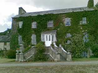
| Bruree House | Bruree House was also located on the Langton estate although at the time of the first Ordnance Survey the property was in the hands of Robert Fetherston who held a number of townlands in the parish, possibly from the Langtons. At the time of Griffith's Valuation the house was in use as an auxiliary workhouse. In 1853 Bruree House was sold to a member of the Shelton family and in 1868 it was sold to John Gubbins of the Kilfrush family. He was a successful racehorse owner and in 1884 built the present Bruree House. When he died in 1906 the property passed to his nephew John Norris Browning. The house was valued at £92 at this time. Owned by the Sheehans and Vernons in the 20th century. Now function as as a rehabilitation centre, known as Cuan Mhuire. A print entitled "The Lawn Meet" by Patrick Hennessy depicts this house. See www.museum.limerick.ie |

|
| Derk | The home of the Considine family in the 19th and 20th centuries and formerly of the Heffernan family. At the time of Griffith's Valuation the house was valued at £40 and held in fee. Bence Jones writes that this house was sold in 1971. |

|
| Castle Ievers | The Ievers were living at Castle Ievers, originally known as Tullerboy, from the mid 18th century. Bence Jones dates this house from the early 19th century. Robert Ivers was resident in 1814, 1837 and at the time of Griffith's Valuation when the buildings were valued at £32. The property was held from William Maunsell. The Irish Tourist Association surveyor wrote in 1943 that much of Tullerboy Castle was demolished in the 1860s to make way for the present building. The owner in the 1940s was Roderic Haines. |

|
| Coolboy | A herd's house and offices situated on the St Leger estate was occupied by Henry Ievers at the time of Griffith's Valuation when the buildings were valued at £14+. Coolboy was occupied by the representatives of Robert Cleary in 1906. A substantial farm is still extant at the site. | |
| Greenpark | In 1814 and 1837 this house was the residence of Richard Ievers, brother of Robert Ievers of Castle Ievers. At the time of Griffith's Valuation it was occupied by Mrs Sarah P. Fitzgibbon, the wife of Richard Ievers who had remarried. She held the property from Alcock Otley and it was valued at £36. This house is now a ruin. |

|
| Cooleen | At the time of Griffith's Valuation William Hart Mason held the townland of Cooleen amounting to 88 acres in fee. The buildings were valued at £12. |
|
| Cherrygrove | Cherrygrove was the home of Edward Cripps in 1814 and of J. Barry in 1837. At the time of Griffith's Valuation it was occupied by Edward John Sheehy who held the property from Robert Harding. The buildings were valued at £21+. The Misses Sheedy were still in residence in the 1940s. A building is still extant at the site. | |
| Belview/Bellevue | A home of the Yielding family, occupied by Richard M. Yielding in 1814 and 1837 and by Timothy Hartigan who held the property from James Barry at the time of Griffith's Valuation. The buildings were valued at £13 at that time. Bought by the Delmeges in the early 1850s. The original house is not extant. | |
| Clorane | A house occupied by Henry Hunt in 1814. Lewis describes Clorane as a "fine old house belonging to the Hunt family". By the time of Griffith's Valuation Edward Browning was leasing the house and 280 acres from Sir David Roche. In the 1870s in the possession of Patrick Hartigan. Old farm buildings are still located at the site but the house is a modern structure. |

|
| Glenbevan | Lewis records J. Bevan as the proprietor of Glen-Bevan in 1837 and Joseph Bevan occupied the house and 173 acres at the time of Griffith's Valuation. The property was located on the Evans estate. The residence of Mr John Hedderman in 1943, this house is still extant and occupied. |

|
| Clogher West | A house occupied by John Fitzgerald and held from George Whitelock at the time of Griffith's Valuation. The buildings were valued at £12. The original house does not appear to be extant. | |
| Maidstown Castle | Originally known as Ballyvenoge, Seoighe writes that John Ormsby first lived at Maidstown which he sold to the Webbs when he went to live at Athlacca. By the mid 18th century the Webbs had sold Maidstown to the Gubbins. The home of a branch of the Gubbins family in the late 18th century and early 19th century. The house was valued at £20 and held by Patrick Coll from John White in the mid 19th century. The Colls sold Maidstown to the O'Regans in 1972. A house is still extant at the site as well as the ruin of the original tower house. | |
| Maiden Hall | Maidenhall was the residence of Boucher Esq in the 1770s and in 1786. Home of the Holmes family in the first half of the 19th century. R. Low Holmes was occupying the house in 1837 and Mrs Susan Holmes in the early 1850s. She held the property from the Reverend Benjamin W. Bradshaw. The buildings were valued at £14. A house is still extant at the site. | |
| Creggane Castle | A property associated with the Hutchins family, occupied by John Quaid at the time of Griffith's Valuation and held from Samuel Hutchins. The buildings were valued at £17. The sale rental 1857 records that the original lease dated 1802 was from Edmund Earl of Cork and Orrery to Emanuel Hutchins. Farm buildings occupy the site. | |
| Abbeyville | A house located on the Finch estate and the home of the White family in the 19th century. Occupied by William White in 1814 and Richard White in 1837 and at the time of Griffith's Valuation when the buildings were valued at £26. Later the home of Henry Ievers, a younger brother of Robert Holmes Ievers, of Castle Ievers. The original house is not extant but a house still exists at the site. |
|
| Ballynanty | Ballynauty was the residence of Mrs Creed in 1837 and of Charles W. Smith in the early 1850s. He held the property from the Trustess of Charles Smith and the buildings were valued at £37 Still recorded by Slater as a Smith property in 1894. . The original house is not extant. | |
| Rockbarton | Also known as Mount Prospect, Fitzgerald describes Mount Prospect as the "magnificent seat and demesne of the present Chief Baron". Lewis describes Rockbarton as the "elegant mansion of Lord Guillamore". It was occupied by John Low at the time of Griffith's Valuation who held it from the Viscount. It was valued at £75. By 1906 the value of the house was reduced to £60 and it was then occupied by Lord Fermoy. The Irish Tourist Association surveyor records the sale of this house to Mr Barry in 1922. It remained in his possession until it was demolished in 1941 and the fittings sold to a Limerick builder. He writes that it was one of the "showplaces of Ireland" with a grand staircase of marble and that it had been renovated at a cost of £70,000 circa 1912 by the Honourable Nigel Baring who was married to a daughter of Lord Fermoy.The house is now a ruin. | |
| Uregare House | Owregare House was the residence of Mrs Gubbins in 1837 and of Mrs N. Barron who held the property from William G. Gubbins at the time of Griffith's Valuation. The buildings were valued at £22+. This house was also known as Newlawn. Fitzgerald writes that it belonged to the Creed family before the Gubbins. Occupied by Thomas A. Dicken in 1906. This house is no longer extant. | |
| Milltown | In the 18th century Miltown was the residence of a branch of the De Lacy family. Mill-town, Bruff, was the residence of Mrs Bevan in 1814. George Gubbins was the occupier in 1837 and at the time of Griffith's Valuation. He held the property valued at £40+ from Edward B. Hartopp. In 1831 George Gubbins married Elizabeth Blood nee Hartopp. This house is named Milltown George on the first Ordnance Survey map. |

|
| Summerville | Occupied by the Reverend Joseph Gabbett, fifth son of Daniel Gabbett of Strand House, Chancellor of Limerick and Prebendary of Effin and held by him from Alcock Otley. The buildings were valued at £23+. In 1786 Wilson refers to a house at Uregare as the seat of General Gabett. A house is still extant at the site. | |
| Mount Coote | The county Limerick seat of the Coote family in the 18th and 19th centuries. Wilson refers to it as "the pleasant seat of Mr. Coote" in 1786. It was occupied by Chidley Coote in 1814. Lewis refers to it as the former seat of Chidley Coote in 1837. Charles Coote was resident at the time of Griffith's Valuation and held the property in fee. The buildings were valued at £53. Their value had increased to £65 by 1906. The Irish Tourist Association surveyor wrote in 1943 that the house was bought by Sir Gilbert Greenall, who became 1st Lord Daresbury, who spent about £200,000 setting up a Model Farm. [Lord Daresbury also owned Clonshire]. Following his death three years previously it was sold and then run as a stud farm. Bence Jones writes that this house was demolished circa 1960 and a new house built in the Georgian style. |

|
| Riversfield | A house located on the Coote estate, occupied by Thomas Weldon in 1837 and at the time of Griffith's Valuation when the buildings were valued at £20. John H. Weldon of Riversfield owned 68 acres in county Limerick in the 1870s. Occupied by Mr and Mrs Watt in 1943. It is still extant. | |
| Castle Oliver | The original Castle Oliver or Clonodfoy was the home of the Oliver family in the 18th and early 19th centuries. It was replaced by the present building in the mid 19th century. In 1814 Castle Oliver was occupied by George Fosbery who may have been employed by the Olivers. In 1837 Lewis described the castle as being in a very dilapidated state. It then belonged to R. O. Gascoigne of the county of York whose bailiff resided in it. The new building was designed by George Fowler Jones and built in the Scottish baronial style for the Oliver Gascoignes. At the time of Griffith's Valuation the castle was valued at £75 and the house at £48 and both were in the possession of Elizabeth O. Gascoigne and her brother-in-law, Frederick Charles Trench. The house was eventually inherited by Elizabeth's step-grandson, William Cosby Trench. He was the occupier in 1906 when it was valued at £125. Restored in the early 21st century it now provides self catering accommodation and is a venue for functions such as weddings. |
|
| Martinstown | Martinstown was the residence of M. Walsh in 1837. At the time of Griffith's Valuation this was a house on the Trench/Gascoigne estate valued at £10+ and inhabited by William O'Grady. Bence Jones refers to a modern house built in circa 1972 at Martinstown, Kilmallock. | |
| Millmount | Occupied by the Reverend Joseph Gabbett and held from Daniel Gabbett at the time of Griffith's Valuation, when the buildings were valued at £16. It is labelled Millmount on the First Edition Ordnance Survey Map and as Ardvullen on the later 25-inch edition of the 1890s. A house is still extant at the site. | |
| Mount Russell | The home of James Russell in 1837 and at the time of Griffith's Valuation. The buildings were valued at £30 and James Russell held the property and 750 acres in fee. It is labelled as "in ruins" on the 25-inch Ordnance Survey map of the 1890s and nothing now remains. | |
| Ash Hill Towers | The residence of a branch of the Coote family in the 18th century, possibly held from the Barons Carbery. Ash Hill is referred to by Wilson as the seat of Chudleigh Coote in 1786. Bought by Eyre Evans from Chidley Coote in 1794 (see sale rental 6 July 1878). Eyre Evans held the property in fee throughout the first half of the 19th century. The Ordnance Survey Field Name Book describes this house as having "a most superb new front with towers at each end". At the time of Griffith's Valuation the buildings were valued at £50. Bence Jones writes that Ash Hill Towers became the residence of John Henry Weldon in the later 19th century. The Irish Tourist Association surveyor wrote in 1943 that the property was owned by Captain P.M. Lindsay, nephew of John H. Weldon, who bought the house from the Evans family in 1880. Still extant, this house is the centre of a stud. |
|
| Ahnagurra | Ahnagurra was the residence of Thomas T. Adams in 1837 and at the time of Griffith's Valuation, when the buildings were valued at £26. He held the property from Francis Coppinger. | |
| Ballynalacken | A house valued at £15 and occupied by George Gubbins who held it from Francis Coppinger at the time of Griffith's Valuation. It is no longer extant. | |
| Griston House | The residence of a branch of the Massy family, occupied by Frederick Massy in 1814. Described by Lewis in 1837 as the fine old family mansion of the Masseys. Fitzgerald writes that Charles Massy of Griston was a brother of Lord Massy and 1st Lord Clarina. At the time of Griffith's Valuation it was valued at £12 and occupied by Michael McMahon, who held it from Charles O'Brien Massy. | |
| Ryves Castle [Castle Jane] | Ryves Castle, previously known as Castle Jane, was the home of the family of this name in the 18th and early 19th centuries. It is referred to as Castle Jane by Wilson in 1786 when he notes it as the seat of Mr. Ryves. By the 1830s however William H. Ryves of Ryves Castle appears to have moved to live in Brighton, as the birth of many of his children is recorded in the Limerick newspapers as having taken place there. In 1826 Fitzgerald records Ryves Castle as the residence of John Lowe. Lewis referring to the parish of Knocklong, notes that Thaddeus R. Ryan was resident at Castle Jane and that there was a vault of the Lowe family located in the grounds of Ryves Castle, that family having previously been its proprietors. For the parish of Ballyscanlan he records Ryves Castle as the residence of P. [T?] Ryan. At the time of Griffith's Valuation the house was valued at £29 and occupied and held in fee by William H. Ryves. In 1906 it was valued at £31 and was occupied by Thomas J. Franks. Later owned by Mr D. Fleming, this house is now demolished. | |
| Scarteen | Thaddeus R. Ryan was resident at nearby Castle Jane [Ryves Castle] in 1837 as recorded by Lewis and Scarteen was unoccupied. John Ryan was the occupier of Scarteen in the early 1850s when the house was valued at £30+. He held the property from William H. Ryves. His widow Alice owned 50 acres in county Limerick in the 1870s. The Ryans still live at Scarteen where the famous pack of hounds of that name is kennelled. |

|
| Glenefy/Gleneefy | Built for George L. Bennett by Charles Frederick Anderson see http://www.dia.ie/works/view/256 The house is named on the first Ordnance Survey map as Gleneefy but on the later 25-inch map as Glenefy. In 1837 Castlecreagh was the residence of G. Bennett and at the time of Griffith's Valuation Castlecreagh, valued at £26 was held by George L. Bennett in fee. In 1906 occupied by William H.M. Bennett and still valued at £26. It is still extant. |
|
| Bosnetstown | The Bennett family were resident at Bosnetstown from the early 19th century. Charles Bennett of Bosnetstown was a coroner for county Limerick in the 1810s. Located on the estate of Lord Lisle this house was occupied by George W[heeler] Bennett in 1814 and 1837 and in the early 1850s by George Bennett. The property was valued at £14. In the 1870s George Wheeler Bennett of Kilfinane held 156 acres in the county. The Bennett also lived in other houses closeby at various times for example Kilfinane House. http://members.iinet.net.au/~nickred/trees/bennett.pdf | |
| Ballynahinch | A house valued at £11 occupied by Thomas Cleary at the time of Griffith's Valuation and held with 354 acres from the Trench/Gascoigne estate. Thomas Cleary of Ballinahinch owned 454 acres in county Limerick in the 1870s. A house is still extant at the site. | |
| Spa Hill | A home of the Oliver family, occupied by Charles Deane Oliver in 1814 and by William Oliver in 1837 and at the time of Griffith's Valuation. The buildings were valued at £23+ and William held them from the Trench/Gascoigne estate, with a corn mill. |

|
| Sunville | A residence of the Godsell family in the 18th century, it was still in the possession of James Godsill in 1814. Lewis writes that Sunville anciently belonged to the Godsall family but was "now" (1837) the residence of E. Sayers. Edward Sayers held it in fee at the time of Griffith's Valuation. Sunville/Sunvale was afterwards a residence of the Low family, being occupied in 1906 by Colonel John Low. Lithographs of this house and mill are included in the sale rental of 1853. The Irish Tourist Association surveyor wrote in 1943 that the house was owned by Mr John O'Donnell. He says that it was built in the early 18th century by the Cosby family from whom it passed to the Lowes. It is labelled Sunvale on the 25-inch Ordnance Survey map of the 1890s. The house is no longer extant. |
|
| Harding Grove | Occupied by G. Harding in 1814 and H. Harding in 1837. The seat of Mr Harding at the time of the first Ordnance Survey. By the time of Griffith's Valuation a Neill McDonald was in possession of Harding Grove. Neil Macdonald of Steyle Park, Bruree owned 354 acres in county Limerick in the 1870s. Francis H. Wyse is recorded as the occupant of Harding Grove in 1906. |

|
| Athlacca House | A residence of the Ormsby family in the 18th century. On the first Ordnance Survey map the house is marked "in ruins". Also known as Old Court. | |
| Ballygrennan Castle | Granted to the Evans family under the Acts of Settlement. In the early 19th century the residence of William Creed. Described as "in ruins" on the 1st edition Ordnance Survey map. Some portions of the building remains though much of the stone has been removed. | |
| Ballywire | The demesne of this house straddled the border between counties Limerick and Tipperary. In 1826 Fitzgerald refers to the house having been "lately fitted up and furnished in a very tasteful manner". Godfrey Massey was resident at Ballywire in 1814. By 1837 it had become the home of John Bolton Massy who held the property in the 1850s from the Provost and Fellows of Trinity College, Dublin. It was valued at £40. This house is still a residence. |

|
| Knocktoran | This late 19th century seat of the Webb family is now a stud farm. Anna Thomasina Webb occupied the house in 1906 when it was valued at £32. Owned by Major S.N.C. Webb in 1943. It is still extant. |
|
| Garryspillane House | A mansion house valued at £16.15 shillings was located in this townland in 1906. It was occupied by Stafford Delmege, second son of the Reverend John Delmege, whose representatives owned 525 acres in county Limerick in the 1870s. A house labelled Garryspillane House is shown on the 25-inch Ordnance Survey Map of the 1890s. There is still an extant house at the site. | |
| Belfort | Originally a Reeves home, occupied by them in 1837, it became the residence of the Clanchy family in the mid 19th century. John Clanchy was resident at the time of Griffith's Valuation when the house was valued at £21 and held with 37 acres from the representatives of John B. Reeves. The Irish Tourist Association Survey of the 1940s refers to it as the residence of Mrs. Clanchy, widow of J.T. Clanchy and noted that it was much associated with horseracing. Bence Jones records the demolition of this house in 1958. | |
| Ballyteige | Originally the home of a branch of the Tuthill family, no large house is marked on the first Ordnance Survey map in this townland. The house was leased to David Conyers of Castletown Conyers in 1885 and to Thomas W. Westropp Bennett in the 1890s. It is now available for hire, see http://www.ballyteigue.com/ |
|
| Ballynacree House | A house valued at £10 and held from Samuel Dixon by Michael Manning in the mid 19th century. Ballynacree is still extant. |

|
| Mooresfort | The home of the Crosbie Moore family in the 18th and early 19th century, Wilson refers to Moore's-fort as "the handsome seat of Edward Moore" in 1786. Lewis records Maurice Crosbie Moore as resident in 1837. At the time of Griffith's Valuation Edward C. Moore was still in possession of Mooresfort. However it was advertised for sale in 1852 and sold to Charles Moore of county Antrim, who altered and remodelled the house, reducing it from a 3 storey to a 2 storey house. The house remained in the possession of this family into the 20th century. It is now the main residence on a working farm. |

|
| Cloverfield | In 1786 Wilson mentions a house called Cloverfield three miles beyond Caherconlish as the seat of Mr. Lloyd. A house named Cloverville is marked on the first edition Ordnance Survey map. On later maps a much larger building is marked. At the time of Griffith's Valuation valued at £9.5 shillings was vacant in this townland. Richard Laffan, a dairy farmer, is recorded as the immediate lessor. The National Inventory of Architectural Heritage dates the original building from circa 1830 with later 19th century additions. The house continues to be used as a residence. |

|
| Knockainy Cottage | Possibly located on the estate of the Earl of Kenmare who owned land in this parish in the mid 19th century. On the first edition Ordnance Survey map this building is named Knockainy Cottage. Later maps show a much larger building now known as Knockainy Stud. |

|
| Mount Blakeney | Mount Blakeney is south west of the town of Kilmallock and very close to the border between counties Limerick and Cork. No large house is marked in the townland of Mount Blakeney on the first Ordnance Survey map (Sheet 47). In 1786 Wilson refers to Mount Blakeney as the seat of Mr. Blakeney. At the time of Griffith's Valuation the townland was in the possession of Mrs. Blakeney Fitzgerald. In 2022 Mount Blakeney was offered for sale. |

|
| Kildromin | In 1786 Wilson refers to "Kildrummond" as the seat of Mr. Lloyd. At the time of Griffith's Valuation, a house in Kildromin townland, valued at almost £4 was being leased by James Fitzgerald from the Apjohn estate. There is still a substantial farm at the site. | |
| Kilteely House | In 1786 Wilson refers to Kilteely as the seat of Mr. McNamara. By the time of Griffith's Valuation, much of this townland is the property of John Ryan jnr. This may be the property occupied by Rev. John Madden and valued at almost £8. Kilteely is shown but not labelled on the 1st edition Ordnance Survey map and is labelled Kilteely House on the 25-inch edition of the 1890s. According to the National Inventory of Architectural Heritage it serves as the local Parochial House. |
|