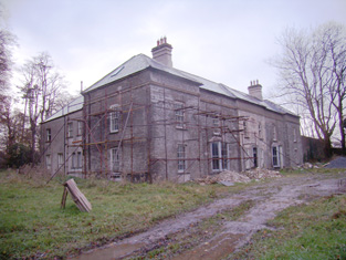
Ballincolloo
Houses within 5km of this house
Displaying 12 houses.
Houses within 5km of Ballincolloo
Displaying 12 houses.
| House name | Description | |
|---|---|---|
| Rathanny | A house situated on the estate of the Earl of Limerick, occupied by John Sheeran in 1814 and by T. Bennett in 1837. Thomas F. Bennett was still resident at the time of Griffith's Valuation when the buildings were valued at £15. |

|
| Baggotstown | The seat of the Bourchier family in the 18th and 19th centuries, valued at £32+ in 1906. The Irish Tourist Association surveyor writes in 1942 that this house was built in 1745 (keystone) and had lately been acquired by Mr T. Mitchell, a solicitor. This house has recently been renovated. |
|
| Elton | In 1786 Wilson notes Elton as the seat of Mr.Grady. Leet records the Reverend Thomas Grady [of Cappercullen] as the occupier of Elton in 1814. Mrs Grady lived at Elton in 1837 and Mrs Mary Jane Grady was resident at the time of Griffith's Valuation. She held the property in fee. The buildings were valued at £34. Described in the rental of 1853 as having a "cheerful and commanding aspect". The tenant from year to year was John Simms. In the later part of the 19th century this house belonged to the Bevans of Camas. The original house is not extant. | |
| Kilballyowen | In 1786 Wilson refers to Kilballyowen as the seat of Mr. O'Grady. This was the main seat of the O'Grady family, described by Lewis as a "handsome modern building" circa 1837. At the time of Griffith's Valuation the buildings were valued at £41. By 1906 they were valued at £70 and the property was still in the possession of 'The O'Grady'. The Irish Tourist Association surveyor lists the types of artifacts, paintings etc to be found in this home of Madam O'Grady in 1942. The house was demolished post 1968. |
|
| Bulgaden Hall | An early residence of the Lords Carbery in county Limerick. Described by Lewis in 1830s as in a "ruinous condition". The site of Bulgaden Hall is noted on both the 1st and 25-edition Ordnance Survey maps. | |
| Greenpark | In 1814 and 1837 this house was the residence of Richard Ievers, brother of Robert Ievers of Castle Ievers. At the time of Griffith's Valuation it was occupied by Mrs Sarah P. Fitzgibbon, the wife of Richard Ievers who had remarried. She held the property from Alcock Otley and it was valued at £36. This house is now a ruin. |

|
| Uregare House | Owregare House was the residence of Mrs Gubbins in 1837 and of Mrs N. Barron who held the property from William G. Gubbins at the time of Griffith's Valuation. The buildings were valued at £22+. This house was also known as Newlawn. Fitzgerald writes that it belonged to the Creed family before the Gubbins. Occupied by Thomas A. Dicken in 1906. This house is no longer extant. | |
| Milltown | In the 18th century Miltown was the residence of a branch of the De Lacy family. Mill-town, Bruff, was the residence of Mrs Bevan in 1814. George Gubbins was the occupier in 1837 and at the time of Griffith's Valuation. He held the property valued at £40+ from Edward B. Hartopp. In 1831 George Gubbins married Elizabeth Blood nee Hartopp. This house is named Milltown George on the first Ordnance Survey map. |

|
| Summerville | Occupied by the Reverend Joseph Gabbett, fifth son of Daniel Gabbett of Strand House, Chancellor of Limerick and Prebendary of Effin and held by him from Alcock Otley. The buildings were valued at £23+. In 1786 Wilson refers to a house at Uregare as the seat of General Gabett. A house is still extant at the site. | |
| Martinstown | Martinstown was the residence of M. Walsh in 1837. At the time of Griffith's Valuation this was a house on the Trench/Gascoigne estate valued at £10+ and inhabited by William O'Grady. Bence Jones refers to a modern house built in circa 1972 at Martinstown, Kilmallock. | |
| Ballygrennan Castle | Granted to the Evans family under the Acts of Settlement. In the early 19th century the residence of William Creed. Described as "in ruins" on the 1st edition Ordnance Survey map. Some portions of the building remains though much of the stone has been removed. | |
| Knockainy Cottage | Possibly located on the estate of the Earl of Kenmare who owned land in this parish in the mid 19th century. On the first edition Ordnance Survey map this building is named Knockainy Cottage. Later maps show a much larger building now known as Knockainy Stud. |

|