Browse Houses
Search Results: Returned 5927 records. Displaying results 1901 – 2000
| House name | Description | |
|---|---|---|
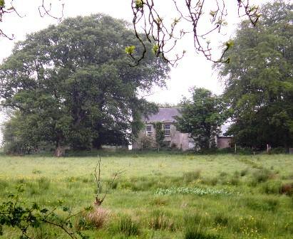
| Corraneary House | 18th century generations of the Adams family of Shercock lived at Corraneary, Knockbride, county Cavan, possibly in a building marked on the first edition six inch Ordnance Survey map (publ. 1837) slightly to the north east of the later house. Corraneary House was built circa 1850. It was the home of Colonel Fulke Southwell Greville, held by him in fee and valued at £23. The house was part of the Greville estate offered for sale in 1864, when it was described as an ‘excellent modern dwelling house with suitable and extensive out-offices, handsomely situated on the banks of Corraneary Lake. It was erected about fifteen or sixteen years since, at an expenditure exceeding £2,000’. Occupied by local magistrate and farmer, Lewis H. Grier and family, in 1901 and by John Blair Moffatt and family in 1911. | |
| Corranroo Lodge | Occupied by Burton Bindon in 1837 and by Samuel Bindon in the mid 19th century, who held the property from Colonel Henry White with 11 acres. Weir writes that it was the home of the Misses Lloyd in the early 20th century, one a painter and the other a sculptress. The house is no longer extant. | |
| Corrard | Located on the Parker estate the National Inventory of Architectural Heritage states that there have been three houses built on this site, the present house dates from the 1920s while the original was a small structure marked on the first edition six inch Ordnance Survey map (publ. 1837). John Carson occupied Corrard at the time of Griffith’s Valuation. The buildings were valued at £10. The Carson family were still resident at the beginning of the 20th century. | |
| Corrard | Located on the Parker estate the National Inventory of Architectural Heritage states that there have been three houses built on this site, the present house dates from the 1920s while the original was a small structure marked on the first edition six inch Ordnance Survey map (publ. 1837). John Carson occupied Corrard at the time of Griffith’s Valuation. The buildings were valued at £10. The Carson family were still resident at the beginning of the 20th century. |

|
| Corrastoona More House | In 1749 Richard Kirwan was living at Coristoonamore. This house appears to have been the residence of K. Lyster [Kirwan Lyster?] in 1814 and of F.T. Byrne in 1837. Occupied by Patrick O'Connor in the mid 1850s, who held the house from Christopher Hamilton. Valued at £2 in 1906 and in the occupation of Sir N. O'Conor. It is no longer extant. | |
| Corratanty | An early 19th century house named on the 1st edition 6 inch Ordnance Survey map (1836) and located on the Templetown estate. A model farm was located here by the mid-19th century when the house was occupied by Andrew Hunter and the buildings valued at £23. David K. Hunter, farmer, was the occupier in the early 20th century. This house is still the centre of a working farm. | |
| Corratanty | An early 19th century house named on the 1st edition 6 inch Ordnance Survey map (1836) and located on the Templetown estate. A model farm was located here by the mid-19th century when the house was occupied by Andrew Hunter and the buildings valued at £23. David K. Hunter, farmer, was the occupier in the early 20th century. This house is still the centre of a working farm |
|
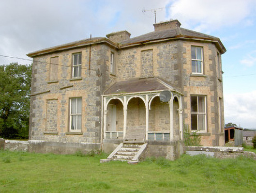
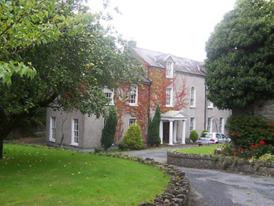
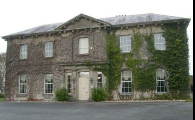
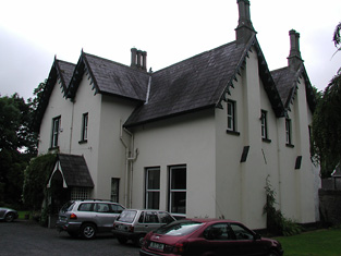
| Corravahan House | Built circa 1841 by Rev Marcus Gervais Beresford, later Archbishop of Armagh, close to the site of the former Drung Parsonage. The house served as the parish rectory until 1870 when it was sold to the Rev Charles Leslie, cousin of the Glaslough Leslies. In 1906, it was occupied by Captain C.R. Leslie and had a rateable valuation of£39. It remained a Leslie family home until 1972. Bought by the Elliott family in 2003 who have been renovating the house and gardens. |
|
| Correal | Built in 1888 by Percy Magan and valued at £35 in 1906. Burnt in 1921 when it was the home of the Walker family. A smaller house was rebuilt. | |
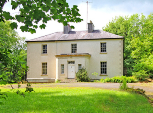
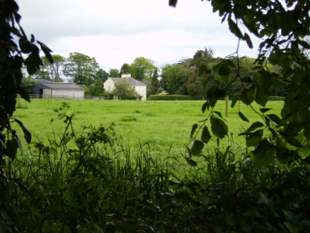
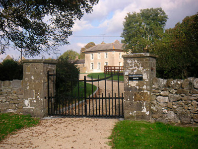
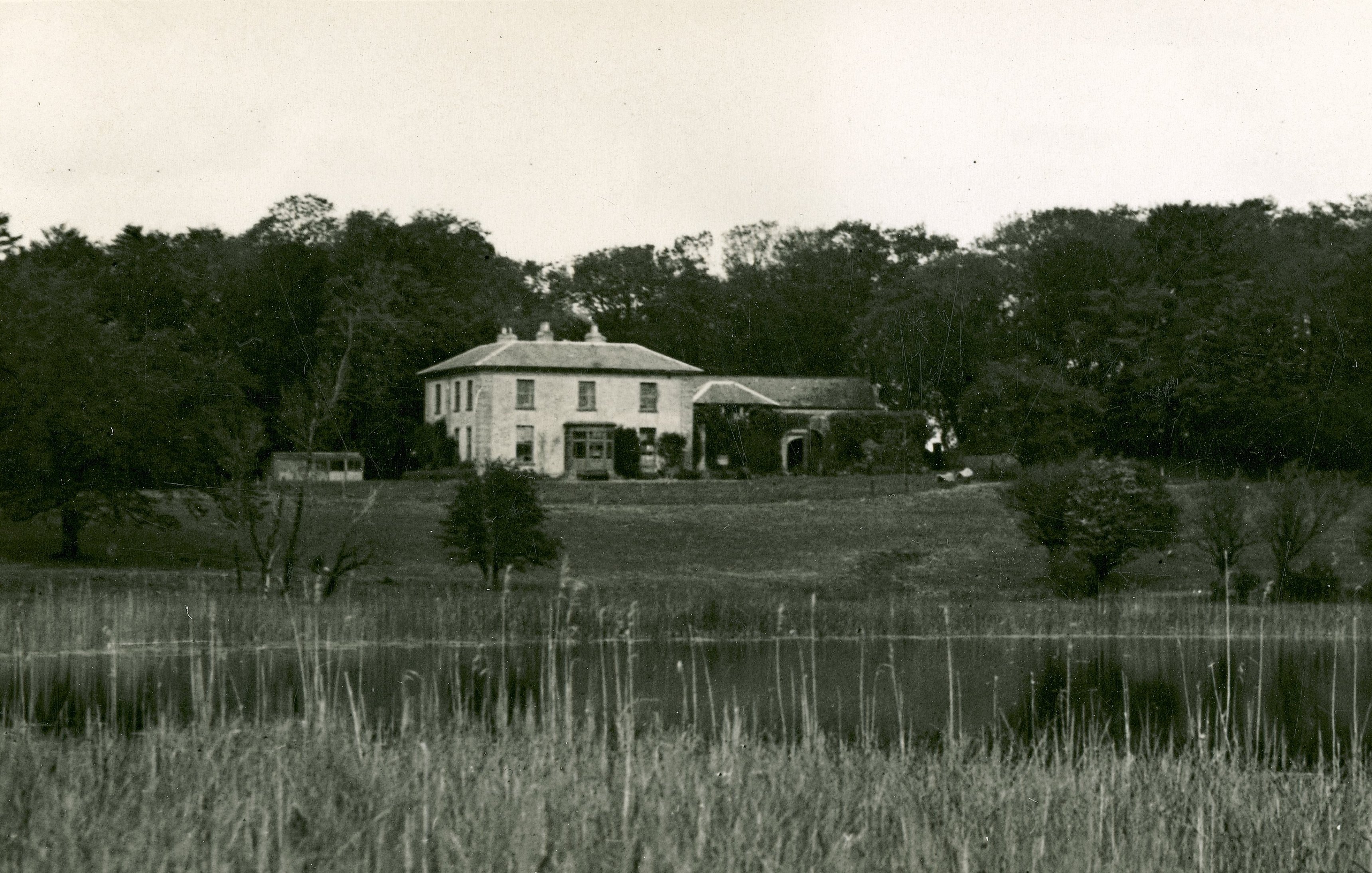
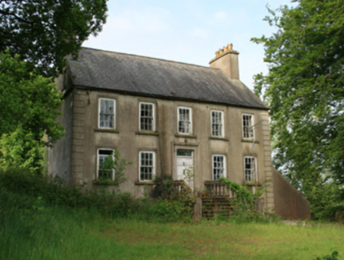
| Correen | At the time of Griffith's Valuation, William T. Potts was occupying the house at Correen, barony of Moycarn, valued at £22. The current house was built in the early 1830s but the Potts family were resident there prior to that as "Carrine" is recorded as their residence by Wilson in 1786. In 1837 the Ordnance Survey Field Name books describe Correen House as "a gentleman's place in very good repair on a demesne of over 300 acres". The building is still extant and occupied as a private residence. |
|
| Corrib View | The home of the Doig family in the Oughterard area, occupied by George Cottingham in 1855 who held it from John Doig. The house is now run as a B&B. http://www.galwaybandb.net/ |

|
| Corrinshigo House | Corrinshigo House was located to the west of the other two Pratt homes, Cabra Cottage and Castle. It is named on the first edition six inch Ordnance Survey map (publ. 1837). Lewis records it as the residence of J. Pratt and Griffith’s Valuation records Francis Pratt as the occupier holding the property from Frances E. Pratt. It had a rateable valuation of £15. Occupied by George Pratt and his mother in 1901. Now a green field site. | |
| Corrofin Lodge | At the time of Griffith's Valuation held by Pierce Blake in fee. The house was valued at £16. Some ruins remain at the site. |
|
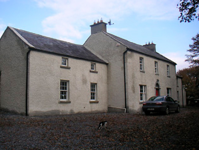
| Corry House | The 1906 record of Untenanted Demesnes records buildings valued at £18 at Corry, parish of Clongesh and barony of Longford. The owner was Colonel H.M.S. Douglas. This property was also part of the Douglas estate at the time of Griffiths Valuation in the early 1850s when it was valued at over £3 and occupied by James Berry. The National Built Heritage Service suggests Corry House was originally built in 1845 but significantly altered in the 1880s. It is still extant. |
|
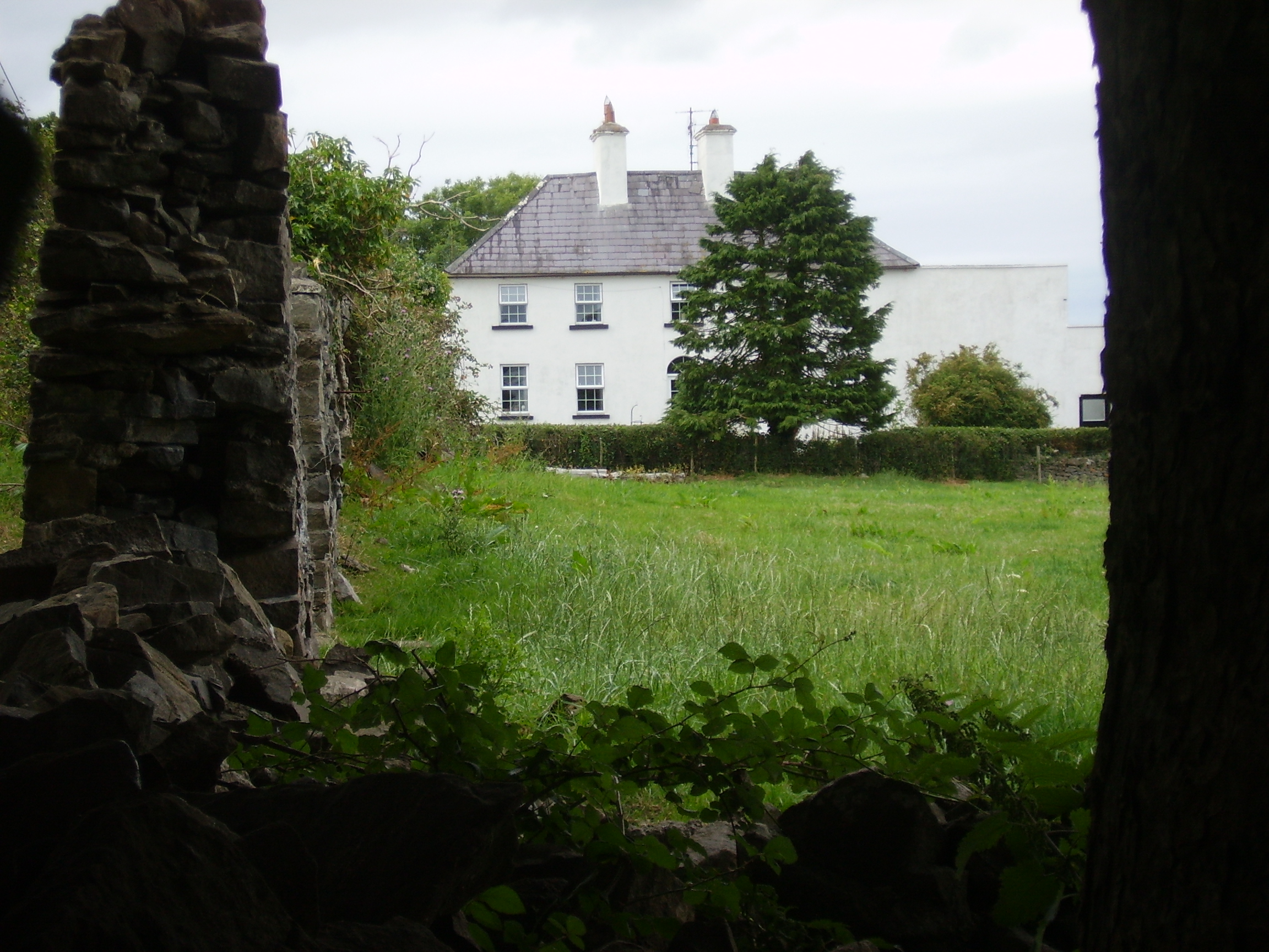
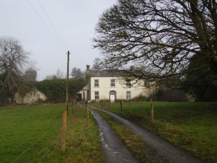
| Corry House (Ballymahon) | Joseph Allen was leasing this property from the White estate at the time of Griffiths Valuation, when it was valued at £10. The earlier Valuation Office records indicate it was occupied by John Murphy in 1840, with a valuation of £14. The National Built Heritage Service suggests the original house was built c.1845 and modified c.1880. The house is labelled Corry House on the 25-inch edition Ordnance Survey map of the early twentieth century. It is still extant | |
| Corry Lodge | At the time of Griffith's Valuation the house at Cavan, known as Corry Lodge, was owned by Francis N. Cullen and was valued at £12. In 1859 when the property was being sold it was claimed that the house had cost £1500 to build. It was the suject of a sale notice again in 1876 when the house was described as having 3 reception rooms and 5 good bedrooms. | |
| Corsallagh | At the time of Griffith's Valuation Charles O'Connor was leasing a property valued at £8 together with over 250 acres at Corsallagh, barony of Leyny from John N. Farrell. Lewis records it as the seat of Dominick O'Connor in 1837. This house is no longer extant. | |
| Corstruce House | A house located on the outskirts of Bellananagh and near a corn mill. It was situated on part of the Fleming estate and was occupied by William Pollock in the mid-19th century and was in the possession of Thomas Brady in the early 20th century. A modern house now occupies this site. | |
| Cortigan | A house on the Jephson estate, probably used as a dower house or agent's residence. At the time of Griffith's Valuation the buildings were valued at £10 and Sir C. D. Jephson Norreys is recorded as occupier. This house was not in use at the end of the 20th century. | |
| Cortolvin | This house was built between the first Ordnance Survey of the 1830s and the surveying for Griffith’s Valuation in the 1850s. It is marked on the 25 inch map (surveyed 1908) and named Cortolvin. In Griffith’s Valuation it was occupied by William A. Hunter and held from Lord Rossmore. It was valued at £16. This house is still extant. | |
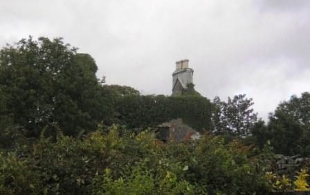
| Corville | The Lawder family may have lived in this townland in the early 18th century. Described by the National Inventory of Architectural Heritage as a late Georgian house, Corville is named on the first edition six inch Ordnance Survey map (publ. 1837), located in a small demesne. Like Brackley Lodge it was the home of members of the Finlay family. It was valued at £23.5.0. in the mid-19th century and was occupied by George Finlay who held the property from Sir Thomas Finlay. Francis Finlay, minor, of Corville is listed in the landowners of 1876. By the beginning of the 20th century Corville was the property of Robert Henry Johnston. Thomas Flynn and family were caretaking the house for him in 1901. This house is still well maintained and occupied. |
|
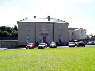
| Corville | Corville was the residence of the Hon Francis A. Prittie in the first half of the 19th century. He was a brother of the 2nd Lord Dunalley. He represented county Tipperary in Parliament and died in 1853. Lewis describes the house as "a handsome structure in the Grecian style". In 1840 the Ordnance Survey Name Books refer to the townland of Corville as "large and beautiful, the principal parts nicely laid out with plantings". At the time of Griffith's Valuation it was valued at £58 and held from the Messrs Birch. The sale rental of 1858 includes a lithograph of the house. The house belonged to O'Byrne family in the later part of the 19th century and is recorded as the seat of Count John O'Byrne in 1894. Now functions as a nursing home. |
|
| Cossaun or Cussane | In 1786 Wilson refers to Cussane as the seat of Mr. Parker. By the time of the 1st Ordnance Survey the house in Cossaun townland is described as "in ruins". The townland was in the possession of the Mahons of Belleville by the time of Griffith's Valuation in the 1850s. | |
| Costello Lodge | A 19th century lodge which was burnt in 1922 and rebuilt in 1925. It was occupied by the Honourable Richard Hely Hutchinson in 1855, leasing from George Cottingham and others when it was valued at £10. It is labelled Derrynea Lodge on the 1st edition Ordnance Survey map but as Costello Lodge on the later 25-inch edition of the 1890s. Later the residence of J. Bruce Ismay, a survivor of the sinking of the ''Titanic'' in the early 20th century and in the mid 20th century by the Herdman family. |

|
| Cottage | James Norcott is recorded as the proprietor of Cottage, Doneraile, in 1814 and J. Norcott MD was resident in 1837. Philip Allen occupied the house in the early 1850s. He held it from Arthur Norcott and the buildings were valued at £20. This house no longers exists. | |
| Cottage | Originally a Vize home, later occupied by the Pyne family, J. Pyne was in residence in 1814 and 1837 and the house appears to be unoccupied at the time of Griffith's Valuation, Reverend John Lawless Pine was the immediate lessor. It was valued at £17.15 shillings. | |
| Cottage (Caher) | The residence of George Fennell from 1814 until at least the mid 19th century, when it was valued at £22+ and held from Mrs Rachel Haughton. A building is still located at this site. | |
| Cottage (Dunkellin) | In 1837 Lewis recorded Cottage as the seat of J. Ryan. Catherine Ryan was leasing the house from Randall Athy at the time of Griffith's Valuation when it was valued at £17. The house at Cottage was part of the Athy estate which was sold in the Encumbered Estates court in July 1857. The new owners, John Edmond Crofton Kelly and Edmond Walker Kelly offered it for sale again in June 1866. At this time the house at Cottage was leased to the representatives of Thomas Redington for 21 years from 1856. By 1906 it was owned by Charles V. Pratt together with 150 acres of untenanted land. The ruins of the house and other buildings are visible at the site. |
|
| Cottage (Kilcloony) | Lewis records The Cottage in the parish of Kilcloony, barony of Clonmacnowen, as the seat of the Colohan family in 1837. This is possibly the same house recorded as in the ownership of Nicholas M. Coolahan in 1906. | |
| Cottage (Loughrea) | In 1786 Wilson refers to Cottage as the seat of Mr. Varo [?]. At the time of Griffith's Valuation, the property was leased by Bryan Rynn from the Clanricarde estate and valued at £4. The original house is no longer extant. | |
| Cottage Vale | At the time of Griffith's Valuation Charles Ensor was leasing a property valued at £10 at Drumdarkan, barony of Mohill, to George West. There is still an occupied house, part of a large farm, at this site. |
|
| Cottlestown | The Kirkwood estate was centred on Cottlestown House. The name seems to have sometimes been known as Castletown and this is how it appears on the First ed. OS sheet but documentary evidence would seem to suggest the estate was also known as Cottlestown. The Buildings of Ireland survey states that it is likely that the present house was added to an earlier, probably eighteenth century structure, which in turn replaced the fortified house on the site. On modern OS sheets the townland is known as Cottlestown. This property later became part of the Boyd estate. |

|
| Coumahon | Col. Palliser was leasing this property to Patrick Stack in 1851 when it was valued at almost £10. A house still exists at the site. | |
| Countenan House | Countenan House on the shore of Countenan Lough is named on the first edition six inch Ordnance Survey map (publ. 1837). It was occupied by Thomas Hartley in the 1850s and held from Robert Burrowes. The rateable valuation was £10.10.0. Home of the Hawe family at the beginning of the 20th century, this house is apparently still attached to a farming enterprise. | |
| Court Devenish | The present Court Devenish House was built at the end of the 18th century and has been extensively renovated and extended at various times. The remains of the important early 17th century Court Devenish House forms a garden feature. The original house was largely destroyed during the 1691 siege. The Devenishes descended from a Dublin merchant who leased land at Athlone from the Crown in the early 17th century. In 1751 their interest in these lands was sold to Gustavus Hamilton [of Viscount Boyne family]. At the time of Griffith’s Valuation (publ. 1854) a Mrs Dubordieu was resident holding the property from William Cooke of Talbot Hall, New Ross, Co Wexford. It was valued at £20.10. Since then the house has had many occupants and owners but is still extant. |
|
| Court Lodge | Described as a small lodge, the residence of Tobias Delmege at the time of the first Ordnance Survey. Occupied by Pierce Brown and held from Lord Southwell at the time of Griffith's Valuation when the buildings were valued at £10. This house is now the home of a dairy farmer. |
|
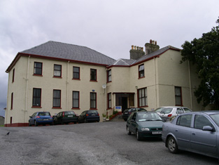
| Court Macsherry | An earlier house had existed in the grounds of the present building. The "Ladies Boyle" held Court Macsherry House in fee at the time of Griffith's Valuation, when it was valued at £30. The building seems to have become the Esplanade Hotel by the time the 25-inch map was published in the 1890s. The Irish Tourist Association survey of the 1940s refers to it as the "beautiful demesne and summerhouse of the Earl of Shannon, now reconstructed as the Esplanade Hotel". This building continues today as the Courtmacsherry Hotel (www.courtmacsherryhotel.ie). |

|
| Court/Kildimo Court | In 1837 Lewis wrote that Kildimo Court "which is nearly entire was the seat of the Hartstonge family". The Hartstonges appear to have inherited this property from the Widenhams. In 1786 Wilson refers to Court as the seat of Sir Harry Hartstronge and notes that "a bridge is now building at the ferry of Court but the house is in ruins". The property called Court Castle is labelled "in ruins" on the 1st edition Ordnance Survey map. A house labelled "Court" appears in the same townland on both the 1st and 25-edition maps. Buildings are still present at this location. | |
| Courthill | The house was built in 1768. In 1786 Wilson refers to "Ranadyff" which may be this property, as a seat of Mr. Gardiner. At the time of Griffith's Valuation the occupier was Lacklin Chisholm. Frank Boland had a racing stable at Courthill in the 1940s and trained a horse named 'Lough Conn', who came second in the Aintree Grand National of 1947. |
|
| Couse Mill | Richard Power was leasing this property from David O'Neill Power at the time of Griffith's Valuation, when it was valued at £22 and included a mill. The mill is labelled on the 1st-edition Ordnance Survey Map but does not appear on the later 25-inch edition of the 1890s. | |
| Coxtown (Gaultiere) | William Quinn was leasing this property from the Fortescue estate in 1848 when it was valued at £10. Farm buildings appear to occupy the site now. | |
| Coxtown (Gaultiere) | William Quinn was leasing this property from the Fortescue estate in 1848 when it was valued at £10. Farm buildings appear to occupy the site now. | |
| Coxtown (Gaultiere) | ||
| Coxtown (Gaultiere) | William Quinn was leasing this property from the Fortescue estate in 1848 when it was valued at £10. Farm buildings appear to occupy the site now. | |
| Coxtown Manor | Coxtown Manor was occupied by Alexander Hamilton at the time of Griffith’s Valuation in the 1850s. He was leasing from the Provost and Fellows of Trinity College. The house was valued at £35. In 1901 Coxtown was occupied by William Alexander Hamilton and his family. The house is still extant and occupied |
|
| Craddanstown House | A building is marked on the first edition OS map at this site which is greatly expanded and named on the 25 inch map as Craddanstown House. The originally house probably dates from the early 19th century and the building was extensively altered sometime in the mid-19th century. Valued at £10 and occupied by James Gibson at the time of Griffiths Valuation (publ. 1854), when it was held from the Earl of Longford. James Gibson and family were still resident at the beginning of the 20th century. |
|
| Craddanstown Lodge | Craddanstown Lodge is named on the first edition OS map as Craddanstown House, and on 25 inch as Craddanstown Lodge. It is a three-bay two-storey house, built about 1800, with two storey wings on each side. Craddenstown House was the home of Lockhart Ramage in 1814 and 1837 so must refer to the Lodge. Lockhart Ramage was resident at the time of Griffith’s Valuation (publ. 1854), when the house was valued at £17 and held from the Earl of Longford. The census of 1911 records Lockhart Ramage aged 82, gentleman farmer, as head of the household. O’Brien writes that the house was sold in 2013 and it was on the market again in 2017. This house was more substantial than the other Craddanstown until the other was altered about 1860. |
|
| Crag House or Rockville | Robert Leeson was occupying this property at the time of Griffith's Valuation when the lessor was William Miles. It was then valued at £18 15s. On the 1st edition Ordnance Survey map the house is labelled as Rockville. Bary quotes O'Donovan who claimed the owner in the 1830s was John Marshell Myles. The house is still extant and the well-known Crag Cave complex is located in the demesne. See www.cragcave.com | |
| Cragbeg | A house situated on the estate of Lord Clarina, occupied by Vokes in the 1770s and in 1786. It was leased to the Vandeleur family in the mid 19th century. Major Thomas Vandeleur was the occupier and the buildings were valued at £38. Occupied by Richard Parson in 1814, by G. Vandeleur in 1837 and by William Henry Harkness in the 1870s. Slater notes Lieut-Col. Lionel E. Massey as the owner in 1894. Still extant and occupied. |

|
| Cragbrien | An 18th century house of the Stacpooles which Wilson notes as "the beautiful seat of Mr. Stacpole" in 1786. It passed to the Stacpoole Mahons in the early 20th century and is still occupied. Matthew Kelly of Cragbrien owned 562 acres in county Clare in the 1870s. |
|
| Cragg | Home of a branch of the Molony family from the 1730s to the early 20th century. The house is still extant and lived in. It was valued at over £14 in the mid 19th century when it was held by Anne Molony in fee. | |
| Cragg | The home of a branch of the Going family, occupied by Robert Going in 1814 and in 1837. Robert died in 1838 and was succeeded by his son John. In 1840 the Ordnance Survey Name Books describe Cragg as "formerly the residence of John Going, it is now going to wreck". He still held Cragg at the time of Griffith's Valuation when the house was valued at £12+. John Going of Cregg House, Birdhill, owned 1,896 acres in the 1870s. A new house was built to the south west of the original house circa 1880 [R709 652]. John's son, Robert Edward Going, had succeeded to Traverston by the early 20th century. The second Cragg House is still extant. |
|
| Craggaunowen Castle | 16th century tower house, "in ruins" at the time of the first Ordnance Survey. The castle, herd's house and 96 acres were in the possession of the Reverend William Ashworth in the mid 19th century, who held them from a Caswell. A mansion house valued at £13 was in the possession of Count James Considine in 1906. The castle was bought by John Hunt in the mid 1960s and was the first home of the Hunt Museum. | |
| Cragleagh | A Mahon house at the end of the 18th century, occupied by Thomas Pilkington in 1814 and by William Kenny at the time of Griffith's Valuation. Kenny held the property from Charles James/Janns and it was valued at £20. | |
| Cragmoher | A house built in the mid 19th century by Major Charles Washington Studdert eldest son of Jonas Studdert. His son Jonas was born 1857. Burnt in the late 20th century. In 1906 buildings at Killeen were valued at over £17. |
|
| Craig's Castle | This five bay two storied house was built on the Leslie estate in the late 18th century. Occupied by John Carlisle and valued at £14 at the time of Griffith’s Valuation. This house is still extant and known as Hillcrest. |
|
| Craig's Hotel | John H. Craig was leasing a property valued at £65 at Back, parish of Kilcloony, barony of Clonmacnowen from the Clancarty estate at the time of Griffith's Valuation. He was running this property as a hotel. In Slater's Commerical Directory, 1846, Craig's hotel was located on the Main Street in Ballinasloe. The Royal Mail car called there on its way from Galway to Dublin. | |
| Cramer's Court or Ballindeenisk | Labelled as Ballindeenisk on the 1st edition Ordnance Map and as Cramer's Court on the 25-inch series published in the 1890s. It was being leased by Benjamin Jeffers from the Earl of Bandon's estate at the time of Griffith's Valuation, when it was valued at £11. It is now a Nursing Home. |

|
| Cranagh | Located beside a castle of the same name this house was occupied by John Lalor in 1814. Lewis records the property belonging to J. Lloyd but occupied by the Reverend M.N. Thompson. At the time of Griffith's Valuation Cranagh was in use as an Auxiliary Poor House and was valued at £25+. The Irish Tourist Association surveyor refers to a 4 storey house built at Crannagh in 1768 by the Lloyd family. The owner in the early 1940s was J. Cullen. This house is no longer in existence. | |
| Cranaghan House | Cranaghan House is marked on the first edition six inch Ordnance Survey map (publ. 1837). The 25 inch map of the early 20th century records it as a rectory. The Reverend J. Story of Cranaghan is named on the list of subscribers to Lewis’ ‘Topographical Dictionary’ in 1837. The Reverend Henry Erskine held the house valued at £25 in fee at the time of Griffith’s Valuation. The Reverend Charles Sinclair and the Reverend Mervyn Rogers were the occupants in 1901 and 1911. This building is now the core of the Slieve Russell Hotel. | |
| Cranagher | Originally a Bindon home this property passed to the Blood family through a marriage in the 1770s. In 1814 it was occupied by Mr James Kerin and in the mid 19th century by Giles Darcy who held it from William Blood. The house was valued at less than £2. There is a substanial house and demesne marked on the first Ordnance Survey map at Cranagher. Weir writes that a new house was started sometime in the 19th century a short distance from the original but was abandoned before completion. General Sir Bindon Blood sold Cranagher in 1905. Some farm building and modern houses exist at the site now. | |
| Cranmore | Built in 1838 by Alexander Clendining Lambert on land he held on lease from Colonel Charles Knox. It reverted to the Knoxes after the Famine and was used as a dower house by Colonel Charles Howe Cuff Knox for his mother, a daughter of the 2nd Marquess of Sligo. The house was bought by the Daly family in the 1920s and sold to the McCartans in the late 1940s. They took off the roof in the 1950s and the house is now a ruin. |
|
| Cranna | The original home of the Going family in county Tipperary, inhabited by the Reverend John Going, eldest son of Richard Going of Birdhill in 1814 and by his son Charles in 1837 and at the time of Griffith's Valuation, when the house was valued at £23+. Buildings are still located at this site. | |
| Crannagh House | There are references to a house owned by the Nugents at Crannagh in the eighteenth century but there is no substantial house shown on the First Edition Ordnance Survey map. Slater refers to "Crane" as the seat of Arthur Nugent in 1846. The townland is in Arthur Nugent's possession at the time of Griffith's Valuation but there is only a caretaker's house of nominal valuation. However, the 25-inch Ordnance Survey map of the 1890s shows a substantial building labelled Crannagh House. This property is no longer extant. | |
| Crannagh House | The main residence of the Walsh family in the 18th century. At the time of Griffith's Valuation occupied by Philip Hayes who held the house from William Potts. It is labelled Crannagh House on the 1st edition Ordnance Survey map but is not shown on the later 25-inch edition of the 1890s. | |
| Cratloe House | Another house belonging to the Stafford O'Brien family, held by Augustus Stafford in fee at the time of Griffith's Valuation and valued at £12. Lewis records this house in the parish of Killeely and Cratloe Woods in the parish of Kilfintinan. Leet records Don O'Brien as resident at Cratloe, county Limerick, in 1814. In 1786 Wilson refers to Cratlagh-Hall as a seat of Mr. O'Brien. Possibly either part of the same building complex as Cratloe Woods or the nearby premises labelled Cratloekeel Castle on both the 1st edition and 25-inch Ordnance Survey maps. | |
| Cratloe Woods | An 17th century house with a 19th century addition, the Irish home of the Stafford O'Briens and still in the family's possession. On the first edition Ordnance Survey map this house appears to straddle the border of the townlands of Cratloe and Portdrine. The house was held by Augustus Stafford at the time of Griffith's Valuation, valued at £24. In 1894 it was the seat of F.H.Stafford-O'Brien. It is still extant. |
|
| Crawford's Lodge | In 1840 the Ordnance Survey Name Books refer to Crawford's Lodge as the residence of W. Crawford. At the time of Griffith's Valuation, the townland was held in fee by William Crawford when the house was valued at £6+. It is not labelled on the later 25-inch map of the 1890s though a house still exists at the site. | |
| Creadan A | In 1848, John Denn was leasing this property from the Fortescue estate when it was valued at just over £15. Modern buildings exist close to the site now. | |
| Creadan B | Michael Spencer was leasing this property from the Earl of Fortescue's estate at the time of Griffith's Valuation when it was valued at £14. Modern buildings exist at this site now. | |
| Creadan House | At the time of Griffith's Valuation, Creadan House was occupied by Edward Blackmore, leasing from the Fortescue estate. It was then valued at £45. A house still exists at this site. | |
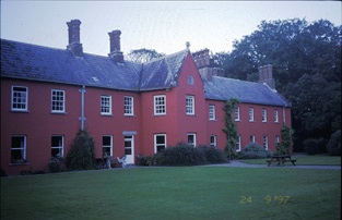
| Creagh | The original house was situated beside the River Robe and was described in September 1836 by Robert Graham as a "nicely laid out cottage residence". Earlier, in 1786, Wilson refers to it as the seat of Mr. Cuff. Mary Louisa Cuffe was leasing the property from Colonel Charles Knox at the time of Griffiths Valuation, when it was valued at £32. A new house was built by Colonel Charles Knox in 1875, which became a tuberculosis sanatorium and a centre for the Agricultural Institute in the 20th century. James Cuff (recorded as Duff), of Creagh, near Ballinrobe, is mentioned as the proprietor of townlands in the parish of Ballynacourty, barony of Dunkellin, county Galway, at the time of the first Ordnance Survey in the 1830s. |
|
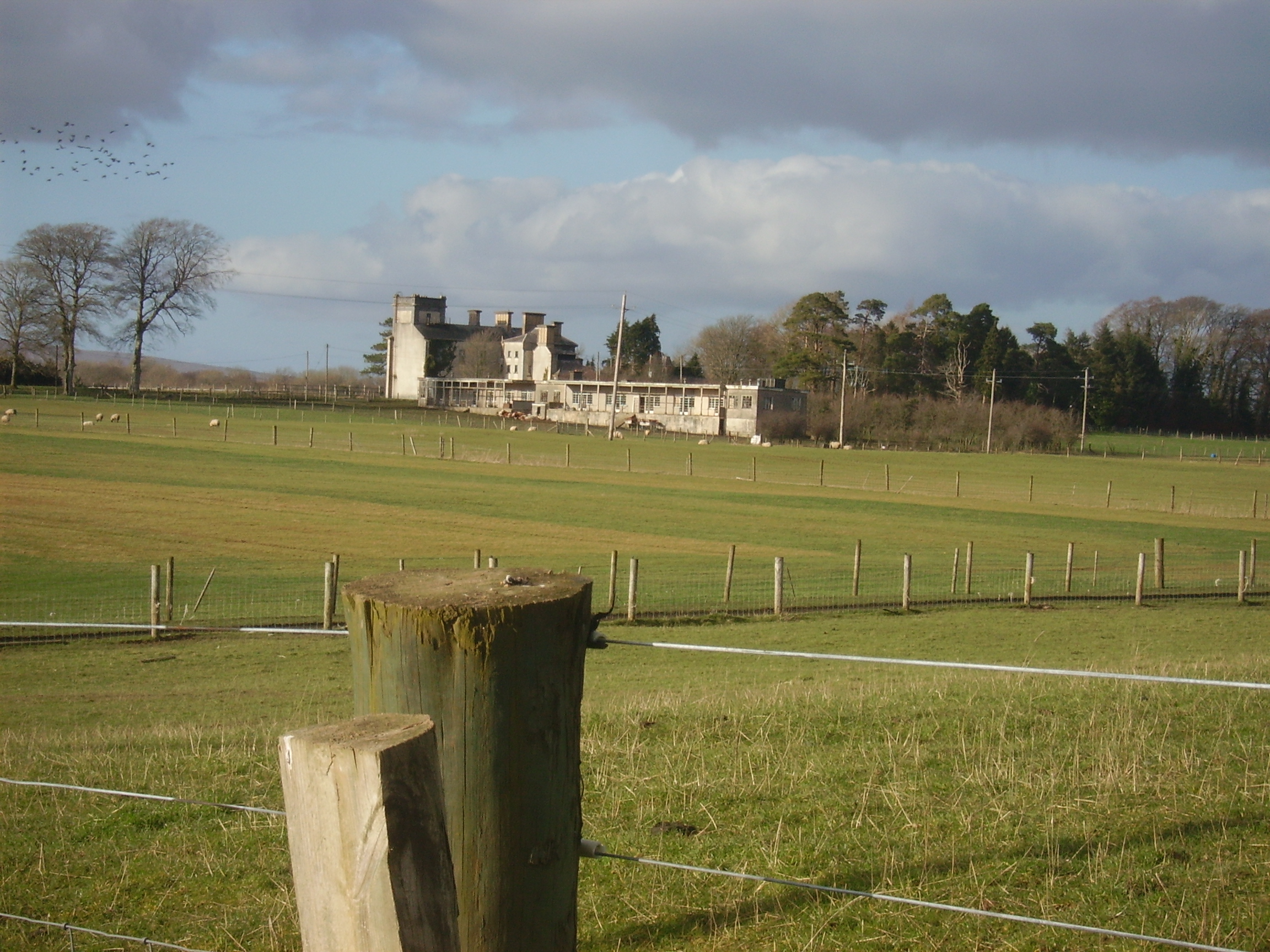
| Creagh Castle | Creagh Castle was acquired by Dr John Creagh in the late 18th century and passed to his daughter Mary and her husband, Kilner Brooke Brasier. Their second son, John Brasier-Creagh, inherited Creagh Castle and is credited with building the present house, the original one having been destroyed by a fire. George Washing Brasier Creagh held Castle Creagh in fee at the time of Griffith's Valuation. The buildings were valued at £50. The descendants of John's brother, George Washington Brasier Creagh, continued to live at Creagh Castle until the 1930s. In 1906 the building was valued at £44+ and occupied by Captain John Brazier Creagh. In the 1940s the Irish Tourist Association Survey noted that there was a castle formerly associated with the Coppinger family on this property. |

|
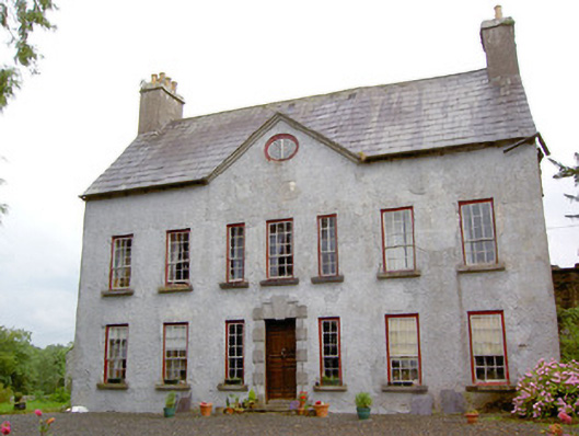
| Creagh House | Wilson, writing in 1786, refers to Cree as the seat of John Becher. At the time of Griffith's Valuation, Sir H. Becher was in possession of Creagh House, then valued at £25. In 1894 and 1906 it was owned by Sir John W. Becher and valued at £30 15s. It is still extant and the well-known gardens are sometimes open to the public. |

|
| Creagh Lodge | Francis Madden was leasing a property valued at £13 at Townparks, barony of Moycarn, from the Earl of Clancarty's estate in the 1850s. This may the property referred to on the 1st edition OS map as Creagh Lodge. | |
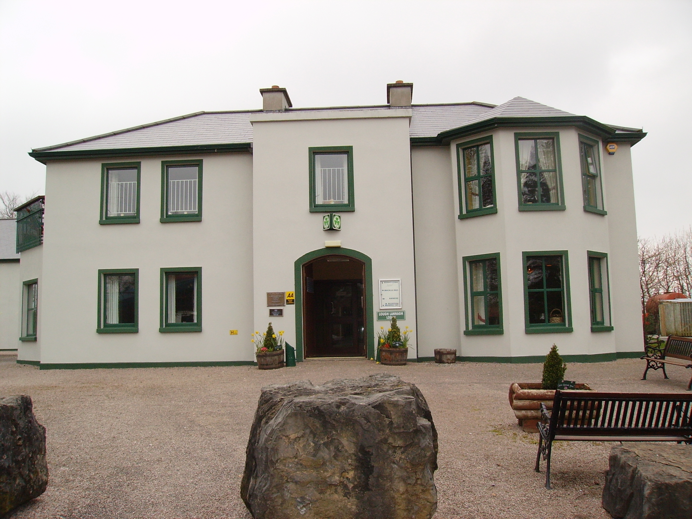
| Creagh's Villa | At the time of Griffith's Valuation, this property appears to be have been leased by Mary Boyd fron the Lucan estate when it was valued at £12. In the 1870s it was the residence of Bernard Peyton. It was destroyed by fire in 1996 and subsequently demolished to make way for the Lough Lannagh holiday complex which includes a building similar to the design of the original house. |
|
| Creaghduff House | A building is marked at the site of Creaghduff House on the first edition OS map but the present house appears to have been built after this date. Gearoid O’Brien refers to Charles Handcock building the house at the time of Griffith’s Valuation (https://www.westmeathindependent.ie/2023/02/03/street-wise-coosan/). Valued at £17 as recorded in Griffith’s Valuation the house was occupied by the Hon Charles Handcock and held from Lord Castlemaine. It is located at the south west corner of Coosan Lough. Donal O’Brien writes that from the end of the 19th century Creaghduff was the home of Robert Degennes Levinge, a grandson of Sir Richard Levinge 4th Bt, and his descendants, who still live there. | |
| Creegh House | A house on the Stewart estate, Weir writes that it was built for James Kelly on his marriage to Margaret Kenny of Freagh Castle and five generations of their descendants have lived there. | |
| Creeraun | At the time of Griffith's Valuation the townland was held by Margaret O'Kelly and the house and some land was occupied by Anthony O'Kelly. In the sale particulars of Creeraun in 1889 the house is marked on the map as 'in ruins'. |

|
| Creevaghmore (Ballymahon) | Edwin Moore Sandys was leasing Creevaghmore House to William Hogan at the time of Griffiths Valuation in the early 1850s, when it was valued at £20. In 1837 Lewis referred to “Creevagh” as the seat of R. Sandys. Leet refers to 'Creevagh' as the seat of John Fetherston in 1814. Creevaghmore is still extant. The National Built Heritage Service suggests it was built in the mid 18th century. |
|
| Creeve House/Creevelands | Built in the early 19th century by the Jackson family in the middle of their linen manufacturing enterprise in this townland. Marked on the first edition 6 inch Ordnance Survey map as Creeve House but later known as Creevelands. Lewis records the occupant as S. Cunningham. The rental of 70 acres at Creeve, the estate of Arthur Montgomery was for sale in the Encumbered Estates Court in 1858. The petitioners were Margaret Cunningham and her children. By the time of Griffith’s Valuation Robert Murdock was the occupier of the house, holding the property from Edward Lucas. This house remains a residence with its extensive and well maintained outbuildings. |

|
| Creevy House (Longford) | George Dobbyn was leasing this property from the Maude estate at the time of Griffiths Valuation in the early 1850s when it was valued at £20. It is still extant. |

|
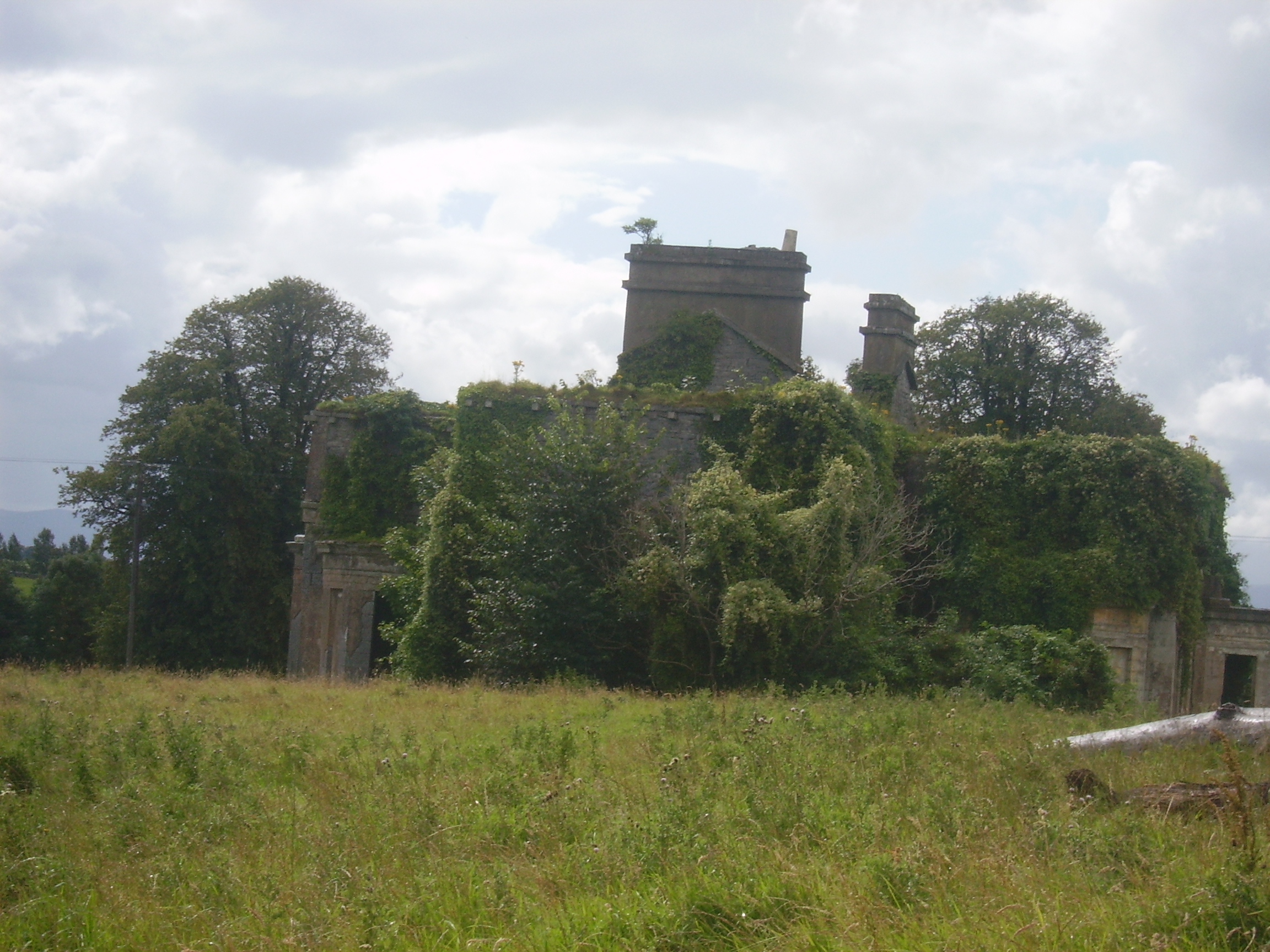
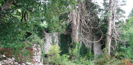
| Cregaclare | The Ordnance Survey Name Books mention that Cregaclare House was built in 1802. In the 1830s it is described as having elegant gardens and a Hot House producing various types of fruit. Cregaclare House is recorded by Lewis as the seat of J.S. Lambert in 1837. At the time of Griffith's Valuation it was leased by James Lambert to Lord Clanmorris and was valued at £50. Bought by Lord Clanmorris in the late 1850s, it was still his property in 1894 and 1906. Only the ruins of a basement and remains of stable yard and gateways are visible. Mausoleum located at M470118 in the ruins of old RC church. This was originally a burial place for the Bingham family (Lords Clanmorris) but those buried there were later re-interred in the grounds of the Church of Ireland, Ardrahan. |
|
| Cregg | The home of a branch of the Lalor family in the 19th century. Thomas E. Lalor is recorded for Creg in 1814 and Lewis writes in 1837 of his handsome residence erected "about ten years since". Cregg was occupied by his son Thomas in the early 1850s. Thomas held the property from the Marquess of Ormonde and the buildings were valued at almost £40. Passed to the Sadlier family of Castleblake, county Tipperary at the end of the 19th century. In 1906 it was valued at £41 and occupied by Annie Sadlier. This house is still a fine residence. |
|
| Cregg Castle | Built in the mid 17th century, the home of the Kirwans until the early 19th century. In 1786 Wilson mentions that it was the last castle to be built in county Galway and that it had lately been remodelled by Mr. Kirwan. Later occupied by a branch of the Blake family. It was held in fee by Francis Blake at the time of Griffith's Valuation, when it was valued at £40. Slater notes it as the residence of Mrs. Blake in 1894. Sold by the Blakes in 1947 to the Johnstons, who made alterations and restored it. Bought by the Murrays in the early 1970s, who ran it as a guest house. Sold again in 2006. |
|
| Cregg Castle | Built by the Hyde family and occupied by John Hyde, a younger son of Arthur Hyde of Castle Hyde, in the mid 18th century. Wilson refers to the residence of John Hyde, "near the ruins of Creg Castle" in 1786. By 1810 Cregg Castle was occupied by Colonel William Stewart from Fort Stewart, county Donegal who had married Anne Hyde. The Colonel was the proprietor in 1837 and Mrs Anne Stewart was still resident in the early 1850s. Her nephew John came to live at the house following the sale of Castle Hyde in 1851 and following his death in 1885 it was leased to various persons. It is still extant. |
|
| Cregg House | Michael Jones, formerly of Lisgoole, county Fermanagh, is described as of Cregg House in 1854. His representatives still held the property in the 1870s. At the time of Griffith's Valuation, it was occupied by Capt. Alex Lumsden, son-in-law of Michael Jones, leasing from John Wynne, when it was valued at £25. Cregg House afterwards came into the possession of the Sisters of La Sagesse and is now a Special Needs facility. |
|
| Cregg House | The house at Cregg seems to have been built by Francis Butler in the 18th century. Wilson refers to it as the seat of Mr. Butler in 1786. In 1814 it was the residence of Walter Butler and Lewis also records it as a Butler house. At the time of Griffith's Valuation it was occupied by Robert J. Lattey and was valued at £25. This also included the premises known as Cregg Cottage which was located in the demesne. In 1906 it was owned by Robert Thomas Lattey and was valued at £33. The original house is no longer extant. |
|
| Cregg South [Avonmore] | The Phipps "of Cregg" are recorded in "Burke's Irish Family Records" from the early 18th century. By the time of Griffith's Valuation the house in Cregg South valued at £22 was occupied by John Carey who held it from John Phipps. On the 25-inch Ordnance Survey map of the 1890s the house at this site is labelled Avonmore. A house is still extant there. | |
| Creggagh | The house valued at £6 was held by John Fair at the time of Griffith's Valuation but was unoccupied. In 1894 Slater noted it as the seat of Major D.R. Fair. It was occupied in the early decades of the twentieth century but is now a ruin surrounded by forestry. |
|
| Creggan | ||
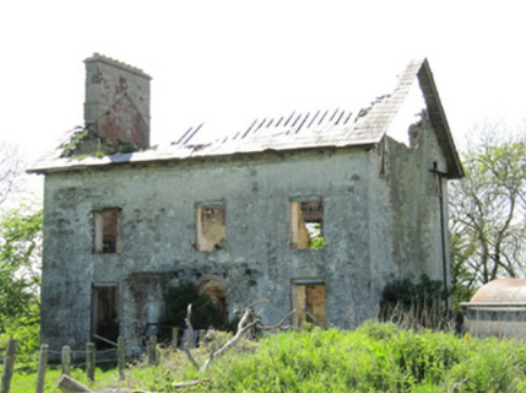
| Creggan House | Creggan House, located just south east of Athlone town and south of Creggan Castle. This house is named on the first edition OS map. It was a two-storey, three-bay house built by the Longworth family in the early 19th century. Peter Longworth was a Cromwellian soldier who settled at Creggan Castle in the mid-17th century. The Longworth family continued to inhabit Creggan House for much of the 19th century, Francis Longworth being recorded as the occupant in 1837. Henry Norwood Trye was resident at the time of Griffith’s Valuation (publ. 1854), holding the house valued at £24 from his brother-in-law Francis Longworth. It was occupied by land agent Peter Metge and his family in 1901 and by widower Thomas Davies Longworth and his daughters in 1911. The house was burnt down in 1921 when occupied by a Major Montgomery and subsequently demolished. | |
| Creggane Castle | A property associated with the Hutchins family, occupied by John Quaid at the time of Griffith's Valuation and held from Samuel Hutchins. The buildings were valued at £17. The sale rental 1857 records that the original lease dated 1802 was from Edmund Earl of Cork and Orrery to Emanuel Hutchins. Farm buildings occupy the site. | |
| Creggane House | Creggane House was in the possession of John [Lichfield] at the time of Griffith's Valuation when it was valued at almost £9. It was leased to Robert Starkey at the time. A more substantial house is shown on the later 25-inch map of the 1890s. In 1885 Walford described Francis Evans Bennett as of "Creggane". A house is still extant at the site. | |
| Creggannacourty | Cregane House in Creggannacourty was occupied by the representatives of Sarah Barry and held from Sir Edward Tierney at the time of Griffith's Valuation, when the house was valued at £35. Hajba associates the names Crofts, Hennessy and Hutchins with the house, which in 2002 was the home of the Lynch family. |

|
| Creggaun House | Bar Kelly was living at Cregan in 1749. At the time of the first Ordnance Survey it is mentioned as the home of Captain Masters. William Masters was leasing a house valued at £16 in Creggaun townland, parish of Ahascragh, from the Clonbrock estate at the time of Griffith's Valuation. This property is no longer extant. | |
| Creggolympry | Henry Adams occupied a house at Creg, Fermoy in 1814 and the Reverend Samuel Adams in 1837. This house valued at £32 was held by the Reverend Samuel Adams in fee at the time of Griffith's Valuation. Guy's ''Cork Alamanac'' (1907) records Miss Adams as resident at Creggolympry. Buildings still remain at the site. | |
| Cremorne House/Cremorne Green | The National Inventory of Architectural Heritage links the building of this house to Alexander Jackson, a member of a family with strong milling interests in the locality. The Ordnance Survey Field Name Book states that it was a neat house of two stories and basement, formerly known as Cremorne Lodge, from having been built on the property of Lord Cremorne. The surveyor continues - it was called ‘Cremorne Green when it became the property of Mr Jackson who was an extensive bleach and linen merchant’. Lewis records J. Jackson as the proprietor. Valued at £12 and occupied by John Jackson at the time of Griffith’s Valuation in the mid-19th century. This house is now a ruin. |
|
| Creta | Occupied by George Harken in 1814 and Daniel Hughes in the mid 1850s and valued at £8. Creta Cottage was occupied by Captain Dillon in 1837. A house is still extant at the site. | |
| Crislaghmore | The buildings at Crislaghmore were leased from the Donegall estate by Samuel and Joseph Cochrane at the time of Griffiths Valuation in the 1850s when the valuations were £19 and £13 respectively. |