Browse Houses
Search Results: Returned 5927 records. Displaying results 1801 – 1900
| House name | Description | |
|---|---|---|
| Coole | A house with a gatelodge marked on the first Ordnance Survey map and located just north of Knocklofty. Occupied by Thomas Morrissey in the mid 19th century, held from the Earl of Donoughmore and valued at £16+. A building is still extant at this location. | |
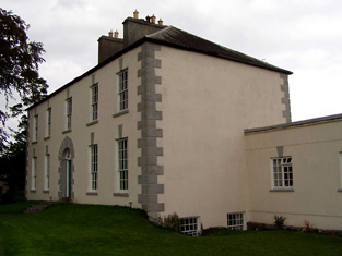
| Coole Abbey | This house was the home of a branch of the Peard family until the early 20th century and is still inhabited. It was occupied by Richard Peard in 1814 and by Henry Hawk Peard in 1837. He was still resident in the early 1850s and held the house valued at £36 from James H. Smith Barry. By the end of the 19th century Orr McCausland was the owner of Coole Abbey. |
|
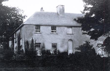
| Cooleen | At the time of Griffith's Valuation William Hart Mason held the townland of Cooleen amounting to 88 acres in fee. The buildings were valued at £12. |
|
| Cooleeney/Coolinny/Cooleeny | At the time of Griffith's Valuation this property was occupied by James Daly and was valued at £15. When offered for sale in February 1863 the house was occupied by Eleanor M. Lynch. In 1906 it was in the possession of John J. Smyth of Masonbrook and was valued at £20. Cooleeney is still extant and occupied. | |
| Cooleeny Lodge | A house has been located at this site since the first edition Ordnance Survey map of circa 1840. Robert Hunt occupied the house, valued at £11.18 shillings in the early 1850s and held from Henry Langley. A house is still extant at this location. | |
| Coolemore | This was the residence of Herbert O'Donnell in 1837 and in the early 1850s. Located on the Wallis estate it was valued at £20. Hajba writes that O'Donnell was agent to the Wallis estate and that it was later the home of the Perry family. A house is still extant at this site. | |
| Coolfadda House | Alexander Swanston was leasing Coolfadda House from the Devonshire estate in 1851 when it had a valuation of £30. Lewis refers to it as the seat of B.Popham in 1837. A house still exists at the site. |
|
| Coolgarriv House | James Donovan, MD, was leasing Coolgarriv House from The McGillycuddy’s estate at the time of Griffith’s Valuation, when it was valued at £12 10s. Bary, quoting the Ordnance Survey Name Books, states that Coolgarriv House was built by the Eager family in the 1830s at a cost of £900. It is still extant and occupied. | |
| Cooliney House | Hajba writes that Cooliney was originally part of the Bowerman estate and that the house was rebuilt in the mid 18th century. It passed through marriage to the Nevilles of Furnass, county Kildare. Occupied by Mr Thomas Weldon in 1814 and by R. Weldon in 1837. At the time of Griffith's Valuation Robert Weldon held the house and 85 acres from James Hill. The house was valued at £20. In the 1940s the Irish Tourist Association survey noted that it was then the home of the Goold family. The house was restored in the 21st century. |
|
| Coolkellure House (Hill Farm) | Held in fee by Major General Shuldham in 1851 when it was valued at almost £17. It is labelled Hill Farm on the 1st edition Ordnance Survey map but as Coolkellure House on the 25-inch edition of the 1890s. It is still extant and part of a large farm.The National Inventory of Architectural Heritage describes it as a late Victorian House designed by Henry Hill. In 1943 the Irish Tourist Association Survey noted that the original house had burned down in 1920 and that this house replaced it. |
|
| Coolkirky | The representatives of Gresham Herrick held this property in fee at the time of Griffith's Valuation, when it was valued at £25. The house burned down in the late 1990s. | |
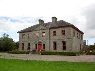
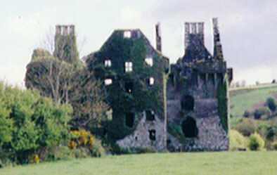
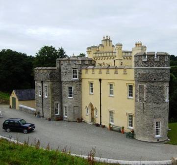
| Coolmain Castle | Thomas Wyse was leasing this property to Hibernicus Scott at the time of Griffith's Valuation, when it was valued at £18. In 1837, Lewis records it as the seat of E. Stowell. In 1814, however, it was the seat of Hib. Scott. The Honourable Henry Boyle Bernard, third son of the 2nd Earl of Bandon, lived here in the 1870s when he owned over a thousand acres in county Cork. Both Walford (1885) and Slater (1894) record him as the owner. In 1942 the Irish Tourist Association Survey noted that the building was becoming derelict. It had recently been the home of the novelist Donn Byrne, who had been involved in a fatal motor accident. Coolmain castle is still extant and now the property of the Disney family. |

|
| Coolmain House | The National Inventory of Architectural Heritage dates this house to circa 1790. It belonged to a family called Graham in the 18th century according to a story recorded in the Schools Collection under Coolmain House. It was named on the 1st edition 6 inch Ordnance Survey Map (1836). In the 19th century this property belonged to the Brooke family of Dromavana, county Cavan. Burke’s Landed Gentry of Ireland 1904 records William Brooke of Dromavana, Dublin and Coolmaine House. He was born in 1769 and married Angel daughter of Captain Edward Perry and niece and heiress of Colonel Richard Graham. John Goudy of Coolmain House is listed in Lewis’ ‘Topographical Dictionary’ published 1837 for the parish of Tehallan but his name is spelt Gondy in the list of subscribers. John Goudy is recorded in Griffith’s Valuation as resident holding the property from the Reverend Edward P. Brooke and others. James Gondy Lewers of Coolmain House died in November 1885 (The Northern Standard, 7 November 1885). This house was occupied by James H. Pollock in 1911 and is still a residence. | |
| Coolmeen | Referred to as a herd' s house at the time of Griffith's Valuation when it was occupied by William Harrison who held it from Patrick Curtis. The house now extant at the site is not the original one. |
|
| Coolmona Glebe House | Townsend Family Records indicate that Rev. Horatio Townsend built the glebe house at Coolmona in 1752. The house did not remain in the Townsend family after his death. On the 25-inch Ordnance Survey map of the 1890s it is labelled "parochial house". |

|
| Coolmore | The seat of the Sankey family in the 18th and 19th centuries, Coolmore was recorded by Wilson as the seat of Mr. Sankey in 1786. It was occupied by John Butler in 1814, by Matthew Villiers Sankey in 1837 and by Jacob Sankey in 1850. He held the property in fee and the buildings were valued at £37.15 shillings. In the second half of the 20th century Coolmore became a world famous stud for the breeding of race horses. The stud was set up in the late 1960s by Tim Vigors and continued by Vincent O'Brien, Robert Sangster and John Magnier. |
|
| Coolmore | Held in fee by Reverend Edward H. Newenham at the time of Griffith's Valuation, when it was valued at £100. He was leasing a smaller house, valued at £8, to John Donegan in the same townland. Noted by Leet as the residence of W.W. Newenham in 1814. Valued at £64 in 1906 when it was the residence of Major William W. Newenham. The Irish Tourist Association Survey also noted it as belonging to the Newenhams in 1943. It is still extant but in poor repair. |
|
| Coolmountain House | Leased to Denis O'Leary by Richard O'Donovan at the time of Griffith's Valuation, when the house was valued at £10 10s. Local traditon indicates that Mr.O'Leary ran a soup kitchen here during the Famine years. This house is no longer extant. | |
| Coolnacarte | Marked on the 1st edition 6 inch Ordnance Survey map (1836), this building is named Coolnacarte Lodge on the 25 inch map (surveyed 1908). The Ordnance Survey Field Name Book states that Coolnacarte was ‘the property of W. Glascock Esq whose embarrassment has thrown it into the courts of Dublin; who appointed Mr Samuel Martin agent’. In the mid-19th century it was valued at £13, occupied by the Reverend Thomas Gartlan and held from Richard Henry. In 1906, William Henry M.D. was resident, when the buildings were valued at £10. The house is extant. | |
| Coolnaconarty House | Held in fee by Herbert Gillman at the time of Griffith's Valuation, when it was valued at £6. Not labelled on the 1st edition Ordnance Survey map but named Coolnaconarty House on the 25-inch map of the 1890s. It is no longer extant. | |
| Coolnagour House | In 1851 the occupier, Arthur McGuire Giles, was leasing this property from Catherine Giles, when it was valued at £13 5s. Lewis refers to it as the seat of W. Giles in 1837. The house is still extant and occupied. | |
| Coolnahane | A house situated on Viscount Lismore's estate and occupied by Jeremiah Leane at the time of Griffith's Valuation when it was valued at £10. It is named Coonahane House on both the 1st and 25-inch edition Ordnance Survey maps. A house is still extant at the site. | |
| Coolnaleen Cottage | Lady Burghersh was leasing this property to Gerard O'Callaghan at the time of Griffith's Valuation, when it was valued at £10. | |
| Coolnamuck Court | At the time of Griffith's Valuation, Coolnamuck was held in fee by James Wall when it was valued at £64.Smith describes it as "the pleasasnt seat of William Wall" in 1777. Bence-Jones noted the house had a curved bow with domed roof and contained a ballroom. Bought by the Sadliers circa 1852. A lithograph of this house is included in both the Wall and Sadlier sale rentals of May 1852 and July 1857. Richard O'Donnell was the tenant at that time. The 1943 ITA survey mentions the existence of this house but it was demolished later in the twentieth century. A folly remains in the former demesne lands. |

|
| Coolnamunna | At the time of Griffith's Valuation Edward Kennedy held buildings valued at £34+ from Ellen Lloyd [widow of Henry Jesse Lloyd of Castle Iney?] in the townland of Coolnamunna. He had a distillery in Mullenkeagh valued at £47. Edward Kennedy of Coolnamoner Park owned 432 acres in county Tipperary in the 1870s. |
|
| Coololla/Coololah | At the time of Griffith's Valuation, George Crowe was leasing a property valued at almost £5 from the Handy estate at Coololla, barony of Kilconnell. Buildings appear at the site on the 1st-edition Ordnance Survey map but appear to be ruinous by the time of the 25-inch edition of the 1890s. | |
| Cooloo Cottage | In 1786 Wilson mentions "Coreloo" as the seat of Mr. Browne. Occupied by James O'Connor in 1814. Held in fee by Edward Browne at the time of Griffith's Valuation when it was valued at £25. It became the home of Michael O'Kelly in the latter half of the 19th century. Cooloo is still extant and occupied | |
| Coolquill Castle | In 1786 Wilson refers to Coolquill as the seat of Mr. Gahan. The property is labelled "Coolquill Castle" on the 1st edition Ordnance Survey map and indicates that it was built on to a tower house. Coolquill was held in fee by Colonel Palliser in the mid 19th century. He was married to Anne Glenstanes. The castle was valued at £5. The castle ruin and other buildings are still extant at the site. | |
| Coolraine House | Occupied by John Vereker at the time of Griffith's Valuation, valued at £30 and held from the Marquess of Lansdowne. It was still extant until the 1940s but the site is now occupied by suburban housing. | |
| Coolreagh | In 1814 Coolrea was occupied by Cor O'Callaghan and in 1837 by Ralph Westropp, who was leasing the property to Robert Studdert by the mid 19th century. The buildings were valued at £28. At the end of the 19th century it was the home of Colonel George O'Callaghan Westropp. The East Clare golf clubhouse now occupies the site, possibly incorporating some of the old house. |

|
| Coolrus House | The residence of Richard Harte circa 1840 and of James Lynch in the early 1850s who held the property and 186 acres from the Court of Chancery. The house has diminished in size by the publication of the 25-inch edition Ordnance Survey map in the 1890s and it is no longer extant. | |
| Coolum | At the time of Griffith's Valuation, Patrick Power was leasing this property from Lord Fortescue's estate when it was valued at £14. An extensive farm is extant at this site now. | |
| Coolum Lodge | In 1848 Lady Carrick was leasing Coolum Lodge from the Fortescue estate when it was valued at over £26. It is no longer extant. | |
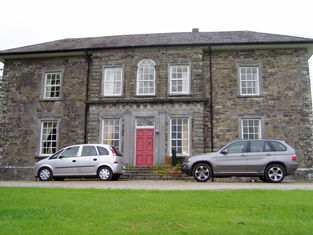
| Coolure | Coolure was held in fee by Sir Richard Pakenham at the time of Griffiths Valuation in the early 1850s when it was valued at £84. The National Built Heritage Service suggests it was built c.1775 with a later extension in the 1820s. It was likely built for Captain (later Admiral) Thomas Pakenham on his marriage to Louisa Staples, who were the parents of Sir Richard Pakenham. In 1906 it was part of the estate of Hugh P. Wilson and valued at £24. Coolure is still extant and occupied. Its extensive stable block was located in the neighbouring townland of Lispopple and was valued at £9 at the time of Griiffiths Valuation. |
|
| Coolville | An early 19th century house, occupied by Richard Grubb in the first half of that century. It was held from Viscount Lismore and with offices and flour mills was valued at £169 in the early 1850s. Home of Edward Sackville West 5th Lord Sackville in the mid 20th century, who added a Gothic conservatory to the building. |

|
| Coolvuck House | O’Brien writes that this early 19th century house was probably built by Francis Dillon, who was recorded as the occupant in 1814. Valued at £13 at the time of Griffith’s Valuation (publ. 1854), it was occupied by Eneas McDonnell who held the property from James George Murphy. Occupied by Thomas Groarke, a farmer and his sister in 1901 and by Thomas Killoughy, a shepherd who held it from Thomas Groarke in 1911. | |
| Coolwood House | John Kingston was leasing this property from the Earl of Shannon's estate at the time of Griffith's Valuation, when it was valued at £8. It is not labelled on the 1st edition Ordnance Survey map but appears on the later 25-inch map as Coolwood House. It is still extant and occupied. | |
| Coolyduff House | At the time of Griffith's Valuation this house valued at £16 was occupied by Alfred Parnell and held from Richard Beamish. Labelled as Coolyduff House on the 25-inch Ordnance Survey map of the 1890s. There is still an extant house at the site. | |
| Coolyhane | Lewis refers to Coolehane as recently erected, Richard Ashe was proprietor. Richard Ashe was still the occupier in the early 1850s and held the property from Elizabeth Foote when it was valued at £15.15 shillings. In 1944 the Irish Tourist Association Survey noted that it had formerly belonged to the Ashe family but was then the home of Mr. Purcell, solicitor. It is still extant. | |
| Coolyhenan House | A house occupied by Michael Shine at the time of Griffith's Valuation and held from the representatives of M. Honan, valued at £28, with a demesne of 343 acres. Though buildings survive at the site they appear to be in a derelict condition. | |
| Coolyrahilly House | Thomas Cuthbert was leasing this property from John C. Kearney's estate in 1851 when it was valued at £6. It is labelled Coolyrahilly House on the 25-inch map published in the 1890s. There is still an extant house here. | |
| Coom Wood Cottage | Timothy O’Sullivan was leasing Coom from Lord Kenmare’s estate at the time of Griffith’s Valuation when it was valued at £5 15s. Bary states that the origina property is no longer extant though a house is present at the site. | |
| Coomhola Lodge (Sans Souci) (Bantry) | Occupied by Richard E. White at the time of Griffith's Valuation, when it was valued at £8. It is labelled as Sans Souci on the 1st edition Ordnance Map but as Coomhola Lodge on the 25-inch edition of the 1890s. Local sources indicate it was formerly a hunting lodge for the Bantry Estate. It is still extant. | |
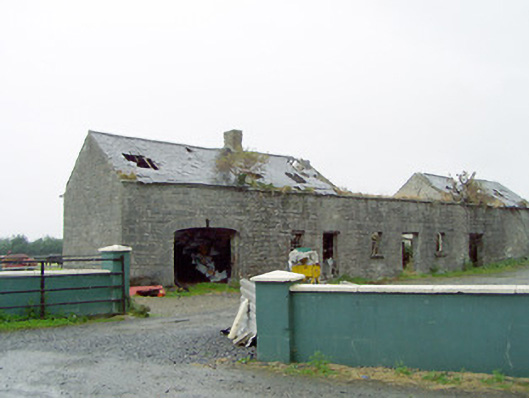
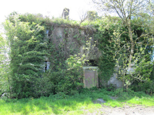
| Coomlogane | A late 18th century house was built near the original building. In 1786 Wilson refers to it as the seat of Mr. O'Leary. This house became the home of the McCarthy-O'Learys for all the 19th century. In the mid 19th century it was valued at £38. John McCarthy O'Leary occupied the house in 1906. It was looted during the War of Independence and is now demolished. | |
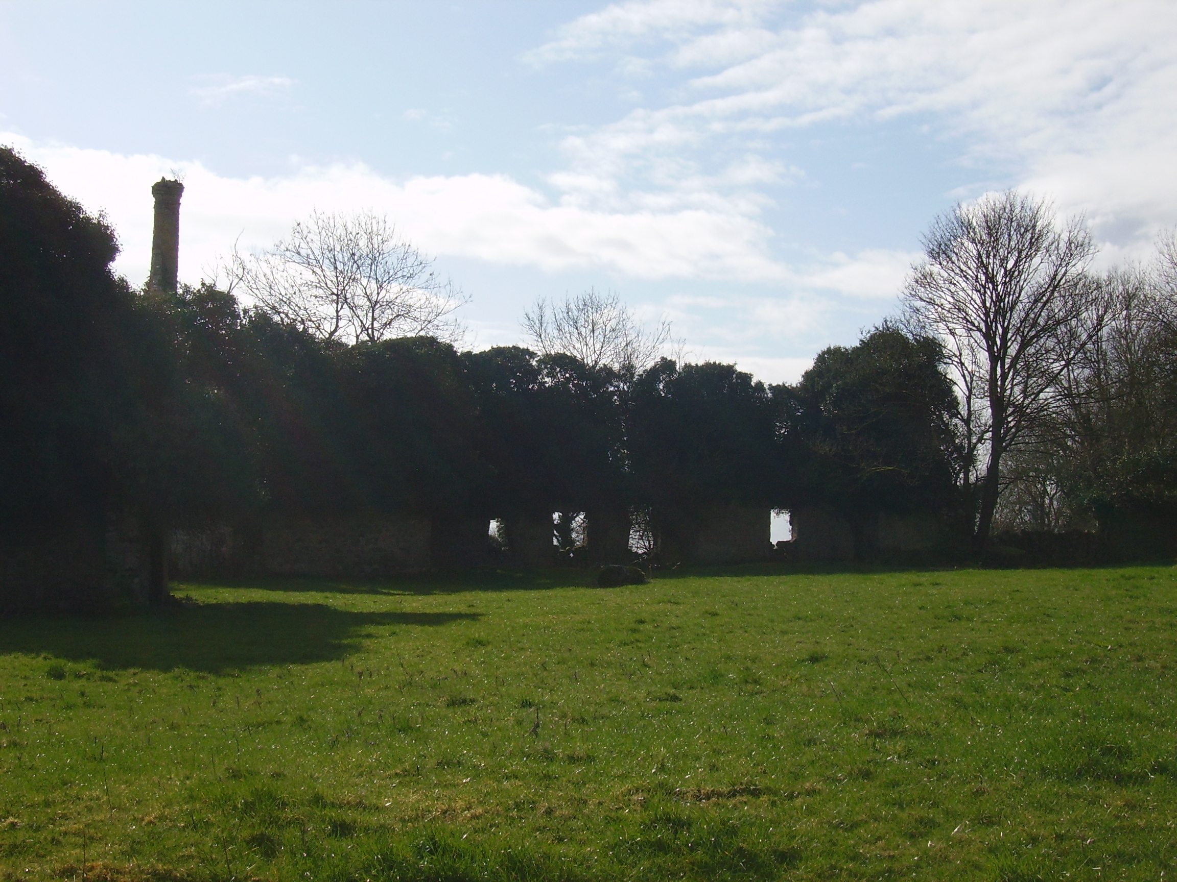
| Coomlumminy Court | The representatives of Reverend D. Mahony were occupying a house valued at almost £5, together with over 1400 acres at the time of Griffith’s Valuation. In 1906 this was the property of Mary Mahony and valued at £3. The building was labelled Coomlumminy Court on the 1st and subsequent edition Ordnance Suvey maps and is now a ruin. | |
| Cooneen Mill | Charles Musgrave was leasing this extensive property from Sir Richard Musgrave at the time of Griffith's Valuation, when it was valued at £31 5s. It is recorded as disused on the 25-inch Ordnance Survey Map of the 1890s. Some ruins remain at the site. | |
| Cooper Hill | The residence of James Cooper in 1814 and occupied by Mrs [Honora] Cooper in 1837. Inherited by James Cooper Tuthill circa 1844 who then assumed the surname Cooper. The house was valued at £45 at the time of Griffith's Valuation and in 1906 when it was occupied by James Cooper. It was advertised for sale in ''Country Life'' (28 April 1955), bought by Cement Ltd who ran a model dairy farm on the property for some years. A large dairy enterprise still operates on the property. The house is a ruin. |

|
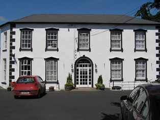
| Coopershill | Coopershill House was completed in 1774. McParlan described its situation as delightful in 1802. Lewis records it as the seat of Arthur Cooper in 1837. At the time of Griffith's Valuation it was occupied by Charles William Cooper and valued at £52. Charles William Cooper later succeeded his uncle as owner of the O'Hara of Annaghmore estate and henceforth Coopershill bacame an O'Hara property. He is recorded as the owner in 1894. The house is still extant and run as a guesthouse by the O'Hara family. |
|
| Coorevin | Lewis records Cooreavan as the property of R. Hall in 1837. In 1840 the Ordnance Survey Name Books indicate that it was occupied by "Mr Gorey Baker, Burresokane". Jeremiah P[ierce] Scully was the occupier at the time of Griffith's Valuation, holding the property from the representatives of Robert Hall. The buildings were valued at £11. A building is still located at this site. | |
| Coote Hall | In the seventeenth and eighteenth centuries Coote Hall was owned by the Coote family. The 4th and 5th Baronets, both named Charles, lived there and it was one of the houses O'Carolan visited and for whom he composed tunes. It was bought by Maurice O'Conor in the 18th century and later again by the Barton family. There is still an extant house at the site. |
|
| Coppinger's Court | Built by Sir Walter Coppinger in the early seventeenth century and partially destroyed in the 1641 Rebellion. Described by Bence-Jones as an impressive semi-fortified house. By the mid nineteenth century it had fallen into ruin and is not mentioned in Griffith's Valuation, when the lessor of the surrounding land was Lady Carbery's estate. |
|
| Copsetown Abbey | This building is named Fitz Urse Lodge on the first edition Ordnance Survey map. It was valued at £6 occupied and held in fee by Richard Beere in the mid 19th century. Hajba writes that William Fitzgibbon, a Cork draper, bought the house in 1851 and that it was the home of the O'Connors in the 20th century. The house was known as Copsetown Abbey by the end of the 19th century. |
|
| Copsewood | Copsewood Cottage is marked on the first Ordnance Survey map at this site. A much larger house was built in the mid 19th century for Major General Caulfeild. It was valued at £36 at the time of Griffith's Valuation and at £63 in 1906. It remained in the possession of the General's descendants until 1919 when it was bought by the Salesian Fathers who started an agricultural school. It is now a secondary school run by the Salesian Order. |
|
| Cor Castle | Thomas Frewen was leasing this property to James Corker at the time of Griffith's Valuation, when it was valued at £16 10s. In 1837 it was the seat of Chambre Corker. Cor Castle was in ruins for many years following its burning in June 1921 during the War of Independence. At the time it was the residence of Mrs. Carolne Stephenson, who, Donnelly indicates, had inherited it from her mother, Sophia Corker. It has recently been restored. |
|
| Corabeg House | John Spottiswoode was leasing this property from the Knight of Kerry's estate at the time of Griffith's Valuaton, when it was valued at almost £4. Lewis refers to it as the seat of Capt. Spotswood in 1837. The 25-inch Ordnance Survey map of the 1890s labels the property as "in ruins". In 1906 a property of the same valuation at Coarhamore nearby was owned by the Congested Districts Board. It is no longer extant. | |
| Corbally | The Spaights were resident at Corbally from the latter part of the 18th century. Poole Gabbett was resident here in the first decade of the 19th century. Griffith's Valuation show that the Spaights held Corbally from the Mahon family "of Corbally". The house appears to have reverted back to the Mahons in the later part of the 19th century. Slater notes it as the residence of George T.M Stacpoole in 1894. | |
| Corbally | ''Burke's Irish Family Records'' describes the Sheehys of Corbally House from about the late 18th century. In the mid 19th century the house was occupied by William J. Sheehy, second son of Bryan Sheehy of Corbally House, died 1806. The buildings were valued at £27 and the property was held from the Reverend Edward Newenham. This house was named 'Mill View' on the first Ordnance Survey map. Mill View was still occupied by Sheehys when it was advertised for sale in 1871. | |
| Corbally | Michael Kirwan was leasing this property from the Fortescue estate at the time of Griffith's Valuation, when it was valued at £11 18s. A property built after the publication of the 1st Ordnance Survey. A house and farm are still extant at the site. | |
| Corbally (Rattoo) | At the time of Griffith's Valuation, William Pope was leasing this property from the Trinity College Estates when it was valued at £6. A modern house, part of a large farming enterprise, exists at the site now. | |
| Corbally House | The Ordnance Survey Name Book records the rebuilding of this house by Poole Gabbet in 1824 at a cost of £1,700. The Gabbets had flour mills closeby. It overlooked the Shannon north of Limerick city and was three storeys high. At the time of Griffith's Valuation it was valued at £35 and was occupied by Thomas Gabbett who held it from Patrick A. Shannon. This house now functions as a nursing home. |
|
| Corbally House (Kilmoylan) | In 1786 Wilson refers to Corbally, the seat of Mr. D'Arcy, situated beside a lough. This would appear to be Corbally House, in the parish of Kilmoylan. By the time of Griffith's Valuation, the townland was in the possession of James O'Hara and Walter Blake was occupying this property which was valued at £2. It is no longer extant. | |
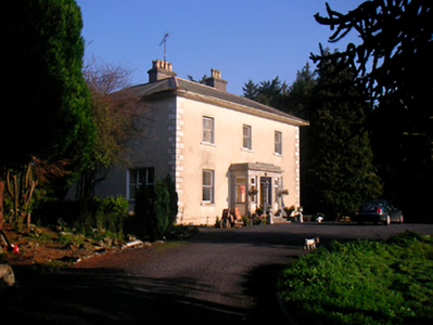
| Corbally House (Magunihy) | The Kenmare estate was the lessor of Corbally House at the time of Griffith's Valuation, when it was valued at £11 5s. Bary states that this farm was originally held by the O'Connor, probably of nearby Fieries Castle. Later a Fr. Dunne built Corbally House as a presbytery near the old Catholic Church. The property is still extant and occupied. | |
| Corbally House (Roscommon) | Patt Dunn, an agent, was living at Corbally in 1749. The home of members of the Plunkett family in the early 19th century. Occupied by William Phibbs at the time of Griffith's Valuation, held from John Egan and valued at £8. A house still exists at the site. | |
| Corbally Park | Built in 1824 by Pierce Shannon for £2,500, this three storey house was held by Patrick A. Shannon in fee at the time of Griffith's Valuation when it was valued at £51. St Munchins College is situated at this location now. A lithograph of this house called Corbally House and the toll bridge is included in the 1856 rental. The house was not included in the sale. | |
| Corbally South | Catherine Delany held buildings valued at £11 from William J. Sheehy in Corbally South at the time of Griffith's Valuation, with 148 acres. Buildings are still located at this site. | |
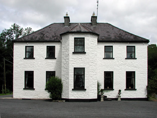
| Corbetstown | Corbetstown house, a D’Arcy home, is named on the first edition OS map. It is a three-bay two-storey over basement house, built about 1820. It must have replaced an earlier house as a D’Arcy is recorded at Corbetstown in the late 1770s. Francis D’Arcy was resident in 1814 and John D’Arcy in 1837. By the time of Griffith’s Valuation (publ. 1854) Joseph Purser was resident holding the house valued at £32 from the Earl of Longford. Occupied by Elizabeth and Frances Reynell in 1911, this house remains extant. |
|
| Corboy (Longford) | At the time of Griffiths Valuation in the 1850s this property was leased by Bridget Phillips from the Fetherston estate and valued at £10. The National Built Heritage Service indicates that the house was later the home of John Philips, the last MP for County Longford. It had later become derelict but redevelopment has taken place at the site. | |
| Corcam | Henry Stewart held this property in fee at the time of Griffiths Valuation in the 1850s, when it was valued at £22. It is labelled Corcam on both the 25-inch and last edition 6-inch Ordnance Survey maps but is not extant now. | |
| Corcamore | A house situated on the Barker estate and occupied by Thomas Gleeson in the mid 19th century and valued at £18. [Grid reference is approximate]. | |
| Corcullen/Kirkullen House | The house valued at £21 was vacant at the time of Griffith's Valuation. Michael D. Browne was the immediate lessor. It is shown as a considerably enlarged structure on the 25-inch map of the 1890s. Buildings are still extant at the site. | |
| Cordangan House | Cordangan was a Cooke family residence in the 18th and 19th centuries, occupied by John Cooke in 1814. The Ordnance Survey Name Books refer to it as being "in very good repair, the residence of J. Cooke". in the early 1850s it was occupied by Thomas Cooke. The property was held from the Smith Barry estate and the buildings were valued at £26. Slater refers to it as the residence of Horatio Townsend in 1894. In 1906 it was in the possession of Lord Barrymore and valued at £53. It is still extant. |

|
| Cordara House | By the end of the 19th century Cordara House had been constructed at a different site in Newpark townland. It has since been demolished though some estate buildings remain at the site. |
|
| Cordivin | At the time of Griffiths Valuation, Reverend Robert Moffett was leasing this property to James Ganley, when it was valued at £14 and included a mill. It is shown on the 1st edition Ordnance Survey map but does not appear on subsequent editions. | |
| Corduff House | The National Inventory of Architectural Heritage estimates that Corduff House was built c.1780. William Penrose was occupying the house at Corduff, barony of Carrigallen, at the time of Griffith's Valuation when it was valued at £8. Corduff House is recorded as the seat of the Penrose family by Lewis in 1837. In 1814 it was the residence of George Percy. The house is still extant and occupied. |
|
| Corfad | Built in 1828, according to the Ordnance Survey Field Name Book, this two storey house was the residence of ‘Mr McCullough an extensive farmer’. Griffith’s Valuation records James McCullagh as the occupier who held the property which included offices, corn and flax mills, in fee. The buildings were valued at £42. This house is now a ruin. |
|
| Corgary or Corgerry | The house known as Corgary was part of the Joyce estate. At the time of Griffith's Valuation, it was occupied by Eleanor Morgan, leasing from Walter Joyce, and valued at £30. It was shown on the 25-inch Ordnance Survey map of the 1890s but labelled "in ruins" on the 6-inch map of 1932. | |
| Corgrig House | Gerald Griffin was the proprietor of Corgrig in 1826, Mrs Griffin occupied Congrieff in 1837 and Gerald Griffin held Corgrig from Lord Monteagle in the early 1850s. The Ordnance Field Name Books state that Peter Griffin was the proprietor circa 1840 and that his father had erected this house about 80 years previously. It is still extant though with modern housing now occupying much of the surrounding area. The 25-inch Ordnance Survey map of the 1890s also shows a house known as Corgrig Lodge in the same townland at R253511. | |
| Corkbeg | The Penrose Fitzgerald Papers in the Boole Library document the building of a mansion house at Corkbeg in the 1820s. It was built to replace an earlier house mentioned by Wilson in 1786 as the seat of Robert Uniacke Fitzgerald. It was held in fee by the Fitzgeralds and valued at £65 in the early 1850s. By 1906 it was valued at £81. Bence Jones writes that the Fitzgeralds sold Corkbeg in the mid 20th century. The Irish Tourist Association survey notes that it functioned as a hotel for a few years. It was demolished in order to establish an oil refinery. | |
| Corkhill House | Sir Malby Crofton is recorded as the lessor of two properties in the parish of Templeboy at the time of Griffith's Valuation. One property is noted as a herd's house, valued at £1 while the second, valued at £1 5s, was leased to Thomas Fury. McTernan notes that in the eighteenth century this house had been leased from the Crofton estate by the Wood family. It eventually fell into disrepair and was demolished. | |
| Corkip | In 1786, Wilson refers to Cork, the seat of Mr. Tough. This appears to be an 18th century house associated with the Lyster family, later occupied by the Keoghs and now in ruins.The townland was in the possession of Arthur Beamish by the time of Griffith's Valuation and there was a herd's house valued at 15s. |
|
| Corlat House | A house named Cook Mount was located in Corlat on the first Ordnance Survey Map (circa 1836). Corlat House was built in the mid-19th century on a nearby site, valued at £20 and occupied by the Reverend James Bleakley, who held it from William Murray. In the early 20th century William McWilliam, Clerk of the Crown and Peace lived at Corlat House. It is no longer extant. | |
| Cormaglava House | William Lewis was leasing this property from William Montfort [Bond] at the time of Griffiths Valuation in the 1850s when it was valued at £12. The Ordnance Survey Name Books note that the townland was the property of Lady Rosse in the 1830s. A house is still extant at this site. | |
| Cormoy House | There was a building located here and marked on the 1st edition 6 inch Ordnance Survey map (1836). Griffith’s Valuation records the house as located on the estate of the Marquess of Bath, valued at £28 and occupied by Peter McCaul. In 1901 it was the only house in the townland and Kate McCaul, a widow, was the head of the household. A building is still located at this site. | |
| Cornadrung Cottage | In 1906 the report on Untenanted Demesnes notes a property at Cornadrung in the possession of Edward Fitzgerald and valued at over £10. This house is labelled Cornadrung Cottage on all editions of the Ordnance Survey map. It appears to have begun as a small property, possibly a hunting lodge on the shores of Lough Gowna which was enlarged in the latter part of the 19th century. In the 1870s Cornadrung was recorded as the address of Mrs. Sarah Hughes. Family history sources suggest it was later owned by the Cole family. The site is now occupied by a modern house. | |
| Cornaher | Cornaher House, named on the first edition OS map, is a two-storey seven-bay country house, built in the early 19th century by the Rev John Vignoles, of Hugenot decent. He married a member of the Lowe family who previously owned the property. It was the home of the Rev. Charles Vignoles in 1814 and 1837, who was rector of the nearby Newtown Church of Ireland church. His sons Thomas and Samuel were in residence at the time of Griffith’s Valuation (publ. 1854) when the house was valued at £32. The Rev Charles Vignoles died at Cornaher in 1877. It was occupied by William George Lowe and family in 1901 and by the Davis family in 1911. Since then it has had a number of owners, been in use as an organic farm and Bed and Breakfast and was for sale in 2022. |
|
| Cornahilt Lodge | Located on the outskirts of Ballyjamesduff, Cornahilt Lodge was occupied by Mary Skelton in the mid-19th century. She held the property with a rateable valuation of £12.10.0. from Robert J. Cuming. Cornahilt Lodge is now the address of a services company based in Ballyjamesduff. | |
| Cornashesk House | This house was not built at the time of the first Ordnance Survey in the 1830s. It was erected within the demesne of Fort William and was occupied in the 1850s by David Kellett and held from the trustees of the Marquess of Headfort. It was valued at £10. Home of the Farrelly family at the beginning of the 20th century. | |
| Cornaveigh | A house in this townland was occupied by George Bowles in the mid 19th century, valued at £17 and held from his father, Spotswood Bowles. The original building is no longer extant. | |
| Cornecassa | This house was the home of the Hamilton family from the early 19th century built by Dacre Hamilton. Lewis records it as the home of Dacre Hamilton, son of Sir James, who was agent for the Rossmore, Castleshane and Templeton estates. Cornakessagh House is named on the 1st edition 6 inch Ordnance Survey map (1836). At the time it had extensive laid out gardens and some plantations. James Hamilton was the occupant at the time of Griffith’s Valuation, circa 1860. He held the property from Lord Rossmore. It was valued at £120. The library was sold in 1922 following the death of Captain Hamilton. The main part of the house was demolished in 1934. The service wing survives as does the farmyard complex. See http://archiseek.com/2016/cornacassa-house-monaghan-co-monaghan/ | |
| Cornfield | Occupied by Westropp Ross in 1814 this house was in the possession of Major William Ball by the time of Griffith's Valuation, when the buildings were valued at £48. Later occupied by members of the Dawson family. The house no longer exists but a gate lodge is still extant. |

|
| Cornfield | Cornfield was the original Ruttledge home in the Hollymount area and continued to be lived in by family members until the 20th century, although it was replaced as the family's principal residence by Bloomfield. In 1786 Wilson refers to it as the seat of Mr. Ruttledge. In the mid 19th century it was the home of Thomas Ruttledge who married Jane Fair. He was leasing from Robert Ruttledge and the buildings were valued at £20. The existing dwelling is part of the original house, as are the ruins beside it. Local sources suggest that portions of the original house were demolished when the property was acquired by the Land Commission and some of the stone used to build houses in Hollymount village |
|
| Cornwall's Brewery | Henry Cornwall held this property in perpetuity at the time of Griffith's Valuation when it was valued at £180. It is labelled Watergate Brewery on the 25-inch Ordnance Survey map of the 1890s. The former miller's house is still extant and now known as The Haven. |
|
| Coronea House | Thomas Clerke was leasing this property from George Robinson at the time of Griffith's Valuation, when it was valued at £17. Lewis refers to Coronea House occupied by Mrs. Marmion in 1837. The residence of Rev. William Robinson in 1814 and in the 1770s and 1780s it was the seat of a Townsend family. It is no longer extant. | |
| Corr House | In 1814 Richard Harkness lived in Corr House, Killeshandra. By the time of Griffith’s Valuation it was owned and occupied by John Alexander Faris. Its rateable valuation was £9. John Alexander Faris married Charlotte, daughter of William Harkness of Corr House on 23 April 1850 (The Anglo Celt, 26 April 1850). In 1906, James A. Faris occupied this 'mansion house' valued at £9.5.0. for rates. Members of the Faris family were still living at Corr at the end of the 20th century. The National Inventory of Architectural Heritage states that the house is no longer in use. | |
| Corr Lodge/Corr House | At the time of Griffith's Valuation the property at Corr was being leased by R.P.Dolphin to Edmund Mahon. In the 1780s, both Taylor and Skinner and Wilson recorded Corr as a seat of the Dolphin family. Slater refers to it as the seat of Redmond D. in 1846. By the 1890s it had become known as Corr House. In 1906, the mansion house at Corr, valued at £15, was owned by Marcella Blake Forster. It is no longer extant. |
|
| Corra More | The residence of Colonel W. Caulfield in 1814. The home of Christopher Balfe, ninth son of Walter Balfe of Heathfield, in the 1830s. John Cornwall occupied the house in the mid 1850s when the house was valued at £23. Extensive high walls as well as the yard remain but the present owners live in a modern bungalow. |

|
| Corrabella | In 1840 the Ordnance Survey Name Books describe this house as "a very good building in bad repair, the residence of Miss Ann Mulcahy". It was leased to William Mulcahy by the Glengall estate and occupied by him in the mid 19th century when it was valued at £18+. A lithograph of this building is included in the sale rental of November 1853. The Mulcahys were still resident in the 1950s. This three storey house still functions as a residence. |
|
| Corrabola House | Hugh Morrow was leasing this property from the Jessop estate at the time of Griffiths Valuation in the 1850s, when it was valued at £28. Lyons records the sale of the house and estate in the Landed Estates Court in 1861. The schedule notes that it had been built by Morrow about 20 years previously and provides a good description of the house and demesne. The interest was purchased by the Jessop estate. The sale notice includes a lithograph of the house. A painting of this house, attributed to Arthur Morrow, is held in a New Zealand collection, where members of the Morrow family emigrated to in the 1860s. This house later features as the address of Thomas Alder Cusack, a Dublin solicitor who managed the Jessop estate. |
|
| Corradoo Lodge | At the time of Griffith's Valuation William Phibbs was leasing the property at Corradoo, barony of Tirerrill to Major Kingston Lloyd when it was valued at £18. Lewis records it as a residence of William Phibbs. McTernan notes that it was originally built by the Phibbs estate as a schoolhouse but was later converted into a residence. It was leased, and later sold to, the Frazier family. Following the deaths of the last of that family it was demolished and a new house built at the site. | |
| Corrandoo House | This property was granted to the ffrenches in the late 17th century in lieu of Monivea Occupied by the Reverend Mr Marsh in the 1770s sand 1780s, by M. Dowdall in the 1830s and Thomas Kenny at the time of Griffith's Valuation when it was valued at £10. It is no longer extant. |
|