Browse Houses
Search Results: Returned 5927 records. Displaying results 2601 – 2700
| House name | Description | |
|---|---|---|
| Forest View | This house is named on the 1st edition 6 inch Ordnance Survey Map (1836). In the mid-19th century it was occupied by Thomas Dawson and held from Lord Cremorne. The buildings were valued at £12. Partial remains are still visible at this site. | |
| Forgney House | Thomas Lennon was occupying Forgney House at the time of Griffiths Valuation in the 1850s, when it was valued at £12 and leased from the King Harman estate. It is possible that this is the same property which the valuers recorded as occupied by William Atkinson in 1840 and then valued at over £13. The house is not visible on the 25” map of the early twentieth century and the area is now covered by forestry. Elsewhere in the same townland, a house is labelled Forgney Old House (N205545) on the 1st edition Ordnance Survey map but does not appear on later maps. | |
| Fort Anne | The residence of S. E. Johnson in 1837, built by his father William. The house was occupied by Richard Johnston in the early 1850s who held the it from the Reverend R. Dickson, who held the demesne in fee. In 1906 this house valued at £13.15 shillings was occupied by William D. Dickson. The original house is no longer extant. | |
| Fort Anne | An 18th century house that was in the possession of Robert Westropp, eldest son of Poole and Mary Westropp, by 1814. His son John, who married Maria Macnamara, was occuping the house in 1837 and their son Robert was resident in the mid 1850s. Robert Westropp held the property in fee and the buildings were valued at £25. This house passed into the possession of the O'Callaghan Westropp family. It no longer exists. | |
| Fort Arthur | Bartholemew Donovan was leasing this property from John Young Sandys in 1851 when it was valued at £7. It is labelled Fort Arthur on both the First and 25-inch edition Ordnance maps and is still extant. | |
| Fort Browne | By the mid 1850s the house was valued at £2.15s and was occupied by Margaret Burke. It is now derelict. |
|
| Fort Edward | Built post the first Ordnance Survey probably by a member of the Westropp family. Occupied by Dr Patrick Cullinan at the time of Griffith's Valuation who held it from the Reverend John Gleeson. The house is still inhabited and well maintained. |
|
| Fort Edward | Fort Edward was the home of Edward Long from at least the mid 1830s and is referred to as his residence by the Ordnance Survey Name Books in 1840. At the time of Griffith's Valuation he held the property from Charles Bianconi and the buildings were valued at £19+. Still extant and occupied. |
|
| Fort Elizabeth | Occupied by John Cripps in 1814 and the residence of the Reverend John Croker in 1837. William Croker was the occupier at the time of Griffith's Valuation when it was held from the representatives of James O'Sullivan and valued at almost £16. A substantial farm remains at the site. | |
| Fort Etna | The home of the Peacock family in the 19th century, although J. Waller O'Grady was resident in 1837. At the time of Griffith's Valuation it was occupied by Mrs Peacocke who held it from Charles Leslie, valued at £30. Occupied by Edmund White in the 1870s Bence Jones records that it later became the home of the Reilly and Peart families. The original house is now a ruin. | |
| Fort Eyre | At the time of Griffith's Valuation a property here, owned by Reverend E. Maunsell, was being leased by Richard A.H. Kirwan and was valued at £42. The house is labelled Fort Eyre on the 1st edition Ordnance Survey map. It is still extant. |
|
| Fort Fergus | A home of the Ross Lewin family in the 18th and early 19th centuries. In 1786 Wilson refers to it as the seat of J. RossLewin. Occupied by Mr Evans in 1814 and by Daniel O'Grady in 1837 and held by Major William Ball in fee in the 1850s, when the buildings were valued at over £32. Bence Jones writes that Major Ball purchased Fortfergus in 1855 in the Encumbered Estates' Court. Weir writes that the house was burnt down in the 1920s. The remaining staff quarters have been turned into a residence and the farm buildings are still in use. | |
| Fort Frederick | Fort Frederick situated close to the shore of Lough Ramor was described by Bence Jones as ‘a 2 storey mid-c18 house with a central 3 sided bow and 2 bays on either side of it’. In 1814 it was the home of Captain Sankey but by 1837 had been acquired by his relative R. Scott who was married to Eleanor Sankey. Griffith’s Valuation records Richard Scott as the occupier. The buildings were valued at £35 and were held in fee. By 1876 Alexander William Jackson Sankey owned the Fort Frederick estate, comprised of 1,324 acres. He died in 1903. His brother Harry Samuel Sankey is recorded as resident at Fort Frederic in 1910. This house continues to be a residence. |

|
| Fort Grady | Located on the O'Grady, Viscount Guillamore estate, Fort Grady was valued at £14 in the mid 19th century and occupied by John O'Connell. In 1837 Lewis describes it as a farm house formerly the residence of the father of Viscount Guillamore. In 1814 it was occupied by Mr Daniel McAuliffe. In 1786 Wilson refers to it as "Knockbrack, the seat of Mr. Gredy". A house and farm are still extant at the site. | |
| Fort Henry | In 1814 Fort Henry, Cootehill, was the home of the Reverend John Moore. Valued at £4 in Griffith’s Valuation it was occupied by Elizabeth J. Stinson and held from Colonel Henry T. Clements. Reduced in size on the 25 inch map, a building still stands on this site. | |
| Fort Henry | Fort Henry, overlooking the Shannon River, was the residence of Stephen Hastings in 1814 and of Finch White in 1837. Earlier, in 1786, Wilson had also noted it as a Hastings residence. At the time of Griffiths Valuation, Finch White held the house from Stephen H. Atkins. It was valued at £28.15s. Finch White was related to the Atkins through marriage with a member of the Gelston family. In 1906 this house was in the possession of Frederick C.Henry. In 1840, however, the Ordnance Survey Name Books had also noted that J.J. Henry was the proprietor. It is still extant. | |
| Fort Henry [Greyfort Cottage] (Borrisokane) | In 1840, the Ordnance Survey Name Books refer to "Fort Henry, a commodious house, the residence of Henry Ely" in the townland of Greyfort, parish of Borrisokane. At the time of Griffith's Valuation, Henry Ely was leasing a property valued at almost £5 from the Saunders estate in this townland. This may refer to the property shown on the 1st edition Ordnance Survey map as Greyfort House. On the later 25-inch map of the 1890s it is known as Greyfort Cottage. A house is still extant at the site. | |
| Fort Henry [Greyfort Cottage] Borrisokane | In 1840, the Ordnance Survey Name Books refer to "Fort Henry, a commodious house, the residence of Henry Ely" in the townland of Greyfort, parish of Borrisokane. At the time of Griffith's Valuation, Henry Ely was leasing a property valued at almost £5 from the Saunders estate in this townland. This may refer to the property shown on the 1st edition Ordnance Survey map as Greyfort House. On the later 25-inch map of the 1890s it is known as Greyfort Cottage. A house is still extant at the site. | |
| Fort House | The residence of David Hartigan in the early 1850s, held from William and Charles Wyse (minors) and valued at £13. | |
| Fort House | This house near the town of Kilrush was the residence of John Trousdell in 1814. Occupied by Richard Studdert in the early 1850s who held the house valued at £7 and three acres from Brew Cox Donovan. Weir writes that it was the agent's house for the Vandeleur estate at one time. | |
| Fort Johnston | The Johnstons were in possession of Stramore from about the mid-18th century and Fort Johnston appears to have been in existence from then. This long house is named on the 1st edition 6 inch Ordnance Survey map (1836). The Ordnance Survey Field Name Book describes Lieutenant Johnson’s house as ‘a pretty good house (cottage built)’ called Fort Johnson. On the 25 inch map (surveyed 1908) it appears as a square block so it may have been altered. In the mid-19th century it was the home of Henry G. Johnston held by him in fee. Burke’s ‘Landed Gentry of Ireland’ (1904) records Fort Johston as the family seat but their residence was in Bandon, county Cork |
|
| Fort Laurel | Patrick and Hugh Maguire were leasing over 60 acres from the Palmer estate at Ardogelly at the time of Griffith's Valuation. Fort Laurel House was later built at this property. It was renovated in the late twentieth century and is now a family home. |
|
| Fort Lodge | John B. Gumbleton was leasing this property to Richard Donovan at the time of Griffith's Valuation, when it was valued at £7. In 1837 Lewis noted it as the seat of R. O'Donovan. It is now in ruins. | |
| Fort Moylan | Home of the Moylan family on the Egmont estate, occupied by Cornelius Moylan at the time of Griffith's Valuation when the buildings were valued at £10. Still extant and occupied |

|
| Fort Nisbitt | Robert Nesbett was resident at Fort Nesbett in 1814. The Ordnance Survey Name Books also mention him in 1839 though they refer to Thomas Towers as the proprietor of the townland. In the early 1850s, Thomas O'Brien was the occupier, holding the property from the Reverend James Nesbitt. The buildings were valued at £12.15 shillings. A building is still located at this site. | |
| Fort Prospect (Clonakilty) | Reverend Benjamin Swete was leasing this property to Richard Wheeler at the time of Griffith's Valuation, when it was valued at £15 15s. In 1837, Lewis notes it as the seat of R. Wheeler. It is still extant. | |
| Fort Richard | John Galway was leasing this house from the Roberts estate at the time of Griffith's Valuation, when it was valued at £16. It is recorded by Lewis as the seat of J. Galway in 1837. A house is still extant at the site. | |
| Fort Robert (Kinneigh) | Described by Lewis in I837 as a "handsome residence" then occupied by Mrs. [O'] Connor. In 1851 it was leased by George Fuller from Mary Longfield [O']Connor and valued at £18. By the mid 1860s it was in the possession of Thomas Kingston Sullivan. The sale rental of 1867 records that Fort Robert had been "allowed to get out of repair, but is beautifully situated". It appears to have become ruinous by 1890s. The Irish Tourist Association Survey of 1944 stated that the ruin was the property of Judge Henry Connor and also that the house had been associated with Art [O']Connor, United Irishman. | |
| Fort Royal | The representatives of Charles Wray were leasing this property from Smith Bryan at the time of Griffiths Valuation in the 1850s when it was valued at £20. This appears to be the property later known as Fort Royal Hotel. It is still extant as a private residence. |
|
| Fort Singleton | The 1st edition 6 inch Ordnance Survey Map (1836) names this house and shows its laid out gardens. The house was the home of the Singleton family, dating from about the mid-18th century. Lewis writes that the home of T. Singleton was ‘situated in a well wooded demesne of 200 acres’ while the Ordnance Survey Field Name Book refers to the ‘neat dwelling house and good office houses’ and that the demesne ‘contains a great deal of fine ash, elm and beech’. The buildings were valued at £60 in Griffith’s Valuation and Whitney Moutray was the occupant, holding from Thomas C. Singleton. Henry Abercrombie, land steward, and his wife were resident in 1901. In more recent times this building has undergone renovation. |
|
| Fort Stewart (KIlmacrenan) | Sir James Stewart was leasing this property from the estate of Thomas Brooke at the time of Griffiths Valuation in the 1850s, when it was valued at £50. In 1837 Lewis also noted it as the seat of Sir J. Stewart. Buildings are still extant at the site. | |
| Fort William | A Parker residence in the early part of the 19th century. In 1841 the Ordnance Survey Name Books referred to it as "a splendid demesne and fine mansion house, the residence of Mr. Parker". By the time of Griffith's Valuation Fort William was occupied by Miss Crawford who held the property from Messrs Egan. The buildings were valued at £18.15 shillings. The Egan sale rental of 1854 gives details of the original lease which was from Charles Egan to John Greene in 1769 for three lives renewable for ever. The last renewal was dated 1803 from John Egan to William Crawford. This house is still in use. |

|
| Fort William | The Ordnance Survey Name Books refer to correspondence with John Cooke in the parish of Glenkeen in 1840. This house was occupied by Mrs Margaret Cooke in the mid 19th century and held from the Earl of Portarlington, valued at £13.10 shillings. John W. Cooke was resident here in the 1870s. Fort William is still extant and occupied. |
|
| Fort William (Ballyshannon) | William Tredennick was occupying this property at the time of Griffith’s Valuation, when it was valued at £28. The National Inventory of Architectural Heritage suggests it remained in the ownership of the Tredennick family until the 1920s. It is still extant and occupied | |
| Fort William (Cornashesk) | A house and outbuildings are marked on the first edition six inch Ordnance Survey map (publ. 1837). Leet records Charles Kellett as the occupant of Corna-sesk in 1814. The house, which had expanded, is named on the 25 inch map. Fort William was the home of Robert Kellett in the 1850s, held from the Marquess of Headfort and valued at £14. Fortwilliam, Virginia, was the home of Ralph Harman in 1876. It is still extant. | |
| Fort William House | Fort William was the residence of a branch of the Odell family in the 18th century. Occupied by Reverend John Graves in 1814. Mrs Graves had a flour mill here in 1837 but T. O'Dell was living at Fort William. The Ordnance Survey Name Book states that this house was formerly the residence of William Brown of Springmount ''at present occupied by a herdsman''. The residence of Richard D. Power in the mid 19th century who held the property valued at £11 from John B. Graves (in Chancery). The home of Goodricke Thomas Peacocke in the 1880s. This house is still extant and occupied. |
|
| Fort William [Kinalea] | Charles L. Bernard held Fort William in fee at the time of Griffith's Valuation, when it was valued at almost £9. Lewis refers to it as the seat of William Penrose in 1837. Buildings remain at the site. | |
| Fort William/Errigal | Situated on the north side of the Annalee River, Fort William is named on the first edition six inch Ordnance Survey map (publ. 1837). By the time of Griffith’s Valuation it was owned and occupied by Samuel Moorhead. The rateable valuation was £25. The house was extended and renamed ‘Errigle’ as shown on the 25 inch map. In 1906, it had a rateable valuation of £40 and was occupied by Thomas H. Moorhead MD. It now functions as the Errigal Country Hotel. | |
| Fort William/Fort Lyster | A house on the outskirts of the village of Athleague, it was the home of N. J. French in 1837. It was valued at £20 and was occupied by Henry West who held the property from Anne Lyster in the 1850s. The house, marked as Fort William on the first Ordnance Survey map, later became known as Fort Lyster. Still valued at £20 and occupied by the representatives of William Jameson in 1906. It was the home of Aileen Cust the first woman veterinary surgeon in the British Isles in the early 20th century. Modern farm buildings occupy the site but the entrance gates remain. |
|
| Fortfield House | Located close to Lisheen Castle, occupied by H. Lloyd in 1837 and by William Butler at the time of Griffith's Valuation. William Butler was married to Catherine Lloyd and held Fortfield, valued at £19+, from his father in law John Lloyd. Home of the Everard family since the mid 19th century. see http://www.lisheencastle.com/?page_id=2 | |
| Forthill Cottage | Lewis records a Burke family resident at Forthill in the parish of Kilbeacanty in 1837. By the time of Griffith's Valuation the holding was being leased by Michael Diviney from William Gregory. The house was valued at £2 but was vacant at that time. It is no longer extant. | |
| Fortland | The Jacksons held this property from the Pratts of Enniscoe. It was described in the 1830s as a plain house ornamented with a few trees and scrubs. At the time of Griffith's Valuation it was leased by George H. Jackson from Mervyn Pratt when it was valued at £12. It is still extant ad now owned by Billy Cook. |
|
| Fortland | Wilson, writing in 1786 refers to "Fortland, pleasantly situated on the banks of the river Easky" as the seat of Mr. Browne. It later passed to the Jones estate. Both Leet in 1814 and Lewis in 1837 record it as a Jones property. In the mid nineteenth century it was bought by Richard Graves Brinkley who was leasing it to John Wingfield King at the time of Griffith's Valuation when it was valued at £14. It was offered for sale in the Landed Estates Court in 1874 when it was occupied by Mrs. Charlotte Lloyd, presumably a relative of Richard Brinkley's wife, Hester Lloyd. In 1906 it was the property of John L. Brinkley and was valued at £39. McTernan notes that the house was afterwards damaged by fire and partially demolished. Various buildings, including substantial remains of an estate farmyard, survive at this site. |
|
| Fortland | Leet records Fort-land, Mount Nugent, as the home of the Reverend H. Maxwell in 1814. Lewis records W. Gosling as the occupant of Fortland in 1837. The first edition Ordnance Survey map (publ. 1837) shows Fortland to have been a substantial property with laid out gardens and plantations and a demesne of over 300 acres. It was the home of the Hon Somerset Maxwell at the time of Griffith’s Valuation. He held the property in fee and the buildings were valued at £27. By 1906 this valuation had increased to £52.10.0. and the house was the home of Mrs Maxwell. The house is demolished and the site now a green field. | |
| Fortland Cottage | Fortland Cottage was built on part of the Cullen estate in the 18th and was the home of Jane Cullen and her husband G. Gledstanes in the mid-nineteenth century. |
|
| Fortland House | John Massy was leasing a building valued at £8 to John Rutherford here in 1856. This is Fortland House which is still extant and occupied. | |
| Fortlands | Fortlands was occupied by members of the Batwell family in the first half of the 19th century. Hajba writes that the Batwells held the property from the Hutchins family. By the mid 19th century Samuel Hutchins was occupying the house, held by him in fee and valued at £31+. The home of the O'Connor family in the 20th century. The original house does not appear to be extant. | |
| Fortlands House (Loughrea) | In 1786 Wilson refers to a charter-school at Loughrea and this premises is labelled on the 1st edition Ordnance Survey map. However, by the time of Griffith's Valuation, it appears to have reverted to use as a house, leased by John Smyth from the Clanricarde estate and valued at £11. The house at this location is labelled Fortlands House on the 25-inch Ordnance survey map of the 1890s. A house is still extant at the site. | |
| Fortlawn Cottage | William Mulrooney held this property in fee at the time of Griffith's Valuation when it was valued at £5. It is labelled as Fortlawn Cottage on both the 1st and 25-inch edition Ordnance Survey maps. A house is still extant at the site. | |
| Fortmoy House Lower | In 1840 the Ordnance Survey Name books refer to "Fordmoy" as "a good dwellinghouse, lately built, the residence of Mr. Prendergast".This house was vacant at the time of Griffith's Valuation. Thomas G. Prendergast was the immediate lessor and the house was valued at £11. Buildings valued at £27.5 shillings were held by the representatives of David Clarke at Fortmoy in 1906. Fortmoy House Lower is still extant. |
|
| Fortview | At the time of Griffith's Valuation occupied by Erasmus Lloyd who held it from William Lloyd. This house is labelled Fortview on the 25-inch edition map of the 1890s. A house is still extant at the site. | |
| Fortville | Fortville was occupied by Robert Fair in 1814. At the time of Griffith's Valuation it was the residence of Anthony Kyne. Now the home of the Curran Flannery family, the Curran family having lived there since the 1910s. |
|
| Fortwilliam | At the time of Griffith's Valuation William Lancaster was leasing a property valued at £25 from the Trench estate at Ardcarn, barony of Moycarn. At the same time Thomas Lancaster was leasing a property to Capt. James Bell. In 1786 Wilson refers to Fortwilliam as the seat of Mr. Lancaster. A modern house occupies the site at Fortwilliam but there are remains of yard buildings and a walled garden. |
|
| Fortwilliam | Thomas B. Hurley was leasing this property from the Talbot-Crosbie estate at the time of Griffith's Valuation, when it was valued at £18 10s Lewis records the house in Killahan parish when he notes that it as belonging to the representatives of the late W. Collis in 1837. Leet states that William Fitzgerald was resident at Fortwilliam in 1814. . Bary writes that, according to O'Donovan, this house was built by William Collis in 1798. It is no longer extant. | |
| Fortwilliam | A house on the Evans estate occupied by William Barry at the time of Griffith's Valuation when it was valued at £23, later a Sheehy residence. The Sheehy sale rental of 1875 records the house containing 3 reception rooms and 5 bedrooms. It was conveyed to Robert K. Sheehy by Edward R. C. Barry on 7 January 1874 and advertised for sale in June 1875. The National Inventory of Architectural Heritage dates this Tudor Revival house from circa 1880 to the design of Sir John Jackson (1851-1919), so the present house may incorporate the earlier one which is marked on the first Ordnance Survey map. In 2006 this house was no longer occupied. |
|
| Fortwilliam (Castlereagh) | The estate of William W.R. Sandford was leasing the house at Ballyfinegan, barony of Castlereagh, to Patrick Tighe at the time of Griffith's Valuation when it was valued at £11. Lewis records a house called Fortwilliam in the parish of Ballintober as the seat of P. Teighe in 1837. The Census of Elphin recorded William Compton as resident at Ballyfinegan in 1749. There is still an extant house at the site. | |
| Fortwilliam House | Named as Lissyviggeen on the 1st edition OS map but as Fort William House on the map of 1896. At the time of Griffith’s Valuation, John Dumas was leasing this property from the Kenmare estate, when it was valued at £11. Bary states that the O’Keeffe family purchased the property in the 1880s. It was still extant and occupied in 1994. | |
| Fortwilliam House (Waterford) | In 1851 J.B. Gumbleton held this property in fee when it was valued at £47 10s. Lewis also refers to it as his seat in 1837 when he describes it as " a handsome demesne with a new house being erected". The ITA survey noted it as the residence of Mr. P. Dunne in 1942. Fortwilliam is still extant and occupied. In 2024 it was offered for sale. |
|
| Fota House | Originally built as a hunting lodge for the Smith Barrys in the 18th century and enlarged in the 1820s to the design of Sir Richard Morrison with further 19th century additions. Valued at £89 and held by James H.S. Barry in fee at the time of Griffith's Valuation. Occupied by Lord Barrymore in 1906 and valued at £160. Inherited by Major and the Honourable Mrs Bell. The Irish Tourist Association survey provides details of some of the paintings in the house and exotic plants in the gardens. Bence Jones writes that Fota was sold to University College, Cork in 1975 following the death of Mrs Bell. It is now in the care of the Irish Heritage Trust and after restoration was reopened to the public in 2009. http://www.fotahouse.com/display.php |

|
| Fountainhill | The home of a branch of the Jennings family for over a hundred years, now a ruin. The house was held in fee by Patrick Blake at the time of Griffith's Valuation, when it was valued at £10. |
|
| Fountainstown | Francis Hodder was leasing this property to George Hodder at the time of Griffith's Valuation, when it was valued at £24. In 1837 Lewis referred to Fountainstown as the seat of G. Hodder. Local sources indicate that this house originally belonged to the Roche family whose lands the Hodders were granted and that the oldest part of Fountainstown House was the original Roche property. In the 1940s the Irish Tourist Association Survey noted that it was listed in the Association's directory of hotels. Fountainstown is still extant and occupied. |

|
| Four Mile Water Court or Durrus Court | Rev. Alleyn Evanson was leasing this property from the Earl of Bandon's estate at the time of Griffith's Valuation, when it was valued at £15. It is labelled Four Mile Water Court on the 1st edition Ordnance Map and Durrus Court on the later 25-inch edition. In 1837, Lewis recorded it as Four Mile Water Court, the seat of A. Evanson. It is still extant. | |
| Foxborough | In 1786 Wilson refers to Foxborough as the seat of Arthur French. Occupied by Patrick Taaffe at the time of Griffith's Valuation, who was leasing from Christopher French. The house was then valued at £20. It is now a ruin though the stable yard survives. | |
| Foxfield House | In 1814, Andrew Bell was resident at Foxfield (N435 888). In the 1850s John George Parr lived at Foxfield House, a residence on the other side of the road from the original Foxfield, which he held in fee. It was valued at £8 for rates. This house continues to be occupied. | |
| Foxhall | In 1786 Wilson refers to Foxhall as the seat of Mr. Anderson. It was the home of a branch of the Rose family in the 19th century following the marriage of Mary Anderson and Richard Rose. Richard A. Rose was resident in 1814 and J. O'Brien in 1837. In 1840 the Orddnance Survey Name Books refer to it as the residence of Dr. Ryordan, " a commodious dwelling house". At the time of Griffith's Valuation W.A. Rose occupied the house valued at £27+ and held in fee. This house is now demolished. | |
| Foxhall (Ballymahon) | Richard M. Fox held this property in fee at the time of Griffiths Valuation in the 1850s, when it was valued at £40. The original valuation also noted it as his property in 1839 with a valuation of £39. In 1906 it was owned by the representatives of R.E. Fox. The Ordnance Survey Name Books mention that the demesne contained 38 acres of woodland in the mid-1830s. Leet referred to it as the residence of Richard Fox in 1814. The National Built Heritage Service suggests that the house at Foxhall was demolished in 1946. Estate architecture, including the stables, survives |
|
| Foxmount | In 1848, Matthew Fox was leasing this property to Edmund Flynn, when it was valued at £10. The Encumbered Estates Sale notice of 1856 indicates that the lands in this vicinity had previously been part of the Wilkinson estate. |
|
| Foyle View | Alexander Porter was leasing this property from the Abercorn estate at the time of Griffiths Valuation in the 1850s, when it was valued at £10. A farm still exists at the site. | |
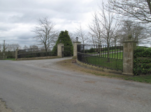
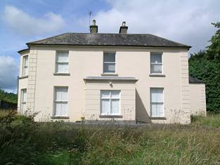
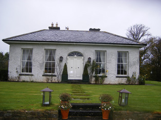
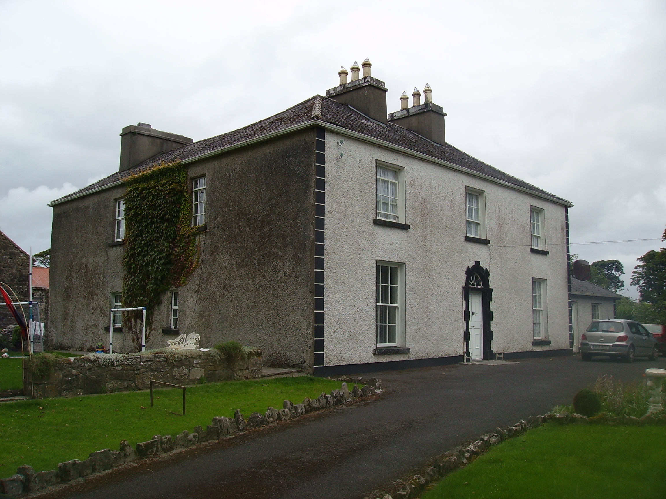
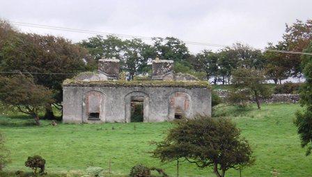
| Foyle View (Castle View) | The representatives of Robert Lepper were leasing this property from the Doherty estate at the time of Griffiths Valuation in the 1850s, when it was valued at £20. It had been noted by Lewis as the seat of Robert Lepper in 1837. This house is labelled Castle View on the 1st edition Ordnance Survey map of the 1830s. A building is still extant at the site. | |
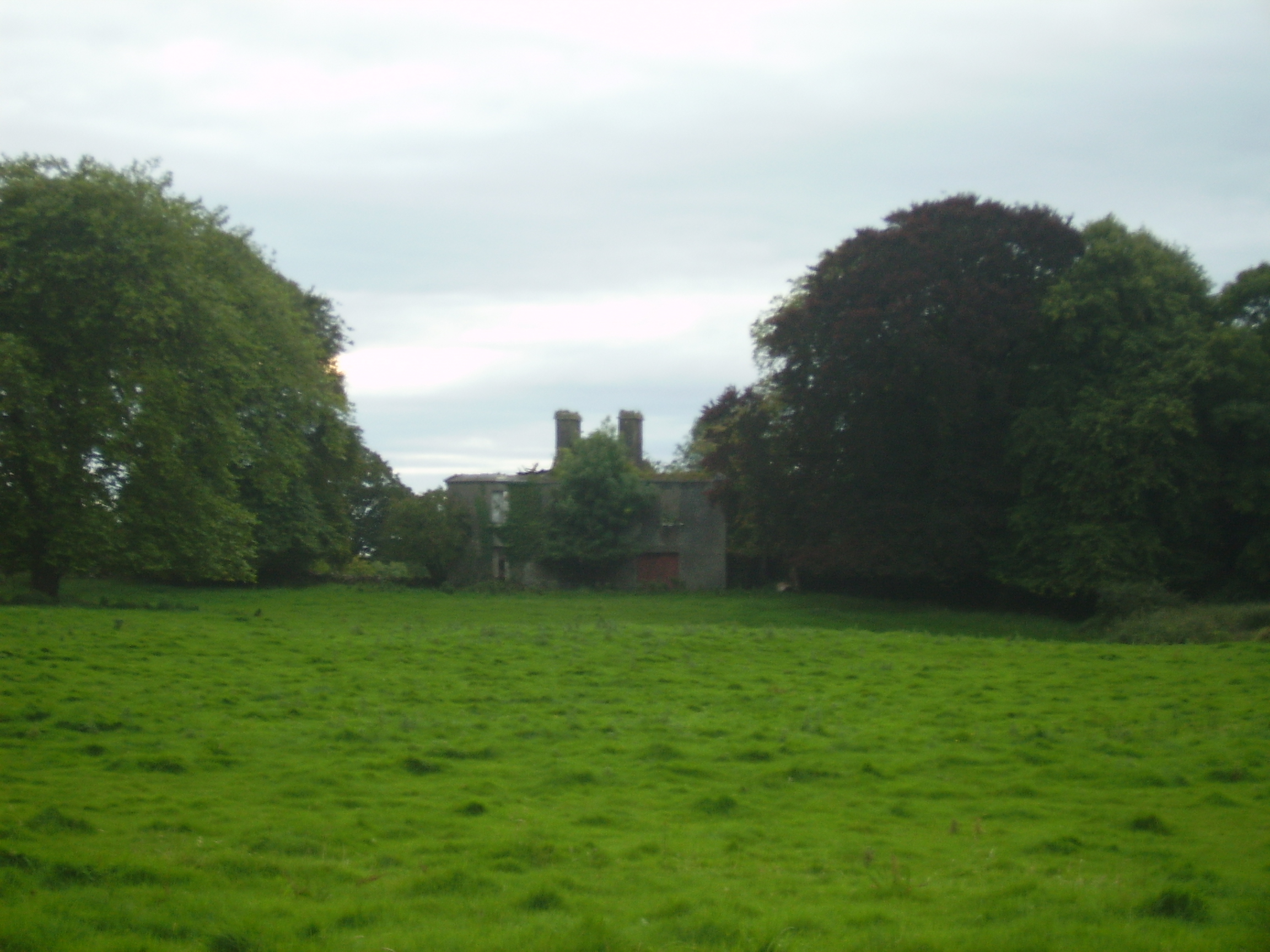
| Foyle View [Castle View] | The representatives of Robert Lepper were leasing this property from the Doherty estate at the time of Griffiths Valuation in the 1850s, when it was valued at £20. It had been noted by Lewis as the seat of Robert Lepper in 1837. This house is labelled Castle View on the 1st edition Ordnance Survey map of the 1830s but as Foyle View on later editions. A building is still extant at the site. |
![Photo of Foyle View [Castle View]](https://landedestates.ie/storage/img/orig/3251.jpg)
|
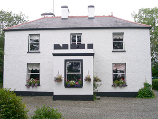
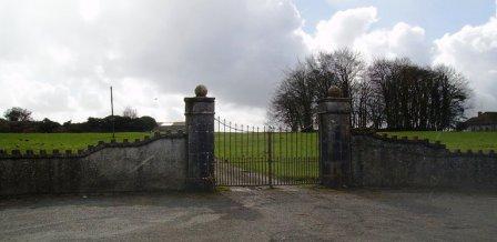
| Foyle View [Castle View] | The representatives of Robert Lepper were leasing this property from the Doherty estate at the time of Griffiths Valuation in the 1850s, when it was valued at £20. It had been noted by Lewis as the seat of Robert Lepper in 1837. This house is labelled Castle View on the 1st edition Ordnance Survey map of the 1830s. A building is still extant at the site. |
![Photo of Foyle View [Castle View]](https://landedestates.ie/storage/img/orig/3134.jpg)
|
| Foynes House | In 1837 Lewis describes a house on Foynes Island as a "handsome marine villa, the summer residence of the Earl of Dunraven". The 1st edition Ordnance Survey map shows a house named Foynes House on the southern part of the island. By the time of Griffith's Valuation this is in possession of Peter Griffin, leasing from the Spring-Rice estate and with a valuation of £1 15s. The later 25-inch Ordnance Survey map shows a much smaller property labelled Burneen, close to the site of Foynes House. This latter property is still extant. | |
| Frankfield | Located on the side of what is now the Frankfield Golf Club, Frankfield House was occupied by S. Lane in 1837 and by the Very Reverend H. J. Newman in the mid 19th century. Reverend Newman held it from William Lane and the buildings were valued at £60. | |
| Frankford House | Reverend Patrick Ratigan was leasing this property from Edward McEvoy’s estate at the time of Griffiths Valuation in the 1850s, when it was valued at £14. It held the same valuation when first valued in 1839. At that time it was occupied by Nathaniel O'Reilly. It is not extant now. | |
| Frankfort | Francis Sealy was leasing this property from F. Westcott at the time of Griffith's Valuation when it was valued at £19 though Lewis refers to "Woodview" as the seat of F. Sealy in 1837 and occupied by Oliver Ellard in 1814. Local sources indicate that this house was built by the Hodder family. See www.bandon-genealogy.com. More recently the Inishannon House Hotel. |

|
| Frankfort | This was a Woodley home, occupied by F. Woodley in 1837 and leased to Robert Wigmore in the early 1850s when the house was valued at £20+. The house was occupied until the 1970s but is now a ruin. |

|
| Frankfort | Samuel Adams was living at Frankford, Newcastle, in 1814. The residence of Richard Standish circa 1840 and of John White who held it in fee in the early 1850s. The buildings were valued at £9. This house is still well maintained and occupied. | |
| Freagh Castle | Mr Thomas Gorman was resident at 'Freigh', Miltown Malbay in 1814. By the time of Griffith's Valuation Matthias Kenny was the occupier and he held the property from Colonel George Wyndham. The Kenny family continued to live at Freagh until 1970. |
|
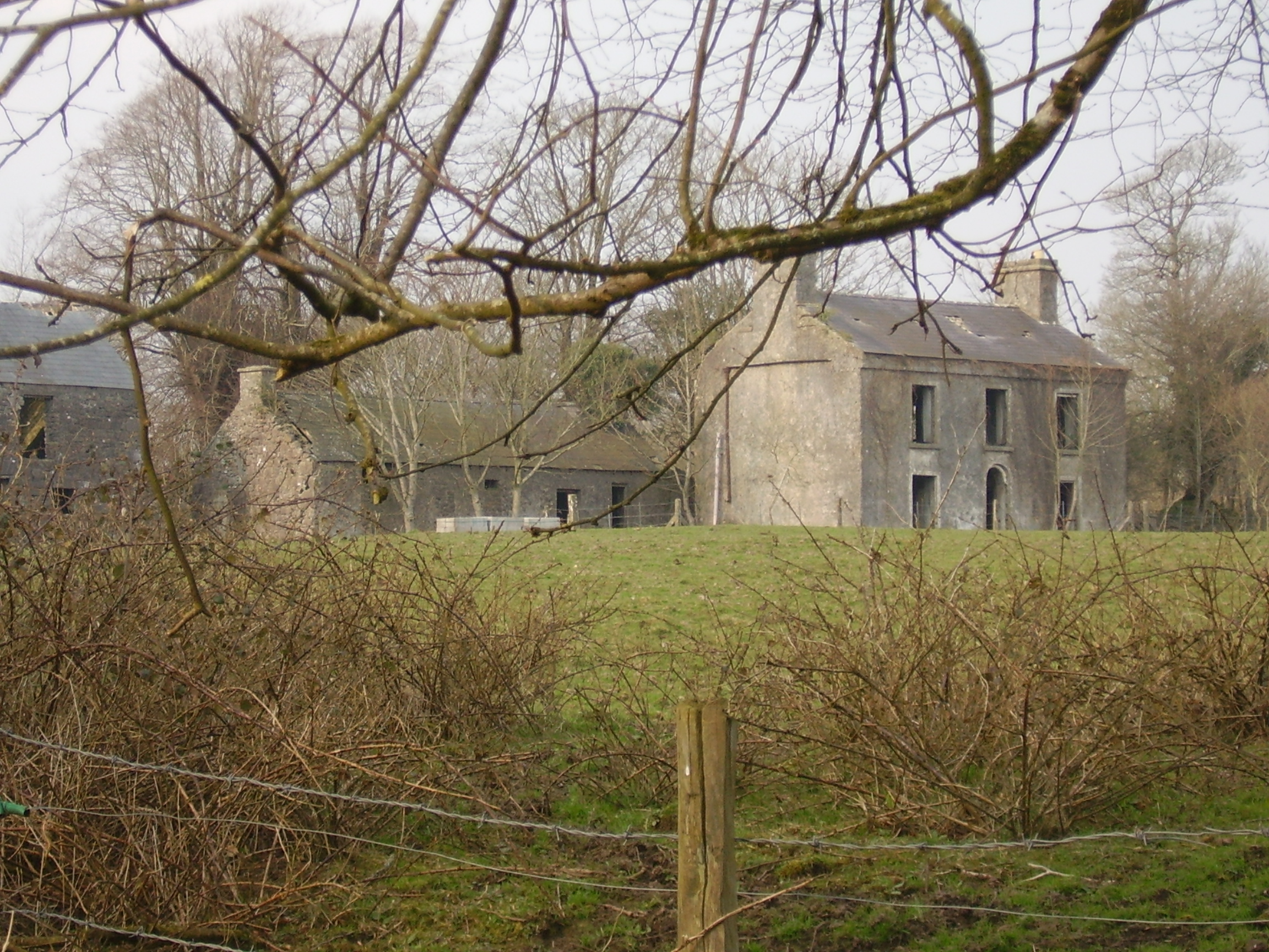
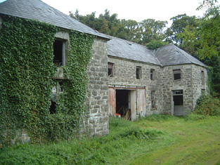
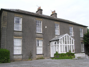
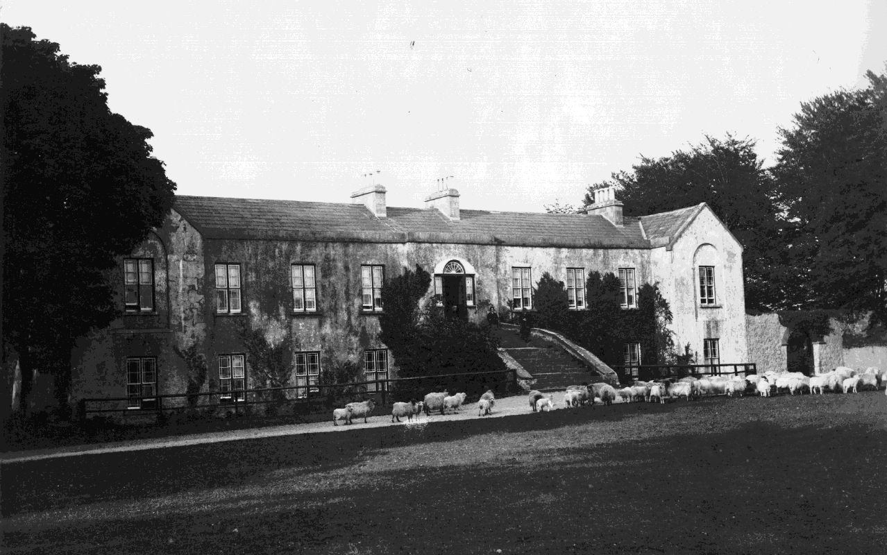
| Freame Mount | ||
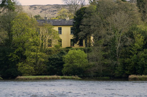
| Freame Mount | This house was built in 1772 (date stone confirms this) for Charles Mayne, land agent, on the Cremorne estate. According to a website dedicated to the history of the Mayne family, it was named after the second wife of Thomas Dawson, Hannah Freame, granddaughter of William Penn. The house was occupied by William Douglas in the mid-19th century and valued at £24. It was occupied by George John Levis, a bank official, and family in the early 20th century. |

|
| Freemount Lodge | Daniel Moynihan was leasing Freemount from the Earl of Kenmare’s estate at the time of Griffith’s Valuation, when it was valued at £5. Bary states that the house had been in the Moynihan family since the 18th century and that it later passed to the Mahony family. It has since been demolished and a modern house built there. | |
| French Park | At the time of Griffith's Valuation Frenchpark was owned by Rev. John Ffrench, Lord de Freyne and was valued at £60. In the 1749 Census of Elphin it was the residence of Arthur and Lady French. In 1786 Wilson described it as "a most beautiful seat with extensive and noble demesnes". It was demolished in the twentieth century. Members of the French family were buried in the graveyard surrounding the ruins of Frenchpark Priory. |
|
| Frenchfort | Frenchfort became a Blake property in 1780 when Michael Blake married Anne Ffrench of Frenchfort. Wilson mentions the house as his seat in 1786. He is described as a resident proprietor in 1824. At the time of Griffith's Valuation the house at Frenchfort in the parish of Oranmore was occupied by his grandson, Theobald Blake. The original house does not appear to be present now but the walled garden layout is still visible. |
|
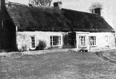
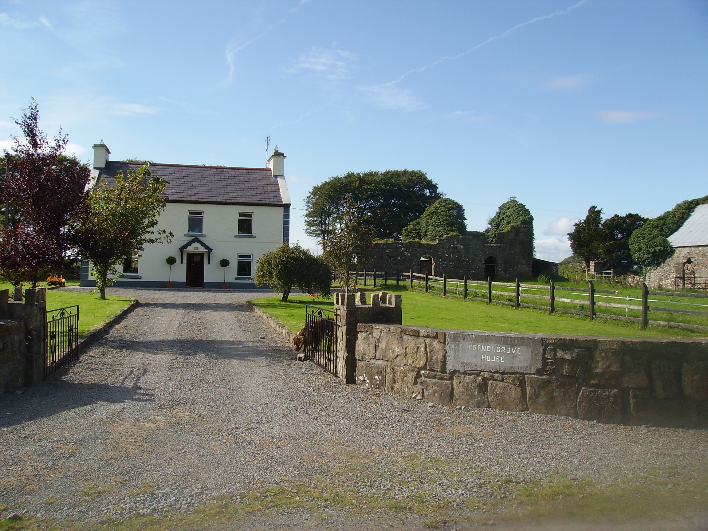
| Frenchgrove | A house marked as 'in ruins' on the 1915 edition of the 6 inch Ordnance Survey map. The Irish Tourist Association file describes Frenchgrove as the residence of the Blakes, later of the Frenches and finally of a man named Eager, a Dublin banker. No house of more than £3 valuation was recorded in Griffith's Valuation for the townland of Frenchgrove. A modern house now occupies the site with the remaining evidence of the old building. |
|
| Frenchlawn | At the time of Griffith's Valuation, the estate of William W.R. Sandford was leasing a property valued at £12 at Frenchlawn, barony of Castlereagh, to James Glancey. In 1837 Lewis recorded Frenchlawn as the seat of Mrs. French. In 1814 it was the residence of Christopher French. There is still an occupied house at this site. |
|
| Friarsfield | A house built circa 1870 for the Manserghs and shown on the 25-inch Ordnance Survey map of the 1890s. It is now occupied by Dr Martin Mansergh and family. In 1840 the Ordnance Survey Name Books refer to another house in this townland, occupied by James Southcote Mansergh and known as Newtown Cottage [R906377]. At the time of Griffith's Valuation, a property in this townland owned by Southcote Mansergh and valued at £40 was in use as an auxiliary workhouse. |

|
| Friarstown | In 1856 William Leith was leasing Friarstown from John Johnston at which time it was valued at £20. In the 1870s it was the address of Thomas Robert Palmer who owned over 1600 acres in Leitrim at that time. In 1814 it was the residence of Andrew Johnston and Lewis also recorded it as a seat of that family in 1837. The original house is no longer extant but modern buildings exist at the site. | |
| Friarstown | The National Inventory of Architectural Heritage states that he house was built in 1827 for David Urqhart Hunt and cost £10,000. At the time of Griffith's Valuation the house was occupied by Henry Hunt who held it from the Reverend Richard Maunsell, valued at £35. This property is now known as Friarstown Stud. |

|
| Friarstown (Grange) | At the time of Griffith's Valuation this house was held from James Kelly by James H. Barry, the buildings were valued at £12. In 1906 Bazil R. Kelly held about 400 acres of untenanted land and buildings valued at £12 at Friarstown. This house is still extant. |

|
| Friarstown (New) | A 2 storey house with offices which was built in 1826 by Vere Hunt on the townland boundary between Friarstown and Friarstown North. It was the residence of Vere Hunt at the time of Griffith's Valuation, held in fee and valued at £20. No house appears to exist at this location now. |
|
| Friendly Cove | Richard T. Evanson was leasing this property from John B. Gumbleton at the time of Griffith's Valuation, when it was valued at £24. Stores adjoining the property were valued at £6. Leet records this property as the residence of Nathaniel Evanson, jnr. in 1814. The house is still extant and in 2009 was offered for sale. |
|
| Frogmore | John McCartie or McCarthy was leasing this property from Sir Edward Denny at the time of Griffith's Valuation, when it was valued at £16. Lewis records Frogmore Lodge as the seat of Reverend Barry Denny in 1837.The Ordnance Survey Name Books reported that it was built by him in 1828 at a cost of £600 and was lived in, in 1840, by Mrs. Townsend Gunn. It is still extant. | |
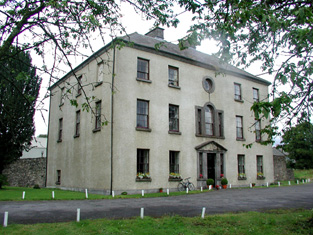
| Frybrook House | Frybrook House was built by Henry Fry, who came to Boyle in 1742, and established a weaving industry in the town. It is still extant. In 2025 it was offered for sale. |
|
| Furbogh House | At the time of Griffith's Valution, Andrew Blake held this property in fee when it was valued at £34. Furbough was demolished in the later twentieth century. The remains of the walled garden are still visible. |
|
| Furraleigh | Col. Palliser held this property in fee at the time of Griffith's Valuation, when it was valued at £34. In 1906 it was owned by Caroline G. Fairholme and valued at £44. | |
| Furzepark House | This house is noted on the 1st editon OS Map as Furze Park House but it may later have been known as Seafort House. The Ordnance Survey Name books describe it as a "bathing lodge, belonging to Mr. J. Smith, Loughrea". It was leased by the Blake estate to Martin Morris at the time of Griffith's Valuation when it was valued at £9. By 1906 the buildings owned by Lord Wallscourt at Treanlaur were valued at almost £2. Substantial ruins of this house are still visible. |
|
| Gaile | Gaile was the home of the Phillips family in the 19th century, occupied by S. Phillips in 1837 and by Richard Phillips in 1850. It was held from Benjamin Bunbury with 749 acres and was valued at £37+. The Phillips continued to reside at Gaile until at least the mid 20th century. This house was vacant in the early 21st century. |
|
| Galdonagh Upper | Charles Watson was leasing this property from the Abercorn estate at the time of Griffiths Valuation in the 1850s, when it was valued at £12. A hose and farm buildings are still extant at the site. | |
| Galeybeg | Occupied by Mr Bart Purdue in 1814 and in the 1830s described as a gent's seat belonging to Mr Bond with a neat demesne attached. The sale rental of 1856 states that it was built by the Reverend James Bond. In the 1850s held by Richard Bond in fee from the Court of Chancery and described as a herd's house with office. The home of Benjamin Greene in 1906. Occupied until the late 20th century, now derelict. |
|
| Gallagh | Built in 1844 with money inherited by Cornelius O'Kelly from his uncle Count John Dillon O'Kelly. By the early 20th century this house was part of the estate of W.A. Ryan. Subsequently it was sold to the Congested Districts Board and then to Tobias Joyce of Leenane, county Galway. It was accidentally burnt in 1932. |
|