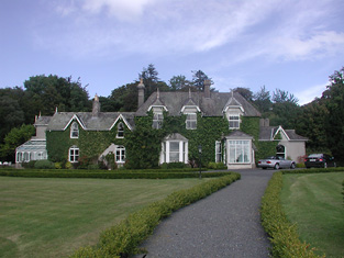
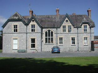
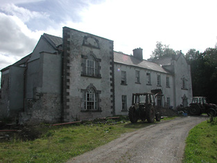
Williamstown Hotel
Houses within 10km of this house
Displaying 41 houses.
Houses within 10km of Williamstown Hotel
Displaying 41 houses.
| House name | Description | |
|---|---|---|
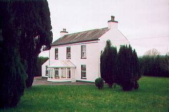
| Tintrim | Up to 1898 this house was in the barony of Leitrim, county Galway. It is now in the barony of Tulla Upper, county Clare. At the time of Griffith's Valuation, John A. Burke was occuping the house valued at £11, at Tintrim, parish of Clonrush, barony of Leitrim, county Galway. Weir states that the house at Tintrim was probably built by John Anthony Burke of Clondegoff Castle nearby. He was most likely a member of the Burke family who lived at Meelick House, Whitegate at the same time. Tintrim continued in the possession of the Burke family as John Anthony Burke moved out to allow his son, Edmund, and his family to live there until the house was sold in 1867. The house later passed to the Madden family and is still extant and occupied. The Irish Tourist Association file records state that John A. Burke died in 1857 though the family history suggests he died in 1863. The Tourist Association file also notes that in 1933 there was a search for the heirs of his reputed son, Martin Edward Burke, in Australia. |
|
| Meelick | Weir states that Meelick was a Burke house in the seventeenth century when Burkes, originally from Clondegoff Castle, in the barony of Longford, settled here. At the time of Griffith's Valuation Walter Blake was occupying the house at Meelick, parish of Clonrush, barony of Leitrim, valued at £17. In 1814 this property was the residence of Matthew Yelverton. The OS Name Books record Meelick as the home of Mr. Gilbertson. Lewis recorded it as "uninhabited" in 1837. There is still an occupied house at Meelick. The Irish Tourist Association file for the parish of Clonrush refers to Meelick as a substantial house with a concrete roof, ancestral home of the Burkes. |
|
| Drummaan | Drummaan House is described as "in ruins" on the 1st edition of the Ordnance Survey. The ruins have disappeared by the later 25-inch map of the 1890s. This townland is now located in county Clare. | |
| Knockbrack | At the time of Griffith's Valuation, Joshua Seward was leasing a house valued at almost £10 at Drummaan East, barony of Leitrim. Since 1898 this house has been located in county Clare. This seems to be the house shown on the 1st edition OS map as Knockbrack. A house valued at £14 at Drummaan East, county Clare, was owned by Maj. Gen. Spencer Cooper in 1906. | |
| Gweeneeny | John Sheehy was occupying a property valued at £8 at Gweeneeny, barony of Leitrim, county Galway at the time of Griffith's Valuation. This property has been located in county Clare since 1898. | |
| Woodpark (Woodpark Lodge) | Phillip Read was occupying Woodpark, parish of Inishcaltra, valued at £28, at the time of Griffiths Valuation. It was also recorded as his seat by Lewis in 1837. The OS Name Books record the existence of Woodpark House in Woodpark townland, "the residence of counsellor Reid". The house later passed by marriage to the Hibbert family. In 1894 Slater refers to it as the seat of Robert Fiennes Hibbert. In 1906 the house was valued at £69, the property of Flora J. Hibbert. It was destroyed by fire in June 1921. The site of this house is now located in county Clare. | |
| Mountshannon | This house was located in county Galway until 1898. Weir states that the original house at Mountshannon was a single-storey building which was enlarged to two storeys in the nineteenth century. At the time of Griffith's Valuation it was occupied by Mary Tandy and was valued at £12. In 1906 it was the property of James Wakely and was valued at £17. The house was damaged by fire in June 1921. It later came into the possession of the Talbots of Malahaide who presented it to An Óige (IYHA) for use as a youth hostel in 1956. It was offered for sale in 2007. |
|
| Oghilly | At the time of Griffith's Valuation, Michael Page was leasing a house at Oghilly, parish of Ballynakill, barony of Leitrim, county Galway from the Clanricarde estate. It was valued at £9. The National Inventory of Architectural Heritage suggests that this house dates from the 1770s. It is still extant and occupied. |

|
| Williamstadt House | Previously the residence of the Brady family, Williamstadt passed to Dr.Francis Sampson through marriage in 1833. At the time of Griffith's Valuation it was valued at £10 and Sampson was leasing it from James Egan. Up to 1898 this house would have been in county Galway. The house is still extant and occupied. |
|
| Moneenroe/Drummaan House | At the time of Griffith's Valuation Anthony Holland was leasing a property valued at £6 from James Egan, at Drummaan East, barony of Leitrim, county Galway. This seems to correspond to the property labelled Moneenroe on the 1st edition OS map. Other members of the Holland family were leasing lands from Egan in the same townland. On the 25-inch Ordnance Survey map of the 1890s this house is labelled Drummaan, the previous house of that name having disappeared. There is still an extant house at this site which is now located in county Clare. | |
| Richmond | Bence Jones writes that this was a fortified house onto which a three storey house was built in 1733. The house was later altered and expanded. Richmond was the seat of the Gason family in the 18th and 19th centuries, originally known as Killashalloe. Occupied by Richard Gason in 1814 and in 1837 and held by him in fee in the early 1850s when it was valued at £46. This house remained in Gason possession until 1956 when the roof was removed and the farm was sold in 1962. Part of the facade of the Ulster Bank headquarters at George's Quay, Dublin, was constructed from blocks of stone from Richmond House (''The Irish Independent'', 16 March 1999) . | |
| St Davids | Lewis refers to the fishing lodge of the Very Reverend Gilbert Holmes, Dean of Ardfert, "beautifully situated on the banks of the Shannon". At the time of Griffith's Valuation, the lodge was valued at £13.10 shillings, occupied by B. W. Holmes and held from John D. and William Kellett. This fishing lodge was altered in the 1860s and renamed St Davids. It remained in the possession of the Holmes family until the 1980s and now functions as a guest house and restaurant. It was offered for sale in 2011. |
|
| Castletown | ''Burke's Irish Family Records'' states that Castletown was purchased by Thomas Sadleir of Sopwell Hall from the family of his brother-in-law, John Briggs of Castletown, in 1706. It passed to Charles, the second son of Thomas Sadleir and was in the possession of his descendants for four generations. In 1747 it was leased to the Cambies by Charles Sadlier. Wilson mentions it as a Parker seat in 1786. In 1814 Leet records the house as unoccupied. C. Cambie was the occupier when Castletown was described by Lewis as a “a handsome castellated building”. Charles Cambie held Castletown from Thomas Sadlier at the time of Griffith's Valuation when the house was valued at £23. Castletown was sold in the Encumbered Estates Court in 1856, Miss Sarah Cambie was the tenant. Thomas Towers of Bushy Park, Borrisokane was the petitioner. He was married to Elizabeth Cambie and Castletown became their home. In 1906 the occupant was Thomas Towers and the house was valued at £24+. In the 1940s Miss Towers and her nephew Mr. Sterling were the occupiers. This 17th century fortified house with early 19th century additions is still in use as a family residence. It was also known as Castle Cambie. |
|
| Prior Park | Built circa 1780 to the design of William Leeson for James Otway, it became the seat of a branch of the Waller family in 1808. A small drawing of the house is included on the 1824 map. Occupied by W. Waller in 1837 and in the early 1850s, when the house was valued at £37 and held in fee. Members of the Waller family continued to reside here until the 1980s. Still a fine country residence. |

|
| Prospect | Taylor and Skinner record General Gabbet as the proprietor in the 1770s. This house was occupied by J. S. Handcock in 1837 and by Maurice Studdert in the early 1850s and held from Sir John Carden. The buildings were valued at £15.10 shillings. In 1840 it was described in the Ordnance Survey Name Books as "a good dwelling house with ornamental grounds, the residence of Thomas Purvis". Later leased to the Woodwards and still in use as a residence. |
|
| Annaghbeg | The home of the Minnitt family in the 18th and 19th centuries, occupied by Joshua Minnitt in 1814. The Ordnance Survey name books describe it as " good dwelling house" in 1840. It wa the residence of Joshua R. Minnitt in 1837 and in the early 1850s. He held the property from the representatives of Eccles Cuthbert and the house was valued at £37. This house is still a country residence. |
|
| Shannonvale/Kilteelagh | Occupied by Mrs Bunbury in 1814 and J. Odell in 1837. The Ordnance Survey Name Books describe it as "a spacious building, the residence of Mr. Cashel" in 1841. Peter Bailey was the occupier in the early 1850s, when the property was held from Mary Nunn. The buildings were valued at £10+. In the 1860s this house was replaced by a new building slightly to the north known as Kilteelagh House. It was built for Lieutenant Colonel W.C. Gason and is still a residence. It was offered for sale in 2012. Anoher Bayley property, known as Hazel Point Cottage, is located close by at R801860. |
|
| Oldcourt | John Brereton of Oldcourt was the second son of John Brereton of Rathurles and his wife, Margaret Watson. He had a son,John, born 1817. The Ordnance Survey Name Books refer to it as his property in 1840 but mention that it was "a commodious house" occupied by his land steward. John Brereton held Oldcourt in fee at the time of Griffith's Valuation when the house was valued at £12. A building is still extant at this site. | |
| Annagh Castle | Annah Castle was the home of Joseph O. Tabourdeau in 1837 and of Arburthard Goold in the mid 19th century. Goold held the property from John Minchin and the buildings were valued at £20. This building is no longer extant. | |
| Annagh | Annah was the residence of J. Minchin in 1837 and was held by John Minchin in fee in the mid 19th century when the buildings were valued at £18.10 shillings. Falkner J. Minchin was the occupier in 1906 and Commander Minchin in the early 1940s. Named on the first edition Ordnance Survey map as Annagh Lodge. This house is still a residence. |
|
| Bellevue | Belview, Nenagh, was the residence of G.W. Biggs in 1814 and in 1837. The Ordnance Survey Name Books note that Thomas Sadlier was the proprietor of Bellevue inn 1840 but that it was the residence of J.W. Biggs and was " a commodious house". Samuel D. Biggs was the occupant at the time of Griffith's Valuation. He held the house valued at £30 with 315 acres from Thomas Sadlier. Samuel D. Biggs was still resident at Belview in the 1870s. Major Biggs lived at Bellevue in the 1940s. Bellevue is still extant. |
|
| Brookfield | D. Cambie is recorded as the proprietor of Brookfield, Nenagh in 1814. The Ordnance Survey Name Books refer to Brookfield as the residence of E. Talbot but "Couns. Geddy [Grady] was the proprietor. In the mid 19th century John Parker was resident, holding the property from Henry D. Grady. The Parkers and Gradys were related. The house was valued at £17 and is still in use as a residence. John Parker was still resident in the 1870s. John's only daughter, Annie, married William James Reeves in 1892 and their eldest son was Henry Parker Reeves. This family is documented in the archive at Damer House, Roscrea. |
|
| Kilgarvan | Occupied by Mr Michael Connor in 1814 and by E. Cambie in 1837. Held by Solomon R. Cambie in fee at the time of Griffith's Valuation when the buildings were valued at £14.15 shillings. The Cambies sold Kilgarvan to the Reeves in the 1870s. This house is still extant and was for sale in 1999 and again in 2002. | |
| Waterloo Lodge | Located on the shore of Lough Derg the Reverend R.P. Vaughan was resident at Waterloo in 1837. The Ordnance Survey Name Books refer to it as his residence, "a neat cottage". Edward Biggs is recorded as the occupier in the mid 19th century, holding the property valued at £10 from Dr Malony. A building is still located at this site. | |
| Johnstown Park | This house was built for Peter Holmes, MP, c. 1777 and probably designed by William Leeson. It was originally known as Peterfield. It was leased to Samuel Prendergast in 1823. Lewis records J.G. Prendergast as resident in 1837 and the Ordnance Survey Name Books refer to it as the residence of Counsellor Prendergast in 1840. The house valued at £49 was occupied by Thomas G. Prendergast in the mid 19th century and held from the representatives of Peter Holmes. From 1865 to 1936 Johnstown was the home of the Headech family. The house was unroofed in the early 1940s and is now demolished. |

|
| Lodge | An early 18th century house, originally the home of the Barry family, sold by them to Lieutenant Colonel Joseph Gabbett in 1766. Passed by inheritance from the Gabbetts to the Studderts, it was occupied by Francis Green in 1814 and by W. Studdart in 1837. The Ordnance Survey Name Books refer to it as "a commodious ancient dwelling house, the residence of William Studdert" in 1840. Maurice Studdert was the occupier at the time of Griffith's Valuation, when the house was valued at £25 and held from the representatives of General Gabbett. Maurice Studdert was the son of the Reverend George Studdert, rector of Kilpeacon, county Limerick, his wife, Mary Gabbett of High Park. Mrs Eliza Studdart of Lodge, Nenagh owned 648 acres in the 1870s. |
|
| Mota | This house dates from about 1800. Edward Cambie was resident at Mota in 1814 and T. Pepper Roberts in 1837 and afterwards. The Ornance Survvey Name Books mention that it was his residence in 1840 and that Thomas Sadlier was the proprietor. Mota and 478 acres, the estate of Theobald Pepper Roberts, was advertised for sale in May 1850. George Taylor occupied the house valued at £15.10 shillings in the mid 19th century. He held it from Peter Byrne. Marcus Tuthill lived here later. This house is still occupied. |

|
| Blackfort | William Molloy was resident in 1814 and W. Minnett in 1837. Blackfort was advertised for sale in May 1851 by the Reverend David Fitzgerald, Edward Galwey was the petitioner. By the time of Griffith's Valuation Edward Galwey held Blackfort, or Lisduff as it became known, in fee. The buildings were valued at £15.10 shillings. Edward Galwey of Lisduff, Nenagh, owned 245 acres in county Tipperary in the 1870s. Richard Galway occupied Blackfort in 1906 when the house was valued at £22+. |
|
| Ballyanny | Lewis records J. Maher as resident at Ballyhenny in 1837. James Meagher occupied the house valued at £16 in the mid 19th century and held the property from Thomas Carroll. James Meagher of Ballyanny, Nenagh, owned 370 acres in the 1870s. | |
| Rockford | The original house was marked on the first edition Ordnance Survey map but it was enlarged and altered sometime after the first Ordnance Survey. Another house also known as Rockford House was built to the south east of the original house in 1881 for Theobald Richard Wolfe, Grid Ref R855 821. It remained in the possession of the Wolfe family until 1943. Rockfort (sic) was the residence of Jeoffrey Kingsley in 1814 and of J. Wolfe in 1837. In 1823 John Wolfe married Frances Elizabeth Kingsley, an only child. John Wolfe held the house valued at £18 and 232 acres from the representatives of General Chowe in the early 1850s. The Wolfes were still resident in the 1870s. |

|
| Castlelough | A circa 1820s house attached to an earlier building on the shore of Lough Derg, Castlelough was the seat of the Parker family. In 1786 Wilson refers to Castlelough and Castletown as seats of the Parker family. Occupied by Anthony Parker in 1814 and in 1837 who was succeeded in that year by his brother the Reverend Standish Grady Parker. The representaives of the Reverend Standish occupied the house at the time of Griffith's Valuation when the buildings were valued at £51+ and held in fee. The Parkers were still resident at the end of the 19th century. This house is still in use as a country residence. |
|
| Landsdown | In 1786 Wilson refers to "Land's-town" as the seat of Mr. Rolleston. The home of W. Parker in 1814 and of Mrs Parker in 1837. In 1840 the Ordnance Survey Name Books refer to "Landstown, a good dwelling house, the residence of William Parker". He was also the occupant in the mid 19th century when the house was valued at £55+ and held in fee. John Parker of Brookfield and Landsdown married Helena, daughter of George Washington Biggs of Bellevue. The Parkers were still resident in the 1870s. Bassett's Directory of 1889 refers to Charles E. Tuthill of Landsdown. In the 20th century the home of the White Spunner family. This house, built in 1779, was for sale in 1991 (see ''Country Life'' Volume 185). It is still extant. |
|
| Youghal House | In 1837 Lewis refers to the seat of W.Smithwick "surrounded by thriving plantations". The house was valued at £39 at the time of Griffith's Valuation and held by William Smithwick in fee. The Smithwicks were still resident at Youghal House in the 1970s. |
|
| Youghal Lodge | Located on the shore of Lough Derg this house is referred to in the Ordnance Survey Name Books in 1840 as Youghal Cottage. However it appears on both the 2st and 25-inch edition maps as Youghal Lodge. At that time it was owned by William Smithwich but Captain Barton was living there. It was occupied by Scrope Bernard at the time of Griffith's Valuation. He held the property from William Smithwick and the house was valued at £19+. A building is still located at this site. | |
| Monroe | Monroe was the residence of Robert Young in 1814 and Lewis describes it as the "neat cottage residence" of R. Power. Pierce Power held the property in fee at the time of Griffith's Valuation when the house was valued at £37+. Occupied by Hamo Massy Power in 1906. Yard buildings remain at this site. | |
| Carney Castle | Daniel Grace traces the occupation of Castle Carney by members of the Grace, Chissers, Saunders, Hunt, Gamble and Nugent families. He writes that in 1797 Catherine Nugent married Arthur French, a Dublin attorney, and that their son, Arthur, came to live in his new house in the 1830s. Lewis describes Carney Castle in 1837 as the residence of A. French "a handsome modern house on part of the site of the ancient castle, now in ruins, and formerly the residence of the Grace family". At the time of Griffith's Valuation Eliza French held the house valued at £17 and 160 acres in fee. In the possession of the Walpole family in 1866. The Falkiner sale rental of June 1873 refers to the deed of partition of the lands of Carney Castle in 1862 and that the Castle Division was alloted to Mrs Eliza ffrench for life. The rental describes Mrs ffrench as "deceased" and that her interest was for sale by her four daughters. | |
| Cloghprior House | The home of the Woodward family until sold to Edwin Cuthbert in 1844. The Ordnance Survey Name Books describes it as "at present in a state of very bad repair, but bears marks of ancient splendour". Held by Edwin Cuthbert in fee at the time of Griffith's Valuation and valued at £5.5 shillings. Daniel Grace writes that it was renovated by John Flower circa 1860s and leased to John Talbot. The Talbot family continued to reside at Cloghprior until the early 20th century. | |
| Garrykennedy | In 1786 Wilson refers to Garry-Kennedy as the seat of Mr. Watson. Lewis refers to the houses of G. Watson and - Kent at Garrykennedy. Two houses are marked in the townland on the first edition Ordnance Survey map Garrykennedy and Shannon ville. The Ordnance Survey Name Books describe Garrykennedy as "a good dwelling house, the residence of James Watson". It was bought by William Parker in 1857. By 1906 a mansion house valued at £25+ was located at Garrykennedy. It was occupied by Robert G. Parker. The building known as Garrykennedy House had been expanded and is marked on later maps. | |
| Woodpark (Cloghprior) | In 1841 the Ordnance Survey Name books refer to Woodpark as "a new house, the occasional residence of George Waller". At the time of Griffith's Valuation, it was held in fee by William Waller and valued at £7. Woodpark is now a ruin. | |
| Knigh Cottage | In 1840 the Ordnance Survey Name Books mention Right Hon. Thomas Lefroy as the proprietor of this house, "a neat cottage, the residence of William Kingsley". He was still the occupier at the time of Griffith's Valuation, when the house was valued at £5. Family history sources suggest that the Kingsley family continued to reside at Knigh Cottage into the early twentieth century when it was acquired by the Harty family. It is still extant. | |
| River View (Knigh) | James Kingsley was leasing this property from the Farrar estate at the time of Griffith's Valuation, when it was valued at £10+. In 1840 the Ordnance Survey Name Books refer to River View House as "a commodious dwelling house, the residence of John Tuthill, esq.". Buildings are still extant at the site. |