Browse Houses
Search Results: Returned 5927 records. Displaying results 3101 – 3200
| House name | Description | |
|---|---|---|
| High Park | Occupied by the Reverend J. W. Edgar in 1837 and by Bridget Hogan in the mid 19th century, valued at £12+ and held from William Coppinger. This house no longer exists. | |
| Highfield | John Daly was leasing this property from Robert D. Beamish at the time of Griffith's Valuation, when it was valued at almost £9. Farm buildings exist at the site now known as Highacres. | |
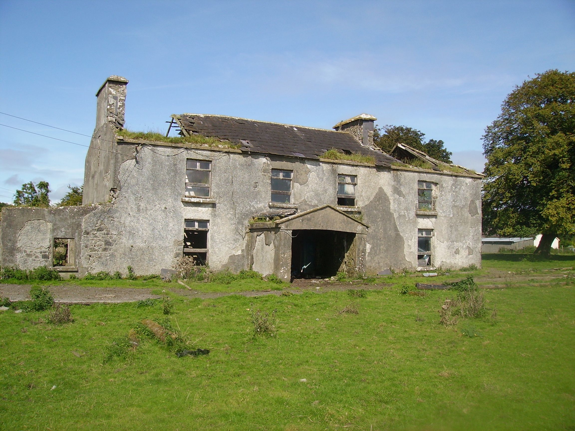
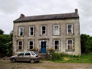
| Highfort | Reverend Somers Payne was leasing this property from Anne Nash at the time of Griffith's Valuation, when it was valued at £12. There is an extant house at the site which the National Inventory of Architectural Heritage asserts was built c.1880. |
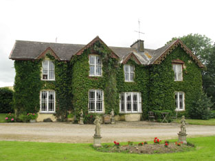
|
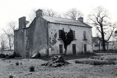
| Highfort | The Purcells originally lived in a thatched house located a short distance from the present building and this house was associated with a Whiteboy attack. John Purcell was knighted for his defense of his property. The later house was built by his son, Dr. Richard Purcell, circa 1837 and Dr Richard's wife, Mrs Eliza Purcell, was resident in the early 1850s when the house was valued at £21+ and held from Pierce Purcell. Mrs Eliza Purcell was the second daughter of Pierce Purcell of Altimira. Occupied by Daniel Stephen Wigmore in the early 20th century. The Irish Tourist Association Survey of the 1940s noted that it was then the residence of the O'Sullivan family. It is no longer extant. | |
| Highpark | A property in the possession of the Gabbett family from the early 18th century. Described in the Ordnance Survey Name Book as having a "decayed appearance", this three-storied house was built between 1759 and 1789. The house, valued at £10, was vacant at the time of Griffith's Valuation. It is still extant. |

|
| Highpark House | At the time of Griffith's Valuation, James Dowdican was leasing property from the Webber estate in the parish of Skreen including a house valued at £2 at Carrowgilhooly. This may be the property named as Highpark House both on the First and 25-inch editions Ordnance Survey Maps. There is still a house extant on the site. | |
| Hill House (Bandon) | William C. Sullivan was leasing this house from the Devonshire estate in 1851 when it was valued at £20. It is labelled Barrett's Hill House on the 1st edition Ordnance Survey map but as Hill House on the 25-inch edition of the 1890s. It does not appear to be extant now. | |
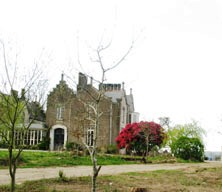
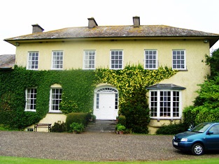
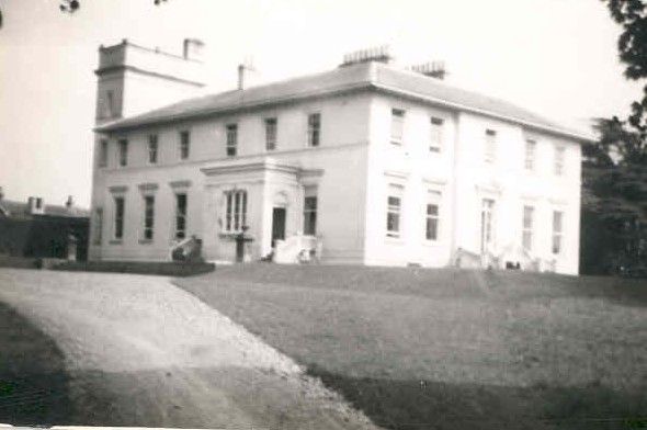
| Hill Ville | At the time of Griffith’s Valuation, this house, valued at almost £12, was being leased from Lord Ventry’s estate by Thomas de Moleyns. Lewis refers to HillVille as the seat of John Hickson. Bary quotes O'Donovan who claims that this house was built as a lodge, in 1833, by James Hickson. In 1906 it was still part of Lord Ventry's estate and valued at £16. It is now Crutch's Country House Hotel. |

|
| Hillgrove | Lewis refers to Hillgrove as the residence of J. Primrose in 1837.In the 1830s, the Ordnance Survey Field Name Books described it as " a rectangular building with two wings, all two stories high and in good repair". Bary states that Hillgrove House was built by John Primrose, senior, agent to the O'Connell estate, in the early nineteenth century. It was being leased by John Primrose, (possibly son of the earlier John) to Denis Coughlan, at the time of Griffith's Valuation, when it was valued at £19 5s.The property was offered for sale in July 1854 in the Encumbered Estates Court when David O'Connor is recorded as the tenant at Hillgrove. Primrose was also a principal lessor in the parish of Caher at this time. Hillgrove is now demolished and much modern development has taken place in the area. | |
| Hillpark | At the time of Griffith's Valuation, Sir Thomas Redington was leasing a property valued at £9 to Patrick Lynch. This property was on the outskirts of Clarinbridge village. | |
| Hillsborough Cottage | Robert Hilliard was occupying this property at the time of Griffith's Valuation when it was valued at £5 15s. The Ordnance Survey Name Books describe it as being two stories high and in good repair in the 1830s. | |
| Hillsbrook | The home of a branch of the Kirwans of Cregg in the first half of the 19th century. Occupied by Henry Campbell at the time of Griffith's Valuation when the house was valued at over £20. It is no longer extant. |
|
| Hillswood | In 1837 Lewis recorded Hillswood as the seat of Hyacinth Donnellan. At the time of Griffith's Valuation in 1856 Edmund Donnellan was leasing the house at Hillswood, together with almost 300 acres, to Obadiah Holland. It is no longer extant. | |
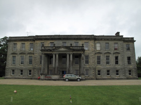
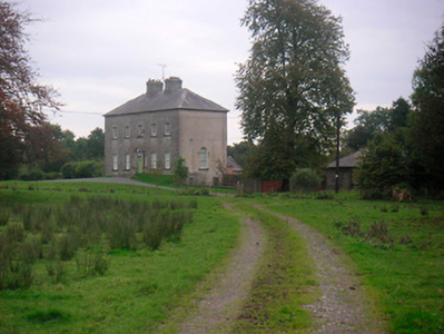
| Hilltown | Hilltown House, built in front of the ruins of a castle, is a three-bay three-storey over basement Palladian country house, built about 1780, possibly by William Webb. It was the home of William Webb in 1814 and in 1837. Valued at £26 at the time of Griffith’s Valuation (publ. 1854) it was occupied by George Webb and held from Lady Oranmore [and Browne]. Members of the Webb family were still resident in the early 20th century and O’Brien writes that the estate was acquired by the Land Commission. The house is still a private residence. |
|
| Hilltown House (Carrigaline) | Hilltown House was leased by Thomas Busteed from Anne Cook at the time of Griffith's Valuation, when it was valued at £8. It is labelled as Hilltown House on both the 6-inch and 25-inch Ordnance Survey maps. | |
| Hilton | This house is not marked on the first Ordnance Survey map. The National Inventory of Architectural Heritage dates the house circa 1850. At the time of Griffith's Valuation the representatives of J. Stephens held most of this townland from the Pennefathers. The home of the Grant family from at least the 1870s. Slater refers to it as the seat of Colonel G. Fox Grant in 1894. Valued at £22+ in 1906 and occupied by Joseph B. Grant. It is still extant. in 2015 it was offered for sale. |

|
| Hilton | Hilton, located just to the south of Modreeny House, was the home of Thomas Dancer, later 6th Baronet, in 1837 and of the 6th Baronet's son, Thomas J. Dancer, in the mid 19th century. Thomas J. Dancer held the house valued at £15 from his father Sir Thomas B. Dancer, 6th Baronet. In 1841 the Ordnance Survey Name Books had noted the house as the residence of Thomas Stoney. A house is still located at this site. | |
| Hilton | A house built after the publication of the 1st Ordnance Survey map. The home of the Grant family from at least the 1870s. Slater refers to it as the seat of Colonel G. Fox Grant in 1894. Valued at £22+ in 1906 and occupied by Joseph B. Grant. It is still extant. In 2015 it was offered for sale. |
|
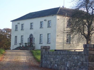
| Hilton Park | According to Shirley it was originally called Maddenstown, changed circa 1780 to Hilltown or Hilton. The Reverend Samuel Madden purchased the estate in 1734 and built the house. It was badly burnt in 1803. In Griffith’s Valuation the buildings were valued at £110 and held by John Madden in fee. The house was extensively enlarged in the 1870s for John Madden by William Hague. The gardens were designed by Ninian Niven. Hilton Park is still the family home of the Madden family where they offer luxury accommodation and authentic country house food, see http://www.hiltonpark.ie/ |
|
| Hoddersfield | Lewis refers to Hoddersfield as the seat of Col. Hodder in 1837 and held in fee by William H. Hodder in 1850. The house was then valued at £95. In 1894 Slater referred to it as the seat of William Hodder. In the 1940s the Irish Tourist Association noted that it was the residence of B Nicholson, who had bought the property from the Hodders and that the Library and other Hodder materials remained intact at the house. Hoddersfield is now a roofless ruin. |

|
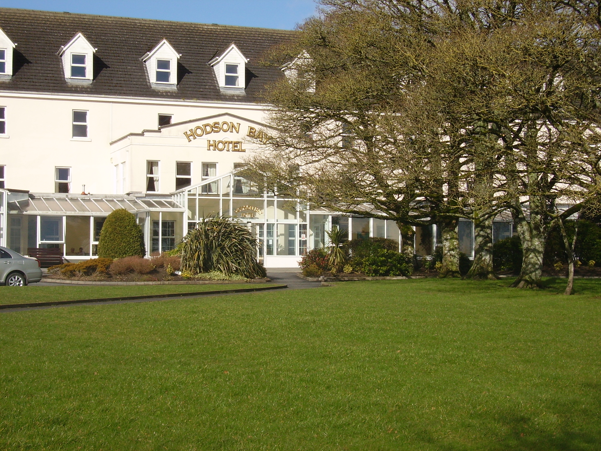
| Hodson Bay | The home of the Hodson family on the shore of Lough Ree. At the time of Griffith's Valuation occuppied by Leonard Hodson junior and Samuel Hodson, who held from the Court of Chancery. Now greatly expanded and functions as a hotel. |
|
| Hollow House | Marked on the 1st edition 6 inch Ordnance Survey map (1836), this house was extended and by the mid-19th century was valued at £12. It was occupied by James Cargill and was situated on the Leslie estate. In 1901, Samuel Cargill, a miller and farmer, was resident with his family. |
|
| Holly Park | In 1786 Wilson describes Holly Park as "the seat of Richard Taylor, it is very commodious and well-situated, having convenient offices and extensive demesnes". Lewis writes that Holly Park was the ancient residence of the Taylor family "now the property of Sir Aubrey de Vere". However Griffith's Valuation records Richard Taylor holding Holly Park in the early 1850s in fee. It was valued at £36. In 1894, Slater referred to it as the seat of George Taylor and in 1906 George Taylor held 277 acres of untenanted land and a mansion house valued at £34 at Currahchase North. Sold by the Taylors in 1939. Feheney writes that the son of Tom Clarke, one of the leaders executed in 1916, bought Holly Park from the Land Commission in the 1940s. The home of John Philip Cohane in the 1970s who had restored the house after a fire. It is still extant. | |
| Holly Park (Leitrim) | In 1786 Wilson refers to a house close to Leitrim village as the seat of William Houghton. He may be referring to the house named on the 1st edition Ordnance Survey map as Holly Park. At the time of Griffith's Valuation Francis La Touche was leasing this property, valued at £4, at Tullylannan, to Edgar Macklin. Extensive redevelopment has taken place in this area | |
| Hollybrook | This house was built in the 1750s as a successor to an earlier castle. The estate passed to the Phibbs family later in the 18th century and Wilson refers to it as the seat of William Phibbs in 1786. It was later bought back by another member of the ffolliott family. McParlan described it as "a very good house" in 1802. At the time of Griffith's Valuation it was the property of John Ffolliott. In 1906 it was the property of Agnes ffolliott when the house was valued at £55. During the twentieth century Hollybrook was run as a hotel for a number of years but it is now privately owned. The house is still standing but does not appear to be occupied. |
|
| Hollybrook | In 1786, Wilson refers to Boullybeg as the seat of Mr. Crean. This house was the home of the Creans and Crean Lynches. At the time of Griffith's Valuation the house was occupied by Ephraim and George Anderson, leasing from Patrick C. Lynch, when it was valued at £25. It is now a ruin. |
|
| Hollybrook | At the time of Griffith's Valuation, John Beecher held two substantial properties in fee at Maulbrack. They were purchased in 1703 by Henry Beecher from the trustees for forfeited estates. In the early 1850s the larger was valued at £36 10s. In 1837 Lewis and Leet in 1814, had noted Hollybrook as the seat of Richard Beecher. It was offered for sale in the Encumbered Estates Court in 1851 and again in February 1852 and April 1858, when the sale notice included a lithograph and floor plan of the house. A plan of the demesne is also included. This house was also the seat of the Beecher family in the late 1770s and noted by Wilson as the seat of an earlier John Becher in 1786. Colonel Anthony Morgan was the owner of a property valued at £150 here in 1906 and The O'Donovan was resident in the mid 20th century. The original house is not extant but a later house exists at the site. |

|
| Hollyfield House | At the time of Griffith's Valuation, Patrick Dwyer was leasing the townland of Edencullentagh or Hollyfield from the Gore Booth estate. This included Hollyfield House, then valued at £6. McTernan indicates that Dwyer was employed as a land steward by the estate. The house had a successionof owners thereafter and was in a derelict condition by the end of the twentieth century but has since been restored. |
|
| Hollyhill | David Hallahan occupied Holy hill, Rathcormack, in 1814 and S. Croker in 1837. Eliza Croker held the property from Francis C. Reeves in the mid 19th century, when the buildings were valued at £11.10 shillings. [for this Croker family see http://members.iinet.net.au/~nickred/croker_research/The_Irish_CROKER.pdf page 121]. Later the home of the Campion and other families, this house is no longer extant. | |
| Hollyhill | At the time of Griffith's Valuation Hollyhill house was the residence of Arthur Daly. Lewis recorded it as the seat of P. Kelly. In 1814 it was occupied by D. Shaughnessy. Michael J. Daly, owner of over 700 acres, was resident there in the 1870s. In 1906 it was owned by Denis B. Daly when it was valued at £9. It is still extant and occupied. | |
| Hollyhill House | Lewis refers to Hollyhill House as the seat of C. Newman in 1837. Leet recorded it as the seat of Thomas Newman in 1814. At the time of Griffith's Valuation, it was being leased by James Radcliff to Mary Anne Collis. Mrs. Collis was the owner of almost 1000 acres in county Tipperary in the 1870s. It does not appear on the 25-inch map of the 1890s and there is no evidence of it now. | |
| Hollymount | A very early 18th century house built by Archbishop John Vesey of Tuam, altered in the 19th century. In 1786 Wilson refers to it as the seat of Mr. Lindsay. It was held in fee by Thomas S. Lindsay at the time of Griffith's Valuation when it was valued at £61. The home of the Lindsey Fitzpatricks until 1922 and of Mr J Loftus in the 1940s, now a ruin. |
|
| Hollymount (Drumahaire) | Hollymount House is said to have been built around 1730. It was leased to Simon Armstrong by Lewis Algeo. Home of Thomas Corscadden in 1910. It is now a ruin but the outbuildings survive. |
|
| Hollymount (Inishowen) | Henry St. George Layard held this property in fee at the time of Griffith’s Valuation in the 1860s, when it was valued at £12. The house does not appear on the 1st edition Ordnance Survey map but is labelled Hollymount on the 25-inch edition of the early 20th century. By the early 20th century this property was owned by John Scott and valued at over £21. The National Inventory of Architectural Heritage suggests the house was built c.1850. A house is still extant at this site. |
|
| Hollypark | In 1814 Hollypark was the seat of Pierce Blake and at the time of Griffith's Valuation the property of Peter Blake when it was valued at £20. In 1894, Slater referred to it as the seat of Col. M.P. Blake. In 1906 Maria C. White held the mansion house at Hollypark. It is still extant and occupied. |
|
| Hollywell | Located on the Farnham estate and known as Tara Cottage on the first edition Ordnance Survey map (publ. 1837) and as Hollywell on the 25 inch map. An engraving in the National Library appears to be this house Hollywell Cottage and dates it to at least 1820, see https://catalogue.nli.ie/Record/vtls000152344. Occupied by the Reverend Henry Cottingham at the time of Griffith’s Valuation. Valued for rates at £14 the house was held from Mark Woods. The Reverend H. Cottingham held a townland in each of the parishes of Annagh and Urney at the time of Griffith’s Valuation. His representatives owned 381 acres in 1876. A building reduced in size continues to occupy this site. | |
| Hollywood | Occupied by James Raymond in 1814 this house became the residence of a junior branch of the Castle Hewson family. The home of James Hewson at the time of Griffith's Valuation who held the property valued at £17+ from Henry Fitzgerald. |

|
| Hollywood | Frederick Hyde was leasing a house valued at almost £10 from the Bland estate at the time of Griffith’s Valuation. Lewis records Hollywood as the seat of the Hyde family in 1837. Frederick Hyde was married to Elizabeth Bland. Bary states that the house was built in the 1830s, possibly on the site of an older house. It was occupied by the Bland family after they sold Derryquin but later fell into disrepair and is now a ruin. | |
| Holmesfort | In the 1940s the Irish Tourist Association survey notes that a house at Shinanagh, parish of Imphrick, was occupied by Major Thomas Holmes in the early nineteenth century and known as Holmesfort. It was replaced in the 1830s by another house, built by an O'Connor family. By the 1940s it had become the home of the O'Regan family. A house and farm buildings are still extant at the site. | |
| Holycross House | In 1840 the Ordnance Survey Name Books refer to Holycross House as a gentleman's residence. At the time of Griffith's Valuation, it was owned by Rev. Garret Wall but was unoccupied. The house was valued at almost £24. A house still stands at this site which now appears to be in use as a presbytery. |
|
| Holymount | At the time of Griffiths Valuation, in the 1850s, Holymount House was leased from the Batt estate by Marcus Knox. The house was then valued at £18 10s. [Marcus Knox may have been a naval officer associated with coastguard inspection]. The National Inventory of Architectural Heritage suggests it was built around 1840 but extended in the 1890s. |

|
| Holywell | Originally a Gunning home that passed to the Blakeneys by marriage. In 1786 Wilson mentions it as the seat of Charles Blakeney. Occupied by C. W. Blakeney in 1837 and by Henry Smyth in the 1850s who held the property from John Goodall. The property is no longer extant. | |
| Holywell | Holywell was built in the 1790s. In the early nineteenth century it was leased from the St. George estate by the Dockery family who in turn leased it to the Munns family, doctors in Carrick-on-Shannon. It was later the home of the Kiernan family and is now a country guesthouse. |
|
| Holywell | In his 1802 description of the Wynne estate McParlan mentions that Rev. Richard Wynne was about to build at Holywell, along the shore of Lough Gill. At the time of Griffith's Valuation John Wynne was leasing the house in Cloghermore to James Patterson when it was valued at almost £7. In 1894, Slater refers to it as the seat of Captain Gethin. This house is still extant and has recently been extensively renovated. |
|
| Holywell | At th time of Griffith's Valuation, John Burke Jnr. and Gerald Burke were jointly leasing this property from Hugh Burke, when the buildings were valued at £14. In 1786 Wilson refers to Holywell as a seat of Mr. Dillon. Some renovations were made to the house in 2005 by its current owner Eamon Healy. |
|
| Holywell/Hollywell House | A Comyn residence, George Comyn married Margaret Lysaght of nearby Ballykeale in the early 19th century. In 1814 occupied by George Comyn and in 1837 by T. F. Comyn. By the time of Griffith's Valuation the house was unoccupied and valued at £5, James Gibson was the immediate lessor. The house is still extant and occupied. |
|
| Honeymount | Honeymount was occupied by John Evans in 1814 and by Captain Lloyd in the early 1850s, when it was valued at £11.10 shillings and held from Leonard Williams. Robert Lloyd is recorded as the tenant in the sale notice of 1856. Honeymount, part of the estate of the Mahons of Co Clare, was advertised for sale in July 1871. A house is still extant at the site. In 2014 it was offered for sale. |

|
| Hop Island | At the time of Griffith's Valuation, Osborne Edwards was leasing this property from the Chatterton estate when it was valued at £16. It is labelled Hop Island on both the 1st and 25-inch edition Ordnance Survey maps. This may be the property referred to by Wilson as Red Island, the seat of Rev. Mr. Saunders, in 1786. A house is still extant at the site. | |
| Horn Head House | In 1786 Wilson referred to Horn Head House as the seat of Mr. Stewart. Lewis recorded Horn Head as the seat of W. Stewart in 1837. At the time of Griffith’s Valuation, it was occupied by Reverend Charles Frederick Stewart and valued at £27. In 1906 it was the property of Captain Charles F. Stewart and valued at almost £28. The National Inventory of Architectural Heritage suggests it was associated with the Stewart family since the early 18th century. It was sold by the family in the 1930s after it appeared that unstable sand dunes were encroaching on the site and has since been unoccupied. Since 2021 some work has been underway to renovate the property. |
|
| Horse Hill House/Knockagarran House (Raphoe South) | The Hone estate was leasing this property to the representatives of John Spear at the time of Griffiths Valuation in the 1850s, when it was valued at £15. It is labelled Knockagarran on the 1st edition Ordnance Survey map but as Horse Hill House on the 25-inch edition of the early twentieth century. It is still extant. | |
| Horse Island | At the time of Griffith's Valuation, Thomas Cave is recorded as holding a house in fee valued at £10 at Horse Island. No house is labelled on the 1st-edition Ordnance Map. The island was notable for its concentration of copper mines. | |
| Horsehead | In 1850, Horsehead was being leased by James Craig from William Lane and was valued at £60. In November 1859 it was offered for sale as part of the Boland estate. Lewis refers to it as the seat of S. Lane in 1837, "an elegent mansion in the Tudor style". In 1943 the Irish Tourist Association Survey noted that the horses of the Duke of Wellington's cavalry had grazed on the front lawn at Horsehead prior to embarking for Europe. It is still extant and occupied. It was offered for sale in 2024. |
|
| Horsehead Cottage | Held from Thomas Boland's estate by Samuel Abbott in 1850 when it was valued at £38 10s. It was included in the sale of the estate in November 1859. It is no longer extant. | |
| Houndswood | In 1786 Wilson refers to Houndswood as the seat of John D'Arcy. It was held in fee by John S. Dawson at the time of Griffith's Valuation when it was valued at £10+. A thatched house, it was accidentally burnt in the early 20th century. |
|
| Hughestown | The seat of the Mulloy family is described as Hughestown but at the time of Griffith's Valuation the buildings at this location are described as "offices" and have a low valuation. C.M. Mulloy was resident at "Husetown"in 1749. Wilson refers to Hughes-town as the seat of Mr. Molloy in 1786. In 1814 Hughestown was the seat of Mulloy McDermott. | |
| Hunting Fort | A house valued at £10 occupied by Patrick Keneiry and held by him with 338 acres from the Duke of Devonshire in the mid 19th century. A building is still extant at this site. | |
| Hunting Hill | Hunting Hill, a single storey house, in the townland of Ballyhimock is marked on the first Ordnance Survey map. Home of the Dwyer family in the first half of the 19th century it was occupied by Mr William Dwyer in 1814 and by Thomas Dwyer at the time of Griffith's Valuation. Located on the Annesley estate it was valued at £15. Various tenants lived at Hunting Hill in the latter half of the 19th century until it was leased to Edward Vaughan, whose descendants continue to live here throughout the 20th century. A house is still extant at the site. | |
| Huntingdon | Huntingdon, a five-bay two-storey over basement country house, built about 1770 by the Purdon family, it remained a Purdon home for all of the 19th century. Robert Purdon was resident in 1814 and 1837. Augustus Cooke Purdon held the house from Robert Purdon at the time of Griffith’s Valuation (publ. 1854), when it was valued at £20. Purdon family members were still resident in the early decades of the 20th century and the house remains extant. |
|
| Huntly | Denis Delahunt was recorded as the occupier of a house, valued at £8, at Feagh, in the parish of Kiltormer, at the time of Griffith's Valuation. In 1906 the house at Feagh was owned by John A. O'Kelly and was valued at almost £6. A substantial modern farm exists at the site. | |
| Hurdleston/Hurdlestown | This was the seat of the Bentley family in the 18th and 19th centuries. The present house dates form 1871 and may well incorporate parts of the former house. The buildings were valued at £40 in 1906. Restored at the end of the 20th century. |

|
| Hydepark | Hyde Park, located north of Kinnegad, is a five-bay two-storey over basement country house, built about 1775 by James D’Arcy. This family were related to the D’Arcys of Corbetstown. John D’Arcy, son of James, was resident in 1814 and 1837. George D’Arcy, son of John, held the property in fee at the time of Griffith’s Valuation (publ. 1854) when the house was valued at £23. In 1906 George N Darcy is recorded as the occupant holding the property with 425 acres of untenanted land. Two D’Arcy sisters were living in Hyde Park in 1911. |
|
| Hymenstown | This house was the home of the Robbins family in the 18th and 19th centuries. Occupied by George Robbins in 1814 and by R. Scully in 1837. Michael Cleary was resident at the time of Griffith's Valuation holding the property from Nathaniel E. Robbins, when the buildings were valued at £20. Included in the sale of the Earl of Portarlington's estates in June 1856. John Graham was living at Hymenstown in the 1870s. This house is still extant. |
|
| Hymenstown House | Hymenstown House is shown on the 25-inch Ordnance Survey map of the 1890s. The National Inventory of Architectural Heritage suggests it was built sometime in the 1860s. The house on the site at the time of Griffith's Valuation was owned by Nathaniel Robbins and valued at under £2. In 1901 it appears to have been the property of Alex Going but was vacant at the time. Hymenstown House is still extant and occupied. |
|
| Ieverstown | A house held by John A. Ievers in fee at the time of Griffith's Valuation when the building was valued at £11.10 shillings. Still inhabited it stands close to the road. | |
| Inagh Lodge | A fishing lodge built in the 1880s by the Berridge family, now a hotel. See http://www.loughinaghlodgehotel.ie/en/history-hotel/ |
|
| Inane | In 1786 Wilson mentions Inane as the seat of Rev. Curtis. Robert Curtis was the proprietor of Inane, Roscrea, in 1814 and P. Jackson was resident in 1837. By the time of Griffith's Valuation Frederick A. Jackson was the occupier, holding the property in fee. The buildings were valued at £50. There appear to be two houses at Inane, a nine bay house dating from the early 18th century and a 19th century house very closeby. The Jacksons were still resident in the 1870s and the representatives of Henry V. Jackson held the property in 1906. It is still extant. |
|
| Inane | At the time of Griffith's Valuation, Rev. Richard Marmion was leasing this property to Thomas Long when it was valued at £16 5s. Noted by Lewis as the seat of H. Marmion in 1837, it is labelled Inane on both the 1st-edition and 25-inch Ordnance Survey maps. There is still an extant house at this site. A smaller property in the same townland, labelled Inane Cottage [W042286], was leased by Patience Marmion from Samuel Townsend in 1853, when it was valued at almost £4. A house still exists at this site also. | |
| Inch | An 18th century building which was the seat of the Ryan family. The Irish Tourist Association Survey records that the Ryans, a Catholic family, came from Munroe to Inch and that their lands were held for them by Aneas Burke of Kilkenny during Penal Times. Wilson, writing in 1786, refers to Inch as the seat of Mr. Ryan. The house was occupied by Daniel Ryan in 1814. Daniel died in 1831 and was succeeded by his brother, George Ryan,who was resident in 1837. The house was valued at £53 at the time of Griffith's Valuation and was held in fee by George Ryan. It was recorded by Slater as the seat of George E. Ryan in 1894. The Ryans continued to live at Inch House until 1985 when it was sold to John and Nora Egan. The building now functions as a county house and restaurant run by the Egan family, see http://www.inchhouse.ie/about-us/a-brief-history-of-inch-house/ |
|
| Inch House (Inishowen) | At the time of Griffiths Valuation, Isaac Colhoun was leasing this property from Lord Templemore's estate when it was valued at £21. In 1837 Lewis referred to Inch House as the seat of J Kennedy. The National Inventory of Architectural Heritage describes it as an important early eighteenth century house but with later remodelling. It is still extant and occupied. |

|
| Inchareagh Lodge | Andrew Talbot was leasing this property, valued at £16 5s, from Lady Anne Headley, at the time of Griffith's Valuation. Bary states that the Eager family had resided here until the early nineteenth century. Later it became the residence of one of Lady Headley's employees. It now forms a complex of buildings, some of which are modern and some much older. | |
| Inchbeg | Located on the Fitzgerald estate, this house was occupied by Henry Young, at the time of Griffith's Valuation. The buildings were valued at £11.15 shillings and he also held a mlll valued at £84. A house is still extant at the site. |
|
| Inchera | This house, also known as Sun Lodge, was the home of the Oliver family. Occupied by S. Oliver in 1814 and Silver Charles Oliver in 1837 and in the 1850s. The buildings were valued at £54 and the property was held from the Reverend Rowland Davis Gray. Owned by C.E. Murphy in the first half of the 20th century. Post 1950 it was destroyed by a fire. | |
| Inchiclogh House | Hamilton White held this property in fee in 1852 when it was valued at almost £34. Lewis refers to it as the seat of R. White in 1837. It is included in the Encumbered Estates Sale Notice of December 1852, which indicates that it was held by Elizabeth White, a widow, by lease from the Court of Chancery. The property does not appear on the 25-inch Ordnance Survey map of the 1890s. | |
| Inchinveema | Christopher Gallway was leasing this property to Daniel Sullivan at the time of Griffith's Valuation, when it was valued at £6. Buildings are still extant at the site. | |
| Inchiquin Cottage | A house on the Marquess of Thomond's estate, valued at £3 at the time of Griffith's Valuation and occupied by the Owens family in the first half of the 19th century. | |
| Inchiquin House | In the early 1850s Henry Hall occupied this house valued at £15 located on the Ponsonby estate. | |
| Inchirourke More | The residence of Hunt Esq in the 1770s and in 1786. Occupied by Edward Hunt in 1814. At the time of Griffith's Valuation, Robert Hunt held the house, valued at £6.5 shillings, and over 500 acres in the townland of Askeaton from Sir Matthew Blakiston. It is still extant. |

|
| Inchydoney House | At the time of Griffith's Valuation, Thomas Hungerford was leasing this property from the Ecclesiastical Commissioners when it was valued at £22. Described by Lewis as "Island House" and the seat of T. Hungerford in 1837. In 1906 it was owned by Mary Sandes Hungerforde and valued at £31 15s. The house is now used as a religious retreat centre. |

|
| India Villa | Valued at £18 at the time of Griffith's Valuation, India Villa was held on a lease from Patrick A. Shannon to William Phayre and was described in 1856 as "an exclusive modern residence". It is no longer extant. | |
| Inish Beg House | Originally a summer retreat but eventually completed by the McCarthy-Morrogh family as a house in 1899. Inish Beg Estate now provides luxury holiday accommodation. |
|
| Inishleena | Located on the Devonshire estate, Inishlenna Abbey was occupied by Cross Fitzgibbon at the time of Griffith's Valuation and in the 1870s. The buildings were valued at £10. The location of the Abbey is now under water as part of a reservoir. | |
| Innishannon House or Castle View | Rev. Robert Maunsell was leasing this property from the Frewen estate at the time of Griffith's Valuation, when it was valued at £22 10s. It is labelled Castle View on the 1st edition Ordnance Survey Map but named Inishannon House on the 25-inch map of the 1890s. It was burnt in June 1921 during the War of Independence. | |
| Inver Lodge | Henry Edward Porter held a house in fee, valued at £14, in Magheross on the outskirts of Carrickmacross, circa 1860. This appears to be Inver Lodge which is named on the first edition Ordnance Survey map (publ. 1836). | |
| Inver Lodge | Henry Edward Porter held a house in fee, valued at £14, in Magheross on the outskirts of Carrickmacross, circa 1860. This appears to be Inver Lodge which is named on the first edition Ordnance Survey map (publ. 1836). This house is still extant. | |
| Inver Lodge | J.Gibbons of Inver is listed in Lewis. | |
| Irishtown | Irishtown is named on the first edition OS map and the 25 inch map. In the late 1770s it was the home of Johnston. The Banon/Bannons lived here in the 19th century. Lewis records J Banon as resident in 1837 and Christopher J Bannon was the occupant at the time of Griffith’s Valuation (publ. 1854). He held the house valued at £15 from William H Magan. The Banons were still living at Irishtown at the time of the 1901 and 1911 censuses. The house was demolished in the 1960s but outbuildings remain. | |
| Ironpool | A Jenings home, described as a "good thatched 2 -storey dwelling house" in 1852, occupied by George Jenings. It was held in fee by William Ogilvie at the time of Griffith's Valuation when it was valued at £6. It is now a ruin. |

|
| Island House | Lewis refers to a "handsome newly erected cottage on the island" in his description of Castleconnell in 1837. Earlier, in 1786, Wilson refers to Park, situated on an island created by a canal and the river Shannon, as the seat of Sir Richard de Burgho. Island House valued at £17+ was the residence of Sir Richard De Burgho at the time of Griffith's Valuation. He held the property, which was surrounded by nine acres, in fee. In 1894, Slater refers to "The Island" as the property of Lady de Burgho. |

|
| Islandbawn | Malachi Ryan held a house, offices, flour mill and 76 acres at Islandbawn from the Honourable O.F.G. Toler at Islandbawn in the mid 19th century. The buildings were valued at £85. |
|
| Islandmacloughry | Thomas O'Connell was leasing this property from the Earl of Listowel's estate at the time of Griffith's Valuation, when it was valued at £8. Buildings are still extant at the site. | |
| Islandmagrath House | Originally a Burton property bought from the Earl of Thomond, Islandmagrath was leased to Edward Maunsell by the Marquess of Conyngham at the time of Griffith's Valuation. It is described as "steward's house", with a £10 valuation. A house and farm buildings are still extant at the site. | |
| Islandmore | Tooreen, located just south of the town of Croom, was the residence of James D. Lyons in 1814 and 1837. By the early 1850s this house, then known as Islandmore, was occupied by Robert Maxwell, valued at £60 and held from Miss Catherine Giles. It later became the home of the Kelly family and Slater refers to it as the seat of John Roche-Kelly in 1894. Colonel Basil Roche Kelly was resident at the time of the Irish Tourist Association survey of 1943. The surveyor wrote that the house was originally Georgian but had suffered many alterations. |
|
| Ivy Cottage (Bantry) | Jeremiah O'Connell was leasing this property from Robert E. White at the time of Griffith's Valuation, when it was valued at £24. A substantial farmyard was located nearby. By the later nineteenth century the house appears to have been known as Beach Cottage. A slightly later building, known as Ardeevin House, exists at this site now. |

|
| Ivy Hall (Loughkeen) | The Ordnance Survey Name Books refer to Ivy Hall as the residence of Richard Palmer in 1840. By the time of Griffith's Valuation, it was occupied by Mary Anne Palmer, who was leasing from William Abernethy, and valued at almost £8. Ivy Hall is still extant and occupied. |
|
| Ivy Hill | A house located on the Anketell estate, marked on the 1st edition 6 inch Ordnance Survey Map (1836) with a walled garden. The house was described as ‘small but very neat being 2 stories high and built with rough stone’. In the mid-19th century the buildings were valued at £12 and John W. Johnston was the occupant. A building is still located at this site. | |
| Ivy Lodge | McTernan states that Ivy Lodge was built on the Caulfield estate in the 1870s, possibly replacing an earlier building. It was initially occupied by the agent to the estate, William Holmes, and later by Edward Purdue, the gamekeeper. Agrarian unrest occurred on the estate in the late nineteenth century, including a boycott of the Purdue family. The property was sold in 1912 and acquired by the Congested Districts Board in 1917 when the lands were divided. The house is still extant and occupied. | |
| Jamesbrook Hall | The home of the Adams family, occupied by Michael Go[o]ld Adams in 1814 and by Richard W. G. Adams in 1837 and in the early 1850s when the house was valued at £60 and held from the Marquess of Thomond. Occupied by William R. G. Adams in 1906. Recently renovated and restored. |

|
| Jamestown Court | Jamestown Court is located to the north west of Castle Geoghegan. It is a three-bay two-storey over basement country house with six-bay single-storey over basement wings to either side (boi). It was originally built in 1740, the date is inscribed on a window opening but was substantially altered at a later date which may be why Lewis records it in 1837 as a ‘spacious and handsome castellated mansion of modern erection’. This house was the home of the Nagle family and the property was originally in the ownership of the McGeoghegan family who were direct ancestors of the Nagles. From the late 18th century Jamestown Court was the home of Sir Richard Nagle, Baronet. He also had connections with Donore Castle, near Horseleap, which he ‘restored’ in 1809. Jamestown Court was later the seat of Sir Richard Neagle (Nagle) Geoghegan 2nd Bt in 1846 (Slater’s Directory). Following his death in 1850 it was inherited by his sister Frances Mary who was married to John Grace of Mantua House, Co Roscommon. At the time of Griffith’s Valuation (publ. 1854) the house was valued at £13, occupied by John Lynam who held the property from John Ennis with 156 acres. The rest of the townland was held by John Grace. In 1901 and 1911 occupied by Lt Colonel Gilbert Lavillan Nugent and family. For sale in 2012 and bought in 2013. |
|
| Jamestown House | Jamestown House was not built at the time of the first edition OS map. Situated on the main Mullingar to Athlone road the house, three-bay two-storey over basement house, was occupied by James Brabazon at the time of Griffith’s Valuation (publ. 1854) when the building was valued at £12 and held from Walter McK Bond. |
|
| Jamestown House or Jamestown Lodge | At the time of Griffith's Valuation Hugh O'Beirne was occupying a house at Jamestown, barony of Leitrm, valued at £40. Jamestown House was held by the O'Beirne family until the twentieth century though in 1894 Slater refers to it as the seat of Gilbert King, junior. In 1906 it was also valued at £40. It is still extant and occupied. |
|