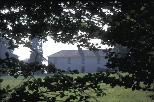
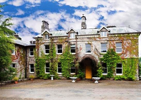
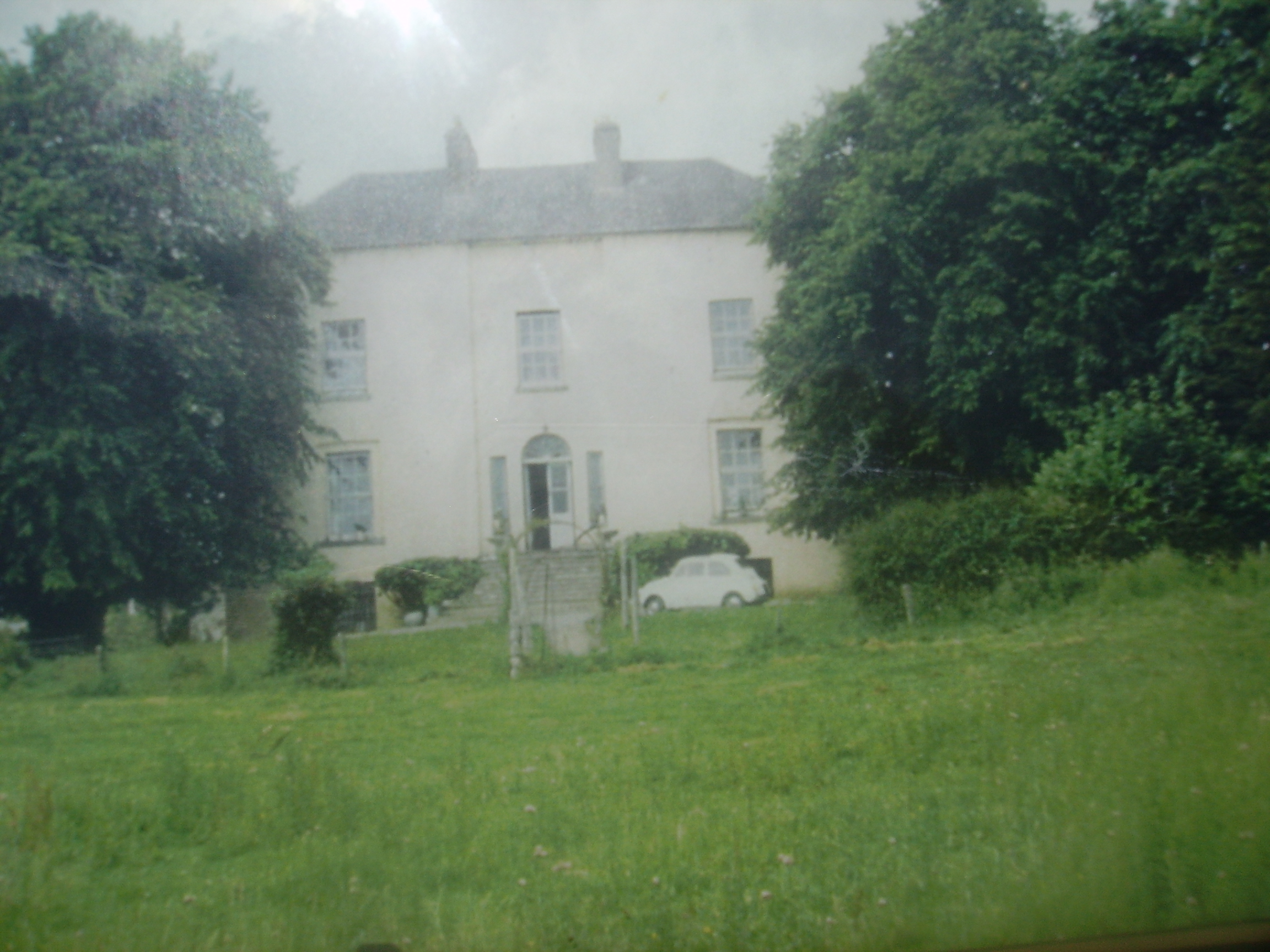
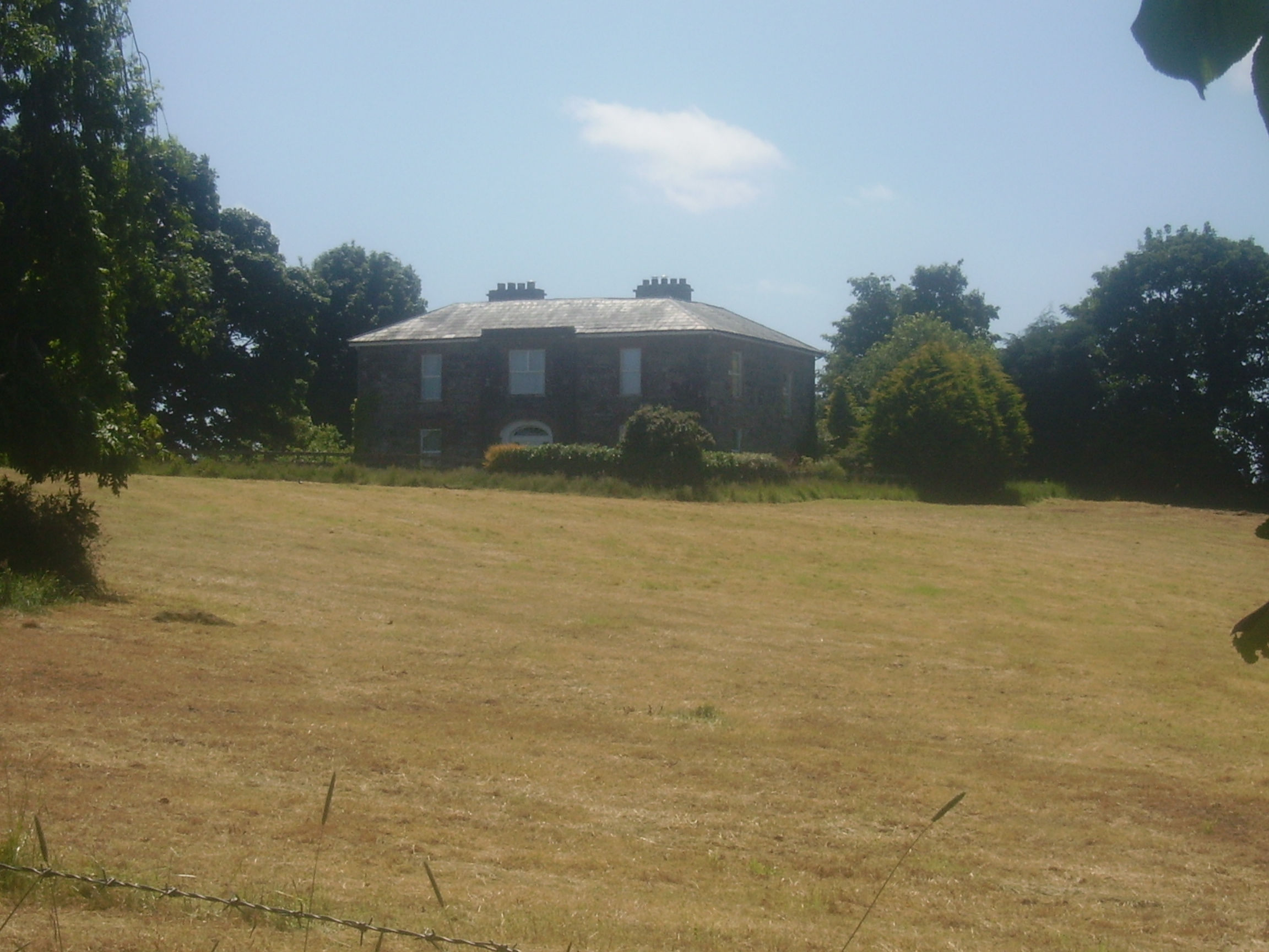
Violet Hill
Houses within 15km of this house
Displaying 109 houses.
Houses within 15km of Violet Hill
Displaying 109 houses.
| House name | Description | |
|---|---|---|
| Dangan | The main residence of the Creagh family in the 18th and 19th centuries, held by Cornelius Creagh in fee at the time of Griffith's Valuation when the house was valued at over £25.. Sold in the 1920s, the Irish Tourist Association Survey file records the house as dilapidated and going to ruin in the 1940s. Weir writes that the house was demolished in 1948. | |
| Castlecrine | Weir writes that this was an 18th century residence possibly incorporating the 16th century tower. Castlecrine was the home of a branch of the Butler family for most of the 18th and 19th centuries, valued at £45 at the time of Griffith's Valuation, it was demolished in the mid 20th century. |

|
| Castlelake | Home of the Gabbett family in the 19th century, occupied by Robert Gabbett in 1814 and by John Gabbett in 1837 and in the 1850s. They held the property from the Westropp family with whom they intermarried. Home of the Carroll family in the second half of the 20th century, still occupied. | |
| Ieverstown | A house held by John A. Ievers in fee at the time of Griffith's Valuation when the building was valued at £11.10 shillings. Still inhabited it stands close to the road. | |
| Mount Ievers | A house built in the 1730s by Henry Ievers to the design of John Rothery. Wilson refers to it as the seat of Mr. J.A. Ievers in 1786. Occupied by Robert Ievers in 1814 and by W. Ivers in 1837. Eyre Ievers was resident at the time of Griffith's Valuation, holding the property from James Ievers. The Ievers family still live in the house. |

|
| Ballintlea | Weir writes that the original house dates from 1696. Ballintlea was occupied by John Kelly in 1837, who is recorded as holding the property in fee at the time of Griffith's Valuation. The Kellys appear to have bought Ballintlea from the D'Esterres. The Kelly and Kelly Roche families have resided there ever since. Fitzjames Kelly was in possession in 1906. | |
| Burtonhill House | Weir writes that this house was probably built by the Carrigaholt Burtons as a sporting lodge. It is marked on the first edition Ordnance Survey map. The Burton Conynghams had a large estate in the parish of Killeely so there can be no doubt that the house was named after them. By the time of Griffith's Valuation it was valued at £11 and Edward H. Goggin was in residence. He held the property from Mrs Taylor. William B. Goggin of Burton Hill married Frances Maria Whitestone in the second half of the 19th century. see http://brew.clients.ch/RichardClare.htm | |
| Summerhill House | Built on the Marquess of Conyngham's estate by the time of the first Ordnance Survey, this house valued at £10 was occupied by John Frost in the mid 19th century and it continued to be the home of the Frosts until the 1970s. A substantial farm still exists at the site. | |
| Ballycannan | A house held by James Gloster in fee at the time of Griffith's Valuation and valued at £20. This house is marked on the first Ordnance Survey map. | |
| Athlunkard House | Hamilton Jackson held what was described as a steward's house from Colonel George Wyndham at the time of Griffith's Valuation. It was valued at £14. Weir also describes a house known as Clare Cottage in Athlunkard. | |
| Ballyglass | Weir writes that this was originally a McAdam property. Ballyglass was described as a steward's house at the time of Griffith's Valuation and was held by Andrew Caswell in fee. It was valued at £10. Modernised in the Tudor style in the early 20th century the house is still inhabited. It was valued at £25 in 1906 and was then in the possession of Mark Maunsell. Also known as Rosmadda House. | |
| Blackwater House | Home of the McAdam family in the 19th century before they moved to live in Sussex. The house was valued at £16 in the mid 19th century and was the residence of Philip McAdam. In 1894 Slater refers to it as the residence of Mrs. Caswell. Also known as Springhill House, it is now demolished. | |
| Fairy Hill | This house was situated on the Gore estate and was the residence of John McDonnell in the mid 19th century who held the property from Charles William Gore. It was valued at £14. In 1837 it was inhabited by E. Burnard. Although the house became derelict in the early 20th century it was later reconstructed and is still a residence. | |
| Quinsborough | The original lease of this property was dated 26 September 1712 from the Earl of Thomond to Henry Widenham. The house was built in 1767 by George Quin, son of Valentine Quin and his wife Mary Widenham. Wilson refers to it as the seat of Mr. Quin in 1786. It was the residence of his grandson, Lord George Quin, in 1814. In 1837 Lewis records Quinsborough as the home of Martin Honan, who was elected Lord Mayor of Limerick in 1841. By the mid 19th century Quinsborough was the home of Anne Maria Honan. It was valued at £42 and held in fee. Advertised for sale with 187 acres in November 1868 by Martin Honan Bourke. Modernized in the early 20th century, some of the house contents were auctioned in the [1940s] on the instructions of S.J.K. Roycroft, a director of the Limerick Steamship Company. The house was the residence of the McGoverns in the 1980s. It is still extant. |

|
| Parteen House | At the time of Griffith's Valuation this house valued at £24 was the residence of George Gloster who held it in fee. Weir writes that the house was demolished in the 1920s to make room for the Ardnacrusha hydro-electric dam. | |
| White Hall | The residence of Mr White in 1778 when it was known as Quin's pool. In 1786 Wilson refers to it as White-Hall, the seat of Mr. White. The home of Captain Richard Kane in 1837. At the time of Griffith's Valuation occupied by John C. Delmege who held it from the Captain's son, Thomas Kane. It is still extant. |
|
| Annesgrove | A 19th century house held by James Joynt from Philip McAdam at the time of Griffith's Valuation when it was valued at £9. | |
| Ballysheen | A house on the Vandeleur estate, occupied by the Walton family for most of the 19th century. Occupied by George Perry in 1814. Valued at £10 at the time of Griffith's Valuation it was renovated in the 20th century. Labelled as Walton Lodge on the 25-inch Ordnance Survey map of the 1890s. |
|
| Rossmanagher House | A D'Esterre home, occupied by Lieutenant Colonel William O'Brien in 1837 and by Solomon Frost in the mid 19th century, when it was valued at £7. Historians and archaeologists believe that this building, some of which still survives, dates to the sixeenth or seventeenth century. | |
| Rossmanagher Cottage | The house in the townland of Newpark is named Rossmanagher Cottage on the first Ordnance Survey map. This was another D'Esterre home, occupied by Richard K. D'Esterre at the time of Griffith's Valuation, valued at £10 and held from Caleb Powell. The remains of a building are still extant at the site. | |
| Cappaghlodge | A property in the possession of the Spaight family from the early 18th century. The house named "Lodge" was the residence of Samuel Spaight in 1814. James Kelly held the property from the representatives of Edward Spaight Ferreter at the time of Griffith's Valuation, when the house was valued at £18. It was in the hands of the Court of Chancery at this time. In 1906 the house valued at £11 was in the possession of James Frost. Weir writes that the house is now demolished. | |
| Russell Villa | An early 19th century house built on the Dromoland estate, the home of the Russell family in the 19th and 20th centuries. The building is still extant. | |
| Kilkishen | An 18th century house that passed into the Studdert's possession throught a marriage with a Cusack of Kilkishen. The house was valued at £40 in the mid 19th century. Slater notes it as the residence of Maj. R.A. Studdert in 1894. It remained a Studdert home until sold to the Binghams in the 1920s. A house is still extant at the site. |
|
| Castlepark | The original building was a residence of the O'Briens of Thomond. Wilson, writing in 1786 refers to Castle-Park as the seat of Mr. Smith. In 1789 it became Ormsby property and was named Blackland Castle. The home of William Maunsell in 1814. In 1833 it became the property of Christopher Delmege who rebuilt most of it. The Ordnance Survey Field Name Book describes it as "a splendid edifice 4 story high overlooking the Shannon and estimated at £2,000." The house was valued at £55 in the early 1850s and Christopher Delmege held it from the Marquess of Lansdowne. It was the seat of James O'Grady Delmege in 1894. Occupied by James Lyons, Limerick city coroner in the late 20th century, the house was gutted by fire in 2001 and for sale in 2007 for 40 million euro (Irish Independent 20 Dec 2007). Caste Park remains derelict. |
|
| Fenloe House | A red brick two storey 18th century house, home of the Hickman family for the 18th and 19th centuries. Hugh Poole Hickman was the occupier in 1837 and at the time of Griffith's Valuation, when the house was valued at £28. He held the property from William Westby. |
|
| Corbally | The Spaights were resident at Corbally from the latter part of the 18th century. Poole Gabbett was resident here in the first decade of the 19th century. Griffith's Valuation show that the Spaights held Corbally from the Mahon family "of Corbally". The house appears to have reverted back to the Mahons in the later part of the 19th century. Slater notes it as the residence of George T.M Stacpoole in 1894. | |
| Toonagh | A home of a branch of the Miller family, probably descended from Henry Miller, uncle to Sir John Riggs Miller. By the mid 19th century Toonagh was unoccupied and the surrounding land was in the possession of John Blood Smyth who held it from William C. Judd. The house is still a residence. | |
| Brook Lodge/Dangan Ville | Occupied by William O'Connell in 1814 and by Pierce O'Brien who held it from Pierce Creagh in the mid 19th century, when the house was valued at over £13. By the 1870s this house, which is labelled Brooke Lodge on the 25-inch map of the 1890s, was the residence of Nicholas Henry Martin. A house is still extant at this site. | |
| Craggaunowen Castle | 16th century tower house, "in ruins" at the time of the first Ordnance Survey. The castle, herd's house and 96 acres were in the possession of the Reverend William Ashworth in the mid 19th century, who held them from a Caswell. A mansion house valued at £13 was in the possession of Count James Considine in 1906. The castle was bought by John Hunt in the mid 1960s and was the first home of the Hunt Museum. | |
| Cullane House | A house built in the 1780s, also known as Lough O'Connell. It was the home of Thomas Steele and in 1821 passed to his nephew "Honest Tom" Steele, friend of Daniel O'Connell. In the late 1840s Cullane was inherited by Tom Steele's niece who had married Charles Studdert of Newmarket House. Their son Robert Wogan Studdert held the house valued at £25 in fee at the time of Griffith's Valuation. It remained in Studdert hands until 1954 and is now a ruin. | |
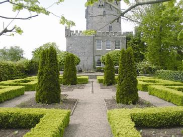
| Knappogue Castle | A Macnamara castle until the early 19th century, it was sold to the Scotts of Cahircon in 1800. In the possession of William Scott by 1837. Lewis writes that the castle formerly belonged to the Macnamaras of Moyriesk and that it "is one of few ancient castles still inhabited". Weir writes that a ten bay residence was added to the tower house in the early 19th century. The sale rental of 1854 records George Sampson as tenant and that £8,000 had recently been spent on the building. By the mid 19th century Lord Dunboyne held the Castle valued at £36 in fee. In the mid 1960s the Castle was developed as a banqueting centre for tourists and continues to function in this role today. http://www.gardensireland.com/knappogue-castle.html |
|
| Rathluby | By the end of the 18th century Rathluby was in the possession of the Bridgeman family. The buildings were valued at £5 at the time of Griffith's Valuation when Henry Bridgeman occupied the house which he held from Eliza Piercey and it continued to be a Bridgeman home until the end of the 19th century. The house is now a ruin. | |
| Belvoir | Belvoir was an early 19th century house on the same site as an earlier building. It was the home of the Wilson family, valued at £32 in the mid 19th century. The house was burnt in 1888 when leased by the Wilson Lynches to Lady Loftus. It was not rebuilt though recorded as the seat of Maj. Wilson Lynch in 1894. Members of the Wilson Lynch family continued to live in the remaining wing until the mid 20th century. It is now a ruin. |
|
| Glenwood | Weir records Poole Gabbett in residence in 1810, Basil Davoren occupied the house in 1837 and John Gabbett at the time of Griffith's Valuation. He held it from George Studdert and it was valued at £10. Alice Studdert married General Frederick Maunsell and they lived at Glenwood which passed to their son Robert Maunsell. This house was the scene of an ambush in which eight Black and Tans were killed in 1920. The house no longer exists. | |
| Ardcloony | A late 19th century house incorporating the earlier Bourchier home. Major General John Bourchier married Mary, daughter of Thomas Macnamara of Ardcloony in the mid 18th century and inherited the property. By the time of Griffith's Valuation the house belonged to Francis C. Fitzgerald who held the property in fee. It was valued at £20. Edmond Fitzgerald of Ardcloony owned 214 acres in county Clare in the 1870s. John Connell Fitzgerald was resident in 1906. A house is still extant at the site. | |
| Millbrook | A 19th century house occupied by the families that ran the mill. At the time of Griffith's Valuation the occupier was Peter Macmillan who held the property from Thomas Arthur. The buildings were valued at £40. A house is still extant in the area but on an adjacent site. | |
| Glenomera | Glenomera was the seat of the Arthur family from the mid 17th century until the early 20th century. In 1786, Wilson refers to Ballyquin as "the fine seat of Mr. Arthur". It is labelled Ballyquin House on the 1st edtion Ordnance Survey map but as Glenomera on the later 25-inch edition. Lewis wrote in 1837 that Glenomera was "celebrated as a shooting station for grouse and pheasant". It was held in fee by Thomas Arthur at the time of Griffith's Valuation and valued at £35. The house is now demolished. | |
| Hurdleston/Hurdlestown | This was the seat of the Bentley family in the 18th and 19th centuries. The present house dates form 1871 and may well incorporate parts of the former house. The buildings were valued at £40 in 1906. Restored at the end of the 20th century. |

|
| Woodfield | Built c 1720s by the Bridgeman family and sold by them to the Reverend M. Locke in 1780. Wilson records it as his seat in 1786. The house was bought by William James O'Brien in 1802. He died in 1822 and the house was occupied by C. Walker in 1837. By the mid 19th century Thomas W. Butterfield was leasing it from the Reverend Savage Hall who had married Anne O'Brien. The buildings were valued at £22. It remained in the possession of the Hall family until at least the late 19th century, it was leased to the Bourke family. This house was advertised for sale in January 2009. |
|
| Doonass | In 1786, Wilson noted the building of "a superb and elegant mansion house" by the Massy family beside the River Shannon. The buildings were valued at £75 in the mid 19th century. George Lloyd and Margaret Maunsell Lloyd advertised the sale of their lease of Doonass and 229 acres in June 1855. Following the death of Sir Hugh Dillon Massy in 1870 the house passed to his wife's nephew Colonel John Thomas Massy-Westropp. The house has had a number of different owners in the 20th century, including Mrs Buckley in the 1940s. It was gutted by fire in 2009. |

|
| Newtown | Newtown House situated on the Massy estate was the home of the Walsh family for most of the 19th century. At the time of Griffith's Valuation it was occupied by the Reverend Richard S. Welsh and was valued at £20. It is now a ruin. | |
| Elm Hill House | A home of the Bourchier family in the 18th century. The Bourchiers intermarried with the Massys. The house was located on the Massy estate. Mrs Davis was resident at Elm Hill in 1837 and Joseph Wallplate in the mid 1850s when the house was valued at £12. The home of the Heffernan family in the latter part of the 19th century. The house is still occupied. | |
| Ruanard House | Weir writes that this house was originally built by the Westropps. It was occupied by Captain J. Walsh in 1837 and by Jonas S. Welsh in the mid 1850s when it was valued at £16. Situated on the Massy estate it remained in the possession of the Walsh family until the early 20th century. A house is still extant at the site. | |
| Summerhill | A large 18th century house close to the River Shannon on the Massy estate. Occupied by the Reverend Charles Massey in 1814, Hugh Dillon Massy in 1837 and by Berkeley Vincent in the mid 19th century, when it was valued at £35. It remained the home of this branch of the Vincent family until the early 20th century. The Irish Tourist Association survey of 1942 refers to the demolition of this house "a few years ago". | |
| Errina House | This house located on the west bank of the River Shannon was occupied by Thomas R. Going in 1814, George Vincent in 1837 and at the time of Griffith's Valuation when he held the house valued at £25 from the Reverend Charles Minchin. The house was later occupied by Admiral Hayes O'Grady, father of Standish Hayes O'Grady. The house became the home of the Bourke family in the 1920s and was demolished in the 1940s. There was another large house known as Errina closeby Grid Ref R657 637. | |
| Rose Hill | A house beside the River Shannon occupied by P. O'Callaghan in 1837 and by James O'Grady in the mid 19th century who held it from Mrs O'Callaghan. It was valued at £11. Weir writes that his successor was Henry O'Grady who died in 1902. The house is now a ruin. | |
| Clonboy | An 18th century house of the Brown family held from the Westropps in the mid 19th century. The Browns were agents for the estate of George Westropp. Occupied by John Brown in 1837 and at the time of Griffith's Valuation. Weir writes that the Browns continued to own Clonboy until the death of Ernest George Brown in 1942. The house was then demolished. | |
| Ross | Home of the Pearse family in the 18th century, in 1786, Wilson refers to the house as the seat of Mr. Pearce. Ross was occupied by John Blake in 1814. In 1822 a new house was built at a cost of £2,500 and was the residence of T. Westropp in 1837. Thomas Westropp was the fifth son of Ralph Westropp of Clonmoney and Attyflin. At the time of Griffith's Valuation Ross was the residence of John Digan who held the property from Anne Westropp [widow of Thomas]. Buildings valued at £23 and some untenanted land at Ross were the property of Ambrose Hall in 1906. It is still extant. |
|
| Trough Cottage | Trough Cottage was occupied by William Walsh who held it from John Carroll at the time of Griffith's Valuation. It was valued at £16. Weir writes that this was the home of the Misses Bentley in the early 20th century. | |
| Trough House | Trough Castle in the townland of Trough is marked as "in ruins" on the first Ordnance Survey map 1842. Weir writes that Dr Elliott O'Donnell who inherited the county Clare property from Sir Charles O'Donnell in 1870 probably built Trough House in the townland of Roo West. Roo Cottage is marked on the first Ordnance Survey map. | |
| Ballycuggaran | Weir writes that the present house dates from the late 19th century. An earlier building was in the possession of members of the Church of Ireland episcopacy. Occupied by Marcus Patterson in the mid 19th century and held by him in fee. The buildings were valued at £8. In 1906 Marcus Wyndham Patterson owned Ballycuggaran with 618 acres of untenanted land. [Grid reference is approximate]. | |
| Ballyvally | A house in the possession of the Parker family from the early 19th century, the Reverend Standish Grady Parker was resident in 1814. His brother William Parker was in residence from at least 1837, holding the property from members of the Law family. By the end of the 19th century Robert Gabbett Parker lived in the house, which is still extant. | |
| Kincora Lodge | A house on the outskirts of Killaloe, Weir writes that it was the home of an O'Brien family in the 1840s. Occupied by Captain Frederick Lowe, Royal Navy, at the time of Griffith's Valuation, who held it from Thomas Macnamara. Captain Lowe married Maria Christina, daughter of Henry Ross-Lewin of Ross Hill in 1847. In the 20th century the house belonged to the Butler-Stoneys for some time. | |
| Tinerana | The Purdon family, originally from Cumberland, held this property on the shore of Lough Derg from the mid 17th century. In the ownership of Simon George Purdon at the time of Griffith's Valuation when the buildings were valued at £30. The Irish Tourist Association Survey File of the 1940s states that the house was built "about 70 years ago", contains about 60 rooms and the original residence of the Purdons stands adjacent to the new house. The estate was sold to the Gleeson family who owned the Athlone Woollen Mills in 1901 and the house later became the property of Dr Carmody who opened a health centre. The property was offered for sale in 2012. |
|
| Mount Baylee | In 1837 the residence of H. Bayley. Occupied by Susannah Baylee at the time of Griffith's Valuation, who held it from Henry Thomas Baylee. The buildings were valued at £8. Weir writes that in the 20th century Miss Edie Baylee married the father of the architect Percy le Clerc. The house is still lived in. | |
| Sunville | Occupied by T. Studdert in 1837 and by Robert Hanley at the time of Grifftith's Valuation who held the property from Thomas Prosser. Also known as Sion Ville. A building is still extant at the site. | |
| Doon House | A seat of Sir Hugh Dillon Massy in the 1780s, leased to Richard Harte in 1814 and the Reverend W. Butler in 1837. Weir writes that the house was rebuilt by Richard Bentley in 1845. Griffith's Valuation records Richard Bentley as the occupier, he held it from Sir Hugh Dillon Massy. The buildings were valued at £18. The house belonged to the Whitehead family in the early 20th century and was later demolished. | |
| Ayle | The home of a branch of the Macnamara family in the 18th and 19th centuries. It was advertised for sale in 1850 and Griffith's Valuation records Joseph Browne as the occupier. He held the property in fee, the buildings were valued at £14. Weir writes that the original house was demolished and that the house now standing which was occupied by the Walshes, agents to the Macnamaras, was uninhabited. see http://www.thisoldhouse.com/toh/article/0,,568230,00.html | |
| St Catherines | An O'Callaghan property from the 18th century, George O'Callaghan was residing at St Catherines in 1814 and D. Sampson in 1837. Burkes 1904 records George's brother Edward "of Coolready" and he was married to a Miss Sampson. At the time of Griffith's Valuation the house was unoccupied and Ralph Westropp was the immediate lessor. The buildings were valued at £24. Only the servants' quarters now remain and have been converted into a family home. |

|
| Coolreagh | In 1814 Coolrea was occupied by Cor O'Callaghan and in 1837 by Ralph Westropp, who was leasing the property to Robert Studdert by the mid 19th century. The buildings were valued at £28. At the end of the 19th century it was the home of Colonel George O'Callaghan Westropp. The East Clare golf clubhouse now occupies the site, possibly incorporating some of the old house. |

|
| Moynoe | In the early 18th century the Ringrose family lived at Moynoe. It is probable that Sir John Reade built the late 18th century house. He was the occupier in 1814 and Fitzgibbon Hinchy was living in the house in 1837. The house was unoccupied at the time of Griffith's Valuation, Thomas Wadson was the immediate lessor. The Sampson family lived in it for the remainder of the 19th century and well into the 20th century. Edward MacLysaght surveyed the papers of Miss Mary Sampson of Moynoe circa 1944. Bought by the present owners in the mid 20th century, the house was demolished in 1998. see http://www.esatclear.ie/~moynoe/Page_16x.htm/ |
|
| Fort Edward | Built post the first Ordnance Survey probably by a member of the Westropp family. Occupied by Dr Patrick Cullinan at the time of Griffith's Valuation who held it from the Reverend John Gleeson. The house is still inhabited and well maintained. |
|
| Ballyvannan | The seat of Lord Dunboyne in 1837 and in the mid 19th century of James Crotty who held it from Lord Dunboyne when the buildings were valued at £3. The house is still occupied. | |
| Cloonusker | On the first Ordnance Survey map Cloonusker house is marked "in ruins". However by the time of Griffith's Valuation Henry Sparling was occupying a steward's house, which he held from Lord Norbury. The buildings were valued at £8. | |
| Drewsborough | A home of the Drew family from the mid 18th century, occupied by Ringrose Drew in 1814 and by Francis Drew in 1837. Bought by Michael Skehan in the Encumbered Estates Court, he is recorded as being resident at the time of Griffith's Valuation, when the house was valued at over £22. Drewsborough, or Victoria Park as it was then known, was sold to William Scanlon in 1869. In 1899 it was bought by John O'Brien, grandfather of Edna O'Brien, the author. The original house was burnt in June 1921. A modern bungalow has been built on part of the site and the O'Brien home is closeby. Some farm buildings and an underground cellar still remain. |
|
| Ballinahinch | A branch of the Molony family appear to have occupied Ballinahinch for some time in the 18th century. Occupied by Cornelius O'Callaghan in 1814 and 1837 and by his son Charles George in the mid to late 19th century. It is recorded as his seat in 1894. By 1906 Ballynahinch mansion house valued at £45 was in the possession of the Gore family. Weir writes that owners left when the "Troubles" began early in the 20th century and the house was vandalised. It was later demolished. The yard buildings remain and are still in use. |
|
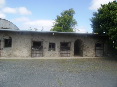
| Derrymore | The MacGraths had a 17th century home here which was incorporated into the servants' quarters when the Gores built their 18th century mansion. They continued to occupy the house until the early 20th century. The 17th century house and servants' quarters still stand but the rest of the house has been demolished. Some of the stone and stone features from Derrymore were taken to build a house near Drewsborough on the outskirts of Scarriff, Discovery Map 58, R637 836. | |
| Kilgory | The main residence of the O'Callaghan family in the 18th century situated on the shore of Kilgory Lough. In 1786 Wilson refers to it as the seat of Mr. Callaghan. Towards the end of the century the house became the residence of the O'Connells. Colman O'Loghlen married a sister of Daniel O'Connell of Kilgory before 1783. In 1814 Kilgory was the home of Daniel O'Connell and in 1837 Maurice O'Connell was the proprietor. It continued to belong to the O'Connells for the rest of the 19th century. Weir writes that most of the house was demolished in 1928. | |
| Newgrove | Home of the Browne family in the 18th century and for the first half of the 19th century. In the 1850s this 18th century house, valued at £30 was in the possession of Eliza Browne, widow of Thomas Browne of Newgrove who died in 1847. Mrs Browne died in 1864 and the house and estate passed to the Brady family. Only some walls of the house remain. |

|
| Bunavory | A house on the Molony estate, occupied by William Scanlan in the 1850s. The house is now divided into two residences. | |
| Cragg | Home of a branch of the Molony family from the 1730s to the early 20th century. The house is still extant and lived in. It was valued at over £14 in the mid 19th century when it was held by Anne Molony in fee. | |
| Fort Anne | An 18th century house that was in the possession of Robert Westropp, eldest son of Poole and Mary Westropp, by 1814. His son John, who married Maria Macnamara, was occuping the house in 1837 and their son Robert was resident in the mid 1850s. Robert Westropp held the property in fee and the buildings were valued at £25. This house passed into the possession of the O'Callaghan Westropp family. It no longer exists. | |
| Kiltanon | Kiltanon was the home of the Molony family for at least two centuries. The house built in 1833 had a drive which linked it to the other nearby Molony residences at Bunavory and Cragg. The house was burnt in September 1920 and is now a ruin. In the second half of the 19th century another house, known as the Home Farm House, was built at Kiltanon for Marcus Molony, eight son of James Molony and his agent. This house is still extant. |

|
| Nutgrove Cottage | Another Molony house in the townland of Kiltanon, occupied by James Robb at the time of Griffith's Valuation, when it was valued at £20, now a ruin. | |
| Maryfort | An early 18th century house with late 19th century embellishments, home of the Westropps. By the early 19th century it was occupied by John O'Callaghan (died 1818) who seems to have moved there from Kilgory. Occupied by his grandson John O'Callaghan at the time of Griffith's Valuation, valued at £35 and held from George Westropp. In the 20th century it was the home of his son Colonel George O'Callaghan who assumed the additional name of Westropp. Weir writes that the house was demolished in 1967 by Colonel Conor J. O'Callaghan Westropp, the last member of the family to live there. |
|
| Tyredagh Castle | Built by at least 1814 when it was occupied by Thomas Brown who in that year married Elizabeth Comyn. In 1837 Mrs Browne was in residence. By the time of Griffith's Valuation Mary Gore was the occupant holding the property from Eliza Browne. Weir writes that the house was accidentally burnt down about 1903. | |
| Raheen | This was the home of the Brady family from the mid 18th century. In 1837 Reverend Thomas B. Brady occupied the house. By the time of Griffith's Valuation William Moreland was in possession and the house, offices and mill valued at £4.10 shillings were leased to Patrick Flynn. In 1906 buildings at Raheen ,which included a mansion house and 401 acres of untenanted land belonging to Robert W. Moreland, were valued at £37. In 1908 the property was bought by S.R. MacLysaght of Mallow, father of Dr Edward MacLysaght, genealogist. The Irish Tourist Association Survey file refers to Raheen Hospital beautifully situated amid a large forest on the shores of Lough Derg. The house no longer exists. | |
| Kilbarron | A property originally associated with the Ryan family. Mr Robert McGrath was residing at Kilbaron in 1814 and in 1837 Lewis records that E. McGrath rebuilt the house "on the site of the old mansion". At the time of Griffith's Valuation the buildings valued at £6.5 shillings were held by Edward McGrath in fee. The house is now a ruin. | |
| Landscape | A house facing the River Shannon, the original house was built in the early 19th century but was remodelled into the current Tudor style c.1917. The residence of Reverend William Friend in 1814, P.W. Creagh in 1837 and of Standish Thomas O'Grady in the 1850s who held it from Elizabeth Creagh. This house is still extant. In 2013 it was offered for sale. |
|
| Ardataggle House | A house known as Fisher's Lodge was located in this townland in 1842 but is not visible on the later 25-inch Ordnance Survey map. The townland of Ardataggle was sold by Thomas Fitzgibbon to Thomas Spaight in 1854. Mrs Spaight was living at Ardataggle House in the 1870s and in 1906 Colonel W. F. Fitzgerald owned the mansion house valued at £41 with 428 acres of untenanted land. | |
| Waterpark | A Bindon family home at the beginning of the 19th century. In the mid 19th century the house was located on the estate of Sir Hugh Dillon Massy and was occupied by John Quinn who also held a corn mill. The house was valued at £24. This house was later a home of the Phelps family who vacated it in 1914. It is no longer extant. The Irish Tourist Association surveyor wrote in 1942 that it was being demolished by its owner Mr Latham. | |
| Annaly Lodge | A house built post 1850 as a shooting lodge for the White family. Sold in the late 1870s to the Phelps it later became the property of the Forestry Department. Back in private hands now it is still occupied. [Grid reference is approximate] | |
| Island House | Lewis refers to a "handsome newly erected cottage on the island" in his description of Castleconnell in 1837. Earlier, in 1786, Wilson refers to Park, situated on an island created by a canal and the river Shannon, as the seat of Sir Richard de Burgho. Island House valued at £17+ was the residence of Sir Richard De Burgho at the time of Griffith's Valuation. He held the property, which was surrounded by nine acres, in fee. In 1894, Slater refers to "The Island" as the property of Lady de Burgho. |

|
| Stormont | Storm-mount was the residence of John Cuffe Kelly esq in 1814 and of Mrs Kelly in 1837. Mrs Kelly was a sister of Francis Drew of Drewscourt. By the time of Griffith's Valuation it was occupied by Joseph Walplate who held it from Sir Richard De Burgho. The buildings were valued at £19+. A house is still extant at this location. In 2022 it was offered for sale. | |
| Worldsend | This house was occupied by Thomas F. Maunsell in 1814 and by James Walplate in the early 1850s. Walplate held the property, valued at £10 and 140 acres from Sir Richard De Burgho. It is still extant and occupied. |

|
| Fairymount | In 1786 Wilson writes that Fairy-Hall was the seat of Hon. Rev. Mr. Murray. It was the residence of Robert Going in 1814 and of Henry O. Bridgeman in 1837 and at the time of Griffith's Valuation. The house was located in the townland of Montpelier on the De Burgho estate and was valued at £16. It was surrounded by a 35 acre demesne. This house is called Fairymount on the first Ordnance Survey map and in Griffith's Valuation. Fairyhall was the name of the townland just to the north of Montpelier. Farm buildings are still extant at the site. | |
| Prospect | The home of Powell in the late 1770s and 1780s, this house was the residence of Sir J. De Burgh Baronet in 1814, of Godfrey Massy in 1837 and of Eyre Lloyd in the early 1850s. Eyre Lloyd held the property from Eyre Powell and it was valued at £46. This mansion house valued at £43 was occupied by Anne G. Crosby in 1906. It is now a ruin. |

|
| Hermitage | Bence Jones writes that this house was built for a banker named Bruce in 1800 but soon afterwards was purchased by the 1st Baron Massy. The main seat of the Massy family in the 19th century, held by them in fee and valued at £70 in the early 1850s. The contents of this house were sold in 1916 and the house was burnt down in June 1920. |
|
| Newgarden | Hugh Ingoldsby Massy is recorded as "of Newgarden" in 1769 and Simon Purdon was resident in the late 1770s and 1786. The widow of Hugh Ingoldsby Massy married Simon Purdon of Tinerana. The Powells of Clonshavoy were located at Newgarden in the early 18th century. A house occupied by William Ryves in 1814 and by Massy Ryves in 1837. By the time of Griffith's Valuation it appears to have fallen into decay. John Dooley occupied a house valued at £1 and Eyre Lloyd held offices valued at £4 from the Earl of Clare. Caleb Powell states that this house was taken down by Eyre Lloyd. | |
| Belmont | Bellmont was the residence of Thomas Grady in 1814 and of Captain Stackpoole in 1837. At the time of Griffith's Valuation it was occupied by John White who held it from Thomas William O'Grady. It was valued at £28 at this time. By the 1870s George Sampson was living at Belmount, Castleconnell. | |
| Woodlands | The residence of J. Tuthill in 1837. This house situated on the Dwyer estate was occupied by Captain John S. Rich who appears to have let the house to lodgers at the time of Griffith's Valuation. The house was valued at £35. In 1942 the Irish Tourist Associaton surveyor records this house as the home of M.D.Shaw "of bacon fame". It still contained a good library and some very valuable paintings and drawings. The Limerick City Museum holds an undated catalogue of the sale of furniture etc from this house belonging to Malcolm D. Shaw 13 Dec [1940s?]. | |
| Shannon Lodge | Occupied by Mr William White circa 1840, by the early 1850s the house was vacant and held from Thomas William O'Grady. It was valued at £16+. Also known as Stradbally House it was destroyed by fire in December 1983. | |
| Corbally House | The Ordnance Survey Name Book records the rebuilding of this house by Poole Gabbet in 1824 at a cost of £1,700. The Gabbets had flour mills closeby. It overlooked the Shannon north of Limerick city and was three storeys high. At the time of Griffith's Valuation it was valued at £35 and was occupied by Thomas Gabbett who held it from Patrick A. Shannon. This house now functions as a nursing home. |
|
| Corbally Park | Built in 1824 by Pierce Shannon for £2,500, this three storey house was held by Patrick A. Shannon in fee at the time of Griffith's Valuation when it was valued at £51. St Munchins College is situated at this location now. A lithograph of this house called Corbally House and the toll bridge is included in the 1856 rental. The house was not included in the sale. | |
| Roseneath Cottage | A villa style house built circa 1820, occupied by Robert Rogers in the early 1850s, valued at £27 and held from Patrick A. Shannon. |
|
| River View | A mid 19th century house, marked on the first Ordnance Survey map. At the time of Griffith's Valuation this house valued at £27 was occupied by John Able and held from the Reverend Edward Croker. |
|
| Prospect House | Occupied by Thomas McNamara at the time of Griffith's Valuation, held from Henry Watson and valued at £22. Described in the sale rental of 1856 as a capital house and office on which over £1,000 had been spent on improvements. The original lease dated 1796 was from Thomas Maunsell to Philip Smith for the lives of members of the Watson family. Henry Watson was the tenant in 1856 and Sir Christopher Arbuthnot Maratt in 1877. | |
| Parteen Villa | Robert Atkins Twiss, second son of Robert Twiss of Cordell House, county Kerry, was living at Parteen Villa in 1837. In 1840 the Ordnance Survey Name Books refer to Parteen Villa as the residence of Thomas Mansell Bradshaw, "a neat house in the cottage [stile]". The house was occupied by the representative of Robert Twiss at the time of Griffith's Valuation, value at £29+ and held from Mrs Margaret Ormsby. Parteen is probably the house at Birdhill occupied by Robert G.E. Twiss in 1906 and valued at £30. A building is still located at this site. | |
| Birdhill | This house was originally the home of a branch of the Going family. Leet records Richard Going as the occupant in 1814. He was murdered in 1821. S. H. Atkins was resident in 1837. In 1840 the Ordnance Survvey Name Books note it as the seat of John Going and describe it as "a commodious dwelling house" with a demesne consisting of "plantation and ornamental ground". At the time of Griffith's Valuation, John Going was also the occupier when he held the house, valued at £40, with 51 acres and the national school, from Mrs Margaret Ormsby [nee Atkins]. She left Birdhill to her nephew George Twiss. Birdhill was burnt in the early 1920s and is now a ruin. | |
| Fort Henry | Fort Henry, overlooking the Shannon River, was the residence of Stephen Hastings in 1814 and of Finch White in 1837. Earlier, in 1786, Wilson had also noted it as a Hastings residence. At the time of Griffiths Valuation, Finch White held the house from Stephen H. Atkins. It was valued at £28.15s. Finch White was related to the Atkins through marriage with a member of the Gelston family. In 1906 this house was in the possession of Frederick C.Henry. In 1840, however, the Ordnance Survey Name Books had also noted that J.J. Henry was the proprietor. It is still extant. | |
| Gortna House | This house was located close to the shore of the River Shannon and is marked on the first edition Ordnance Survey map and the later 25 inch map as Gortna House. Lewis records H. Franks as resident at Shannon View in the parish of Templeachally. Henry Franks occupied a house valued at £12+ and held from Stephen H. Atkins at the time of Griffith's Valuation. Henry Franks was married to Elizabeth daughter of Ringrose Atkins. There are still buildings at this location. | |
| Birdhill (Kyle) | Christopher Kayes held a house and offices valued at £27.18 shillings with 231 acres from Mrs Margaret Ormsby in the townland of Birdhill at the time of Griffith's Valuation. These would appear to be located south west of Birdhill House and just east of Kyle burial ground. | |
| Mary Ville | This house is marked as Mary Ville on the first edition Ordnance Survey map. In 1840 the Ordnance Survey Name Books refer to it as "a respectable farmhouse and offices" the proprietor of which was Michael Head. This may be the house recorded by Lewis as Derry Ville inhabited by J. Salmon. At the time of Griffith's Valuation Mrs Mary Sparling was resident, holding the lodge valued at £13 from Francis Spaight. Buildings are still extant at this site. | |
| Ryninch | Lewis records J. O'Brien of Ryninch and Jeremiah O'Brien held a house valued at £10 and 115 acres from Francis Spaight in the mid 19th century. There were quarries in this townland. | |
| Lakeview | Henry D. Head occupied a house valued at £14+ in this townland in the mid 19th century. He held the property in fee. A house and large farmyard are now located at this site. | |
| Garruragh House | In 1786 Wilson refers to "Garuragh" as the seat of Mr. Harrison. At the time of Griffith's Valuation, the house was part of the O'Callaghan estate but leased to the Tulla Board of Guardians as an auxiliary workhouse when the buildings were valued at £48. It is labelled Garruragh House on both the 1st edition and 25-inch edition Ordnance Survey maps though much of the buildings have disappeared by the 1890s and only some ruins remain now. | |
| Oakfield (Tulla Lower) | In 1786 Wilson refers to Oakfield as the seat of Mr. Waller. By the time of Griffith's Valuation this house is part of the Massy estate and valued at £9. It is still extant and part of a large farm. | |
| Pass House | In 1786 Wilson writes that Pass House was the seat of Mr. Peacock. By the time of Griffith's Valuation the house was occupied by Solomon Frost, leasing from the Peacock estate and valued at over £5. The property does not appear on the 25-inch Ordnance Survey map of the 1890s. | |
| Feenagh House | Feenagh House is described as "in ruins" on the 1st edition Ordnance Survey map and has almost disappeared by the publication of the 25-inch edition in the 1890s. In 1786 Wilson refers to "Fenagh House" as the seat of Mr. Wilson. By the time of Griffith's Valuation, the townland in which it was situated was the subject of Court of Chancery proceedings. Some fragments of the walls are still visible. |