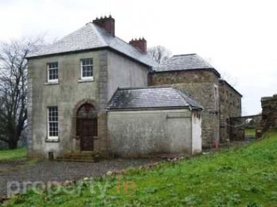
Ballyboe
Houses within 15km of this house
Displaying 111 houses.
Houses within 15km of Ballyboe
Displaying 111 houses.
| House name | Description | |
|---|---|---|
| Carrick House | The sale rental of 1851 records Walter Herbert holding the mansion house and demesne on a renewal lease dated 1796. This house no longer exists. | |
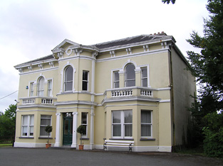
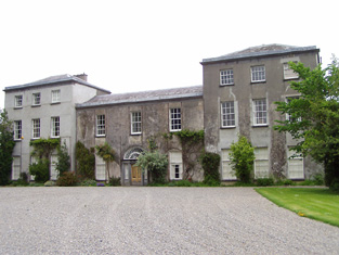
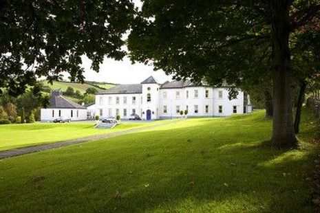
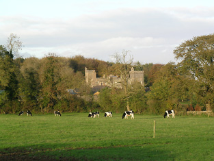
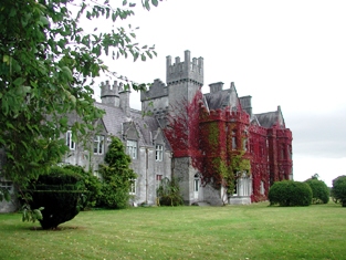
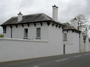
| Knocklofty | A mainly 18th century house, cited by Wilson as the seat of John Hely Hutchinson in 1786. In 1840 the Ordnance Survey Name Books describe it as "spacious and handsome, having a fine plain front". It was valued at £70 in the mid 19th century, the seat of the Earls of Donoughmore until 1983, though Walford mentions Samuel H. Goold-Adams of Knocklofty in 1885. The Irish Tourist Association surveyor writes that Knocklofty was De Valera's headquarters for a time during the Civil War. Until recently it served as a hotel but in 2013 it was offered for sale. |

|
| Lakefield (Middlethird) | Gambonstown was occupied by B.B. Bradshaw in 1814. In 1786 Wilson had referred to it as the seat of Mr. Hackett. The National Inventory of Architectural Heritage records the building of Lakefield house in 1831 by William Pennefather, replacing the former Hackett home of Gambonstown. and the Ordnance Survey Name Books record it as his residence in 1840. At the time of Griffith's Valuation William Pennefather held the house valued at £48.14 shillings and 413 acres from Mrs Hackett and others. Sold by the Pennefathers to the O'Briens in 1907 and sold again to the Goodbodys in 1955. Lakefield is still extant. |
|
| Marlhill | This house was the residence of Robert Prendergast in 1814. In 1840 the Ordnance Survey Name Books also record it as his residence under the slightly variant name of Marlow Hill. James Prendergast held the house valued at £12.15 shillings from the Reverend John Bagnell with 182 acres in the mid 19th century [see Bagnell entry in ''Burkes Irish Family Records'']. Home of the Rice family from the 1860s. A building still stands at this site. | |
| Mount Richard | Mount Richard was the residence of John Power in 1837 and in the early 1850s when the buildings were valued at £30.10 shillings and held from the Earl of Bessborough. This house is still in use as a residence. |
|
| Villa Mantilla Verda | On the outskirts of the town of Carrick on Suir, this house was occupied by Mrs Sophia Manderville in the mid 19th century. She held it from Walter Herbert [nephew of Dorothea Herbert] and the buildings were valued at £16.11 shillings. | |
| Ballycurkeen | The home of James Manderville in the mid 19th century, held from James F. O'Ryan and valued at £19+. Ballycurkeen was still a Mandeville home in the early 1940s when Frank Mandeville was recorded as resident. The Irish Tourist Association surveyor also writes that Ballycurkeen was the residence of John O'Mahony, a Fenian leader in 1848. This house is still a family home. |

|
| Anner Castle | Marked on the first Ordnance Survey map as Ballina House, this residence of the Reverend Nicholas Manderville was valued at £46+ and held by him in fee in the early 1850s. Bence Jones writes that Anner Castle was built in the 1860s "incorporating the old square castle of the Manderville family which had up till then been known as Ballinahy". It was destroyed by fire in 1926 and only the front portion was rebuilt. The Mandervilles were still resident in the 20th century. This property was sold in 2013. |
|
| Ballydine | The Mandevilles were situated at Ballydine from the 14th century. Ballydine Castle was sold to the Earl of Clonmel in 1781 and members of the Power family lived there in the first half of the 19th century, William Power in 1814 and James Power in the early 1850s. The Powers and the Mandevilles were related. A lithograph of the house is included in the Power sale rental of 4 November 1853. ''Burke's Irish Family Records'' records Frank Hackett Mandeville (1841-1905) as the last family member to live at Ballydine. He was Member of Parliament for mid Tipperary 1892-1900 and died at Ballydine Castle in 1905. Mary Lyons records the Landy family as resident from 1855-1901. | |
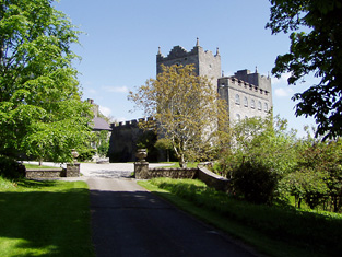
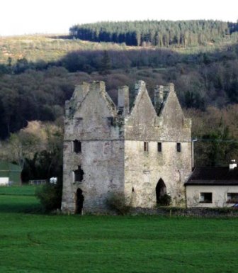
| Carrick Castle | A 16th century house built by the 10th Earl of Ormonde, which was abandoned by the family in the 18th century. Lewis wrote in 1837 “The castle is still a stately building although much of it is in ruins; it was for many years the residence of the Ormonde family, and part of it has been converted into a private residence”. At the time of Griffith's Valuation it was vacant and valued at £19. Taken over by the Office of Public Works in the 20th century and restored as a national monument. Now functions as a museum. |
|
| The Cottage | The home of William O'Donnell in 1837 and in the early 1850s held from the representatives of Michael D. Keating. The building were valued at £18+ in the mid 19th century. Richard O'Donnell of Carrick on Suir owned 359 acres in the 1870s. | |
| Coole | A house with a gatelodge marked on the first Ordnance Survey map and located just north of Knocklofty. Occupied by Thomas Morrissey in the mid 19th century, held from the Earl of Donoughmore and valued at £16+. A building is still extant at this location. | |
| New Abbey | In 1786 Wilson refers to New-Abbey as the seat of Moore Cootee. He notes that the house was close to "the great flour mills built by the late Stephen Moore". New-Abbey was occupied by Henry Moore in the mid 19th century and held from Stephen Moore, the buildings were valued at £11.16 shillings. | |
| Salisbury | Stephen Moore is recorded as resident here in 1814 and T. Sadlier in 1837. The christian name of the mother of Stephen Moore was Salisbury. By the time of Griffith's Valuation John Bagwell held the house in fee. It was valued at £18+. Percy Gough of Salisbury, Clonmel, owned 724 acres in King's County in the 1870s. Slater refers to "Inislonagh House" as the seat of Lt-Gen. Sir Charles J. Gough in 1894. Bence Jones writes that this house was leased to J.W. Cleeve in the early 20th century and from the late 1920s to Sir David O'Brien 6th Baronet. |

|
| Oaklands | William Ryal was living at Oakland, Clonmel, in 1814 and Mr Bagwell in 1837. Colonel Phipps was resident at the time of Griffith's Valuation, holding the house valued at £49.10 shillings from John Bagwell. Still occupied as a residence. |

|
| Woodrooff | The seat of the Perry family in the 18th and 19th centuries, Samuel Perry was resident in 1814 and William Perry in 1837 and at the time of Griffith's Valuation, when the buildings were valued at £66+. Samuel Perry was resident in 1906. Bence Jones writes that this house is now mostly demolished. | |
| Haywood | A house situated on the northern outskirts of the town of Clonmel, the home of Charles Riall in the first half of the 19th century. It appears to straddle the parish border between Rathronan and St Mary's Clonmel. The residence of John Riall in the 1870s. The site is now occupied by a shed. | |
| Anner Ville | Anner Ville was the home of Pierce A. Butler in 1814 but by 1837 was in Riall possession. The Ordnance Survey Name Books describe it as "handsomely situated, having a garden, orchard and ornamental ground attached". At the time of Griffith's Valuation Samuel Riall held the house valued at £23.14 shillings from Barclay Clibburn junior. Anner Ville continued to be a Riall residence in the 1870s and is still a fine home. |
|
| Redmondstown | In 1814 Redmondstown was the residence of J. Parson Ducket and in 1837 of a member of the Quinn family. In the early 1850s R.G. Fitzgerald was the occupier, holding the house valued at £16.15 shillings from the Earl of Glengall. This house is still extant and is located in a wooded area. Thomas Albert Quin of Redmondstown owned 612 acres in the 1870s. | |
| Shanballyard | Shanballyard House is marked on the first Ordnance Survey map. In the mid 19th century John Scully held buildings valued at £16+ and 299 acres from James Scully. The National Inventory of Architectural Heritage records this house as "disused". |
|
| Silver Spring House | This building was originally a charter school. By the mid 19th century it was occupied by Charles Bianconi, valued at £16 and held from Mrs Putland and Sir Charles Hulse. Mrs Anne Moore lived here in the 1870s. It is no longer in use. |

|
| E.T.M. Ville | E.T.M. Ville, Clonmel was occupied by E.T.M. Butler [Edmond Theobald Mandeville Butler] in 1814 and by his widow Mrs Eliza Butler in the mid 19th century. The house was then valued at £13 and held from the Putland/Hulse estate. Some buildings remain at the site. | |
| Anner Park | In 1837 Lewis records the extensive flour mills and residence of Barclay Clibborn in the parish of Kilgrant. In 1840 the Ordnance Survey Name Books describe the townland of Twomilebridge as " a demesne, consisting of planted ornamental ground, gardens and orchard". In the mid 19th century Barclay Clibburn occupied a house valued at £22 and held from the Putland/Hulse estate. Joseph Clibburn of Two mile bridge owned 20 acres in the 1870s. William Clibborne was resident in 1906 when the house was valued at £30+. This house is still occupied and well maintained. |
|
| Ballyvaughan | The Bushell family were located at Ballyvaughan from the 18th century. The will of Edward Bushell of Ballyvaughan dated 30 July 1778 names his six sons. At the time of Griffith's Valuation Samuel Bushell held buildings valued at almost £13 from John Lindsey. http://www.igp-web.com/IGPArchives/ire/tipperary/wills/bushell01.txt | |
| Kilheffernan/Cottage | Thomas Ryan was the proprietor of Cottage, Clonmel, in 1814 and Lewis records T. Ryan of Cottage, parish of Killaloan. At the time of Griffith's Valuation Patrick Fennelly held the house valued at £10.13 shillings from Thomas Ryan. Altered over the years this house is still in use as a residence. |
|
| Kilmurry Lodge | A house valued at £16.13 shillings was occupied by the Reverend Richard Morrissey in the townland of Ballynamona at the time of Griffith's Valuation. It was held from William P. Barker. Kilmurry Lodge is marked on the first Ordnance Survey map and is described in the Ordnance Survey Name Books as "a lodge, handsomely situated, with a garden, orchard and fir plantation". This house is still in use as a residence. |

|
| Lindville | A house named Lindville is marked on the first Ordnance Survey map in this townland close to the bank of the River Suir. At the time of Griffith's Valuation it was valued at £16+ and occupied by Thomas Lindsey who held it from William Butler. No building is now extant at this site. | |
| Newtown Anner | The seat of the Osborne family, held by R.B. Osborne MP in fee in the mid 19th century when the buildings were valued at £56+. Inherited by 12th Duke of St Albans, grandson of R.B. Osborne. Occupied by the Duchess of St Albans in 1906 and still in this family's possession in the early 1940s. The Irish Tourist Association survey states that the Osbornes bought the property from Clonmel Corporation in 1774. The National Inventory of Architectural Heritage dates this house 1829. It continues to be in use as a residence. |
|
| Ballingarrane | Ballingarrane was originally leased and then purchased in the late 18th century by Solomon Watson, banker of Clonmel. He built Summerville House which later became known as Ballingarrane. W. H. Bradshaw occupied the house in 1837 and John Mulcahy in the mid 19th century when the buildings were valued at £25+ and held from Solomon Watson. The Watsons occupied the house again in the second half of the 19th century and family members were still resident in the late 20th century. |

|
| Glenconnor | This house also know as Larchfield was built by Solomon Watson at the end of the 18th century as a dower house for Summerville (Bence Jones). Leet records Larchfield as unoccupied in 1814. J. Bagwell was resident at Glenconnor in 1837 and Pierce Gough in the early 1850s when the house was valued at £23.10 shillings. Alderman William Byrne of Clonmel was resident here in the 1870s. Additions were made to the house in the 1880s and it was owned by a Colonel George Elliot in the early 20th century who sold it in 1938 to H.J.Cleeve. |

|
| Barn | The seat of the Moore family in the 18th, 19th and 20th centuries. In 1786 Wilson refers to it as the seat of Thomas Moore In 1840 the Ordnance Survey Letter Books note that it had "a garden nursery and ornamental ground". It was held by Stephen Moore in fee in the mid 19th century and valued at £49+. Randal K. Moore was resident in 1906 and Mr and Mrs Murray Moore in the early 1940s when the house contained a very fine library and antique art collection. Barn is still extant. |

|
| Knockeevan/Darling Hill | William Pennefather (died 1819) of Knockeevan was the second son of Richard Pennefather of New Park. Knockeevan became the home of his eldest son, Richard, Baron of the Exchequer, Ireland, who employed William Tinsley as architect in the mid 1820s. The house was originally known as Darling Hill and it belonged to the Carleton family in the 18th century. Wilson refers to it as the seat of Mr. Carleton in 1786. Oliver Carleton sold it to the Pennefathers in 1782. The house was held by the Honourable Baron Pennefather in fee at the time of Griffith's Valuation when it was valued at £54+. It later passed into the possession of Lady Emily Hankey, daughter-in-law of Baron Pennefather and then to the Stanhope family. Sold by the Stanhopes in the late 19th century or early 20th century. This house no longer exists. see http://www.dia.ie/architects/view/5338#tab_works concerning the architect. |
|
| Orchardstown | The home of the Hamerton family in the 19th century, occupied by John Hamerton in 1814. Mathew Hamerton was the occupier in the early 1850s holding the house from Major William M. Hamerton. The buildings were valued at £18+. | |
| Rathronan House | A property granted to John Walsh in 1679. Lewis describes this house as the "elegant residence of Major General Sir Hugh Gough". Viscount Gough was still resident in the mid 19th century when the buildings were valued at £47+ and held from Major William M. Hamerton. This property was in the possession of the Whalley family in the late 19th century. A house is still extant at the site. | |
| Cregg | The home of a branch of the Lalor family in the 19th century. Thomas E. Lalor is recorded for Creg in 1814 and Lewis writes in 1837 of his handsome residence erected "about ten years since". Cregg was occupied by his son Thomas in the early 1850s. Thomas held the property from the Marquess of Ormonde and the buildings were valued at almost £40. Passed to the Sadlier family of Castleblake, county Tipperary at the end of the 19th century. In 1906 it was valued at £41 and occupied by Annie Sadlier. This house is still a fine residence. |
|
| Ballyknockane | Marked on the first Ordnance Survey map as Ballyknockane Cottage, valued at £21 and occupied by Walter Asper at the time of Griffith's Valuation. He held the property from the Marquess of Ormonde. In 1894 Slater noted it as part of the latter estate. This building no longer exists. | |
| Melview | A house on the outskirts of Clonmel, occupied by Robert Malcomson in the mid 19th century, held from John Bagwell and valued at £52. This building now functions as a nursing home. |

|
| Powerstown | The residence of George Green in 1814 and in the early 1850s when the buildings were valued at £26+ and held from Mrs Putland and Sir Charles Hulse. This house no longer exists. | |
| Ballynagrana | Taylor and Skinner's map indicates that this is the location of the house originally known as Wilmar, which was occupied by Nicholson Esq in the 1770s. Wilmar Mill is marked closeby in the townland of Ballyrichard on the first edition Ordnance Survey map. The Ordnance Survey Letters refer to the property as Wilmer House in 1840. Lorenzo Hickie Jephson lived at Wilmar for some time in the early 19th century. Francis Mandeville was resident in 1814. Denis Kennedy occupied a house in Ballynagrana, held from Denis Hayden and valued at £13.14 shillings at the time of Griffith's Valuation. Ellen Hayden of Ballynagrana owned 255 acres in county Tipperary in the 1870s. This house is no longer extant. | |
| Rathduff | A house occupied by Thomas Kennedy and held from the Reverend John W. Hackett and partners in the mid 19th century when the buildings were valued at £16.15 shillings. | |
| Bird Hill | A house located on the outskirts of Clonmel town was the residence of a member of the Taylor family in 1837. At the time of Griffith's Valuation this house valued at £10.12 shillings was occupied by Margaret Cantwell and held from Stephen Moore with 7 acres of land. This house is still in use as a residence. | |
| Garrangibbon | This house known as South Lodge was occupied by J.B. Elliott in 1814. The Ordnance Survey Name Books describe it as "handsomely situated....with garden plantation and planted ornamental grounds" in 1840. It was occupied by Richard C. Jackson who held the house valued at £14 from the representatives of Mrs R. Hartford in the mid 19th century. Some alterations to the house have taken place in more recent times and it still functions as a country residence. |

|
| Kilburry | The home of Jeremiah Meagher in 1814 and of Robert Maher in the mid 19th century. He held the house valued at £16.15 shillings from William Beasley. Buildings are still located at this site. | |
| Ballylanigan (Cramer) | [Thomas Pennefather is recorded as resident at Ballylanigan (Pennefather?) in 1814]. Lewis refers to the Cramer family of Ballylanigan. At the time of Griffith's Valuation Ballylanigan (Cramer) was occupied by Thomas Sexton and held from Mrs Catherine Reeves. The buildings were valued at £17+. This house still exists. | |
| Ballywalter | Occupied in the early 1850s by John Doherty, valued at £12 and held from the [Reverend] John Burdett, uncle of Arthur Burdett. | |
| Gurteen | Thomas Bryan was the proprietor of Gorteen, Callan, in 1814 and Lewis records Gurteen as the home of the Reverend W. O'Brien [Bryan?]. The Reverend William Bryan held the property in fee at the time of Griffith's Valuation when the buildings were valued at £10.15 shillings. Members of the Bryan family were still resident at Gurteen in the 1980s. Buildings still exist at this location. | |
| Clonacody | The residence of John Hunt in 1814 but the Kelletts were resident by 1837. The Ordnance Survey Name Books refer to Clonacody as the seat of John D. Kellett. James Sadlier was the occupier in 1850 holding the house valued at £28+ from John Kellett. The sale rental of 1856 records James Sadlier as tenant under the Court of Chancery in a case Massey v Kellett. The Kellett family continued to live at Clonacody until the mid 20th century and the house is still extant. |
|
| Ballyclohy | Leased from the Disney estate by James Moloney in 1850, when it was valued at £11 10s. | |
| Churchtown House (Dysert) | Leased from the Disney estate by James Connolly at the time of Griffith's Valuation, when it was valued at £25. In 1837 Lewis notes Churchtown as " the pleasant residence of John Power". In 1777, Charles Smith refers to it as the seat of Eccles Disney. The house is still extant. It was partially renovated in the early 21st century and in 2010 was offered for sale. |
|
| Coolnamuck Court | At the time of Griffith's Valuation, Coolnamuck was held in fee by James Wall when it was valued at £64.Smith describes it as "the pleasasnt seat of William Wall" in 1777. Bence-Jones noted the house had a curved bow with domed roof and contained a ballroom. Bought by the Sadliers circa 1852. A lithograph of this house is included in both the Wall and Sadlier sale rentals of May 1852 and July 1857. Richard O'Donnell was the tenant at that time. The 1943 ITA survey mentions the existence of this house but it was demolished later in the twentieth century. A folly remains in the former demesne lands. |

|
| Glen Lower (Dysert) | Leased by Patrick Hurley from John Congreve's estate at the time of Griffith's Valuation, when the buildings were valued at £11 10s. This appears to be the property known as Glen Castle House taking its name from castle ruins nearby. A house is still extant at the site. | |
| Glen Lodge (Glen Poer) | Labelled on the first edition Ordnance Survey Map as Glen Lodge and on the later 25-inch map as Glen Poer. Held by James Gallway from James Power at the time of Griffith's Valuation, when the buildings were valued at £19. In 1876 it is given as the address of Capt. Walter Mansfield. The 1943 ITA survey notes it as the residence of Mrs. Monsell [?]. Now in the possession of the Rosminian Order as a retreat house and known as Glencomeragh House. |
|
| Cloneen House | The home of the Meagher family, occupied by William Meagher in 1814 and by Henry C. Meagher in 1850. The property was held from the Earl of Clare and was valued at £18. This house is still occupied. |
|
| Bannixtown | A Clutterbuck home from at least the 1770s, Richard Clutterbuck was resident at Bannixtown in 1814. On the first Ordnance Survey map circa 1838 Bannixtown house is recorded as "in ruins". In 1840, though, the Ordnance Survey Name Books mention Bannixtown as a large farmhouse. The 25-inch map shows a building labelled "Bannixtown House" at the same site. A house valued at £19 was occupied by John Shea at Bannixtown in the early 1850s and held from the representatives of Thomas Clutterbuck. John Shea of Bannixtown owned 254 acres in the 1870s. | |
| Grove | A mid 18th century house which was altered in the 1830s. Grove was the seat of the Barton family, mentioned by Wilson as the seat of William Barton in 1786. It was occupied in 1814 by Thomas Barton and by William Barton in 1837. The Ordnance Survey Name Books describe it as "a very large dwelling house with extensive offices" in 1840. At the time of Griffith's Valuation, William Barton held Grove in fee and it was valued at £69. Grove remained in the possession of the Barton family until the mid 20th century when it passed to the Ponsonby family. This house is still extant and occupied. |
|
| Ballyrichard | The Ordnance Survey Name Books describe Ballyrichard as "a good farmer's hosue with offices and garden" in 1840. The house, valued at £12.18 shillings, was occupied by Matthew Hughes and held from Colonel W. Palliser at the time of Griffith's Valuation. Richard H. Hughes of Ballyrichard owned 597 acres in the 1870s. A substantial farm is still extant at the site. | |
| Langley Lodge | In 1840 the Ordnance Survey Name Books refer to Langley Lodge as "a good house with offices and garden". This house was occupied by Mrs Mary Langley in the early 1850s. She held it from Henry Langley and the buildings were valued at £19.19 shillings. By the time of the sale in December 1853 John Kane was resident. A building is still extant at this site. | |
| Hamilton Abbey | Hamilton Abbey is described in the sale rental of 4 June 1850 as "old fashioned" but "a most romantic and elegant residence". It contained a "fine cellarage, servants apartments and offices, large sized hall, breakfast parlour, dining rooom and drawing room, ten bed chambers, dairy, pantries, etc." and was in the possession of W.H. Latham. It was valued in Griffith's Valuation at £15.3 shillings. This property appears to have originally belonged to Hamilton Lowe. The ''Limerick General Advertiser'' of 16 May 1820 records the giving of the nearby Augustinian Abbey at Fethard to the Reverend Thomas Condon, Prior, by Mrs Hamilton Lowe and W. Latham. |

|
| Kiltinan | Kiltinane Castle was the seat of the Cooke family in the 18th and 19th centuries. Lewis describes the castle as the seat of R. Cooke, it "consists of an ancient circular tower .... and a residence erected on the old site by the late E. Cooke". In the mid 19th century the buildings were valued at £38+ and held by Robert Cooke in fee. Noted by Slater in 1894 as the seat of Robert Cooke. Sold by the Cookes in the 1920s to Mrs le Terrier, Kiltinan Castle now belongs to Andrew Lloyd Webber. |
|
| Westgrove | Arthur Riall was residing at Westgrove in 1837 and in 1850 when the house was valued at £23+ and held from Robert Maunsell. This house is still in use as a residence. |
|
| Donegal | John O'Halloran occupied Donegal House in the mid 19th century which he held from Arthur Riall. The buildings were valued at £12.18 shillings. This house no longer exists but a farm complex is still located at the site. | |
| Peppardstown | The home of members of the Henderson family in 1814 and in 1850 when Samuel Henderson held a house valued at £10.14 shillings from Matthew Jacob at Peppardstown. In the mid 1870s Jerome James Guiry was living at Peppardstown, Fethard and the Guiry family were still resident in the early 21st century. The National Inventory of Architectural Heritage dates the present Peppardstown house from circa 1870. Beatrice P. Saunders was occupying the mansion house at Peppardstown in 1906. |
|
| Garraun | In the early 1850 John O'Meagher occupied a steward's house at Garraun which he held from - Stratford. The buildings were valued at £12+. A farming enterprise is still located at this site. | |
| Maginstown | A house valued at £13+ in the townland of Maginstown was occupied by James O'Donnell at the time of Griffith's Valuation and held from William Fennell. Buildings are still located at this site. | |
| Annesgift | This house was the home of the Glenstanes. In 1814 Anne Glenstanes daughter of John Jacob Glenstanes married Wray Palliser and the house passed into Palliser ownership. Annesgift was occupied by George Ponsonby in 1814, by Major Gough in 1837 and by Colonel W. Palliser and George Ponsonby at the time of Griffith's Valuation. They held the property in fee and the buildings were valued at £32+. This house was occupied by the Hughes family in the first half of the 20th century and is now converted into apartments. |
|
| Ardsallagh | The home of George Gough in the first half of the 19th century. It is described in the Ordnance Survey Name Books in 1840 as "a gentleman's residence with garden's attached and surrounded with ornamental grounds". It was valued at £37.12 shillings in 1850 and held from George Fennel. In the 1870s Colonel George Frend of Ardsullagh owned 100 acres in county Tipperary. Still in use as a country house. |

|
| Coolmore | The seat of the Sankey family in the 18th and 19th centuries, Coolmore was recorded by Wilson as the seat of Mr. Sankey in 1786. It was occupied by John Butler in 1814, by Matthew Villiers Sankey in 1837 and by Jacob Sankey in 1850. He held the property in fee and the buildings were valued at £37.15 shillings. In the second half of the 20th century Coolmore became a world famous stud for the breeding of race horses. The stud was set up in the late 1960s by Tim Vigors and continued by Vincent O'Brien, Robert Sangster and John Magnier. |
|
| Derryluskan | The Pallisers were resident at Derryluskan from at least the mid 18th century. John Palliser was the proprietor in 1814 and Mrs Palliser in 1837. Their son Colonel Wray Palliser was the occupant at the time of Griffith's Valuation. He held the property from Colonel Gore and the buildings were valued at £45.17 shillings and held with a demesne of 682 acres. The Pallisers were still residing at Derryluskan in the 1870s. The house has been greatly reduced in size but still functions as a residence. |
|
| Rathcool | Blake Esq was resident at Racool in the 1770s. In 1840 the Ordnance Survey Name Books describe Rathcool as "a castle apparently inhabited. There is another dwelling house attached with a garden". In the mid 19th century Rathcool Castle was occupied by Charles Blackmore and held from the representatives of L. Clutterbuck. The buildings were valued at £16.13 shillings. Charles Blackmore was still residing at Rathcool in the 1870s when he is recorded as the owner of one acre in county Tipperary. Rathcool is still in use as a house. |
|
| Rocklow | Taylor and Skinner records Rocklowe as the residence of Lowe Esq in the 1770s. Rocklow was the home of Benjamin Frend and his wife, Eliza Gough, in the first half of the 19th century. Benjamin was resident there from at least 1814 to the 1850s. Griffith's Valuation records that it was held from Hugh Barton and was valued at £37+ in the early 1850s. This house later belonged to the Massys and is still in use as a residence. In 2022 it was offered for sale. |
|
| Tullamain Castle | Tullamaine Castle was the home of John Power, father of the 1st Sir John Power, Baronet. Leet records J.D. Scully as resident at Tullaghmain-castle, Fethard, in 1814. This was James Scully (1779-1853), fourth son of Jeremiah Scully of Silverfort. By 1837 Lewis records John Maher as resident though the Ordnance Survey Name Books in 1840 refer to the proprietor as a Mr. Walsh. By the time of Griffith's Valuation Maher is recorded as holding the property in fee. The buildings were valued at £44.16s. By the mid 1870s Tullamaine Castle belonged to Henry Maynard Harding who advertised it for sale in July 1880. Slater still refers to it as his property in 1894. Dr M.J. Barry was resident at Tullamain in 1906. The castle was burnt in the early 1920s but rebuilt and is still a country residence. In the early 1940s C. A. Vigours was resident. |
|
| Glenabbey House | Leased from Richard Carey by Garrett R. Carey at the time of Griffith's Valuation, when it was valued at almost £8. | |
| Kilnamack | In 1849, the representatives of John Greene were leasing this property to Edward Butler when it was valued at £12 11s. Both Wilson and Taylor and Skinner had also recorded it as a residence of the Greene family in the 1780s. It is still extant and in 2013 was offered for sale. |
|
| Ballydavid | In the mid 19th century Patrick Murphy held a house valued at £10 from Thomas Power in the townland of Ballydavid. | |
| Whitesfort | At the time of Griffith's Valuation John Norris was leasing this property from the Stradbroke estate when it was valued at £11. Referring to the 1770s Sadleir notes "John White, of Whitefort" who was married to a daughter of Ambrose Lane. It is not named on the 1st edition Ordnance survey map though buildings and a walled garden are visible. The ruins of some buildings remain. | |
| Kilmanahan Castle | Robert Sparrow was leasing this property from the Greene estate in 1850 when it was valued at over £72. It was offered for sale as part of William Greene's estate in July and December 1852. The sale notice includes a lithograph of the castle. It was bought by Alexander Glasgow who sold it on to the Earl of Donoughmore in 1855. Earlier, in 1786, Wilson notes it as the seat of Mr. Greene. In 1837, Lewis refers to it as the seat of Lt. Col. Nuttall Greene. Hussey records Thomas Wright Watson of Kilmanahan Castle in the mid 1870s. In 1906 it was part of th Donoughmore estate and valued at £45. It is still extant. |
|
| Tikincor Castle | Tickincor Castle, a fortified house, is described as "in ruins" on the first edition Ordnance Survey map in 1840. Buildings at the site were valued at £7 18s at the time of Griffith's Valuation in the 1850s when they were owned by Ralph B. Osborne and leased to Thomas Prendergast. In 1777 Smith notes that Tickencore was the property of Sir William Osborne. |
|
| Ballinattin | In 1786 Wilson refers to "Ballattin" as the seat of Mr. Parsons. This house valued at £17+ in the mid 19th century was occupied by Thomas Cooney and held from William Moore. A farm exists at the site and the original house is not extant. | |
| Ballinattin House | Occupied by Denis Cooney at the time of Griffith's Valuation, valued at £13+ and held from Edward B. Vise. This house is still extant and occupied. | |
| Gurteen Le Poer/Gurteen House | Held in fee by John Power in 1850 when it was valued at over £96. In 1837 Lewis noted Gurteen as the seat of E. Power. Count Edmond de la Poer was the owner in 1894 and 1906 when the house was valued at £87. By the later nineteenth century it had come to be called Gurteen Le Poer, the name by which it is still known. |
|
| Landscape House | John Congreve held Landscape in fee in 1850 when it was valued at almost £20. Lewis also refers to it as a seat of the Congreve family in 1837. However, by 1906 Congreve's buildings at Landscape were only valued at £2. Landscape House is still extant and occupied. |
|
| Ballyknock | A house valued at £12 10s which was vacant at the time of Griffith's Valuation . Probably in the possession of Thomas Dooley who was leasing property from the Beresford estate in the area. There is no house visible on the later 25-inch map of the 1890s. | |
| Feddans | Reverend John Condon, PP, was leasing this property from the Power estate in 1850 when it was valued at £11. The parochial house is labelled on the 25-inch Ordnance Survey map of the 1890s. A house is still extant at the site. | |
| Rathgormuck Castle | The buildings in the vicinity of Rathgormuck Castle were valued at £10 in 1850 and leased by Walter Mansfield to Thomas Terry. On the first edition Ordnance Survey map the castle is described as "in ruins". | |
| Graigavalla | Walter Henry Mansfield owned several properties in this townland at the time of Griffith's Valuation. The largest was a mill valued at £12. A property labelled Glenduff Corn & Tuck Mill appears on the First Edition Ordnance Survey map in this townland. It is not visible on the 25-inch edition of the 1890s. Another property in the same townland was leased to Catherine Kirwan with a value of £11. A farm is still extant at this site. | |
| Shanakill (Upperthird) | John Hearne was leasing this property from the Power estate at the time of Griffith's Valuation, when it was valued at £11 10s. Morris states that the Hearns had held an interest in this property since the 1720s. Financial difficulties led to its sale to Mary Anne Quin in 1866. In 1906 it was owned by Anne Ussher Quin and Frances Anne Quin and was valued at £18 10s. This house was also associated with the Labarte family. A house is still extant at the site. | |
| Kilgainy | In 1850 Ralph Osborne was leasing this property to Henry Pedder when it was valued at £18 5s. It is labelled Kilgainy on the 25-inch Ordnance Survey Map of the 1890s. It is no longer extant. | |
| Lyranearla | Held in fee by Henry Pedder at the time of Griffith's Valuation when it was valued at almost £10. In 1906 Helena Pedder owned the property, then valued at almost £6. [Grid Reference is approximate] | |
| Poulboy Mill House | Winifred Daniel was leasing this property from the Osborne estate at the time of Griffith's Valuation, when it was valued at £13 10s. The adjacent mill, valued at £42, was being leased by her to Patrick Corcoran at the same time. By the 1880s the mill is no longer visible. | |
| Spring Field (Clonmel) | Francis Prittie was leasing this property from the representatives of E. Labarte in 1850. It was then valued at £32 10s. It is still extant and occupied. |
|
| Merlin | In 1850 Abraham Grubb held this property in fee when it was valued at £54. Merlin is still extant and occupied. |

|
| Rose Ville (Clonmel) | At the time of Griffith's Valuation, Mrs. Anne Murray was leasing this property from Abraham Grubb when it ws valued at £33. The National Inventory of Architectural Heritage states that it was designed by Tinsley for the Murray family. Rose Ville has been in use as the Loreto convent since 1881. |

|
| Ashbourne (Clonmel) | In 1850 William Davis was leasing this property from Abraham Grubb when it was valued at almost £36. The National Inventory of Architectural Heritage indicates it was designed by William Tinsley for the Davis family. It is still extant and occupied. |
|
| Fairyhill House (Clonmel) | Leased by Thomas Hughes to David Franks at the time of Griffith's Valuation in 1850 when it was valued at almost £27. Fairy Hill is still extand and occupied. |
|
| Spa Ville | Cuffe Wall was leasing this property to Mrs. Susan Vowel at the time of Griffith's Valuation, when it was valued at £15 10s. It is labelled Spaville on both the 1st edition and later 25-inch edition Ordnance Survey maps. A house still exists at the site. | |
| Spa A | Thomas Dee was leasing this property from the Bagwell estate at the time of Griffith's Valuation, when it was valued at £14. | |
| Glenbrook | At the time of Griffith's Valuation, William Smyth was leasing a house and mill complex from the Bagwell estate, then valued at almost £27. By the end of the nineteenth century the mill is no longer functioning and the house has become known as Glenbrook. | |
| Raheen House (Clonmel) | Held in fee by Mrs. Elizabeth Greer at the time of Griffith's Valuation, when it was valued at over £55. It was offered for sale in September 1878 on behalf of William Greer, described as a lunatic, by his guardians. | |
| Ballyglasheen | This house is not marked on the first edition Ordnance Survey map. The Inventory of Irish Architecture dates this house circa 1870. It was occupied in the 1870s by John Barnes. It is still extant and well maintained. |
|
| Little Island | This house was situated on an island in the Suir River in the southern part of Clonmel town. It was the home of the Morton family in the 19th century but is no longer extant. The Reverend James Morton held the house valued at £42 from his father Samuel at the time of Griffith's Valuation. | |
| Minella | This house was built by the Malcomsons in 1863, now a hotel located in county Waterford. http://www.hotelminella.ie/ |
|
| Summerhill | Summer-hill, Clonmel, was the residence of the Reverend George Mills (sic) in 1814. The house was valued at £15+ in the mid 19th century, occupied by Mrs Dorothea Moore and held from the representatives of the Reverend Miles. In the 1870s Dorothea Moore of Dublin owned 288 acres and Henry Moore of Summerhill, Clonmel owned 247 acres in county Tipperary. Lewis refers to the handsome residence of R. Moore in 1837. |
|
| Milltown House | In the mid 19th century Henry Briscoe was occupying a house valued at £10.19 shillings and held from Captain Richard Long. This house is still extant. | |
| Knockkelly | In the mid 19th century Richard Crane held a house valued at £12+ from William Barton in the townland of Knockkelly. This appears to be the house marked as Knockkelly house on the first edition Ordnance Survey map. | |
| Redcity | In the mid 19th century William Harney held a house valued at £11+ from Sir John Power in the townland of Redcity. Buildings are still located at this site. | |
| Ballyneill | Patrick O'Donnell held buildings valued at £13 from Rodolphus Scully at Ballyneill in the mid 19th century. This may be the present house however it looks as if it might date from later in the 19th century. It is situated close to the remains of Ballyneill Castle. |

|
| Cloran | A house valued at £10. 11 shillings at the time of Griffith's Valuation, occupied by Miss Mary Kelly and held from the Earl of Clare with 224 acres. A building is still located at this site. | |
| Ballinard Castle | In 1894 Slater refers to Ballinard Castle as the residence of William Tennant. At the time of Griffith's Valuation, John Lindsay owned land in the townland of Friarsgrange, parish of Coolmundry, in which Ballinard Castle is situated. It appears that, in the nineteenth century, a house was built adjoining the original tower house as, in 1840, the Ordnance Survey Name Books refer to Ballinard Castle, a gentleman's seat in the townland of Friarsgrange. Information in the Woodstock Museum, Ontario, Canada, indicates that the building was owned by the Lindsay family until 1926. The building is still extant. |
|
| Chancellorstown House | In 1786 Wilson refers to Chancellors' Town as the seat of Mr. Moore. The house and surrounding demesne are shown on the first edition Ordnance Survey map but are not marked on the 25-inch edition of the 1890s. The townland was part of the estate of Stephen Moore at the time of Griffith's Valuation, though the house was leased by the representatives of Joseph Gough to Denis Daly and was valued at £7 10s. Farm buildings occupy the site now. | |
| Brookhill House | In 1786 Wilson refers to Brookhill as the seat of Mr. Lowe. The 1st edition Ordnance Survey map shows Brookhill house, "in ruins", in Farranshea townland, parish of Peppardstown. An old manor house, also in ruins, is shown as well. The Ordnance Survey Name Books, in 1840, describe the site as "two large houses, one having its eastern end and the other, its eastern side, joining the ruins of the Old Manor House". At the time of Griffiths' Valuation, the townland was in the possession of the Hackett estate and the houses are described as "in ruins". The ruins are not shown on the later 25-inch map of the 1890s. | |
| Knockbrack (Fethard) | In 1786 Wilson mentions Knockbrack as the seat of Mr.Letham. The house at Knockbrack, close to the village of Fethard, is described as "in ruins" on the 1st edition Ordnance Survey map. By the time of Griffith's Valuation, the townland was held in fee by William Barton, when the buildings were valued at almost £3. Farm buildings occupy the site of the old house now. |