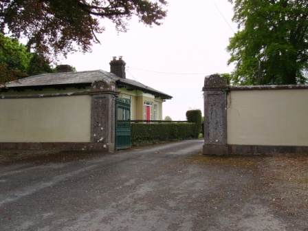
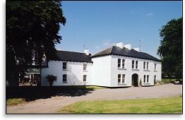
Harding Grove
Houses within 15km of this house
Displaying 106 houses.
Houses within 15km of Harding Grove
Displaying 106 houses.
| House name | Description | |
|---|---|---|
| Odell Ville | This house was occupied by John Odell in the early 1850s and held by him in fee. It was valued at almost £14. The house was the residence of William Odell in the 1870s. Home of the Morony and Lloyd families in the late 19th and 20th centuries. Occupied by Wilfrid H. Wilkinson in 1906. It was advertised for sale in February 2009. |

|
| Clonshire | Occupied by George Fosberry in 1814 and by J. Dickson in 1837. This one storey house was described as a ''comfortable slated cottage built in 1812 by the present occupier Col. John Dickson'' [brother of the Reverend Richard]. This house, valued at £22 at the time of Griffith's Valuation, was occupied by Samuel D. Power who held it from John Pigott. Clonshire is now the location of a large equestrian centre. Owned by the Greenall family, Lord Daresbury, in the 20th century. [The Greenalls also bought Mount Coote]. |

|
| Mount Brown | The main residence of the Brown family of Rathkeale until Castle Matrix was restored in the 1830s. Held by them in fee, the buildings were valued at £23 at the time of Griffith's Valuation. The mansion house at Dromard was occupied by John Walker circa 1840. In 1906 the house was occupied by the representatives of Col Edward Browne. |

|
| Fort William House | Fort William was the residence of a branch of the Odell family in the 18th century. Occupied by Reverend John Graves in 1814. Mrs Graves had a flour mill here in 1837 but T. O'Dell was living at Fort William. The Ordnance Survey Name Book states that this house was formerly the residence of William Brown of Springmount ''at present occupied by a herdsman''. The residence of Richard D. Power in the mid 19th century who held the property valued at £11 from John B. Graves (in Chancery). The home of Goodricke Thomas Peacocke in the 1880s. This house is still extant and occupied. |
|
| Springmount | Richard S. Croker was the proprietor of this townland at the time of the first Ordnance Survey and Springmount was the residence of William Brown. By the time of Griffith's Valuation Gerard Barry held the house and 56 acres in fee. | |
| Maryville | Built in 1790 and located on the Monsell estate the residence of Hugh F. Finch in 1837 and of Mrs Finch at the time of Griffith's Valuation when the buildings were valued at £28. In 1906 Captain G.W. Finch occupied the mansion house at Maryville valued at £35. Still in the ownership of the Finch family at the time of the Irish Tourist Association survey 1943. This property is now known as Maryville stud. |

|
| Ballymurphy | Occupied by Eyre Powell in 1837 and by the Reverend George Peacock in the early 1850s and held from Edward C. Villiers. |
|
| Jockeyhall | A Blackall residence in the 18th century, by the mid 19th century Jockeyhall was on the Tuthill estate and occupied by Patrick Dundon. This house was included in the sale of the Tomkins estate in 1861 when held by the representatives of George Tuthill. |
|
| Richmond Villa | This house valued at £16 in the mid 19th century was occupied by the Westropp family from at least 1814, although a Mrs Wallace was in residence in 1837. The Reverend Fitzgerald records a Mr William Wallace as resident in the 1820s and that the house was built about 70 years previously. It was situated on the Tomkins estate. | |
| Duane Ville | The residence of Alexander O'Grady Rose, held by him in fee at the time of Griffith's Valuation when it was valued at £7. It is no longer extant. | |
| Bettyville | Occupied by John Lee in 1814 and held by his son William Norris Lee in fee at the time of Griffith's Valuation and valued at £11+. Fitzgerald describes Bettyville in the 1820s as a 'handsome thatched cottage' occupied by Captain John Franklin. This house was the home of the Revrend John T.N. Lee and valued at £13 in 1906. | |
| Attyflin | A mid 18th century house, Wilson refers to Atthyflin as the seat of the Westropps in 1786. The house was occupied by Hamilton Jackson at the time of Griffith's Valuation and held from John Westropp. The buildings were valued at £50. In 1943 this house was owned by Mrs A. White, nee Massy Westropp and its contents at this time are described by the Irish Tourist Association surveyor. Home of a branch of the Hewson family in the 20th century. It is still extant. |

|
| Fort Elizabeth | Occupied by John Cripps in 1814 and the residence of the Reverend John Croker in 1837. William Croker was the occupier at the time of Griffith's Valuation when it was held from the representatives of James O'Sullivan and valued at almost £16. A substantial farm remains at the site. | |
| Monaster House | This house was the home of Michael Furnell in 1803. By 1814 the house on the Vandeleur estate, was leased to John Cantillon Heffernan . At the time of Griffith's Valuation, the buildings at Monaster were valued at £35 and leased by John Cantillon from the Vandeleur estate. In 1943 the Irish Tourist Association surveyor refers to a story concerning ghostly activities and that the house had been "pulled down" a short time previously. Much of the farmyard building complex survives. |
|
| Rockfield | Situated on the estate of Edward C. Villiers, this house was the home of a branch of the Blennerhassett family in the mid 19th century. It was named Rock View on the first Ordnance Survey map. The Ordnance Survey Field Name Book refers to Rockview as a "plain thatched cottage built in 1819". On the later 25-inch map the house is labelled "Rockfield House". Slater, in 1894, refers to it as the seat of R.B. Blennerhassett. In 1906 Rockfield was described as a mansion house and valued at £22. It was occupied by Richard A. Blennerhassett. A house is still extant at the site. | |
| Fedamore | A house known as Fedamore Cottage is marked on the first Ordnance Survey map. By the early 1850s John and Edward Synan were the occupiers of a house valued at £27 in Fedamore townland, which they held from Colonel Wyndham. The property is shown as Fedamore House on the 25-inch map of the 1890s, by which time it was the residence of J.G. Kelly. It is still extant and occupied. | |
| Kilpeacon | Lewis writes that the manor was granted to William King in the reign of James I and that "the late proprietor" had erected a handsome mansion which was now the "property and residence of Cripps Villiers". In his will dated 1704 William King refers to his niece Mary Villiers. The Ordnance Survey Field Name Book states that Kilpeacon House was the property of Edward Villiers, Dublin, and was occupied by Miss Deborah Cripps. Built in 1820 it was a large, commodious building of 2 stories. It was the residence of Edward C. Villiers at the time of Griffith's Valuation, held in fee and valued at £60. Bought by Major George Gavin in the early 1850s from the Villiers and the residence of his son Montiford W. Gavin in the early 20th century. The Irish Tourist Association surveyor writes in 1942 that this house was completed in 1799. The owner was Mrs O'Kelly, her husband having purchased the house in 1927 from the Gavins. This house is still extant and occupied. |
|
| Drombeg | A house located on the estate of the Earl of Sandwich at the time of Griffith's Valuation and occupied by John Mulcahy, when it was valued at £11. [Grid reference is approximate]. | |
| Loughgur Castle | In 1786 Wilson refers to Lough-Gur as the seat of Henry Baylee. This house was ccupied by John "Boylie" in 1814 and by Miss Bailie in 1837. In the early 1850s William Evans was resident. He held the house valued at £11 from the Count De Salis. It was adjacent to the remains of a tower house known as Bouchier's Castle. The property at this site is labelled "Lough Gur Farm" on the 25-inch map of the 1890s. The book edited by Mary Carbery, "The Farm by Lough Gur", published in 1937, contains a description of the Baylee property at Loughgur. The original Bayley house is no longer extant. | |
| Grange Hill | Leet records Grange-Hill as the residence of Edward Croker in 1814. Edward John Croker was resident at the time of the first Ordnance Survey. It was a residence of the Count De Salis at the time Griffith's Valuation. The Count held it in fee and the buildings were valued at £27. The Count was still the occupier of Grange in 1906. Owned by Colonel and Mrs Galloway in 1942. The house is now known as Loughgur. |
|
| Camas | The seat of the Bevan family located on the estate of the Earl of Limerick. At the time of Griffith's Valuation, it was held by Frederick Bevan from the Earl of Limerick and valued at £29. The house is now demolished but the farm buildings remain. |
|
| Baggotstown | The seat of the Bourchier family in the 18th and 19th centuries, valued at £32+ in 1906. The Irish Tourist Association surveyor writes in 1942 that this house was built in 1745 (keystone) and had lately been acquired by Mr T. Mitchell, a solicitor. This house has recently been renovated. |
|
| The Grange | The home of the Grady/O'Grady family in the 18th and 19th century. In 1786 Wilson describes it as "the beautiful and well-improved seat of Standish O'Grady". It was inherited by the Crokers in 1861. Occupied by Standish [O'] Grady in 1814 and Henry O'Grady in 1837 and at the time of Griffith's Valuation. The buildings were valued at £77 and the property was held in fee. In 1894 it was noted by Slater as the seat of Captain Edward Croker. This house was described as in very good repair even though it had not been occupied for a number of years preceding the Irish Tourist Association survey of 1942. The house is now a ruin. |
|
| Ballincolloo | This house was the residence of Mrs Bennet in 1814 and by 1837 of J. Gubbins. Joseph L. Gubbins occupied the house at the time of Griffith's Valuation holding it from the representatives of Samuel Bennett. It was valued at £14. It is no longer extant. | |
| Kilballyowen | In 1786 Wilson refers to Kilballyowen as the seat of Mr. O'Grady. This was the main seat of the O'Grady family, described by Lewis as a "handsome modern building" circa 1837. At the time of Griffith's Valuation the buildings were valued at £41. By 1906 they were valued at £70 and the property was still in the possession of 'The O'Grady'. The Irish Tourist Association surveyor lists the types of artifacts, paintings etc to be found in this home of Madam O'Grady in 1942. The house was demolished post 1968. |
|
| Cahir Guillamore | The seat of the O'Grady family from the mid 18th century acquired through marriage with a member of the Hayes family. Held by the Viscount Guillamores in fee and valued at £50 in the early 1850s. Viscount Guillamore was recorded as the occupier in 1906 when the house was valued at £48. The Irish Tourist Association surveyor in 1942 refers to this house as been unused since 1922 when the estate was divided by the Land Commission. All the fittings has been removed and only the shell of the house remained. The house is now a ruin. |

|
| Dooneen | The Reverend Fitzgerald writes that this house was "lately" built by Villiers Peacocke. The Ordnance Survey Name Books records 1820 as the date of its erection. Villiers Peacocke was still in residence in 1837 and Griffith's Valuation records him holding the property in fee. The buildings were valued at £18. It was included in the sale of the life estate of Eugene Kieran in the Land Judges' Court in April 1890 when the house was described as "a very good dwelling house.....suitable for a gentleman's residence". The sale was adjourned. A house is still extant at the site. | |
| Bulgaden Hall | An early residence of the Lords Carbery in county Limerick. Described by Lewis in 1830s as in a "ruinous condition". The site of Bulgaden Hall is noted on both the 1st and 25-edition Ordnance Survey maps. | |
| Ballynoe | An 18th century house built by the Cox family. This house valued at £39 was the home of William Cox in the 1850s and 1870s. At the time of Griffith's Valuation it was held from the Court of Chancery. Bence Jones records this house as now derelict. Described as the Irish Tourist Association surveyor in 1944 as a "grand" Georgian house but in a very bad state of repair. |

|
| Finniterstown | Mr Edmund Hogan was resident at Finniterstown in 1814. The Ordnance Survey Field Name book records the building of a 2 storey house at Finneterstown in 1833 and that it was occupied by William Fosberry circas 1840. Located on the St Leger estate this house was occupied by Frederick Maunsell in the early 1850s and was valued at £11. | |
| Ballyknockane | The home of the Scanlan family from at least 1814 when Michael Scanlan was resident. Occupied by William Scanlan at the time of Griffith's Valuation, held by him in fee and valued at £25+. In 1906 William Scanlan held 145 acres of untenanted land and a mansion valued at £22 at Ballyknockane. Residence of Miss Reynolds in 1944. | |
| Ballynahaha | The residence of Mathew Scanlan circa 1840. Located on the Scanlan estate in the mid 19th century, occupied by David Bennett and valued at £11. | |
| Liskennet | Nicholas Monckton of Liskennet made his will in 1721. Patrick Heffernan lived at Liskennet in 1814 and Roger Sheehy circa 1840. In the 1850s the house was ccupied by Francis S. Walker, valued at £15+ and held from John Anster, Trinity College Dublin and Ellen Heffernan. The sale rental of the Walker/Anster estate in 1873 refers to Lots 1 and 2 as formerly part of the estate of Michael Heffernan of Camas. By the 1870s Liskennet was in the possession of the Conyers family. The old stable block is still extant but the house is a modern structure. |
|
| Garrane | A house located on the Wyse Minors estate in the mid 19th century, occupied by Margaret Hartigan and valued at £11+. This house is barely marked on the first Ordnance Survey map. | |
| Fort House | The residence of David Hartigan in the early 1850s, held from William and Charles Wyse (minors) and valued at £13. | |
| Drewscourt | Home of the Drew family in the 18th and early 19th century. Drew's Lodge, Charleville, is listed as the residence of F. Drew in 1814 and Lewis refers to Drew's Court as the residence of the Drew family. The house appears to be vacant at the time of Griffith's Valuation and was in the possession of Henry Thomas Allen who held land from Francis Drew. Clennel Frank Massy Drew occupied this house in 1906, valued at £18. Drewscourt was burnt down in the 1920s but the farmyard complex remains. |
|
| Rossmore | Rossmore was the home of the Shelton family in the 18th and 19th centuries, occupied by J. Shelton in 1814 and 1837. The Reverend Grantley Shelton was resident in the early 1850s. The house was held from the Conyers family and was valued at £25. In 1894 Slater refers to it as the residence of Deane Shelton. | |
| Ballynakill | A house on the Pigott estate, burnt by the insurgents on 24 February 1822 according to Fitzgerald as it had been converted into a soldiers' barrack. It was occupied by Richard Pierce Power in the early 1850s and valued at £14. |

|
| Heathfield House | Located on the Warren estate this house was occupied by Edward Lloyd circa 1840 and in the early 1850s who held it along with 609 acres. Still in Lloyd occupation in the 1970s. This house was offered for sale in 2010. | |
| Bruree Lodge | Bruree was the home of the Langton family in the 18th century. The house was occupied by Michael Ryan at the time of Griffith's Valuation and held from Michael Shaughnessy, it was valued at £13+. |
|
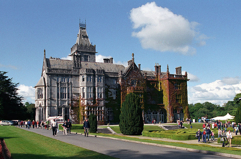
| Adare Manor | Early 18th century house replaced by a Tudor-Revivalist style building in the mid 19th century, the home of the Quin family and Earls of Dunraven. In 1786 Wilson describes the original house as "a very noble structure with fine and extensive demesnes". At the time of Griffith's Valuation valued at £130 and in 1906 the buildings at Adare Manor were valued at £182. Now functions as a hotel. |
|
| Frankfort | Samuel Adams was living at Frankford, Newcastle, in 1814. The residence of Richard Standish circa 1840 and of John White who held it in fee in the early 1850s. The buildings were valued at £9. This house is still well maintained and occupied. | |
| Kilmore | Brian de Breffny writes that the back section of Kilmore House is part of the 17th century house built by the Moncktons. The front part was built by the Tuthills in the mid 18th century. George Tuthill purchased the house from Edward Monckton in 1737. The Tuthills had previously held it on lease. Occupied by Thomas Lynch in 1814 and by Colonel William Jones in the early 1850s, when the property was held from Elizabeth Tuthill and valued at £15. In 1906 Kilmore was the residence of Anne Isabel O'Grady. This house is still extant and occupied. |
|
| Ballyneale | Bence Jones writes of this house having an early 19th century appearance. Occupied by John Cox and held from the Honourable John Massy in the early 1850s. The buildings were valued at £13+. At the end of the 20th century this house was the home of Lewis Glucksman. Sold by the Glucksmans in 1998. In 2008 it was placed on the market again by its current owner David Pearl for 10,000,000 euro. see http://www.michaelhdaniels.com/index.cfm?fuseaction=propdetails&Prop_RefId=39 |

|
| Glenwilliam | A house built in 1797 by the Reverend William Massy, second son of the Reverend Godfrey Massy. Occupied by George Massy in 1814. The residence of Mary Anne Massy at the time of Griffith's Valuation, held from the Court of Chancery and valued at £38. In the later 19th century it was the home of the Atkinson family. Slater noted it as the seat of Thomas D. Atkinson in 1894. This house is still extant and occupied. |

|
| Lisduane | The seat of Walter Mason, situated on the estate of General Dixon [Dickson], circa 1840. Occupied by John [Leland] Mason at the time of Griffith's Valuation and held by him from the Court of Chancery. The buildings were valued at £12. William Harte Mason of Cooleen, Bruree owned 190 acres in the 1870s. A house and farm are still extant at the site. | |
| Kilbeg Lodge | The seat of John Scanlan circa 1840 and of Sarah Scanlan in the early 1850s, held from William Scanlan and valued at £14. In 1906 occupied by William Scanlan and valued at £10. | |
| Coolrus House | The residence of Richard Harte circa 1840 and of James Lynch in the early 1850s who held the property and 186 acres from the Court of Chancery. The house has diminished in size by the publication of the 25-inch edition Ordnance Survey map in the 1890s and it is no longer extant. | |
| Castletown Conyers | The seat of the Conyers family, occupied by C. Conyers in the early 19th century. By the time of Griffith's Valuation the house appears to be in use as an auxiliary workhouse, held by the Croom Guardians from William Bailey, medical doctor, and valued at £25. In 1894 it was the residence of Charles Conyers. |
|
| Bruree House | Bruree House was also located on the Langton estate although at the time of the first Ordnance Survey the property was in the hands of Robert Fetherston who held a number of townlands in the parish, possibly from the Langtons. At the time of Griffith's Valuation the house was in use as an auxiliary workhouse. In 1853 Bruree House was sold to a member of the Shelton family and in 1868 it was sold to John Gubbins of the Kilfrush family. He was a successful racehorse owner and in 1884 built the present Bruree House. When he died in 1906 the property passed to his nephew John Norris Browning. The house was valued at £92 at this time. Owned by the Sheehans and Vernons in the 20th century. Now function as as a rehabilitation centre, known as Cuan Mhuire. A print entitled "The Lawn Meet" by Patrick Hennessy depicts this house. See www.museum.limerick.ie |

|
| Kilmurry | A house valued at £11 and held by Eyre Lloyd in fee at the time of Griffith's Valuation, now derelict. |
|
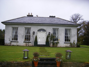
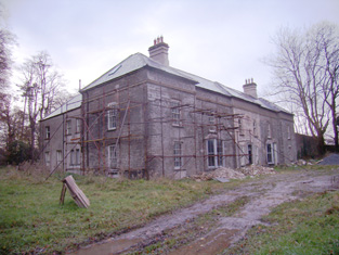
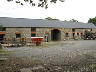
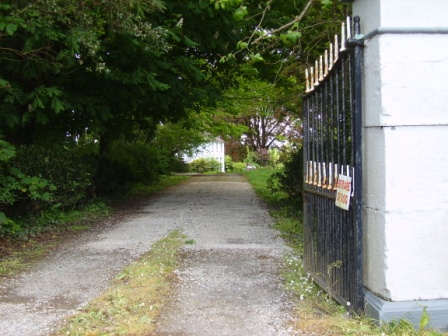
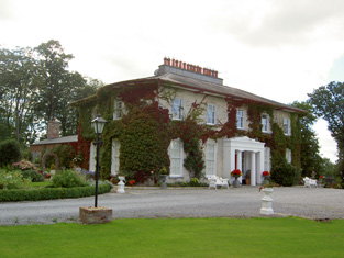
| Rineroe [Fort Union] | The house at this site is labelled Rineroe on the 1st edition Ordnance Survey maps but as Fort Union on the later 25-inch map of the 1890s. It was held by John Christy from the Dunraven estate at the time of Griffith's Valuation and valued at £24. It is still extant and occupied. |
![Photo of Rineroe [Fort Union]](https://landedestates.ie/storage/img/orig/2850.jpg)
|
| Castleroberts | Occupied by Michael Cantlow [Cantillon] in 1814 and by John Heffernan Cantillon at the time of Griffith's Valuation and held from Edward B. Hartopp. The buildings were valued at £13+. A farmyard is visible at the site now. | |
| Castle Ievers | The Ievers were living at Castle Ievers, originally known as Tullerboy, from the mid 18th century. Bence Jones dates this house from the early 19th century. Robert Ivers was resident in 1814, 1837 and at the time of Griffith's Valuation when the buildings were valued at £32. The property was held from William Maunsell. The Irish Tourist Association surveyor wrote in 1943 that much of Tullerboy Castle was demolished in the 1860s to make way for the present building. The owner in the 1940s was Roderic Haines. |

|
| Coolboy | A herd's house and offices situated on the St Leger estate was occupied by Henry Ievers at the time of Griffith's Valuation when the buildings were valued at £14+. Coolboy was occupied by the representatives of Robert Cleary in 1906. A substantial farm is still extant at the site. | |
| Greenpark | In 1814 and 1837 this house was the residence of Richard Ievers, brother of Robert Ievers of Castle Ievers. At the time of Griffith's Valuation it was occupied by Mrs Sarah P. Fitzgibbon, the wife of Richard Ievers who had remarried. She held the property from Alcock Otley and it was valued at £36. This house is now a ruin. |

|
| Cooleen | At the time of Griffith's Valuation William Hart Mason held the townland of Cooleen amounting to 88 acres in fee. The buildings were valued at £12. |
|
| Cherrygrove | Cherrygrove was the home of Edward Cripps in 1814 and of J. Barry in 1837. At the time of Griffith's Valuation it was occupied by Edward John Sheehy who held the property from Robert Harding. The buildings were valued at £21+. The Misses Sheedy were still in residence in the 1940s. A building is still extant at the site. | |
| Belview/Bellevue | A home of the Yielding family, occupied by Richard M. Yielding in 1814 and 1837 and by Timothy Hartigan who held the property from James Barry at the time of Griffith's Valuation. The buildings were valued at £13 at that time. Bought by the Delmeges in the early 1850s. The original house is not extant. | |
| Carass House | Caherass/Carass House was the seat of the Roche family from the early 19th century. The family had a large flour mill in the townland of Caherass and the house was situated closeby but in the next townland. At the time of Griffith's Valuation Sir David Roche held the house and 235 acres in Ballouragan from Messrs Barrington and Delmege. In 1894 it was the seat of Sir David V. Roche. In 1943 the Irish Tourist Association surveyor wrote that the house was accidentally destroyed by fire "many years ago". | |
| Carass Court | ''Burke's Irish Family Records'' states that Jeffrey Browning purchased Carass Court, from Lord Carbery. Leet records Jeffrey Browning as the proprietor of Carass Park in 1814. Jeffrey/Geoffrey Browning was married to Frances, sister of Sir David Roche, 1st Baronet. By the time of Griffith's Valuation Thomas Wise Browning was the occupier and he held the property, valued at £50, from Sir David Roche. The Brownings were still resident at Carass Court in the 1940s but the house was later demolished. |
|
| Clorane | A house occupied by Henry Hunt in 1814. Lewis describes Clorane as a "fine old house belonging to the Hunt family". By the time of Griffith's Valuation Edward Browning was leasing the house and 280 acres from Sir David Roche. In the 1870s in the possession of Patrick Hartigan. Old farm buildings are still located at the site but the house is a modern structure. |

|
| Croom House | Croom House was the home of the Lyons family in the 18th and 19th centuries. The house of James D. Lyons was valued at £48 in the early 1850s and he had a flour mill valued at £75 closeby. He held the property from John Croker. Described in 1943 by the Irish Tourist Association surveyor as a beautiful mansion on the left bank of the Maigue river, it was then in use as a military post. The house is still extant and occupied. |

|
| Islandmore | Tooreen, located just south of the town of Croom, was the residence of James D. Lyons in 1814 and 1837. By the early 1850s this house, then known as Islandmore, was occupied by Robert Maxwell, valued at £60 and held from Miss Catherine Giles. It later became the home of the Kelly family and Slater refers to it as the seat of John Roche-Kelly in 1894. Colonel Basil Roche Kelly was resident at the time of the Irish Tourist Association survey of 1943. The surveyor wrote that the house was originally Georgian but had suffered many alterations. |
|
| Croom Castle | Originally a Fitzgerald Castle, subsequently granted to the Duke of Richmond who sold it to John Croker in 1721. Reverend Fitzgerald writes that Croker was agent to the Duke. A residence was built with some of the stone from the old castle. Situated on the outskirts of the town of Croom this house was occupied by Samuel A. Dickson in the mid 19th century who held it from the Crokers. The buildings were valued at £30. Sold in the late 1880s to the Lyons family and bought by Michael Corry in 1936. Now functions as self catering accommodation. see http://www.croomcastle.com/history.html |

|
| Glenbevan | Lewis records J. Bevan as the proprietor of Glen-Bevan in 1837 and Joseph Bevan occupied the house and 173 acres at the time of Griffith's Valuation. The property was located on the Evans estate. The residence of Mr John Hedderman in 1943, this house is still extant and occupied. |

|
| Clogher West | A house occupied by John Fitzgerald and held from George Whitelock at the time of Griffith's Valuation. The buildings were valued at £12. The original house does not appear to be extant. | |
| Maidstown Castle | Originally known as Ballyvenoge, Seoighe writes that John Ormsby first lived at Maidstown which he sold to the Webbs when he went to live at Athlacca. By the mid 18th century the Webbs had sold Maidstown to the Gubbins. The home of a branch of the Gubbins family in the late 18th century and early 19th century. The house was valued at £20 and held by Patrick Coll from John White in the mid 19th century. The Colls sold Maidstown to the O'Regans in 1972. A house is still extant at the site as well as the ruin of the original tower house. | |
| Maiden Hall | Maidenhall was the residence of Boucher Esq in the 1770s and in 1786. Home of the Holmes family in the first half of the 19th century. R. Low Holmes was occupying the house in 1837 and Mrs Susan Holmes in the early 1850s. She held the property from the Reverend Benjamin W. Bradshaw. The buildings were valued at £14. A house is still extant at the site. | |
| Creggane Castle | A property associated with the Hutchins family, occupied by John Quaid at the time of Griffith's Valuation and held from Samuel Hutchins. The buildings were valued at £17. The sale rental 1857 records that the original lease dated 1802 was from Edmund Earl of Cork and Orrery to Emanuel Hutchins. Farm buildings occupy the site. | |
| Abbeyville | A house located on the Finch estate and the home of the White family in the 19th century. Occupied by William White in 1814 and Richard White in 1837 and at the time of Griffith's Valuation when the buildings were valued at £26. Later the home of Henry Ievers, a younger brother of Robert Holmes Ievers, of Castle Ievers. The original house is not extant but a house still exists at the site. |
|
| Ballynanty | Ballynauty was the residence of Mrs Creed in 1837 and of Charles W. Smith in the early 1850s. He held the property from the Trustess of Charles Smith and the buildings were valued at £37 Still recorded by Slater as a Smith property in 1894. . The original house is not extant. | |
| Rockbarton | Also known as Mount Prospect, Fitzgerald describes Mount Prospect as the "magnificent seat and demesne of the present Chief Baron". Lewis describes Rockbarton as the "elegant mansion of Lord Guillamore". It was occupied by John Low at the time of Griffith's Valuation who held it from the Viscount. It was valued at £75. By 1906 the value of the house was reduced to £60 and it was then occupied by Lord Fermoy. The Irish Tourist Association surveyor records the sale of this house to Mr Barry in 1922. It remained in his possession until it was demolished in 1941 and the fittings sold to a Limerick builder. He writes that it was one of the "showplaces of Ireland" with a grand staircase of marble and that it had been renovated at a cost of £70,000 circa 1912 by the Honourable Nigel Baring who was married to a daughter of Lord Fermoy.The house is now a ruin. | |
| Uregare House | Owregare House was the residence of Mrs Gubbins in 1837 and of Mrs N. Barron who held the property from William G. Gubbins at the time of Griffith's Valuation. The buildings were valued at £22+. This house was also known as Newlawn. Fitzgerald writes that it belonged to the Creed family before the Gubbins. Occupied by Thomas A. Dicken in 1906. This house is no longer extant. | |
| Milltown | In the 18th century Miltown was the residence of a branch of the De Lacy family. Mill-town, Bruff, was the residence of Mrs Bevan in 1814. George Gubbins was the occupier in 1837 and at the time of Griffith's Valuation. He held the property valued at £40+ from Edward B. Hartopp. In 1831 George Gubbins married Elizabeth Blood nee Hartopp. This house is named Milltown George on the first Ordnance Survey map. |

|
| Summerville | Occupied by the Reverend Joseph Gabbett, fifth son of Daniel Gabbett of Strand House, Chancellor of Limerick and Prebendary of Effin and held by him from Alcock Otley. The buildings were valued at £23+. In 1786 Wilson refers to a house at Uregare as the seat of General Gabett. A house is still extant at the site. | |
| Dunnaman | Matthew O'Flaherty held buildings valued at £13+ and 219 acres from James D. Lyons at the time of Griffith's Valuation. Grid Reference is approximate. | |
| Carrigeen | John Christy held a house valued at £21 and 513 acres at Carrigeen from the Earl of Dunraven at the time of Griffith's Valuation. A modern farm is extant at the site now. | |
| Dollas Upper | Mary Blake occupied a house valued at £12+ and 48 acres on the Langford estate at the time of Griffith's Valuation. This property is labelled Dollas House on the Ordnance Survey map published in 1942. Unroofed buildings are still extant at the site. | |
| Mount Coote | The county Limerick seat of the Coote family in the 18th and 19th centuries. Wilson refers to it as "the pleasant seat of Mr. Coote" in 1786. It was occupied by Chidley Coote in 1814. Lewis refers to it as the former seat of Chidley Coote in 1837. Charles Coote was resident at the time of Griffith's Valuation and held the property in fee. The buildings were valued at £53. Their value had increased to £65 by 1906. The Irish Tourist Association surveyor wrote in 1943 that the house was bought by Sir Gilbert Greenall, who became 1st Lord Daresbury, who spent about £200,000 setting up a Model Farm. [Lord Daresbury also owned Clonshire]. Following his death three years previously it was sold and then run as a stud farm. Bence Jones writes that this house was demolished circa 1960 and a new house built in the Georgian style. |

|
| Riversfield | A house located on the Coote estate, occupied by Thomas Weldon in 1837 and at the time of Griffith's Valuation when the buildings were valued at £20. John H. Weldon of Riversfield owned 68 acres in county Limerick in the 1870s. Occupied by Mr and Mrs Watt in 1943. It is still extant. | |
| Millmount | Occupied by the Reverend Joseph Gabbett and held from Daniel Gabbett at the time of Griffith's Valuation, when the buildings were valued at £16. It is labelled Millmount on the First Edition Ordnance Survey Map and as Ardvullen on the later 25-inch edition of the 1890s. A house is still extant at the site. | |
| Ash Hill Towers | The residence of a branch of the Coote family in the 18th century, possibly held from the Barons Carbery. Ash Hill is referred to by Wilson as the seat of Chudleigh Coote in 1786. Bought by Eyre Evans from Chidley Coote in 1794 (see sale rental 6 July 1878). Eyre Evans held the property in fee throughout the first half of the 19th century. The Ordnance Survey Field Name Book describes this house as having "a most superb new front with towers at each end". At the time of Griffith's Valuation the buildings were valued at £50. Bence Jones writes that Ash Hill Towers became the residence of John Henry Weldon in the later 19th century. The Irish Tourist Association surveyor wrote in 1943 that the property was owned by Captain P.M. Lindsay, nephew of John H. Weldon, who bought the house from the Evans family in 1880. Still extant, this house is the centre of a stud. |
|
| Fanningstown Castle | An 18th century house which was the home of the Jackson family. Henry Lee is recorded as resident at Fannings-town in 1814. This house was demolished and a battlemented building was erected in the bawn of the old medieval castle by Hamilton L. Jackson in the 1850s and offered for sale in 1860. Bought by David Vandeleur Roche of nearby Carass in the 1860s. Occupied by James Fitzgerald Bannatyne in 1906 who held the mansion house valued at £31+ and 359 acres of untenated land. The castle now provides self catering accommodation and can be hired as a venue for functions such as weddings. http://www.fanningstowncastle.com/index.htm |

|
| Grove House | This house appears to straddle the boundary of the parishes of Ballingarry and Rathkeale and the border of the baronies of Connello Upper and Lower. Occupied by Colonel William O'Dell Member of Parliament in 1814 and by Major O'Dell in 1837. By the time of Griffith's Valuation Major O'Dell's estate at Rylanes was in Chancery and Grove House was in use as an Auxiliary Workhouse. It was valued at £35 and held by the Croom Guardians from Robert Maxwell. This house is no longer extant but substanial yard buildings remain. |

|
| The Turret | Lewis writes that the Turret was erected by a branch of the De Lacy family and repaired by Colonel O’Dell in 1683 and was "lately the residence of Major O’Dell". The Ordnance Survey Name Books refer to an inscription on the wall of the building which recorded the O'Dell family inhabiting the building in 1683. It was reputed to incorporate a turret from an old house of the Knights Hospitallers. Thomas O'Dell was resident in 1814 and Mrs O'Dell of the Turret, Ballingarry, died in 1818 according to the church records of that parish. Fitzgerald in 1826 refers to Jackson's Turret, built on a hill and "now nearly in ruins". Bence Jones writes that a porch and wing were added to the building in the late 19th century and that it became a presbytery. Grid reference is approximate. | |
| Cappanihane | This house was occupied by John Mason in 1814, by R. Mason in 1837 and in use as an auxiliary workhouse at the time of Griffith's Valuation, when the buildings were valued at £15. This house was the home of John Parker Graham in the 1860s and 1870s. Another house in this townland, Glenbrook Lodge, was occupied in the early 1850s by Myles Mason and valued at £9+, grid reference R492 318. Mary Hamilton held a mansion house valued at £20 and 41 acres of untenanted land at Cappanihane in 1906. | |
| Athlacca House | A residence of the Ormsby family in the 18th century. On the first Ordnance Survey map the house is marked "in ruins". Also known as Old Court. | |
| Ballygrennan Castle | Granted to the Evans family under the Acts of Settlement. In the early 19th century the residence of William Creed. Described as "in ruins" on the 1st edition Ordnance Survey map. Some portions of the building remains though much of the stone has been removed. | |
| Ballylin | Michael Smith was living at Ballylin, Rathkeale, in 1814 and R. Smith in 1837. | |
| Smithfield | Originally a Aylmer residence, later leased by the Smith family. The house was occupied by Richard Smith in 1814 and by R. Smith in 1837, later in the possession of the Fergusons. A 3 storey hand drawn house is depicted on the sale rental map of the Aylmer estate. Smithfield House is now the centre of a working farm run by the Lowe family and offers Bed and Breakfast accommodation. |

|
| Ashborough | Lewis records Daniel D. Power as resident at Ash Grove in the parish of Ballingarry in 1837. Held Daniel D. Power at the time of Griffith's Valuation and valued at £16 and in his occupation at the time of the 1854 sale. An old outbuilding remains at the location of this house. |
|
| Castle Harrison | An early 18th century house, the seat of the Harrison family until the 1950s. According to Lewis it was built on the site of Castle Dod, an old Fitzgerald castle and was inhabited by Standish Harrison in 1837. A map dated 1736 in the National Library includes a drawing of the house then known as Castle Dodd. In the 1940s the Irish Tourist Association Survey noted that it was the residence of Mrs. Harrison, widow of General Harrison. It provides a description of the great hall which contained artefacts that had been unearthed on the estate during the construction of the nearby railway. Castle Harrison was inherited by five sisters in 1951 and the estate was sold to the Land Commission in 1956. The house was subsequently demolished. | |
| Baily Ville | Situated on the Neville estate this house was built by the Baily family in the mid 19th century. It is marked on the first Ordnance Survey map, circa 1840. By the 1870s Richard Gregg was living in the house which was then known as Oakville. He owned 405 acres in county Cork. Hajba writes that Gregg sold his interest in the property to the Fitzpatricks in the 1880s and this family was still in residence in the early 21st century. | |
| Cooliney House | Hajba writes that Cooliney was originally part of the Bowerman estate and that the house was rebuilt in the mid 18th century. It passed through marriage to the Nevilles of Furnass, county Kildare. Occupied by Mr Thomas Weldon in 1814 and by R. Weldon in 1837. At the time of Griffith's Valuation Robert Weldon held the house and 85 acres from James Hill. The house was valued at £20. In the 1940s the Irish Tourist Association survey noted that it was then the home of the Goold family. The house was restored in the 21st century. |
|
| Milltown Castle | Originally the home of Thomas Evans, a younger brother of the 1st Baron Carbery, and of his son Eyre Evans. Mary, sister of Eyre Evans, married George Bruce in the mid 18th century. The Castle was subsequently leased by the Evans to the Bruces and it remained the home of the Bruces until the late 19th century. Described by Lewis as “a handsome castellated mansion in the later English style”. Reduced in size in the early 20th century. The Irish Tourist Association Survey of the 1940s noted that the buildings, at that time the residence of the Keane family, were not in good repair. However, the building continues to be occupied. |
|
| Gibbings Grove | This house was the seat of the Gibbings family in the 18th and early 19th centuries. The family was still resident in 1837 but by the early 1850s the house was occupied by Edmond Irwin who held it form Richard Gibbons. It was valued at £14. Later occupants were local priests and it was eventually sold by the Gibbings in the late 19th century. In 1944 the Irish Tourist Association Survey referred to it as the home of the Cagney family who had purchased the property c.1912 and also that it was famous for growing the Toormore apple, used in making cider. The house is still occupied. |

|
| Belfort | Originally a Reeves home, occupied by them in 1837, it became the residence of the Clanchy family in the mid 19th century. John Clanchy was resident at the time of Griffith's Valuation when the house was valued at £21 and held with 37 acres from the representatives of John B. Reeves. The Irish Tourist Association Survey of the 1940s refers to it as the residence of Mrs. Clanchy, widow of J.T. Clanchy and noted that it was much associated with horseracing. Bence Jones records the demolition of this house in 1958. | |
| Ballyteige | Originally the home of a branch of the Tuthill family, no large house is marked on the first Ordnance Survey map in this townland. The house was leased to David Conyers of Castletown Conyers in 1885 and to Thomas W. Westropp Bennett in the 1890s. It is now available for hire, see http://www.ballyteigue.com/ |
|
| Fortlands | Fortlands was occupied by members of the Batwell family in the first half of the 19th century. Hajba writes that the Batwells held the property from the Hutchins family. By the mid 19th century Samuel Hutchins was occupying the house, held by him in fee and valued at £31+. The home of the O'Connor family in the 20th century. The original house does not appear to be extant. | |
| Sanders Park | Late 18th century house, the seat of the Sanders family, occupied by William Saunders in 1814 and by C. Saunders in 1837. Griffith's Valuation records William R. Saunders holding the property from the Earl of Cork, the buildings were valued at £34+. The Irish Tourist Association Survey of the 1940s stated that it was then the residence of Mr. Binchy, a merchant in Charleville. It was converted into flats in the latter half of the 20th century but the building was derelict at the beginning of the 21st century. Also known as Charleville Park. |
|
| Newtown | Hajba dates this house from 1749 when it was built as a hunting lodge for the Courtenays. Described by Lewis in 1837 as the seat of Robert Courtney, John Culhane was resident by the time of Griffith's Valuation, holding the property from John Courtnay. The buildings were valued at £13. In 1943 the Irish Tourist Association Survey noted that it was then the home of the Culhane family. The house was demolished in the 1960s. | |
| Gortskagh | No house of more than £5 valuation is recorded in Griffith's Valuation in Gortskagh except the glebe house at £26. This house was occupied by Reverend William Bunbury who held the property from John Courtenay. The Deane connection with Gortskagh commenced with the marriage in 1871 of Honourable Matthew J.H.F. Deane, uncle of the 4th Baron Muskerry, with Maria, daughter of Reverend William Bunbury. The Deanes sold the house to the Binchy family in the 1890s. Home of the Foley family in the early 21st century. |
|
| Springfort | Dating from the very early 18th century, Springfort was the home of the Vowell family in the 18th century but Mr Cox is recorded as the proprietor in the late 1770s. By 1837 the Reverend Jonathan Bruce was resident. In the early 1850s William Carroll occupied the house holding the property from William Cox. The buildings were valued at £11+. This house was still extant in the 1980s when it was the home of the Cagneys. | |
| Moatville | Located on the outskirts of Charleville this house was occupied by Mrs Ryan in 1837 and of Michael Ryan at the time of Griffith's Valuation. Moatville was later the birthplace of Dr Reeves, Bishop of Down, Connor and Dromore. In the 1940s the Irish Tourist Association Survey described it as "a quaint high house, the residence of Mr. Ball". It is still extant. |

|
| Mount Blakeney | Mount Blakeney is south west of the town of Kilmallock and very close to the border between counties Limerick and Cork. No large house is marked in the townland of Mount Blakeney on the first Ordnance Survey map (Sheet 47). In 1786 Wilson refers to Mount Blakeney as the seat of Mr. Blakeney. At the time of Griffith's Valuation the townland was in the possession of Mrs. Blakeney Fitzgerald. In 2022 Mount Blakeney was offered for sale. |

|