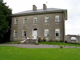
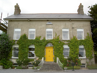
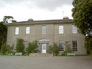
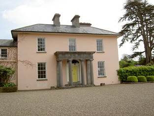
Grallagh Castle
Houses within 15km of this house
Displaying 104 houses.
Houses within 15km of Grallagh Castle
Displaying 104 houses.
| House name | Description | |
|---|---|---|
| Ballyphilip | The seat of the Going family in the 18th and 19th centuries, W. and A. Going were resident in 1814 and Ambrose Going held the property in fee at the time of Griffith's Valuation. The buildings were valued at £30.15 shillings. This house was held by the representatives of B.F. Going in 1906. Buildings are still extant at the site. | |
| Ballinunty House | William Going occupied this house and held it in fee in the mid 19th century when it was valued at £24.10 shillings. In 1894 Slater notes it as the seat of Miss A.J. Going. This house no longer exists. | |
| Coalbrook | A Langley home in the 18th and 19th centuries. The Ordnance Survey Name Books describe the demesne as "nearly one half wood and oranmental ground" in 1838. It was valued at £35.10 shillings in the mid 19th century when held by Henry Langley in fee. George Langley was the occupier in 1906 when the buildings were valued at £41+. This house is still extant and lived in. |
|
| Lisnamrock Castle | The Langleys were resident here from the 18th century. Wilson, writing in 1786, refers to Lisnarock as the seat of Mr Langley. Henry Langley was the occupier in the mid 19th century, holding the property in fee. The buildings were valued at £11.10 shillings. Held by George Langley in 1906. Buildings still exist at this location. | |
| Lickfinn | Fergus Langley occupied Lickfinn in 1814 and John Langley held the house valued at £12 and 273 acres in fee at the time of Griffith's Valuation. This house was later known as Knockanure. In 1906 held by the representatives of John Langley. | |
| Pastor Ville [Kockboy] | In 1840 the Ordnance Survey Name Books refer to Pastorville as a gentleman's seat and to Micheal Meeghan as the proprietor. At the time of Griffith's Valuation Timothy Meighan held a house at Knockboy valued at £10.15 shillings and 15 acres from Edmund Byrne. This appears to be the house Pastor Ville marked on the first Ordnance Survey map and on the later 25-inch map of the 1890s. Buildings are still located at this site. | |
| Littlefield | Littlefield, Killenaule, was the residence of Flor Carrol in 1814 and of E. Cooke "who occasionly resides here" in 1837. Earlier, in 1786, Wilson had referred to it as the seat of Mr. Cooke. Edward Cooke is recorded as the occupier at the time of Griffith's Valuation. He held the property in fee and the buildings were valued at £12. This house is now a ruin. |
|
| Poyntstown | A home of a branch of the Cooke family in the 18th century. In 1786 Wilson refers to "Point's-town" as the seat of William Cooke. He was also the proprietor in 1814. In 1837 Lewis records Poyntstown as the property of Phanuel Cooke "in ruins". The house is marked as in ruins on the first Ordnance Survey map. Fennell Cooke held this townland at the time of Griffith's Valuation. | |
| Helen Park | Oliver Latham was residing at Helen Park in 1814 and in the mid 19th century Reverend Martin Laffan, Parish Priest of Killenaule, was the occupant. He held the property from Patrick Waldron and the buildings were valued at £22.15 shillings. Helen Park is listed as one of the residences of Lawrence Waldron in the 1870s. Still extant and occupied. |
|
| Cleragh House | William Power was living at Cleragh, Killenaule in 1814 and Charles Blackmore was resident in the mid 19th century. Blackmore held the house valued at £13 from Patrick Waldron with 257 acres. This house is still in use as a country residence. |
|
| Glenview | Glenview was occupied by the Reverend Edmund Prendergast in the early 1850s. He held the house valued at £18.15 shillings from Matthew Prendergast. In the early 20th century the house was altered and extended by a religious order who set up a school. |
|
| Noan | Originally the home of the Taylor family, Wilson refers to Noan as the seat of Godrey Taylor in 1786. It was occupied by Natt. Taylor in 1814 and recorded by Lewis as the seat of the Taylor family. In 1840 the Ordnance Survey Name Books refer to Mary Phelps as the proprietor of Noan House. By the mid 19th century it was occupied by the representatives of John Bagwell and held in fee. The buildings were valued at almost £30. The sale rental of 1853 records James Chadwick as tenant on a seven year lease. A lithograph of the house is included. Occupied by Dr Armitage in the 1870s who owned over 2,000 acres in the county. It is still extant and occupied. |
|
| Willmount | Occupied in 1814 by Robert Lane and by Hampden Lane in the early 1850s, when the house was valued at £17 and held from William P. Barker. This house is still an occupied residence. |
|
| Knockanglass | This house was the home of James Riall in the early 1850, who held the property from K.Pennefather. The buildings were valued at £18.15 shillings. The National Inventory of Architectural Heritage states that this house was associated with the Langley family and was sold to the O'Dwyers in 1912. It was occupied by Adelaide Langley in 1906. It still functions as a residence. |
|
| Moglass House | Moglass valued at £11 was held by John Riall from George Riall at the time of Griffith's Valuation. It is described as "in ruins" on the 25-inch Ordnance Survey map of the 1890s. | |
| Lanespark | The home of the Lane family from the 18th century,Wilson refers to it as the seat of Hamilton Lane in 1786. Held by John Lane in 1814 and by his representatives in the early 1850s, when the house was valued at £26. The sale rental of 1858 describes the farm offices as extensive and that a powerful steam engine had been erected. Lanespark House is still extant. | |
| Roan | Dennis Duan was resident here in 1814 and Robert Purcell in 1814. He held the property valued at £18.15 shillings from Matthew Jacob. This house had later associations with the Bianconi family and is still a family home. |
|
| Silverfort | Silverfort was the home of a branch of the Scully family throughout the 19th century. Jeremiah Scully was resident in 1814, in 1837 and in the early 1850s when he held the house valued at £18.10 shillings from George Carlton. Jerome J. Scully was tenant in November 1857 and still resident in the mid 1870s. This house is still in use as a country home. |
|
| Ardmayle/Clonmore | Ardmayle House in the townland of Clonmore North is marked on the first Ordnance Survey map. The Prices were resident here from at least the 1770s ad Wilson mentions it as the seat of Mr. Price in the 1780s. "Ardmoyle", Cashel, was the residence of Thomas Price in 1814 and in 1837. Richard Price was the occupant in 1850 holding the house valued at £21.17 shillings from John Hyde. The National Inventory of Architectural Heritage states that the present house dates from circa 1870s and was formerly the wing of an 18th century house demolished in 1951. Louis H. Grubb occupied at house at Clonmore North in 1906 valued at £56. This house is now known as Clonmore. |
|
| Fort Edward | Fort Edward was the home of Edward Long from at least the mid 1830s and is referred to as his residence by the Ordnance Survey Name Books in 1840. At the time of Griffith's Valuation he held the property from Charles Bianconi and the buildings were valued at £19+. Still extant and occupied. |
|
| Longfield | The seat of the Long family, occupied by Richard Long in 1814 and in 1837. Bought by Charles Bianconi in the 1840s, he held it in fee in the early 1850s when the house was valued at £27+. By 1906 the house was valued at £37 and was occupied by Mary Anne O'Connell. The house remained in the ownership of Bianconi's descendants until 1968 when it was bequeathed by Mrs Mary O'Connell Bianconi to the Irish Georgian Society. |

|
| Ballinree | Ballinree House was valued at £16+ in 1850 and was occupied by the Reverend William Kirwan and held from Smyth Barry. Arthur H.S. Barry was the occupier in 1906. | |
| Ballysheehan | Occupied by the Lethams from at least the 1770s and noted by Wilson as their residence in 1786. William Latham is recorded as resident in 1814 and Thomas Brinly in 1850 when the buildings were valued at £28+ and held from Smyth Barry. This house still exists, the centre of a stud. | |
| Ballytarsna | John Max occupied this house which he held from the Bunbury estate in 1850. The buildings were valued at £16.12 shillings. In 1906 James Grene was resident. Recently renovated this house is still well maintained and occupied. |
|
| Dually | William Scully, fourth son of Roger Scully of Kilfeacle and Dualla, county Tipperary, was living at Dually in the late 18th century. John Scully was resident at Dually in 1837. In 1811 John had married Catherine Moore sister of the poet Thomas Moore. Roger Scully was the occupier in the early 1850s. He held the property from Oliver Latham and the buildings were valued at £24.14 shillings. This house is now run as a Bed and Breakfast guesthouse by the Power family. http://www.duallahouse.com/ |
|
| New Park | A mid 18th century house built by the Pennefather family and occupied by them until sold to the Davies family after the Famine (Bence Jones). In the mid 19th century the house was valued at almost £49 and held in fee by Captain M. Pennefather. It was advertised for sale by the Pennefathers in June 1852 and bought by the Davies who sold it to the McCans in 1864. Joseph McCann was resident in 1906. Now known as Ballyowen House and still in use as a country house. |
|
| Rathclogh Cottage | A small residence when marked on the first Ordnance Survey map. Occupied by Charles Minchin in 1850, valued at £13+ and held from John Millett. | |
| Mayfield House | A Price home, occupied by Thomas Price in the mid 19th century and held from William Price, it was valued at £14+. Still extant and occupied. |

|
| Coleraine | The seat of the Price family occupied by William Price in the mid 19th century and held by him in fee. The buildings were valued at £31.15 shillings. Thomas Price was resident in 1906. This house is still extant and occupied. | |
| Meldrum | The Sall family were located at Meldrum in the early 17th century and through marriage the property passed to the Latham family who were resident in the 1780s. . A mainly 18th century house built onto part of a 17th century house Meldrum was a Lloyd residence in the 19th century. It was the home of Richard Lloyd in 1814 and of the Reverend Richard Lloyd in 1837 and at the time of Griffith's Valuation, when it was valued at £26+ and held from Oliver Latham. The Lethams were resident in the 1770s. In 1894 Slater notes it as the seat of David Tennant. A house and large farm now occupy the site. |
|
| Lismortagh | Matthew N. Sankey was residing at Lismortagh in 1814 and John Millett in 1850. Millet held the property from the representatives of William Burgess and the buildings were valued at £17.15 shillings. This 18th century house is still a fine residence. |
|
| Mortlestown Castle | Captain James G. Jacob was the occupant of Mortlestown Castle in 1814. By the time of Griffith's Valuation Thomas P. Lloyd was resident holding the property from Robert Jacob. The house was valued at £29. Buildings are still located at this site. | |
| Gaile | Gaile was the home of the Phillips family in the 19th century, occupied by S. Phillips in 1837 and by Richard Phillips in 1850. It was held from Benjamin Bunbury with 749 acres and was valued at £37+. The Phillips continued to reside at Gaile until at least the mid 20th century. This house was vacant in the early 21st century. |
|
| Regaile | In 1840 the Ordnance Survey Name Books record Rev. Mr. Joice as the occupant of Regeale. The Reverend Robert Armstrong occupied the house at the time of Griffith's Valuation holding it from Richard Phillips. The buildings were valued at £20.18 shillings.A house is still extant at Regaile. | |
| Graiguenoe | In 1837 Lewis refers to C. Clarke "who has recently erected a spacious and elegant mansion on his estate". In 1850 this mansion was valued at £44.12 shillings and it was held in fee by Charles Clarke. Slater noted it as the seat of James Neville Clarke in 1894 and the Clarkes were still resident at Granguenoe Park in the early 20th century. The house was burnt in 1923. The site is now occupied by a stud farm. | |
| Killough | A 16th century tower house with a number of additions, Lewis records Killough Castle as the "occasional residence" of the Honourable Mrs Plunkett. In 1850 the Honourable Bowes Daly occupied the castle valued at £22.14 shillings which he held in fee. |
|
| Ballinamona | Ballinamona was the home of the Murphy family in the 19th century, occupied by William Murphy in 1814 and in 1850. The buildings were valued at £21.15 shillings and held in fee. Edmund William Murphy was resident in 1906. |

|
| Deerpark | This house valued at £34.12 shillings was occupied by John Hare and held from the representatives of - Wyse in the mid 19th century. The National Inventory of Architectural Heritage survey indicates it was built around 1850. It is still extant. |
|
| Lowesgreen | Lowesgreen was the home of Richard Butler Hamilton Lowe in the 1780s. By 1814 Benjamin Bradshaw was resident here and Mrs Hannah Carey was occupying the house in the mid 19th century when it was valued at £16+ and held from Robert [Richard] B. Lowe. The Newenham sale rental of 1865 records Solomon Watson as tenant and representative of Hamilton Lowe who had been granted a lease for lives renewable for ever from John Newenham in 1753. A house is still extant at this site. | |
| Mobarnan | Mobarnan was the seat of the Jacob family in the 18th and 19th centuries. Occupied by Samuel Jacob in 1814, M. Jacob in 1837 and by Samuel Jacob at the time of Griffith's Valuation. He held the property in fee and the buildings were valued at £37+. Later the home of the Tennant family. This house was enlarged in the early 19th century and is still in use as a residence. In the 1970s it was owned by Major Marcus William Keane, formerly of Beech Park, and his wife, Anne R. Armitage of Noan, Co Tipperary. |
|
| Peppardstown | The home of members of the Henderson family in 1814 and in 1850 when Samuel Henderson held a house valued at £10.14 shillings from Matthew Jacob at Peppardstown. In the mid 1870s Jerome James Guiry was living at Peppardstown, Fethard and the Guiry family were still resident in the early 21st century. The National Inventory of Architectural Heritage dates the present Peppardstown house from circa 1870. Beatrice P. Saunders was occupying the mansion house at Peppardstown in 1906. |
|
| Beechmount | John Godfrey was the occupant of Beechmount, Fethard, in 1814 but by 1837 T. G. [Thomas Godfrey] Phillips was resident. He held the property from the Massys and in the early 1850s the buildings were valued at £18.12 shillings. The representatives of Samuel Phillips were still resident here in the 1870s. The house is still a residence. |
|
| Garraun | In the early 1850 John O'Meagher occupied a steward's house at Garraun which he held from - Stratford. The buildings were valued at £12+. A farming enterprise is still located at this site. | |
| Annesgift | This house was the home of the Glenstanes. In 1814 Anne Glenstanes daughter of John Jacob Glenstanes married Wray Palliser and the house passed into Palliser ownership. Annesgift was occupied by George Ponsonby in 1814, by Major Gough in 1837 and by Colonel W. Palliser and George Ponsonby at the time of Griffith's Valuation. They held the property in fee and the buildings were valued at £32+. This house was occupied by the Hughes family in the first half of the 20th century and is now converted into apartments. |
|
| Ardsallagh | The home of George Gough in the first half of the 19th century. It is described in the Ordnance Survey Name Books in 1840 as "a gentleman's residence with garden's attached and surrounded with ornamental grounds". It was valued at £37.12 shillings in 1850 and held from George Fennel. In the 1870s Colonel George Frend of Ardsullagh owned 100 acres in county Tipperary. Still in use as a country house. |

|
| Coolmore | The seat of the Sankey family in the 18th and 19th centuries, Coolmore was recorded by Wilson as the seat of Mr. Sankey in 1786. It was occupied by John Butler in 1814, by Matthew Villiers Sankey in 1837 and by Jacob Sankey in 1850. He held the property in fee and the buildings were valued at £37.15 shillings. In the second half of the 20th century Coolmore became a world famous stud for the breeding of race horses. The stud was set up in the late 1960s by Tim Vigors and continued by Vincent O'Brien, Robert Sangster and John Magnier. |
|
| Derryluskan | The Pallisers were resident at Derryluskan from at least the mid 18th century. John Palliser was the proprietor in 1814 and Mrs Palliser in 1837. Their son Colonel Wray Palliser was the occupant at the time of Griffith's Valuation. He held the property from Colonel Gore and the buildings were valued at £45.17 shillings and held with a demesne of 682 acres. The Pallisers were still residing at Derryluskan in the 1870s. The house has been greatly reduced in size but still functions as a residence. |
|
| Rathcool | Blake Esq was resident at Racool in the 1770s. In 1840 the Ordnance Survey Name Books describe Rathcool as "a castle apparently inhabited. There is another dwelling house attached with a garden". In the mid 19th century Rathcool Castle was occupied by Charles Blackmore and held from the representatives of L. Clutterbuck. The buildings were valued at £16.13 shillings. Charles Blackmore was still residing at Rathcool in the 1870s when he is recorded as the owner of one acre in county Tipperary. Rathcool is still in use as a house. |
|
| Rocklow | Taylor and Skinner records Rocklowe as the residence of Lowe Esq in the 1770s. Rocklow was the home of Benjamin Frend and his wife, Eliza Gough, in the first half of the 19th century. Benjamin was resident there from at least 1814 to the 1850s. Griffith's Valuation records that it was held from Hugh Barton and was valued at £37+ in the early 1850s. This house later belonged to the Massys and is still in use as a residence. In 2022 it was offered for sale. |
|
| Castlelake Cottage | Major M. Lidwell was resident at Castlelake, Cashel, in 1814. In 1837 Lewis records a distillery and the neat residence of Thomas Mathew. The Ordnance Survey Name Books refer to it as being occupied by Mathew Gilbert in 1840. These buildings appear to be in the possession of the Poor Law Commissioners at the time of Griffith's Valuation, valued at £40+ and held from General Hall. The buildings no longer exist. [In 1786 Wilson may be referring to this property when he note a seat of Mr. Burke at Castlelake]. | |
| Rock View | Rock View, Cashel, was occupied by John Lane in 1814, by Sam Cooper in 1837 and by Mrs Margaret Matthews in the early 1850s. The buildings were valued at £18.16 shillings and held from General Hall. This house, located close to the road between Golden and Cashel, is still occupied. |
|
| Racecourse Hall | Lewis records Avary Jordan as the proprietor of Race-Course Lodge in 1837. The house was valued at £35 in the mid 19th century, occupied by Avary Jordan and held from the Cashel Commissioners. Mrs Jordan of Racecourse owned 3 acres in the 1870s. This house, located just south of the town of Cashel, still survives as a fine country residence. |
|
| St Johnstown | St Johnstown originally belonged to Matthew Jacob, whose only daughter and heir married Richard Pennefather of New Park in 1782. Wilson refers to it as the seat of Mr. Jacob in 1786 but their second son Matthew J. Pennefather was resident at St Johnstown in 1814. In 1837 Lewis records St Johnstown Castle as "consisting of a high square tower in good preservation, [it] is the property of James Millet Esq who has a modern house in its immediate vicinity". The buildings were valued at £31+ in the early 1850s, James Millet was still the occupier holding the property from Stephen C. Moore. | |
| Tullamain Castle | Tullamaine Castle was the home of John Power, father of the 1st Sir John Power, Baronet. Leet records J.D. Scully as resident at Tullaghmain-castle, Fethard, in 1814. This was James Scully (1779-1853), fourth son of Jeremiah Scully of Silverfort. By 1837 Lewis records John Maher as resident though the Ordnance Survey Name Books in 1840 refer to the proprietor as a Mr. Walsh. By the time of Griffith's Valuation Maher is recorded as holding the property in fee. The buildings were valued at £44.16s. By the mid 1870s Tullamaine Castle belonged to Henry Maynard Harding who advertised it for sale in July 1880. Slater still refers to it as his property in 1894. Dr M.J. Barry was resident at Tullamain in 1906. The castle was burnt in the early 1920s but rebuilt and is still a country residence. In the early 1940s C. A. Vigours was resident. |
|
| Ballynahinch | A house valued at £14, occupied by Denis Heany and held from Richard B. H. Lowe at the time of Griffith's Valuation. This house is still extant and the centre of a working farm. |

|
| Clonbonane | Edmund Scully of the Silverfort branch of the Scully family lived here in the first half of the 19th century. By the time of Griffith's Valuation Jeremiah Scully held the house valued at £12 from the Earl of Norbury. This house no longer exists. | |
| Clonbrogan | An early 18th century house built by Solomon Watson, the residence of M. Watson in 1814. By the time of Griffith's Valuation John Murphy was the occupier holding the house from Jeremiah Scully. It was valued at £5.14 shillings. This house is still a residence. |
|
| Marlow | An early 18th century house, the seat of a branch of the Pennefather family, with some early 20th century additions. Still extant, this house was the residence of Thomas Pennefather in 1814 and Edward Pennefather in the mid 19th century. He held the property in fee and the buildings were valued at £14. The Pennefathers were still resident at Marlow in the mid 20th century. |

|
| Ballymore House | The Murphys were established at Ballymore from the early 18th century. A castle and two houses are located in this townland at the time of Griffith's Valuation, all inhabited by members of the Murphy family. The main residence was Ballymore House, which was occupied by Edmond W. Murphy. He held the house and 423 acres from the Earl of Norbury. The buildings were valued at £24.5 shillings. Daniel Murphy also occupied a house valued at £12.5 shillings (Grid Ref S021 457). Ballymore House is still a family residence. |
|
| Woodford | John Murphy lived at Woodford in 1814 and Edmund Murphy in the mid 19th century when the house was valued at £30.15 shillings and held from Francis Greene. The Ordnance Survey Name Books describe it as "a gentleman's seat situated in a small demesne" in 1841. It is still extant. |
|
| Cappamurragh | The Grene family home occupied by John Grene in the first half of the 19th century. He held the property in fee and the buildings were valued at £24 in the early 1850s. In 1841 the Ordnance Survey Name Books describe it as "a gentleman's seat in a very handsome demesne of considerable extent". It is still extant. |

|
| Castle Fogarty | Lewis writes that Castle Fogarty was "the ancient seat of the O'Fogarty family from whom it descended to the present proprietor J. Lanigan". He describes it as a "square castellated mansion, with embattled towers at the angles". The seat of the Lenigan family in the 18th and 19th centuries [held from the Earls of Portarlington until the fee was purchased in the mid 19th century]. Noted by Slater as the seat of Captain Vivian Ryan-Lanigan in 1894. A ruin since it was burnt in 1922. |
|
| Mountalt | Occupied by Martin Ryan in 1814 and in 1837 and held from J. Lenigan. James Lenigan is recorded as the occupier at the time of Griffith's Valuation, holding the property in fee, when the farm house and offices were valued at £7. | |
| Crossoge | Lewis refers to Prior Lodge as the residence and property of the Reverend Dr Prior. The house in Crossoge is named Prior Lodge on the first edition Ordnance Survey map. This house appears to have been replaced by another building, a short distance to the south, known as Crossoge House sometime in the mid 19th century. Occupied and held in fee with 92 acres by the Reverend John Prior at the time of Griffith's Valuation when the buildings were valued at £25.15 shillings. This house is still in use as a country residence. [This may be the house to which Wilson, writing in 1786, refers to as"Bachelor's Lodge", in this area, which was a seat of Mr. Roe]. |
|
| Ballynera | The residence of Richard Pennefather in 1837 and at the time of Griffith's Valuation when the house was valued at £10 and held in fee. A house is still extant at the site. | |
| Moyaliff | Mealiffe was the residence of the Reverend William Armstrong in 1837 (the Chancellor) and of John Armstrong in the early 1850s. John Armstrong held the property from Colonel Pennefather and the buildings were valued at £29.10 shillings. Moyaliff was the residence of Edward Marcus Armstrong in the 1880s. Mark Armstrong occupied this house in 1906. This house, which incorporates building from the 18th and 19th century, is still a residence. |

|
| Brittas Castle | The original castle was burnt circa 1820 (Bence Jones) when the owner was Henry Grace Langley. His nephew Major Henry Langley began to build a Medieval Revival castle to the design of William V. Morrison but died when only the gate tower was completed. The Irish Tourist Association surveyor wrote that it was to be a replica of Warwick Castle. In 1840 the Ordnance Survey Name Books commented that Brittas Castle was "a modern unfurnished building on a most magnificent scale but in all probability it will never be finished"! In the mid 19th century Henry Langley held the castle valued at £30 from the Court of Chancery. The sale rental of December 1853 records Thomas Kirwan as the tenant of the castle and 464 acres for 7 years from 25 March 1851 pending the cause of Langley v Langley. From 1853 Brittas belonged to the Knox family who lived in a single storey house located behind the gate tower. This house was described as a mansion house in 1906, valued at £25 and occupied by Fitzroy Knox. |

|
| Ballycahill | A house at Ballycahill valued at £11+ was occupied by Mrs Mary Cormack at the time of Griffith's Valuation and held from Doctor Wall. | |
| Farney Castle | A seat of a branch of the Armstrong family. Wilson refers to this property as Farney Bridge in 1786, a seat of Mr. Armstrong. It was occupied by Captain Armstrong in 1814 and 1840, when the Ordnance Survey Name Books describe it as "a circular old castle to which a gentleman's residence has been attached". Major William Armstrong was the occupier in the early 1850s. The buildings were then valued at £42.10 shillings and held from the Reverend Garrett Wall. It was still in Armstrong possession in the 1870s. Farney Castle is still extant and occupied. |

|
| St Kevinsfort | St Kevinsfort was occupied by William Massey [William Creagh Massy?] at the time of Griffith's Valuation. The buildings were valued at £15.17 shillings and held from Usher Beere. In 1840 the Ordnance Survey Name Books refer to the house as the property of Mr. Massy. |
|
| Heathview | This house is marked on the first edition Ordnance Survey map as Liskeveen House. Luke Bray was the proprietor of Liskeveen in 1814. A vacant house valued at £14.18 shillings was in the possession of Samuel M. Going at the time of Griffith's Valuation. A new house located slightly to the south of the original house was built circa mid 19th century. This is the house known as Heathview occupied by Samuel M. Going's daughter Margaret and her husband Owen Lloyd Mansergh in the late 19th century. | |
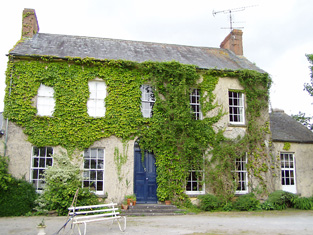
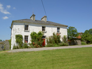
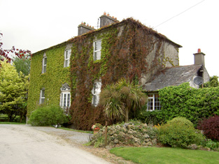
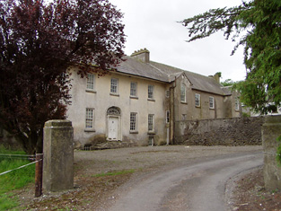
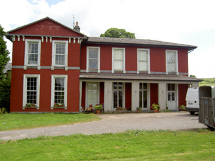
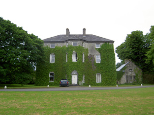
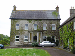
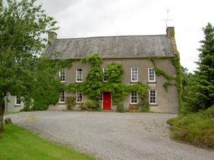
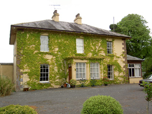
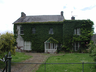
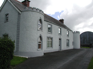
| Liskeveen [Fannyville] | Originally known as Fanny Ville and marked on the first Ordnance Survey map as such. The Ordnance Survey Name Books refer to it as the residence of Richard Beere in 1840. This house was extended sometime in the mid 19th century and was valued at £30+ when occupied by Samuel M. Going and held by him in fee at the time of Griffith's Valuation. It is still extant. |
![Photo of Liskeveen [Fannyville]](https://landedestates.ie/storage/img/orig/2015.jpg)
|
| Newhill | A property belonging to the Going family in the late 18th and 19th centuries. Newhill was the home of James Going in 1814 and of John Thomas Going, son of Samuel Murray Going, in the mid 19th century. The buildings were valued at £18.12 shillings at this time and held from Christopher Donville. Newhill passed to John Thomas Going's sister Mary Braddell who was resident in 1906. | |
| Riversdale | A house occupied by Patrick Hyland at the time of Griffith's Valuation, held from Usher Beere and valued at £15+. | |
| Parkstown | The Lamphiers were resident at Parkstown from at least the 1770s. In 1786 Wilson refers to Parkes-town as the seat of "Mr. Lanphier". Henry Langley lived at Parkstown in 1814 and John P. Lamphier was resident in 1837 and in the early 1850s. Lamphier held the property from the Court of Chancery and the buildings were valued at £23+. John P. Lanphier was the occupant at the time of sale in 1852. This building is still a fine residence. |
|
| Cabragh Castle | The home of James Fogarty in 1814. In 1840 the Ordnance Survey Name Books refer to P. Fogarty as the proprietor of "Cabra House". Denis Leahy was the occupier in the mid 19th century when the castle was valued at £16+ and held from the Court of Chancery. | |
| Turtulla | A member of the Blunden family was living at "Turkla" close to Thurles in the 1770s. William Nicholson was living at Turtola in 1814. Lewis writes in 1837 that it was the property of Valentine Maher but that John B. O'Brien was resident. A flour mill was located on the property. In 1840 the Ordnance Survey Name Books record a Mr. Lister in charge of the mill. They refer to Valentine Maher as the proprietor. By the time of Griffith's Valuation Nicholas Maher was the occupier. He held the property from the Court of Chancery and the buildings were valued at £50+. Nicholas had succeeded his cousin Valentine in 1844 and died without heirs in 1871. Turtulla then became the home of the Barry family from county Limerick. It was unoccupied from 1927 to 1944 when it was purchased by the Thurles golf club and has been their club house since then. see http://www.thurlesgolfclub.com/cluboverview.html |
|
| Raheen Park | Located south east of Farneybridge this house was occupied by Edward Wilson in the mid 19th century, valued at £34 and held from William B. Armstrong. Raheen Park may have been previously known as Brasfort. Brasfort was the home of the Wilsons in the 1830s. Edward Wilson was Chief Magistrate of Police in county Tipperary in the 1820s. In 1820, his son, Edward Wilson, married Isabella, daughter of Thomas Goodricke Peacock of Fort Etna and they had a son, Thomas Goodricke Wilson, who married Mary Studdert in 1861 and emigrated to Canada. In 1840 the Ordnance Survey Name Books refer to E. Wilson as the proprietor of Raheen Park. Edward Wilson of Raheen Park died at Monkstown, county Dublin in 1880, aged 81, (see D.23260 in the National Archives). | |
| Maxfort House | Maxfort was the home of John Max in 1814 and of William Max in 1837 and at the time of Griffith's Valuation. It was held from Viscount Hawarden and valued at £15.18 shillings. A house is still extant at the site. | |
| Laurel Lodge | In the mid 19th century Vernon Lamphiere occupied a house in the townland of Moycarky held from William Max and valued at £13.5 shillings. A house is still extant at the site. | |
| Kilrush | In 1840 the Ordnance Survey Name Books refer to Kilrush House as a gentleman's residence, possibly that of a Mr. Fogarty. John Ellis was occupying a house valued at £14 in Kilrush at the time of Griffith's Valuation. He held the property from John Trant who held 210 acres from James Byron. A house is still extant at this location. | |
| Liscahill [Lodge] | The Ordnance Survey Name Books indicate that Liscahill House was the residence of P. Ryan in 1840 though it also refers to Liscahill Lodge, the residence of Mr. Baker. A vacant house valued at £12+ was located in this townland held by William Baker senior in the mid 19th century. Buildings are still located at this site. | |
| Archerstown | The home of a branch of the Langley family, occupied at the time of Griffith's Valuation by Henry Langley and held from the Reverend Robert Lockwood. The buildings were valued at £25+. The Langley family continued to live here until the 1970s. |
|
| Rathmanna | Thomas Ryan of Rathmanna died in 1835 and is buried in the graveyard of St Mary's Church, Thurles. Rathmanna house was occupied by Thomas Ryan in the mid 19th century and held from Messrs Waller and Doherty on a lease dated 1791 James Doherty to Thomas Ryan. It was valued at £22.17 shillings. In 1865 it was advertised for sale with about 340 acres belonging to Thomas Ryan. Rathmanna a substanial and spacious house was in the possession of Michael Cahill in 1873. A building is still located at this site. | |
| Ballyduff | Ballyduff was the residence of Hunte Esq in the 1770s. In 1814 J. Minchin occupied Ballyduff, Thurles. In the mid 19th century Benjamin White of Ballyduff held the house valued at £11 and 48 acres from John Hunt. The Hunts and Whites were related. Ballyduff , the estate of John Hunt, was advertised for sale in December 1859 and again in November 1860. The house marked on the 25'' OS map is not on the same site as the original house marked on the first edition OS map. Henry O'Neill of Shanballyduff, Thurles, held 155 acres in the 1870s. The will of Henry O'Neill of Annesbrook, county Dublin and Ballyduff, county Tipperary dated 2 Oct 1891 is in the National Archives (T.12,231). Some of his descendants live in Argentina, see http://www.irishgenealogy.com.ar/genealogia/N/ONeill/henry.htm | |
| Littleton Lodge | Littleton Lodge was the residence of Thomas Ellard in 1814. In 1840 the Ordnance Survey Name Books record it as "the name of a castle, the residence of a gentleman". Charles Wilkinson as the occupier then and in the early 1850s. Wilkinson held the house valued at £17.12 shillings from Mrs Ellard. This house is still a family home. |
|
| Ballydavid | The residence of Marcus C. Russell in 1814 and of John Russell at the time of Griffith's Valuation, when it was valued at £26.15 shillings and held from Edward H. Byrne. The sale rental of 1854 includes a lithograph of this house. It was bought by Richard Power and his descendants continued to live in the house until 1950. The house was demolished in 1963. | |
| Ardfort House | The National Inventory of Architectural Heritage dates this house from approximately 1875. It was the home of the O'Brien family of Thurles and is still extant. |
|
| Synone | A house built in the second half of the 19th century, still extant and lived in. |
|
| Brittas House | Built in the late 19th century by James O'Heney/Heney of Cashel and valued at £25 in 1906. Brittas House is now a stud farm belonging to Peter Magnier. | |
| Camus | A house occupied by James Chadwick and held from the representatives of Eustin [Austin] Cooper at the time of Griffith's Valuation. The buildings were valued at £28.18 shillings. |
|
| Springhill | Occupied by Dr Samuel Hemphill and held by Samuel Hemphill Esq in fee at the time of Griffith's Valuation when the house was valued at £5.15 shillings. |
|
| Knockkelly | In the mid 19th century Richard Crane held a house valued at £12+ from William Barton in the townland of Knockkelly. This appears to be the house marked as Knockkelly house on the first edition Ordnance Survey map. | |
| Beakstown House | Major Ledwell was resident at Beakstown in 1837 and the Ordnance Survey Name Books also mention it as his residence in 1840. At the time of Griffith's Valuation one house at Beakstown appears to be in use as an auxiliary poorhouse, held by the Reverend George Peacock from the Court of Chancery and valued at £22+. Another property seems to be labelled Abbey View on the 1st Edition Ordnance Survey map but as Beakstown Cottage on the 25-inch map of the 1890s. The OS Name Books refer to this house as the residence of Mr. Mullvany, proprietor of Beakstown Flour Mills nearby. The name Beakstown Cottage had previously belonged to another property in Beakstown which is still extant [S087559]. The original Beakstown House does not appear to be extant. | |
| Ballyfowloo House | At the time of Griffith's Valuation, James Heaney was leasing a holding of 130 acres from Lord Stanley's estate at Ballyfowloo. The 25-inch Ordnance Survey map of the later 19th century shows a house in this area labelled Ballyfowloo House. | |
| Ballymurreen | In 1786 Wilson refers to "Ballymoreen, with the ruins of castle and church" as the seat of Mr. Baker. This townland was described as "in chancery" at the time of Griffith's Valuation. | |
| Shanbally House (Moycarkey) | In 1786 Wilson refers to Shanbally as the seat of Colonel Slaughter. In1840 the Ordnance Survey Name Books note that "Shanbally Old Castle" was the name given to a house in the parish of Moycarkey. By the time of Griffith's Valuation the townland is part of the estate of Miss Emma Stannix. A house is still extant at this site, now part of a large farm. | |
| Mount Judkin House | In 1786 Wilson refers to the seat of Mr. Judkin, located half a mile byond Cashel on the right. At the time of Griffith's Valuation, the townland was leased by Richard Jordan to Edmund Cusack and the house was valued at almost £8. Buildings are still extant at the site. | |
| Coolquill Castle | In 1786 Wilson refers to Coolquill as the seat of Mr. Gahan. The property is labelled "Coolquill Castle" on the 1st edition Ordnance Survey map and indicates that it was built on to a tower house. Coolquill was held in fee by Colonel Palliser in the mid 19th century. He was married to Anne Glenstanes. The castle was valued at £5. The castle ruin and other buildings are still extant at the site. | |
| Venter Fair | The Ordnance Survey Name Books refer to this house in the townland of Clashduff, parish of Ballingarry as "Venture Fair" and note the existence there of coal mines of the same name. At the time of Griffith's Valuation, it was leased by Mrs. Mary O'Sullivan from the Langley estate and valued at almost £10. A house is still extant at the site. | |
| Holycross House | In 1840 the Ordnance Survey Name Books refer to Holycross House as a gentleman's residence. At the time of Griffith's Valuation, it was owned by Rev. Garret Wall but was unoccupied. The house was valued at almost £24. A house still stands at this site which now appears to be in use as a presbytery. |
|
| Abbeyfield / Gortnagowth | In 1840 the Ordnance Survey Name Books refer to Abbeyfield House as the residence of William Jones. At the time of Griffith's Valuation, Jeremiah O'Brien was leasing this property from the Wall estate when it was valued at £15+ and included a mill. It is labelled Abbeyfield on the 1st edition Ordnance Survey map but as Gortnagowth on the 25-inch map of the 1890s. It is still extant. | |
| Whitefort House | The Ordnance Survey Name Books refer to Whitefort House as a gentleman's residence in 1840. At the time of Griffith's Valuation, this property was leased by John Jones from the Wall estate when it was valued at almost £10. It is still extant. | |
| Woodhouse (Middlethird) | In 1841 the Ordnance Survey Name Books refer to Woodhouse, a gentleman's house, the proprietor being Basil Bryan. By the time of Griffith's Valuation, a property at Woodhouse was occupied by Timothy Connolly, who was leasing it from Richard Price. It was valued at £10+. Woodhouse is labelled "in ruins" on the 25-inch edition Ordnance Survey Map of the 1890s. |