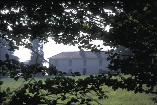
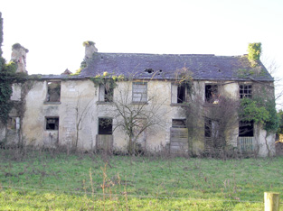
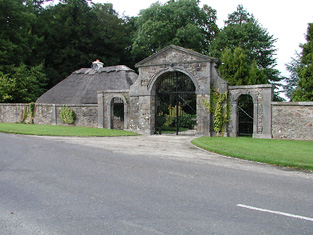
Rockvale
Houses within 15km of this house
Displaying 102 houses.
Houses within 15km of Rockvale
Displaying 102 houses.
| House name | Description | |
|---|---|---|
| Ballyglass | Weir writes that this was originally a McAdam property. Ballyglass was described as a steward's house at the time of Griffith's Valuation and was held by Andrew Caswell in fee. It was valued at £10. Modernised in the Tudor style in the early 20th century the house is still inhabited. It was valued at £25 in 1906 and was then in the possession of Mark Maunsell. Also known as Rosmadda House. | |
| Blackwater House | Home of the McAdam family in the 19th century before they moved to live in Sussex. The house was valued at £16 in the mid 19th century and was the residence of Philip McAdam. In 1894 Slater refers to it as the residence of Mrs. Caswell. Also known as Springhill House, it is now demolished. | |
| Annesgrove | A 19th century house held by James Joynt from Philip McAdam at the time of Griffith's Valuation when it was valued at £9. | |
| Ardcloony | A late 19th century house incorporating the earlier Bourchier home. Major General John Bourchier married Mary, daughter of Thomas Macnamara of Ardcloony in the mid 18th century and inherited the property. By the time of Griffith's Valuation the house belonged to Francis C. Fitzgerald who held the property in fee. It was valued at £20. Edmond Fitzgerald of Ardcloony owned 214 acres in county Clare in the 1870s. John Connell Fitzgerald was resident in 1906. A house is still extant at the site. | |
| Millbrook | A 19th century house occupied by the families that ran the mill. At the time of Griffith's Valuation the occupier was Peter Macmillan who held the property from Thomas Arthur. The buildings were valued at £40. A house is still extant in the area but on an adjacent site. | |
| Glenomera | Glenomera was the seat of the Arthur family from the mid 17th century until the early 20th century. In 1786, Wilson refers to Ballyquin as "the fine seat of Mr. Arthur". It is labelled Ballyquin House on the 1st edtion Ordnance Survey map but as Glenomera on the later 25-inch edition. Lewis wrote in 1837 that Glenomera was "celebrated as a shooting station for grouse and pheasant". It was held in fee by Thomas Arthur at the time of Griffith's Valuation and valued at £35. The house is now demolished. | |
| Doonass | In 1786, Wilson noted the building of "a superb and elegant mansion house" by the Massy family beside the River Shannon. The buildings were valued at £75 in the mid 19th century. George Lloyd and Margaret Maunsell Lloyd advertised the sale of their lease of Doonass and 229 acres in June 1855. Following the death of Sir Hugh Dillon Massy in 1870 the house passed to his wife's nephew Colonel John Thomas Massy-Westropp. The house has had a number of different owners in the 20th century, including Mrs Buckley in the 1940s. It was gutted by fire in 2009. |

|
| Newtown | Newtown House situated on the Massy estate was the home of the Walsh family for most of the 19th century. At the time of Griffith's Valuation it was occupied by the Reverend Richard S. Welsh and was valued at £20. It is now a ruin. | |
| Elm Hill House | A home of the Bourchier family in the 18th century. The Bourchiers intermarried with the Massys. The house was located on the Massy estate. Mrs Davis was resident at Elm Hill in 1837 and Joseph Wallplate in the mid 1850s when the house was valued at £12. The home of the Heffernan family in the latter part of the 19th century. The house is still occupied. | |
| Ruanard House | Weir writes that this house was originally built by the Westropps. It was occupied by Captain J. Walsh in 1837 and by Jonas S. Welsh in the mid 1850s when it was valued at £16. Situated on the Massy estate it remained in the possession of the Walsh family until the early 20th century. A house is still extant at the site. | |
| Summerhill | A large 18th century house close to the River Shannon on the Massy estate. Occupied by the Reverend Charles Massey in 1814, Hugh Dillon Massy in 1837 and by Berkeley Vincent in the mid 19th century, when it was valued at £35. It remained the home of this branch of the Vincent family until the early 20th century. The Irish Tourist Association survey of 1942 refers to the demolition of this house "a few years ago". | |
| Errina House | This house located on the west bank of the River Shannon was occupied by Thomas R. Going in 1814, George Vincent in 1837 and at the time of Griffith's Valuation when he held the house valued at £25 from the Reverend Charles Minchin. The house was later occupied by Admiral Hayes O'Grady, father of Standish Hayes O'Grady. The house became the home of the Bourke family in the 1920s and was demolished in the 1940s. There was another large house known as Errina closeby Grid Ref R657 637. | |
| Rose Hill | A house beside the River Shannon occupied by P. O'Callaghan in 1837 and by James O'Grady in the mid 19th century who held it from Mrs O'Callaghan. It was valued at £11. Weir writes that his successor was Henry O'Grady who died in 1902. The house is now a ruin. | |
| Clonboy | An 18th century house of the Brown family held from the Westropps in the mid 19th century. The Browns were agents for the estate of George Westropp. Occupied by John Brown in 1837 and at the time of Griffith's Valuation. Weir writes that the Browns continued to own Clonboy until the death of Ernest George Brown in 1942. The house was then demolished. | |
| Ross | Home of the Pearse family in the 18th century, in 1786, Wilson refers to the house as the seat of Mr. Pearce. Ross was occupied by John Blake in 1814. In 1822 a new house was built at a cost of £2,500 and was the residence of T. Westropp in 1837. Thomas Westropp was the fifth son of Ralph Westropp of Clonmoney and Attyflin. At the time of Griffith's Valuation Ross was the residence of John Digan who held the property from Anne Westropp [widow of Thomas]. Buildings valued at £23 and some untenanted land at Ross were the property of Ambrose Hall in 1906. It is still extant. |
|
| Ballycuggaran | Weir writes that the present house dates from the late 19th century. An earlier building was in the possession of members of the Church of Ireland episcopacy. Occupied by Marcus Patterson in the mid 19th century and held by him in fee. The buildings were valued at £8. In 1906 Marcus Wyndham Patterson owned Ballycuggaran with 618 acres of untenanted land. [Grid reference is approximate]. | |
| Ballyvally | A house in the possession of the Parker family from the early 19th century, the Reverend Standish Grady Parker was resident in 1814. His brother William Parker was in residence from at least 1837, holding the property from members of the Law family. By the end of the 19th century Robert Gabbett Parker lived in the house, which is still extant. | |
| Kincora Lodge | A house on the outskirts of Killaloe, Weir writes that it was the home of an O'Brien family in the 1840s. Occupied by Captain Frederick Lowe, Royal Navy, at the time of Griffith's Valuation, who held it from Thomas Macnamara. Captain Lowe married Maria Christina, daughter of Henry Ross-Lewin of Ross Hill in 1847. In the 20th century the house belonged to the Butler-Stoneys for some time. | |
| Landscape | A house facing the River Shannon, the original house was built in the early 19th century but was remodelled into the current Tudor style c.1917. The residence of Reverend William Friend in 1814, P.W. Creagh in 1837 and of Standish Thomas O'Grady in the 1850s who held it from Elizabeth Creagh. This house is still extant. In 2013 it was offered for sale. |
|
| Ardataggle House | A house known as Fisher's Lodge was located in this townland in 1842 but is not visible on the later 25-inch Ordnance Survey map. The townland of Ardataggle was sold by Thomas Fitzgibbon to Thomas Spaight in 1854. Mrs Spaight was living at Ardataggle House in the 1870s and in 1906 Colonel W. F. Fitzgerald owned the mansion house valued at £41 with 428 acres of untenanted land. | |
| Mount Shannon | An 18th century house, bought from the White family by John FitzGibbon before 1780. Mount Shannon appears to be named Ballingown on the Taylor and Skinner map of the late 1770s. Wilson, however, refers to Mount Shannon, "where taste and elegance are united" as the residence of the Hon. Silver Oliver in 1786. Bence Jones writes that it was enlarged by the 1st Earl of Clare and remodelled by the 2nd Earl. In the early 1850s the house was valued at £179 and was held by the Earl in fee. The contents of the house were sold in 1888 and the house itself to the Nevin family circa 1893 (Bence Jones). Burnt in the early 1920s Mount Shannon is now a ruin. |

|
| Ballyvorheen | Occupied by Edmond Bourke in 1814, by T. Holland in 1837 and William F. Holland at the time of Griffith's Valuation who held the property from Thomas Lloyd. The buildings were valued at £25. | |
| Ashroe | The Ordnance Survey Name Books record the building of Ashroe House in 1770 for £850. The residence of the Evans family in the late 18th and 19th century, held from Sir Matthew Barrington at the time of Griffith's Valuation, when it was valued at £23+. Wilson mentions it as the seat of Mr. Evans in 1786. The National Inventory of Architectural Heritage suggests modifications were made to the house during the nineteenth century. It is still extant and well-maintained. |

|
| Clonshavoy | Located on the Barrington estate this house was occupied by Caleb Powell and valued at £15 at the time of Griffith's Valuation. Bence Jones describes Clonshavoy as a single storey early 19th century house in the "cottage" style. In the 20th century it was the home of the last Barrington to live in the Limerick area. The Irish Tourist Association surveyor writes in 1944 that the house was interesting as it was the remains of a very old Elizabethan house. He says that more than half the house was pulled down as it was unsafe "and the present eastern wing is a reconstruction". This house is still extant. |

|
| Glenstal | Described by Bence Jones as a "massive Norman-Revival castle", built for the Barrington family. The building began in 1837 but was not completed until the 1880s. Noted by Slater as the seat of Sir Charles Burton Barrington in 1894. The buildings were valued at £65 in the early 1850s and at £58 in 1906. Now known as Glenstal Abbey, it is a boys' boarding school run by the Benedictine monks, who bought the property from the Barringtons in 1927. |

|
| Portnard | Located on the Stafford O'Brien estate and occupied by the Reverend Rickard Lloyd in the mid 19th century, when the buildings were valued at £27. Miss Catherine Lloyd was the last Lloyd occupant. The property was sold 1910-1913. |
|
| Towerhill | This property was the original residence of the Lloyd family where they settled in the 17th century. It passed to William, second son of Reverend Thomas Lloyd of Towerhill. Occupied by William's son, Reverend Rickard Lloyd, in 1814. The buildings were valued at £31 at the time of Griffith's Valuation when William Lloyd was the occupier. The property was held from the Stafford O'Briens. Purchased by the Devanes at the end of the 19th century, the house is now in ruins. |
|
| Abington House | Abington House in the townland of Dromeliagh is marked on the first Ordnance Survey map. In 1786 Wilson states "at Abingdon, is a very pleasant seat of Sir Nicholas Lawless". At the time of Griffith's Valuation a house valued at £17 was occupied by Michael Apjohn in this townland. In the 1860s this house was occupied by John Connell Fitzgerald and his wife Margaret (Apjohn). ''The Limerick Chronicle'' of 1 Oct 1872 records the death of Mary Anne Apjohn of Abington House, widow of Michael Apjohn. The property was held from Lord Cloncurry. A ruined house is still extant at the site. |
|
| Farnane House | Located on the Cloncurry estate Farnane was the home of the Costelloe family from at least 1837. Occupied by Thomas Costelloe in the early 1850s and valued at £12+. It is labelled Farnane House on the 1st edition Ordnance Survey map but is not labelled on the later 25-inch edition of the 1890s. It is no longer extant. | |
| Wilton | In 1786 Wilson refers to Wilton-Hall as the seat of Mr. Perceval. A house labelled Wilton is shown on the 1st edition Ordnance Survey map. It was occupied by George Duhy at the time of Griffith's Valuation, valued at £14 and held from Lord Cloncurry. On the 25-inch map of the 1890s this property is labelled Wilton Constabulary Barracks. It is no longer extant. | |
| Waterpark | A Bindon family home at the beginning of the 19th century. In the mid 19th century the house was located on the estate of Sir Hugh Dillon Massy and was occupied by John Quinn who also held a corn mill. The house was valued at £24. This house was later a home of the Phelps family who vacated it in 1914. It is no longer extant. The Irish Tourist Association surveyor wrote in 1942 that it was being demolished by its owner Mr Latham. | |
| Eyon | The Ordnance Survey Name Book records this house as costing £500 to build in 1838 when it became the seat of Mr Richard Laffan. The house valued at £12+ at the time of Griffith's Valuation, was occupied by Richard Laffan, a dairy farmer. Laffan held the property from Edward B. Hartopp. ''Burke's Irish Family Records'' records Edward Lloyd of Eyon in the mid 18th century. | |
| Raheen | A steward's house on the Bourke estate was recorded at Raheen in the early 1850s. It was valued at £11+. | |
| Thornfield | Leet records Thorn-field as the residence of Thomas Thornley in 1814. By the mid 19th century it was the residence of Sir Richard Bourke held by him in fee and valued at £25. The Ordnance Survey Field Name Book refers to Sir Richard Bourke repairing the house circa 1840. It was 2 storeys high, 60x50 feet. This house has remained in the possession of Sir Richard's descendants into the 21st century. |

|
| Island House | Lewis refers to a "handsome newly erected cottage on the island" in his description of Castleconnell in 1837. Earlier, in 1786, Wilson refers to Park, situated on an island created by a canal and the river Shannon, as the seat of Sir Richard de Burgho. Island House valued at £17+ was the residence of Sir Richard De Burgho at the time of Griffith's Valuation. He held the property, which was surrounded by nine acres, in fee. In 1894, Slater refers to "The Island" as the property of Lady de Burgho. |

|
| Stormont | Storm-mount was the residence of John Cuffe Kelly esq in 1814 and of Mrs Kelly in 1837. Mrs Kelly was a sister of Francis Drew of Drewscourt. By the time of Griffith's Valuation it was occupied by Joseph Walplate who held it from Sir Richard De Burgho. The buildings were valued at £19+. A house is still extant at this location. In 2022 it was offered for sale. | |
| Worldsend | This house was occupied by Thomas F. Maunsell in 1814 and by James Walplate in the early 1850s. Walplate held the property, valued at £10 and 140 acres from Sir Richard De Burgho. It is still extant and occupied. |

|
| Fairymount | In 1786 Wilson writes that Fairy-Hall was the seat of Hon. Rev. Mr. Murray. It was the residence of Robert Going in 1814 and of Henry O. Bridgeman in 1837 and at the time of Griffith's Valuation. The house was located in the townland of Montpelier on the De Burgho estate and was valued at £16. It was surrounded by a 35 acre demesne. This house is called Fairymount on the first Ordnance Survey map and in Griffith's Valuation. Fairyhall was the name of the townland just to the north of Montpelier. Farm buildings are still extant at the site. | |
| Highpark | A property in the possession of the Gabbett family from the early 18th century. Described in the Ordnance Survey Name Book as having a "decayed appearance", this three-storied house was built between 1759 and 1789. The house, valued at £10, was vacant at the time of Griffith's Valuation. It is still extant. |

|
| Coolyhenan House | A house occupied by Michael Shine at the time of Griffith's Valuation and held from the representatives of M. Honan, valued at £28, with a demesne of 343 acres. Though buildings survive at the site they appear to be in a derelict condition. | |
| Ahabeg | Built in 1827 this house was the home of the Rose family in the 19th century. It was occupied by Michael Lloyd who held it from Counsellor Richard Rose circa 1840. The residence of Richard Rose held by him in fee at the time of Griffith's Valuation and valued at £18+. Aghabeg is still extant and well-maintained. | |
| Ballyclogh House | The Ordnance Survey Field Name Book refers to the building of this house in 1822 by Henry Rose as a cost of £600. Occupied by P. Cudmore in the 1830s and by Henry Rose at the time of Griffith's Valuation who held the property from the representatives of Samuel Dixon [Dickson]. The buildings were valued at £9+ in the 1850s. Ballyclogh is still extant. |

|
| Maddyboy | Occupied by John Burke in 1814, by Captain Wickham in 1837 and by Benjamin Lucas in the early 1850s. The buildings were valued at £14 and the property held from John Lucas. | |
| River Ville [Mulkear] | Built circa 1800 and the seat of Arnold Hill circa 1840 this house was occupied by Samuel F. Dickson at the time of Griffith's Valuation and held by him from William D. Farrer with 206 acres, The buildings were valued at almost £16.The house is labelled River Ville on the 1st edition Ordnance Survey map but as Mulkear on the 25-inch edition of the 1890s. A house is still extant at the site. | |
| Mulkear | Built by the Reverend J. Crampton in 1812 at a cost of £3,000. He was still resident in 1837. Occupied by George Gough in the early 1850s, held by him from John Tuthill and valued at £35. Later the home of Samuel Frederick Dickson. Home of Martin Edward Patrick White circa 1900. On the 25-inch edition Ordnance Survey map the house at this site is labelled Woodstown House. An earlier Woodstown House is described as "in ruins" in the adjoining townland of Woodstown on the 1st edition Ordnance Survey Map. In 1786 Wilson refers to a house at "Gran" as the seat of Mr.Gough, which may refer to an earlier house in this area. This property is now part of a health services facility. | |
| Shannon View | It was valued at £22+ at the time of Griffith's Valuation, occupied by Thomas Kelly and held from Henry O. Seward. Thomas Kelly was an uncle of James Michael Kelly of Rockstown Castle and Cahircon. He married Letitia Roche, a granddaughter of Philip Roche of Shannon View and his wife, Margaret Kelly of Limerick. This house is no longer extant and extensive urban development has taken place in the area. | |
| Caherline House | The home of the Gabbett family in the 19th century, held by the Gabbetts from John Brown in the mid 19th century and valued at £38. The Brown interest in this house was advertised for sale in July 1862. Recorded as the seat of Richard J. Gabbett in 1894. | |
| Prospect | The home of Powell in the late 1770s and 1780s, this house was the residence of Sir J. De Burgh Baronet in 1814, of Godfrey Massy in 1837 and of Eyre Lloyd in the early 1850s. Eyre Lloyd held the property from Eyre Powell and it was valued at £46. This mansion house valued at £43 was occupied by Anne G. Crosby in 1906. It is now a ruin. |

|
| Hermitage | Bence Jones writes that this house was built for a banker named Bruce in 1800 but soon afterwards was purchased by the 1st Baron Massy. The main seat of the Massy family in the 19th century, held by them in fee and valued at £70 in the early 1850s. The contents of this house were sold in 1916 and the house was burnt down in June 1920. |
|
| Ballynacourty | This house located on the Massy estate was the residence of Colonel John Vandeleur in the early 1850s when it was valued at £17+. | |
| Milford | Built by George Maunsell, fourth son of Richard Maunsell of Ballywilliam, in the late 18th century. Occupied by the Reverend M. Widenham in the late 1770s, and 1786, by Lord Kiltarton [John Prendergast Smyth became Viscount Gort in 1816] in 1814, by T. Fitzgerald in 1837, by Captain Stackpool circa 1840 and by Henry Allen in the early 1850s, this house was situated on the Maunsell estate. It was valued at £28 at the time of Griffith's Valuation. Referred to as the "splendid residence" of the Dowager Lady Massy in the sale rental of 1868. Tracy writes that the 5th Baron Massy bought it for his mother in 1850 from the Maunsells. Later sold to the Russell family and bought by the religious order, the Little Company of Mary, in 1923. Now part of a nursing home for the terminally ill. |

|
| Rich Hill | The residence of the Howley family in the 19th century, held by them in fee and valued at £39 in the early 1850s. Rich Hill was also the childhood home of Captain William O'Shea. |

|
| Plassey | Built by Thomas Maunsell, founder of Maunsells' bank, Limerick, and occupied by him in 1814. Inherited by his daughter Mrs Robert Hedges Eyre Maunsell. Occupied by Reuben Harvey in 1837 and at the time of Griffith's Valuation. Harvey held the property from the trustees of Mrs Hedges Maunsell. The residence of Richard Russell in 1868. Home of John Norris Russell in the 1870s. Bence Jones writes that the present Plassey House is "a rambling two storey Victorian Italianate house built by the Russells". This house is now part of the University of Limerick. |

|
| Newgarden | Hugh Ingoldsby Massy is recorded as "of Newgarden" in 1769 and Simon Purdon was resident in the late 1770s and 1786. The widow of Hugh Ingoldsby Massy married Simon Purdon of Tinerana. The Powells of Clonshavoy were located at Newgarden in the early 18th century. A house occupied by William Ryves in 1814 and by Massy Ryves in 1837. By the time of Griffith's Valuation it appears to have fallen into decay. John Dooley occupied a house valued at £1 and Eyre Lloyd held offices valued at £4 from the Earl of Clare. Caleb Powell states that this house was taken down by Eyre Lloyd. | |
| Shannon Park | The residence of the O'Ferralls from at least 1814 when occupied by Michael O'Ferrall. Michael Richard O'Farrell was the occupier at the time of Griffith's Valuation and the house worth £10+ with 146 acres was located on the Brown estate. | |
| Woodsdown | This house was the home of the Gough family in the late 18th and early 19th centuries. It was occupied by Matthew O'Brien in 1814. The Ordnance Survey Field Name Book states that this house was built by the ancestors of Major Gough and "it is now in ruins". It is marked as "in ruins" on the first Ordnance Survey map. Another house was later built by the Bannatynes and occupied by the Goodbody family in the early 20th century. Now run by the Sisters of Charity as St Vincents Centre for persons with intellectual disabilities. | |
| Belmont | Bellmont was the residence of Thomas Grady in 1814 and of Captain Stackpoole in 1837. At the time of Griffith's Valuation it was occupied by John White who held it from Thomas William O'Grady. It was valued at £28 at this time. By the 1870s George Sampson was living at Belmount, Castleconnell. | |
| Woodlands | The residence of J. Tuthill in 1837. This house situated on the Dwyer estate was occupied by Captain John S. Rich who appears to have let the house to lodgers at the time of Griffith's Valuation. The house was valued at £35. In 1942 the Irish Tourist Associaton surveyor records this house as the home of M.D.Shaw "of bacon fame". It still contained a good library and some very valuable paintings and drawings. The Limerick City Museum holds an undated catalogue of the sale of furniture etc from this house belonging to Malcolm D. Shaw 13 Dec [1940s?]. | |
| Woodpark | Built in 1821 by Councellor Devite for a cost of £300, this 2 storey house was occupied by Thaddeus McDonnell and held from Patrick Carey junior in the early 1850s, when it was valued at £21. In May 1865 the house and demesne of Woodpark, a 3 storied house with 5 bedrooms, the estate of Robert Keays was advertised for sale on 57 acres. | |
| Shannon Lodge | Occupied by Mr William White circa 1840, by the early 1850s the house was vacant and held from Thomas William O'Grady. It was valued at £16+. Also known as Stradbally House it was destroyed by fire in December 1983. | |
| Castle Garde | The seat of Hugh M. O'Grady at the time of Griffith's Valuation, held by him in fee. Powell writes in his list of Jurors that it was built by Hugh's father the Honourable Waller O'Grady circa 1830. Valued at £38 in 1906. It is still extant. |
|
| Bilboa Court | Built in the last decade of the 17th century by the Reverend Dean Story. It was later occupied by Colonel Wilson. Lewis refers to Bilboa House as the property of the Earl of Stradbroke. It was "nearly in ruins", was built "wholly of brick from Holland" and was formerly the residence of Colonel Wilson. Circa 1840 the Ordnance Survey Name Book records a three-storey ruin with about 40 windows which had been falling into decay since about the 1770s. |
|
| Cappercullen | Tierney writes that Lord Carbery built this house in 1717. It was inhabited by the Grady family in the latter half of the 18th century and Wilson refers to it as their seat in 1786. It was in ruins by the time of the first Ordnance Survey. The site of this house is now the tennis court at Glenstal. | |
| Gardenhill House | The original Gardenhill House, home of the Blackall family, was by the time of the first edition Ordnance Survey map, circa 1840, "in ruins". The present house dates from after 1840 and is located at R675 613. |

|
| Clonkeen House (Barrington) | Croker Barrington, second son of Sir Croker Barrington, was the occupant of a mansion house at Clonkeen (Barrington) in 1906, valued at £48. The Barringtons owned a house in this area at the time of Griffith's Valuation which was valued at almost £10. This older property is known as Clonkeen House and was enlarged later in the nineteenth century. The 25-inch Ordnance Survey Map of the 1890s shows a second property, labelled Barrington's Bridge House [R683547]. This latter property is locally known as The Red House. Houses are still extant at both sites. Clonkeen House was offered for sale in 2013. |

|
| Castle Troy | Home of the Matterson family, proprietors of a bacon factory, in the mid 19th century, when the house was valued at £16.5 shillings and of Colonel Richard Arthur Milton Henn, son of Thomas Rice Henn in the early 20th century. The house is labelled Castletroy House on the 1st edition Ordnance Survey map. On the 25-inch edition of the 1890s, however, another house some distance to the south has this title while the original house is labelled Castletroy. Buildings are still extant at both sites. |

|
| Kilboy | In 1786, Kilboy was described by Wilson as the fine seat of Henry Prittie. Lord Dunalley is recording as resident at Dunally Castle, Nenagh, in 1814. In 1837 Lewis writes that Kilboy, the seat of Lord Dunalley, "was erected about 60 years since". In the mid 19th century it was valued at £76+ and held in fee. This house, which the National Inventory of Architectural Heritage describes as a "detached five-bay single-storey house over basement, built c. 1775" and designed by William Leeson, was destroyed in 1922. A similar house was erected on the site but was demolished in 1955. A smaller house is now located on the site. |
|
| Parteen Villa | Robert Atkins Twiss, second son of Robert Twiss of Cordell House, county Kerry, was living at Parteen Villa in 1837. In 1840 the Ordnance Survey Name Books refer to Parteen Villa as the residence of Thomas Mansell Bradshaw, "a neat house in the cottage [stile]". The house was occupied by the representative of Robert Twiss at the time of Griffith's Valuation, value at £29+ and held from Mrs Margaret Ormsby. Parteen is probably the house at Birdhill occupied by Robert G.E. Twiss in 1906 and valued at £30. A building is still located at this site. | |
| Birdhill | This house was originally the home of a branch of the Going family. Leet records Richard Going as the occupant in 1814. He was murdered in 1821. S. H. Atkins was resident in 1837. In 1840 the Ordnance Survvey Name Books note it as the seat of John Going and describe it as "a commodious dwelling house" with a demesne consisting of "plantation and ornamental ground". At the time of Griffith's Valuation, John Going was also the occupier when he held the house, valued at £40, with 51 acres and the national school, from Mrs Margaret Ormsby [nee Atkins]. She left Birdhill to her nephew George Twiss. Birdhill was burnt in the early 1920s and is now a ruin. | |
| Cragg | The home of a branch of the Going family, occupied by Robert Going in 1814 and in 1837. Robert died in 1838 and was succeeded by his son John. In 1840 the Ordnance Survey Name Books describe Cragg as "formerly the residence of John Going, it is now going to wreck". He still held Cragg at the time of Griffith's Valuation when the house was valued at £12+. John Going of Cregg House, Birdhill, owned 1,896 acres in the 1870s. A new house was built to the south west of the original house circa 1880 [R709 652]. John's son, Robert Edward Going, had succeeded to Traverston by the early 20th century. The second Cragg House is still extant. |
|
| Greenhall | A home of the White family in the 18th and 19th centuries, In 1786 Wilson refers to Greenhall as the seat of Mr. White. Lewis records H. White of Green Hall in 1837. The Ordnance Survey Name Books refer to it as "a neat dwelling house, the residence of H. White" in 1840 though it implies that "Counsellor Grady" was the proprietor. James Grace was resident in the mid 19th century when the house was valued at £12+. A building is still located at this site. | |
| Barna | Barna was the home of the Lee family in the 18th and first half of the 19th century. Leet records G. Lee as resident in 1814 and H. Lee was the proprietor in 1837 and at the time of Griffith's Valuation when the house was valued at £23+. This house no longer exists. | |
| Shallee | The Youngs appear to have been located in Shallee from at least the mid 18th century. Leet records Mr Francis Young as resident in 1814. In 1840 and at the time of Griffith's Valuation Francis E. Young was the occupant, holding the property from George Cashin [Cashel]. The buildings were valued at £20+. The sale rental of 1868 refers to a lease dated 1853 from Edward Worth Newenham to George Cashel of Shallee House. A house is still extant at Shallee. | |
| Cranna | The original home of the Going family in county Tipperary, inhabited by the Reverend John Going, eldest son of Richard Going of Birdhill in 1814 and by his son Charles in 1837 and at the time of Griffith's Valuation, when the house was valued at £23+. Buildings are still located at this site. | |
| Bushfield | In 1786, Wilson refers to Bushfield as the seat of Mr. Cashell. Francis W. Cashell was living at Bushfield, Nenagh, in 1814 and J. Philips in 1837. Henry Phillips was the occupant at the time of Griffith's Valuation when the house was valued at £14 and held from Henry Cashin [Cashel]. This house appears to be still extant. see http://humphrysfamilytree.com/Cashel/henry.bushfield.html | |
| Mountphilips | In 1786 Wilson refers to Mount-Phillips as the seat of Counsellor Phillips. Mount-philips was the home of William Philips in the first half of the 19th century. In the early 1850s the house was valued at £21+ and held in fee. By 1906 it was valued at £17 and occupied by John P. Phillips. This house no longer exists. Wilson also makes reference to another Phillips residence, at Killeen, nearby. | |
| Mount Rivers | The seat of the Phillips family, occupied by Richard Philips in the first half of the 19th century and held by him in fee. The house was valued at £30 at the time of Griffith's Valuation. The sale rental of 1874 describes Mount Rivers as "a fine modern country mansion in thorough repair" and gives a description of the rooms and out houses. Wyndham Gabbett occupied the mansion house valued at £27 in 1906. In 2013 the property was offered for sale. |

|
| Castle Waller | The seat of the Waller family in the 18th and first half of the 19th century, occupied by Richard Waller in 1814 and in 1837. In 1840 the Ordnance Survey Name Books reported that is was then uninhabited. Thomas Mullowney [possibly the youngest son of Croasddaile Molony] was the occupant at the time of Griffith's Valuation when the buildings were valued at £17. Castle Waller was occupied for sometime in the 1850s by William de Rythre who married Blanche Waller. In the 1870s Michael Moloney of Castle Waller owned 5 acres. The building was in ruins by the early 20th century. | |
| Oakhampton | In 1786 Wilson mentions Oakhampton as the seat of Joseph "Phelps". John Philips was resident here in 1814 and S.W. Phillips in 1837. Lewis writes that it was the property of Lord Bloomfield. In 1840 the Ordnance Survey Name Books record Oakhampton as " a good dwelling house, the residence of Mr. S. Phillips". The Reverend Anthony Armstrong was the occupant at the time of Griffith's Valuation, holding the property from Lord Bloomfield. The buildings were valued at £25+. Reverend Anthony was still resident in the 1870s when he owned 504 acres in county Tipperary. Reverend A. Armstrong was rector of Killoscully and, in 1835, married Anna Going of Ballyphilip. Oakhampton is still extant. |
|
| Clonsingle | A house situated on the Tipperary/Limerick county border, occupied by R. Young in 1837 and by Robert Young in the early 1850s, when it was valued at £30 and held in fee. Robert Young was still resident in the 1870s. A house is still located at this site. | |
| Ciamaltha House | Builtby Lord Benjamin Bloomfield, ADC to George III, as a sporting lodge, the Ordnance Survey Name Books describe it as "recently erected" in 1840. Lewis writes in 1837 "Lord Bloomfield is building a handsome lodge in the Elizabethan style and has laid out an extensive nursery from which considerable plantations have been made on the surrounding mountains". At the time of Griffith's Valuation this house was valued at £58+ and was held in fee by Lord Bloomfield. The 1906 report on Untenanted Demesnes claims that the house was occupied by his daughter, the Honourable Harriott Kingscote, who, in 1833, had married Thomas Henry Kingscote of Gloucestershire. However, family sources indicate that the house was actually occupied in the early 1900s by her grandson, Col. Randolph Kingscote, who continued to live there until 1922. The house is still in use as a residence. |

|
| Ballymackeogh | The seat of the Ryan family for much of the 18th and 19th centuries, occupied by William Ryan in 1814 and by his son William Ryan in 1837. The Ordnance Survey Name Books refer to the house as the residence of Mr. Hawkshaw in 1840. William Ryan held the property in fee at the time of Griffith's Valuation when the buildings were valued at £31. The Ryans were still resident at the beginning of the 20th century. This house is still extant. | |
| Annaholty | Mr Patrick Bourke was resident at Annaholty, Castleconnel, in 1814. In 1841 the Ordnance Survey Name Books describe Annaholty as "a good farmhouse in a demesne with some scattered trees". James Dundon was the occupier in the early 1850s. He held the property from Charles J. Henry and the buildings were valued at £13.11 shillings. A farm residence is still located at this site. | |
| Fort Henry | Fort Henry, overlooking the Shannon River, was the residence of Stephen Hastings in 1814 and of Finch White in 1837. Earlier, in 1786, Wilson had also noted it as a Hastings residence. At the time of Griffiths Valuation, Finch White held the house from Stephen H. Atkins. It was valued at £28.15s. Finch White was related to the Atkins through marriage with a member of the Gelston family. In 1906 this house was in the possession of Frederick C.Henry. In 1840, however, the Ordnance Survey Name Books had also noted that J.J. Henry was the proprietor. It is still extant. | |
| Gortna House | This house was located close to the shore of the River Shannon and is marked on the first edition Ordnance Survey map and the later 25 inch map as Gortna House. Lewis records H. Franks as resident at Shannon View in the parish of Templeachally. Henry Franks occupied a house valued at £12+ and held from Stephen H. Atkins at the time of Griffith's Valuation. Henry Franks was married to Elizabeth daughter of Ringrose Atkins. There are still buildings at this location. | |
| Birdhill (Kyle) | Christopher Kayes held a house and offices valued at £27.18 shillings with 231 acres from Mrs Margaret Ormsby in the townland of Birdhill at the time of Griffith's Valuation. These would appear to be located south west of Birdhill House and just east of Kyle burial ground. | |
| Churchfield House | Dr Langer Carey was a member of the Careyville family. He lived at Churchfield House, Newport in the mid 19th century, valued at £17.10 shillings and held from Lady Waller. A house is still extant at the site. | |
| Bloomfield | In 1786 Wilson writes that Bloomfield Lodge was occupied by Mr. Bloomfield. In 1837 Bloomfield was occupied by Edmund Scully, fifth son of James Scully of Kilfeacle and by Edmund's son, Carbery Scully, in 1840 and at the time of Griffith's Valuation. He held the property from Lady Waller and the buildings were valued at £29. George M. Finch was living at Bloomfield, Newport in the 1870s. Bloomfield is still extant. |

|
| Derryleigh House | Lewis records G. Ryan as resident at Derryleagh Castle in 1837. In 1840 and at the time of Griffith's Valuation Henry Hawkshaw held a house valued at £12+ from Lady Waller at Derryleigh. A building is still located at this site. The Ordnance Survey Name Books record the existence of an old castle in this townland which had been "razed to the ground by Mr. Hawkshaw" some time previously. | |
| Derry Castle | In 1786, Wilson writes that Derry Castle was the seat of Michael Head. Lewis records Derry Castle as the seat of M.P. Head. In 1840 the Ordnance Survey Name Books describe the demesne at Derry as "chiefly composed of platation and ornamental ground. Derry House (a commodious building) is the residence of Michael Petty Head". By the time of Griffith's Valuation it was held by Francis Spaight in fee, the buildings were valued at £71. ''The Nenagh Guardian'' of 15 April 1872 report on a bad fire at Derry Castle. Spaight family members appear to be still resident in the early 20th century. The National Inventory of Architectural Heritage states that the castle is now demolished. |

|
| Mary Ville | This house is marked as Mary Ville on the first edition Ordnance Survey map. In 1840 the Ordnance Survey Name Books refer to it as "a respectable farmhouse and offices" the proprietor of which was Michael Head. This may be the house recorded by Lewis as Derry Ville inhabited by J. Salmon. At the time of Griffith's Valuation Mrs Mary Sparling was resident, holding the lodge valued at £13 from Francis Spaight. Buildings are still extant at this site. | |
| Ryninch | Lewis records J. O'Brien of Ryninch and Jeremiah O'Brien held a house valued at £10 and 115 acres from Francis Spaight in the mid 19th century. There were quarries in this townland. | |
| Lakeview | Henry D. Head occupied a house valued at £14+ in this townland in the mid 19th century. He held the property in fee. A house and large farmyard are now located at this site. | |
| Foxhall | In 1786 Wilson refers to Foxhall as the seat of Mr. Anderson. It was the home of a branch of the Rose family in the 19th century following the marriage of Mary Anderson and Richard Rose. Richard A. Rose was resident in 1814 and J. O'Brien in 1837. In 1840 the Orddnance Survey Name Books refer to it as the residence of Dr. Ryordan, " a commodious dwelling house". At the time of Griffith's Valuation W.A. Rose occupied the house valued at £27+ and held in fee. This house is now demolished. | |
| Dromore | Mrs Rebecca Benn held this house valued at £17 in fee in the mid 19th century. The mansion house at Clonbunny was occupied by William B. Cronyn in 1906. The Benns and Cronyns were related. It was valued at £22. |
|
| Lackamore Lodge | A late 19th century house valued at £13+ in 1906 and held by the representatives of Robert Heard. This building was located just to the south of a police barrack and is now a ruin. | |
| Tulla | Tulla House was the home of the Carroll family in the 19th century. William Carrol was resident in 1814 and Major General Sir Parker Carrol in 1837. Captain W. H. Carrol held the house valued at £20+ and townland in fee at the time of Griffith's Valuation. The house valued at £18 was still occupied by the Carrols in 1906. A house is extant at the site. | |
| New Ross | In 1786 Wilson writes that New Ross was the seat of Mr. White. The property is labelled "site of New Ross House" on the first edition Ordnance Survey map of the 1830s. The Ordnance Survey Name Books record that "the site of this old house is all that can be found at present .....It was once a place of some account being the residence of Bishop Buscow and afterwards of the White family ...they lived here til about 1790". This townland was in the possession of Bolton Waller at the time of Griffith's Valuation. | |
| Newport House | In 1786 Wilson refers to a house at Newport which was the seat of Sir Robert Waller. This may be the property labelled "site of Newport House" on the 1st edition Ordnance Survey map. In 1840 the Ordnance Survey Name Books refer to the the site of a house "formerly the residence of the late Sir Robert Waller. It is now nearly altogether taken away". | |
| Rivers | In 1786 Wilson refers to Rivers as the seat of Brooke Brasier. Only the remains of a driveway and estate buildings are visible on the 1st edition Ordnance survey map of the 1830s. | |
| Oakfield (Tulla Lower) | In 1786 Wilson refers to Oakfield as the seat of Mr. Waller. By the time of Griffith's Valuation this house is part of the Massy estate and valued at £9. It is still extant and part of a large farm. | |
| Silvermines Cottage | In 1840 the Ordnance Survey Name Books describe Silvermines Cottage as "a neat and comfortable cottage, the residence of Rowan P. Cashell". He was also the occupier at the time of Griffith's Valuation, leasing from Lord Dunalley's estate. The property was valued at £10 15s. The National Inventory of Architectural Heritage states that it was, for a time, the mine manager's house, for the nearby mines. Silvermines Cottage is still extant and well-maintained. |
|