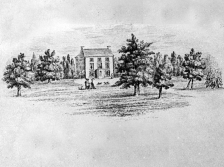
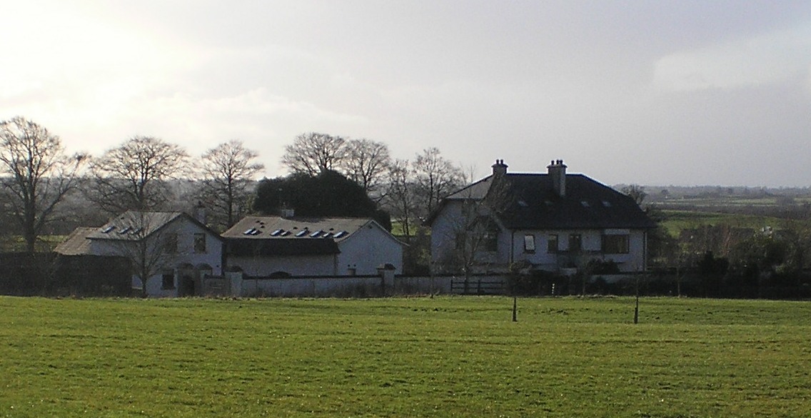
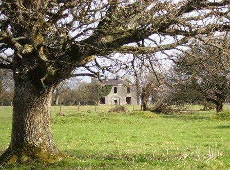
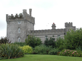
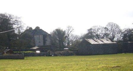
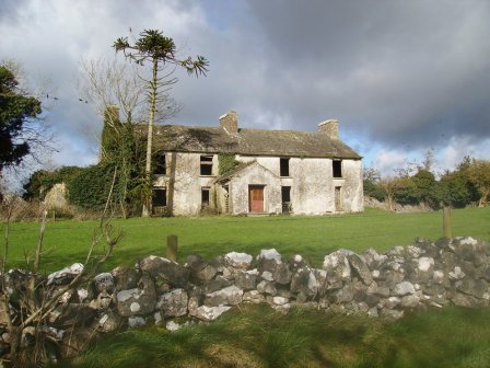
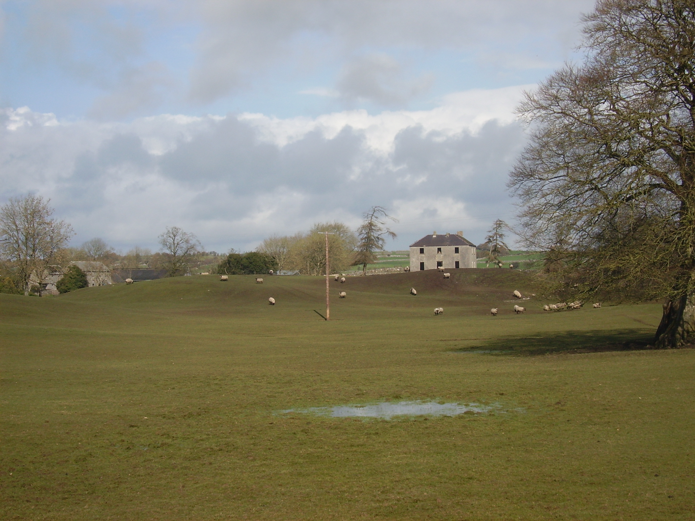
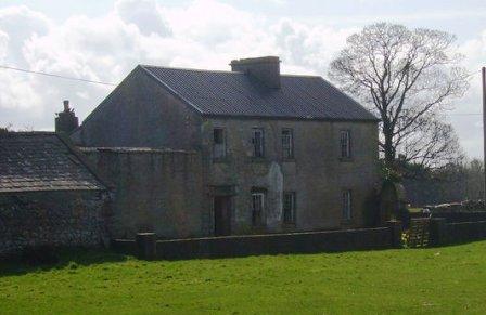
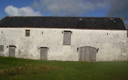
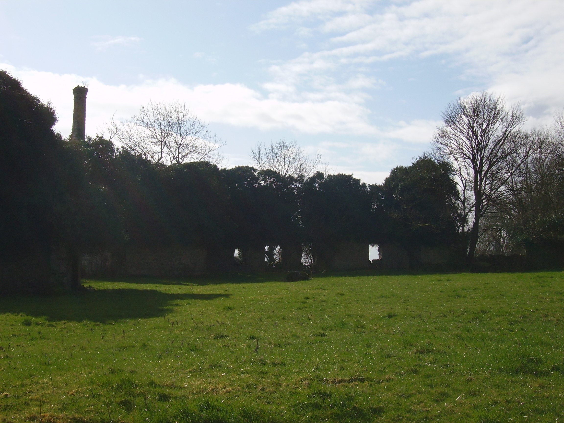
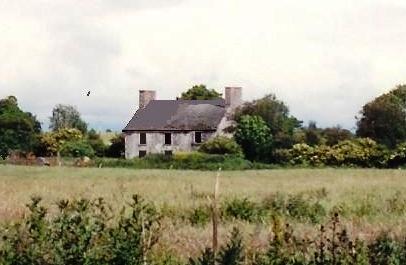
Newcomen Castle
Houses within 15km of this house
Displaying 92 houses.
Houses within 15km of Newcomen Castle
Displaying 92 houses.
| House name | Description | |
|---|---|---|
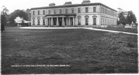
| Garbally Park | In 1783 Taylor and Skinner show Garbally as a seat of the Trench family. Wilson mentions Garbally , "the very fine seat of Willaim Power Keating Trench", in 1786. At the time of Griffith's Valuation it was the seat of the Earl of Clancarty and was valued at £150. It became St. Joseph's College, Garbally Park, in 1922 and has functioned as a school until very recently. It is still extant. |
|
| Sycamorehill | At the time of Griffith's Valuation, Allan Pollok held a property at Sycamorehill, parish of Clonfert, valued at £16. Molloy states that this house was burned during land agitation on the Pollok estate in the 1850s but it was subsequently re-built. Sycamorehill is still extant and part of a large farm. |

|
| Kylemore Dairy | Allan Pollok held a property valued at £7 together with over 400 acres in the townland of Kylemore, parish of Clonfert, barony of Longford in 1856. On the 25-inch Ordnance survey map of the 1890s there is a property labelled Kylemore Dairy in this townland. Parts of the farm buildings remain at the site. | |
| Coolbeg House | In 1856 Thomas Stratford Eyre was leasing a property valued at £5 together with 146 acres, located in the townland of Coolbeg, parish of Clontuskert, barony of Longford to William Seymour. It is labelled Coolbeg House on the 25-inch Ordnance Survey map of the 1890s. A house still exists at the site. | |
| Crowsnest | In 1856 Allan Pollok was the occupier and lessor of a property valued at £6 together with over 460 acres, in the townland of Crowsnest, parish of Clontuskert, barony of Longford. Molloy provides a detailed description of the huge farmyard (M868239) in the neighbouring townland of Ganaveen which was part of the Pollok estate. The latter was destroyed by fire in 1920. The Crowsnest property is now in ruins. |

|
| Lismany/Lismanny | Allan Pollok's estate was centred on the property at Lismany. In 1856 the buildings there were valued at £10. In 1906 Lismanny was owned by the representatives of John Pollok. It was valued at £90. It was sold by the Pollok family in 1924 and demolished some years later. Only the cellar of the house together with the ruins of an extensive range of estate buildings now remains at Lismanny. However both gatelodges and several other estate houses are still occupied. |
|
| Ahascragh Glebe/Rectory | At the time of Griffith's Valuation, Rev. Sir William Mahon was leasing a house valued at £20 in the townland of Ahascragh West, barony of Kilconnell, to Reverend Peter Browne. He was also leasing property in this townland to Thomas Hunt. Reverend Mahon was rector of Rawmarsh, Yorkshire. This property is still extant and occupied as a private house. |
|
| Fairfield House | Lewis records Fairfield as the residence of T. Wade in 1837. It is described in the Ordnance Survey Name books as "built on rising ground from which there is a good prospect". At the time of Griffith's Valuation the house was being leased by Thomas Wade from the Handy estate. In 1906 it was in the possession of Rochford Wade when it was valued at £23. Fairfield House is no longer extant and the demesne is the focus for a major sawmilling operation. |
|
| Lowville | Lowville was originally the seat of Nathanial Lowe who held this estate in the mid-18th century and Wilson refers to it as his seat in 1786. In 1814 it was the residence of the Hon. Mrs. Low. In 1837 Lewis recorded Lowville as the seat of W. McDonagh. It was still occupied by Walter McDonagh in the 1850s and was valued at £45. By 1906 it was in the possession of Bernard Connaughton and was valued at £33. It was later the home of the Byrne family but was sold in the early 1970s and ceased to be residential. It is now a ruin. |
|
| Northbrook Cottage | Lewis records Northbrook as the seat of J. North in 1837. The Ordnance Survey Name books note Major Warburton as the proprietor of the townland. The First Edition Ordnance map shows Northbrook Cottage. At the time of Griffith's Valuation, a house in progress in the townland was being leased by Joseph Denham from James McBride and was valued at £3 10s. This house is labelled Northbrook House on the 25-inch map of the 1890s. It is now a ruin. |
|
| South Park | At the time of Griffith's Valuation, Lawrence Kerrans was leasing a property valued at £11 from the Clonbrock estate at Kilglass, parish of Ahascragh. It is not named on the first edition Ordnance Survey Map but is labelled South Park on the 25-inch edition produced in the 1890s. The house is still extant and occupied. |
|
| Creggaun House | Bar Kelly was living at Cregan in 1749. At the time of the first Ordnance Survey it is mentioned as the home of Captain Masters. William Masters was leasing a house valued at £16 in Creggaun townland, parish of Ahascragh, from the Clonbrock estate at the time of Griffith's Valuation. This property is no longer extant. | |
| Clooncannon/Cloncannon/Runnamead | Far Kelly was resident at Cloncannon in 1749. It is described in the Ordnance Survey Name Books as the residence of William Kelly. This property was offered for sale in the Encumbered Estates in July 1850. At that time it was occupied by Mathew C. Browne. John and Edward Lennon were occupying this property, valued at £9, at the time of Griffith's Valuation. It was part of a holding of almost 400 acres. Joseph Trumperant Potts laid the foundation stone for his house known as Runnymeade in 1866 (''Saunders Newsletter'', 23 June 1866). It is labelled as Runnamead House on the 25-inch Ordnance Survey map of the 1890s. In 1906 a house valued at £10 at Clooncannon Kelly was part of the Clonbrock estate together with almost 400 acres of untenanted land.. It is no longer extant. | |
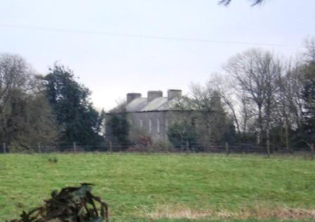
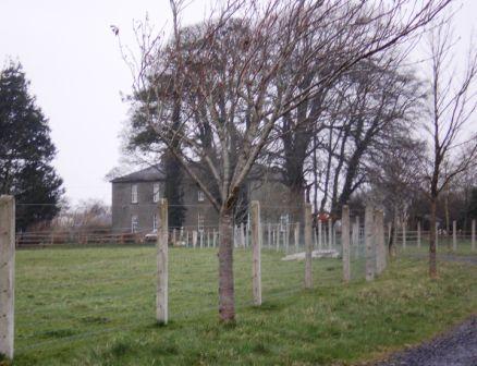
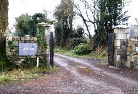
| Weston | John D. Mahon was leasing this property, valued at £35, from Sir William Mahon, at the time of Griffith's Valuation. It is described as unoccupied at the time of the first Ordnance Survey. The National Inventory of Architectural Heritage indicates that the original Weston house is now demolished. A smaller house, known as Weston Lodge, was also located in the demesne (M779403). It is no longer extant. |
|
| Annaghbeg House | John Moor lived at Anabeg in 1749 and in 1814 this was the residence of Edmund Moore. In the 1830s it is described by the Ordnance Survey Name Books as the residence of F. Grady and in bad repair. Charles Bailey was leasing the property at Annaghbeg, parish of Ahascragh, barony of Clonmacnowen from Hubert Moore at the time of Griffith's Valuation. Annaghbeg House is described as "in ruins" on the 1948 edition of the 6-inch OS map. Another house, known as Annaghbeg Cottage is located nearby at M823356. Buildings are still extant at the latter site. | |
| Ballyglass House | James Mahon, a brother of Ross Mahon of Castlegar, was residing at Balliglass in 1749. The Ordnance Survey Name Books record it as the residence of George Clarke in the 1830s. A herd's house valued at £5 and over 250 acres of the Mahon estate were located at Ballyglass in the parish of Ahascragh at the time of Griffith's Valuation. A house still exists at the site. | |
| Kellysgrove | Wilson refers to Kellysgrove as the seat of Mr. Kelly in 1786. In 1837 Lewis recorded Kellysgrove as the seat of W. Kelly. The house was occupied by Charles Denis Kelly at the time of the Encumbered Estates court sale in December 1850. At the time of Griffith's Valuation, the house at Kellysgrove, parish of Clontuskert, valued at £20, was leased by Robert St. George from the Earl of Clancarty's estate. The original house is no longer extant. |
|
| Sonnagh | Walter McDonagh was leasing a property at Sonnagh, parish of Fohanagh, barony of Clonmacnowen, from the Clancarty estate at the time of Griffith's Valuation. He was also the occupier of a mill at Pollboy, valued at £95, in this parish. His estate was centred on Lowville in the barony of Kilconnell. A house still exists at the Sonnagh site. | |
| Craig's Hotel | John H. Craig was leasing a property valued at £65 at Back, parish of Kilcloony, barony of Clonmacnowen from the Clancarty estate at the time of Griffith's Valuation. He was running this property as a hotel. In Slater's Commerical Directory, 1846, Craig's hotel was located on the Main Street in Ballinasloe. The Royal Mail car called there on its way from Galway to Dublin. | |
| Brackernagh Lodge | A house valued at £18 at Brackernagh, parish of Kilcloony, barony of Clonmacnowen, was being leased by the Clancarty estate to Miss L. Trench at the time of Griffith's Valuation. This is most likely the house which appears on the 6-inch OS map as Brackernagh Lodge. The National Inventory of Architectural Heritage notes that it was previously known as Mount Catherine. It is still extant and occupied. |
|
| Caher | Lewis records Caher as the seat of J. Dillon in 1837. The house at Caher, with a demesne, the property of James Dillon, were offered for sale in the Encumbered Estates court in July 1854. Samuel Wade was leasing a property valued at £17 at Caher, in the parish of Kilcloony, barony of Clonmacnowen, from the Clancarty estate at the time of Griffith's Valuation. The ruins of the house and stable block are still visible. |
|
| Cleaghmore | Andrew Montgomery was leasing a house valued at £13 from the Clancarty estate at Cleaghmore, parish of Kilcloony, barony of Clonmacnowen, at the time of Griffith's Valuation. | |
| Cleaghmore Villa | A vacant house, valued at £11 and part of the property of Norman Ashe, was located at Cleaghmore, parish of Kilcloony, barony of Clonmacnowen at the time of Griffith's Valuation. This is possibly the house shown on the 25-inch Ordnance Survey map of the 1890s as Cleaghmore Villa which is still extant. |
|
| Knockglass | Charles Masters was leasing buildings valued at £14 which included a mill at Knockglass, parish of Kilcloony, barony of Clonmacnowen, from the Ashe estate at the time of Griffith's Valuation. Builidings are still extant at the site. | |
| Nutfield House | Described as Nutley House by Lewis in 1837, Nutfield House was the residence of Edward Ash in 1846. Norman Ashe was leasing a property valued at £11 from Dudley Persse at Glennavaddoge, parish of Kilcloony, at the time of Griffith's Valuation, which appears to be the same property. A house still exists as the site. | |
| Cleaghmore B & C | At the time of Griffith's Valuation, the Clancarty estate was leasing two houses in this townland to members of the Le Poer Trench family, one (Cleaghmore B) valued at £23 and the other Cleaghmore C) at £21. They were leased by Mrs. Le Poer Trench and Robert Le Poer Trench respectively. | |
| Deerpark | At the time of Griffith's Valuation, James Horsman was leasing buildings valued at £28 which included a mill, at Deerpark, parish of Kilcloony, barony of Clonmacnowen, from the Clancarty estate. The property was in ruins by the 1890s. | |
| Mackney | In 1837 Lewis records Mackney as the seat of Archdeacon Trench. Henry Gascoyne was leasing a house valued at £36 from the Clancarty estate at Mackney, parish of Kilcloony, barony of Clonmacnowen, at the time of Griffith's Valuation. A second house in this townland, valued at £11, was leased to Thomas Gill. This may have been the property described on the 6-inch OS Map as Mackney Cottage. | |
| Perssepark | At the time of Griffith's Valuation, William Persse was leasing a house valued at £10 from Dudley Persse at Perssepark, parish of Kilcloony, barony of Clonmacnowen. Earlier, in 1837, Lewis recorded Perssepark as the residence of S. Masters. Now the site of modern industrial development. | |
| Beechlawn House (Kilcloony) | John Craig was leasing a house valued at £10 to Geoffrey Prendergast at Pollboy, parish of Kilcloony, at the time of Griffith's Valuation. On the 1st edition Ordnance Survey map the building at this site is labelled schoolhouse. However, a larger building of differing proportions is shown on the later 25-inch Map of the 1890s. The property at this site is named Beechlawn House by the National Inventory of Architectural Heritage. |
|
| Fairfield (Kilgerrill) | Wilson, writing in 1786, notes Fairfield as the seat of Mr. O'Brien. In 1837, Lewis records Fairfield as the seat of John O'Brien. At the time of Griffith's Valuation Fairfield was leased by James Thorngate to Daniel Cruise. Taylor and Skinner record Fairfield as a seat of the O'Brien family in 1783. The original house is not extant. |
|
| Heathview House | At the time of Griffith's Valuation, Christopher Usher was leasing buildings including a mill, valued at £25, to William Usher, in the townland of Kilgerrill, barony of Clonmacnowen. Earlier, in 1837, "The Lodge" in the parish of Kilgerrill was recorded by Lewis as the seat of William Usher. Described by the Ordnance Survey Name Books as "in good repair", it was then the residence of J. Usher. A house still exists at the site. | |
| Dalysgrove | The Ordnance Survey Name books describe Dalysgrove as the residence of Peter Daly and in good repair. At the time of Griffith's Valuation, Francis Daly was leasing the property at Dalysgrove valued at £32 from Peter Daly. The house was in the possession of Peter F. Daly in 1906. Sold by the Dalys in 1928, the shell of the house and parts of the walled garden remains. |
|
| Muckloon | In 1786 Wilson mentions "Muckland" as the seat of Mr. Kelly. Occupied in the mid 1850s by Richard P. Lloyd to whom most of the Kelly estate was let. The house was then valued at £20. It is no longer extant. | |
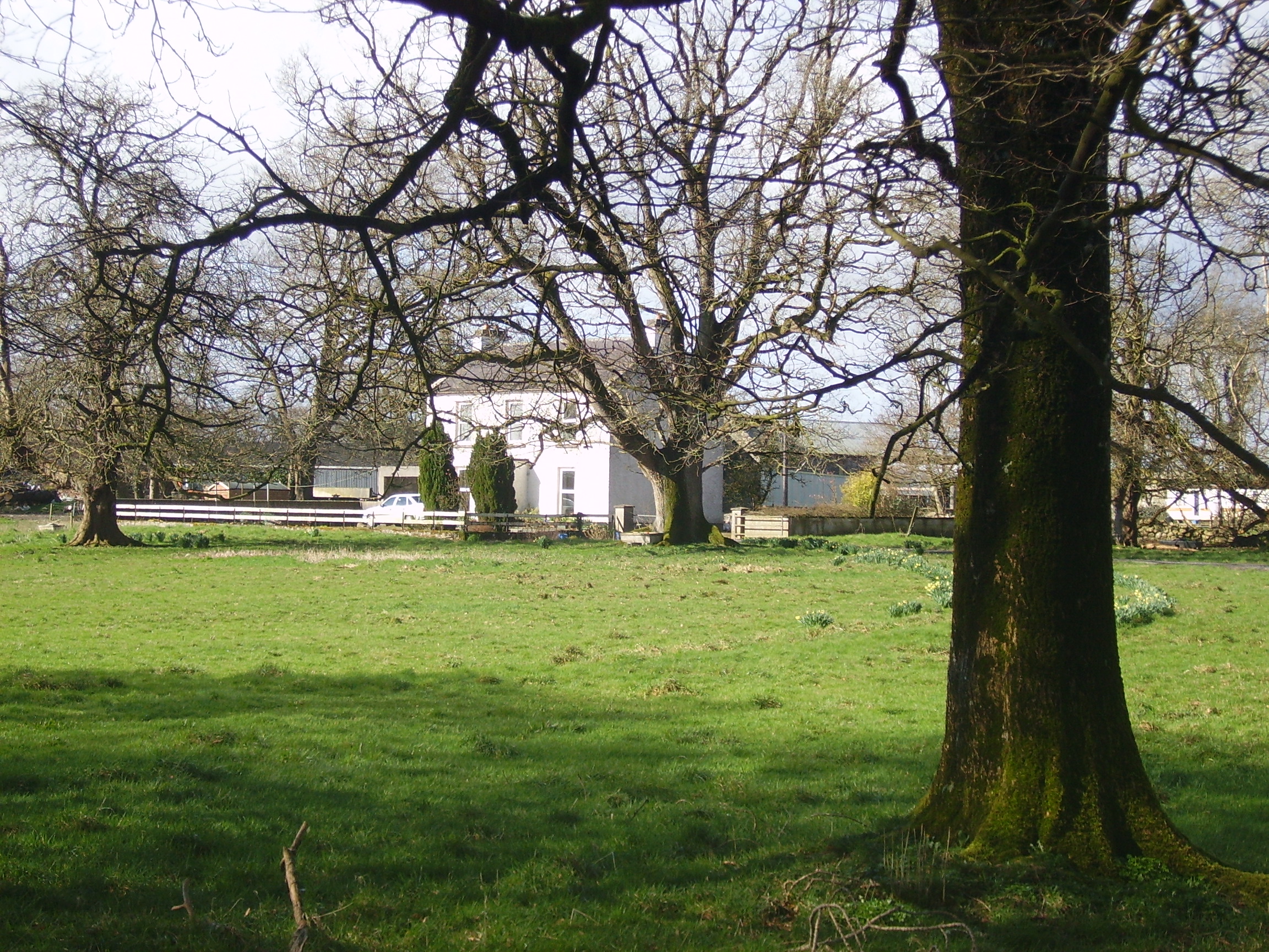
| Castlegar | The principal residence of the Mahon family, designed by Sir Richard Morrison circa 1801, replacing an earlier house. Wilson, writing in 1786, refers to this earlier house as the seat of Mr. Mahon. In the 1830s the Ordnance Survey Name Books describe it as in good repair but Sir Ross Mahon was not resident there at the time. Sir William Mahon was still in possession of the property in 1906 when it was valued at £67. In 1979 the house was sold by the Mahons to John Horan, who advertised the house for sale again in 1988. The house is still extant. |
|
| Chapel Park | At the time of Griffith's Valuation Thomas Jones was both a lessor and an occupier of lands in three townlands in Clontuskert parish, barony of Clonmacnowen. This included a property valued at almost £3 at Chapel Park. A farm with modern buildings is extant at the site now. | |
| Fortwilliam | At the time of Griffith's Valuation William Lancaster was leasing a property valued at £25 from the Trench estate at Ardcarn, barony of Moycarn. At the same time Thomas Lancaster was leasing a property to Capt. James Bell. In 1786 Wilson refers to Fortwilliam as the seat of Mr. Lancaster. A modern house occupies the site at Fortwilliam but there are remains of yard buildings and a walled garden. |
|
| Claremont | Described in the Ordnance Survey Name Books as a 'neat modern building', the house was located close to the bank of the River Suck. It was the home of Gonville ffrench and he held it from the D'Arcy family. In the D'Arcy sales rental of May 1851 there is reference to 'the splendid mansion' of Gonville ffrench. Occupied by the Honourable Clarinda ffrench in the 1850s who held the property from the Right Honourable Richard W. Greene, valued at £21. The house is now a ruin. |
|
| Coololla/Coololah | At the time of Griffith's Valuation, George Crowe was leasing a property valued at almost £5 from the Handy estate at Coololla, barony of Kilconnell. Buildings appear at the site on the 1st-edition Ordnance Survey map but appear to be ruinous by the time of the 25-inch edition of the 1890s. | |
| Aughrim Castle | The 1st edition Ordnance Survey map indicates a house located a short distance to the north of the site of Aughrim Castle. Lewis records Aughrim Castle as the seat of R. Stanford in 1837. In 1786 Wilson mentions "Aghrim, the seat of the Rev. Mr. Ward". At the time of Griffith's Valuation, Robert Standord was leasing a property from the Handy estate, valued at £15, and which included a mill. It is no longer extant. | |
| Moyvannan Castle | 16th century tower house with late 19th century extension. In the sale rental of the Domvile estate 1865 it is described as a handsome and commodious residence. In 1986 Moyvannan was restored by Don Panoz, Chairman of the Elan Corporation. |
|
| Keoghville | Built by Laurence Keogh and his wife Mary Fallon at the end of the 18th century. They were the grandparents of Judge Keogh. Described in the Ordnance Survey Name Books as still in the occupation of Keogh, the representaive of the ancient proprietors of Doohy-Keogh 'but he is poor and nearly shook'. This must be Ross Keogh who resided in Keoghville in 1837. By the time of Griffith's Valuation the house was held in fee by John McKay and valued at £15. Abandoned in the 20th century and replaced by a modern bungalow, the yard is still in use. |
|
| New Park | A Lyster home from the early 18th century, inherited by the Smyths of Barbaville through marriage. Held in fee and valued at £38 at the time of Griffith's Valuation. The home of Marcus Anthony Levinge in 1906. The house remained in Levinge hands until about the 1940s when the roof was removed. In the early 1970s the house was restored as a hotel by Paddy Kenny. |

|
| Thomastown Park | Built in the 18th century and home of the Naghten family for over 200 years, valued at £35 in the 1850s. Wilson refers to it as the seat of Mr. Naghten in 1786. In 1894 Slater mentions Thomastown park as the seat of Mrs. Naghten. It is no longer extant. | |
| Crannagh House | The main residence of the Walsh family in the 18th century. At the time of Griffith's Valuation occupied by Philip Hayes who held the house from William Potts. It is labelled Crannagh House on the 1st edition Ordnance Survey map but is not shown on the later 25-inch edition of the 1890s. | |
| Mounthussey | The home of the Hussey Walsh family, valued at £4 at the time of Griffith's Valuation. The later 25-inch map of the 1890s shows a much larger house at Moynure. A house still exists on the site. | |
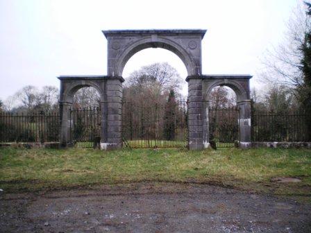
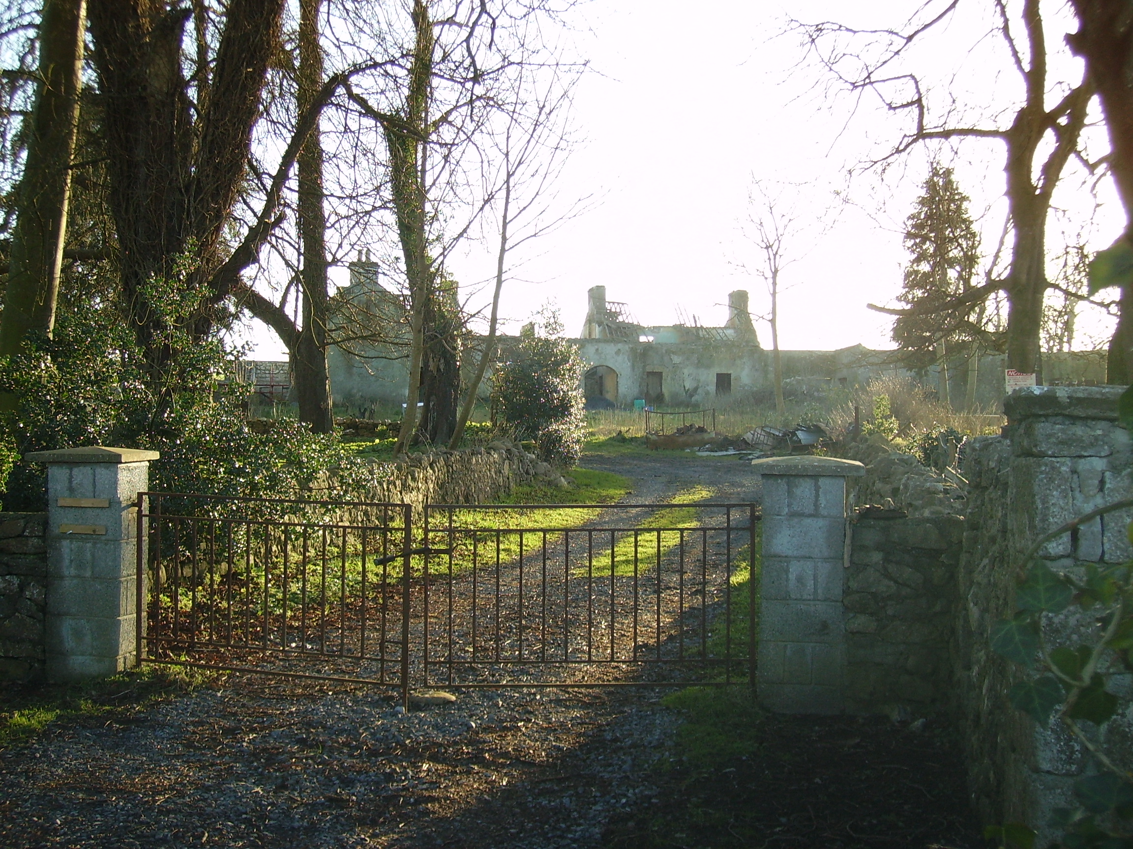
| Johnstown | Built circa 1782 by Colonel John Dillon and held on a lease in perpetuity from the Incorporated Society for Promoting English Protestant Schools in Ireland. The Ordnance Survey Name Books refer to this fine residence, occupied by D. Kelly. The Dillons were in residence again by the time of Griffith's Valuation. It became the home of the Kelly family in the early 1870s until the late 1920s. Demolished by the Land Commission, only the entrance gates still remain. | |
| Mount Florence | This house originally known as the 'Whitehouse' and later as 'Mount Florence' was the home of the O'Sullivan family from the mid 18th century. In 1883 it was sold to the Greene family from the Ballinasloe area. It is now a ruin. | |
| Camma Lodge | A home of the St George family in the 19th century. A house is still occupied at the site. |

|
| Curraghboy House | Occupied by J. Byrne or Burne in the 1830s and by Thomas W. Jefferson at the time of Griffith's Valuation and still a family residence. |
|
| Lysterfield | Originally a Lyster property that later came into the possession of Lord Ashtown, a descendant of Anthony Lyster. The home of members of the Lyster family until the mid 1830s and occupied by Mr John Burne at the time of the first Ordnance Survey and by Henry Trench in the 1850s. Nothing now remains except some red bricks, possibly part of a fireplace, at the corner of a farmyard. |
|
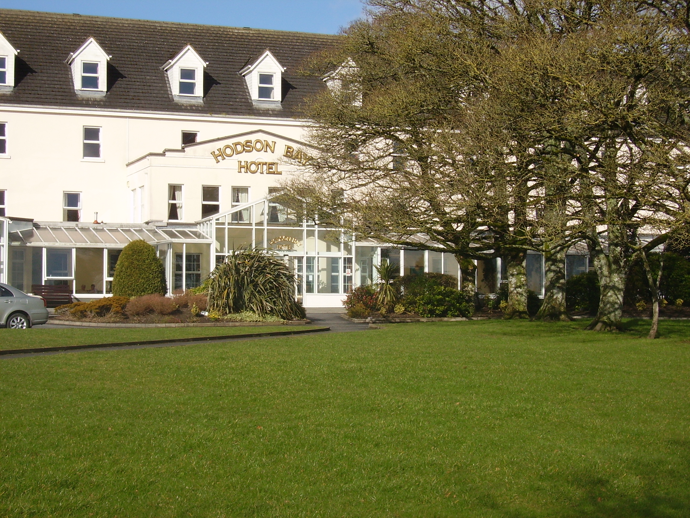
| Hodson Bay | The home of the Hodson family on the shore of Lough Ree. At the time of Griffith's Valuation occuppied by Leonard Hodson junior and Samuel Hodson, who held from the Court of Chancery. Now greatly expanded and functions as a hotel. |
|
| Lissygreaghan | Held in fee by J. P. Gannon at the time of Griffith's Valuation when the house was valued at £4.10 shillings. | |
| Kiltoom | Crofton Kelly bought or acquired the Kiltoom property where he built a house in the mid 18th century. Occupied by Thomas H. Strevens who held a number of townlands from Sarah Kelly at the time of Griffith's Valuation and left to him at her death. Kiltoom remained a Strevans home until the 1970s, now a derelict building. |
|
| Rockhill | Occupied by John Burne in 1814 and described as a tolerably good farmhouse at the time of the first Ordnance Survey. Occupied by E. Hodson in 1837 and by Thomas Wilson who held it from James Wilson in the 1850s. Thomas Wilson was still resident in the 1870s. |
|
| Turrock | This house was in ruins by the time of the first Ordnance Survey in the mid 1830s. The Kellys lived at Weston, county Meath, from the mid 19th century to the 1930s. | |
| Camlagh | The Newcomens resided at Camlagh in the mid 18th century and then leased the property to the Keoghs. Occupied by a Cruise in 1814 and described as a house of small dimensions at the time of the first Ordnance Survey. Occupied by E. Kilkenny in 1837 and by James Kelly and James Naughton in the 1850s. | |
| Esker | Occupied by W. Kelly in 1837. Bought by the Glennon family and occupied by them for most of the 20th century, still extant. |

|
| Feacle/Fighill | The residence of Dennis Keogh in 1814, occupied by R. Keogh in 1837 and by Richard Keogh in the 1850s when the house was valued at £2. The house has been known as Fighill since at least 1837. The old house is no longer lived in. |
|
| Larkfield House | Built circa 1780, this house was the home of Joseph Sproule at the beginning of the 19th century. Bought by Edward Larkin in 1839 and sold to John Holton in 1873. A succession of owners followed until it was bought by the Naughton family in 1923. | |
| Woodberry House | In the possession of Richard Bermingham in the mid 18th century, when he sold it to Philip Parker of Erris, county Mayo and his wife, Maria Kelly. It appears to have remained in Parker ownership until purchased by the Holton family in the 1850s. Now owned by Louis Walsh. | |
| Cloonagh | The home of a branch of the Fallon family from the mid 18th century. Wilson refers to it as the seat of John Fallon in 1786. Occupied by James Mannion in 1814 and described in the 1830s as "a well built modern mansion forming three fourths of a cross". Occupied by James Bailey at the time of Griffith's Valuation, when it was part of the Trench estate. It is now a ruin. | |
| Ballina | Wilson refers to Ballyna as the seat of Mr. Fallon in 1786. Occupied by Malachy Fallon in 1814. It was held in fee by Anthony Fallon at the time of Griffith's Valuation when it was valued at £6. Occupied by John Duignan in 1906. It is still extant. |
|
| Ardkeenan | A Kelly home at the end of the 18th century which passed to the Cruise family following the marriage of Daniel John Cruise, grandson of Daniel Cruise of Cruise Lodge and Ann Kelly in 1820. Occupied by Edmond Naghten in the 1830s and by Timothy Connell at the time of Griffith's Valuation who purchased the property. | |
| Ardmullan | Built post 1838 and described as a steward's house at the time of Griffith's Valuation when it was occupied by Thomas Pim junior who held it in fee. A mansion valued at £23 was still in the possession of Thomas Pim in 1906. The house no longer exists but some of the yard buildings remain. |
|
| Bellfield Cottage | Bellfield Cottage, valued at £6, was the residence of Michael E. Murphy at the time of Griffith's Valuation. A house is still extant at the site. | |
| Grange | The Lyster house at Grange was knocked down in the early 19th century after the sale to Farrell and a new one built. | |
| Cuilleen House | A branch of the Naghten family lived at Cuilleen in the 1830s. Malachy Naghten of Cuilleen died in 1865 aged 63 and is buried in Drum Old Cemetery. The house is labelled Cuilleen House on the 1st edition Ordnance Survey map of the 1830s but is not shown on the later 25-inch edition of the 1890s and no trace is visible now. | |
| Corkip | In 1786, Wilson refers to Cork, the seat of Mr. Tough. This appears to be an 18th century house associated with the Lyster family, later occupied by the Keoghs and now in ruins.The townland was in the possession of Arthur Beamish by the time of Griffith's Valuation and there was a herd's house valued at 15s. |
|
| Burnbrook | A house with mills closeby on the river. | |
| Ardcarn (Lancaster) | Thomas Lancaster was leasing this property to Capt. James Bell at the time of Griffith's Valuation. Lewis records it as the residence of Capt. Bell in 1837. The house is still extant and occupied. |
|
| Ashford Old House | At the time of Griffith's Valuation Joseph Sharpe was leasing a property from Dudley Persse, at Ashford, barony of Moycarn. It was accompanied by 350 acres and was valued at £5. In 1814 Leet records Ashford as the residence of John Maher. The 6" and 25"edition OS maps record this as "Ashford Old House". | |
| Atticorra | Brabazon Sharpe was leasing a property valued £20, including a mill, to Patrick Harney. This property was situated at Atticora, barony of Moycarn. A mill is shown at this location on the 1st edition OS map. The ruins of the buildings are still visible at the site. |
|
| Birch Grove | At the time of Griffith's Valuation Thomas Brabazon was leasing a property valued at £10 at Beagh, barony of Moycarn, county Roscommon, to Ellen O'Shaughnessy. In 1837 Lewis records Birch Grove as the residence of J. O'Shaughnessy. Referred to as the residence of J.J. O'Shaughnessy in 1894. A house is still extant at the site. | |
| Castle Park House | William Kelly was occupying a house valued at £23, at Cuilleen, barony of Moycarn, at the time of Griffith's Valuation. It is described as "in ruins" on the 25-inch Ordnance Survey map of the 1890s. | |
| Kilgarve House | At the time of Griffith's Valuation, Joseph Potts was leasing the house known as Kilgarve, barony of Moycarn, valued at £28, from the Earl of Clancarty's estate. At the time of the first Ordnance Survey the house is not shown although buildings and woodland are indicated. On the later 25" map, Kilgarve House is marked. A house is still extant at the site. | |
| Sralea House | At the time of Griffiths Valuation, Thomas Tully was leasing a property at Sralea, barony of Moycarn, valued at £8, to James Seyer. Modern buildings exist at the site. now. | |
| Lancaster House or Lancaster Park | Home of Thomas Lancaster in 1814. Thomas Lancaster was leasing a property at Suckfield, barony of Moycarn, valued at £17, to Robert H. Orr, at the time of Griffith's Valuation. Extensive remains of the stable block still exist at the site. In 1786 Wilson refers to "Suckville", the seat of Mr. Lynch. |
|
| Woodmount | The Reverend P.K. Egan in his book on Ballinasloe records the building of this house by Laughlen Kelly in 1783. At the time of Griffith's Valuation, John Kelly was leasing a property at Tonalig, barony of Moycarn, valued at £13, to James Delahunty. Both Lewis and Leet record this property as the residence of Hugh Kelly in 1837 and 1814 respectively. . Fr. Egan records that the Kellys sold the property around 1880 and emigrated to Australia. The property was in the possession of William and John Hynes in 1906. It is now in ruins. |
|
| Creagh Lodge | Francis Madden was leasing a property valued at £13 at Townparks, barony of Moycarn, from the Earl of Clancarty's estate in the 1850s. This may the property referred to on the 1st edition OS map as Creagh Lodge. | |
| Ballydangan | At the time of Griffith's Valuation James Thorngate was leasing a property valued at £6 at Ballydangan, barony of Moycarn, to James Miller. There is no house marked on 1st edition OS map at this location, though a police barracks is shown nearby. The building is no longer extant. | |
| Correen | At the time of Griffith's Valuation, William T. Potts was occupying the house at Correen, barony of Moycarn, valued at £22. The current house was built in the early 1830s but the Potts family were resident there prior to that as "Carrine" is recorded as their residence by Wilson in 1786. In 1837 the Ordnance Survey Field Name books describe Correen House as "a gentleman's place in very good repair on a demesne of over 300 acres". The building is still extant and occupied as a private residence. |
|
| Drumalagagh Cottage | At the time of Griffith's Valuation, George Harrison was leasing a property at Drumalagagh, barony of Moycarn, valued at £14, from Lieutenant Colonel Maberly. This seems to be the property known as Drumalagagh Cottage. This was earlier associated with the St. George family. In 1837 Lewis records Dromalga Cottage as owned by Sir R. St. George but the seat of Mr. Dexter. The Ordnance Survey Name books of the same year describe the property as "a gentleman's place in good repair". It appears to have been situated on the demesne known as Mount Equity, of about 770 acres. Buildings labelled "Mount Equity" appear on the 1st edition OS Map but not on subsequent editions. In the Encumbered Estates sale notice of 1852 Dromalgagh Cottage is described as unoccupied but formerly the residence of the late Mrs. Dexter. In 2009, this property was offered for sale. An eighteenth century mausoleum, dedicated to Henry St. George, is also located in this townland. |
|
| Faltia House | Daniel Mathers occupied Faltia House, barony of Moycarn, at the time of Griffith's Valuation, when it was valued at £9. It was part of a demesne of over 400 acres. The Ordnance Survey Field Name books of 1837 describe it as "a gentleman's place in good repair". | |
| Kilbegly House | At the time of Griffith's Valuation, John Dillon was leasing a house valued at £20 at Kilbegley, barony of Moycarn, to William Colohan. In 1837 Lewis records Kilbegley as the residence of B. Newcomen. In the same year it is recorded in the Ordnance Survey Name books as "a gentleman's place, two stories high, in good repair". The 25-inch map of the 1890s indicates alterations to the house. Only ruins remain at Kilbegly now. | |
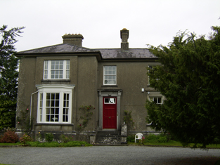
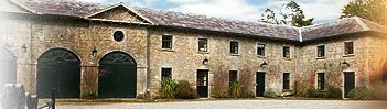
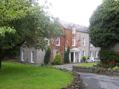
| Rathpeak House [Woodpark Lodge] | Owen Lynch was occupying the house at Rathpeak at the time of Griffith's Valuation when it was valued at £14. Lewis records Woodpark as his seat in 1837. This is also the property listed as his residence in 1814. At the time of the first Ordnance Survey in 1837 the house, known as Rathpeak House, is described as "a fine house, three stories high and in tolerable repair". When the property was advertised for sale in the Landed Estates' Court in 1861 Woodpark Lodge was described as a mansion house which originally cost several thousand pounds to build. There is now no sign of the house and there are modern farm sheds at the stables. Family history sources suggest the house was demolished in the latter years of the twentieth century. |
![Photo of Rathpeak House [Woodpark Lodge]](https://landedestates.ie/storage/img/orig/2807.jpg)
|
| Tully (Moycarn) | A house labelled as "Tully House" at Tully, barony of Moycarn, is shown on the first edition of the Ordnance Survey map adjacent to Tully Castle. It was described in the accompanying Name books as "a gentleman's place, a very good home in good repair". This townland was owned by James Thorngate at the time of Griffith's Valuation but the only house is valued at 10s. Tully Castle is labelled as "in ruins" on the 25-inch Ordnance survey map of the 1890s. In 1786 Wilson mentions "Tulleigh" as the beautiful seat of Sr R. St.George. | |
| Tristaun | At the time of Griffith's Valuation, Simon Sellers was leasing a property valued at £8, including a mill, from the Earl of Clancarty's estate. | |
| Milverton | Thomas Hunt was leasing a property valued at £20 from the Mahon estate at the time of Griffith's Valuation. Extensive corn mills are shown at this site at the time of the First Ordnance Survey but by the 1890s it is occupied by a house labelled Milverton which is still extant. |

|
| Ballyforan | In 1786 Wilson refers to a house at Ballyforan, the seat of Mr. Kelly. This may be the unamed property shown on the 1st edition Ordnance Survey map, close to the river Suck, which is labelled The Lodge on the subsequent 25-inch edition. At the time of Griffith's Valuation, this property was held from the Greene estate by Thomas Kenny. The house was valued at almost £7 and the nearby mills at £23. It is now a ruin. | |
| Killure | Writing in 1786, Wilson refers to Killure as the seat of Mr. Dillon. He appears to be referring to either Killure Castle or a property associated with it. The castle is described as "in ruins" on the 1st edition Ordnance Survey map of 1842 and the ruin of the tower house is still visible. | |
| Court Devenish | The present Court Devenish House was built at the end of the 18th century and has been extensively renovated and extended at various times. The remains of the important early 17th century Court Devenish House forms a garden feature. The original house was largely destroyed during the 1691 siege. The Devenishes descended from a Dublin merchant who leased land at Athlone from the Crown in the early 17th century. In 1751 their interest in these lands was sold to Gustavus Hamilton [of Viscount Boyne family]. At the time of Griffith’s Valuation (publ. 1854) a Mrs Dubordieu was resident holding the property from William Cooke of Talbot Hall, New Ross, Co Wexford. It was valued at £20.10. Since then the house has had many occupants and owners but is still extant. |
|