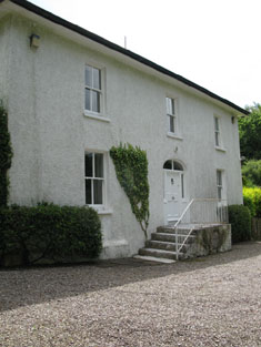
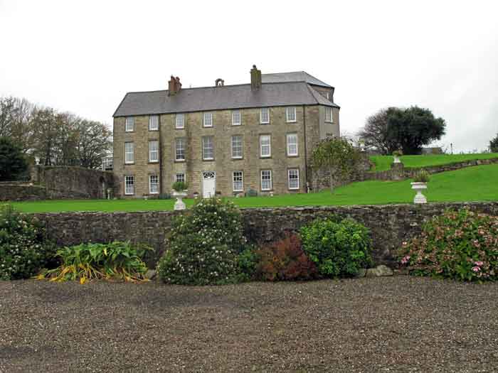
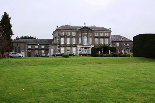
Cloghfadda House
Houses within 15km of this house
Displaying 111 houses.
Houses within 15km of Cloghfadda House
Displaying 111 houses.
| House name | Description | |
|---|---|---|
| Vernon Mount | Built by Atwell Hayes in the 1780s, Vernon Mount was the residence of John Leslie in 1814 and of O. Hayes in 1837. Soon afterwards it was leased to William Lane and he was the occupier at the time of Griffith's Valuation, holding the house valued at £55 from Attiwell Hayes. The Hayes sale rental of 1851 describes this house as "a large handsome building erected by the present owner's father at a cost of £5000". It was leased by the Hayes family to William Lane in 1839. A building still exists at this site. | |
| Old Dromore | Smith refers to the "pleasant seat" of Sir Matthew Deane, "lately rebuilt, with an elegant front of hewn stone". A larger house built in the early 1780s was dismantled almost as soon as it was built by Sir Robert Deane, lst Baron Muskerry. Hajba writes that Jeremiah and Richard Gifford Campion occupied Dromore Old in the last decade of the 18th century. A house valued at £23 in the mid 19th century was the home of the Williamson family located on the Purcell estate. Occupied by U[sher] Williamson in 1814, Reverend Benjamin Williamson in 1837 and in the early 1850s. In 1894 Slater refers to it as the residence of Mrs. Williamson. In the latter half of the 20th century the home of the Hegartys. A house is still extant at Dromore. | |
| Classes | Classes was occupied by William O'Callaghan in the early 1850s and held from John Stevely. The buildings were valued at £11. There are two houses at Classes on the 1st edition Ordnance Survey map. Classes House is located at W562705 while the second is labelled Classes House East and located at the site of the current Classes House which bears a date label of 1823. |
|
| Lisheens | The residence of Richard Donovan at the time of Griffith's Valuation, held from the representatives of John Stevely and valued at £16. | |
| Oriel House | Built in the first decade of the 19th century by the Board of Ordnance. The house was occupied by Charles Wilkes, the superintendant of the gunpowder mills until purchased by the Tobins of Liverpool in the mid 1830s. Mrs Tobin was a painter and their residence became known as Oriel House under Tobin ownership. The house has been a hotel since 1983. |

|
| Woodside | Wilson refers to Wood-side as the seat of Mr. Carleton in 1786. It was occupied by John Carleton in 1814 and by the Reverend E.M. Carleton in 1837. By the early 1850s the house was occupied by Horace Townsend and held by him in fee. It was valued at £40. It had become known as Kilcrenagh by the publication of the 25-inch Ordnance Survey map in the 1890s. Donnelly states that it was burnt in May 1921 during the War of Independence when it was the residence of the family of Ebenezer Pike. The National Inventory of Architectural Heritage notes that it is now in ruins. | |
| Rock Lodge | A house on the Donoughmore estate, occupied by R. Carleton in 1837 and by Henry Osborne Seward at the time of Griffith's Valuation when it was valued at £25. A house is still extant at the site. | |
| Coolyduff House | At the time of Griffith's Valuation this house valued at £16 was occupied by Alfred Parnell and held from Richard Beamish. Labelled as Coolyduff House on the 25-inch Ordnance Survey map of the 1890s. There is still an extant house at the site. | |
| Lackenshoneen | Benjamin Cross occupied this house in the mid 19th century. He held it from Philip Cross and the buildings were valued at £12. The buildings have all but disappeared on the 25-inch edition Ordnance Survey map of the 1890s and nothing remains at the site now. | |
| St Anne's Hill | Richard Barter occupied a house valued at £55 in the townland of Kilnamucky at the time of Griffith's Valuation. St Anne's Hill is marked on the first Ordnance Survey map in this townland. By the 1890s this property had become absorbed into a complex of buildings labelled Hydropathic Establishment. The National Inventory of Architectural Heritage notes that most of the complex is now in ruins though Maranatha House survives as a residence. |

|
| Ardrum | The seat of the Colthurst family, baronets, valued at £85 in the mid 19th century. The Colthursts moved from here to Blarney in the 1870s. However Sir George St John Colthurst is still given as the occupier in 1906 when the house was valued at £45. In 1944 the Irish Tourist Association survey noted it as originally the seat of the Colthursts and still owned by the family. The house is now demolished. | |
| Dawstown | A house on the Putland estate in county Cork, built by Dean Davies early in the 18th century and occupied by his family until the early 19th century. In the 1940s the Irish Tourist Association Survey claimed that he had built the house following his "being turned out of Blarney Castle by the Hollow Blade Company". George Davis was resident in 1810. Occupied by Edmond Mullane in the early 1850s and valued at £12. In the 1940s it was the residence of John Turpin. The house was accidently burnt down in 1956. | |
| Surmount/Sirmount | Sirmount was the residence of Emmanuel Moor in 1750. In 1786 Wilson refers to it as the seat of Mr. Hawkes. This house was occupied by G. Hawkes in 1837 and by Quaile Hawkes in the early 1850s. The property was held from Lady Carbery. The buildings were valued at £8.15 shillings. It is no longer extant. | |
| Blarney Castle | The original 15th century castle belonged to the McCarthys of Muskerry. In 1786 Wilson describes Blarney as the "very fine seat, with ample and beautiful demesnes, of Mr. Jeffreys". Lewis wrote in 1837 that Blarney Castle was purchased in 1701 by Sir James Jefferyes, Governor of Cork [from the Hollow Sword Blades Company] who “ soon after erected a large and handsome house in front of it, which was the family residence for many years, but is now a picturesque ruin”. A new house was built in 1874 on the demesne lands by the Colthurst family and is still occupied by them. |

|
| Bawnnafinny | Described at the time of Griffith's Valuation as a caretaker's house, valued at £12 and held by St John Jefferyes in fee. | |
| Woodview | A house named Wood-view near Cork was occupied by Thomas Cuthbert in 1814. The Reverend William Spedding occupied Woodview in the early 1850s. He held it from Sir George Colthurst and the buildings were valued at £12. A house is still extant at the site. | |
| Cloghroe House | In 1786 Wilson refers to Cloghroe as the seat of Mr. Capel. In the late 18th century this house passed by marriage from the Capel family to the Fitzgerald family. J. C. Fitzgerald was resident at Cloghroe in 1814. The house, valued at £28, was occupied by Thomas Keogh in the early 1850s and held from Thomas Fitzgerald. In 1944 the Irish Tourist Association Survey referred to it as the residence of Major O'Mahony of Blarney Mills. A house is still extant at Cloghroe. | |
| Inchbeg | Located on the Fitzgerald estate, this house was occupied by Henry Young, at the time of Griffith's Valuation. The buildings were valued at £11.15 shillings and he also held a mlll valued at £84. A house is still extant at the site. |
|
| Firmount | A Townsend family home, occupied by Horace Townsend in 1837 and by William Coghlan at the time of Griffith's Valuation. It was then valued at £14.10 shillings and was held from Horatio Townsend. The sale rental of 1877 records a fee farm grant of Firmount from John Crewe Chetwood Townsend to Arthur Chute dated 1871 and a fee farm grant from Arthur Chute to J.C.C. Townsend executed the following year. A house is still extant at the site. | |
| Knockane | A house valued at £14.10 shillings in the early 1850s when it was occupied by Henry Ruby and held from Samuel P. Townsend. The original house is no longer extant. | |
| Garraun | George C. Stawell held this property from Sir George Colthurst at the time of Griffith's Valuation. The buildings were valued at £7.10 shillings. This house was still occupied by the Stawells in the 1870s. A house and farm are still extant at the site. | |
| Rich Hill | A house occupied by Thomas George French at the time of Griffith's Valuation, valued at £20 and held by him in fee. | |
| Garrycloyne | Leet records Robert McCarthy occupying Garrycloyne in 1814. "Burkes Irish Family Records" states that Garrycloyne Castle was acquired by Samuel Philip Townshend from John Travers in 1837. The buildings were valued at £45 in the early 1850s and held by Samuel Townsend in fee. The house was later the home of the Barrys. In the 1940s the roof was taken off the house and it has remained a ruin ever since. | |
| Greenfort | A house valued at £10 occupied by Francis Wyse and held by him in fee at the time of Griffith's Valuation. | |
| Birchhill Cottage/Birchhill House | This house was occupied by John Travers at the time of Griffith's Valuation. He held it from Francis Wyse and it was valued at £10.10 shillings. Jane Clerke occupied a mansion house valued at £20 in this townland in 1906. It is labelled Birchhill Cottage on the 1st edition Ordnance Survey map but as Birchhill House on the 25-edition of the 1890s. A house is still extant at the site. | |
| Newcastle | The buildings at Newcastle were valued at £18 in the early 1850s, occupied by Daniel Donohoe and held from Francis Wyse. | |
| Burnfort | Burnfort valued at £7 was occupied by the representatives of Richard Harris Purcell at the time of Griffith's Valuation and held by them in fee. A house is still extant at the site. | |
| Ballyknockane | A house occupied by Thomas Ware in the early 1850s, valued at £11 and held in fee. It is labelled Ballyknockane House on the 25-inch edition of the Ordnance Survey map of the 1890s. It is now a ruin. | |
| Knockanroe | A house valued at £17 at the time of Griffith's Valuation and held by Robert A. Rogers in fee. It is not marked on the first Ordnance Survey map and was probably built in the 1840s. | |
| Glancam | This house was occupied by Robert Aldworth at the time of Griffith's Valuation, held by him in fee and valued at £8. Extensive buildings remain at the site, the centre of a large farming enterprise. | |
| Carrigrohane Castle | A fortified house that came into the possession of the Hoare family through marriage with a member of the Baker family in the 1770s. In 1786 Wilson refers to Carrigrohan as the seat of Mr. Colthurst. Reconstructed in the 1830s by Augustus Robert McSweeny, a corn merchant, who also leased the floor mills nearby. At the time of Griffith's Valuation Jane McSweeny was resident. The Castle later reverted back to the Hoares who owned it until the 1940s. They are mentioned by the Irish Tourist Association survey as resident there. It is still extant. |

|
| Rockvale | Lewis refers to this recently erected mansion of Samuel George Beamish. In the early 1850s it appears to be unoccupied and valued at £12, the land was held by Michael Kelleher from S. G. Beamish. This house no longer exists. | |
| Bishop's Island | Grice Richard Smyth held buildings valued at £25 in the townland of Bishop's Island at the time of Griffith's Valuation. ''Burke's Irish Family Records'' refers to his father Henry Mitchell Smyth of Bishop's Island. In 1786 Wilson notes Bishop's Island as the seat of Mr. Mitchell. | |
| Bridestown | Leet records the Reverend Edward Carleton as resident at Bride-town, Rathcormack. E. Morgan was the proprietor in 1837 and at the time of Griffith's Valuation, holding the property in fee. The buildings were valued at £42. Bence Jones writes that the Morgans sold the property in the second half of the 19th century having been ruined by the gambling of Lady Louisa Morgan, known as "Unlimited Loo". Later the home of the Lindsay and Horgan families and still occupied. |

|
| Killuntin | Home of a branch of the Roche family, occupied by Edmund Roche in 1814, by R. Roche in 1837 and by Richard V. Roche at the time of Griffith's Valuation. Richard Roche held the property in fee and the buildings were valued at £15.10 shillings. Hajba records the house as a ruin. | |
| Bushy Park | Hajba writes that Gifford Campion, born at Leitrim, acquired the lands of Bushy Park in the mid 18th century and that his son Richard Gifford Campion possibly built the house in the late 18th century. Bushy Park, Rathcormack, was occupied by John Walsh in 1814 and by Richard G. Campion in the early 1850s. The buildings were valued at £18.15 shillings and held from Major Heliger Lloyd. Occupied by William Moore Hodder in 1906. This house is still a residence. |

|
| Kildinan | The home of Edward Roche father of the 1st Baron Fermoy in the late 18th and early 19th centuries. In 1837 Lewis refers to the "highly improved property" of Edmund Roche. By the time of Griffith's Valuation Kindinan valued at £32 was leased to William Dargan who also held a flax mill and 561 acres from the Roches. This house is still occupied. | |
| Shanbally | Hajba records this house as a Welsh/Walsh home. John Welsh was the proprietor in 1837. E.B. Roche is given as the occupier in the early 1850s when the house was valued at £11. He held the property in fee. The house is still a residence. | |
| Glenville | Originally a Coppinger property sold to the Hudsons in the mid to late 18th century. The Hudsons built a new house and this house was added too in 1887. E. G. Hudson was resident at Glenville in 1814 and Lewis records the Reverend E. G. Hudson as the proprietor of Mount Pleasant in the parish of Ardnageehy in 1837. In the mid 19th century William E. Hudson held the property valued at £46 in fee. Inherited by William E. Hudson's nephew Sir Edward Hudson Kinahan who was the occupier in 1906 when the house was valued at £150. Sold to the Bence Jones family in 1949. Also known as Mount Prospect and The Manor, this house was the home of Mark Bence Jones, author. |
|
| Brooklodge House | A house and paper mill valued at £30 held by Mary Eliza Phair from the Reverend Robert Bury at the time of Griffith's Valuation. This Phair family were involved in paper mills in a number of townlands in this locality. | |
| Brookville | Home of Cornelius O'Callaghan who held it from the Reverend Robert Bury in the mid 19th century. The buildings were valued at £35. |

|
| Blossomgrove | Blossomgrove was the residence of William Casey in the early 1850s. He held the house valued at £22 and 335 acres from Simon Dring. A house is still extant at the site. | |
| Butlerstown | Nathaniel C. Martin held a house, offices, foreman's house and spade factory valued at £25 from Francis Beamish. The property is labelled Butlerstown House on the 25-inch Ordnance Survey map of the 1890s when the spade factory is no longer visible. There is still an extant house at the site. | |
| Corbally | ''Burke's Irish Family Records'' describes the Sheehys of Corbally House from about the late 18th century. In the mid 19th century the house was occupied by William J. Sheehy, second son of Bryan Sheehy of Corbally House, died 1806. The buildings were valued at £27 and the property was held from the Reverend Edward Newenham. This house was named 'Mill View' on the first Ordnance Survey map. Mill View was still occupied by Sheehys when it was advertised for sale in 1871. | |
| Maryborough | The sale rental for the Mannix estate states that this house was built in 1816 at a cost of £3,000. Occupied by J. Wallis in 1837 and by Henry Mannix in the early 1850s. Mannix held the property from the representatives of the Reverend Robert Dring and the buildings were valued at £28. |

|
| Rockgrove | The seat of the Dring family in the 18th and 19th centuries, valued at £50 in the early 1850s. Bence Jones writes that it was sold by the Drings in the early 20th century, valued at £80 in 1906, and was restored in the 1970s. The house is now used as offices. |
|
| Riverstown | An early 18th century house with fine plasterwork by the Francini brothers, the seat of the Browne family for two and a half centuries. The Brownes were still occupying the house in 1837 but John Carmichael is recorded as the occupier in the early 1850s when it was valued at £32.10 shillings. Restored in the 1960s by the Dooleys with help from the Irish Georgian Society. |
|
| Glyntown House | Unoccupied in the early 1850s, this house was held by Eliza McCaul from William B. Hoare. It was valued at £35. Bence Jones writes that this house, now demolished, was built by Samuel McCall and was owned in the 20th century by the Dring family. | |
| Ballinglanna | Occupied by J. Newsom in 1814 and E. Newsom in 1837. Edward Newsom held this house from Eliza McCaul and Louis Denay at the time of Griffith's Valuation when it was valued at £24. This house is named Glenville on the first Ordnance Survey map. |

|
| Kilcoolishal | Thomas Martin occupied a house valued at £18+ in this townland at the time of Griffith's Valuation. He held it from W. B. Hoare. | |
| Factory Hill | The seat of a branch of the Hoare family in the 18th and 19th centuries. Occupied by E. Hoare in 1814 but by 1837 leased to William Letchfield or Lichfield. He occupied the house in the early 1850s when it was valued at £25. Richard Martin of Factory Hill owned 506 acres in county Cork in the 1870s. A larger property, known as Dunsland House, occupies the site of Factory Hill on the 25-inch Ordnance Survey map of the 1890s. This latter property was later the residence of Joseph Pike and was burnt in August 1920 during the War of Independence. |

|
| Richmond | The home of the Mannix family in the late 18th and 19th centuries. Occupied by S. Oliver in 1814 and by R. Mannis [Mannix] in 1837. [Henry Mannix was resident in the early 1850s when the house was valued at £27 and held from Jonas Morris.] A house is still extant at the site. | |
| Woodville | Woodville was originally a home of the Cummins family. In 1800 Charlotte Cummins married Thomas Mannix. Occupied by N.W. Cummins in 1837 [and by Richard B. Isaack in the early 1850s when it was valued at £23]. Buildings are still extant at the site though extensive modern development has taken place in the area. | |
| Dunkettle | Seat of the Morris family from the late 18th century, occupied by Abraham Morris in 1814 and 1837. Wilson, writing in 1786, provides a detailed description of the demesne. At the time of Griffith's Valuation Jonas Morris held the property from George Newenham. The buildings were valued at £60. Bence Jones writes that this house was built on or close to the site of a previous house belonging to the Trant family. The house was sold in the late 19th century to the Gubbins family. |

|
| Glenburn | Glenburn was occupied by A. Lewis in 1837 and was held in fee by John T.C. Gibbings at the time of Griffith's Valuation. The buildings were valued at £20.15 shilllings. |

|
| Carrignavar | The castle of Carrignavar was from the mid 17th century the seat of this the senior branch of the McCarthy clan. Bence Jones writes that Carrignavar is a late 19th century castellated house incorporating the remains of the old castle. Lewis refers to Carrignavar as the seat of Justic McCarthy in 1837 and Justin McCarthy junior was resident at the time of Griffith's Valuation when the buildings were valued at £28. Bought by John Sheedy in the 20th century and sold by him in the 1950s to the Sacred Heart Fathers. The house is part of their college complex. |

|
| Ashton Grove | This house is marked Ashton Grove on the first Ordnance Surve map. John Cotter was the proprietor of Ashton, Cork, in 1814 and T. Cleary of Ballingohig in 1837. Thomas J. Cleary held the property from Henry Braddell at the time of Griffith's Valuation when the buildings were valued at £22. Cleary held a cornmill from Braddell in the townland of Kilrussane. James Fitzgerald held 122 acres of untenanted land and buildings valued at £26+ in 1906. |
|
| Mitchellsfort/Fellfort | This house was the home of Mitchell Esq in the 1770s and 1780s. Occupied by Brooke Brazier in 1814 and by his son Henry B. Mitchell in the early 1850s. Henry B. Mitchell owned the property in fee and the buildings were valued at £52+. Slater noted it as the residence of R.L. Fell in 1894, now demolished. | |
| Little Island House | A Bury residence, occupied by Richard Bury in 1814, by Phineas Bury in 1837 and by his widow Eliza at the time of Griffith's Valuation. The house was valued at £51 and held from the Earl of Limerick. Bence Jones wrote n 1978 that the house was a ruin and the site is now occupied by industrial buildings. | |
| Inchera | This house, also known as Sun Lodge, was the home of the Oliver family. Occupied by S. Oliver in 1814 and Silver Charles Oliver in 1837 and in the 1850s. The buildings were valued at £54 and the property was held from the Reverend Rowland Davis Gray. Owned by C.E. Murphy in the first half of the 20th century. Post 1950 it was destroyed by a fire. | |
| Hermitage | A house valued at £18, occupied by Eliza Martin and held from Robert Webb at the time of Griffith's Valuation. In the 20th century the home of Edmund Glen Browne. |

|
| Wood View | The home of J. Cremen in 1837 and Jeremiah Crimmin in the early 1850s, when the house was valued at £16 and held from Thomas Wyse. | |
| Sarsfieldscourt [Old] | In 1837 Lewis refers to Sarsfieldscourt as an ancient mansion "formerly belonging to the Sarsfield family but now to Mr Rutland [Putland] of Dublin". On the first Ordnance Survey map one building is marked as "in ruins". Another building also named Sarsfield's Court is marked closer to the Glashaboy River. At the time of Griffith's Valuation Charles Putland junior was recorded as occupier, holding the house valued at £13 from his father Charles Putland. This latter property is labelled Beechmount on the 25-inch Ordnance Survey map of the 1890s. A property labelled Sarsfieldcourt House is also located in the townland on the later map [W723779]. It is no longer extant and St.Stephen's Hospital now occupies the grounds. | |
| Condonstown | Timothy Mahony occupied a house valued at £6 which he held with 165 acres at Condonstown North from J.H.S. Barry in the mid 19th century. By 1906 the buildings were valued at £15+ and Arthur H.S. Barry is given as the occupier. Grid reference is approximate. | |
| Doughcloyne | Originally the home of the Ronayne family, it passed by marriage to the Sarsfields. Occupied by Dr Sarsfield in the 1770s and 1780s, by Mr Haynes in 1814, by D. Sarsfield in 1837 and by Thomas R. Sarsfield in the early 1850s, who held it in fee, value £43. In 1894 Slater notes it as the seat of Capt. T.R. Sarsfield. This house is no longer extant. | |
| Turret Farm House | At the time of Griffith's Valuation occupied by St John Jeffreys and held by him in fee, the buildings were valued at £26. | |
| Leemount | The residence of John T. Hartnell in 1814 and of Nicholas C. Brabazon at the time of Griffith's Valuation. Brabazon held the house valued at £72 from St John Jeffreys with 118 acres. The 1870s landowners' records indicate it as owned by Henry Lindsey Young and Slater records it as his residence in 1894. Leemount is still extant. |

|
| Mount Desert | The home of the Dunscombe family in the 18th and 19th centuries, it was noted by Wilson as the seat of Mr. Dunscombe in 1786. The house was occupied by George Dunscombe in 1814 and by Nicholas Dunscombe in the early 1850s when it was valued at £55. Still valued at the same amount in 1906 when it was occupied by Robert Dunscombe. The house is no longer extant and the Bon Secours Health Care unit is now located at this site. |
|
| Castle White | Occupied by Whyte Esq in the 1770s Wilson refers to this property as Rochfordstown in 1786. George M. White was the owner in 1837 and held by him in fee at the time of Griffith's Valuation when the house was valued at £35. Lucia P. Hawkes was recorded as the occupier of two mansion houses in this townland in 1906, one valued at £27 and the other at £53. Castle White is still extant. In 2023 it was offered for sale by Sothebys International. |
|
| Chetwynd | The Pigotts were established at Chetwynd in the early 18th century and Wilson refers to it as their seat in 1786. By the end of the century they were resident in county Laois. In 1837 J. Forrest was the proprietor of Chetwin and in the mid 19th century William Bateman occupied the house, valued at £25, which he held from John Dennis. Two houses are marked on the first Ordnance Survey map for Chetwynd. It is not clear which one was the Pigott house. | |
| Park Farm House | Henry Morrogh of Park Farm was a younger son of James Morrogh of Cork. He was resident at Park Farm in 1837 and in the early 1850s when the house was valued at £35 and held in fee. He married Helena Power. Mrs Helen Morrogh owned 828 acres in county Cork in the 1870s. | |
| Lauriston | A house valued at £40 at the time of Griffith's Valuation and held by Nicholas D. Murphy from Joseph Anderson. | |
| Lotabeg | Bence Jones writes that this house was built circa 1800 for Sir Richard Kellett 1st Baronet. Lewis gives D. Callaghan as the proprietor of Lotabeg in 1837. Poole Hickman was resident at the time of Griffith's Valuation, holding the property from William Galway. The buildings were valued at £87. Home of the Mahony family in the late 19th century. | |
| Lota Lodge | Occupied by James H.Smith Barry in 1837 and at the time of Griffith's Valuation when the buildings were valued at £75 and held from John Courtney. The residence of Arthur Frederick Sharman Crawford at the end of the 19th century. Bence Jones writes that this house was partially destroyed by fire in 1902 and rebuilt the following year. It is now the Vienna Woods Hotel. |

|
| Lota Park | Built in the early 19th century by John Power and purchased by Jeremiah James Murphy circa 1836. By the early 1850s occupied by Colonel Ludlow Beamish who held it from John Courtney. In the 1870s the home of Edmund Burke. In the 20th century home of Joseph Gubbins and later of Mrs Francis Mahony. Now operates as a health care facility. |

|
| Lota House | Occupied by William Hastings Greene in 1837 [of the Greene family of Greenville, county Kilkenny] whose interest in Lota was advertised for sale in January 1851. William H. Greene was married to Mary Sarsfield of Doughcloyne and held Lota on a long lease from Robert Courtenay. George A. Wood was tenant in 1851 and resident at the time of Griffith's Valuation. He held the house valued at £85 from John Courtney. Now a hospital site. |
|
| Lotamore House | The residence of the Honourable C.L. Bernard in 1837 and of Frederick Hamilton at the time of Griffith's Valuation. He held the house valued at £64 from William C. Rogers. The interest of Joseph Harrison in Lotamore was for sale in February 1871. Sir William Bartholomew Hackett was the tenant. Owned in the late 19th century by the Perrier family and the Mahonys. Wilson writing in 1786, refers to Lota as the seat of Mr. Rogers. It has operated as a guesthouse for many years. |

|
| Kilbarry | In the mid 19th century occupied by George Wise and held from James H. S. Barry. The buildings were valued at £35. | |
| Ballincurrig | W.C. Logan occupied Ballincurrig Cottage in 1837 and William Coppinger occupied a house at Ballincurrig valued at £33 and held by him in fee at the time of Griffith's Valuation. | |
| Cleve Hill | Samuel Perrott was residing at Cleve Hill in 1837 and in the early 1850s when the house was valued at £68 and held from Alexander McCarthy. Cleve Hill a modern family mansion on 13 acres was advertised for sale in October 1873, the estate of Joseph Gadsden Nash and Arthur Power Harty, bankrupts. | |
| Clifton | John Moore Travers inhabited this house in the first half of the 19th century. At the time of Griffith's Valuation Clifton was valued at £65 and held from the Earl of Bandon. John M. Travers only child Elizabeth married in 1827 Sir William Henry St Lawrence Clarke, Baronet. Later the home of Nicholas Murphy and in the 20th century in use as a convent. | |
| Besborough | In the 1770s the residence of Allen Esq. The seat of the Pike family for most of the 19th century. Occupied by J. Spence in 1814 and by Ebenezer Pike in 1837 and in the early 1850s. He held the property from the representatives of Bousfield and the house was valued at £78. This house was used as a convent in the 20th century. http://www.askaboutireland.ie/reading-room/history-heritage/big-houses-of-ireland/bessborough-house-and-est/index.xml | |
| Hampstead | The residence of G. Britton in 1814 and of Lieutenant Boyle Hill in 1837. Occupied by John H. Bainbridge at the time of Griffith's Valuation. He held the property in fee and the house was valued at £22. The house is not labelled on the 25-inch Ordnance Survey map of the 1890s and is no longer extant. | |
| Ballygaggin | Occupied by Edmond Murphy at the time of Griffith's Valuation, valued at £30 and held from the Duke of Devonshire. | |
| Frankfield | Located on the side of what is now the Frankfield Golf Club, Frankfield House was occupied by S. Lane in 1837 and by the Very Reverend H. J. Newman in the mid 19th century. Reverend Newman held it from William Lane and the buildings were valued at £60. | |
| Lee Cottage | Marked on the first Ordnance Survey map this house was occupied by Henry O. Seward in the early 1850s when it was valued at £52 and held from the Ecclesiastical Commissioners. Now incorporated into the university. | |
| Castlemahon | Seat of the Chatterton family, occupied by Sir James Chatterton in 1814 and Sir William in 1837 and at the time of Griffith's Valuation when it was valued at £47. The property was held from the Ecclesiastical Commissioners. The building now houses a youth centre run by the Redemptorist Order. |
|
| Ferney | Ferney was the residence of Mrs Coote in 1814 and of J.H. Manley in 1837. Joseph Manly occupied the house valued at £68 at the time of Griffith's Valuation. He held it from Sir William Chatterton. This house is still extant. | |
| Lakeview | Occupied by Miss Allen in 1837 and by William Prittie Harris in the early 1850s when the house was valued at £28 and held from Sir William Chatterton. In the 1870s Richard Harris of Lakeview, Cork, owned 169 acres. This house no longer exists. | |
| Ringmahon Castle | The proprietor of Ring Mahon Castle in 1837 was J. Murphy. James Murphy occupied the house valued at £68 in the early 1850s and held the property from William Crawford who held from the Chattertons by lease dated 1797. This property was still in the possession of the Murphy family at the end of the 19th century. | |
| Dundanion Castle | The residence of the architect Sir Thomas Deane in 1837, valued at £78 in the early 1850s and held from Richard Sampson. Sold by Sir Thomas to William Wise in 1860 and by Wise to William Thornton in 1868. A residence is still extant at this site. | |
| Garrane | In the early 1850s Francis Hennis occupied a house valued at £30 from William Howe Hennis. A building still exists at this site. | |
| Grange | H. Conron occupied Grange in 1837 and at the time of Griffith's Valuation when the buildings were valued at £40 and held from J.D.C. Beamish. Hatton Condon was still living at Grange in the 1870s. In 1894 Slater records Grange as the seat of E.R. Conron. This house no longer exists. | |
| Lehenaghbeg | A house valued at £14 in the mid 19th century and held by Edward Casey from James H. S. Barry. Edward Casey was the owner of 121 acres at Lehenaghbeg in the 1870s. | |
| Lehenagh | Occupied by T. Curtis in 1837. By the early 1850s Mary Curtis was resident holding the house valued at £28 from the Reverend Edward H. Newinham. | |
| Lehenagh House | A home of a member of the Newingham family in 1814 and of Charles Mathew in the mid 19th century.James Mathews of Lehenagh owned 107 acres in the 1870s. This house no longer exists. | |
| Ashton | A house occupied by John Cotter from at least 1814 until his death in 1864 and by Mrs Catherine Cotter until at least 1871. It is not clear if John Cotter was a member of the Cotter family, baronets. The house is now part of the Ashton School complex. | |
| Ballyphilip House | This property was leased to Samuel Adams Austen and occupied by John Forrest in the early 1850s. When the Newenham's fee of Ballyphilip was for sale in 1865 David Cagney was resident. A house still exists at the site. | |
| Gawsworth | In the mid 19th century this house valued at £19 was occupied by Russell Fitton and held from the representatives of Robert Hedges and Mr Pratt. | |
| Woodhill | Originally this property belonged to the Dennis family. Following the marriage of Elizabeth Dennis to Cooper Penrose, a Quaker, of Waterford, it passed into the possession of the Penrose family, who enlarged the house. Another Cooper Penrose was the occupant in 1814 and in the mid 19th century holding the property from James Murphy. The buildings were valued at £100. The house was demolished circa 1980s. | |
| Ballycannon | The home of the Spread family in the 18th century, by the time of Griffith's Valuation the buildings were valued at £7 and occupied by Michael and John Daly who held the property from the representatives of William Spread. A building is still extant at this location. | |
| Trantstown | A Trant home in the 18th century, occupied by Mrs Pepper in 1837 and by James Barry in the early 1850s. He held the house valued at £8+ from Lady A.H. Fitzgerald. Buildings are still located at this site. | |
| Wilton | In 1786 Wilson refers to "Willtown" as the seat of Mr. Izod. Charles H. Leslie occupied Wilton in 1814 and in 1837. By the mid 19th century Matthew Leslie was resident, holding the house valued at £55 from John Craig and H. Mitchell. A college is now located at this site. | |
| Shanakiel | Daniel Leahy is recorded as the occupier of Shanakiel House in the first half of the 19th century. The house was valued at £85 in the early 1850s and held from the Earl of Cork and Orrery. This house no longer exists and its site is located in the grounds of a hospital. | |
| Maglin | A house valued at £15 and held by James Barry [Berry] from John Popham and others at the time of Griffith's Valuation. Buildings are still extant at this location. | |
| Rosanna | Rosanna was the home of the Webb family in the 19th century, occupied at the time of Griffith's Valuation by Hannah (widow of the Reverend Dr John Webb) valued at £75 and held from St John Jeffreys. A building is still located at this site. | |
| Corbally South | Catherine Delany held buildings valued at £11 from William J. Sheehy in Corbally South at the time of Griffith's Valuation, with 148 acres. Buildings are still located at this site. | |
| Spud Villa | This house is marked on the first edition Ordnance survey map. Anne and Jane Wise occupied a house in the townland of Mount Desert valued at £38 and held from Thomas Wise in the mid 19th century. | |
| Rathpeacon House | At the time of Griffith's Valuation, Rathpeacon House was occupied by William le Fanu leasing from Richard Thomas when the house was valued at £27. In the 1870s it is recorded as the residence of John Davis. | |
| Ballincollig | In 1786, Wilson mentions a seat of Mr.Lloyd at Ballincollig, "near the ruins of the castle". By the time of Griffith's Valuation, this area appears to have been in the possession of Thomas Tobin and the house may have been that leased by Rev. David Horgan, when the buildings were valued at £14. A substantial farm still exists at this site. | |
| Greenfield (Ballincollig) | In 1786, Wilson refers to Greenfield, near Ballincollig, as the seat of Mr. Carleton with another house, the seat of Mr. Wetheral, opposite. Greenfield House is labelled on the 1st edition Ordnance Survey map but is not shown on the 25-inch edition of the 1890s. Greenfield Upper, across the road, is shown on both maps. At the time of Griffith's Valuation this townland was in the possession of Francis Carleton. Greenfield House was valued at £11 while the second house in the townland was valued at almost £10. Neither were occupied. A building is still extant at the Greenfield Upper site though extensive modern housing has been built in the surrounding area. |