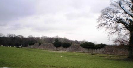
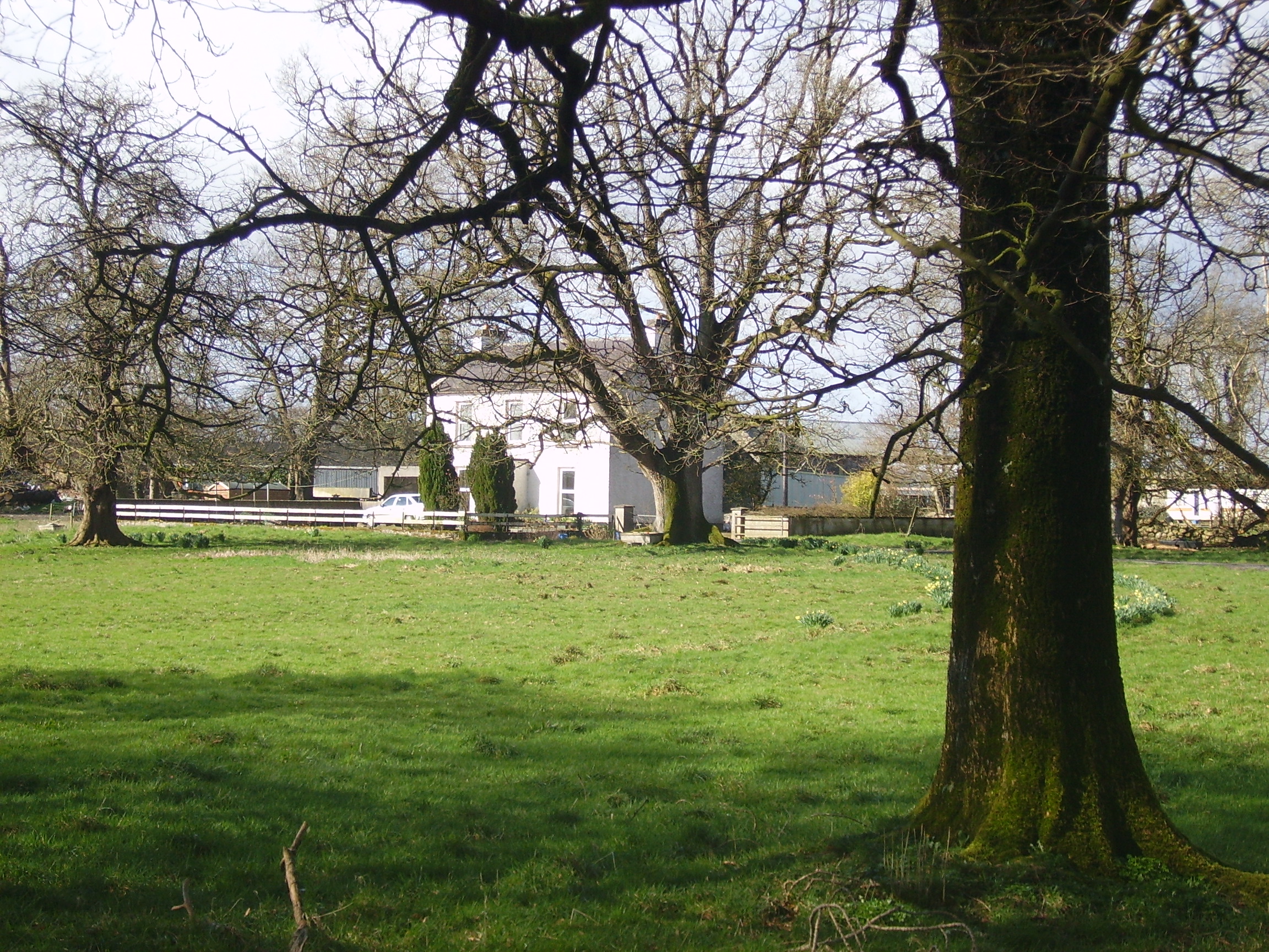
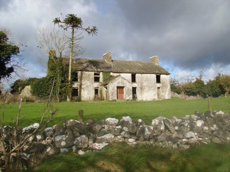
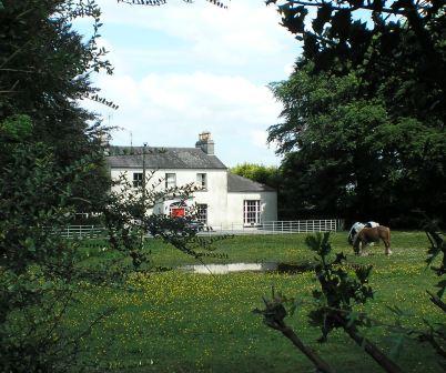
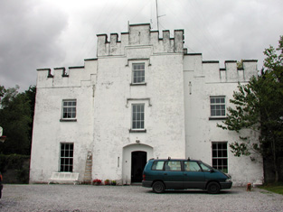
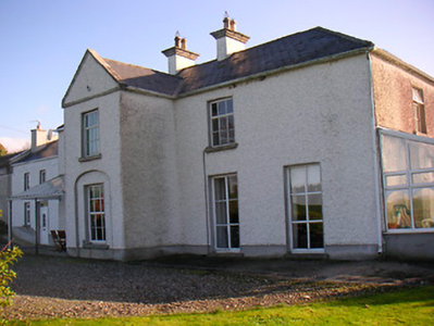
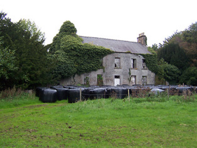
Ardkeenan
Houses within 15km of this house
Displaying 80 houses.
Houses within 15km of Ardkeenan
Displaying 80 houses.
| House name | Description | |
|---|---|---|
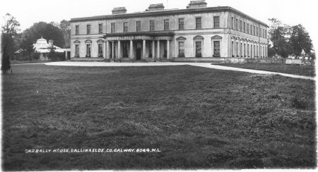
| Garbally Park | In 1783 Taylor and Skinner show Garbally as a seat of the Trench family. Wilson mentions Garbally , "the very fine seat of Willaim Power Keating Trench", in 1786. At the time of Griffith's Valuation it was the seat of the Earl of Clancarty and was valued at £150. It became St. Joseph's College, Garbally Park, in 1922 and has functioned as a school until very recently. It is still extant. |
|
| Creggaun House | Bar Kelly was living at Cregan in 1749. At the time of the first Ordnance Survey it is mentioned as the home of Captain Masters. William Masters was leasing a house valued at £16 in Creggaun townland, parish of Ahascragh, from the Clonbrock estate at the time of Griffith's Valuation. This property is no longer extant. | |
| Annaghbeg House | John Moor lived at Anabeg in 1749 and in 1814 this was the residence of Edmund Moore. In the 1830s it is described by the Ordnance Survey Name Books as the residence of F. Grady and in bad repair. Charles Bailey was leasing the property at Annaghbeg, parish of Ahascragh, barony of Clonmacnowen from Hubert Moore at the time of Griffith's Valuation. Annaghbeg House is described as "in ruins" on the 1948 edition of the 6-inch OS map. Another house, known as Annaghbeg Cottage is located nearby at M823356. Buildings are still extant at the latter site. | |
| Craig's Hotel | John H. Craig was leasing a property valued at £65 at Back, parish of Kilcloony, barony of Clonmacnowen from the Clancarty estate at the time of Griffith's Valuation. He was running this property as a hotel. In Slater's Commerical Directory, 1846, Craig's hotel was located on the Main Street in Ballinasloe. The Royal Mail car called there on its way from Galway to Dublin. | |
| Brackernagh Lodge | A house valued at £18 at Brackernagh, parish of Kilcloony, barony of Clonmacnowen, was being leased by the Clancarty estate to Miss L. Trench at the time of Griffith's Valuation. This is most likely the house which appears on the 6-inch OS map as Brackernagh Lodge. The National Inventory of Architectural Heritage notes that it was previously known as Mount Catherine. It is still extant and occupied. |
|
| Cleaghmore | Andrew Montgomery was leasing a house valued at £13 from the Clancarty estate at Cleaghmore, parish of Kilcloony, barony of Clonmacnowen, at the time of Griffith's Valuation. | |
| Cleaghmore Villa | A vacant house, valued at £11 and part of the property of Norman Ashe, was located at Cleaghmore, parish of Kilcloony, barony of Clonmacnowen at the time of Griffith's Valuation. This is possibly the house shown on the 25-inch Ordnance Survey map of the 1890s as Cleaghmore Villa which is still extant. |
|
| Cleaghmore B & C | At the time of Griffith's Valuation, the Clancarty estate was leasing two houses in this townland to members of the Le Poer Trench family, one (Cleaghmore B) valued at £23 and the other Cleaghmore C) at £21. They were leased by Mrs. Le Poer Trench and Robert Le Poer Trench respectively. | |
| Deerpark | At the time of Griffith's Valuation, James Horsman was leasing buildings valued at £28 which included a mill, at Deerpark, parish of Kilcloony, barony of Clonmacnowen, from the Clancarty estate. The property was in ruins by the 1890s. | |
| Beechlawn House (Kilcloony) | John Craig was leasing a house valued at £10 to Geoffrey Prendergast at Pollboy, parish of Kilcloony, at the time of Griffith's Valuation. On the 1st edition Ordnance Survey map the building at this site is labelled schoolhouse. However, a larger building of differing proportions is shown on the later 25-inch Map of the 1890s. The property at this site is named Beechlawn House by the National Inventory of Architectural Heritage. |
|
| Dalysgrove | The Ordnance Survey Name books describe Dalysgrove as the residence of Peter Daly and in good repair. At the time of Griffith's Valuation, Francis Daly was leasing the property at Dalysgrove valued at £32 from Peter Daly. The house was in the possession of Peter F. Daly in 1906. Sold by the Dalys in 1928, the shell of the house and parts of the walled garden remains. |
|
| Fortwilliam | At the time of Griffith's Valuation William Lancaster was leasing a property valued at £25 from the Trench estate at Ardcarn, barony of Moycarn. At the same time Thomas Lancaster was leasing a property to Capt. James Bell. In 1786 Wilson refers to Fortwilliam as the seat of Mr. Lancaster. A modern house occupies the site at Fortwilliam but there are remains of yard buildings and a walled garden. |
|
| Moyvannan Castle | 16th century tower house with late 19th century extension. In the sale rental of the Domvile estate 1865 it is described as a handsome and commodious residence. In 1986 Moyvannan was restored by Don Panoz, Chairman of the Elan Corporation. |
|
| Keoghville | Built by Laurence Keogh and his wife Mary Fallon at the end of the 18th century. They were the grandparents of Judge Keogh. Described in the Ordnance Survey Name Books as still in the occupation of Keogh, the representaive of the ancient proprietors of Doohy-Keogh 'but he is poor and nearly shook'. This must be Ross Keogh who resided in Keoghville in 1837. By the time of Griffith's Valuation the house was held in fee by John McKay and valued at £15. Abandoned in the 20th century and replaced by a modern bungalow, the yard is still in use. |
|
| New Park | A Lyster home from the early 18th century, inherited by the Smyths of Barbaville through marriage. Held in fee and valued at £38 at the time of Griffith's Valuation. The home of Marcus Anthony Levinge in 1906. The house remained in Levinge hands until about the 1940s when the roof was removed. In the early 1970s the house was restored as a hotel by Paddy Kenny. |

|
| Thomastown Park | Built in the 18th century and home of the Naghten family for over 200 years, valued at £35 in the 1850s. Wilson refers to it as the seat of Mr. Naghten in 1786. In 1894 Slater mentions Thomastown park as the seat of Mrs. Naghten. It is no longer extant. | |
| Crannagh House | The main residence of the Walsh family in the 18th century. At the time of Griffith's Valuation occupied by Philip Hayes who held the house from William Potts. It is labelled Crannagh House on the 1st edition Ordnance Survey map but is not shown on the later 25-inch edition of the 1890s. | |
| Mounthussey | The home of the Hussey Walsh family, valued at £4 at the time of Griffith's Valuation. The later 25-inch map of the 1890s shows a much larger house at Moynure. A house still exists on the site. | |
| Johnstown | Built circa 1782 by Colonel John Dillon and held on a lease in perpetuity from the Incorporated Society for Promoting English Protestant Schools in Ireland. The Ordnance Survey Name Books refer to this fine residence, occupied by D. Kelly. The Dillons were in residence again by the time of Griffith's Valuation. It became the home of the Kelly family in the early 1870s until the late 1920s. Demolished by the Land Commission, only the entrance gates still remain. | |
| Mount Florence | This house originally known as the 'Whitehouse' and later as 'Mount Florence' was the home of the O'Sullivan family from the mid 18th century. In 1883 it was sold to the Greene family from the Ballinasloe area. It is now a ruin. | |
| Camma Lodge | A home of the St George family in the 19th century. A house is still occupied at the site. |

|
| Curraghboy House | Occupied by J. Byrne or Burne in the 1830s and by Thomas W. Jefferson at the time of Griffith's Valuation and still a family residence. |
|
| Lysterfield | Originally a Lyster property that later came into the possession of Lord Ashtown, a descendant of Anthony Lyster. The home of members of the Lyster family until the mid 1830s and occupied by Mr John Burne at the time of the first Ordnance Survey and by Henry Trench in the 1850s. Nothing now remains except some red bricks, possibly part of a fireplace, at the corner of a farmyard. |
|
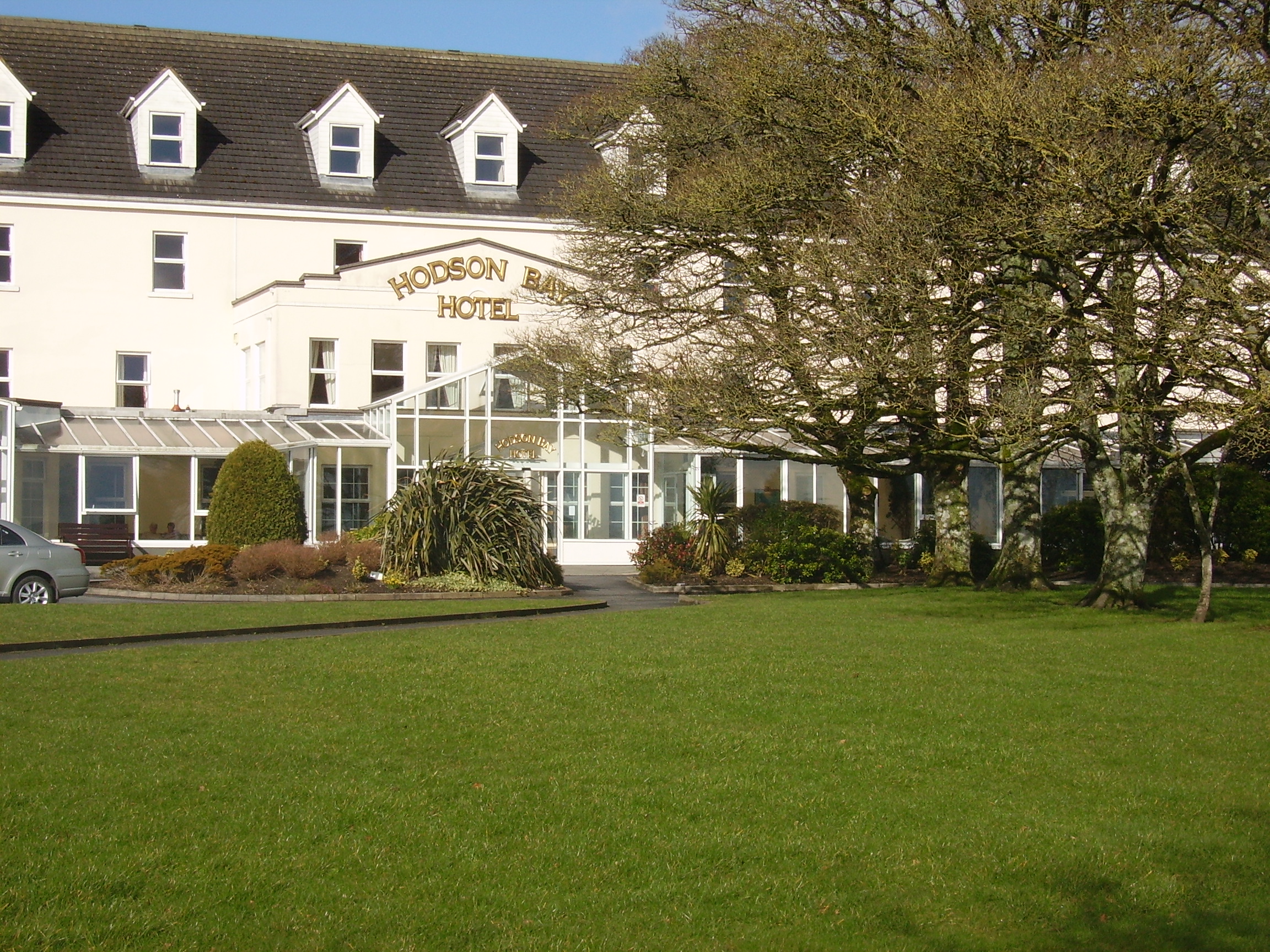
| Hodson Bay | The home of the Hodson family on the shore of Lough Ree. At the time of Griffith's Valuation occuppied by Leonard Hodson junior and Samuel Hodson, who held from the Court of Chancery. Now greatly expanded and functions as a hotel. |
|
| Lissygreaghan | Held in fee by J. P. Gannon at the time of Griffith's Valuation when the house was valued at £4.10 shillings. | |
| Kiltoom | Crofton Kelly bought or acquired the Kiltoom property where he built a house in the mid 18th century. Occupied by Thomas H. Strevens who held a number of townlands from Sarah Kelly at the time of Griffith's Valuation and left to him at her death. Kiltoom remained a Strevans home until the 1970s, now a derelict building. |
|
| Rockhill | Occupied by John Burne in 1814 and described as a tolerably good farmhouse at the time of the first Ordnance Survey. Occupied by E. Hodson in 1837 and by Thomas Wilson who held it from James Wilson in the 1850s. Thomas Wilson was still resident in the 1870s. |
|
| Camlagh | The Newcomens resided at Camlagh in the mid 18th century and then leased the property to the Keoghs. Occupied by a Cruise in 1814 and described as a house of small dimensions at the time of the first Ordnance Survey. Occupied by E. Kilkenny in 1837 and by James Kelly and James Naughton in the 1850s. | |
| Esker | Occupied by W. Kelly in 1837. Bought by the Glennon family and occupied by them for most of the 20th century, still extant. |

|
| Feacle/Fighill | The residence of Dennis Keogh in 1814, occupied by R. Keogh in 1837 and by Richard Keogh in the 1850s when the house was valued at £2. The house has been known as Fighill since at least 1837. The old house is no longer lived in. |
|
| Larkfield House | Built circa 1780, this house was the home of Joseph Sproule at the beginning of the 19th century. Bought by Edward Larkin in 1839 and sold to John Holton in 1873. A succession of owners followed until it was bought by the Naughton family in 1923. | |
| Woodberry House | In the possession of Richard Bermingham in the mid 18th century, when he sold it to Philip Parker of Erris, county Mayo and his wife, Maria Kelly. It appears to have remained in Parker ownership until purchased by the Holton family in the 1850s. Now owned by Louis Walsh. | |
| Newcomen Castle | Newcomen residence in the 18th century. It is shown on the 1st edition Ordnance Survey map but only the site of the castle is recorded on the later 25-inch map of the 1890s. | |
| Ardmullan | Built post 1838 and described as a steward's house at the time of Griffith's Valuation when it was occupied by Thomas Pim junior who held it in fee. A mansion valued at £23 was still in the possession of Thomas Pim in 1906. The house no longer exists but some of the yard buildings remain. |
|
| Bellfield Cottage | Bellfield Cottage, valued at £6, was the residence of Michael E. Murphy at the time of Griffith's Valuation. A house is still extant at the site. | |
| Cuilleen House | A branch of the Naghten family lived at Cuilleen in the 1830s. Malachy Naghten of Cuilleen died in 1865 aged 63 and is buried in Drum Old Cemetery. The house is labelled Cuilleen House on the 1st edition Ordnance Survey map of the 1830s but is not shown on the later 25-inch edition of the 1890s and no trace is visible now. | |
| Kilmore | Originally a Shaen property which passed by marriage to the Carters. A house and 4 acres were leased by Sir Arthur Shaen to William Hartly on 3 Aug 1706 (see sale rental 1855). In 1749, 1778 and 1786 it was occupied by the Waller family. The house was a ruin by the 1830s. | |
| Corkip | In 1786, Wilson refers to Cork, the seat of Mr. Tough. This appears to be an 18th century house associated with the Lyster family, later occupied by the Keoghs and now in ruins.The townland was in the possession of Arthur Beamish by the time of Griffith's Valuation and there was a herd's house valued at 15s. |
|
| Burnbrook | A house with mills closeby on the river. | |
| Ardcarn (Lancaster) | Thomas Lancaster was leasing this property to Capt. James Bell at the time of Griffith's Valuation. Lewis records it as the residence of Capt. Bell in 1837. The house is still extant and occupied. |
|
| Ashford Old House | At the time of Griffith's Valuation Joseph Sharpe was leasing a property from Dudley Persse, at Ashford, barony of Moycarn. It was accompanied by 350 acres and was valued at £5. In 1814 Leet records Ashford as the residence of John Maher. The 6" and 25"edition OS maps record this as "Ashford Old House". | |
| Atticorra | Brabazon Sharpe was leasing a property valued £20, including a mill, to Patrick Harney. This property was situated at Atticora, barony of Moycarn. A mill is shown at this location on the 1st edition OS map. The ruins of the buildings are still visible at the site. |
|
| Birch Grove | At the time of Griffith's Valuation Thomas Brabazon was leasing a property valued at £10 at Beagh, barony of Moycarn, county Roscommon, to Ellen O'Shaughnessy. In 1837 Lewis records Birch Grove as the residence of J. O'Shaughnessy. Referred to as the residence of J.J. O'Shaughnessy in 1894. A house is still extant at the site. | |
| Castle Park House | William Kelly was occupying a house valued at £23, at Cuilleen, barony of Moycarn, at the time of Griffith's Valuation. It is described as "in ruins" on the 25-inch Ordnance Survey map of the 1890s. | |
| Kilgarve House | At the time of Griffith's Valuation, Joseph Potts was leasing the house known as Kilgarve, barony of Moycarn, valued at £28, from the Earl of Clancarty's estate. At the time of the first Ordnance Survey the house is not shown although buildings and woodland are indicated. On the later 25" map, Kilgarve House is marked. A house is still extant at the site. | |
| Sralea House | At the time of Griffiths Valuation, Thomas Tully was leasing a property at Sralea, barony of Moycarn, valued at £8, to James Seyer. Modern buildings exist at the site. now. | |
| Lancaster House or Lancaster Park | Home of Thomas Lancaster in 1814. Thomas Lancaster was leasing a property at Suckfield, barony of Moycarn, valued at £17, to Robert H. Orr, at the time of Griffith's Valuation. Extensive remains of the stable block still exist at the site. In 1786 Wilson refers to "Suckville", the seat of Mr. Lynch. |
|
| Woodmount | The Reverend P.K. Egan in his book on Ballinasloe records the building of this house by Laughlen Kelly in 1783. At the time of Griffith's Valuation, John Kelly was leasing a property at Tonalig, barony of Moycarn, valued at £13, to James Delahunty. Both Lewis and Leet record this property as the residence of Hugh Kelly in 1837 and 1814 respectively. . Fr. Egan records that the Kellys sold the property around 1880 and emigrated to Australia. The property was in the possession of William and John Hynes in 1906. It is now in ruins. |
|
| Creagh Lodge | Francis Madden was leasing a property valued at £13 at Townparks, barony of Moycarn, from the Earl of Clancarty's estate in the 1850s. This may the property referred to on the 1st edition OS map as Creagh Lodge. | |
| Ballydangan | At the time of Griffith's Valuation James Thorngate was leasing a property valued at £6 at Ballydangan, barony of Moycarn, to James Miller. There is no house marked on 1st edition OS map at this location, though a police barracks is shown nearby. The building is no longer extant. | |
| Correen | At the time of Griffith's Valuation, William T. Potts was occupying the house at Correen, barony of Moycarn, valued at £22. The current house was built in the early 1830s but the Potts family were resident there prior to that as "Carrine" is recorded as their residence by Wilson in 1786. In 1837 the Ordnance Survey Field Name books describe Correen House as "a gentleman's place in very good repair on a demesne of over 300 acres". The building is still extant and occupied as a private residence. |
|
| Drumalagagh Cottage | At the time of Griffith's Valuation, George Harrison was leasing a property at Drumalagagh, barony of Moycarn, valued at £14, from Lieutenant Colonel Maberly. This seems to be the property known as Drumalagagh Cottage. This was earlier associated with the St. George family. In 1837 Lewis records Dromalga Cottage as owned by Sir R. St. George but the seat of Mr. Dexter. The Ordnance Survey Name books of the same year describe the property as "a gentleman's place in good repair". It appears to have been situated on the demesne known as Mount Equity, of about 770 acres. Buildings labelled "Mount Equity" appear on the 1st edition OS Map but not on subsequent editions. In the Encumbered Estates sale notice of 1852 Dromalgagh Cottage is described as unoccupied but formerly the residence of the late Mrs. Dexter. In 2009, this property was offered for sale. An eighteenth century mausoleum, dedicated to Henry St. George, is also located in this townland. |
|
| Faltia House | Daniel Mathers occupied Faltia House, barony of Moycarn, at the time of Griffith's Valuation, when it was valued at £9. It was part of a demesne of over 400 acres. The Ordnance Survey Field Name books of 1837 describe it as "a gentleman's place in good repair". | |
| Kilbegly House | At the time of Griffith's Valuation, John Dillon was leasing a house valued at £20 at Kilbegley, barony of Moycarn, to William Colohan. In 1837 Lewis records Kilbegley as the residence of B. Newcomen. In the same year it is recorded in the Ordnance Survey Name books as "a gentleman's place, two stories high, in good repair". The 25-inch map of the 1890s indicates alterations to the house. Only ruins remain at Kilbegly now. | |
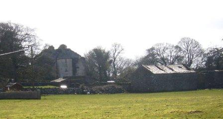
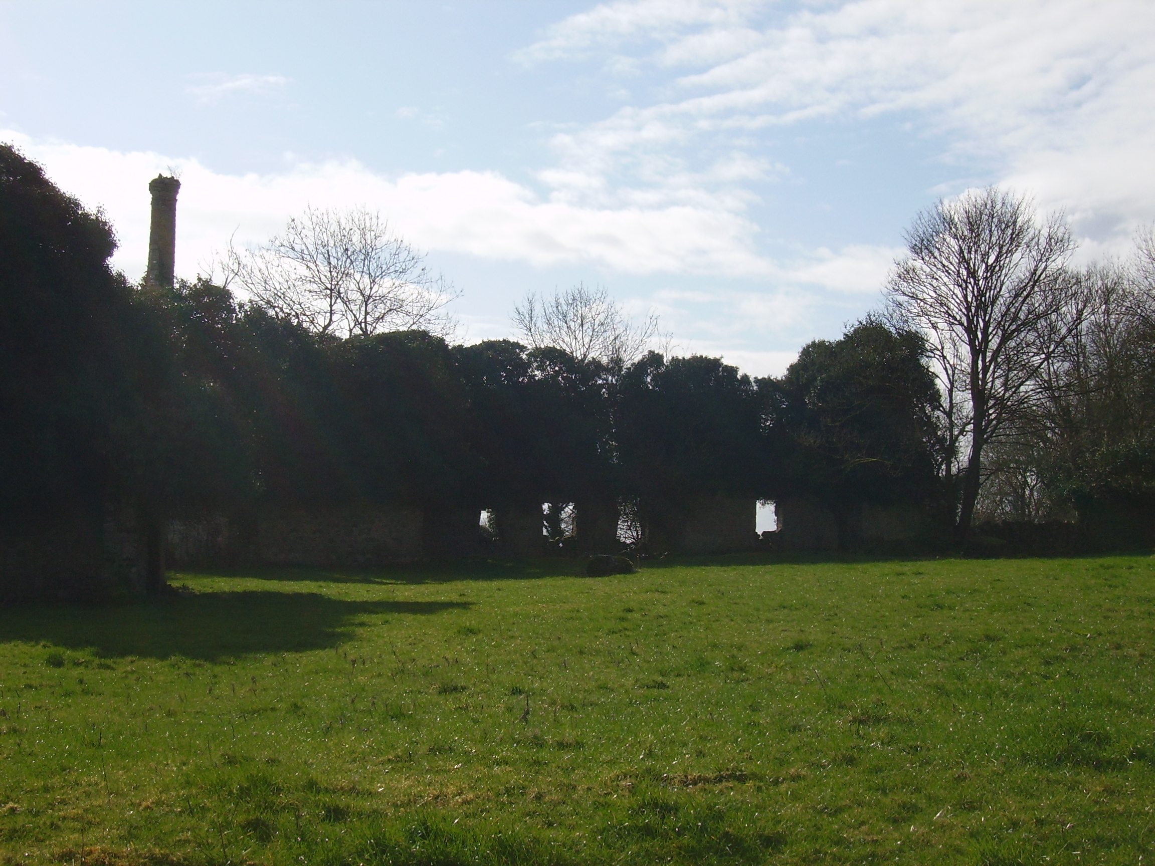
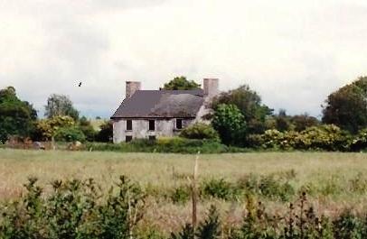
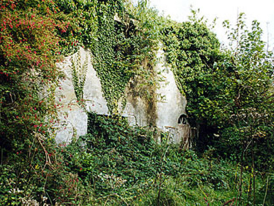
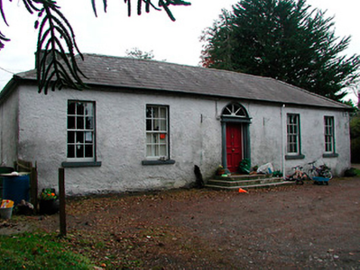
| Rathpeak House [Woodpark Lodge] | Owen Lynch was occupying the house at Rathpeak at the time of Griffith's Valuation when it was valued at £14. Lewis records Woodpark as his seat in 1837. This is also the property listed as his residence in 1814. At the time of the first Ordnance Survey in 1837 the house, known as Rathpeak House, is described as "a fine house, three stories high and in tolerable repair". When the property was advertised for sale in the Landed Estates' Court in 1861 Woodpark Lodge was described as a mansion house which originally cost several thousand pounds to build. There is now no sign of the house and there are modern farm sheds at the stables. Family history sources suggest the house was demolished in the latter years of the twentieth century. |
![Photo of Rathpeak House [Woodpark Lodge]](https://landedestates.ie/storage/img/orig/2807.jpg)
|
| Tully (Moycarn) | A house labelled as "Tully House" at Tully, barony of Moycarn, is shown on the first edition of the Ordnance Survey map adjacent to Tully Castle. It was described in the accompanying Name books as "a gentleman's place, a very good home in good repair". This townland was owned by James Thorngate at the time of Griffith's Valuation but the only house is valued at 10s. Tully Castle is labelled as "in ruins" on the 25-inch Ordnance survey map of the 1890s. In 1786 Wilson mentions "Tulleigh" as the beautiful seat of Sr R. St.George. | |
| Ladywell | Although much of the demesne of Harmony Hall is shown in the townland of Bunown on the first edition OS map, the house Ladywell was not built at this time. An elegant Italianate country house, six-bay two-storey over (partial) basement country house on L-shaped plan, built about 1845 to a design by Sandham Symes (1808-1894), for the Mahon Family (boi). In the mid-19th century Ross Mahon was the occupant holding the building valued at £37 in fee. Members of the Metge, Crofton, Williams and Flannery have all been occupants of this house. It has extensive views over Killinure Lough to the south. |
|
| The Lodge | The Lodge on Hare island was a hunting/fishing lodge built c 1814 for William Handcock, 1st Lord Castlemaine of Moydrum to designs by Sir Richard Morrison (1767 - 1849), having a veranda supported on cast-iron pillars to the entrance front (boi). In 1837 Lewis describes it as a ‘Beautiful cottage’ belonging to Lord Castlemaine. On Hare Island he engaged in fishing, shooting and boating on Lough Ree and hosted many social events on the island during the first half of the nineteenth century. In 1906 the buildings on Hare Island were valued at £18, occupied by Lord Castlemaine who held 110 acres of untenanted land there. It is now derelict. |
|
| Lough Ree Lodge | This lodge located on the eastern shore of Lough Ree, named on the first edition OS map, is a four-bay two-storey house, built c.1815, by a branch of the Handcock-Temple family of Waterstown House. It was the home of a Gustavus H. Temple, in 1837 and at the time of Griffith’s Valuation, when it was valued at £21. Later the home of the Daniels and Fagan families and still occupied. |
|
| St Marks | St Marks named on first edition OS map and on the 25 inch map, is now a ruin. It was the home of the Potts family, occupied by John Potts in 1814 and 1837 and by William Potts at the time of Griffith’s Valuation, when the building was valued at £16.10. O’Brien writes that in the 1860s the house came into the possession of the Magan family. The house was twice destroyed by fire . On the second occasion it was not rebuilt and the stables were converted into a residence. | |
| Killinure House | Killinure House located close to the eastern shore of Lough Ree is an early 19th century house originally constructed by a branch of the Murray Family. Occupied by Alexander Murray in 1814 and by Major General Murray in 1837. It was later the home of the Maunsell Family in the mid-to-late nineteenth-century. Members of the Brereton and Metge families were residents in the 20th century. It was later the home of the Reid family who opened it as a hotel. The Glasson Lakehouse hotel resort is located there now. |

|
| Annagh | Annagh was a Dillon home as probably were Glenmore and Lakeview houses also in this townland. There is a building still at the Glenmore site but the other two houses are gone. O’Brien writes that an early 19th century house was built in front of an earlier house and that Dillons lived here from at least the mid-18th century. In 1814 and 1837 Christopher R Dillon was resident and Mary Ann Dillon in the mid-19th century when the house was valued at £10 and held from Lord Ashtown of Woodlawn, County Galway. In the latter part of the 20th century the house was abandoned and is now derelict. | |
| Rossana House | Rossana House is named on the first edition OS map. It was built in the early 19th century but is not mentioned in Leet (1814). However, Lewis records Captain Stubbs as the occupant in 1837. By the time of Griffith’s Valuation Elizabeth Murray (nee Rushworth), widow of Major General James P Murray of Killinure House, was resident holding the property valued at £16.5 from Anne Stubbs who held the 30 acre townland from the King-Harmans. Members of the Murray family appear to have occupied the house during the rest of the 19th century. John and Ethel Hall were resident in 1901. Sold to the Sisters and Disciples of the Divine Master in the mid-1960s and demolished circa 1990 according to the list of Protected Structure for the county. | |
| Easthill House | Detached three-bay early nineteenth-century Regency villa, built in 1803. This house was originally built by a branch of the Handcock-Temple family of nearby Waterstown House and by 1814 was the home of Richard Cuppaidge, who is also recorded in 1837 as the occupant. John Cuppaidge was resident at the time of Griffith’s Valuation. The house was the property of the Clynes, Dolan and O’Shea families in the 20th century. |
|
| Ballaghkeeran House | Ballaghkeeran House marked on the 25 inch OS map but not on the earlier first edition map. This ‘mansion’ house was erected in the 1860s according to a Murtagh sale rental of 8 December 1876 which states that the sale included “a fine residence, erected within the last ten years, regardless of expense, built on an eminence affording commanding views of lake scenery … and approached from the public road by a handsome carriage drive, with ornamental iron gates and lodge at entrance’. Mrs Murtagh was the occupant at this time holding the house and nine acres as a tenant under the Court of Chancery. Members of the Murtagh family were still living in the house in 1901 and 1911. This house appears to be the residence of a farming enterprise. | |
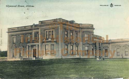
| Glynwood House | Glynwood house is located east of Athlone. The original house was constructed about 1790 by Francis Longworth and rebuilt about 1860 by John Longworth (1798-1881). A new house in the Italianate style was built in the early 1880s for Francis Travers Dames Longworth to the design of George Moyers. On 1 February 1918, a few lines in the Belfast News-Letter stated that Glynwood House, Athlone, the family mansion of the Dames-Longworth family, had been destroyed by fire. It is now an ivy covered ruin. See https://houseandheritage.org/2018/02/01/glynwood-house/ The present Glynwood House, formerly the agent’s house is located to the northwest of the site of the original Glynnwood House and dates from the late 19th century. |
|
| Moydrum Castle | The National Built Heritage Service states that Moydrum Castle is a Gothic Revival castellated country house built circa 1812 to designs by Sir Richard Morrison (1767-1849), who was commissioned by William Handcock to rebuild an existing house befitting of his new status as Lord Castlemaine. Lewis describes it as ‘a handsome castellated mansion, erected in 1814’. It was valued at £75 in the mid-19th century. The building remained the home of the Castlemaines until it was burnt down on 3 July 1921. A photograph of the remains featured on the cover of the U2 album ‘The Unforgettable Fire'. |
|
| Twyford | Twyford House was originally built about 1760 by the Handcock Family of Waterstown House, Glassan, but passed into the ownership of the Hodson Family, at the end of the 18th century. In 1814 John Hodson was resident and E Hodson in 1837. Valued at £24 John Hodson was the occupant at the time of Griffith’s Valuation (publ. 1854), holding the property from John Longsworth. The Hodsons continued to reside at Twyford until it was sold about 1960. The house is now derelict. |
|
| Ballynahown | Ballynahown built in 1746 by Edmond Malone (lawyer and later MP for Granard) and his wife Ruth Malone nee Judge. It is a building of three storeys over a basement, having a three-bay single-storey wing, added c.1850 by the Ennis family. The National Built Heritage Service states that this grand house is unusual in that it is constructed of brick, a very rare building material in Westmeath at the time of construction. In 1837 Lewis wrote that Ballynahown was the ancient residence of the Malone family, built on the site of an old castle and now unoccupied, having passed into other hands. Andrew Ennis bought the house in 1828. He was a wealthy Catholic merchant and business man who bought up land in the Athlone area of County Westmeath. His son John Ennis became a Governor of the Bank of Ireland and was knighted in 1866. He occupied the house at the time of Griffith’s Valuation (publ. 1854) when it was valued at £15. Sir John was succeeded by his son Sir John James Ennis who died in 1884 and was succeeded by his sister Marie Sophie who was married to Daniel O’Donaghue of the Glens. The O’Donaghues continued to own Ballynahown until they sold it in 1968. It remains a well maintained residence. |
|
| Fardrum House | Fardrum House, an early 19th century house, named on the first edition OS map. Described by the National Built Heritage Service as a highly appealing early nineteenth-century gentleman’s cottage. Valued at £12 at the time of Griffith’s Valuation (publ. 1854) it was occupied by Eliza Mathews who held it from John Ennis. Later occupants have been the Robinson and Campbell families and it remains a family residence. |
|
| Old Court | Old Court located on the northern outskirts of Athlone town was built circa 1840 (O’Brien) and incorporated an earlier house. The building on the site on the first edition OS map is named Springpark House. The Potts were settled here from the 18th century. P Cusack occupied Spring Park in 1837 and the house valued at £26 was held by William Potts in fee at the time of Griffith’s Valuation (publ. 1854). In the early 20th century the house was occupied by the Magan family and William Morgan Tilson Magan spent his childhood years here. This house was demolished in the 1980s. | |
| Newcourt | The National Built Heritage Service records a substantial mid-Victorian house which retains its character and much of its early fabric despite numerous later extensions and alterations. A four-bay two-storey house, built about 1864 by William Potts of nearby Old Court. There is a plaque of the Longwood Family over the crenellated extension. Owned by the Potts into the 20th century and by the Heaton family since the 1950s. | |
| Court Devenish | The present Court Devenish House was built at the end of the 18th century and has been extensively renovated and extended at various times. The remains of the important early 17th century Court Devenish House forms a garden feature. The original house was largely destroyed during the 1691 siege. The Devenishes descended from a Dublin merchant who leased land at Athlone from the Crown in the early 17th century. In 1751 their interest in these lands was sold to Gustavus Hamilton [of Viscount Boyne family]. At the time of Griffith’s Valuation (publ. 1854) a Mrs Dubordieu was resident holding the property from William Cooke of Talbot Hall, New Ross, Co Wexford. It was valued at £20.10. Since then the house has had many occupants and owners but is still extant. |
|
| Auburn House | Auburn House located on the eastern outskirts of Athlone town is described by O’Brien as a late 18th century, two-storey, three bay house built by James Sproule about 1790. Occupied by the Bruce family of Gore House, Northgate Street, for about fifteen years before they emigrated to Australia. W S Bruce was resident in 1837. At the time of Griffith’s Valuation (publ. 1854) Laurence or Lorenzo Dundas was resident, holding the house valued at £22 from George Mechum. in 1894 Slater noted it as the residence of George A.G. Adamson, J.P. Various persons occupied this house in the following years including the Mahon and Browne families in the 20th century. Sold to the state in the 1960s it became a ruin and is now demolished. The Athlone Regional College now occupies the site. | |
| Mountain View Cottage | This building is named as Mount View Cottage on the first edition OS map and Mount View on the 25 inch map. O’Brien writes that Mount View on the Moate road is a two-storey, three-bay Victorian house built by a Mr Vaughan in 1866. At the time of Griffith’s Valuation (publ. 1854) the previous house on this site, valued at £10, was occupied by Mrs Diana Sproule, who held the property from Robert Jameson. The present house was a McNamara home in the 20th century and is still extant. | |
| Cloonbonny | Cloonboony is a five-bay single-storey over basement house on a U-shaped plan, built c.1790, having two two-storey returns (boi). Cloonbonny House was originally built by the Longworth family as a dower house to Glynwood House (O’Brien). Edward Marsh was resident at the time of Griffith’s Valuation (publ. 1854) when the house was valued at £11 and was held from Francis Longworth. The Johnson and Byrne families have occupied the house from 1869 until the present day. |
|
| Creaghduff House | A building is marked at the site of Creaghduff House on the first edition OS map but the present house appears to have been built after this date. Gearoid O’Brien refers to Charles Handcock building the house at the time of Griffith’s Valuation (https://www.westmeathindependent.ie/2023/02/03/street-wise-coosan/). Valued at £17 as recorded in Griffith’s Valuation the house was occupied by the Hon Charles Handcock and held from Lord Castlemaine. It is located at the south west corner of Coosan Lough. Donal O’Brien writes that from the end of the 19th century Creaghduff was the home of Robert Degennes Levinge, a grandson of Sir Richard Levinge 4th Bt, and his descendants, who still live there. | |
| Creggan House | Creggan House, located just south east of Athlone town and south of Creggan Castle. This house is named on the first edition OS map. It was a two-storey, three-bay house built by the Longworth family in the early 19th century. Peter Longworth was a Cromwellian soldier who settled at Creggan Castle in the mid-17th century. The Longworth family continued to inhabit Creggan House for much of the 19th century, Francis Longworth being recorded as the occupant in 1837. Henry Norwood Trye was resident at the time of Griffith’s Valuation (publ. 1854), holding the house valued at £24 from his brother-in-law Francis Longworth. It was occupied by land agent Peter Metge and his family in 1901 and by widower Thomas Davies Longworth and his daughters in 1911. The house was burnt down in 1921 when occupied by a Major Montgomery and subsequently demolished. | |
| Woodville | Hawthorn Cottage is named on the first edition OS map and on the 25 inch map as Woodville. ‘The Cottage’ was the seat of William Cooke in 1837 and at the time of Griffith’s Valuation (publ. 1854) when the building was valued at £16 and held from Lord Castlemaine. O’Brien writes that the Bourke family were in possession in the late 19th and early 20th centuries. The house was demolished post 1950. The site is now among state and industrial buildings located on the east side of Athlone. | |
| Retreat | Retreat was a two-storey, three bay late 18th century house built by Thomas Cooke and located close to the east side of Athlone town. It was occupied by General Hart in 1814, F E Moony in 1837 and by Major Owen Lloyd Ormsby at the time of Griffith’s Valuation (publ. 1854), who held the property valued at £20 from William Cooke. Later occupants of this house were the Costello, Kilduff and Young families. The house and lands were sold to the Athlone Urban District Council in 1998 and the house demolished. |