Ardkeenan
Houses within 10km of this house
Displaying 31 houses.
Houses within 10km of Ardkeenan
Displaying 31 houses.
| House name | Description | |
|---|---|---|
| Keoghville | Built by Laurence Keogh and his wife Mary Fallon at the end of the 18th century. They were the grandparents of Judge Keogh. Described in the Ordnance Survey Name Books as still in the occupation of Keogh, the representaive of the ancient proprietors of Doohy-Keogh 'but he is poor and nearly shook'. This must be Ross Keogh who resided in Keoghville in 1837. By the time of Griffith's Valuation the house was held in fee by John McKay and valued at £15. Abandoned in the 20th century and replaced by a modern bungalow, the yard is still in use. |
|
| Thomastown Park | Built in the 18th century and home of the Naghten family for over 200 years, valued at £35 in the 1850s. Wilson refers to it as the seat of Mr. Naghten in 1786. In 1894 Slater mentions Thomastown park as the seat of Mrs. Naghten. It is no longer extant. | |
| Crannagh House | The main residence of the Walsh family in the 18th century. At the time of Griffith's Valuation occupied by Philip Hayes who held the house from William Potts. It is labelled Crannagh House on the 1st edition Ordnance Survey map but is not shown on the later 25-inch edition of the 1890s. | |
| Mounthussey | The home of the Hussey Walsh family, valued at £4 at the time of Griffith's Valuation. The later 25-inch map of the 1890s shows a much larger house at Moynure. A house still exists on the site. | |
| Johnstown | Built circa 1782 by Colonel John Dillon and held on a lease in perpetuity from the Incorporated Society for Promoting English Protestant Schools in Ireland. The Ordnance Survey Name Books refer to this fine residence, occupied by D. Kelly. The Dillons were in residence again by the time of Griffith's Valuation. It became the home of the Kelly family in the early 1870s until the late 1920s. Demolished by the Land Commission, only the entrance gates still remain. | |
| Mount Florence | This house originally known as the 'Whitehouse' and later as 'Mount Florence' was the home of the O'Sullivan family from the mid 18th century. In 1883 it was sold to the Greene family from the Ballinasloe area. It is now a ruin. | |
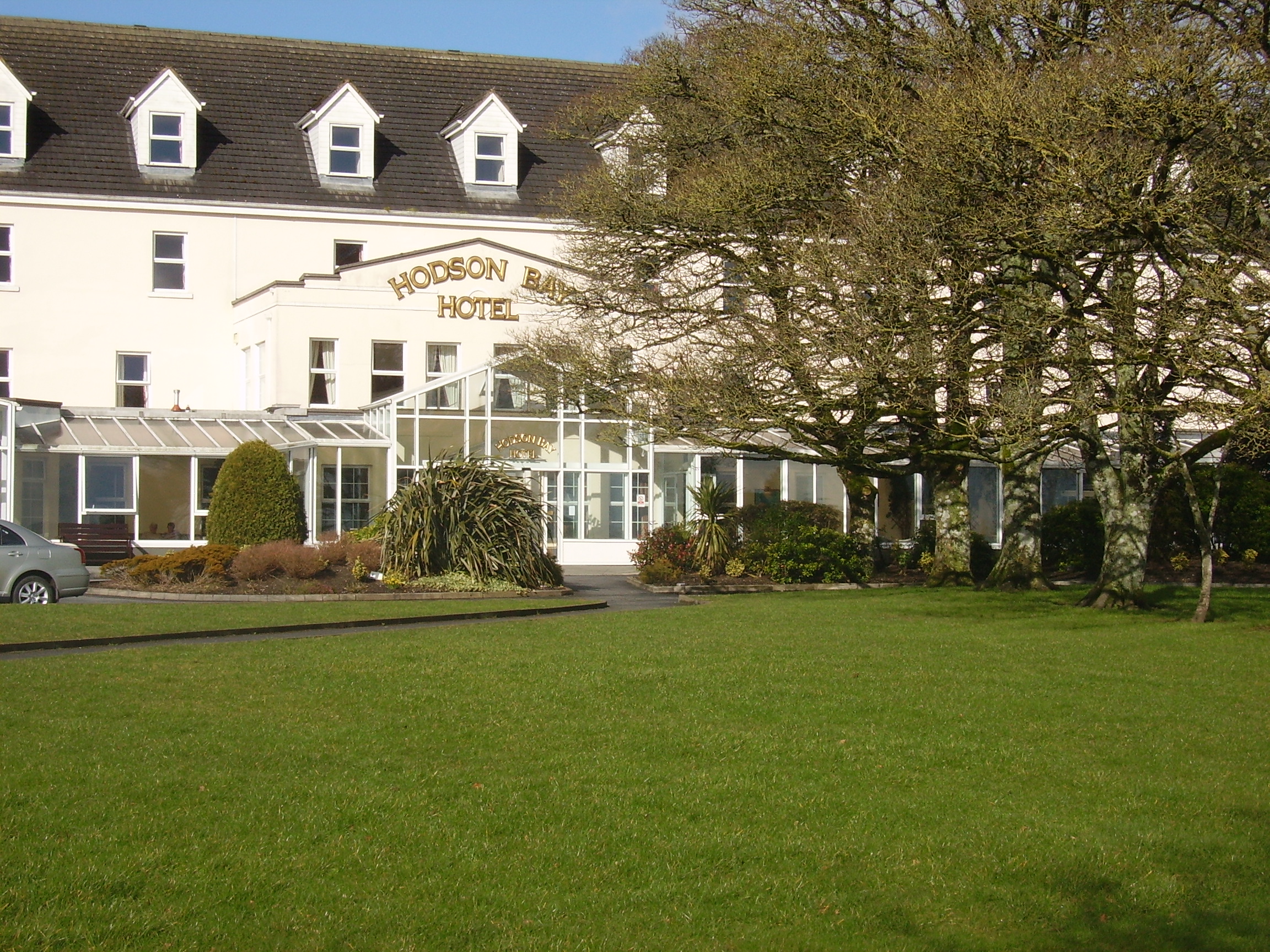
| Hodson Bay | The home of the Hodson family on the shore of Lough Ree. At the time of Griffith's Valuation occuppied by Leonard Hodson junior and Samuel Hodson, who held from the Court of Chancery. Now greatly expanded and functions as a hotel. |
|
| Lissygreaghan | Held in fee by J. P. Gannon at the time of Griffith's Valuation when the house was valued at £4.10 shillings. | |
| Esker | Occupied by W. Kelly in 1837. Bought by the Glennon family and occupied by them for most of the 20th century, still extant. |

|
| Feacle/Fighill | The residence of Dennis Keogh in 1814, occupied by R. Keogh in 1837 and by Richard Keogh in the 1850s when the house was valued at £2. The house has been known as Fighill since at least 1837. The old house is no longer lived in. |
|
| Larkfield House | Built circa 1780, this house was the home of Joseph Sproule at the beginning of the 19th century. Bought by Edward Larkin in 1839 and sold to John Holton in 1873. A succession of owners followed until it was bought by the Naughton family in 1923. | |
| Woodberry House | In the possession of Richard Bermingham in the mid 18th century, when he sold it to Philip Parker of Erris, county Mayo and his wife, Maria Kelly. It appears to have remained in Parker ownership until purchased by the Holton family in the 1850s. Now owned by Louis Walsh. | |
| Newcomen Castle | Newcomen residence in the 18th century. It is shown on the 1st edition Ordnance Survey map but only the site of the castle is recorded on the later 25-inch map of the 1890s. | |
| Bellfield Cottage | Bellfield Cottage, valued at £6, was the residence of Michael E. Murphy at the time of Griffith's Valuation. A house is still extant at the site. | |
| Cuilleen House | A branch of the Naghten family lived at Cuilleen in the 1830s. Malachy Naghten of Cuilleen died in 1865 aged 63 and is buried in Drum Old Cemetery. The house is labelled Cuilleen House on the 1st edition Ordnance Survey map of the 1830s but is not shown on the later 25-inch edition of the 1890s and no trace is visible now. | |
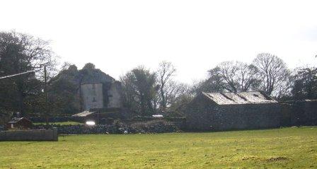
| Corkip | In 1786, Wilson refers to Cork, the seat of Mr. Tough. This appears to be an 18th century house associated with the Lyster family, later occupied by the Keoghs and now in ruins.The townland was in the possession of Arthur Beamish by the time of Griffith's Valuation and there was a herd's house valued at 15s. |
|
| Burnbrook | A house with mills closeby on the river. | |
| Birch Grove | At the time of Griffith's Valuation Thomas Brabazon was leasing a property valued at £10 at Beagh, barony of Moycarn, county Roscommon, to Ellen O'Shaughnessy. In 1837 Lewis records Birch Grove as the residence of J. O'Shaughnessy. Referred to as the residence of J.J. O'Shaughnessy in 1894. A house is still extant at the site. | |
| Castle Park House | William Kelly was occupying a house valued at £23, at Cuilleen, barony of Moycarn, at the time of Griffith's Valuation. It is described as "in ruins" on the 25-inch Ordnance Survey map of the 1890s. | |
| Woodmount | The Reverend P.K. Egan in his book on Ballinasloe records the building of this house by Laughlen Kelly in 1783. At the time of Griffith's Valuation, John Kelly was leasing a property at Tonalig, barony of Moycarn, valued at £13, to James Delahunty. Both Lewis and Leet record this property as the residence of Hugh Kelly in 1837 and 1814 respectively. . Fr. Egan records that the Kellys sold the property around 1880 and emigrated to Australia. The property was in the possession of William and John Hynes in 1906. It is now in ruins. |
|
| Ballydangan | At the time of Griffith's Valuation James Thorngate was leasing a property valued at £6 at Ballydangan, barony of Moycarn, to James Miller. There is no house marked on 1st edition OS map at this location, though a police barracks is shown nearby. The building is no longer extant. | |
| Drumalagagh Cottage | At the time of Griffith's Valuation, George Harrison was leasing a property at Drumalagagh, barony of Moycarn, valued at £14, from Lieutenant Colonel Maberly. This seems to be the property known as Drumalagagh Cottage. This was earlier associated with the St. George family. In 1837 Lewis records Dromalga Cottage as owned by Sir R. St. George but the seat of Mr. Dexter. The Ordnance Survey Name books of the same year describe the property as "a gentleman's place in good repair". It appears to have been situated on the demesne known as Mount Equity, of about 770 acres. Buildings labelled "Mount Equity" appear on the 1st edition OS Map but not on subsequent editions. In the Encumbered Estates sale notice of 1852 Dromalgagh Cottage is described as unoccupied but formerly the residence of the late Mrs. Dexter. In 2009, this property was offered for sale. An eighteenth century mausoleum, dedicated to Henry St. George, is also located in this townland. |
|
| Faltia House | Daniel Mathers occupied Faltia House, barony of Moycarn, at the time of Griffith's Valuation, when it was valued at £9. It was part of a demesne of over 400 acres. The Ordnance Survey Field Name books of 1837 describe it as "a gentleman's place in good repair". | |
| Kilbegly House | At the time of Griffith's Valuation, John Dillon was leasing a house valued at £20 at Kilbegley, barony of Moycarn, to William Colohan. In 1837 Lewis records Kilbegley as the residence of B. Newcomen. In the same year it is recorded in the Ordnance Survey Name books as "a gentleman's place, two stories high, in good repair". The 25-inch map of the 1890s indicates alterations to the house. Only ruins remain at Kilbegly now. | |
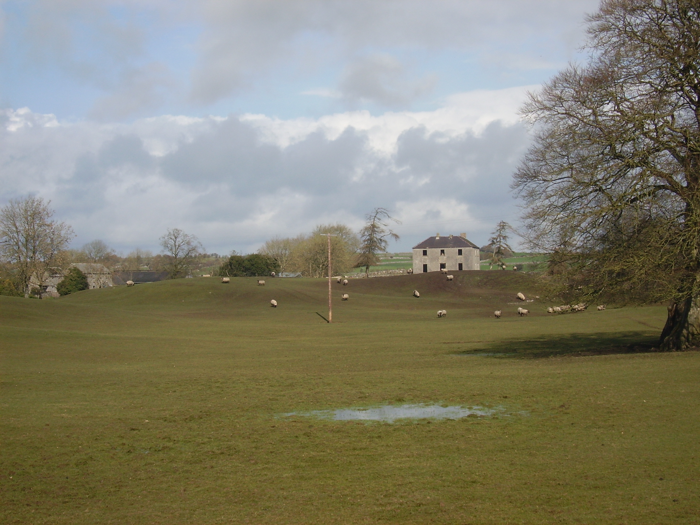
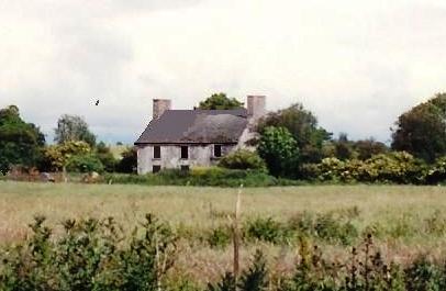
| Rathpeak House [Woodpark Lodge] | Owen Lynch was occupying the house at Rathpeak at the time of Griffith's Valuation when it was valued at £14. Lewis records Woodpark as his seat in 1837. This is also the property listed as his residence in 1814. At the time of the first Ordnance Survey in 1837 the house, known as Rathpeak House, is described as "a fine house, three stories high and in tolerable repair". When the property was advertised for sale in the Landed Estates' Court in 1861 Woodpark Lodge was described as a mansion house which originally cost several thousand pounds to build. There is now no sign of the house and there are modern farm sheds at the stables. Family history sources suggest the house was demolished in the latter years of the twentieth century. |
![Photo of Rathpeak House [Woodpark Lodge]](https://landedestates.ie/storage/img/orig/2807.jpg)
|
| Tully (Moycarn) | A house labelled as "Tully House" at Tully, barony of Moycarn, is shown on the first edition of the Ordnance Survey map adjacent to Tully Castle. It was described in the accompanying Name books as "a gentleman's place, a very good home in good repair". This townland was owned by James Thorngate at the time of Griffith's Valuation but the only house is valued at 10s. Tully Castle is labelled as "in ruins" on the 25-inch Ordnance survey map of the 1890s. In 1786 Wilson mentions "Tulleigh" as the beautiful seat of Sr R. St.George. | |
| Old Court | Old Court located on the northern outskirts of Athlone town was built circa 1840 (O’Brien) and incorporated an earlier house. The building on the site on the first edition OS map is named Springpark House. The Potts were settled here from the 18th century. P Cusack occupied Spring Park in 1837 and the house valued at £26 was held by William Potts in fee at the time of Griffith’s Valuation (publ. 1854). In the early 20th century the house was occupied by the Magan family and William Morgan Tilson Magan spent his childhood years here. This house was demolished in the 1980s. | |
| Newcourt | The National Built Heritage Service records a substantial mid-Victorian house which retains its character and much of its early fabric despite numerous later extensions and alterations. A four-bay two-storey house, built about 1864 by William Potts of nearby Old Court. There is a plaque of the Longwood Family over the crenellated extension. Owned by the Potts into the 20th century and by the Heaton family since the 1950s. | |
| Court Devenish | The present Court Devenish House was built at the end of the 18th century and has been extensively renovated and extended at various times. The remains of the important early 17th century Court Devenish House forms a garden feature. The original house was largely destroyed during the 1691 siege. The Devenishes descended from a Dublin merchant who leased land at Athlone from the Crown in the early 17th century. In 1751 their interest in these lands was sold to Gustavus Hamilton [of Viscount Boyne family]. At the time of Griffith’s Valuation (publ. 1854) a Mrs Dubordieu was resident holding the property from William Cooke of Talbot Hall, New Ross, Co Wexford. It was valued at £20.10. Since then the house has had many occupants and owners but is still extant. |
|
| Mountain View Cottage | This building is named as Mount View Cottage on the first edition OS map and Mount View on the 25 inch map. O’Brien writes that Mount View on the Moate road is a two-storey, three-bay Victorian house built by a Mr Vaughan in 1866. At the time of Griffith’s Valuation (publ. 1854) the previous house on this site, valued at £10, was occupied by Mrs Diana Sproule, who held the property from Robert Jameson. The present house was a McNamara home in the 20th century and is still extant. | |
| Retreat | Retreat was a two-storey, three bay late 18th century house built by Thomas Cooke and located close to the east side of Athlone town. It was occupied by General Hart in 1814, F E Moony in 1837 and by Major Owen Lloyd Ormsby at the time of Griffith’s Valuation (publ. 1854), who held the property valued at £20 from William Cooke. Later occupants of this house were the Costello, Kilduff and Young families. The house and lands were sold to the Athlone Urban District Council in 1998 and the house demolished. |