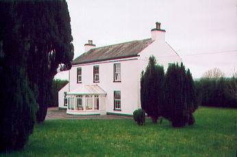
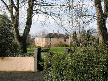
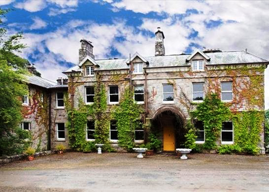
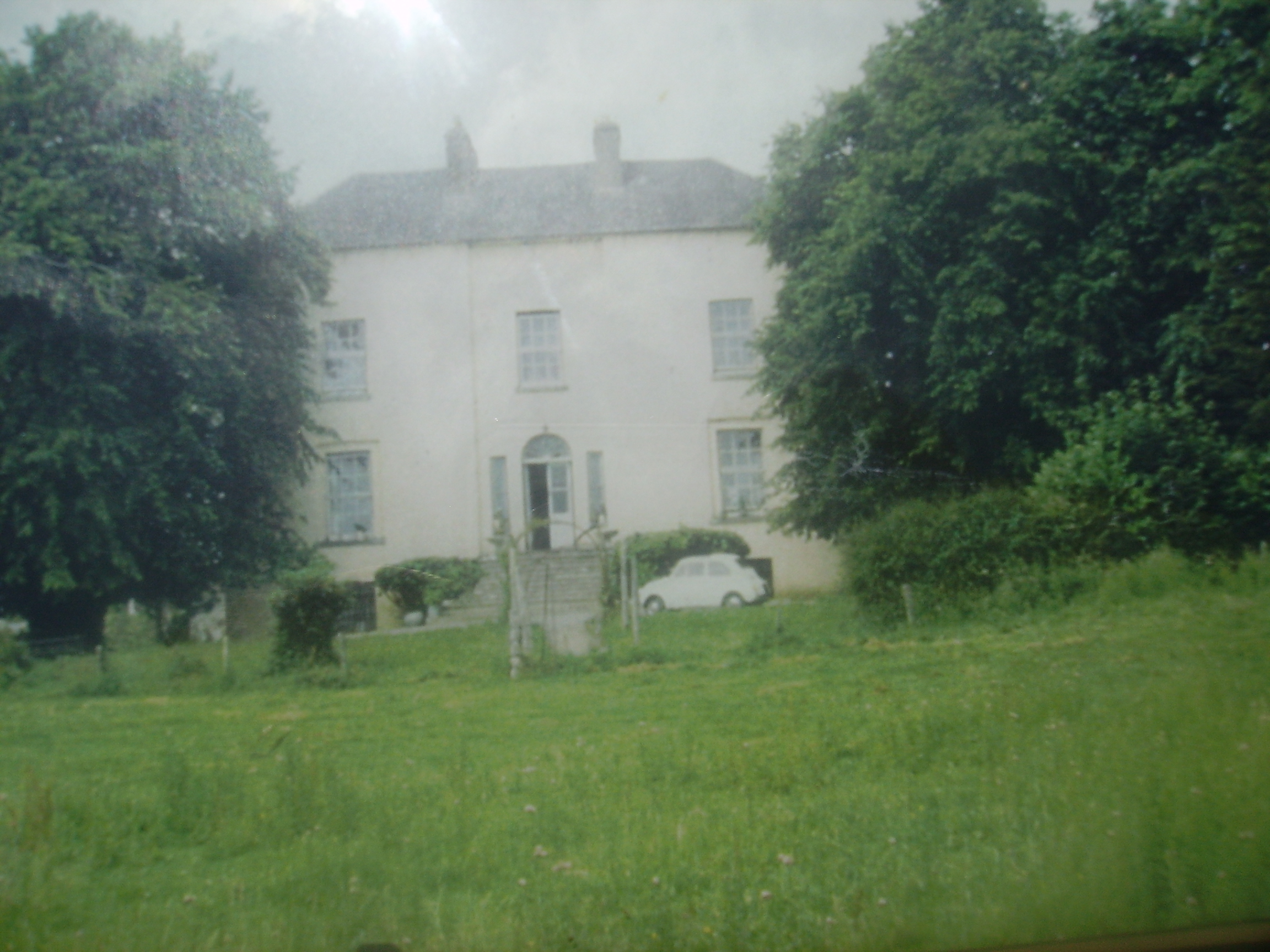
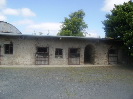
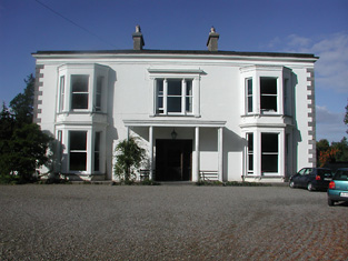
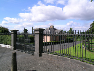
Woodpark (Woodpark Lodge)
Houses within 10km of this house
Displaying 22 houses.
Houses within 10km of Woodpark (Woodpark Lodge)
Displaying 22 houses.
| House name | Description | |
|---|---|---|
| Tintrim | Up to 1898 this house was in the barony of Leitrim, county Galway. It is now in the barony of Tulla Upper, county Clare. At the time of Griffith's Valuation, John A. Burke was occuping the house valued at £11, at Tintrim, parish of Clonrush, barony of Leitrim, county Galway. Weir states that the house at Tintrim was probably built by John Anthony Burke of Clondegoff Castle nearby. He was most likely a member of the Burke family who lived at Meelick House, Whitegate at the same time. Tintrim continued in the possession of the Burke family as John Anthony Burke moved out to allow his son, Edmund, and his family to live there until the house was sold in 1867. The house later passed to the Madden family and is still extant and occupied. The Irish Tourist Association file records state that John A. Burke died in 1857 though the family history suggests he died in 1863. The Tourist Association file also notes that in 1933 there was a search for the heirs of his reputed son, Martin Edward Burke, in Australia. |
|
| Meelick | Weir states that Meelick was a Burke house in the seventeenth century when Burkes, originally from Clondegoff Castle, in the barony of Longford, settled here. At the time of Griffith's Valuation Walter Blake was occupying the house at Meelick, parish of Clonrush, barony of Leitrim, valued at £17. In 1814 this property was the residence of Matthew Yelverton. The OS Name Books record Meelick as the home of Mr. Gilbertson. Lewis recorded it as "uninhabited" in 1837. There is still an occupied house at Meelick. The Irish Tourist Association file for the parish of Clonrush refers to Meelick as a substantial house with a concrete roof, ancestral home of the Burkes. |
|
| Drummaan | Drummaan House is described as "in ruins" on the 1st edition of the Ordnance Survey. The ruins have disappeared by the later 25-inch map of the 1890s. This townland is now located in county Clare. | |
| Knockbrack | At the time of Griffith's Valuation, Joshua Seward was leasing a house valued at almost £10 at Drummaan East, barony of Leitrim. Since 1898 this house has been located in county Clare. This seems to be the house shown on the 1st edition OS map as Knockbrack. A house valued at £14 at Drummaan East, county Clare, was owned by Maj. Gen. Spencer Cooper in 1906. | |
| Gweeneeny | John Sheehy was occupying a property valued at £8 at Gweeneeny, barony of Leitrim, county Galway at the time of Griffith's Valuation. This property has been located in county Clare since 1898. | |
| Mountshannon | This house was located in county Galway until 1898. Weir states that the original house at Mountshannon was a single-storey building which was enlarged to two storeys in the nineteenth century. At the time of Griffith's Valuation it was occupied by Mary Tandy and was valued at £12. In 1906 it was the property of James Wakely and was valued at £17. The house was damaged by fire in June 1921. It later came into the possession of the Talbots of Malahaide who presented it to An Óige (IYHA) for use as a youth hostel in 1956. It was offered for sale in 2007. |
|
| Williamstown Hotel | Joshua Seward was leasing a building valued at £7 to the City of Dublin Steam Packet company at Drummaan East, barony of Leitrim, county Galway, at the time of Griffith's Valuation. This building functioned as the Williamstown Hotel. The original hotel building is no longer extant but the stable block remains and is used as a house. Following 1898 boundary revisions this property is now located in county Clare. |
|
| Williamstadt House | Previously the residence of the Brady family, Williamstadt passed to Dr.Francis Sampson through marriage in 1833. At the time of Griffith's Valuation it was valued at £10 and Sampson was leasing it from James Egan. Up to 1898 this house would have been in county Galway. The house is still extant and occupied. |
|
| Moneenroe/Drummaan House | At the time of Griffith's Valuation Anthony Holland was leasing a property valued at £6 from James Egan, at Drummaan East, barony of Leitrim, county Galway. This seems to correspond to the property labelled Moneenroe on the 1st edition OS map. Other members of the Holland family were leasing lands from Egan in the same townland. On the 25-inch Ordnance Survey map of the 1890s this house is labelled Drummaan, the previous house of that name having disappeared. There is still an extant house at this site which is now located in county Clare. | |
| Ballycuggaran | Weir writes that the present house dates from the late 19th century. An earlier building was in the possession of members of the Church of Ireland episcopacy. Occupied by Marcus Patterson in the mid 19th century and held by him in fee. The buildings were valued at £8. In 1906 Marcus Wyndham Patterson owned Ballycuggaran with 618 acres of untenanted land. [Grid reference is approximate]. | |
| Tinerana | The Purdon family, originally from Cumberland, held this property on the shore of Lough Derg from the mid 17th century. In the ownership of Simon George Purdon at the time of Griffith's Valuation when the buildings were valued at £30. The Irish Tourist Association Survey File of the 1940s states that the house was built "about 70 years ago", contains about 60 rooms and the original residence of the Purdons stands adjacent to the new house. The estate was sold to the Gleeson family who owned the Athlone Woollen Mills in 1901 and the house later became the property of Dr Carmody who opened a health centre. The property was offered for sale in 2012. |
|
| Coolreagh | In 1814 Coolrea was occupied by Cor O'Callaghan and in 1837 by Ralph Westropp, who was leasing the property to Robert Studdert by the mid 19th century. The buildings were valued at £28. At the end of the 19th century it was the home of Colonel George O'Callaghan Westropp. The East Clare golf clubhouse now occupies the site, possibly incorporating some of the old house. |

|
| Moynoe | In the early 18th century the Ringrose family lived at Moynoe. It is probable that Sir John Reade built the late 18th century house. He was the occupier in 1814 and Fitzgibbon Hinchy was living in the house in 1837. The house was unoccupied at the time of Griffith's Valuation, Thomas Wadson was the immediate lessor. The Sampson family lived in it for the remainder of the 19th century and well into the 20th century. Edward MacLysaght surveyed the papers of Miss Mary Sampson of Moynoe circa 1944. Bought by the present owners in the mid 20th century, the house was demolished in 1998. see http://www.esatclear.ie/~moynoe/Page_16x.htm/ |
|
| Ballyvannan | The seat of Lord Dunboyne in 1837 and in the mid 19th century of James Crotty who held it from Lord Dunboyne when the buildings were valued at £3. The house is still occupied. | |
| Cloonusker | On the first Ordnance Survey map Cloonusker house is marked "in ruins". However by the time of Griffith's Valuation Henry Sparling was occupying a steward's house, which he held from Lord Norbury. The buildings were valued at £8. | |
| Drewsborough | A home of the Drew family from the mid 18th century, occupied by Ringrose Drew in 1814 and by Francis Drew in 1837. Bought by Michael Skehan in the Encumbered Estates Court, he is recorded as being resident at the time of Griffith's Valuation, when the house was valued at over £22. Drewsborough, or Victoria Park as it was then known, was sold to William Scanlon in 1869. In 1899 it was bought by John O'Brien, grandfather of Edna O'Brien, the author. The original house was burnt in June 1921. A modern bungalow has been built on part of the site and the O'Brien home is closeby. Some farm buildings and an underground cellar still remain. |
|
| Raheen | This was the home of the Brady family from the mid 18th century. In 1837 Reverend Thomas B. Brady occupied the house. By the time of Griffith's Valuation William Moreland was in possession and the house, offices and mill valued at £4.10 shillings were leased to Patrick Flynn. In 1906 buildings at Raheen ,which included a mansion house and 401 acres of untenanted land belonging to Robert W. Moreland, were valued at £37. In 1908 the property was bought by S.R. MacLysaght of Mallow, father of Dr Edward MacLysaght, genealogist. The Irish Tourist Association Survey file refers to Raheen Hospital beautifully situated amid a large forest on the shores of Lough Derg. The house no longer exists. | |
| Castlelough | A circa 1820s house attached to an earlier building on the shore of Lough Derg, Castlelough was the seat of the Parker family. In 1786 Wilson refers to Castlelough and Castletown as seats of the Parker family. Occupied by Anthony Parker in 1814 and in 1837 who was succeeded in that year by his brother the Reverend Standish Grady Parker. The representaives of the Reverend Standish occupied the house at the time of Griffith's Valuation when the buildings were valued at £51+ and held in fee. The Parkers were still resident at the end of the 19th century. This house is still in use as a country residence. |
|
| Landsdown | In 1786 Wilson refers to "Land's-town" as the seat of Mr. Rolleston. The home of W. Parker in 1814 and of Mrs Parker in 1837. In 1840 the Ordnance Survey Name Books refer to "Landstown, a good dwelling house, the residence of William Parker". He was also the occupant in the mid 19th century when the house was valued at £55+ and held in fee. John Parker of Brookfield and Landsdown married Helena, daughter of George Washington Biggs of Bellevue. The Parkers were still resident in the 1870s. Bassett's Directory of 1889 refers to Charles E. Tuthill of Landsdown. In the 20th century the home of the White Spunner family. This house, built in 1779, was for sale in 1991 (see ''Country Life'' Volume 185). It is still extant. |
|
| Youghal Lodge | Located on the shore of Lough Derg this house is referred to in the Ordnance Survey Name Books in 1840 as Youghal Cottage. However it appears on both the 2st and 25-inch edition maps as Youghal Lodge. At that time it was owned by William Smithwich but Captain Barton was living there. It was occupied by Scrope Bernard at the time of Griffith's Valuation. He held the property from William Smithwick and the house was valued at £19+. A building is still located at this site. | |
| Derry Castle | In 1786, Wilson writes that Derry Castle was the seat of Michael Head. Lewis records Derry Castle as the seat of M.P. Head. In 1840 the Ordnance Survey Name Books describe the demesne at Derry as "chiefly composed of platation and ornamental ground. Derry House (a commodious building) is the residence of Michael Petty Head". By the time of Griffith's Valuation it was held by Francis Spaight in fee, the buildings were valued at £71. ''The Nenagh Guardian'' of 15 April 1872 report on a bad fire at Derry Castle. Spaight family members appear to be still resident in the early 20th century. The National Inventory of Architectural Heritage states that the castle is now demolished. |

|
| Garrykennedy | In 1786 Wilson refers to Garry-Kennedy as the seat of Mr. Watson. Lewis refers to the houses of G. Watson and - Kent at Garrykennedy. Two houses are marked in the townland on the first edition Ordnance Survey map Garrykennedy and Shannon ville. The Ordnance Survey Name Books describe Garrykennedy as "a good dwelling house, the residence of James Watson". It was bought by William Parker in 1857. By 1906 a mansion house valued at £25+ was located at Garrykennedy. It was occupied by Robert G. Parker. The building known as Garrykennedy House had been expanded and is marked on later maps. |