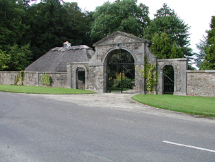
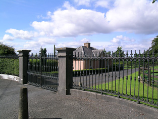
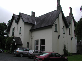
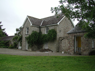
Bushfield
Houses within 10km of this house
Displaying 34 houses.
Houses within 10km of Bushfield
Displaying 34 houses.
| House name | Description | |
|---|---|---|
| Ardcloony | A late 19th century house incorporating the earlier Bourchier home. Major General John Bourchier married Mary, daughter of Thomas Macnamara of Ardcloony in the mid 18th century and inherited the property. By the time of Griffith's Valuation the house belonged to Francis C. Fitzgerald who held the property in fee. It was valued at £20. Edmond Fitzgerald of Ardcloony owned 214 acres in county Clare in the 1870s. John Connell Fitzgerald was resident in 1906. A house is still extant at the site. | |
| Ballycuggaran | Weir writes that the present house dates from the late 19th century. An earlier building was in the possession of members of the Church of Ireland episcopacy. Occupied by Marcus Patterson in the mid 19th century and held by him in fee. The buildings were valued at £8. In 1906 Marcus Wyndham Patterson owned Ballycuggaran with 618 acres of untenanted land. [Grid reference is approximate]. | |
| Ballyvally | A house in the possession of the Parker family from the early 19th century, the Reverend Standish Grady Parker was resident in 1814. His brother William Parker was in residence from at least 1837, holding the property from members of the Law family. By the end of the 19th century Robert Gabbett Parker lived in the house, which is still extant. | |
| Kincora Lodge | A house on the outskirts of Killaloe, Weir writes that it was the home of an O'Brien family in the 1840s. Occupied by Captain Frederick Lowe, Royal Navy, at the time of Griffith's Valuation, who held it from Thomas Macnamara. Captain Lowe married Maria Christina, daughter of Henry Ross-Lewin of Ross Hill in 1847. In the 20th century the house belonged to the Butler-Stoneys for some time. | |
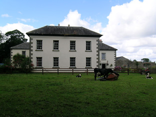
| Kilboy | In 1786, Kilboy was described by Wilson as the fine seat of Henry Prittie. Lord Dunalley is recording as resident at Dunally Castle, Nenagh, in 1814. In 1837 Lewis writes that Kilboy, the seat of Lord Dunalley, "was erected about 60 years since". In the mid 19th century it was valued at £76+ and held in fee. This house, which the National Inventory of Architectural Heritage describes as a "detached five-bay single-storey house over basement, built c. 1775" and designed by William Leeson, was destroyed in 1922. A similar house was erected on the site but was demolished in 1955. A smaller house is now located on the site. |
|
| Lissenhall | In 1786 Wilson mentions Lissen-Hall as the seat of Mr. Otway. Mr Thomas Devoy occupied Lissenhall in 1814 and in 1837 Rowan P. Cashel was resident. Margaret Dagg held the house valued at £42.13 shillings from the Honourable Mrs Otway Cave at the time of Griffith's Valuation. Lissenhall dwelling house and 242 acres bought for £5000 by William H. Carrol in 1853. In 1906 the mansion house in Lissenhall townland was valued at £30 and occupied by Alice J. Carroll. This house no longer exists. | |
| Ballintogher House | In 1786 Ballintogher is referred to by Wilson as the seat of Mr. Strafford. Afterwards it was a Crawford property, occupied in 1814 by John Crawford. George Langford of Ballintogher House was the third son of Richard Coplen Langford who, in 1784, married Catherine Cooper Crawford of Fermoyle. In 1828, George married Maria, daughter of the Reverend Henry Bayly of Bayley's Farm, county Tipperary. In 1840 the Ordnance Survey Name Books refer to the house as "the residence of Attorney Langford". By the time of Griffith's Valuation George Langford held Ballintogher and 236 acres in fee. The house was valued at £20. A building is still located at this site. | |
| Tullahedy | Dominick Meade of Tullaheady, county Tipperary, died in 1717. Edwin Sadleir held a house valued at £15+ and 64 acres at Tullahedy from John O'Dwyer at the time of Griffith's Valuation. By 1906 Tullahedy valued at £16 was occupied by the representatives of Thomas J.R. Miller who held over 500 acres of untenanted land there. The Riggs Millers are still resident at Tullahedy. The Ordnance Survey Name Books record the existence of Tullahedy Old House, "almost in a state of ruins, occupied by a herdsman, but formerly a good dwelling house occupied by the Tumpane family". This property is shown on the 1st edition Ordnance Survey map at R841771. | |
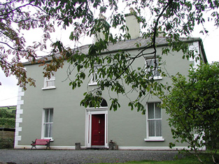
| Landsdown | In 1786 Wilson refers to "Land's-town" as the seat of Mr. Rolleston. The home of W. Parker in 1814 and of Mrs Parker in 1837. In 1840 the Ordnance Survey Name Books refer to "Landstown, a good dwelling house, the residence of William Parker". He was also the occupant in the mid 19th century when the house was valued at £55+ and held in fee. John Parker of Brookfield and Landsdown married Helena, daughter of George Washington Biggs of Bellevue. The Parkers were still resident in the 1870s. Bassett's Directory of 1889 refers to Charles E. Tuthill of Landsdown. In the 20th century the home of the White Spunner family. This house, built in 1779, was for sale in 1991 (see ''Country Life'' Volume 185). It is still extant. |
|
| Parteen Villa | Robert Atkins Twiss, second son of Robert Twiss of Cordell House, county Kerry, was living at Parteen Villa in 1837. In 1840 the Ordnance Survey Name Books refer to Parteen Villa as the residence of Thomas Mansell Bradshaw, "a neat house in the cottage [stile]". The house was occupied by the representative of Robert Twiss at the time of Griffith's Valuation, value at £29+ and held from Mrs Margaret Ormsby. Parteen is probably the house at Birdhill occupied by Robert G.E. Twiss in 1906 and valued at £30. A building is still located at this site. | |
| Birdhill | This house was originally the home of a branch of the Going family. Leet records Richard Going as the occupant in 1814. He was murdered in 1821. S. H. Atkins was resident in 1837. In 1840 the Ordnance Survvey Name Books note it as the seat of John Going and describe it as "a commodious dwelling house" with a demesne consisting of "plantation and ornamental ground". At the time of Griffith's Valuation, John Going was also the occupier when he held the house, valued at £40, with 51 acres and the national school, from Mrs Margaret Ormsby [nee Atkins]. She left Birdhill to her nephew George Twiss. Birdhill was burnt in the early 1920s and is now a ruin. | |
| Cragg | The home of a branch of the Going family, occupied by Robert Going in 1814 and in 1837. Robert died in 1838 and was succeeded by his son John. In 1840 the Ordnance Survey Name Books describe Cragg as "formerly the residence of John Going, it is now going to wreck". He still held Cragg at the time of Griffith's Valuation when the house was valued at £12+. John Going of Cregg House, Birdhill, owned 1,896 acres in the 1870s. A new house was built to the south west of the original house circa 1880 [R709 652]. John's son, Robert Edward Going, had succeeded to Traverston by the early 20th century. The second Cragg House is still extant. |
|
| Greenhall | A home of the White family in the 18th and 19th centuries, In 1786 Wilson refers to Greenhall as the seat of Mr. White. Lewis records H. White of Green Hall in 1837. The Ordnance Survey Name Books refer to it as "a neat dwelling house, the residence of H. White" in 1840 though it implies that "Counsellor Grady" was the proprietor. James Grace was resident in the mid 19th century when the house was valued at £12+. A building is still located at this site. | |
| Barna | Barna was the home of the Lee family in the 18th and first half of the 19th century. Leet records G. Lee as resident in 1814 and H. Lee was the proprietor in 1837 and at the time of Griffith's Valuation when the house was valued at £23+. This house no longer exists. | |
| Shallee | The Youngs appear to have been located in Shallee from at least the mid 18th century. Leet records Mr Francis Young as resident in 1814. In 1840 and at the time of Griffith's Valuation Francis E. Young was the occupant, holding the property from George Cashin [Cashel]. The buildings were valued at £20+. The sale rental of 1868 refers to a lease dated 1853 from Edward Worth Newenham to George Cashel of Shallee House. A house is still extant at Shallee. | |
| Cranna | The original home of the Going family in county Tipperary, inhabited by the Reverend John Going, eldest son of Richard Going of Birdhill in 1814 and by his son Charles in 1837 and at the time of Griffith's Valuation, when the house was valued at £23+. Buildings are still located at this site. | |
| Mountphilips | In 1786 Wilson refers to Mount-Phillips as the seat of Counsellor Phillips. Mount-philips was the home of William Philips in the first half of the 19th century. In the early 1850s the house was valued at £21+ and held in fee. By 1906 it was valued at £17 and occupied by John P. Phillips. This house no longer exists. Wilson also makes reference to another Phillips residence, at Killeen, nearby. | |
| Castle Waller | The seat of the Waller family in the 18th and first half of the 19th century, occupied by Richard Waller in 1814 and in 1837. In 1840 the Ordnance Survey Name Books reported that is was then uninhabited. Thomas Mullowney [possibly the youngest son of Croasddaile Molony] was the occupant at the time of Griffith's Valuation when the buildings were valued at £17. Castle Waller was occupied for sometime in the 1850s by William de Rythre who married Blanche Waller. In the 1870s Michael Moloney of Castle Waller owned 5 acres. The building was in ruins by the early 20th century. | |
| Rockvale | Reverend M. Moore was the proprietor of Rockvale in 1837. In 1840 the Ordnance Survey Name Books note it as the seat of Rev. A. Armstrong and describe it as " a commodious dwelling house". Francis J. O'Neill was the occupier in the early 1850s. He held the house, offices and flour mills, valued at £61 from John F. Waller. A house is still located at this site. | |
| Oakhampton | In 1786 Wilson mentions Oakhampton as the seat of Joseph "Phelps". John Philips was resident here in 1814 and S.W. Phillips in 1837. Lewis writes that it was the property of Lord Bloomfield. In 1840 the Ordnance Survey Name Books record Oakhampton as " a good dwelling house, the residence of Mr. S. Phillips". The Reverend Anthony Armstrong was the occupant at the time of Griffith's Valuation, holding the property from Lord Bloomfield. The buildings were valued at £25+. Reverend Anthony was still resident in the 1870s when he owned 504 acres in county Tipperary. Reverend A. Armstrong was rector of Killoscully and, in 1835, married Anna Going of Ballyphilip. Oakhampton is still extant. |
|
| Ciamaltha House | Builtby Lord Benjamin Bloomfield, ADC to George III, as a sporting lodge, the Ordnance Survey Name Books describe it as "recently erected" in 1840. Lewis writes in 1837 "Lord Bloomfield is building a handsome lodge in the Elizabethan style and has laid out an extensive nursery from which considerable plantations have been made on the surrounding mountains". At the time of Griffith's Valuation this house was valued at £58+ and was held in fee by Lord Bloomfield. The 1906 report on Untenanted Demesnes claims that the house was occupied by his daughter, the Honourable Harriott Kingscote, who, in 1833, had married Thomas Henry Kingscote of Gloucestershire. However, family sources indicate that the house was actually occupied in the early 1900s by her grandson, Col. Randolph Kingscote, who continued to live there until 1922. The house is still in use as a residence. |

|
| Fort Henry | Fort Henry, overlooking the Shannon River, was the residence of Stephen Hastings in 1814 and of Finch White in 1837. Earlier, in 1786, Wilson had also noted it as a Hastings residence. At the time of Griffiths Valuation, Finch White held the house from Stephen H. Atkins. It was valued at £28.15s. Finch White was related to the Atkins through marriage with a member of the Gelston family. In 1906 this house was in the possession of Frederick C.Henry. In 1840, however, the Ordnance Survey Name Books had also noted that J.J. Henry was the proprietor. It is still extant. | |
| Gortna House | This house was located close to the shore of the River Shannon and is marked on the first edition Ordnance Survey map and the later 25 inch map as Gortna House. Lewis records H. Franks as resident at Shannon View in the parish of Templeachally. Henry Franks occupied a house valued at £12+ and held from Stephen H. Atkins at the time of Griffith's Valuation. Henry Franks was married to Elizabeth daughter of Ringrose Atkins. There are still buildings at this location. | |
| Birdhill (Kyle) | Christopher Kayes held a house and offices valued at £27.18 shillings with 231 acres from Mrs Margaret Ormsby in the townland of Birdhill at the time of Griffith's Valuation. These would appear to be located south west of Birdhill House and just east of Kyle burial ground. | |
| Tullamore Park | A late 18th century house built for Edward Finch. It was the seat of the Finch family in the 19th century, occupied by William Finch in 1837 and at the time of Griffith's Valuation, when the house was valued at £27 and held in fee. Sold in the early 20th century to the Kennedy family. This house is still in use as a residence. |
|
| Kilcolman | The original residence of the Finch family in the 18th century, Wilson refers to it as the seat of Mr. Finch in 1786. It was occupied by John Finch in 1814 and by Mrs Finch in 1837 and 1840. Leased by the representatives of Mrs W. Finch to Edmund Parker in the mid 19th century when the house was valued at £45. William Finch of Kilcoleman owned 412 acres in the 1870s. Charles Finch occupied this house in 1906. This house no longer exists. | |
| Derry Castle | In 1786, Wilson writes that Derry Castle was the seat of Michael Head. Lewis records Derry Castle as the seat of M.P. Head. In 1840 the Ordnance Survey Name Books describe the demesne at Derry as "chiefly composed of platation and ornamental ground. Derry House (a commodious building) is the residence of Michael Petty Head". By the time of Griffith's Valuation it was held by Francis Spaight in fee, the buildings were valued at £71. ''The Nenagh Guardian'' of 15 April 1872 report on a bad fire at Derry Castle. Spaight family members appear to be still resident in the early 20th century. The National Inventory of Architectural Heritage states that the castle is now demolished. |

|
| Mary Ville | This house is marked as Mary Ville on the first edition Ordnance Survey map. In 1840 the Ordnance Survey Name Books refer to it as "a respectable farmhouse and offices" the proprietor of which was Michael Head. This may be the house recorded by Lewis as Derry Ville inhabited by J. Salmon. At the time of Griffith's Valuation Mrs Mary Sparling was resident, holding the lodge valued at £13 from Francis Spaight. Buildings are still extant at this site. | |
| Ryninch | Lewis records J. O'Brien of Ryninch and Jeremiah O'Brien held a house valued at £10 and 115 acres from Francis Spaight in the mid 19th century. There were quarries in this townland. | |
| Lakeview | Henry D. Head occupied a house valued at £14+ in this townland in the mid 19th century. He held the property in fee. A house and large farmyard are now located at this site. | |
| Monroe | Monroe was the residence of Robert Young in 1814 and Lewis describes it as the "neat cottage residence" of R. Power. Pierce Power held the property in fee at the time of Griffith's Valuation when the house was valued at £37+. Occupied by Hamo Massy Power in 1906. Yard buildings remain at this site. | |
| Tulla | Tulla House was the home of the Carroll family in the 19th century. William Carrol was resident in 1814 and Major General Sir Parker Carrol in 1837. Captain W. H. Carrol held the house valued at £20+ and townland in fee at the time of Griffith's Valuation. The house valued at £18 was still occupied by the Carrols in 1906. A house is extant at the site. | |
| New Ross | In 1786 Wilson writes that New Ross was the seat of Mr. White. The property is labelled "site of New Ross House" on the first edition Ordnance Survey map of the 1830s. The Ordnance Survey Name Books record that "the site of this old house is all that can be found at present .....It was once a place of some account being the residence of Bishop Buscow and afterwards of the White family ...they lived here til about 1790". This townland was in the possession of Bolton Waller at the time of Griffith's Valuation. | |
| Silvermines Cottage | In 1840 the Ordnance Survey Name Books describe Silvermines Cottage as "a neat and comfortable cottage, the residence of Rowan P. Cashell". He was also the occupier at the time of Griffith's Valuation, leasing from Lord Dunalley's estate. The property was valued at £10 15s. The National Inventory of Architectural Heritage states that it was, for a time, the mine manager's house, for the nearby mines. Silvermines Cottage is still extant and well-maintained. |
|