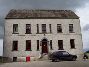
Mertonhall
Houses within 5km of this house
Displaying 28 houses.
Houses within 5km of Mertonhall
Displaying 28 houses.
| House name | Description | |
|---|---|---|
| Knockanacree Wood House | A house valued at £17+, occupied by Hawtrey Andrews and held from the Reverend Frederick F. Trench in the mid 19th century. Walford states that Hawtrey Andrews was the second son of Maunsell Andrews of Rathanny. This house is now demolished. | |
| Clermont House | Clermont or Claremount House, Nenagh, was occupied by William Short in 1814 and by Frederick Evans in 1837. In 1840 the Ordnance Survey Name Books refer to it as "a good dwelling house, the residence of Mr. J. Evans". It was also occupied by Evans at the time of Griffith's Valuation. The house was then valued at £24 and held from the Marquess of Ormond. This house still functions as a residence. |
|
| Bellpark | Occupied by T. Robinson in 1837. The Ordnance Survey Name Books record Eyre C. Baldwin as the proprietor in 1840. It was occupied by Thomas Goold in the early 1850s. Goold held the house valued at £17+ with 116 acres from Denis Leonard and was the tenant at the time of house of the 1852 sale. A house is still extant at the site. | |
| Bellgrove | The home of the Leonard family in the first half of the 19th century. The Ordnance Survey Name Books refer to Geoffrey Leonard as the proprietor in 1840 but note that the house was not inhabited. It was held by Denis Leonard in fee at the time of Griffith's Valuation when the buildings were valued at £25.10 shillings. This house was unoccupied at the time of the 1852 sale. It appears to have been bought by Hyacinth Richard Daly, who advertised it for sale again in 1863. The sale rental states that the dwelling house was in "an unfinished state". Bellgrove no longer exists. | |
| Ballinderry | Occupied by the Saunders family from at least the 1770s. Owen Saunders was resident in 1814. He was related to the Sadleirs of Ballinderry. Lewis records Thomas Sadlier junior as the proprietor of Ballinderry "on which a house was about to be erected". Thomas Sadlier held the property in fee at the time of Griffith's Valuation when the buildings were valued at £29. At the time of the Saunders sale in 1877 this house was described as modern and substanial and "approached by a noble avenue lined with beech trees". It was in the owner's possession. Occupied by William J. Russell in 1906. This house is still a residence. | |
| Killavalla | Lewis records Killavalla as the seat of R. Johnston Stoney. The Ordnance Survey Name Books refer to the house in this townland as "Honeywood House, the residence of Robert Johnstone Stoney, very commodious with convenient offices attached". Stoney's representatives held the property valued at £16+ from the representatives of Stephen Egan at the time of Griffith's Valuation. It later became the seat of the Saunders family. This house no longer exists. |
|
| Greyfort Cottage [later Greyfort House] | The Stoneys were residing at Greyfort from at least the 1770s as recorded by Taylor and Skinner and also by Wilson in 1786. A house known as Greyfort Cottage was marked on the first edition Ordnance Survey map at this location and is also mentioned in the Ordnance Survey Name Books which refers to it as "a good dwelling house, the residence of Henry Owen Saunders". On later maps a different building in the townland is known as Greyfort House. Biggs A. Stoney was living at Grey-fort, Borrisokane, in 1814 and Saunders is recorded as the proprietor by Lewis. William Gray was the occupier of a house in Greyfort townland, valued at £12+, at the time of Griffith's Valuation and held from Henry O. Saunders. Thomas R. Grey of Greyfort House owned 500 acres in the 1870s. Buildings are still extant at this site. | |
| Ballyrickard House | Ballyrickard may possibly be the house known as Lettyville on the Taylor and Skinner map from the 1770s. Leet records Daniel Falkener as resident at Ballyrickard in 1814 and Lewis records N. Falkiner as the proprietor. The Ordnance Survey Name Books refer to Ballyrickard as "a commodious house", the residence of Nathaniel Falkiner. In the early 1850s Addison Hone was the occupier holding the property from Richard H. Falkiner. The buildings were valued at £15. This 18th century house is still extant and occupied. |

|
| Congor | Occupied by F. Falkiner in 1837 and described by the Ordnance Survey Name Books as "the commodious residence of Nicholas Biddulph" in 1840. It was still occupied by him at the time of Griffith's Valuation when the house was valued at £20. Nicholas Biddulph was still resident in the mid 1870s when he is recorded as owning 74 acres in county Tipperary. A building is still located at this site. | |
| Mount Falcon | Bence Jones writes that this house was built in 1720 by Richard Falkiner. It was the seat of the Falkiner family in the 18th and 19th centuries. The Ordnance Survey Name Books refer to it as the seat of Richard Fitzpatrick Falkiner (a minor) in 1840 and that it was occupied by Obediah Holan. At the time of Griffith's Valuation the house was valued at £15. It is still extant. |

|
| Bushy Park | Bushy Park was the home of Thomas Towers in 1814 and in 1837. In 1840, the Ordnance Survey Name Books refer to it as " a comfortable house, the residence of Thomas Towers" and also include reference to a letter written by Mr. Towers in which he expressed the wish that the house would revert to the name Shesharaghmore house though this does not seem to have happened. Sarah Cambie was occupying the house valued at £15 and held from Thomas Towers in the mid 19th century. David Clarke is described as "of Bushy Park, Borrisokane and Macclesfield" in the 1870s. Still valued at £15 this house was held by the representatives of David Clarke in 1906. A building is still extant at the site. | |
| Ballynavin | According to the National Inventory of Architectural Heritage the origins of this building date back to the mid 17th century. Ballynavin was a Robinson home in the 19th century, occupied by Mrs Robinson in 1837 and by Reverend Robert Robinson in the early 1850s. He held the property in fee and the buildings were valued at £18. Robert Robinson lived at Ballynavin in the 1870s. The house is still in use as a residence. |

|
| Northland | Northland was the residence of Sir A. Dancer in 1814 and of William Smith in 1837. By the time of Griffith's Valuation William Henry Head occupied this house valued at £10. He held the property from Lord Dunalley. The house was demolished by the early 20th century. | |
| Willow Lodge | James Fleetwood was resident at Willow Lodge in 1814 and in 1837. By the time of Griffith's Valuation the house appears to be only valued at £1 and occupied by David Tierney. Willow Lodge is marked on the first edition Ordnance Survey map. It is named Alma on the 25-inch map of the 1890s. There is still an extant house at the site. | |
| Riversdale | This house was built after the first Ordnance Survey. At the time of Griffith's Valuation Thomas S. D. Robinson is recorded as the occupier of a house valued at £15 in the townland of Ballynavin. He held the property in fee. Thomas S.D. Robinson was still living at Riversdale in the 1870s. This house continues to be used as a residence. |

|
| Deer Park | Lewis records Park House as the property of William Trench but the residence of De La Pere A. J. Robinson. The Reverend Frederick F. Trench was the occupier in the mid 19th century, holding the house valued at £23 from Lord Dunalley. This house still functions as a residence. |

|
| Cloghkeating | The home of Augustus Robinson from the 1830s. The Ordnance Survey Name Books refer to Cloghkeating as "a large new house" in 1841. At the time of Griffith's Valuation Augustus Robinson held the property in fee and the buildings were valued at £19. Augustus Robinson of Cloghkeating owned 231 acres in the 1870s. This house is still in use as a residence. |

|
| Cloghjordan House | This house was the home of the Reverend Edwin Palmer in 1814. By the time of Griffith's Valuation John Hodgins occupied the house and ran the nearby nursery gardens. The buildings were valued at £13+ and held from Lord Dunalley. This building which includes the remains of the old castle still functions as a country residence. |
|
| Tenessee | This house is labelled Tenessee House on both the First and 25-inch edition Ordnance Survey map. In 1841 the Ordnance Survey Name Books suggest that it was the property of Lord Dunally. In the mid 19th century it was occupied by Thomas R. Barnes and held from Joseph Falkiner. The buildings were valued at £14. 15 shillings. The house is still in use as a residence. |

|
| Coolnamunna | At the time of Griffith's Valuation Edward Kennedy held buildings valued at £34+ from Ellen Lloyd [widow of Henry Jesse Lloyd of Castle Iney?] in the townland of Coolnamunna. He had a distillery in Mullenkeagh valued at £47. Edward Kennedy of Coolnamoner Park owned 432 acres in county Tipperary in the 1870s. |
|
| Fort William | A Parker residence in the early part of the 19th century. In 1841 the Ordnance Survey Name Books referred to it as "a splendid demesne and fine mansion house, the residence of Mr. Parker". By the time of Griffith's Valuation Fort William was occupied by Miss Crawford who held the property from Messrs Egan. The buildings were valued at £18.15 shillings. The Egan sale rental of 1854 gives details of the original lease which was from Charles Egan to John Greene in 1769 for three lives renewable for ever. The last renewal was dated 1803 from John Egan to William Crawford. This house is still in use. |

|
| Modreeny House | In 1786 Wilson refers to "Moderenny" as the seat of Sir Amyrald Dancer. The Ordnance Survey Name Books refer to the house as Eminisky House in 1841 but it is marked on the first edition map as Modreeny House and was the home of the Dancer family. It was replaced by a new house circa 1920s. The outbuildings, gates and gatelodge of the original house still remain. At the time of Griffith's Valuation Sir Thomas B. Dancer held this property in fee. The buildings were valued at £21. Hussey gives Modreeny House as the address of Sir Thomas Dancer in 1878. |
|
| Hilton | Hilton, located just to the south of Modreeny House, was the home of Thomas Dancer, later 6th Baronet, in 1837 and of the 6th Baronet's son, Thomas J. Dancer, in the mid 19th century. Thomas J. Dancer held the house valued at £15 from his father Sir Thomas B. Dancer, 6th Baronet. In 1841 the Ordnance Survey Name Books had noted the house as the residence of Thomas Stoney. A house is still located at this site. | |
| Elysium | This house is marked on the first edition Ordnance Survey map and was inhabited by Thomas Ely in 1837. Thomas Ely held the property in fee at the time of Griffith's Valuation when the house was valued at £23. The Elys were still resident in the 1870s. George Evans was occupying this house in 1906. There is still a house located at this site. | |
| Modreeny | Lewis records W. H. Head as the proprietor of Modreeny House in 1837. He was still resident at the time of Griffith's Valuation and held the house valued at £35 in fee. Burke's ''Landed Gentry of Ireland'' (1904) records William Henry Head's father as "of Modreeny House". In 1906 the representatives of George Whitfield were the occupiers and the house was valued at £36.10 shillings. George Whitfield of Modreeny owned 443 acres in the 1870s. In 1890 his daughter Kathleen married Sir Francis Osborne, Baronet. This house was bought by Donald Swan in 1965 and Charlie Swan, champion jockey, was born at Modreeny in 1968. |
|
| Fort Nisbitt | Robert Nesbett was resident at Fort Nesbett in 1814. The Ordnance Survey Name Books also mention him in 1839 though they refer to Thomas Towers as the proprietor of the townland. In the early 1850s, Thomas O'Brien was the occupier, holding the property from the Reverend James Nesbitt. The buildings were valued at £12.15 shillings. A building is still located at this site. | |
| Lisheen (Lower Ormond) | In 1840 the Ordnance Survey Name Books refer to Lisheen House in the parish of Aglishcloghane as held by John Crawford but an addendum to the entry on the parish of Uskane note that Lisheen was the residence of Geo.Fosbery, Jnr. By the time of Griffith's Valuation it was held in fee by George Fosberry and valued at almost £8. A house is still extant at the site. | |
| Fort Henry [Greyfort Cottage] Borrisokane | In 1840, the Ordnance Survey Name Books refer to "Fort Henry, a commodious house, the residence of Henry Ely" in the townland of Greyfort, parish of Borrisokane. At the time of Griffith's Valuation, Henry Ely was leasing a property valued at almost £5 from the Saunders estate in this townland. This may refer to the property shown on the 1st edition Ordnance Survey map as Greyfort House. On the later 25-inch map of the 1890s it is known as Greyfort Cottage. A house is still extant at the site. |