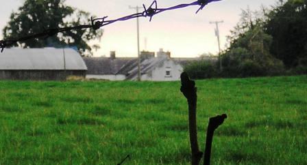
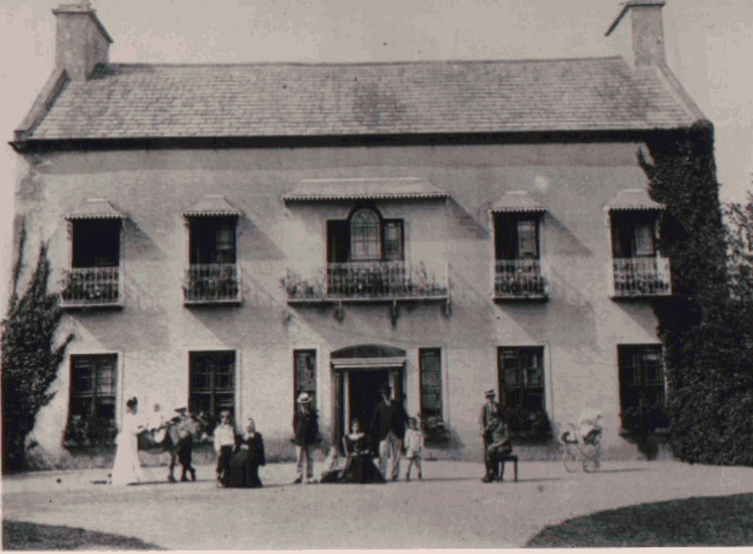
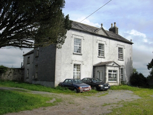
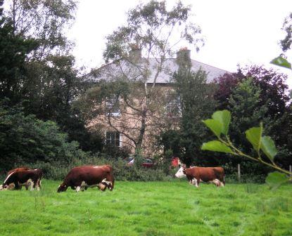
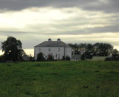
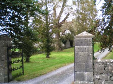
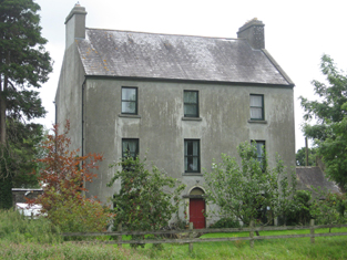
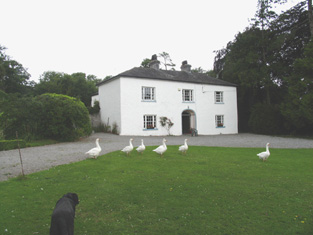
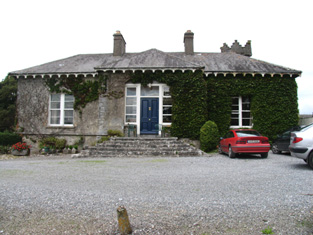
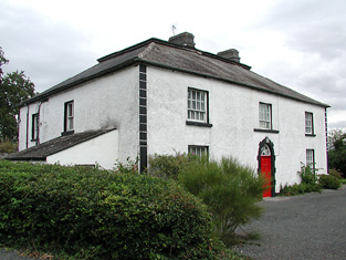
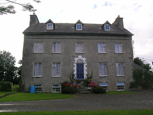
Portland Park
Houses within 10km of this house
Displaying 53 houses.
Houses within 10km of Portland Park
Displaying 53 houses.
| House name | Description | |
|---|---|---|
| Portumna | Reverend Lewis Hawkes was leasing a property at Portumna, valued at £16 from the Ecclesiasical Commissioners at the time of Griffith's Valuation. The Reverend Louis Hawkes of Brierfield died in 1857. A house still exists at the site. | |
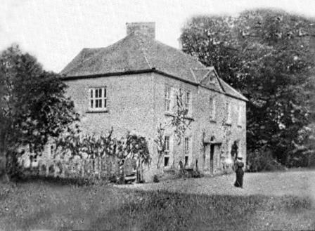
| Portumna Castle | The house we know as Portumna Castle was built in the early seventeenth century by Richard de Burgo or Burke, 4th Earl of Clanricarde. It was used as the de Burgo/Burke family residence for over 200 years until it was badly damaged by fire in 1826 when it was replaced by another house close by. This second house is no longer extant. In 1906 the buildings at Portumna were valued at £40. The original Portumna Castle has been restored and is open to the public. |
|
| Grange | The Earl of Huntington's estate in Galway included a house valued at £7 at Grange, parish of Killeenadeema, leased to Patrick Murphy. A house labelled Grange House appears on the 1st edition Ordnance Survey map. On the 25-inch edition of the1890s the original house is not shown and Grange House is located at M878146. This house is now a ruin. | |
| Flower Hill | Flower Hill was occupied by Anthony F. Nugent at the time of Griffith's Valuation when it was valued at £28. IN 1894 it was the residence of Charles Nugent. Flower Hill is still extant and now operates as an equestrian centre. See www.flowerhill.net |
|
| Tully | Joseph Cowan leased lands and a house valued at £7 at Tully to Matthew Madden in 1856. In 1906 Tully was the property of Stephen Cowan and still valued at £7. It is still extant and occupied. |
|
| Moorfield House | In 1778and 1786, this house was the residence of the Blake family. Moorfield was a steward's house on the Eyre estate at the time of Griffith's Valuation. In April 1869 the Eyre's Moorfield estate, including the house, was offered for sale in the Landed Estates court. In 1906 it was owned by James Howard Jnr and was valued at £28. The National Inventory of Architectural Heritage suggests that the extant house at Moorfield is of late nineteenth century date. |
|
| Heathlawn | At the time of Griffith's Valuation, Heathlawn house, valued at £31, was occupied by George Saunderson. In 1837, Lewis records it as the seat of M. Monahan. Slater, in 1846, also notes it as the seat of Michael Monaghan. In 1906 it was the property of James H. Monahan. In 1783 Taylor and Skinner, and Wilson, writing in 1786, noted Heathlawn as a seat of the Hamilton family. It is no longer extant. | |
| Moat | A property in the townland of Moat, parish of Killimorbologue, valued at £9 was being leased from the Clanricarde estate by John Donnelly in 1856. The house was demolished in the later half of the twentieth century and no traces remain. | |
| Earlstown | In 1786 Wilson refers to "Capasell" s the seat of Mr. Devenish [?]. The house at this location is labelled Earlstown on the 1st edition Ordnance Survey map. In 1846 Slater refers to Robert Grace resident at Earlston. Robert Eyre was leasing a property in the townland of Cappasallagh, parish of Kilmalinogue, barony of Longford, valued at £11 from the Clanricarde estate in 1856. There are still occupied buildings at this site, the focus of a large farming enterprise. |
|
| Corr Lodge/Corr House | At the time of Griffith's Valuation the property at Corr was being leased by R.P.Dolphin to Edmund Mahon. In the 1780s, both Taylor and Skinner and Wilson recorded Corr as a seat of the Dolphin family. Slater refers to it as the seat of Redmond D. in 1846. By the 1890s it had become known as Corr House. In 1906, the mansion house at Corr, valued at £15, was owned by Marcella Blake Forster. It is no longer extant. |
|
| Derryhivney House/Harding Grove | Wilson may be referring to this property when he mentions the ruins of a castle at "Derryborn" and the seat of Mr. Hind. In 1814 this house was known as Harding Grove and was the seat of Jonathan Harding. It appears under this title on the 1st edition Ordnance Survey map. The Harding family also had an estate in north Tipperary. In 1846 Slater refers to "Derryhiney" as the seat of Cuthbert Fetherston. At the time of Griffith's Valuation, the house at Derryhivney was occupied by him. On the 25-inch map of the 1890s it is labelled Derryhivney House. David England Young of Ballygibbon, county Tipperary and Harding Grove, county Galway is recorded in Walfords (1910). |
|
| Prospect (Meelick) | In 1856 Joseph Cowan was leasing a property at Prospect, in the parish of Meelick, barony of Longford, from Francis Usher. In 1837 Lewis recorded Prospect as the seat of C.A. O'Malley. Slater refers to it as the seat of John Smith in 1846. In 1906 Prospect was the property of Ernest Kenny and valued at £12. In 1778 and 1786, this property was the residence of the French family. Prospect House is still extant and occupied. |
|
| Kilquain | At the time of Griffith's Valuation Allen Pollok held a property in Kilquain valued at £5 10s which was used as a steward's house. There is evidence of estate architecture in the vicinity but twentieth century buildings on site. | |
| Gurtray/Gortrea/Gortray/Fairfield | Writing in 1786 Wilson refers to this house as Fairfield, the seat of Mr. Hamilton. Ambrose O'Kelly was the owner of a house valued at £20 in Gortrea or Fairfield, parish of Kilmalinoge, barony of Longford, county Galway in 1856. Slater refers to "Gurtray" as the seat of John Appleyard O'Kelly in 1894. In 1906 this house was the property of John A. O'Kelly. According to family tradition the house lost its roof on the Night of the Big Wind in 1839. It is still extant and occupied and in 2007 was offered for sale. |
|
| Fairy Hill | Thomas Doolan was leasing a property at Fairy Hill, valued at £20, to Charles Cooper at the time of Griffith's Valuation. Slater had noted it as the residence of Thomas Doolan in 1846. In 1894 Slater records Fairy Hill as the seat of Colonel Cheevers. This house is still extant. |
|
| Palmerstown ( Pokoroko) | In 1814 a house at Fairy Hill was the residence of Mr. Palmer. This property was held on a lease renewable forever from the Clanricarde estate. It is recorded in Lewis under Portumna town. In 1865 it was occupied by Lewis Goodbody who had purchased it in the Landed Estates Court in 1861. The sale notice refers to the house as "Pokoroko" and this title appears again in the Cunningham sale report of June 1886. However on both the 1st and 25-inch editions of the Ordnance Survey map it is labelled Palmerstown House, the name by which it is still known. It is still extant and occupied. |
|
| Thornfield | Slater refers to Thornfield as the seat of John Davis in 1846. In 1856 Thomas Galbraith was leasing a property valued at £7 in the townland of Thornfield, parish of Lickmolassy, barony of Longford, from the Clanricarde estate. It is no longer extant. | |
| Gortaha House | Cuthbert Featherston held a property valued at £10 in the townland of Gortaha, parish of Lickmolassy, barony of Longford, in 1856. It is labelled Gortaha House on the 1st edition Ordnance Survey Map. The 25-inch map of the 1890s records that it was "in ruins" and very little now remains. | |
| Willmount or Gortnacloghy | In 1856 Matthew McDonagh was leasing a property valued at £19 in the townland of Gortnacloghy, parish of Lickmolassy, barony of Longford, from the Clanricarde estate. This house was also known as Wilmount or Wellmount. |
|
| Oakley Park | At the time of Griffith's Valuation, John Cunningham was leasing a house valued at £13 at Gowil, parish of Lickmolassy, from Anne Shewbridge. This appears to be the house known as Oakley Park, occupied in the 1870s by the Pigot family. It is still extant and occupied. |
|
| Ormond View | The representatives of Redmond Dolphin were leasing a property at Ballycrossaun, barony of Longford, to John D. Lemon at the time of Griffith's Valuation when it was valued at £12. Slater notes this property as the seat of Joseph Lemon in 1846. Hogan states that this house was formerly known as Waterview. Ormond View is still extant and occupied. |
|
| Longford Lodge | In 1846 Slater refers to Patrick and Stephen Kelly, both of "Longford House". Patrick Kelly was occupying the house at Gortadullisk, barony of Longford at the time of Griffith's Valuation. In 1837 Lewis had recorded Longford Lodge as the home of a Major Kelly. In 1906 it was owned by Denis Kelly and was valued at almost £15. It is no longer extant though part of the walled garden remains. |
|
| Greenfield/ Fahy | In 1777 a house at Fahy is recorded by Taylor and Skinner as a Hamilton residence. In 1786 Wilson mentions Faghy as the seat of Mr. Hamilton. Lewis records Fahy as the seat of T. Burke in 1837. The OS Name Books state that the gentleman's residence in the townland of Fahy was called Greenfield. At the time of Griffith's Valuation, Pierce Joyce held over 400 acres of this townland together with buildings valued at over £6. The house is labelled Greenfield on both the 1st and 25-inch Ordnance Survey maps. Some ruins survive at the site. | |
| Quainsborough/Quansbury Lodge/Stowlin | Originally a Daly house. In 1783 Taylor and Skinner and Wilson, in 1786, record Queensborough as a seat of the Earl of Louth. Slater refers to Quansborough Lodges as the seat of William B. Burke in 1846. Mentioned in the sale notice for portion of the St. George estate in November 1853. John P Watson was the occupier of a house valued at £13 in the townland of Stowlin, parish of Kilquain, barony of Longford, in 1856. In 1906 this house was owned by Kate Watson and was valued at £33. Buildings are still extant at site though may have been modernised. The Clonbrock Estate Papers, Collection List 54 in the National Library contain early 19th century rentals of the Quansbury estate. In many documents the name of this house is spelt Quansbury but on the Ordnance Survey maps it is spelt Quainsborough. |
|
| Killeen House (Portumna) | Killeen House was the birthplace of Mary Anne Kelly, otherwise known as Eva of the Nation. The house was the property of her father Edward Kelly. In 1837 Lewis recorded it as the seat of E. Kelly. At the time of Griffith's Valuation it was valued at £18. Extensive corn mills are shown at the site on the First Edition Ordnance map. Killeen House is still extant. |
|
| Longford House (Tirnascragh) | At the time of Griffith's Valuation, George Kenny was occupying a property valued at almost £7 at Longford. Hogan states that Longford House was built c.1844-1850. It passed from the Kenny family to Major Longbourne in the 1890s but Hogan records that he sold the estate in 1902. In 1906 the Congested Districts Board are recorded as the owners and the house was valued at £12 at the time. It passed to the Stoddart family in 1914 and is still extant and occupied. |
|
| Castle Biggs/Drominagh | The Smythe sale rental of July 1870 states that the original lease (1711) was from Godfrey Boate and Benjamin Friend to William Biggs. Built by the Biggs family on the shore of Lough Derg this house was occupied by William L. Biggs in 1814 and by Dr W. Biggs in 1837. In 1840 the Ordnance Survey Name Books refer to Castle Biggs as "a most commodious house". Edward Biggs was resident in the mid 19th century, holding the property from Sir John Power. The house was valued at £22. The sale rental of November 1853 describes this "3-storey mansion containing every necessity and a range of out offices". It was in the possession of Edward Biggs, the owner, and was bought by Captain William Tuthill. William Tuthill sold the property to Frederick Smythe in 1859. It was for sale again in July 1870. At this time the Esmondes of county Wexford bought it from Frederick Smythe. In the early 1940s owned by Owen Esmonde but purchased by the Moss family in the 1940s. It is still extant. |
|
| Drominagh Lodge | According to the sale rental of November 1853 Dr Frederick Biggs had built a handsome residence in Shanakill for a sum exceeding £1,000. Drominagh Lodge is marked on the first edition Ordnance Survey map. Griffith's Valuation records Frederick Biggs as the occupier of the house valued at £13. He held the property from Edward Biggs. This house has been the home of the Fogarty family since the late 19th century. |
|
| Gortmore | The sale rental states that Robert Biggs built this house for about £800 in the mid 19th century. It is not marked on the first edition Ordnance Survey map. Griffith's Valuation records Samuel Biggs as the occupier of the house, valued at £11 and held from Edward Biggs. The sale rental of November 1867 advertised the sale of a valuable leasehold, the estate of Samuel and Robert Biggs, at Gortmore (222 acres and dwelling house). The 22[2?] acre estate of Samuel Biggs at Gortmore was sold to John Samuel Clarke, the petitioner, in November 1867 for £650 (The Irish law times and solicitors' journal: Volume 1, 1868 - Page 679). A house is still located at this site. | |
| Fortmoy House Lower | In 1840 the Ordnance Survey Name books refer to "Fordmoy" as "a good dwellinghouse, lately built, the residence of Mr. Prendergast".This house was vacant at the time of Griffith's Valuation. Thomas G. Prendergast was the immediate lessor and the house was valued at £11. Buildings valued at £27.5 shillings were held by the representatives of David Clarke at Fortmoy in 1906. Fortmoy House Lower is still extant. |
|
| Spring Park | In the mid 19th century Benjamin Armitage occupied a house valued at £10 in Gortnagrann which he held with 243 acres from William Woods. The Ordnance Survey Name Books note it as being occupied by Mr. Armitage in 1841. The site is now occupied by farm buildings. | |
| Milford | Lewis records Milford as the occasional residence of Ralph Smith. By the early 1850s it was occupied by Thomas Bunbury and held from William Woods. Bence Jones writes that it was the home of Edmond Murphy who died in 1882. In 1840, he Ordnance Survey Name Books refer to the house as the residence of John Monsell and describe the demesne as "principally composed of plantation and ornamental grounds". |

|
| Redwood House | Redwood was the home of the Bloomfield family in county Tipperary, occupied by Major Bloomfield in 1837. In 1840 the Ordnance Survey Name Books mention that Redwood was "a commodious house, at present occupied by a party of the constabulary and also the residence of Mr. Ryan, under-agent to Maj. Bloomfield". It is marked as a police station on the 1st edition Ordnance Survey map. At the time of Griffith's Valuation. Phillip Crawley held the property from Lord Bloomfield and the house was valued at £15. Redwood House later became a Trench home, valued at £18.15 shillings in 1906. It no longer exists. | |
| Abbeville | Home of the Hemsworth family in the 18th and 19th centuries, occupied by Thomas Hemsworth in 1814. Thomas G. Hemsworth was resident in 1837 and in the early 1850s. Thomas George Hemsworth of Abbeville owned 387 acres in the 1870s. |
|
| Firmount | The seat of the Firman family in the late 18th century, occupied by Thomas P. Terman in 1814. The house is marked on the first edition Ordnance Survey map. The Ordnance Survey Name Books refer to it as "the mansion house of Firmount now falling into ruins, It appears to be a ruin by the time of Griffith's Valuation. The only buildings over £10 valuation were the Santa Cruise flour mill and house of Samuel Palmer. The Irish Tourist Association surveyor records "an extremely charming house converted from stabling" at Firmount and occupied by Major H.H. Deasy in the early 1940s. The surveyor states that the original house was destroyed by fire. | |
| New Grove | Marked on the first edition Ordnance Survey map as New Grove, this house appears on the 25-inch map of the 1890s and is still known by the name, St Kierans. Occupied by J. W. Bayly in 1837 and described by the Ordnance Survey Name Books as " a good dwelling house, the residence of John Bayly" in 1840. It was occupied by Thomas Fetherston at the time of Griffith's Valuation and held from John Bailey. The buildings were valued at £19+. This property was advertised for sale in November 1851, the estate of John Washington Bayly. |
|
| Kilcarren | A house occupied by Ralph Smith in 1814 and by A. Carew in 1837. The Ordnance Survey Name Books describe it as "a good dwelling house" in 1841. Alexander Carew, a descendant of Lynn Carew, held the property from Ralph Smith in the mid 19th century when the buildings were valued at £17+. The house is still extant and occupied. |

|
| Lackeen | Lackeen House is an early 18th structure attached to part of a 17th century house. John Baily was the proprietor of Lackeen Castle, Parsonstown [Birr], in 1814 and in the mid 19th century the house valued at £12.10 shillings was occupied by Hamilton English and held from Lord Cremore. This house is now unoccupied. |
|
| Ballyquirk | In 1837 Lewis refers to the ruins of Ballyquirk castle "near which is a handsome modern house of that name". Colonel Henry Dwyer was the occupant in the mid 19th century, holding the house valued at £32 and 716 acres from Edward Newingham. |
|
| Harvest Lodge | The Stoneys were resident at Harvest Lodge from at least 1837. Thomas Johnston Stoney, born 1780, fourth son of Thomas Stoney of Arran Hill held the property in fee at the time of Griffith's Valuation, when the house was valued at £30. Harvest Lodge was the home of J.M. Wilson in the 1870s. This house no longer exists. | |
| Curraghglass | J.W. Walsh is noted as the proprietor of Curraghglass in the Ordnance Survey Name Books of 1841. In the mid 19th century Thomas Meara occupied a house valued at £11 and held from the representatives of Jonathan Walsh. There is still a building located at this site. | |
| Firville | In 1841 the Ordnance Survey Name Books refer to "Ferville" as the residence of R.F. Drought. William S. Smith occupied the house in the mid 19th century which he held from Ralph Smith. It was valued at £15+. This building is still part of a farm complex. | |
| Belle Isle | A house overlooking the River Shannon, originally the home of a junior branch of the family it became the property of the 3rd Lord Avonmore through his second marriage to Cecilia O'Keeffe. The seat of 3rd Lord Avonmore in the mid 19th century held by him in fee and valued at £48. Belle Isle was occupied by Thomas Maunsell in 1814 and by Lord Avonmore in 1837. This house is no longer occupied. |

|
| Redwood | Marked on the first edition Ordnance Survey map as Moatfield House and on later maps as Redwood. Moate-field, Burris-a-kane, was the home of William Clarke in 1814. In 1841 the Ordnance Survey Name Books refer to it as "Moat Field, a good dwelling house the residence of Miss Clarke". In the mid 19th century Robert Daly held a house valued at £15 and 324 acres in Redwood from Lord Bloomfield. Redwood is still extant. | |
| Slevoir | Lewis records R. Monsell as resident at Slevoir in 1837. The Reverend Francis Synge was the occupier at the time of Griffith's Valuation, holding the property from the representatives of Mr Steele. The buildings were valued at £34. The National Inventory of Architectural Heritage states that the present house was built in the Italianate style in the 1870s for Lieutenant Colonel J.F. Hickey by John McCurdy. In the early 1940s General Carlos J. Hickie was the owner and the house contained very beautiful furnishings and valuable family pictures according to the Irish Tourist Association surveyor. This house sold for over £3 million in 2000 and was offered for sale again in 2011. |
|
| Newlawn | Originally a Carroll home that passed through marriage to the Dempsters. The Ordnance Survey Name Books mention J.Dempster as the proprietor of Newlawn in 1839 though elsewhere they refer to it as the residence of Mr. Egan, distiller. In the mid 19th century David Dempster was the occupant holding the property from Dr Dempster, the buildings were valued at £13.15 shillings. The building is still in use as a house. |
|
| Ballinderry | In 1840 the Ordnance Survey Name Books refer to Ballinderry House as "a good house in a demesne with some trees". James Demspter was noted as the proprietor at the time. By the time of Griffith's Valuation it appears to be the mill manager's house, occupied by William Egan and held from Timothy Hogan, part of a building complex valued at £97, known as Santa Cruise Mills. Now in use as a private residence. |
|
| Ashgrove | Lewis records B. Talbot as resident. In 1840 the Ordnance Survey Name Books record that the house derived its name from "a large ash grove, recently cut away". A house valued at £15+ at the time of Griffith's Valuation when it was occupied by Reverend Benjamin Talbot and held from Sir John Power. Reverend Benjamin was still resident in the 1870s. Ash Grove is still extant. |
|
| Shannon View | Close to the shore of Lough Derg, this house is marked on the first edition Ordnance Survey map. In 1840 the Ordnance Survey Name Books refer to it as "a good dwelling house". At the time of Griffith's Valuation it was occupied by Anne Talbot, held from the Reverend Benjamin Talbot and valued at £4.10 shillings. Frances Talbot of Shannonview owned 42 acres in the 1870s. It is still extant. |
|
| Derrinvohil | This house was not built at the time of the first Ordnance Survey. It bears the name of a townland but was originally located in the townland just to the west of Derrinvohil. The townland boundary has now altered and the house is in the townland of Derrinvohil. It was built by James Jocelyn Poe in 1845. Valued at £17 at the time of Griffith's Valuation and held from the Messrs Saurin. The house continues to function as a residence. |
|
| Somerset | The National Inventory of Architectural Heritage states that this house was built in 1875. It appears to have replaced an earlier house also known as Somerset marked on the first edition Ordnance Survey map circa 1840. In 1841 the Ordnance Survey Name Books refer to Somerset as "a small demesne and good dwelling house, the residence of Mr. Going". It was the home of John O'Meara in the mid 1870s. In 1906 William H. O'Meara occupied a house valued at £12+ in the townland of Abbeville. |
|
| Palmerstown Cottage (Lodge) | At the time of Griffith's Valuation, Timothy Joyce was leasing this property from the Palmer estate when it was valued at £5. It is still extant but not currently occupied. | |
| Roden House | In 1841 the Ordnance Survey Name Books describe Roden House as "a good dwelling house". C.W. Hemsworth is noted as the proprietor. At the time of Griffith's Valuation, it was occupied by Thomas R. Deane, leasing from Thomas Hackett, when the buildings had a valuation of almost £3. The National Inventory of Architectural Heritage dates this property to 1784. It is still extant and occupied. |
|