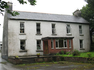
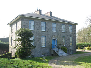
Raheen House (Kinalmeaky)
Houses within 10km of this house
Displaying 61 houses.
Houses within 10km of Raheen House (Kinalmeaky)
Displaying 61 houses.
| House name | Description | |
|---|---|---|
| Warrensbrook | Richard Donovan was leasing this property to Daniel Donovan at the time of Griffith's Valuation, when it was valued at £14. There is still a house at this site, part of a large farm complex. |
|
| Kilcondy | Kilcondy was occupied by William Davies, medical doctor, in 1837 and by John F. Beale at the time of Griffith's Valuation. Beale held the property from Richard Rye and the buildings were valued at £18+. The Crooke sale rental of 1860 records the leasing of 97 acres of Kilcondy including the dwelling house to Richard Browne Crooke by Richard Tonson Rye in 1840 for 3 lives. John Fleming Beale is given as the tenant. Earlier, in 1786, Wilson refers to Kilcondie as the seat of Mr. Crooke. It is now a ruin. | |
| The Cottage | A house built after the first Ordnance Survey. Thomas Gillman was leasing this property from George Wiseman at the time of Griffith's Valuation, when it was valued at £11 5s, It is still extant and known as Grove House. |
|
| Knockaneady | John Beamish was leasing this property to John Schofield at the time of Griffith's Valuation, when it was valued at £6. It does not appear on the later 25-inch Ordnance Survey map of the 1890s. | |
| Ballymoney Glebe House | At the time of Griffith's Valuation, Reverend Robert Meade was leasing this property from the Trinity College estates when it was valued at £23. A slightly different building is labelled "Rectory" on the 25-inch Ordnance Survey map of the 1890s. It is still extent and in use. |
|
| Phale Court | At the time of Griffith's Valuation, Standish Smithwick was leasing this property from William Stanley, when it was valued at almost £8. It is recorded as Phale House on the 1st edition OS Map and as Phale Court on the later 25 inch Map. In 1837, Lewis refers to Phale House as the seat of E.H. Good. In 1914 it was occupied by the Hosford family. In 1786 Wilson refers to it as the seat of John Wade. It is also associated with the Deasy family. |
|
| Mount Beamish | John Beamish was leasing this property to Rev. John Baldwin at the time of Griffith's Valuation, when it was valued at £15. In 1837 Lewis records it as the seat of J. Beamish. Leet noted it as the seat of Rev. Samuel Beamish in 1814. Farm buildings exist at the site now. | |
| Roseville | At the time of Griffith's Valuation, Henry Beamish was leasing this property to Bernard Beamish, when it was valued at £16. Henry Beamish was also the owner of a flour mill [W381539] in the same townland, leased to William Norwood, and valued at £150. The mills do not appear on the 25-inch Ordnance Survey map of the 1890s. Roseville is still extant. | |
| Kilrush House | Thomas Beamish held this property in fee at the time of Griffith's Valuation, when it was valued at £24. Lewis records it as the seat of A. Poole in 1837. The National Inventory of Architectural Heritage records that an earlier house, built around 1650, originally stood at this site and the extant house may incorporate parts of that earlier structure. |

|
| Church Hill House | At the time of Griffith's Valuation, Rev. Mountifort Longfield was leasing this property from Susan McDonnell, when it was valued at £24. [This may be Susan McDaniel of Bandon, as Daniel McDaniel of Knockmacool, is listed in a Bandon Directory of 1876]. Lewis records the house as the seat of Mountifort Longfield in 1837. It is still extant. |

|
| Knockmacool House | Mrs Susan McDonnell [McDaniel] held this property in fee at the time of Griffith's Valuation, when it was valued at £11 10s. It is labelled Desert Cottage on the 1st edition Ordnance Survey map and Knockmacool House on the later 25-inch edition. An Encumbered Estates Sale notice of May 1851 indicates she had previously held it from the Warren estate. A house is still extant at the site. | |
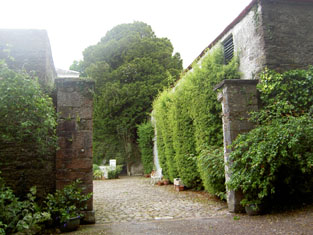
| Carrigboy | E. Barrett resided at Carriguoy, parish of Kilmichael, in 1837. At the time of Griffith's Valuation John E. Barrett occupied this house valued at £15.10 shillings and held by him in fee. A lithograph of the house, with the hunt assembled outside the hall door, is included in the rental. | |
| Cooldaniel | This house was the home of Barter esq in the 1770s and 1780s, of Thomas Barter in 1814, of J. Barter in 1837 and of Michael Buckley at the time of Griffith's Valuation who held it from William Gallagy. It was valued at £10. In the 1940s the Irish Tourist Association Survey noted that it had been converted to farm buildings.. | |
| Greenville | The home of a branch of the Swete family from the early 18th century, occupied by Samuel Swete in 1814 and by B. Swete in 1837. Valued at £35 at the time of Griffith's Valuation and held by Benjamin Swete in fee. The house is described as the family residence in the sale rental of 1877 but was held on a short term lease by Frederick Theodore Courtis. It was in ruins by the 1940s as the Irish Tourist Association Survey reported that portion of the ruins were visible on the farm of Mr. Cashman. It also referred to an attack on the house by the Whiteboys in the 1820s which has resulted in several of them being killed. | |
| Ballytrasna | Located on the Earl of Bandon's estate, occupied by the Reverend B. Gash in 1837 and by Thomas Neville in the early 1850s when the house was valued at £10. The location of this house now appears to be under water. | |
| Curraclogh House | Mary Gibson occupied this house at the time of Griffith's Valuation. It was held from Sir Augustus Warren and was valued at £12.10 shillings. This house is no longer extant. | |
| Elmglyn | Elmglyn was the residence of T. Gollock in 1837 and of Patrick Daly at the time of Griffith's Valuation. He held the property from the representatives of Thomas Gollock and the buildings were valued at £11. The original house is not extant. | |
| Lissardagh | The residence of William Baldwin at the time of Griffith's Valuation, held by him in fee and valued at £20. There is still a house extant at this location. |
|
| Shandangan House | Smith records Christopher Earbury as resident at Shandangan in 1750. Devonsher Esq was the proprietor of Shandangan in the 1770s and 1780s. A Mr Timothy Mahony was living at Shandangan, Macroom in 1814. Lewis records S. Penrose as the proprietor of Shandangan (parish of Kilmurry) in 1837 and Samuel Penrose was still occupying the house at the time of Griffith's Valuation. He held it in fee and it was valued at £13.10 shillings. | |
| Old Fort | A house occupied by Henry Good at the time of Griffith's Valuation, held from Samuel Penrose and valued at £18.10 shillings. | |
| Ryecourt | Seat of the Rye family in the 18th, 19th and 20th centuries, In 1786 Wilson refers to it as the seat of Colonel Rye. Lewis writes in 1837 that “the plantations around Rye Court are very extensive and beautiful”. The buildings were valued at £66 in the early 1850s. Ryecourt was burnt in June 1921 during the War of Independence. The family built a smaller house in the garden and continued in residence at Ryecourt into the 1970s. Ryecourt House was demolished but some of the farmyard complex remains. |
|
| Warren's Court | Kilbarry was bought by the Warrens in the late 17th century. The house Warren's Court was built in the 18th century and was the main seat of this family in the 18th and 19th centuries. In 1750 Smith refers to Kilbarry the "handsome house" of Robert Warren. Wilson notes it as "the fine seat of Thomas Warren" in 1786. In 1894 Slater refers to it as the seat of Sir A. Warren. In 1906 it was valued at £66 and occupied by Sir Augustus Riversdale Warren.. It was burnt in June 1921 during the War of Independence when it was the residence of Sir Augustus D. Warren. The original house is no longer extant. In the 1940s the Irish Tourist Association Survey reported that a modern two-storey house had been constructed nearby. | |
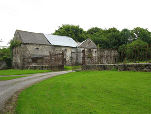
| Crookstown | Smith records Mr Crook of Crookstown in 1751. The mother of Robert Warren, 1st Baronet, was Anne Crooke and this house may have got its name from her. It was the home of a branch of the Warren family from the late 18th century, occupied by the Reverend E. W. Warren in 1814, by the Reverend R. Warren in 1837 and in the early 1850s. The Reverend Robert Warren held the property in fee and the buildings were valued at £48. It was burnt in June 1921 during the War of Independence when it was the residence of Robert Warren. It is still extant and occupied. |
|
| Warrensgrove | This house was the home of John Borlase Warren who succeeded his brother Sir Augustus Warren as 4th Baronet. He is recorded as being resident in 1837 and at the time of Griffith's Valuation when he held the property from Sir A. Warren. The buildings were valued at £48. In the 1940s the Irish Tourist Association Survey noted that Warrensgrove had been burnt in 1921. The original house is now a ruin but buildings adjacent have been redeveloped as a country house. In 2014, the property, including the ruin, was offered for sale. |

|
| Bellmount | Bellmount, Innishannon was the residence of the Reverend James Crowley in 1814. T. Herrick was the proprietor of Bellmount in 1837 along with a large flour mill. The mill and house were in the possession of Patrick Howard at the time of Griffith's Valuation and held from John E. Herrick. The house was valued at £18 and the mill at £65. The mill building, though now disused, is still extant. |
|
| Shandangan East | A house occupied by Patrick Hassett at the time of Griffith's Valuation held from Samuel Penrose and valued at £18.10 shillings. This property is labeled Larch Hill House on the 25-inch Ordnance Survey Map of the 1890s. It is still extant and occupied. |
|
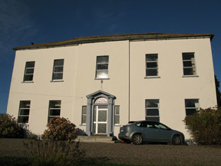
| Palace Anne | Wilson, writing in 1786, refers to Palace Anne as the seat of Mr. Bernard. Both Leet in 1814 and Lewis in 1837 note Palace Anne as the residence of Arthur B. Bernard. It was held in fee by him in 1851 when it was valued at £30. Lewis describes it as " a stately mansion, beautifully situated". Bence Jones states that it was named in honour of Anne LePoer, wife of Arthur Bernard, who built the house in 1714. The house became dilapidated after the sale in the mid-nineteenth century and much of it has been demolished though one wing still survives. In 1944 the Irish Tourist Association Survey reported that it was then in a possession of Mr Warner who had refurbished this wing as a dwelling. The Survey provides a detailed description of the remainder of the property. |

|
| Curravarahane House/Bernard Court | William Smith Bernard was leasing this property from the Bandon estate at the time of Griffith's Valuation, when it was valued at £42. Lewis notes the residence of W.S. Bernard, as The Farm, in 1837. It was labelled Bernard Court on the 25-inch Ordnance Survey map of the 1890s. It is still extant. |

|
| Gurteen Old Mill | Samuel Levis was leasing this property, including a mill, valued at £10, to John Crowley, at the time of Griffith's Valuation. Earlier, in 1786, Wilson refers to a property at Gurteen owned by Mr. Gilman. It is labelled Gurteen Old Mill on the first edition Ordnance Survey Map. It does not appear on the 25-inch Map of the 1890s and there is no trace of it now. | |
| Kilcolman House | Held in fee by William Galway in 1851 when it had a valuation of £38. In 1837 Lewis identified it as the residence of Adderley Beamish, "beautifully situated on the banks of the river Bandon and surrounded by fine plantations". Capt. Beamish had fought in the Napoleonic campaigns at Talavera and Waterloo. He also had a house at Knaresborough in Yorkshire. Kilcolman was burnt in June 1921 during the War of Independence when it was the residence of the Longfield family. It is now a ruin. | |
| Mount Bernard | William Bernard was leasing this property from the Devonshire estate at the time of Griffith's Valuation, when it was valued at £15 10s. A house is still extant at this site. |

|
| Carhoon House | Thomas Bullen was leasing Carhoon from the Devonshire estate in 1851 when it was valued at £10 10s. It is still extant and part of a large farming enterprise but not occupied. |

|
| Laragh House | In 1851 Edmund Murphy was leasing this property, then valued at £28, from the Devonshire estate. There was a mill adjacent. Lewis records it as the residence of I. Swanton in 1837. It is still extant and part of a large farming enterprise. |

|
| Mallowgaton | Leased by Robert Foulkes from the Devonshire estate in 1851 when it was valued at £11 10s. Labelled Mallowgaton on the 1st edition Ordnance Survey map and as Mallowgaton House on the 25-inch edition of the 1890s. It is still extant. | |
| Shinagh House | Leased by Thomas Banfield from the Devonshire estate in 1851 when it was valued at £18. Local sources suggest that the Banfields had resided there since at least the 1690s. This building is labelled Shinagh House on the 1st edition Ordnance Survey map but has disappeared by the 1890s when Shinagh House is shown some distance north-east of the original site at W457555. A business centre now occupies the site. | |
| Woodfort (Bandon) | John Ottley was leasing Woodford from the Alcock family in 1851 when it was valued at £25. It is still extant. | |
| Roughgrove | Leased by Benjamin Hosford from the Alcock estate at the time of Grifith's Valuation, when it was valued at £30. It was included in the sale of Hosford's estate in the Encumbered Estates Court in January 1851, when it was noted that it was "a handsome mansion house, occupied by John Ottley who had spent considerable sums on improvement". Both Lewis, in 1837, and Leet, in 1814, refer to it as the seat of Maskelyne Alcock. This is possibly also the property noted by Wilson in 1786 as Ballygarvy. It is no longer extant. | |
| Mawbeg House | Leased by Robert Popham from the Devonshire estate at the time of Griffith's Valuation, when it was valued at £10. A house still exists at the site. |

|
| Mawmore House | William Scott was leasing Mawmore from the Devonshire estate in 1851 when it had a valuation of £24. Lewis refers to is as the seat of S.B. Beamish in 1837. A house still exists at the site. |

|
| Killaneer House | Occupied by Francis Beamish in perpetuity at the time of Griffith's Valuation, when it was valued at £22. Leet refers to it as the seat of Thomas Gash in 1814. Buildings are still extant at the site. | |
| Mount Pleasant | Held in fee by Henry Baldwin in 1851 when it was valued at £30. Lewis described it in 1837 as " a handsome mansion on a commanding eminence in a highly improved demesne". Also the seat of Henry Baldwin in 1814 and referred to by Wilson in 1786 as "Curravordrie, the fine seat of Walter Baldwin". In 1943 the Irish Tourist Association survey noted that it was owned by the Russell family but that it was possible some of the building would have to be demolished. The house is still extant but in poor repair. |

|
| Mount Pleasant Cottage | Leased by Mathew Belsange from the Baldwin estate in 1851 when it was valued at £10 10s. This property no longer exists. | |
| Farranhavane House | Leased by John Smith Wood from the representatives of Maskelyne Alcock in 1851 when it had a valuation of £10. It is still extant and part of a large farming enterprise. | |
| Mossgrove | Held in fee by Samuel Baldwin in 1851 when it had a valuation of £20. Also noted as his residence by Lewis in 1837. Mossgrove seems to have pre-dated Mount Pleasant as the Baldwin residence in this area. There is still an extant house at this site. | |
| Mossgrove Lower | Mossgrove Lower appears on the 1st edition Ordnance Survey map close to the site of a fortified house dating from the early modern period which is recorded as "in ruins" by the 1830s. In 1851 Henry Baldwin was leasing the property here to Thomas Barter when it was valued at £9. Leet notes a property at Mossgrove as the residence of Robert Popham in 1814. It was no longer extant by the publication of the 25-inch map of the 1890s, | |
| Scartnamuck House | Benjamin Popham was leasing this house from the Devonshire estate at the time of Griffith's Valuation, when it was valued at £25. It is also noted by Lewis as his residence in 1837. The house is still extant. |

|
| Old Park House (Templemartin) | Leased by Benjamin Hosford from the Devonshire estate at the time of Griffith's Valuation, when it was valued at £13. Lewis refers to Old Park as the seat of H.Gillman in 1837. A house still exists at the site. | |
| Garranes (Templemartin) | In 1837 Lewis describes Garranes as "a newly erected and handsome house, near the old family mansion, the residence of J. Splaine". At the time of Griffith's Valuation, it was held by James Splaine from the Duke of Devonshire's estate and valued at £28. It is still extant. |
|
| Lisnagat | James Dawson was leasing a property valued at £10 from the representatives of James Baldwin at Lisnagat in 1851. It is still extant part of an extensive farm complex. | |
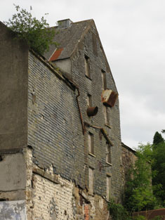
| Lisnagat Mills | John Wheeler held this property from the Baldwin estate at the time of Griffith's Valuation when it was valued at £26+. It is labelled Lisnagat cotton mill on the 1st edition Ordnance Survey map but does not feature on the 25-inch map of the 1890s. | |
| Garranes House | Leased by James Splaine from the Devonshire estate in 1851 when it was valued at £28. Described by Lewis in 1837 as a "newly erected and handsome house, near the old family mansion, the residence of J. Splaine". |

|
| Enniskean Cottage or Mount Lodge | Noted by Lewis as the residence of Rev. W. Sherrard in 1837 and being leased by him from James Gillman in 1851 when it was valued at £12 10s. Later the residence of Orpen Beamish, MD. It is labelled Enniskean Cottage on the 1st edition Ordnance Survey map but as Mount Lodge on the 25-inch map of the 1890s. It is still extant. It was offered for sale in 2023. |
|
| Mary Ville (Kinneigh) | Leased by Joseph Hosford from the Devonshire estate at the time of Griffith's Valuation, when it was valued at £11 10s. | |
| Gardeville | Noted by Lewis in 1837 as the seat of Rev. W. Hall. Leased by Sarah Hosford from the Devonshire estate in 1851 when it was valued at £13. | |
| Capeen | Richard Hungerford was leasing this property to Henry Hungerford in 1851 when it was valued at almost £10. Labelled Cappeen on the 1st edition Ordnance Survey Map. An enlarged building is named Cappeen House on the 25-inch map of the 1890s. A house still exists at the site. | |
| Carrigmore House (Kinneigh) | James Lysatt [Lysaght] held a property in fee here, valued at £46, at the time of Griffith's Valuation. Bence Jones states that it was built in 1842 by James Lysaght on the site of an earlier house known as Connorville, which had been purchased by Lysaght from the Connor family. In 1837 Lewis had referred to it as "the deserted and dilapidated mansion of the O'Connors." In 1783 Taylor and Skinner had indicated Connorsville as a seat of the Connor family as had Wilson in 1786. An adjacent smaller house, known as Laurel Hill, was held by Adderley Bernard in 1851. Carrigmore House and 312 acres, the estate of James Lysaght, were advertised for sale in July 1853. A lithograph of the house is included in the sale rental. Lyons indicates that the estate was sold privately to James L. Holmes. Carrigmore and Laurel Hill were offered for sale in the Landed Estates Court in 1876, as part of the sale of the Holmes estate. Donnelly states that it was burnt in October 1920 during the War of Independence when it was the property of James H. Morton. The house is now derelict. | |
| Fort Robert (Kinneigh) | Described by Lewis in I837 as a "handsome residence" then occupied by Mrs. [O'] Connor. In 1851 it was leased by George Fuller from Mary Longfield [O']Connor and valued at £18. By the mid 1860s it was in the possession of Thomas Kingston Sullivan. The sale rental of 1867 records that Fort Robert had been "allowed to get out of repair, but is beautifully situated". It appears to have become ruinous by 1890s. The Irish Tourist Association Survey of 1944 stated that the ruin was the property of Judge Henry Connor and also that the house had been associated with Art [O']Connor, United Irishman. | |
| Lakemount (Kinneigh) | John J. Baylis, MD, was leasing Lakemount from the Devonshire estate in 1851, when it was valued at £14. It is still extant and well-maintained. |

|
| Dromavane House | Leased by Thomas Wrenn from the Devonshire estate at the time of Griffith's Valuation, when it was valued at £9. It it still extant and occupied. |

|
| Palace Anne Mills | A substantial milling complex and house, leased to William Norwood by Arthur B. Bernard in 1851, when it was valued at £34. Lewis referred to the property as "an extensive flour mills" in1837. The property has been converted into apartments in the last decade. |

|
| Castle View | A house located just east of the present day reservoir south of Macroom. Lewis records P. Ronayne as resident at Castleview in 1837. Patrick Ronane was the occupier of a house valued at £11 in this townland in the mid 19th century. The sale rental of April 1861 describes the house as "commodious" with a walled in garden. It was held on a lease from Michael Cox to John Ronayne as trustee for Thomas Browne dated 1800. Buildings are still located at this site. |