Ballynoe House
Houses within 15km of this house
Displaying 42 houses.
Houses within 15km of Ballynoe House
Displaying 42 houses.
| House name | Description | |
|---|---|---|
| Ballyroe Lodge | Sir Edward Denny was leasing this property to Pierce Chute at the time of Griffith's Valuation when it was valued at £17 15s. Bary writes that it was built by Pierce Chute, possibly in 1836, according to O'Donovan. The Chutes continued in residence until the late nineteenth century after which it had a succession of owners. It now forms part of the Ballyroe Heights Hotel complex. |
|
| Barrow House | Sir Edward Denny was leasing Barrow House to John Collis at the time of Griffith's Valuation when it was valued at £20 10s. In 1837 Lewis mentions Barra [sic] as the seat of T. Collis. In the 1830s, the Ordnance Survey Name Books indicate it was the residence of John Collis, having been built about two centuries previously. Leet noted it as the seat of John Collis in 1814. Bary states that the house was built by a William Collis, a Cromwellian officer, and continued to be associated with the Collis family until latter half of the nineteenth century. In the 1990s it was a restaurant and guesthouse but has now reverted to private ownership. |
|
| Listrim House | Sir Edward Denny was leasing Listrim House to Robert Fortune at the time of Griffith's Valuation, when it was valued at £12 10s. In the 1830s the Ordnance Survey Name Books record that it was the residence of Henry Oliver by whom it was supposedly erected in 1836. It is now a ruin. | |
| Lisadale Lodge | John Busteed was leasing Lisadale Lodge from William Howard at the time of Griffith's Valuation, when it was valued at £6 10s. The Ordnance Survey Name Books record it as the residence of William Howard, by whom it was supposedly built, in 1836. Bary writes that the house may have been a hunting lodge. It is now ruinous. | |
| Ballygarran House | Sir Edward Denny was the lessor of Ballygarran at the time of Griffith's Valuation, when the property, valued at £9 10s, was vacant. In the 1830s, the Ordnance Survey Field Name Books mention Ballygarran House as the residence of William Hilliard by whose family it had been built in the eighteenth century. It is described as " an oblong low thatched house". Bary notes that it was a house frequently associated with the Hilliard and later the Fitzmaurice families. It was demolished in the mid-twentieth century. | |
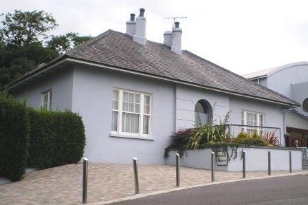
| Church Hill House | At the time of Griffith's Valuation, Rev. Henry Denny was leasing Church Hill from Sir Edward Denny when it was valued at £27. According to Bary the house was in the hands of the Denny family for much of the eighteenth and nineteenth centuries until it passed to the Neligans, possibly in the 1880s. In 1906 it was owned by William Neligan and valued at £27. It is still extant and occupied. |
|
| Plover Hill House | Sir Edward Denny was leasing this property to George Gunn at the time of Griffith's Valuaton, when it was valued at £16 5s. Lewis records it as the seat of George Gun in 1837. Bary states that the house was built in the early nineteenth century by Barry-William Gun, whose mother was Arabella Denny. The Gunn family continued to own the property until the 1880s. Buildings still exist at the site. | |
| Doon House | At the time of Griffith's Valuation, William M. Hickson was in possession of this property, then valued at £9 15s. | |
| Oakpark or Collis-Sandes House | Maurice Sandes was in possession of this property at the time of Griffith's Valuation, when it was valued at £60. It is labelled as Oakpark on the 1st edition Ordnance Survey Map. In 1837 Lewis recorded Oakpark as the seat of John Bateman. Bary writes that, Killeen, the original house at this site, was a late seventeenth century house. It was followed by Oakpark, built by John Bateman in the 1820s. This is the house mentioned by Wilson in 1786 as the seat of Rowland Bateman. Maurice Sandes purchased the estate in the late 1840s and built the later Oakpark House c.1857. In 1906 this house was owned by Falkiner Sandes and valued at £112. The house was sold in 1922 and is now used as offices. |
|
| Lismore | Edward Day Stokes was in possession of the house at Lismore at the time of Griffith's Valuation, when it was valued at £13 10s. Bary writes that the house was associated with the Martelli family who were related by marriage to the Blennerhassetts. Later it was occupied by Collis and Huggard families. It is now a ruin. | |
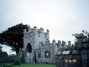
| Ardfert Abbey | William T. Crosbie was in possession of Ardfert Abbey at the time of Griffith's Valuation, when it was valued at £62. Lewis, writing in 1837 and Leet, in 1814, note the house as the residence of the Earl of Glandore.It was the home of Lt-Col. John Darnley Talbot Crosbie in 1894. In 1906 it was the property of L.T Crosbie and valued at £66. Bary writes that the original house built here by the Crosbies was destroyed in the 1641 rebellion and another erected in the early 18th century. The Ordnance Survey Name Books quote the inscription relating to the original house from 1635. It remained the residence of the family until the late nineteenth century when it passed to John Talbot, whose son, William Talbot-Crosbie, then inherited. The house was burnt during the Civil War in 1922 and only the elaborate entrance gate remains.. |
|
| Sackville House | William T. Crosbie was leasing this property to Sarah Heck at the time of Griffith's Valuation, when it was valued at £22 10s. Lewis records it as the property of the Crosbie family but resided in by Rev. R. Maunsell in 1837. Leet, in 1814, noted Sackville as the residence of John Saunders. In 1786, Wilson mentions Sackville " a very neat house, newly erected" as the seat of Rev. Thomas Graves, Dean of Ardfert. In 1906 it was the property of L.T. Crosbie and valued at £25. Bary states that Sackville was built by Thomas Graves, dean of Ardfert, in 1788, as there was no Glebe house there. It was named for Diana Sackville, wife of John Crosbie, second Earl of Glandore. It was leased by the Crosbies or lived in by one of the family for much of the nineteenth century. It was sold in the twentieth century and demolished in the 1950s. | |
| Tubrid House | George Gunn was leasing this property to Henry Hilliard at the time of Griffith's Valuation, when it was valued at £22 10s. Lewis recorded Tubrid as the seat of J. O'Connell.The Ordnance Survey Name Books indicate that this townland was owned by John O'Connell of Grenagh, Killarney and that John Sullivan of Tubrid was his agent in the 1830s. The house was occupied by Capt. Henry Hilliard at that time. In 1814, Leet noted the house as the seat of Townsend Gunn. Bary states that Tubrid House was built by the Crosbie family in the mid-eighteenth century and resided in by several generations of that family. The late eighteenth century owner, John G. Crosbie, was involved in a duel in which Sir Barry Denny was killed. A year later Crosbie himself died in mysterious circumstances. The house afterwards was owned by the Gunn and Hewson families. It is no longer extant. | |
| Ballyheige Castle | Pierce Crosbie was in possession of Ballyheige Castle at the time of Griffith's Valuation, when it was valued at £62 10s. Noted by Slater as the seat of Col. James Crosbie in 1894. In 1906 it was owned by James D. Crosbie and valued at £50. The Ordnance Survey Field Name Books describe the house as "a splendid and commodious building in the Gothic style" and record that the house was burned on the night of 14 November 1840. Bary writes that this had originally been the property of the Cantillons, some of whom later intermarried with the Crosbies. The original house on this site was constructed in the mid-eighteenth century but was renovated and enlarged to the design of Richard Morrison in the early nineteenth century. The building was used as a prison at the time of the War of Independence in the early 1920s and was subsequently burnt. Very little of the original remains but some renovation has taken place and there is holiday accommodation at the site, now surrounded by the Golf Course. |

|
| Ballyheige Glebe | The representatives of Pierce Crosbie were leasing this property to Reverend Thomas Heffernan at the time of Griffith's Valuation, when it was valued at £17 15s. In the 1830s, the Ordnance Survey Name Books describe it as "a good slated house, two stories high", then the residence of Reverend James P. Chute. A house is still extant at the site. | |
| Toanreagh | This house seems to have been constructed after the publication of the 1st edition Ordnance Survey Map but it appears on the 25-inch edition of the 1890s. Richard Oliver was leasing this property to Francis Creagh at the time of Griffith's Valuation, when it was valued at £9 10s. A house and substantial farm are still extant at the site. | |
| Ballyhorgan South | At the time of Griffith's Valuation, Goodman Gentleman was leasing this property from Sophia Herranc, when it was valued at £7. Lewis mentions a house called Ballyhorgan under Finuge Civil Parish as the seat of W. Hilliard in 1837. Leet also notes it as the seat of William R. Hilliard in 1814. In 1906 it was owned by Robert G. Gentleman and valued at £8. | |
| Ballyhorgan West | Sophia Herrane was leasing this property to Stephen Sandes at the time of Griffith's Valuation, when it was valued at £10 15s. It is labelled Ballyhorgan West on the 25-inch Ordnance Survey map of the 1890s. Buildings are still extant at the site. | |
| Ballyhorgan House (Ratoo) | At the time of Griffith's Valuation, Thomas Stoughton was occupying this property which was valued at £33. Lewis refers to it as the seat of T.A. Stoughton in 1837. Bary states that this house was built by the Stoughtons in the seventeenth century and continued to be occupied by them until the twentieth century, though it suffered attacks from the Whiteboys and during the War of Independence. It is now a ruin. | |
| Ballynagare House | John Morrogh Bernard was leasing this property to George Gilbert (Senior) at the time of Griffith's Valuation, when it was valued at £6. In 1837, Lewis described it as the seat of the representatives of the late John Barnard. Leet had noted it as the seat of the latter in 1814. Bary indicates that the original house at this site has been demolished. | |
| Crotta House | Samuel Julian was in possession of this property at the time of Griffith's Valuation, when it was valued at £27. Lewis records it as the seat of T. Ponsonby in 1837 while Leet notes it as the residence of James O'Donnel in 1814. In 1786 Wilson writes that "Crotto" was the seat of James Carrigue Ponsonby and "very pleasantly situated with good plantations". Bary writes that Crotta had been built by the Ponsonby family and was later held on lease from the Court of Chancery by the Julian estate. At the sale of the latter estate in 1857, Crotta was described as being in the hands of the proprietor Samuel Julian. Later in the nineteenth century it was leased to the Kitchener family. Herbert Kitchener, later Earl of Khartoum, lived there as a boy. The estate was the property of the Browne family in the later nineteenth century but was offered for sale by Thomas Beale Browne in 1877. In 1894 Slater records it as the seat of Richard Savage. In the 1940s the Irish Tourist Association Survey describes it as " a ruined shell" where there was once "an imposing mansion". The remains of the house were demolished in the later twentieth century. |
|
| Rea | William Talbot Crosbie's estate owned this property at the time of Griffith's Valuation, when it was valued at £5 15s. The original house is not extant now. | |
| Banna House | Robert E. Stokes was leasing this property from the Earl of Listowel's estate at the time of Griffith's Valuation, when it was valued at £11. Bary writes that it was built by Oliver Stokes in 1815. It was demolished many years ago. | |
| Fortwilliam | Thomas B. Hurley was leasing this property from the Talbot-Crosbie estate at the time of Griffith's Valuation, when it was valued at £18 10s Lewis records the house in Killahan parish when he notes that it as belonging to the representatives of the late W. Collis in 1837. Leet states that William Fitzgerald was resident at Fortwilliam in 1814. . Bary writes that, according to O'Donovan, this house was built by William Collis in 1798. It is no longer extant. | |
| Corbally (Rattoo) | At the time of Griffith's Valuation, William Pope was leasing this property from the Trinity College Estates when it was valued at £6. A modern house, part of a large farming enterprise, exists at the site now. | |
| Bushmount | Wilson Gun was leasing this property to Dominick Rice at the time of Griffith's Valuation, when it was valued at £16 10s. In 1837 Lewis refers to it as the seat of Dominick Rice. In 1814 Leet had recorded Dominick Rice as resident at Ballymaquin. Bary states that Bushmount was possibly built in the early years of the nineteenth century by Dominick Rice. The house is still extant and occupied. | |
| Lisnagonee or Rattoo West | At the time of Griffith's Valuation, Wilson Gun was leasing this property to Thomas O'Connell, when it was valued at £13 5s. It is labelled Rattoo House on the 1st edition Ordnance Map but on the later 1890s Map it is named as Rattoo West. Bary states that this house is now known as Lisnagonee House. It was built by the Gun family, though the date is not clear, but probably in the eighteenth century. It is still extant and occupied. | |
| Rattoo House | At the time of Grffith's Valuation, Rattoo House, in the possession of Wilson Gun, was valued at £20. Lewis refers to Rattoo Lodge as the residence of W.T. Gun in 1837. This would appear to be the house which Bary states was built by Wilson Gun in 1836. The 1st editon Ordnance Survey map, however, indicates "Rattoo House (in ruins)", south west of the Round Tower, which would suggest there was an earlier house also known by this name. In 1906 it was owned by William T.J. Gun and valued at £63. The house remained in the Gun family and their descendents until the early twentieth century when it was sold to the Land Commission by Ella Browne, grand-daughter of Wilson Gun. The Irish Tourist Association Survey, however, still describes it as in her possession "a large straggling building with fourteen bedrooms and fine sittingrooms". It is still extant and occupied. In 2010 it was offered for sale. |

|
| Rattoo A | Wilson Gun was leasing a property to John Hanlon at the time of Griffith's Valuation, when it was valued at £8 10s. This may be the building shown on the Ordnance Survey maps adjacent to the area known as The Paddock and not far from the farmyard. Buildings are still extant at these locations. | |
| Ballyconry House | Eyre Stack was in possession of Ballyconry House at the time of Griffith's Valuation, when it was valued at £13. In 1814 Leet noted Ballyconry as the residence of John Stack while Lewis mentions it as the seat of Eyre W. Stack in 1837. Bary writes that it later came into the ownership of the Rice family, became semi-derelict but was then rescued and used a Youth Centre. She notes that it was also known as Ballyloughrane House. | |
| Ennismore House | George Hewson was leasing this property from the Earl of Listowel's estate at the time of Griffith's Valuation, when it was valued at £22. In 1814 Leet refers to it as the residence of F. Hewson while Lewis, in 1837 notes that Ennismore, the seat of J.F. Hewson, gave its name to a title held by the Hare family, Earls of Listowel and Barons Ennismore. In 1906 it was part of the Listowel estate and valued at £26 10. Bary writes that this property was originally in the possession of the Knight of Kerry but was bought by the Hare family, Earls of Listowel in the 1790s. The Hewson family lived here up until the 1920s but the house is now demolished. | |
| Killacrim House | At the time of Griffith's Valuation, Timothy Horgan was leasing this property from the Earl of Listowel's estate when it was valued at £5. In 1837 Lewis mentions it as the seat of Captain O'Halloran. In 1814, Leet refers to it as the residence of John Raymond. Bary writes that, in the eighteenth century, it was in lived in by members of the Fitzgerald family, the Knights of Kerry. The original house was destroyed by fire in the early 1970s and a new one constructed at the site. | |
| Spraymount | Sophia Herranc was leasing this property to Anne Raymond at the time of Griffith's Valuation, when it was valued at £5 5s. An adjacent property was being leased by Anne Raymond to William Hartnett, valued at £6. Lewis refers to "Spraymount" as the seat of Capt.W, Raymond in 1837. It is no longer extant. | |
| Ballyeagh House | Sophia Herranc held this property in fee at the time of Griffith's Valuation, when it was valued at £3 10s and part of a holding of 540 acres. It is described as a Steward's House. This appears to be Ballyeagh House, built after the 1st Ordnance Survey map was published and labelled as such on the later 25-inch map of the 1890s. Now the site of a large farm. | |
| Killehenny Lodge | Robert Cashel was leasing this property from the estate of Lady Burghersh at the time of Griffith's Valuation, when it was valued at £5 and part of a holding of over 280 acres. Bary notes that, in the eighteenth century, this house had been associated with the Tidmarsh family. It is no longer extant and the area is covered by housing. | |
| Milford/Millview | Lewis refers to "Millview" as the seat of Kerry Supple in 1837. A house named Millford is shown in the parish of Rattoo on the 1st edition Ordnance Survey map, adjacent to a building labelled Millford Tuck Mill. The house is present on the 25-inch map of the 1890s but the mill is not labelled. At the time of Griffith's Valuation, Justice Rice held this property from the Provost and Fellows of Trinity College when it was valued at £2 15s. Bary writes that it burned down in the 1970s and is now a ruin. | |
| Drommartin | Lewis refers to Dromartin as the residence of J. Creagh in 1837. At the time of Griffith's Valuation, John Creagh was leasing this property from Richard Oliver when it was valued at £4. No house exists at this location now. | |
| Abbeylands | In 1906 L.T, Crosbie owned a property at Skrillagh, valued at £17. This townland also belonged to the Crosbie estate at the time of Griffith's Valuation, when it was let to the McElligott family. Bary states that the house, Abbeylands, was built in the 1870s as a residence for George Trench, agent to the Crosbie estate. In 1901 it was occupied by Ross Palmer and his family, JP for county Kerry and creamery owner. It was burnt in 1921 but restored later in the twentieth century and is now an ecumenical retreat centre. | |
| Mount Hawk | In 1906 Mounthawk was owned by Elizabeth Stokes and valued at £18 5s. The townland was in the possession of George Stokes at the time of Griffith's Valuation. Bary states that it was built by George Stokes on lands purchased from the McCarthy family and remained in the Stokes family well into the twentieth century. It was later used as a clubhouse by Tralee Golf Club. | |
| Ballyhennessy | At the time of Griffith's Valuation, George Sandes was leasing this property from Mrs. S.C. Herrane, when it was valued at £5 and included an orchard. By the 1890s the 25-inch edition Ordnance Survey map indicates that the orchard was all but gone and the buildings were also altered. A substantial farm exists at the site now. | |
| Ballyhenry House | In 1786 Wilson refers to Ballyhenry as the seat of Mr. Hartnett. No house is named in this townland on the 1st edition Ordnance Survey Map. At the time of Griffith's Valuation the property is held by Michael Duggan leasing from the Hurley estate and the house is valued at £3 10s. Modern farm buildings exist at the site now. | |
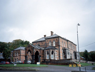
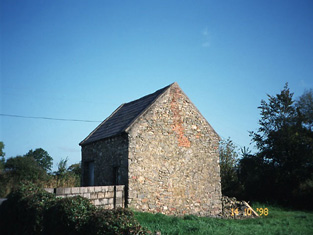
| Old Court [Lixnaw House] | The Irish Tourist Association Survey refers to the "once magnificent mansion" of the Fitzmaurices, Earls of Kerry. By the 1940s only a few walls remained "supporting a henhouse and some turnip and potato pits". The survey also noted the survival of a summer house, a high circular mausoleum and a "hermitage". Bary notes that the property was home to the family for up to 500 years but fell into ruin in the later eighteenth century. It is labelled "Lixnaw House (in ruins)" on the 1st edtion Ordnance Survey map but as "Old Court" on the later 25-inch edition of the 1890s. Some ivy-covered ruins remain at the site. |
![Photo of Old Court [Lixnaw House]](https://landedestates.ie/storage/img/orig/2854.jpg)
|