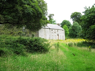
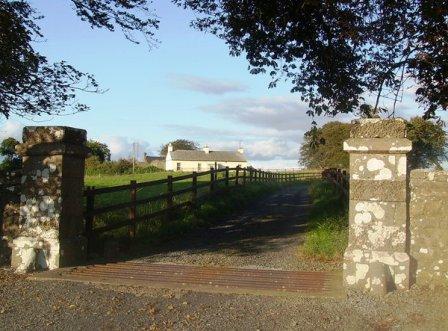
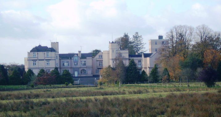
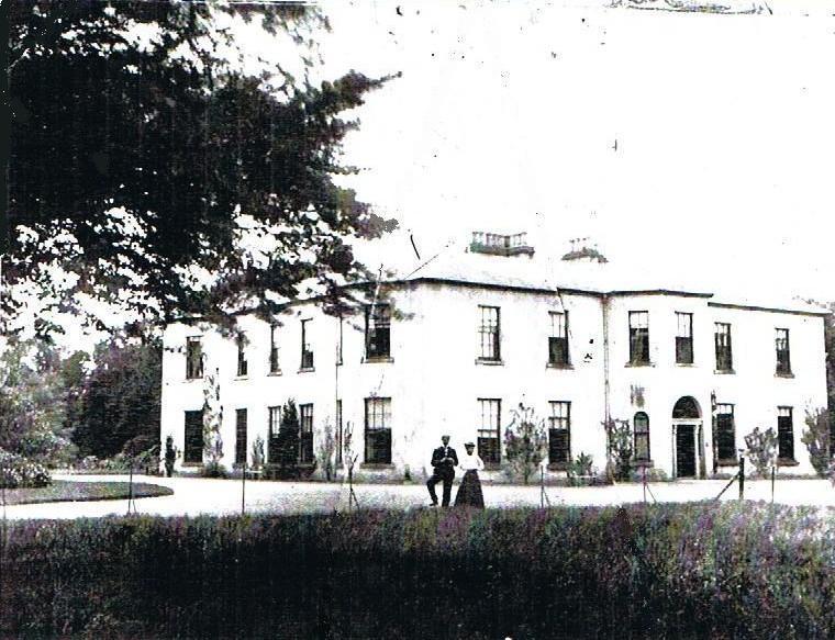
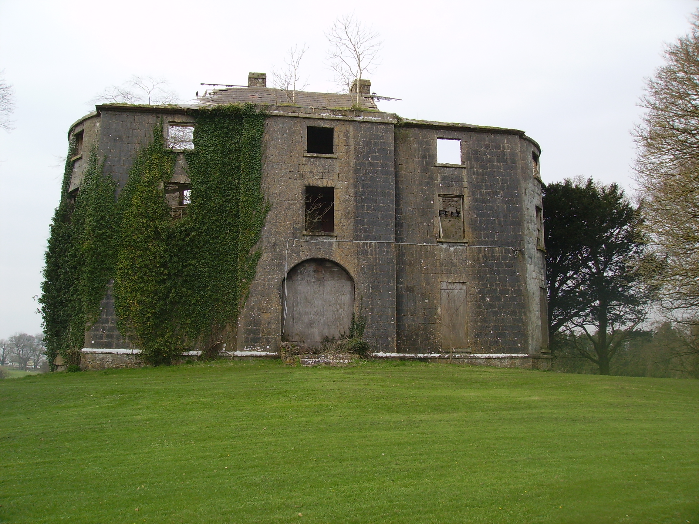
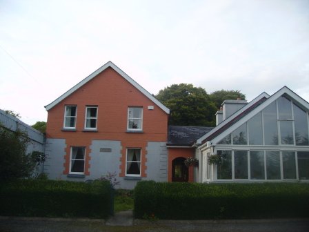
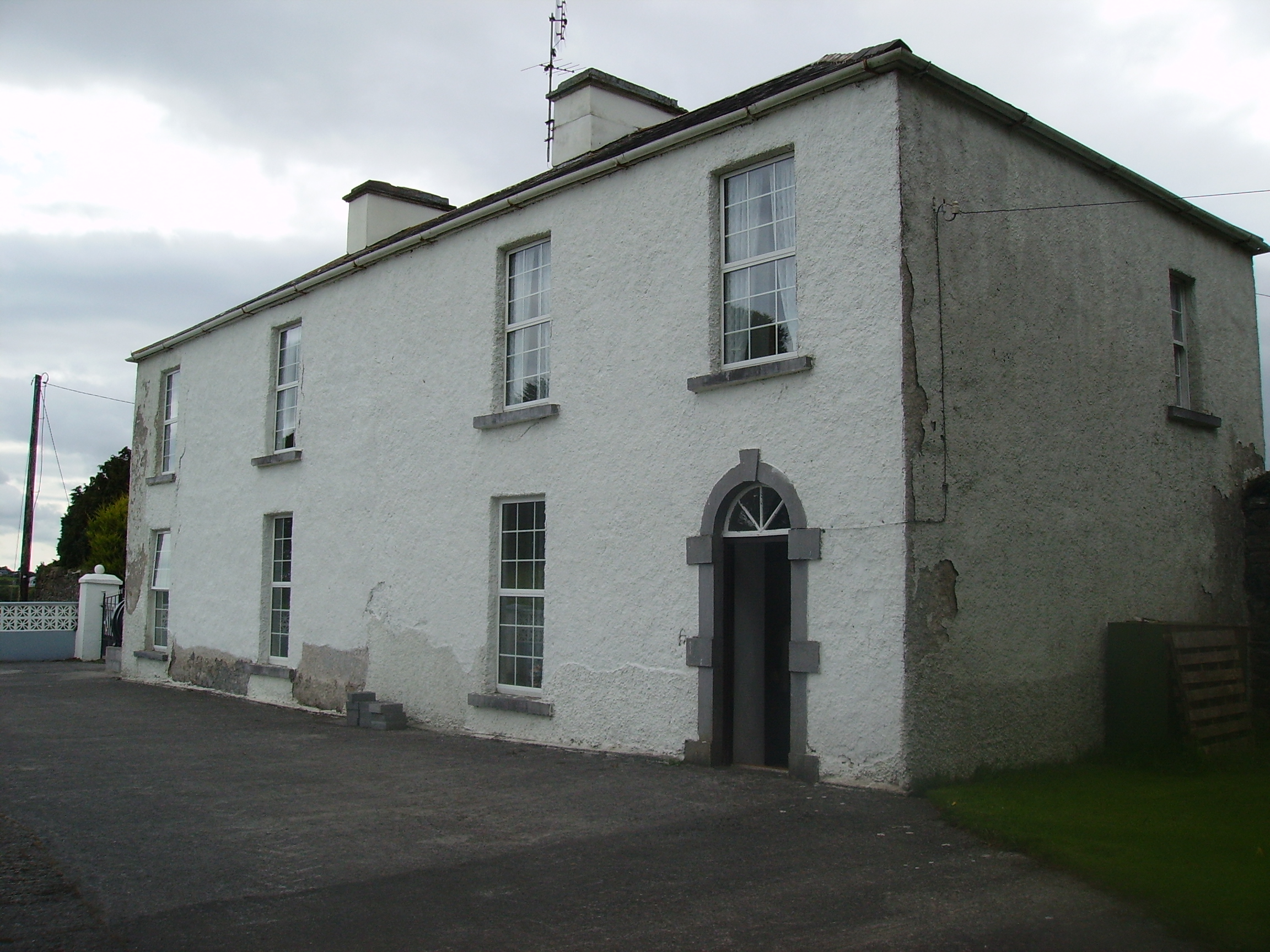
Rockfort
Houses within 15km of this house
Displaying 57 houses.
Houses within 15km of Rockfort
Displaying 57 houses.
| House name | Description | |
|---|---|---|
| Mannin | The harper, Turlough O'Carolan, was a regular visitor to Mannin House and composed a number of tunes in honour of the Dillons and Betaghs. At the time of Griffith's Valuation the townland was owned by Margaret Mary "Beatty" and included a house valued at £5. The house still exists but is not inhabited. It was owned by a Mr Grogan in the 1940s. |
|
| Ballinvilla | The home of the Crean family in the 19th century. Ballinvilla was held in fee by Austin F. Crean at the time of Griffith's Valuation when it was valued at £7. This house no longer exists. | |
| Lugboy | Home of the Nolan family and the Nolan Ferrall family, this house no longer exists. The only feature still visible is a well in what was once part of the yard. |
|
| Holywell | At th time of Griffith's Valuation, John Burke Jnr. and Gerald Burke were jointly leasing this property from Hugh Burke, when the buildings were valued at £14. In 1786 Wilson refers to Holywell as a seat of Mr. Dillon. Some renovations were made to the house in 2005 by its current owner Eamon Healy. |
|
| Bekan | The exact location of the Burke's house in the village is not known. | |
| Annagh | This townland was in the possession of Thomas Tyrle (Tyrrell) at the time of Griffith's Valuation. No house there has a significant valuation. In 1786 Wilson had noted Annagh as the seat of Mr. Dillon. | |
| Purrauns | Home of a branch of the Bell family of county Mayo and occupied by the Lynches in the mid 19th century. At the time of Griffith's Valuation it was occupied by Patrick King leasing from James Lynch when the buildings were valued at £5. Buildings are still extant at the site. |
|
| Mount Jennings | Home of the Jenings family in the 18th and 19th centuries. Mount Jennings was held in fee by Benjamin Jenings at the time of Griffith's Valuation when the house was valued at £20. It was the childhood home of the ballad singer, Delia Murphy. Her parents still resided in the house in the 1940s. The roof was taken off the house in the 1970s and it is now demolished. | |
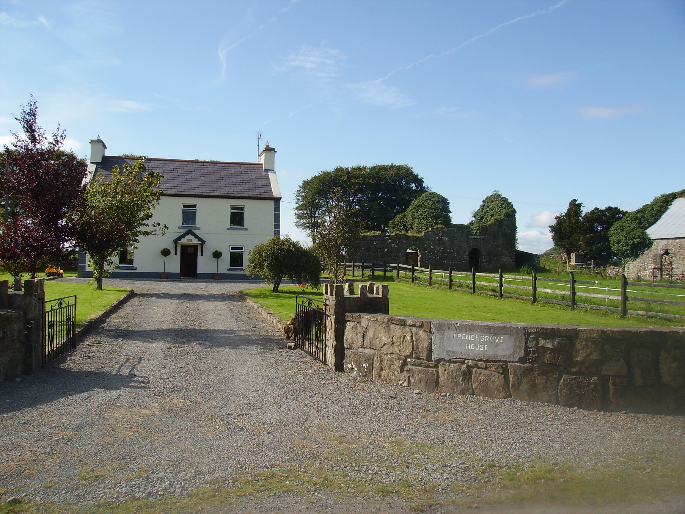
| Frenchgrove | A house marked as 'in ruins' on the 1915 edition of the 6 inch Ordnance Survey map. The Irish Tourist Association file describes Frenchgrove as the residence of the Blakes, later of the Frenches and finally of a man named Eager, a Dublin banker. No house of more than £3 valuation was recorded in Griffith's Valuation for the townland of Frenchgrove. A modern house now occupies the site with the remaining evidence of the old building. |
|
| Ballyheeragh St Leger | This house was held in fee by Dominick Kearns at the time of Griffith's Valuation, when it was valued at £10. Bought by the Tierney family in the early 20th century and still occupied by them. |
|
| Farmhill/Carradoyne | In 1786, Wilson refers to Farmhill as the seat of Mr. Vesey. Dean Arbuthnot, who lived in the house in 1814, was rector of the parishes of Crossboyne and Kilcolman and a brother of Sir Robert Arbuthnot. The Gonne Bells were recorded as resident in Lewis and the Ordnance Survey Name Books. The house appears to have been known as Farmhill during the Vesey/Arbuthnot/Gonne Bell ownership and thereafter as Carradoyne House. It was occupied by Thomas Elwood in 1845 and by Lady Lynch Blosse at the time of Griffith’s Valuation. By the 1860s it was the home of the Sheffields. It was occupied by Katherine Tynan and her husband, Henry Albert Hinckson, during World War I. Carradoyne House is still extant and occupied. |

|
| Bushfield | The original house, now a ruin, was sometimes known as Creaghduff. Creaghduff was occupied by Burke esq in the 1770s. Thomas Ruttledge of Bloomfield made his will at Bushfield in 1797 and died there in 1805. Bushfield was the home of Arthur Knox and his wife Barbara, nee Lambert. Their daughter, Elizabeth, married Annesley Knox of Rappa Castle. Barbara married Charles White as her second husband and sublet the house to Robert Fair, son of Robert Fair of Fortville. It was valued at £15 the time of Griffith's Valuation. Robert Fair of Bushfield had an only daughter, Jane, who married Thomas Ruttledge of Bloomfield and their second son took the surname Ruttledge Fair. A new house was built in the 1920s and is the home of the Delaney family. Extensive remains of the original Bushfield farmyard survive at the site. |
|
| Ballyhowly | A Ruttledge family home in the 19th century, there is a lithograph of the house included in the sales advertisement of the Oranmore and Browne estate 1854. At the time of Griffith's Valuation, William Rutledge was leasing the property, valued at £10, from John Nolan Ferrall. Wilson describes it as "a country seat belonging to Henry Browne" in 1786. This house now offers farmhouse accommodation to guests. |
|
| Castlevilla | A Ruttledge family home in the 19th century, still extant and lived in. At the time of Griffith's Valuation it was leased by James Rutledge from Lady de Clifford's estate and valued at £18. |
|
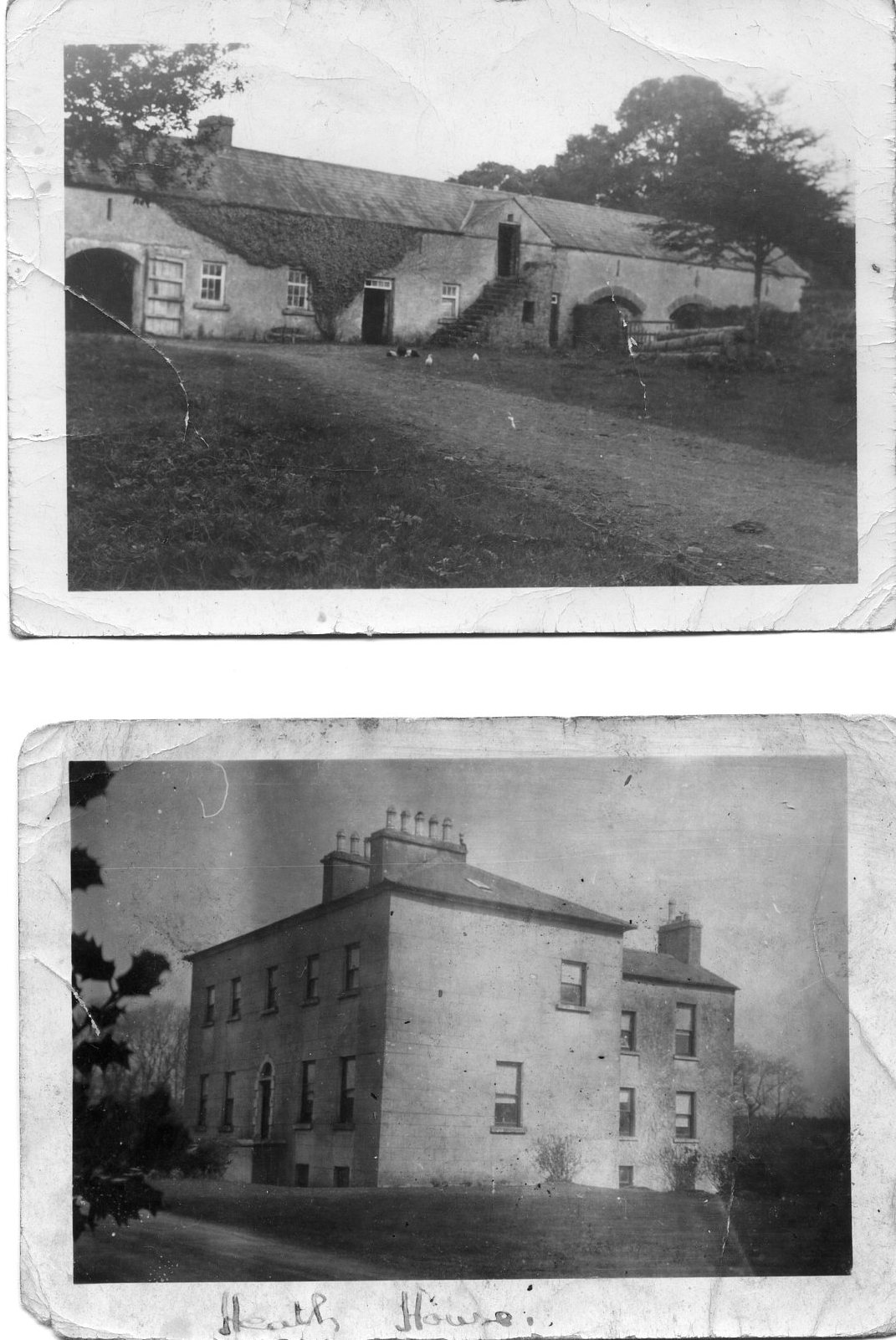
| The Heath | At the time of Griffith's Valuation, it was the property of Henry Blake and valued at £10. Described in 1863, when sold by the Blakes to the Tighes, as a substantial dwelling house with two reception rooms and six bedrooms, all in good repair. It is now a ruin. |
|
| Doonmacreena | In 1786 Wilson notes "Dunmacrene" as the seat of Mr. Blake. The sales rental of 1851 states that the old house at Doonmacreena was the residence of Mr Blake's ancestor 'now in ruins'. |
|
| Streamstown | William Coghlan was living at Streamstown, near Claremorris, in 1814. In the 1830s the townland is noted as belonging to Mr. Gonne Bell of Farmhill, Claremorris. By the time of Griffith's Valuation there is no house with a significant valuation in the townland. | |
| Claremount | Built in the 18th century, this house was the home of George Browne, third son of the 1st Earl of Altamont, in the 1760s. His daughter and heiress married Dominick Browne of Castlemagarret and ownership of Claremount appears to have passed to the Castlemagarret Brownes. The Kirwans and Denis Browne of Westport lived in the house in the late 18th and early 19th centuries. It was bought by Murray McGregor Blacker from Lord Oranmore and Browne in 1858 for £4,250. Blacker owned the house until 1874. In 1877 the house and about 313 acres were sold to the local parish priest by Thomas D. Maguire for the purpose of establishing a Convent of Mercy. The nuns ran a girls' secondary school in the house. In October 1906 just over 300 acres of Claremount was vested in the Congested Districts' Board. |
|
| Woodstock | There is no substanial house marked on the first Ordnance Survey map for the townland of Woodstock. | |
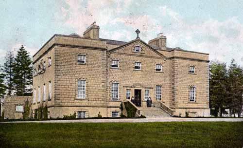
| Castlemagarret | In 1786, Wilson refers to CastleMacGarret as the seat of D.G. Browne, "a handsome seat, surrounded with one of the best wooded demeses in Ireland". The house, built in 1694, was destroyed by fire in August 1811 and a replacement built in the Tudor Gothic style. Robert Graham, in his journal of September 1836, refers to the fire and that "the present house is constructed out of the old offices, but is amazingly comfortable as far as it goes". Held in fee by Geoffrey Browne at the time of Griffith's Valuation, when it was valued at £25. The house functioned as a nursing home after it was sold by the Brownes in 1964. It is still extant but unoccupied. In 2015 it was offered for sale. |
|
| Millbrook House | There is a lithograph of this house attached to the sales rental of Lord Oranmore and Browne's estate in 1854. The sale rental states that the late tenant [Lawrence Glynn] recently expended a large sum in building a residence on this lot. This later building is labelled Millbrook House on the 25-inch Ordnance Survey map of the 1890s. It is no longer extant. | |
| Brookhill | Brookhill was situated on church land held by the Gonnes, who leased the house to the Kirwans in the late 1770s. Occupied by the Lambert family from the 1790s to the 1940s when it was sold to Gerald Maguire, a solicitor in Claremorris. Now the home of the Noone family. |
|
| Ballygowan Cottage | A Prendergast home in the 19th century, now in an advanced state of disrepair. The property was held in fee by Richard Prendergast at the time of Griffith's Valuation when it was valued at almost £10. |
|
| Carrowneden | Jon Treston was leasing this house, valued at £4, from the O'Farrell estate at the time of Griffith's Valuation. A house is still extant at the site. | |
| Dalgin | In 1786 Wilson refers to "Dalygan" as the seat of Mr. Birmingham. It was held in fee by Michael Bermingham at the time of Griffith's Valuation when it was valued at £17. Inhabited by the Birminghams and later the Kirwans until 1954, subsequently demolished. Out buildings still remain at the site beside a modern bungalow, the home of Mr John Curran. |
|
| Coolcon Castle | Originally a Burke castle and later a residence of the Blakes in county Mayo, very little of this castle now remains. | |
| Castlegar | Occupied by Ignatius Kelly in 1814, by William T. Kelly at the time of Griffith's Valuation and by Edward Dale in 1906. In the 20th century it became a boys' secondary school. There is a lithograph of the house in the sale rental for Castlemagarret in the Public Record Office of Northern Ireland. | |
| Ballintava | In 1906 Samuel Barret owned the mansion house at Ballintava which was valued at almost £14. The house is extant and appeared to be in the process of renovation in the early 21st century. |

|
| Carrolton House | The house known as Beagh Lodge, an O'Carroll house, is shown on the First Edition Ordnance Survey . It is not visible on the 25-inch Ordnance Map of the 1890s. A house on a nearby site is labelled Carrolton House on the latter map. The original house is not extant though there are later buildings. |

|
| Carrowntryla | Occupied by Henry esq in the 1770s and in 1786. It was the home of the Handcock family in the 19th century, sold to Captain Dick in 1897 and occupied by him in the early years of the 20th century. Bought by Major Gerald Stratford Handcock in 1928 and inherited by his niece, Mrs Voss, who sold the house to Hector McDonnell, a Galway building contractor. The house is no longer extant. |
|
| Millbrook | Millbrook House was held in fee by John Bermingham at the time of Griffith's Valuation when the house was valued at £11 and the nearby mill (M412635) at £12. Both buildings are now in ruins. |
|
| Carnaun/Carnane | Carnaun was occupied by the Kirwan family in the mid 19th century when Mary Anne Kirwan was leasing from the Ecclesiastical Commissioners. The property was valued at £12. A house is still extant at the site. | |
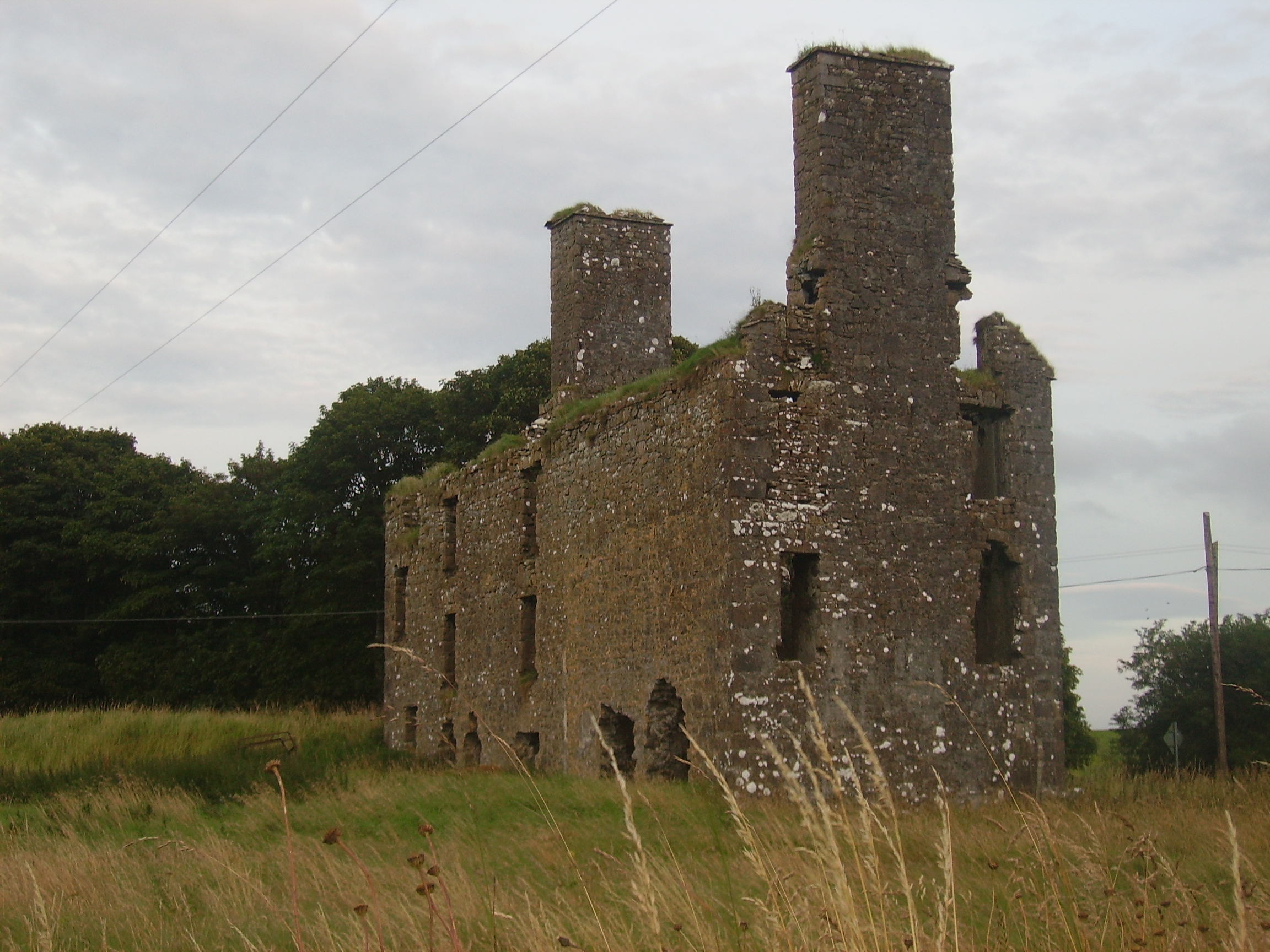
| Castlegrove | Originally a Blake house, it was occupied by the Lewins from 1888. Wilson refers to Castle-Grove as the seat of Mr. Blake in 1786. It would seem that this house was replaced in the nineteenth century as, although listed in Leets directory of 1814, the sale rental of 1852 records Castlegrove as a mansion house erected 'within the last twelve years'. It included a ballroom, oak staircase and numerous bedrooms. It was bought by John William Cannon. The sale rental includes a lithograph of the house. Castlegrove was burnt in 1922 and is now a ruin. |
|
| Newborough | Occupied by Lynch esq in the 1770s, this house passed to the Crean family by marriage. Newborough became a Blake house in the early 19th century. At the time of Griffith's Valuation there were two houses valued at £3 in the townland of Bunagarraun, occupied by Patrick Higgins and Margaret Higgins, who held from Patrick Crean Lynch. The original house is not extant. |
|
| Belmont | Home of the Blakes in the late 18th century and first half of the 19th century. Wilson refers to it as the seat of John Blake in 1786. Recorded as a steward's house at the time of Griffith's Valuation when it was held by James D. Meldon from the Bishop of Tuam. The original house is now a ruin. |
|
| Quarrymount | Built in the 1830s, Quarrymount [also known as Kilcloony] was the home of the Bodkin family in the latter half of the 19th century and is reputed to have replaced an early home in the nearby townland of Ardnagall. The house was leased to Edward O'Kelly in 1881 for 31 years. By the early 20th century it was in the hands of the Congested Districts' Board and passed onto the Land Commission who sold the house and 220 acres to the Gordon family. In 1971 Henry Gordon sold the house and remaining 20 acres. The house has been extensively renovated in the early 21st century by the Costellos. |
|
| Siller House | On the 1838 Ordnance Survey map Siller House is marked as a substantial residence in the townland of Kilcloony. However by the time of Griffith's Valuation there was no house of more than £2 valuation in the townland of Kilcloony. There is no house at this location on the 25-inch Ordnance map of the 1890s. | |
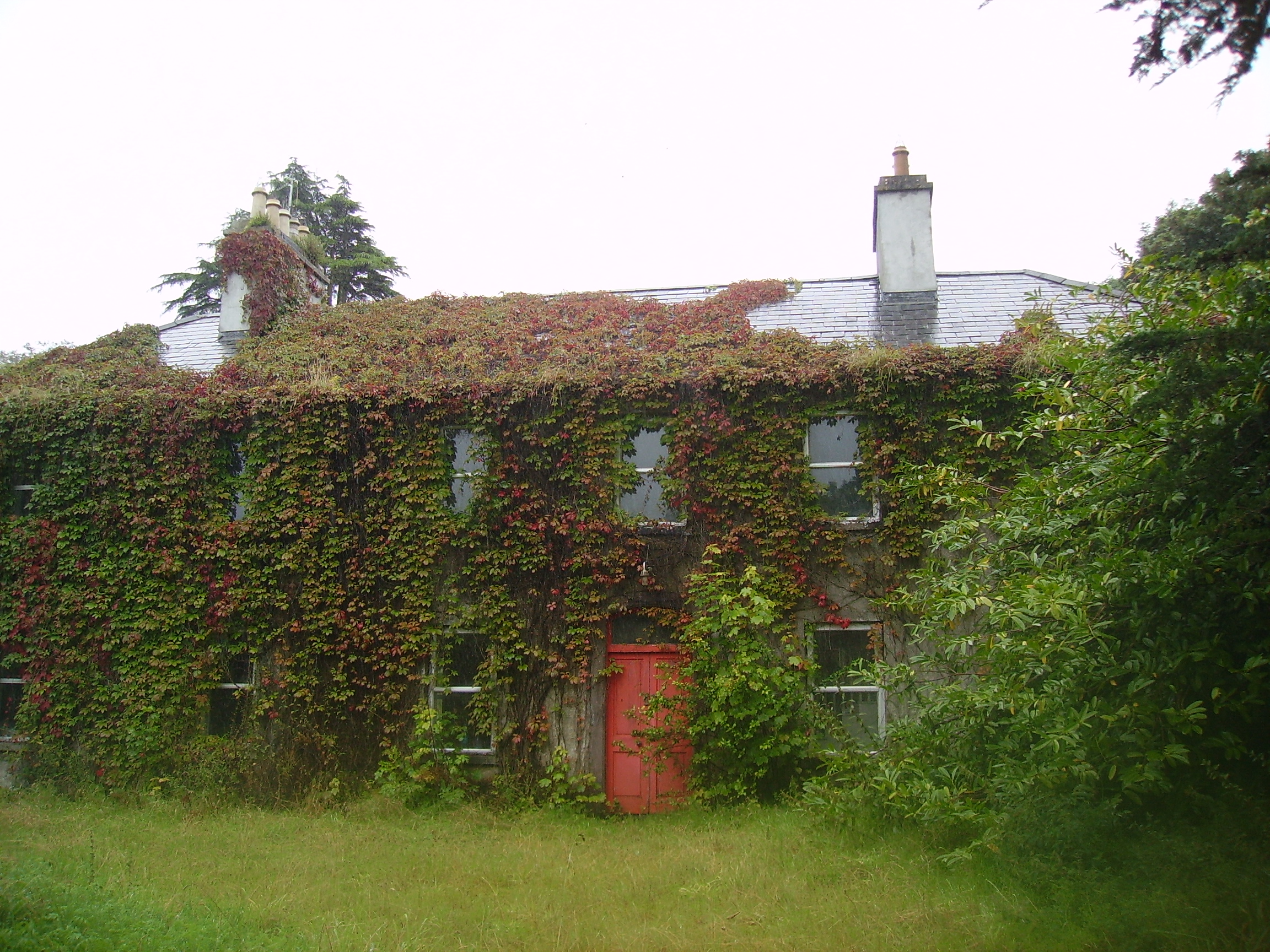
| Joyce Grove House [Browne's Grove] | A house at this site was occupied by the Joyces in the 1770s and in 1814. It is shown on the first edition Ordnance Survey map at M466578. The property was later acquired by the Browne family and is labelled Browne's Grove on the 25-inch map of the 1890s. A modern house is located in front of the site of the nineteenth century house. The impressive entrance gates still remain. |
![Photo of Joyce Grove House [Browne's Grove]](https://landedestates.ie/storage/img/orig/2505.jpg)
|
| Ironpool | A Jenings home, described as a "good thatched 2 -storey dwelling house" in 1852, occupied by George Jenings. It was held in fee by William Ogilvie at the time of Griffith's Valuation when it was valued at £6. It is now a ruin. |

|
| Blindwell | In 1786 Wilson refers to Blindwell as the seat of Mr. Kirwan. It was held in fee by Martin S. Kirwan at the time of Griffith's Valuation, when it was valued at almost £18. A fireplace still marks the site of the house which was demolished in the early 20th century. After 1900 this property was owned by the Websters, Nolans and now by the Fair family. Part of Blindwell also belonged to the Agricultural Institute. |
|
| Queensfort Lodge | An old building still appears to be extant behind a large modern house. |
|
| Dunmore House | William D. Griffith, brother of Richard Griffith of ''Valuation'' fame, was agent to Sir George Shee in the mid 19th century and lived at Dunmore House. In 1894 Slater refers to Dunmore House as the seat of Captain Robert W. Martin. A fine ruin situated on the edge of the golf course. |
|
| Castletown | The Knight of Glin stated that this was a late 18th century and early 19th century house built for the O'Haras. This may be the residence known as Tullinadaly, occupied by William Brannock, recorded in 1814, and by James Kirwan in 1837. Earlier, in 1786, Wilson refers to "Tullinadaly" as the seat of Mr. Bodkin. Valued at £15 and occupied by Laurence Mullins at the time of Griffith's Valuation. It is now a ruin. |
|
| Prospect | Richard Ouseley (1733-1804) rebuilt Prospect House and let it to Captain Charles O'Connor. The remains of outbuildings are still visible. |
|
| Dunmore Castle | A tower house occupied by the Ouseley family from the late 17th century. In ruins by the late 19th century. |

|
| Woodfield | Home of a branch of the Kirwan family in the 18th and early 19th centuries. By the time of Griffith's Valuation, the townland was owned by the Hancock family but no house had a substantial valuation. A house still exists at the site. | |
| Carrowpadden | Carrowpadden House is marked on the Taylor and Skinner map of 1778. In 1786 Wilson refers to it as the seat of Mr. Higgins. A herd's house occupied by Thomas Higgins who held it from James Higgins is recorded in the townland of Carrowpadden East at the time of Griffith's Valuation. It was valued at almost £5. This property appears to have been built after the first Ordnance Survey map was published. There is still a house extant at the site. | |
| Lowberry | The Encumbered Estates' Sale notice of May 1856 indicates that the mansion at Lowberry had "formerly" stood in the demesne and recommends it as a "most desirable site for building". It is shown on the First Edition Ordnance Survey map but no buildings are recorded in the townland at the time of Griffith's Valuation. It is labelled "Lowberry House (in ruins)" on the 25-inch map of the 1890s. A portion of these ruins still remain at the site. | |
| Brooklawn | A Blake home occupied by John Griffin in 1814. At the time of Griffith's Valuation Charles Blake held the townland of Fartamore from James Lynch. A house valued at £10 was being leased from him by the Bord of Works. Fartamore is still extant but unoccupied. |
|
| Oldtown | A single storey house until the early 20th century when a second storey was added to part of the house. Occupied by the Bourkes from the 18th century until the 1920s and then by the Curran family. Restored by the present owner in the late 1990s. |
|
| Cuillaun | Part of the Oranmore and Browne estate in the mid 19th century, occupied by Frenches, Brownes and by Edward Rush at the time of Griffith's Valuation, when the house was valued at £7. Now the home of the Donnellys. |
|
| Knocknagur | Sometimes spelt Cnocnagur. | |
| Gardenfield House [Kilcommon] | Another Bowen home, occupied by William Bowen in 1814. The townland was in the possession of Henry Martin Blake at the time of Griffith's Valuation. It is labelled Gardenfield House on the 25-inch edition Ordnance Survey map of the 1890s. Still a family home, renovated in the early 21st century. |
![Photo of Gardenfield House [Kilcommon]](https://landedestates.ie/storage/img/orig/731.jpg)
|
| Queensfort House | This house no longer exists. It was the home of a branch of the Leonard family in the 19th century. At the time of Griffith's Valuation it was held in fee by Stephen J. Leonard and valued at £16. |
|
| Dunmore Lodge | Melvin states that the Dunmore estate had been inherited by the Gores in the early eighteenth century and that Ralph Gore resided at Dunmore during that century. His mansion was subsequently in use as a barracks until it was destroyed during the Civil War in the early twentieth century. Marked on the Taylor and Skinner map of 1778 as the residence of the Earl of Ross and also noted as "the fine seat of the Earl of Ross" by Wilson in 1786. In 1814 Leet noted "Dunmore Lodge" as the residence of John Egan. | |
| Rockfield | Marked on the first edition Ordnance Survey map, this house was occupied by Henry French at the time of Griffith's Valution and was described as a herd's house. It was valued at £4 and was located on the estate of Lord Oranmore and Browne. Now derelict it was last occupied by the Dillon family. |
|
| Cloontreston | The notice advertising the sale of Michael Francis Treston's property at Cloontooa, barony of Clanmorris states that "the dwelling house with the offices, garden and demesne, known as Cloontreston, is in fair order and condition, suitable as a residence for a gentleman". At the time of Griffith's Valuation the townland was owned by John Treston who also held a herd's house there. The house is labelled Cloontreston on twentieth century maps. Buildings are still extant at the site. |