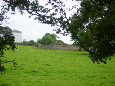
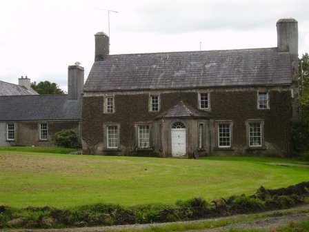
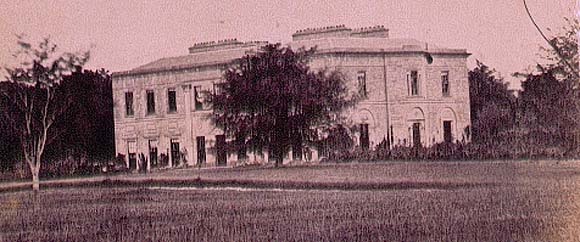
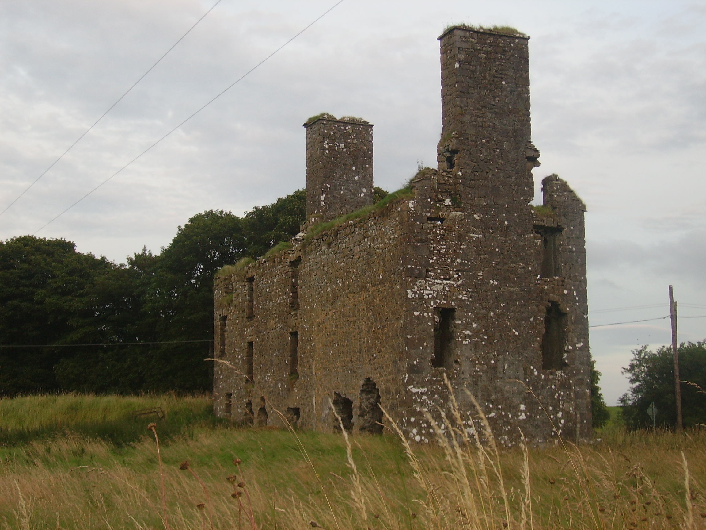
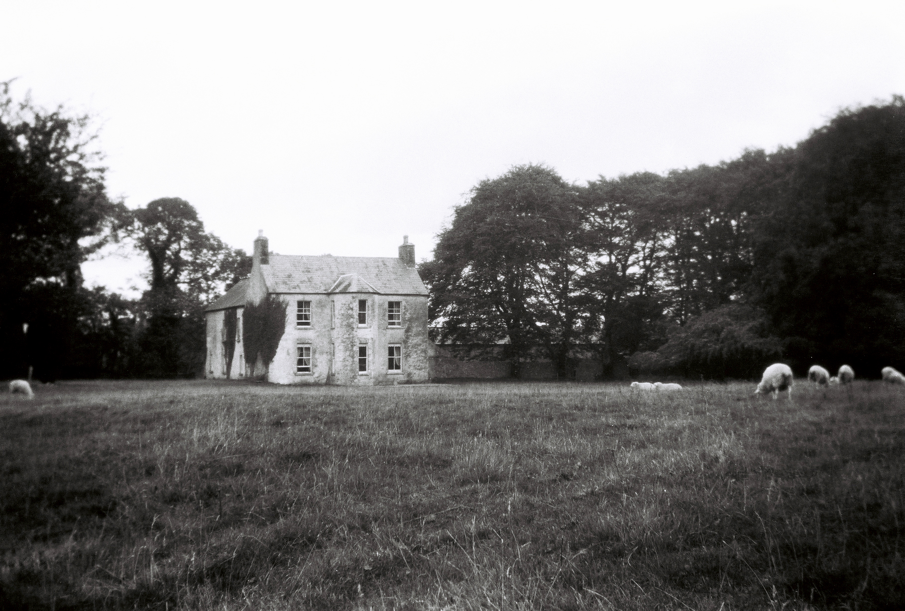
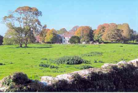
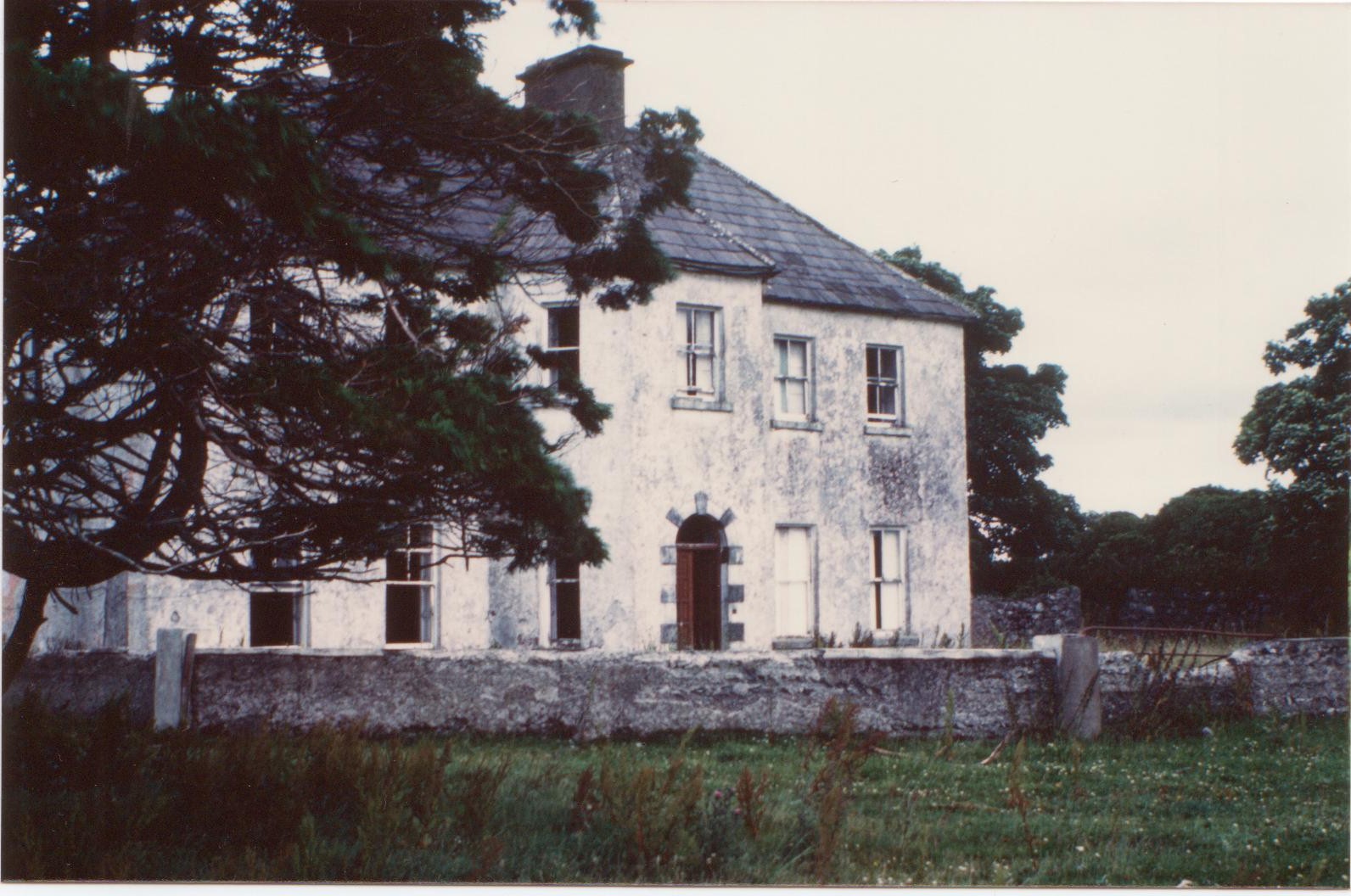
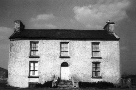
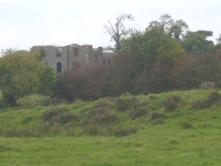
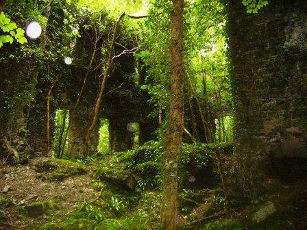
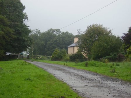
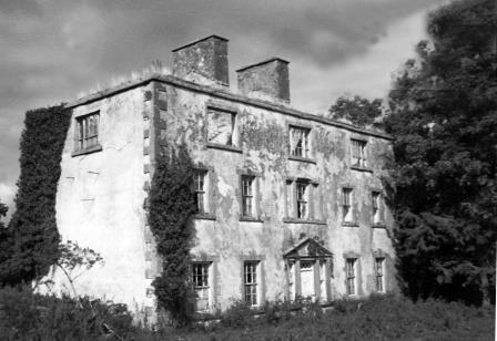
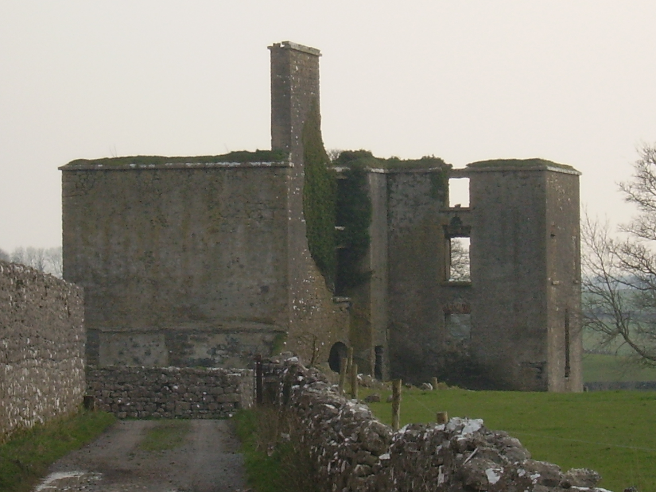
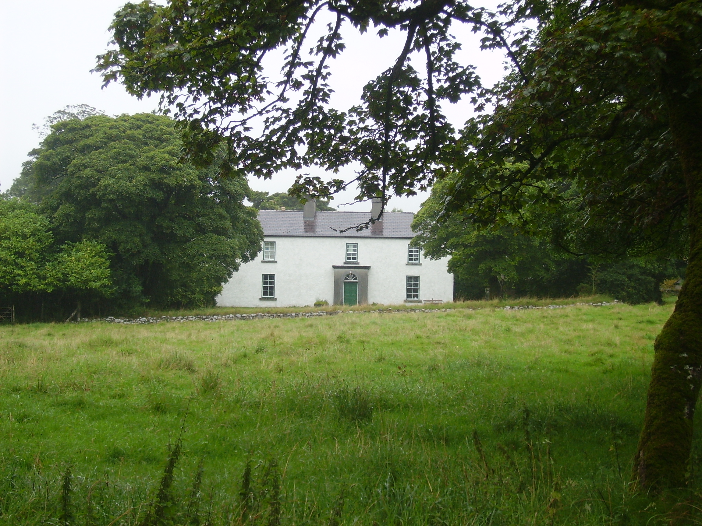
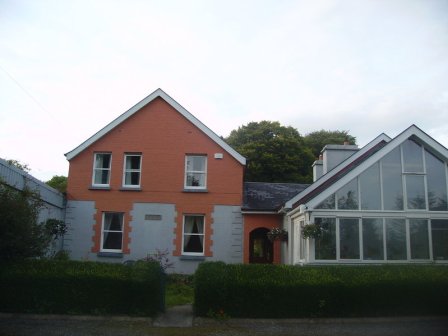
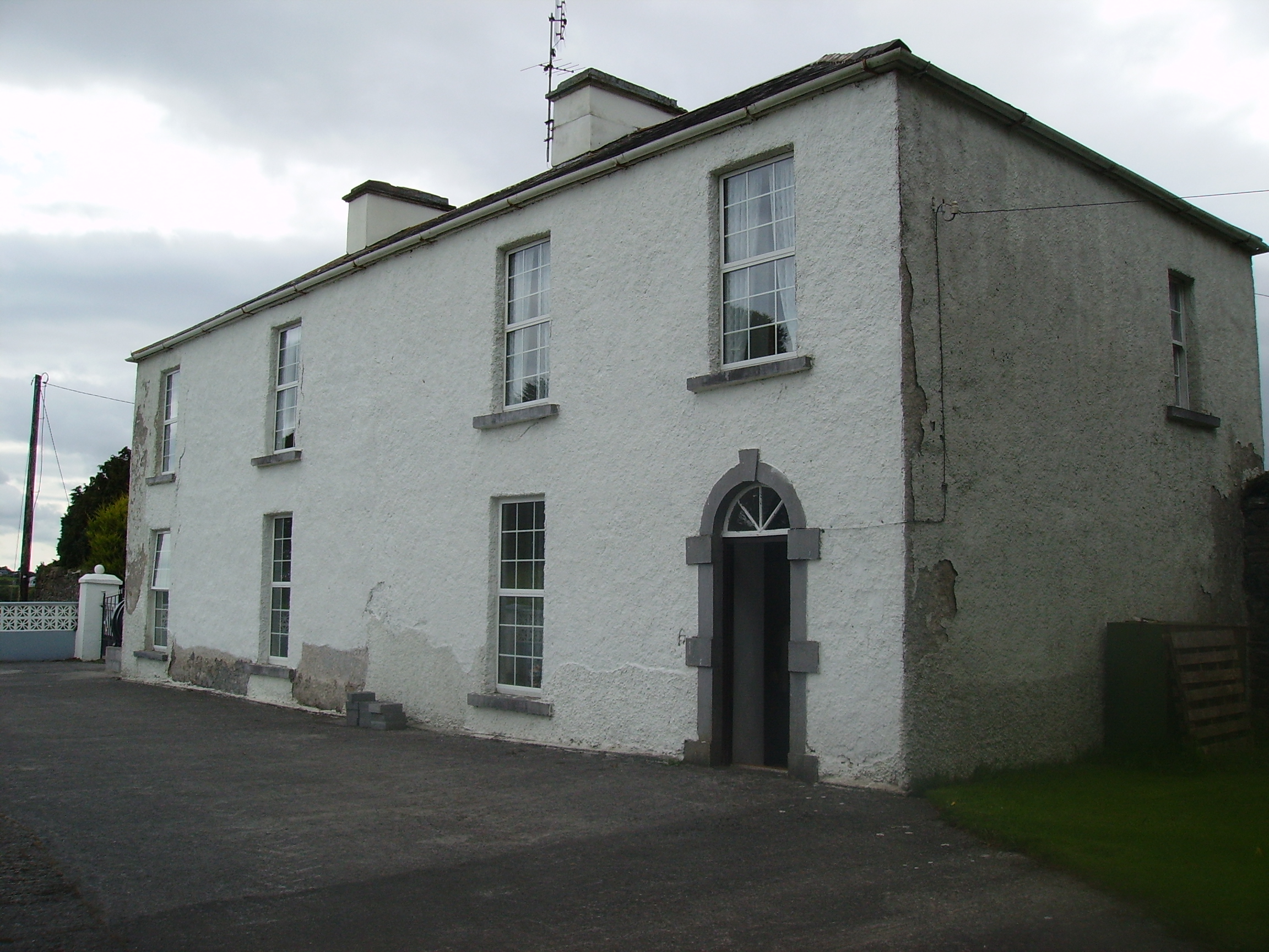
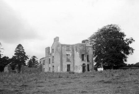
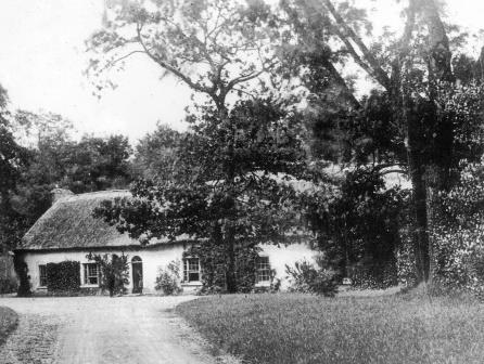
Knocknagur
Houses within 15km of this house
Displaying 81 houses.
Houses within 15km of Knocknagur
Displaying 81 houses.
| House name | Description | |
|---|---|---|
| Purrauns | Home of a branch of the Bell family of county Mayo and occupied by the Lynches in the mid 19th century. At the time of Griffith's Valuation it was occupied by Patrick King leasing from James Lynch when the buildings were valued at £5. Buildings are still extant at the site. |
|
| Barbersfort | Originally a Bermingham residence, sold to the Ruttledges in 1816 and recorded as the seat of Mrs. Rutledge in 1894. Burnt down in the 1920s apparently by accident. A new house was built on part of the site which adjoins the old farmyard. Now the home of the Dunlevy family. |
|
| Rathgranagher | A house on the Lindsey estate, lived in by Charles Cromie in the late 1830s. It was occupied by John Jackson at the time of Griffith's Valuation, leasing from Thomas Lindsey, when it was valued at £14. A house is still extant there. |
|
| Greaghans | At the time of Griffith's Valuation this property was held by Robert Bowen and occupied by Dominick Browne. The National Inventory of Architectural Heritage notes that it was later occupied by Robert T. Crawford, agent to Lady de Clifford. It is still extant. |
|
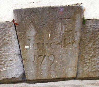
| Annefield | Built by Anthony Elwood in 1795, the property passed to the Blakes of Windfield, county Galway, in the mid 19th century. It was occupied by Charles Cromie in the 1830s and at the time of Griffith's Valuation by Emerson Dawson. It was sold to the Brannick family early in the 20th century and was bought by a Mr Fleishche in the 1980s, who restored the derelict house. The house was for sale in 2007. |
|
| Mount Jennings | Home of the Jenings family in the 18th and 19th centuries. Mount Jennings was held in fee by Benjamin Jenings at the time of Griffith's Valuation when the house was valued at £20. It was the childhood home of the ballad singer, Delia Murphy. Her parents still resided in the house in the 1940s. The roof was taken off the house in the 1970s and it is now demolished. | |
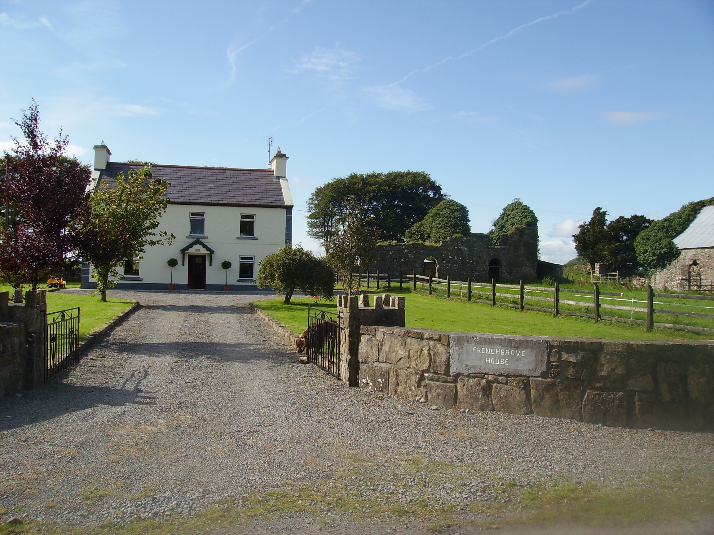
| Frenchgrove | A house marked as 'in ruins' on the 1915 edition of the 6 inch Ordnance Survey map. The Irish Tourist Association file describes Frenchgrove as the residence of the Blakes, later of the Frenches and finally of a man named Eager, a Dublin banker. No house of more than £3 valuation was recorded in Griffith's Valuation for the townland of Frenchgrove. A modern house now occupies the site with the remaining evidence of the old building. |
|
| Carravilla | There are actually two houses known as Carravilla and both are marked on the Ordnance Survey map of 1838. The house located at M265 637 is named Carravilla House and is situated in a small demesne. The other, smaller, house is located at M262 641. Carravilla was occupied by Robert Fair in the 1830s. At the time of Griffith's Valuation William Ruttledge occupied Carravilla which he held from David Watson Ruttledge. Both houses are still extant. |
|
| Ballyheeragh St Leger | This house was held in fee by Dominick Kearns at the time of Griffith's Valuation, when it was valued at £10. Bought by the Tierney family in the early 20th century and still occupied by them. |
|
| Bushfield | The original house, now a ruin, was sometimes known as Creaghduff. Creaghduff was occupied by Burke esq in the 1770s. Thomas Ruttledge of Bloomfield made his will at Bushfield in 1797 and died there in 1805. Bushfield was the home of Arthur Knox and his wife Barbara, nee Lambert. Their daughter, Elizabeth, married Annesley Knox of Rappa Castle. Barbara married Charles White as her second husband and sublet the house to Robert Fair, son of Robert Fair of Fortville. It was valued at £15 the time of Griffith's Valuation. Robert Fair of Bushfield had an only daughter, Jane, who married Thomas Ruttledge of Bloomfield and their second son took the surname Ruttledge Fair. A new house was built in the 1920s and is the home of the Delaney family. Extensive remains of the original Bushfield farmyard survive at the site. |
|
| Cloghansmore | Occupied by Martin P. Costello at the time of Griffith's Valuation, valued at £12. Still extant and occupied. | |
| Castlevilla | A Ruttledge family home in the 19th century, still extant and lived in. At the time of Griffith's Valuation it was leased by James Rutledge from Lady de Clifford's estate and valued at £18. |
|
| Fortville | Fortville was occupied by Robert Fair in 1814. At the time of Griffith's Valuation it was the residence of Anthony Kyne. Now the home of the Curran Flannery family, the Curran family having lived there since the 1910s. |
|
| Cloghans House | Lane esq was residing at Cloghan Castle in the 1770s. In 1786, however, Wilson refers to Cloghan Castle as the residence of Mr. Lewin. Ruane describes the house as early 18th century with 19th century alterations. It was held in fee by Henry H. Lewin at the time of Griffith's Valuation, when it was valued at £10. it was occupied by General Arthur Lewin in the early 20th century. He was an aviation enthuaist and went to live in Nairobi, Kenya, in the 1930s. Cloghans was sold to the McCartans in the 1940s and is now the home of the Kelly family. |
|
| Turin | Turin Castle has recently been renovated. The house no longer exists but some of the farm buildings are still visible. In the 1770s Kirwan esq occupied Turin Castle and in 1814 Arthur Browne was recorded as resident there. At the time of the first Ordnance Survey Samuel Lindsey Bucknall was living in Turin House and it was occupied by the Rutherfords in the 1850s. |
|
| Milford | Early 18th century house with some 20th century alterations. |
|
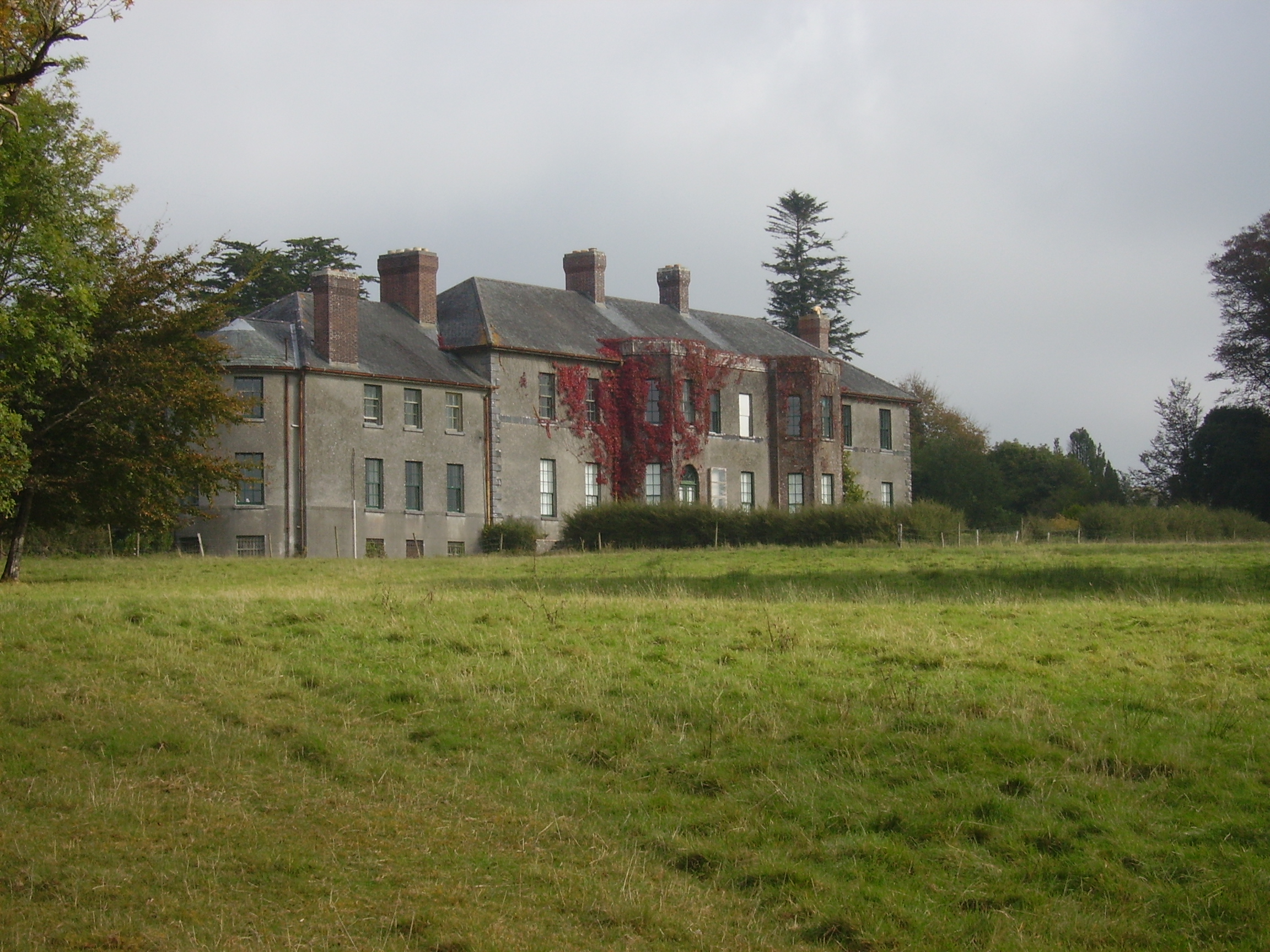
| Dalgan | Built in 1801 as the new home of the Kirwan family formerly of Claremount, Claremorris. It was bought by the Duke of Bedford in 1853 for Lady de Clifford, the wife of his first cousin. In the 1860s Henry Edward Joly and Charles Joly are recorded at Dalgan Park (''Connaught Telegraph'' 27 March 1867). In 1894 Slater noted it as the seat of Allan J. Algie. The house became a seminary for the missionary Society of St Columban in 1918. The Irish Tourist Association file describes the fine mansion as in ruins. It contained about 50 rooms and had been stripped of its roof and fittings about a year previously, circa 1944. It is now demolished. |
|
| Lakefield | In 1786 Wilson refers to the seat of Nicholas Reddington, situated near the lake. He may be referring to this house whch he says was "daily improving in beauty and commands a very extensive prospect". Home of James Fox in the 1830s. Occupied by John Commins at the time of Griffith's Valuation, leasing from the de Clifford estate. The house was valued at £8 at that time. It is still extant. | |
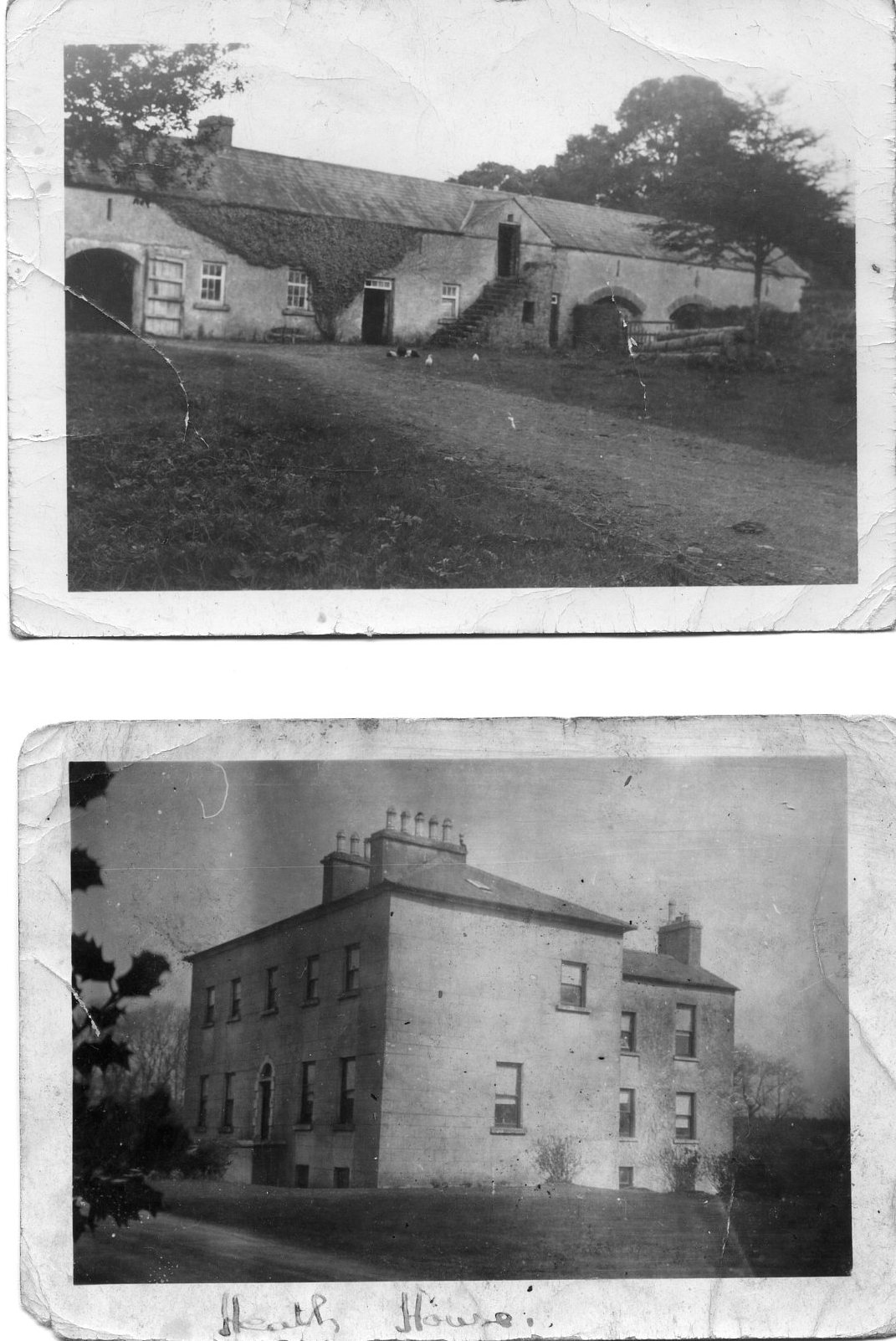
| The Heath | At the time of Griffith's Valuation, it was the property of Henry Blake and valued at £10. Described in 1863, when sold by the Blakes to the Tighes, as a substantial dwelling house with two reception rooms and six bedrooms, all in good repair. It is now a ruin. |
|
| Doonmacreena | In 1786 Wilson notes "Dunmacrene" as the seat of Mr. Blake. The sales rental of 1851 states that the old house at Doonmacreena was the residence of Mr Blake's ancestor 'now in ruins'. |
|
| Woodstock | There is no substanial house marked on the first Ordnance Survey map for the townland of Woodstock. | |
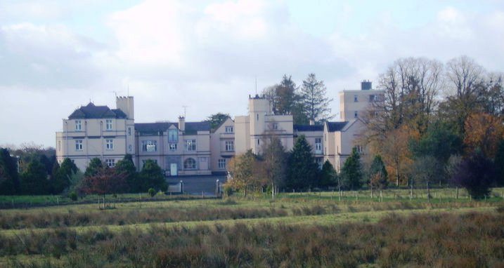
| Castlemagarret | In 1786, Wilson refers to CastleMacGarret as the seat of D.G. Browne, "a handsome seat, surrounded with one of the best wooded demeses in Ireland". The house, built in 1694, was destroyed by fire in August 1811 and a replacement built in the Tudor Gothic style. Robert Graham, in his journal of September 1836, refers to the fire and that "the present house is constructed out of the old offices, but is amazingly comfortable as far as it goes". Held in fee by Geoffrey Browne at the time of Griffith's Valuation, when it was valued at £25. The house functioned as a nursing home after it was sold by the Brownes in 1964. It is still extant but unoccupied. In 2015 it was offered for sale. |
|
| Dalgin | In 1786 Wilson refers to "Dalygan" as the seat of Mr. Birmingham. It was held in fee by Michael Bermingham at the time of Griffith's Valuation when it was valued at £17. Inhabited by the Birminghams and later the Kirwans until 1954, subsequently demolished. Out buildings still remain at the site beside a modern bungalow, the home of Mr John Curran. |
|
| Coolcon Castle | Originally a Burke castle and later a residence of the Blakes in county Mayo, very little of this castle now remains. | |
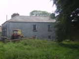
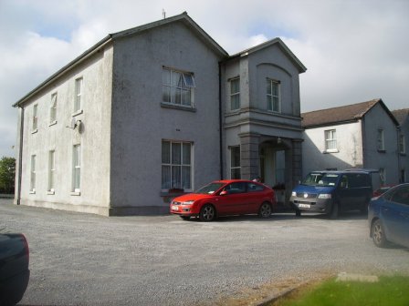
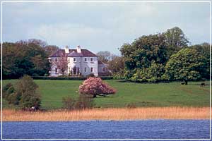
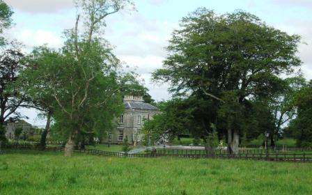
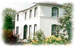
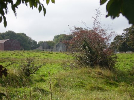
| River View [Donaghpatrick] | This house was occupied by James Kearns in the 1850s, leasing from the Duke of Bedford's estate, when the house was valued at £8. It is still extant and occupied. |
![Photo of River View [Donaghpatrick]](https://landedestates.ie/storage/img/orig/184.jpg)
|
| Ross Lodge | Occupied by Anthony Blake in the second decade of the 19th century and by Walter John Blake in the 1830s. It was leased by Walter Blake from Anthony Blake at the time of Griffith's Valuation, when it was valued at almost £9. Named as Ross Lodge on the first edition Ordnance Survey Map the house seems to gone by the time of the 25-inch map in the 1890s. This may be the property referred to by Wilson in 1786 as "The Lodge, beautiful seat"of a Mr. Shaw. | |
| Corrofin Lodge | At the time of Griffith's Valuation held by Pierce Blake in fee. The house was valued at £16. Some ruins remain at the site. |
|
| Thomastown | At the time of Griffith's Valuation, Thomastown House, barony of Clare, was occupied by James Clarke and valued at over £10. The National Inventory of Architectural Heritage indicates that this is a two-phase house, the original part dating from the early eighteenth century. It is still extant and occupied. |
|
| Waterville/Cloonkeen | The residence of John Connis in 1814, of - Cunneys in 1837 and of Jane D. Coneys in the 1850s when it was valued at £10. . It is labelled on the 1st and 25-inch edition Ordnance Survey Maps as Cloonkeen. The property is now a ruin. | |
| Sylaun | Descriptions indicate that Sylaun House, which was valued at £7 at the time of Griffith's Valuation, was a single storey, thatched structure. No trace now remains of the house though other estate architecture is visible. | |
| Toghermore | Held in fee by Hugh Henry at the time of Griffith's Valuation, when it was valued at £16. Toghermore is now a training centre for persons with disabilities run by the Health Service Executive. |
|
| The Grove | A house on the outskirts of the town of Tuam, occupied by Mrs Cheevers in 1814 and by Patrick Kelly at the time of Griffith's Valuation, who held it from Martin S. Kirwan. Earlier, in 1786, Wilson refers to it as the seat of Martin Kirwan. The house was described in the sale rental of the early 1860s as having two large reception rooms, eight bedrooms and two water closets. Run as a hospital by the Bon Secour Sisters 1945-2001. | |
| Mossfort | A house labelled Caherakeeny is shown here on the First ediiton Ordnance Survey map. It was valued at £12 and occupied by John Kilkelly at the time of Griffith's Valuation. The present house was constructed in the late nineteenth century and is labelled Mossfort on the 25-inch Ordnance Survey map of the 1890s. |
|
| Castlehacket | Castlehacket takes its name from the Hackett family who owned the land in the 14th century. An early 18th century house was built by the Kirwan family and lived in by their descendants until 1985. Wilson mentions it as the seat of John Kirwan in 1786. It was held in fee by Denis Kirwan at the time of Griffith's Valuation when it was valued at £40. Referred to as the seat of Bernard Percy Broderick by Slater in 1894. The original house of 3 storeys was burnt in 1923 and rebuilt at the end of the 1920s as a 2 storey house. The house has had a number of owners in the past 20 years. |
|
| Dennistown House | Built post 1838, occupied by Hugh Craven at the time of Griffith's Valuation and a centre for the Agricultural Institute in the late 20th century. | |
| Carrowbeg House | A former Bodkin house, the home of the Lynch family in the second half of the 19th century and early part of the 20th century. It was held in fee by Dominick Lynch at the time of Griffith's Valuation when it was valued at £8. It is still extant and in use. |
|
| Ballybanagher | A Nolan family home, now a ruin. It was held in fee by Andrew Nolan at the time of Griffith's Valuation when it was valued at £12. In 1894 Slater recorded it as the seat of Christopher R. Browne. |
|
| Ballinderry | The house was burnt in the early 1920s and nothing remains except the farm buildings, which are accessed through a stone archway dated 1843. Recorded as the seat of John Phillip Nolan, M.P.in 1894. |
|
| Lisdonagh | An O'Flaherty home, built in the late 18th century, sold to the O'Mahonys in the late 19th century and passed by marriage to the Palmers. Now functions as a guest house run by John and Finola Cook. http://www.irelands-blue-book.ie/lisdonagh.htm |
|
| Caherhugh | Occupied by John Lynch in 1814, by Mrs Martin in the 1830s and by Michael Cullinane at the time of Griffith's Valuation. The home of Mark Killilea (Member of the European Parliament) in the 1970s. The house no longer exists but a walled garden is still extant. |
|
| Mirehill | Home of Thomas Redington in 1814, Stepney St George in the 1820s and occupied by Michael Kelly in the 1850s, when it was valued at £4 and by Stephen R. Roche in 1906. It is no longer extant. | |
| Newgarden | The home of Edward Burton, Rector of Annaghdown and Vicar General of Tuam in the latter part of the 18th century. Occupied by Mrs Smith in 1814, in the 1830s by Roderick O'Connor and in the 1850s by Richard Jennings. In the Ordnance Survey Name Books it is decribed as a pretty lodge, the residence of the proprietor Lieutenant Daniel Smith. A modern house and some old farm buildings are still visible at the site. |
|
| Shrulegrove | The ruin of the castle at Shrulegrove remains as a prominent feature in the village of Shrule. On the Ordnance Survey map of 1838 a substantial house and gardens are marked in the townland of Shrulegrove. All the townland, including a herd's house and offices valued at £1, were held by Richard Golding from the Duke of Bedford at the time of Griffith's Valuation. |
|
| Ballintava | In 1906 Samuel Barret owned the mansion house at Ballintava which was valued at almost £14. The house is extant and appeared to be in the process of renovation in the early 21st century. |

|
| Carrowntryla | Occupied by Henry esq in the 1770s and in 1786. It was the home of the Handcock family in the 19th century, sold to Captain Dick in 1897 and occupied by him in the early years of the 20th century. Bought by Major Gerald Stratford Handcock in 1928 and inherited by his niece, Mrs Voss, who sold the house to Hector McDonnell, a Galway building contractor. The house is no longer extant. |
|
| Millbrook | Millbrook House was held in fee by John Bermingham at the time of Griffith's Valuation when the house was valued at £11 and the nearby mill (M412635) at £12. Both buildings are now in ruins. |
|
| Carnaun/Carnane | Carnaun was occupied by the Kirwan family in the mid 19th century when Mary Anne Kirwan was leasing from the Ecclesiastical Commissioners. The property was valued at £12. A house is still extant at the site. | |
| Castlegrove | Originally a Blake house, it was occupied by the Lewins from 1888. Wilson refers to Castle-Grove as the seat of Mr. Blake in 1786. It would seem that this house was replaced in the nineteenth century as, although listed in Leets directory of 1814, the sale rental of 1852 records Castlegrove as a mansion house erected 'within the last twelve years'. It included a ballroom, oak staircase and numerous bedrooms. It was bought by John William Cannon. The sale rental includes a lithograph of the house. Castlegrove was burnt in 1922 and is now a ruin. |
|
| Newborough | Occupied by Lynch esq in the 1770s, this house passed to the Crean family by marriage. Newborough became a Blake house in the early 19th century. At the time of Griffith's Valuation there were two houses valued at £3 in the townland of Bunagarraun, occupied by Patrick Higgins and Margaret Higgins, who held from Patrick Crean Lynch. The original house is not extant. |
|
| Kilcloghan | A house in the townland of Mount Potter, marked as Thornhill on the First edition Ordnance Survey map but as Kilcloghan House on the 25-inch map of the 1890s. Occupied by Charles Blake junior in 1850 and held from Jeremiah Tully. Subsequently the home of Arthur Netterville Blake. A modern house exists at the site now. | |
| Belmont | Home of the Blakes in the late 18th century and first half of the 19th century. Wilson refers to it as the seat of John Blake in 1786. Recorded as a steward's house at the time of Griffith's Valuation when it was held by James D. Meldon from the Bishop of Tuam. The original house is now a ruin. |
|
| Quarrymount | Built in the 1830s, Quarrymount [also known as Kilcloony] was the home of the Bodkin family in the latter half of the 19th century and is reputed to have replaced an early home in the nearby townland of Ardnagall. The house was leased to Edward O'Kelly in 1881 for 31 years. By the early 20th century it was in the hands of the Congested Districts' Board and passed onto the Land Commission who sold the house and 220 acres to the Gordon family. In 1971 Henry Gordon sold the house and remaining 20 acres. The house has been extensively renovated in the early 21st century by the Costellos. |
|
| Siller House | On the 1838 Ordnance Survey map Siller House is marked as a substantial residence in the townland of Kilcloony. However by the time of Griffith's Valuation there was no house of more than £2 valuation in the townland of Kilcloony. There is no house at this location on the 25-inch Ordnance map of the 1890s. | |
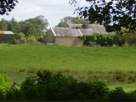
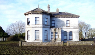
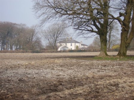
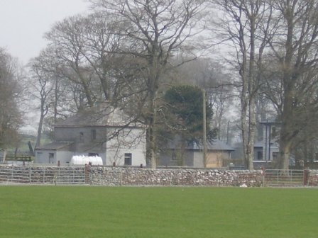
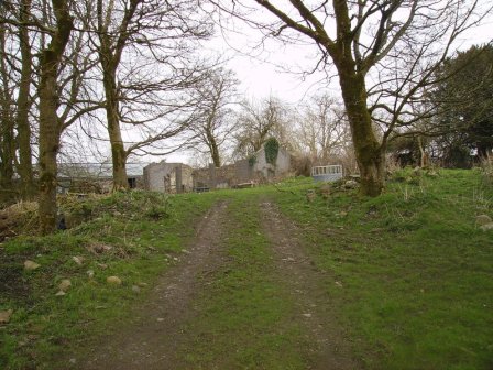
| Joyce Grove House [Browne's Grove] | A house at this site was occupied by the Joyces in the 1770s and in 1814. It is shown on the first edition Ordnance Survey map at M466578. The property was later acquired by the Browne family and is labelled Browne's Grove on the 25-inch map of the 1890s. A modern house is located in front of the site of the nineteenth century house. The impressive entrance gates still remain. |
![Photo of Joyce Grove House [Browne's Grove]](https://landedestates.ie/storage/img/orig/2505.jpg)
|
| Oakmount | Built post 1838 and occupied by Edward Kelly at the time of Griffith's Valuation when the house was valued at £9. A house is still extant at the site. |
|
| Bermingham/Birmingham House | An 18th century house which was originally the seat of the Bermingham family, Barons Athenry and Earl of Louth. Occupied by Richard D'Arcy in 1814 and uninhabited in 1837. It was leased to John Irwin Dennis the following year and bought by him in 1851 from Clifford Trotter. Since then the house has been the home of the related families of Dennis, O'Rorke and Cusack Smith. The house and demesne were advertised for sale early in 2007. The Clonbrock Estate Papers, Collection List 54 in the National Library contain early 19th century rentals of the Bermingham estate. |
|
| Ironpool | A Jenings home, described as a "good thatched 2 -storey dwelling house" in 1852, occupied by George Jenings. It was held in fee by William Ogilvie at the time of Griffith's Valuation when it was valued at £6. It is now a ruin. |

|
| Gallagh | Built in 1844 with money inherited by Cornelius O'Kelly from his uncle Count John Dillon O'Kelly. By the early 20th century this house was part of the estate of W.A. Ryan. Subsequently it was sold to the Congested Districts Board and then to Tobias Joyce of Leenane, county Galway. It was accidentally burnt in 1932. |
|
| Castlemoyle | Built in the 18th century, this house was the residence of Deane esq in the late 1770s and 1780s and occupied in 1814 by Thomas Browne. It was held by Edward Blake in fee in the mid 1850s when it was valued at £8. Sebastian Nolan bought it from the Blakes and lived there until the late 1880s. It is now a substantial ruin. |
|
| Gardenfield | Home of a branch of the Kirwan family from the late 18th century to the mid 20th century. The original house was replaced by the present house circa 1870. Following the death of Edward Kirwan the estate was divided by the Land Commission in the 1950s. Gardenfield House is now a bed and breakfast. http://www.corrib.net/BedBC14.htm |
|
| Blindwell | In 1786 Wilson refers to Blindwell as the seat of Mr. Kirwan. It was held in fee by Martin S. Kirwan at the time of Griffith's Valuation, when it was valued at almost £18. A fireplace still marks the site of the house which was demolished in the early 20th century. After 1900 this property was owned by the Websters, Nolans and now by the Fair family. Part of Blindwell also belonged to the Agricultural Institute. |
|
| Ballygaddy | Occupied by Kirwan esq in the 1770s and in 1786. It was the residence of Thomas Lally in 1814 and, from the 1830s, of John Daly, who held it from Nesbitt Kirwan. The house was valued at £5 at the time of Griffith's Valuation. The site is now occupied by farmbuildings. | |
| Queensfort Lodge | An old building still appears to be extant behind a large modern house. |
|
| Rockwell | The main residence of the Lynch family throughout the 19th century, valued at £13 in the mid 1850s. |
|
| Cloonteen | At the time of Griffith's Valuation occupied by George Jennings when the house was valued at £7. Some ruins remain at the site. | |
| Fear More | Occupied by William Roper junior at the time of Griffith's Valuation and by John J. Daly in 1906. | |
| Hazelwood House | Not built at the time of the first Ordnance Survey in the mid 1830s. Valued at £13 at the time of Griffith's Valuation. The remains of the stable buildings are still visible. |
|
| Dunmore House | William D. Griffith, brother of Richard Griffith of ''Valuation'' fame, was agent to Sir George Shee in the mid 19th century and lived at Dunmore House. In 1894 Slater refers to Dunmore House as the seat of Captain Robert W. Martin. A fine ruin situated on the edge of the golf course. |
|
| Castletown | The Knight of Glin stated that this was a late 18th century and early 19th century house built for the O'Haras. This may be the residence known as Tullinadaly, occupied by William Brannock, recorded in 1814, and by James Kirwan in 1837. Earlier, in 1786, Wilson refers to "Tullinadaly" as the seat of Mr. Bodkin. Valued at £15 and occupied by Laurence Mullins at the time of Griffith's Valuation. It is now a ruin. |
|
| Wilford | Occupied by W. Lindsey in 1837. A roofless ruin now occupies the site. |
|
| Prospect | Richard Ouseley (1733-1804) rebuilt Prospect House and let it to Captain Charles O'Connor. The remains of outbuildings are still visible. |
|
| Dunmore Castle | A tower house occupied by the Ouseley family from the late 17th century. In ruins by the late 19th century. |

|
| Clogherboy Cottage | David Rutledge was leasing a house valued at over £8 to James Kealy at Clogerboy, barony of Clare, at the time of Griffith's Valuation. The house was later known as Cahergal. There is still a building extant at this site. |
|
| Cloonmore | At the time of Griffith's Valuation the house was valued at £3 and was held in fee by Charles Grant.It is labelled Cloonmore on both the 1st and 25-inch edition Ordnance Survey maps but is no longer extant. | |
| Carrowpadden | Carrowpadden House is marked on the Taylor and Skinner map of 1778. In 1786 Wilson refers to it as the seat of Mr. Higgins. A herd's house occupied by Thomas Higgins who held it from James Higgins is recorded in the townland of Carrowpadden East at the time of Griffith's Valuation. It was valued at almost £5. This property appears to have been built after the first Ordnance Survey map was published. There is still a house extant at the site. | |
| Brooklawn | A Blake home occupied by John Griffin in 1814. At the time of Griffith's Valuation Charles Blake held the townland of Fartamore from James Lynch. A house valued at £10 was being leased from him by the Bord of Works. Fartamore is still extant but unoccupied. |
|
| Oldtown | A single storey house until the early 20th century when a second storey was added to part of the house. Occupied by the Bourkes from the 18th century until the 1920s and then by the Curran family. Restored by the present owner in the late 1990s. |
|
| Cuillaun | Part of the Oranmore and Browne estate in the mid 19th century, occupied by Frenches, Brownes and by Edward Rush at the time of Griffith's Valuation, when the house was valued at £7. Now the home of the Donnellys. |
|
| Rockfort | Valued at £4 in the mid 19th century when it was occupied by Thomas Bourke who held from David Ruttledge. The Westport Estate Papers contain two 17th century maps of Levallyroe in the possession of Gerald Dillon and held from the Blakes. The Malones also had an interest in Levallyroe and Boleyboy. | |
| Queensfort House | This house no longer exists. It was the home of a branch of the Leonard family in the 19th century. At the time of Griffith's Valuation it was held in fee by Stephen J. Leonard and valued at £16. |
|
| Woodquay Lodge | At the time of Griffith's Valuation James Joyner was leasing this property from the O'Conor Donelan estate when it was valued at £3. It is labelled as Woodquay Lodge on both the 1st and 25-inch edition Ordnance Survey Maps. Modern buildings occupy the site now. |
|