Ballina
Houses within 15km of this house
Displaying 94 houses.
Houses within 15km of Ballina
Displaying 94 houses.
| House name | Description | |
|---|---|---|
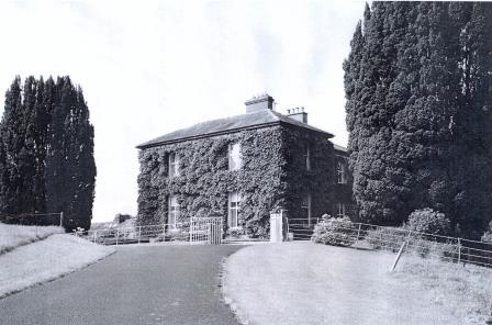
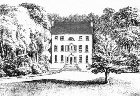
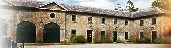
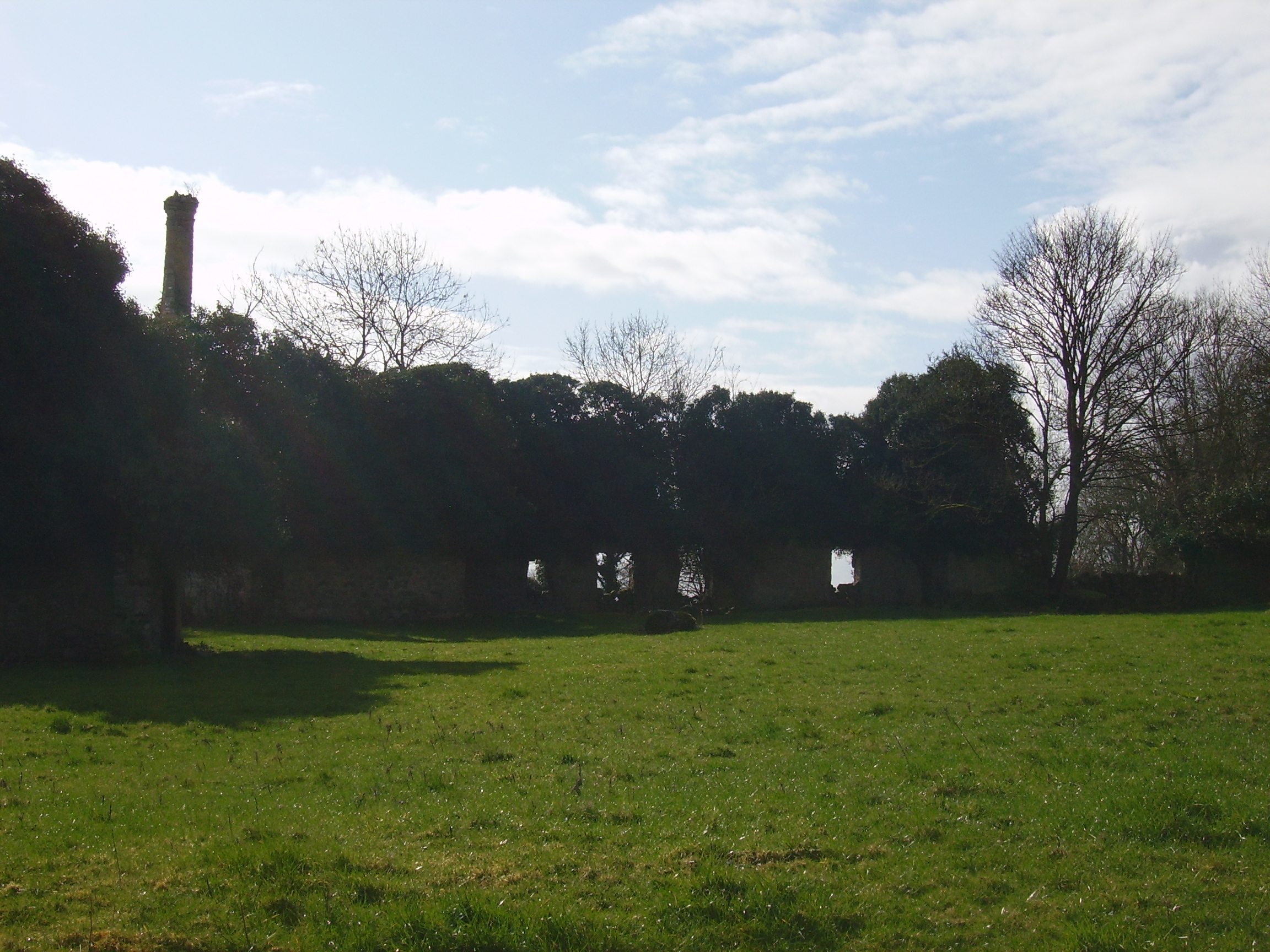
| Castleffrench | Castle ffrench is said to have been built c.1779 by Charles Ffrench, then Mayor of Galway. Wilson, in 1786, in one instance refers to "Clougher" as the seat of Mr. French but in a later reference notes Castle-French as "the fine seat of Sir Thomas French". In 1814 and again in 1837 it is recorded as the residence of Lord French. In 1856 it was occupied by James Thorngate when it was valued at £40. It is still extant and occupied and in 2006 was offered for sale. |

|
| Ticooly/Tycooly | Occupied by the O'Kellys in the 18th and early 19th centuries. By the time of Griffith's Valuation it was part of the Clonbrock estate and was valued at £16. A building on a slightly different site, is noted as Tycooly House on the 25-inch Ordnance map of the 1890s. There is still an extant property at this site. |
|
| Caltra Lodge | The home of P.J.Joyce in the late 1830s and of Mary Joyce in the 1850s. The Joyces held this house from the Bellews of Mount Bellew. On the 25-inch map of the 1890s it is labelled as Caltra Park. The ruin of the original house was visible until the end of the twentieth century, | |
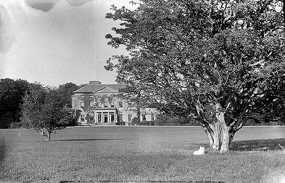
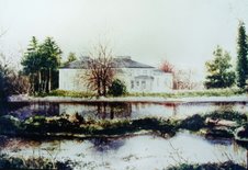
| Clonbrock | Designed by William Leeson and built in the 1780s. In 1837 Lewis recorded it as the seat of Lord Clonbrock. In 1786 Wilson refers to Clonbrock as the seat of R. Dillon. At the time of Griffith's Valuation the house at Clonbrock was valued at £100. In 1906 it was valued at £135. The house was badly damaged by fire in the 1980s and only one wing is now inhabited. |
|
| Ballybaun | At the time of Griffith's Valuation, Lord Clonbrock owned a mill, gate house and other buildings valued at £35 in the townland of Ballybaun, parish of Ahascragh. The gate house is still extant and occupied. Local sources suggest it was at one time used as a school for children in the area. |
|
| Ahascragh Glebe/Rectory | At the time of Griffith's Valuation, Rev. Sir William Mahon was leasing a house valued at £20 in the townland of Ahascragh West, barony of Kilconnell, to Reverend Peter Browne. He was also leasing property in this townland to Thomas Hunt. Reverend Mahon was rector of Rawmarsh, Yorkshire. This property is still extant and occupied as a private house. |
|
| Pallas | At the time of Griffith's Valuation John J. Bodkin was leasing a property at Pallas, parish of Fohanagh, to Thomas O'Connor. The house was valued at £3 but was accompanied by over 600 acres. A new house appears to have been constructed after the publication of the 1st edition Ordnance Survey map. It is labelled Pallas on the 25-inch edition of the 1890s. It is now derelict. |
|
| Doon House | At the time of Griffith's Valuation Charles Filgate was leasing a house valued at £5 and 400 acres from the Clonbrock estate. In the 1830s, he is noted in the Ordnance Survey name books as the agent for several county Galway estates, including the Mahons of Castlegar and the Blakeneys of Abbert. Doon House wsa constructed within a ring fort and the remains of the building still exist. | |
| Lowville | Lowville was originally the seat of Nathanial Lowe who held this estate in the mid-18th century and Wilson refers to it as his seat in 1786. In 1814 it was the residence of the Hon. Mrs. Low. In 1837 Lewis recorded Lowville as the seat of W. McDonagh. It was still occupied by Walter McDonagh in the 1850s and was valued at £45. By 1906 it was in the possession of Bernard Connaughton and was valued at £33. It was later the home of the Byrne family but was sold in the early 1970s and ceased to be residential. It is now a ruin. |
|
| South Park | At the time of Griffith's Valuation, Lawrence Kerrans was leasing a property valued at £11 from the Clonbrock estate at Kilglass, parish of Ahascragh. It is not named on the first edition Ordnance Survey Map but is labelled South Park on the 25-inch edition produced in the 1890s. The house is still extant and occupied. |
|
| Creggaun House | Bar Kelly was living at Cregan in 1749. At the time of the first Ordnance Survey it is mentioned as the home of Captain Masters. William Masters was leasing a house valued at £16 in Creggaun townland, parish of Ahascragh, from the Clonbrock estate at the time of Griffith's Valuation. This property is no longer extant. | |
| Clooncannon/Cloncannon/Runnamead | Far Kelly was resident at Cloncannon in 1749. It is described in the Ordnance Survey Name Books as the residence of William Kelly. This property was offered for sale in the Encumbered Estates in July 1850. At that time it was occupied by Mathew C. Browne. John and Edward Lennon were occupying this property, valued at £9, at the time of Griffith's Valuation. It was part of a holding of almost 400 acres. Joseph Trumperant Potts laid the foundation stone for his house known as Runnymeade in 1866 (''Saunders Newsletter'', 23 June 1866). It is labelled as Runnamead House on the 25-inch Ordnance Survey map of the 1890s. In 1906 a house valued at £10 at Clooncannon Kelly was part of the Clonbrock estate together with almost 400 acres of untenanted land.. It is no longer extant. | |
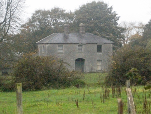
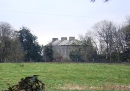
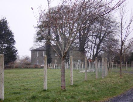
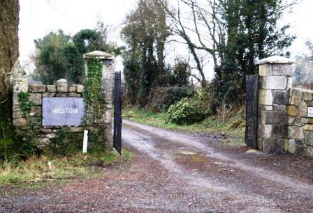
| Weston | John D. Mahon was leasing this property, valued at £35, from Sir William Mahon, at the time of Griffith's Valuation. It is described as unoccupied at the time of the first Ordnance Survey. The National Inventory of Architectural Heritage indicates that the original Weston house is now demolished. A smaller house, known as Weston Lodge, was also located in the demesne (M779403). It is no longer extant. |
|
| Annaghbeg House | John Moor lived at Anabeg in 1749 and in 1814 this was the residence of Edmund Moore. In the 1830s it is described by the Ordnance Survey Name Books as the residence of F. Grady and in bad repair. Charles Bailey was leasing the property at Annaghbeg, parish of Ahascragh, barony of Clonmacnowen from Hubert Moore at the time of Griffith's Valuation. Annaghbeg House is described as "in ruins" on the 1948 edition of the 6-inch OS map. Another house, known as Annaghbeg Cottage is located nearby at M823356. Buildings are still extant at the latter site. | |
| Ballyglass House | James Mahon, a brother of Ross Mahon of Castlegar, was residing at Balliglass in 1749. The Ordnance Survey Name Books record it as the residence of George Clarke in the 1830s. A herd's house valued at £5 and over 250 acres of the Mahon estate were located at Ballyglass in the parish of Ahascragh at the time of Griffith's Valuation. A house still exists at the site. | |
| Sonnagh | Walter McDonagh was leasing a property at Sonnagh, parish of Fohanagh, barony of Clonmacnowen, from the Clancarty estate at the time of Griffith's Valuation. He was also the occupier of a mill at Pollboy, valued at £95, in this parish. His estate was centred on Lowville in the barony of Kilconnell. A house still exists at the Sonnagh site. | |
| Craig's Hotel | John H. Craig was leasing a property valued at £65 at Back, parish of Kilcloony, barony of Clonmacnowen from the Clancarty estate at the time of Griffith's Valuation. He was running this property as a hotel. In Slater's Commerical Directory, 1846, Craig's hotel was located on the Main Street in Ballinasloe. The Royal Mail car called there on its way from Galway to Dublin. | |
| Cleaghmore | Andrew Montgomery was leasing a house valued at £13 from the Clancarty estate at Cleaghmore, parish of Kilcloony, barony of Clonmacnowen, at the time of Griffith's Valuation. | |
| Cleaghmore Villa | A vacant house, valued at £11 and part of the property of Norman Ashe, was located at Cleaghmore, parish of Kilcloony, barony of Clonmacnowen at the time of Griffith's Valuation. This is possibly the house shown on the 25-inch Ordnance Survey map of the 1890s as Cleaghmore Villa which is still extant. |
|
| Cleaghmore B & C | At the time of Griffith's Valuation, the Clancarty estate was leasing two houses in this townland to members of the Le Poer Trench family, one (Cleaghmore B) valued at £23 and the other Cleaghmore C) at £21. They were leased by Mrs. Le Poer Trench and Robert Le Poer Trench respectively. | |
| Deerpark | At the time of Griffith's Valuation, James Horsman was leasing buildings valued at £28 which included a mill, at Deerpark, parish of Kilcloony, barony of Clonmacnowen, from the Clancarty estate. The property was in ruins by the 1890s. | |
| Perssepark | At the time of Griffith's Valuation, William Persse was leasing a house valued at £10 from Dudley Persse at Perssepark, parish of Kilcloony, barony of Clonmacnowen. Earlier, in 1837, Lewis recorded Perssepark as the residence of S. Masters. Now the site of modern industrial development. | |
| Fairfield (Kilgerrill) | Wilson, writing in 1786, notes Fairfield as the seat of Mr. O'Brien. In 1837, Lewis records Fairfield as the seat of John O'Brien. At the time of Griffith's Valuation Fairfield was leased by James Thorngate to Daniel Cruise. Taylor and Skinner record Fairfield as a seat of the O'Brien family in 1783. The original house is not extant. |
|
| Heathview House | At the time of Griffith's Valuation, Christopher Usher was leasing buildings including a mill, valued at £25, to William Usher, in the townland of Kilgerrill, barony of Clonmacnowen. Earlier, in 1837, "The Lodge" in the parish of Kilgerrill was recorded by Lewis as the seat of William Usher. Described by the Ordnance Survey Name Books as "in good repair", it was then the residence of J. Usher. A house still exists at the site. | |
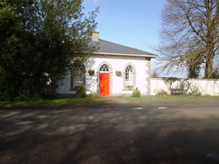
| Killian | This house was the main residence of the Cheevers family, valued in the mid 19th century at £45. The house is no longer extant but the gate lodge survives. |
|
| Dalysgrove | The Ordnance Survey Name books describe Dalysgrove as the residence of Peter Daly and in good repair. At the time of Griffith's Valuation, Francis Daly was leasing the property at Dalysgrove valued at £32 from Peter Daly. The house was in the possession of Peter F. Daly in 1906. Sold by the Dalys in 1928, the shell of the house and parts of the walled garden remains. |
|
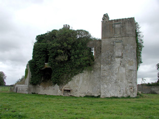
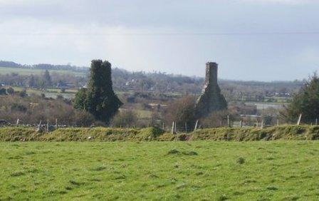
| Aghrane Castle/Castle Kelly | A 16th century tower house with 19th century additions. Castle-Kelly is recorded by Wilson as the seat of Denis Kelly in 1786. Lithographs of the entrance to Castle Kelly, Castle Kelly and Ballygar town are included in the sales rental of 1863. It was bought by the Bagots, sold by them to the Department of Agriculture in 1910 and demolished in 1919. Parts of the demesne are now owned by Coillte, the Forestry Service. |
|
| Ballybaun | Wilson refers to Ballybawne as the seat of Mr. Kelly in 1786. Occupied by John Kelly in 1837 and by John Mahon at the time of Griffith's Valuation. The sales rental of 1863 includes a lithograph of Ballybaun, which was described as 4 storeys high. The house was occupied by the Mahon family until 1916 when it was taken over by the Congested Districts' Board. It is no longer extant. |
|
| Thornfield | Occupied by John Mahon at the time of Griffith's Valuation and held from the Kellys. The sales rental of 1863 includes a lithograph of Thornfield which was sold privately to Christopher Bagot. It continued to be occupied by the Mahon family until 1917, when it was taken over by the Land Commission, Henry English inhabited the house until the 1950s. This house on the Galway/Roscommon border now appears to be a ruin, with a substantial garden wall still intact. |
|
| Riversdale | In the 1830s the house is described as "on rising ground and in good repair" Held by James Kelly in fee at the time of Griffith's Valuation when it was valued at £22. The original house is no longer extant. | |
| Rookwood | The house, located on the border between counties Galway and Roscommon, was built in the late 1720s by a branch of the Ormsby family of Tobervaddy. Jane Ormsby married Robert Waller. Both Wilson and Taylor and Skinner record that Rookwood was occupied by Major Waller in the 1780s. The house was later leased by the Thewles family. Edmund Kelly purchased the lease of Rookwood from his cousin, James Thewles, in 1800. The house was occupied by the Taaffes in the early 19th century and by the Kellys from the 1830s. In 1900 Dr Charles E. Crean of Ballyhaunis bought Rookwood and sold it to the Land Commission in 1922. The house was intermittently occupied until the 1940s and gradually became derelict. |
|
| Muckloon | In 1786 Wilson mentions "Muckland" as the seat of Mr. Kelly. Occupied in the mid 1850s by Richard P. Lloyd to whom most of the Kelly estate was let. The house was then valued at £20. It is no longer extant. | |
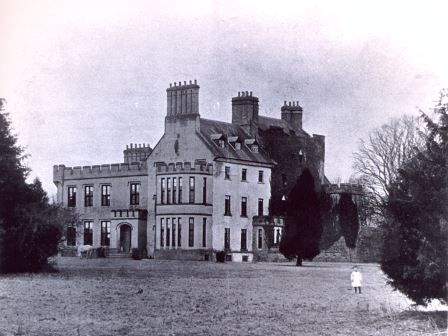
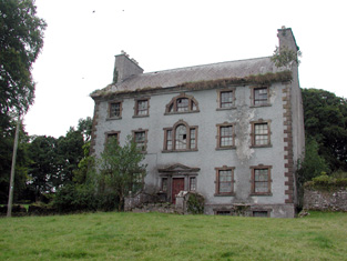
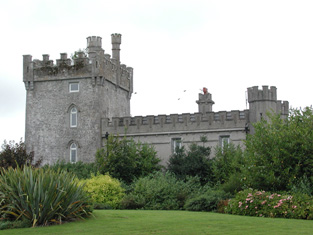
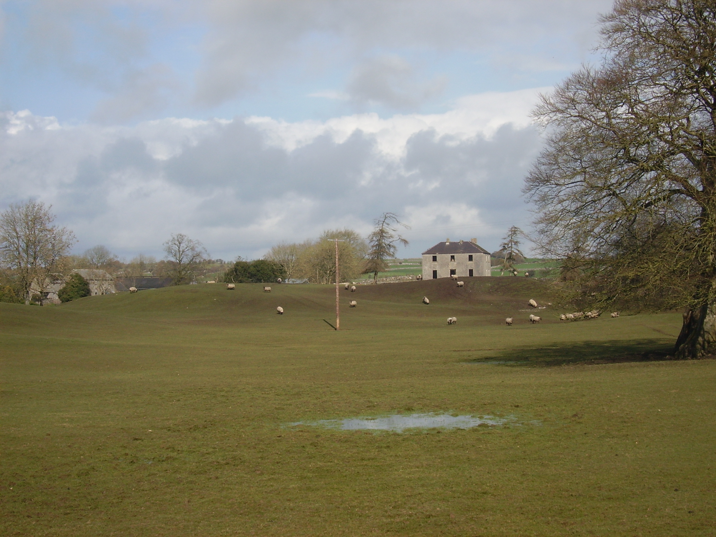
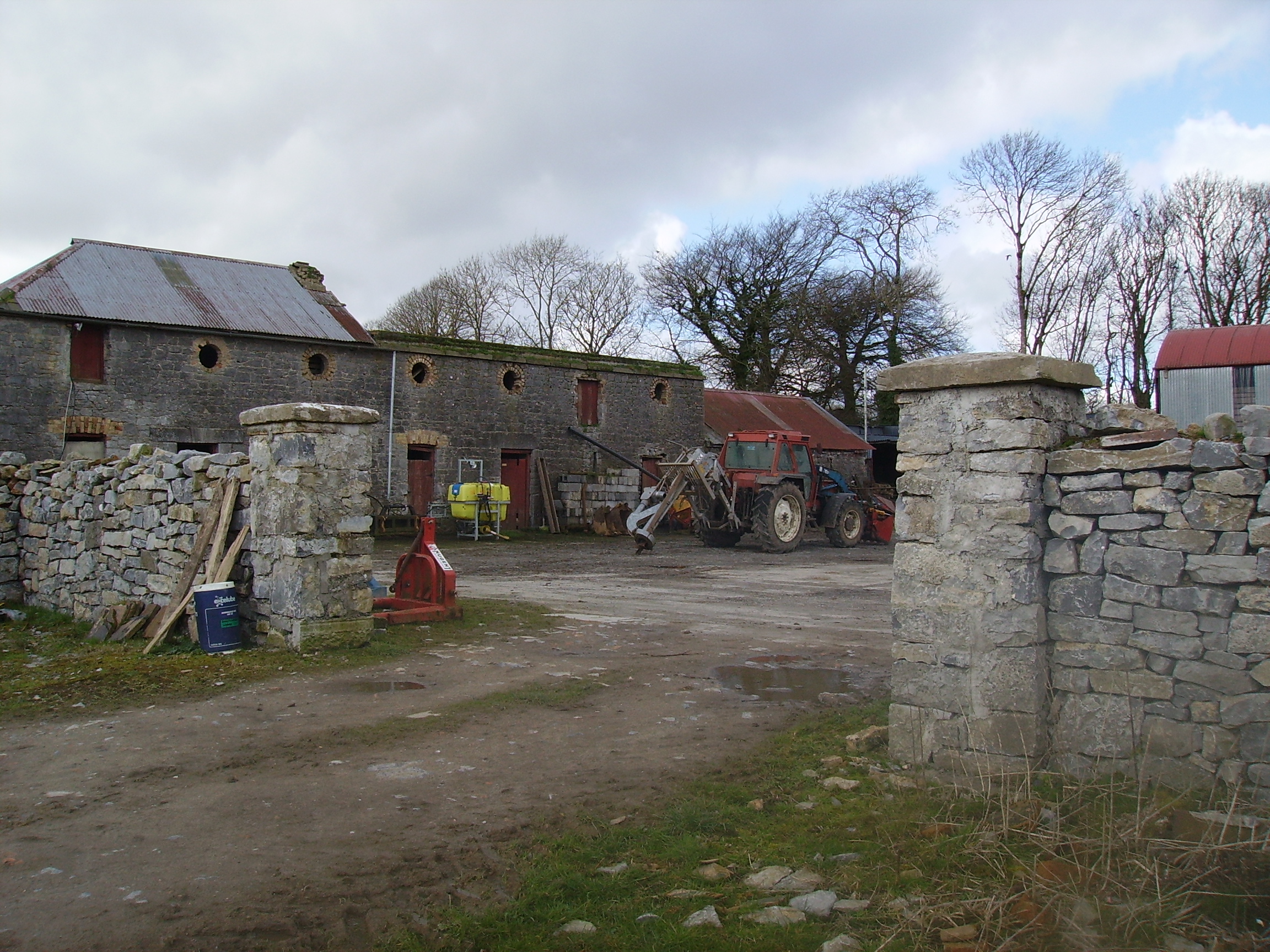
| Castlegar | The principal residence of the Mahon family, designed by Sir Richard Morrison circa 1801, replacing an earlier house. Wilson, writing in 1786, refers to this earlier house as the seat of Mr. Mahon. In the 1830s the Ordnance Survey Name Books describe it as in good repair but Sir Ross Mahon was not resident there at the time. Sir William Mahon was still in possession of the property in 1906 when it was valued at £67. In 1979 the house was sold by the Mahons to John Horan, who advertised the house for sale again in 1988. The house is still extant. |
|
| Ballinamore House or Curraghboy Lodge | The residence of Martin ffrench held by him in fee at the time of Griffith's Valuation and valued at £35. The house is noted on the 1st edition OS map as Curraghboy Lodge. In 1906 the owner was Michael Neary. |
|
| Ballinlass | William Kelly was residing at Ballinglass, parish of Killeroran, in 1749. Occupied by Nicholas D'Arcy from the 1830s to the early 1850s and by Malachy Fallon in the mid 1850s. Buildings exist at the site. | |
| St Brendans | Occupied by the Honourable Thomas ffrench from the 1830s to 1850s who held the house from the Honourable Martin ffrench. It is now almost ruinous. |
|
| Claremont | Described in the Ordnance Survey Name Books as a 'neat modern building', the house was located close to the bank of the River Suck. It was the home of Gonville ffrench and he held it from the D'Arcy family. In the D'Arcy sales rental of May 1851 there is reference to 'the splendid mansion' of Gonville ffrench. Occupied by the Honourable Clarinda ffrench in the 1850s who held the property from the Right Honourable Richard W. Greene, valued at £21. The house is now a ruin. |
|
| Woodbrook | Originally a Netterville home, Woodbrook was located in the demesne of Netterville Lodge and is marked on the first Ordnance Survey map of 1838. At the time of Griffith's Valuation it was described as a steward's house valued at £5. It is now a ruin. | |
| Corra More | The residence of Colonel W. Caulfield in 1814. The home of Christopher Balfe, ninth son of Walter Balfe of Heathfield, in the 1830s. John Cornwall occupied the house in the mid 1850s when the house was valued at £23. Extensive high walls as well as the yard remain but the present owners live in a modern bungalow. |

|
| Mount Talbot | Built circa 1750, Mount Talbot is recorded by Wilson as "the fine seat of William J. Talbot" in 1786. It was enlarged by William Talbot in the 1820s. The house was valued at £70 at the time of Griffith's Valuation. A nursery business operated in the gardens in the 1890s. Burnt in 1922 and now a ruin. |
|
| Rocksavage | The home of Waldrons and Ormsbys in the 18th century.In 1786 Wilson refers to it as the seat of Mr. Waldron. The residence of Jeffrey French in 1814 and occupied by Mr Smith at the time of the first Ordnance survey and by Samuel Hodson who held it from William Longfield in the 1850s. Occupied by Robert O. Longfield in 1906. A modern house now occupies the site but some old farm buildings still remain. |

|
| Keenagh | Described at the time of Griffith's Valuation as a steward's house, held in fee by Percy Magan and valued at £4.10. The ruins of the building still exist at the site. |

|
| Lackan | Occupied by James Lyster in 1814 and by Patrick McDonnell at the time of Griffith's Valuation. The house is modernised and still used as a family home. |

|
| Castlestrange | Named after the L'Estrange family who held the land and castle in the late 16th century, Castlestrange appears to have belonged to the Gunning family early in the 18th century. A house was built by the Mitchell family in the 18th century which at the time of Griffith's Valuation was valued at £47. In 1894 the residence of James Mulry and occupied by Thomas Mulry in 1906. The original house, coach house and stables are now in ruins but other outbuildings have been converted into a home. |

|
| Churchboro | Occupied by Edward Kelly in 1814, E. Kelly in 1837 and by Patrick Grehan at the time of Griffith's Valuation. The house is no longer extant. |

|
| Scregg | A Kelly home built in 1767, occupied by J.E. Kelly in 1837 and Eliza Kelly in the 1850s. In the sale rental of 1856 the house is described as a respectable mansion, 3 stories high with basement and attic stories and a view of the Shannon River. Occupied in 1906 by the representatives of Henry Potts. The house is extant but no longer lived in. It is currently (2009) being restored with support from the Irish Georgian Society, see http://www.igs.ie/Programmes/Conservation-Grants/Scregg-House.aspx |
|
| Rahara | In the 1830s and at the time of Griffith's Valuation the home of Alexander Sproule who held Rahara from the Blake Knox family. The house was originally a thatched one storey building. On the night of the Big Wind in 1839 the thatch was blown away and the house was rebuilt with an additional storey and a slate roof. Now the home of the Donnelly family. |

|
| Longfield | The Sproules were settled at Longfield from the late 17th century. At the time of the first Ordnance Survey described as a house of small dimensions with ruins attached on the south side. Lewis records Longfield as the residence of P. Sproules. The house is now a ruin. |
|
| Bushy Park | Early 18th century house, used as a school for the sons of Protestant clergymen. Occupied by Andrew Lyster in 1814. The residence of James Barlow in the 1830s and in the mid 1850s. Bushy Park became the home of the ffrench family in the 1860s, who bought out the property in the early 20th century. Dr Noelle Davies, author and poet, was a 20th century member of the ffrench family. This house is now the home of Laurence and Helga Mullins. |
|
| Coolderry | Occupied by Thomas Kelly in 1814 and by Bryan Fenerty in the 1850s. | |
| Tobervaddy | The Ordnance Survey Field Name Books record the ruins of an old castle. The Discovery map mark a fortified house. A branch of the Ormsby family resided at Tobervaddy in the 18th century. and Wilson, writing in 1786 refers to Tobervaddy as the seat of Mr. Ormsby. Robert Irwin held the townland at the time of Griffith's Valuation. |
|
| Moyvannan Castle | 16th century tower house with late 19th century extension. In the sale rental of the Domvile estate 1865 it is described as a handsome and commodious residence. In 1986 Moyvannan was restored by Don Panoz, Chairman of the Elan Corporation. |
|
| Keoghville | Built by Laurence Keogh and his wife Mary Fallon at the end of the 18th century. They were the grandparents of Judge Keogh. Described in the Ordnance Survey Name Books as still in the occupation of Keogh, the representaive of the ancient proprietors of Doohy-Keogh 'but he is poor and nearly shook'. This must be Ross Keogh who resided in Keoghville in 1837. By the time of Griffith's Valuation the house was held in fee by John McKay and valued at £15. Abandoned in the 20th century and replaced by a modern bungalow, the yard is still in use. |
|
| New Park | A Lyster home from the early 18th century, inherited by the Smyths of Barbaville through marriage. Held in fee and valued at £38 at the time of Griffith's Valuation. The home of Marcus Anthony Levinge in 1906. The house remained in Levinge hands until about the 1940s when the roof was removed. In the early 1970s the house was restored as a hotel by Paddy Kenny. |

|
| Thomastown Park | Built in the 18th century and home of the Naghten family for over 200 years, valued at £35 in the 1850s. Wilson refers to it as the seat of Mr. Naghten in 1786. In 1894 Slater mentions Thomastown park as the seat of Mrs. Naghten. It is no longer extant. | |
| Camma Lodge | A home of the St George family in the 19th century. A house is still occupied at the site. |

|
| Curraghboy House | Occupied by J. Byrne or Burne in the 1830s and by Thomas W. Jefferson at the time of Griffith's Valuation and still a family residence. |
|
| Lysterfield | Originally a Lyster property that later came into the possession of Lord Ashtown, a descendant of Anthony Lyster. The home of members of the Lyster family until the mid 1830s and occupied by Mr John Burne at the time of the first Ordnance Survey and by Henry Trench in the 1850s. Nothing now remains except some red bricks, possibly part of a fireplace, at the corner of a farmyard. |
|
| Lissygreaghan | Held in fee by J. P. Gannon at the time of Griffith's Valuation when the house was valued at £4.10 shillings. | |
| Kiltoom | Crofton Kelly bought or acquired the Kiltoom property where he built a house in the mid 18th century. Occupied by Thomas H. Strevens who held a number of townlands from Sarah Kelly at the time of Griffith's Valuation and left to him at her death. Kiltoom remained a Strevans home until the 1970s, now a derelict building. |
|
| Rockhill | Occupied by John Burne in 1814 and described as a tolerably good farmhouse at the time of the first Ordnance Survey. Occupied by E. Hodson in 1837 and by Thomas Wilson who held it from James Wilson in the 1850s. Thomas Wilson was still resident in the 1870s. |
|
| Turrock | This house was in ruins by the time of the first Ordnance Survey in the mid 1830s. The Kellys lived at Weston, county Meath, from the mid 19th century to the 1930s. | |
| Bellgrove House | Described in the Ordnance Survey Field Name Books as a small house with a demesne of 115 acres. Occupied in 1837 by O. Irwin and the residence of John C. Davis at the time of Griffith's Valuation. Demolished in the mid 20th century. | |
| Sandfield House | Wilson notes this house as the seat of Mr. Sandys in 1786. The residence of Robert Sandes in 1814 and occupied by Bernard Reilly and valued at £3.10s at the time of Griffith's Valuation. A house is still extant at this location. | |
| Kellybrook | Wilson records this house as a Kelly residence in 1786. The seat of Denis Kelly in the 1830s and of Jane Kelly in the 1850s who held the property from Esther Dillon and the representatives of Maria Boswell. The house was valued at £3. Still occupied by a family named Kelly. |
|
| Camlagh | The Newcomens resided at Camlagh in the mid 18th century and then leased the property to the Keoghs. Occupied by a Cruise in 1814 and described as a house of small dimensions at the time of the first Ordnance Survey. Occupied by E. Kilkenny in 1837 and by James Kelly and James Naughton in the 1850s. | |
| Esker | Occupied by W. Kelly in 1837. Bought by the Glennon family and occupied by them for most of the 20th century, still extant. |

|
| Feacle/Fighill | The residence of Dennis Keogh in 1814, occupied by R. Keogh in 1837 and by Richard Keogh in the 1850s when the house was valued at £2. The house has been known as Fighill since at least 1837. The old house is no longer lived in. |
|
| Cloonagh | The home of a branch of the Fallon family from the mid 18th century. Wilson refers to it as the seat of John Fallon in 1786. Occupied by James Mannion in 1814 and described in the 1830s as "a well built modern mansion forming three fourths of a cross". Occupied by James Bailey at the time of Griffith's Valuation, when it was part of the Trench estate. It is now a ruin. | |
| Gort | A home of the O'Kellys in the mid 18th century. Occupied by "Doyle esquire" in 1778 and 1786 and by Simon J. Dowell in 1814. The house is labelled Gort on the 1st edition Ordnance Survey map but is not named on the 25-inch edition of the 1890s. The townland was in the possession of Elizabeth Dowell at the time of Griffith's Valuation when she was leasing a house valued at £4 10s to Michael Kelly. Some ruins exist at the site now. | |
| Newcomen Castle | Newcomen residence in the 18th century. It is shown on the 1st edition Ordnance Survey map but only the site of the castle is recorded on the later 25-inch map of the 1890s. | |
| Cloghan Castle | In the early 1850s Cloghan Castle was in the possession of Richard Burke as agent to the trustees or owners. It is labelled as "in ruins" on the 25-inch Ordnance survey map of the 1890s and a house constructed nearby. A building is still extant at the latter site. | |
| Kilmore | A house at Kilmore was occupied by the Reverend William Thompson in 1814. Edward Corcoran and John Sadlier held Kilmore valued at £3 in fee at the time of Griffith's Valuation. Edward Kennedy owned the property in the 1870s. The house, which was located just inside the stone pillars, was demolished circa 2004. |
|
| Ardmullan | Built post 1838 and described as a steward's house at the time of Griffith's Valuation when it was occupied by Thomas Pim junior who held it in fee. A mansion valued at £23 was still in the possession of Thomas Pim in 1906. The house no longer exists but some of the yard buildings remain. |
|
| Bellfield Cottage | Bellfield Cottage, valued at £6, was the residence of Michael E. Murphy at the time of Griffith's Valuation. A house is still extant at the site. | |
| Fort William/Fort Lyster | A house on the outskirts of the village of Athleague, it was the home of N. J. French in 1837. It was valued at £20 and was occupied by Henry West who held the property from Anne Lyster in the 1850s. The house, marked as Fort William on the first Ordnance Survey map, later became known as Fort Lyster. Still valued at £20 and occupied by the representatives of William Jameson in 1906. It was the home of Aileen Cust the first woman veterinary surgeon in the British Isles in the early 20th century. Modern farm buildings occupy the site but the entrance gates remain. |
|
| Grange | The Lyster house at Grange was knocked down in the early 19th century after the sale to Farrell and a new one built. | |
| Corkip | In 1786, Wilson refers to Cork, the seat of Mr. Tough. This appears to be an 18th century house associated with the Lyster family, later occupied by the Keoghs and now in ruins.The townland was in the possession of Arthur Beamish by the time of Griffith's Valuation and there was a herd's house valued at 15s. |
|
| Burnbrook | A house with mills closeby on the river. | |
| Taghboy House | Built in the 1860s by the O'Rorkes and home to Mary O'Rorke for the rest of the 19th century. Valued at £9.5s in 1906. The last occupants were the Kelly family who were still in residence in the 1930s. | |
| Correal | Built in 1888 by Percy Magan and valued at £35 in 1906. Burnt in 1921 when it was the home of the Walker family. A smaller house was rebuilt. | |
| Hazelbrook | The residence of the Reverend Oliver Carey in 1814 and in the 1830s of Robert Blakeney. At the time of Griffith's Valuation occupied by Joseph A. Holmes and in 1906 by the representatives of John Neilan. Still extant but not occupied. | |
| Ashford Old House | At the time of Griffith's Valuation Joseph Sharpe was leasing a property from Dudley Persse, at Ashford, barony of Moycarn. It was accompanied by 350 acres and was valued at £5. In 1814 Leet records Ashford as the residence of John Maher. The 6" and 25"edition OS maps record this as "Ashford Old House". | |
| Atticorra | Brabazon Sharpe was leasing a property valued £20, including a mill, to Patrick Harney. This property was situated at Atticora, barony of Moycarn. A mill is shown at this location on the 1st edition OS map. The ruins of the buildings are still visible at the site. |
|
| Castle Park House | William Kelly was occupying a house valued at £23, at Cuilleen, barony of Moycarn, at the time of Griffith's Valuation. It is described as "in ruins" on the 25-inch Ordnance Survey map of the 1890s. | |
| Woodmount | The Reverend P.K. Egan in his book on Ballinasloe records the building of this house by Laughlen Kelly in 1783. At the time of Griffith's Valuation, John Kelly was leasing a property at Tonalig, barony of Moycarn, valued at £13, to James Delahunty. Both Lewis and Leet record this property as the residence of Hugh Kelly in 1837 and 1814 respectively. . Fr. Egan records that the Kellys sold the property around 1880 and emigrated to Australia. The property was in the possession of William and John Hynes in 1906. It is now in ruins. |
|
| Creagh Lodge | Francis Madden was leasing a property valued at £13 at Townparks, barony of Moycarn, from the Earl of Clancarty's estate in the 1850s. This may the property referred to on the 1st edition OS map as Creagh Lodge. | |
| Ballagh | The residence of John Kelly in 1814. At the time of Griffith's Valuation, there is no house with a substantial valuation in the townland, which was the property of "Bernard Kelly, a minor, in chancery". | |
| Fohenagh | Sir Henry Grattan Bellew dates this house from the 1830s. In 1906 Norah Johnston was the owner of buildings valued at £10 at Fohenagh as well as over 500 acres of untenanted land. Various members of the Johnston family had held lands in the area at the time of Griffith's Valuation mostly leased from the Hodson estate. Buildings still remain at this site. | |
| Milverton | Thomas Hunt was leasing a property valued at £20 from the Mahon estate at the time of Griffith's Valuation. Extensive corn mills are shown at this site at the time of the First Ordnance Survey but by the 1890s it is occupied by a house labelled Milverton which is still extant. |

|
| Ballyforan | In 1786 Wilson refers to a house at Ballyforan, the seat of Mr. Kelly. This may be the unamed property shown on the 1st edition Ordnance Survey map, close to the river Suck, which is labelled The Lodge on the subsequent 25-inch edition. At the time of Griffith's Valuation, this property was held from the Greene estate by Thomas Kenny. The house was valued at almost £7 and the nearby mills at £23. It is now a ruin. | |
| Cloonlyon | In 1786 Wilson refers to Clonlyon, the seat of Mr. Kelly. The 1st edition Ordnance Survey map shows ruins in this townland. | |
| Ballinturly | In 1786 Wilson refers to Ballinturly as the seat of Mr. Mitchell. By the time of Griffith's Valuation, this townland is part of the estate of Sir Charles Coote. John Brennan was leasing a house valued at almost £4 and 180 acres at the time. The buildings are not shown on the 25-inch Ordnance Survey map of the 1890s. | |
| Killure | Writing in 1786, Wilson refers to Killure as the seat of Mr. Dillon. He appears to be referring to either Killure Castle or a property associated with it. The castle is described as "in ruins" on the 1st edition Ordnance Survey map of 1842 and the ruin of the tower house is still visible. |