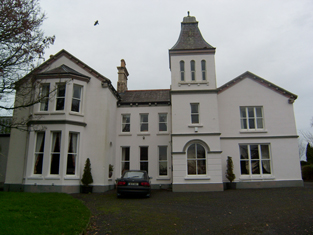
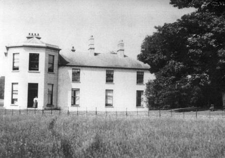
Monivea
Houses within 10km of this house
Displaying 34 houses.
Houses within 10km of Monivea
Displaying 34 houses.
| House name | Description | |
|---|---|---|
| Abbert | In 1786, Wilson refers to Abbert as the seat of Mr. Blakeney. Occupied by David Watson Ruttledge at the time of Griffith's Valuation when the buildings were valued at £35. Slater refers to Abbert as the seat of John Blakeney in 1894. A new house has been built at the site but the ruins of the original outbuildings still exist. |
|
| Castle Ellen | Castle Ellen was built in 1810. It is described as the property of Captain Lambert in the Ordnance Survey Name Books. At the time of Griffith's Valuation it was owned by Walter Lambert and was valued at £21. In 1906 it was owned by the representatives of Peter F. Lambert at which time it was valued at £35. It is still extant and occupied. For more information see www.castleellen.com. For more information on the genealogy of the Lambert family see http://www.familylambert.net/History/index.htm |
|
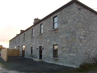
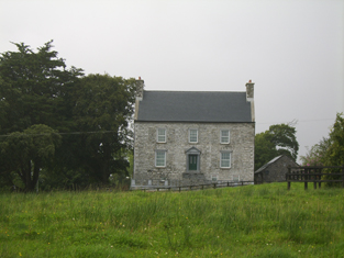
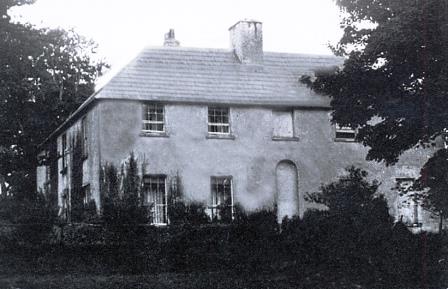
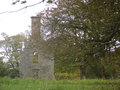
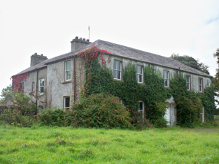
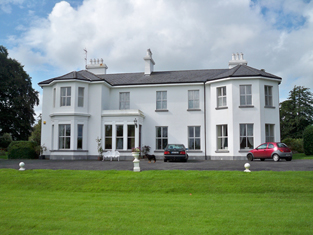
| Culliagh North [Knockmoy Abbey] | Occupied by Robert Blake Forster leasing from Martin J. Blake, at the time of Griffith's Valuation when the house was valued at £10. It is still extant and occupied. Melvin notes that it was also known as Knockmoy Abbey. |
![Photo of Culliagh North [Knockmoy Abbey]](https://landedestates.ie/storage/img/orig/2494.jpg)
|
| Mount Browne | The home of the Cullinane family for about the last 200 years and still occupied by them. The house is reputed to be about 300 years old and was undergoing renovation in 2007. The outbuildings are well maintained. |
|
| Cullairbaun | Occupied by James Perry at the time of Griffith's Valuation. | |
| Moyne | Built in the first half of the 19th century by Michael J. Browne who was forced to sell his estate in the mid 1850s when the house was described as ‘a magnificent pile of Grecian architecture of the Doric order’. John Stratford Kirwan bought the house and demesne in 1857 from Edward Browne who had purchased it in 1855. Kirwan advertised it for sale again in 1865. It was eventually sold to the Waithmans who later purchased Merlin Park. In 1912 the house became a hospice for infirm priests and in the 1930s was taken over by the Sacred Heart Missionaries. Since 1972 it has been the home of a number of people, including the broadcaster and poet George MacBeth and the singer Donovan. A floor plan and lithographs of the house are included in the various sale rentals. |

|
| Vermount | Also known as Munine or Moneen, the house was described as 'in ruins' on the Ordnance Survey 6 inch map (1932), following its burning in 1923. Extensive outbuildings are still in use and part of the yard is now a residence. McHale writes that this was, in fact, the original house. The National Inventory of Architectural Heritage suggests that the family occupied this building while Vermont House was being constructed. In 1786, Wilson refers to a house called "Munnine" as a seat of Mr. French. |
|
| Crumlin | Built in 1844, the original house was held in fee by Peter Blake and valued at 7 at the time of Griffith's Valuation. It was later altered and extended by Cecil Henry in the style of a French chateau. The house was sold to the Land Commission in 1913 and to John Costello in 1917, whose grandson renovated it and the courtyard in the early 1990s. |
|
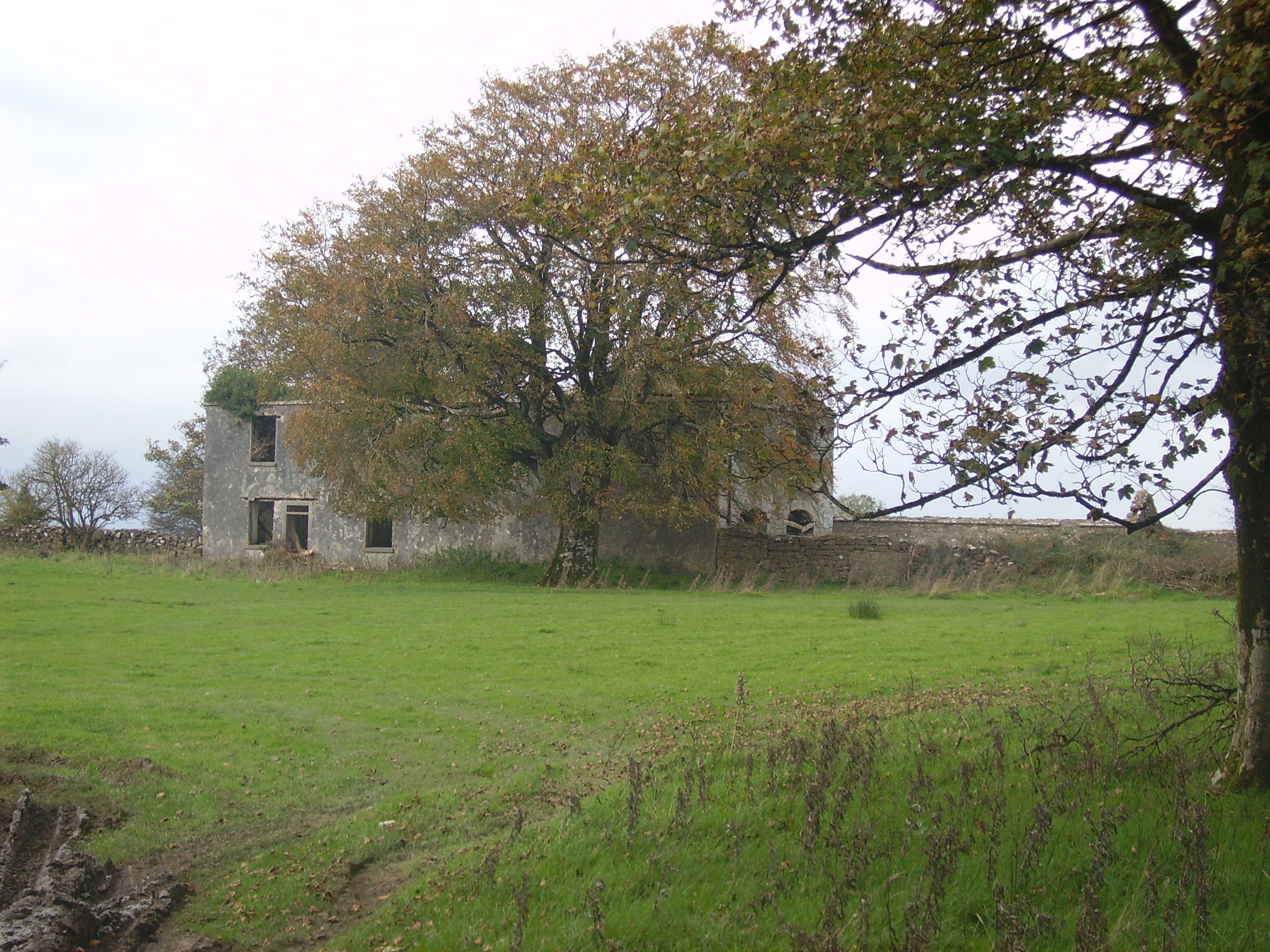
| Mountbernard | Home of Bernard Browne in the 1830s. Occupied by James C. [Leslie] Foster at the time of Griffith's Valuation, leasing from Andrew Browne, when the house was valued at £35 Foster was married to Henrietta, daughter of Sir Ross Mahon of Castlegar. The house is now in ruins. |
|
| Killimer Castle | Originally a tower house, Killimor Castle was modernised in the early 1700s by the addition of two slated wings. The Dalys continued to reside there until the end of the 18th century when the castle and demesne were leased to Dominick Burke of Slatefield. In 1837 Lewis records it as the seat of Hyacinth Burke. Dominick J. Burke was still leasing the house at Killimor from Rev. Nicholas Devereux at the time of Griffith's Valuation. It was then valued at £16. The house at Killimordaly had fallen into disrepair but has been restored. |
|
| Cross House | Built in the early 19th century and the home of the Evans family afterwards. The walls of the house and extensive farm buildings still remain alongside some modern farm buildings. |
|
| Corrandoo House | This property was granted to the ffrenches in the late 17th century in lieu of Monivea Occupied by the Reverend Mr Marsh in the 1770s sand 1780s, by M. Dowdall in the 1830s and Thomas Kenny at the time of Griffith's Valuation when it was valued at £10. It is no longer extant. |
|
| Glennagloughaun North | A building valued at £12 was occupied by Digby French at the time of Griffith's Valuation, this may have been the old charter school marked on the first Ordnance Survey map. The latter building appears to have fallen into disuse by the 1890s and the site is now occupied by a farm supply stores. | |
| Windfield | Originally a Blake house, Wilson refers to it as the seat of Mr. Blake in 1786. It was sold to the Jameson family in the early 1820s and occupied by J. Lynch in the late 1830s. Catherine Lynch was leasing the property at the time of Griffith's Valuation, when it was valued at £30. The house was burnt in 1921 and nothing remains now. |
|
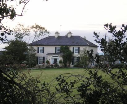
| Newtown | The home of the Kelly family in the 19th century, sold to Major Frederick Carr in the early 1930s and sold again in the late 1960s. The house has had a number of owners in the intervening years and is well maintained. It was offered for sale in 2007. |
|
| Farmhill | Joseph Kelly was leasing a property valued at almost £10 from Charles Kelly at Farmhill, barony of Tiaquin, at the time of Griffith's Valuation. A house still exists at this site. | |
| Killaclogher House/Spring Park | This property is labelled Spring Park on the First edition Ordnance Survey map and as Killaclogher House on the 25-inch edition of the 1890s. It was the main home of the Kenney family in the 18th and 19th centuries. At the time of Griffith's Valuation it was valued at over £16 and held in fee by James C. Kenny. The house is no longer extant. |

|
| Ryehill | Ryehill House was built in the early part of the 19th century and was still occupied in 1906 by a member of the Roche family. Unroofed in the mid 1950s only the impressive gateway and yard buildings still remain. |
|
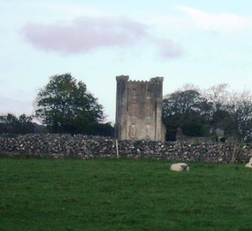
| Belleville | Built in the late 18th and early 19th century. Belleville was held in fee by Thomas Mahon at the time of Griffith's Valuation when it was valued at £30. The only part of the house remaining is the tower. |
|
| Bingarra | Occupied by James Clarke in the mid 1850s, leasing from the Bodkin estate and advertised for sale in Nov 1855. Modern buildings exist at the site now. | |
| Temple | This property is labelled Temple House on the 25-inch Ordnance Survey map having been built after the publicaiton of the 1st edition maps. In the 1850s William Poole was leasing the property from the Graves estate when the buildings were valued at £10. Substantial ruins still exist at the site. |
|
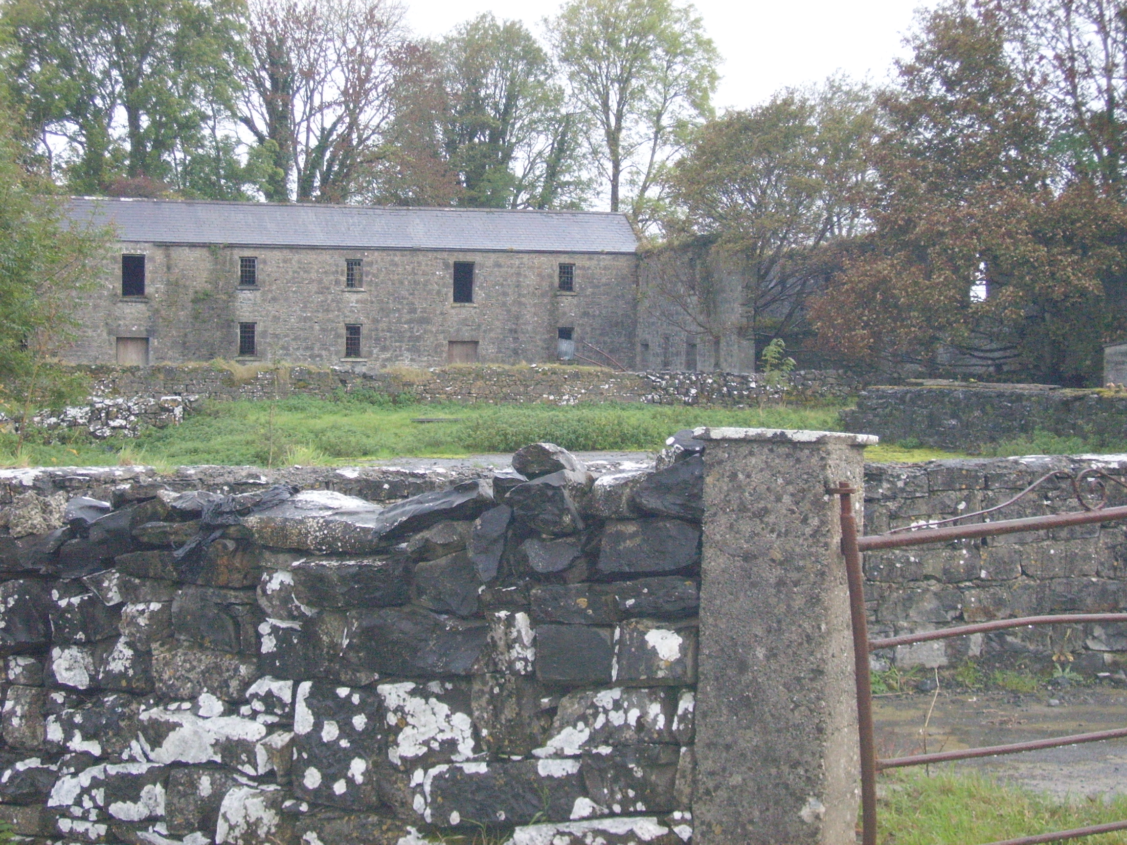
| Colmanstown | Originally a French property which became a Quaker settlement. Griffith's Valuation describes the buildings as a herd's and steward's house occupied by Edward Barrington and partners and then valued at £30. Buildings on both sides of the road mark the site of Colmanstown. Only the walls remain of some of these buildings, others are still in use. |
|
| Attymon House | At the time of Griffith's Valuation this house was occupied by Mary Broderick, who later married Lord Dunsandle. It was then valued at £8. In 2008 the current house at this site was offered for sale. The sale details state that it was originally built as a hunting lodge but later extended. See Irish Times 22 May 2008. |
|
| Tiaquin | At the time of the Burke sale in 1851 the house was described as an 'old fashioned cottage style' type of building. A gable end of the house still stands with the nearby farm buildings still in use. |
|
| Creeraun | At the time of Griffith's Valuation the townland was held by Margaret O'Kelly and the house and some land was occupied by Anthony O'Kelly. In the sale particulars of Creeraun in 1889 the house is marked on the map as 'in ruins'. |

|
| Knockbrack | A house built in the early 1850s by the Hall family and occupied by them until 1922. In 1906 it was valued at £36. The roof of the house was later removed. Only the outline of the basement walls now remain. The farmyard buildings are still used by the Feeney family. |
|
| Kilskeagh | Leet's Directory records Dominick Browne of Kilskeagh in 1814 and a small house is marked on the 1838 Ordnance Survey map. By the time of Griffith's Valuation only a herd's house valued at 10 shillings is recorded. | |
| Clooncah | In 1778, Clooncah was a property of the Daly family. and Wilson mentions it as the seat of Peter Daly in 1786. Lewis records it as the seat of P. Daly in 1837. William Galway held this property at the time of Griffith's Valuation, when it was valued at £30. According to local tradition, Clooncah House was demolished in the early twentieth century and the stone used in the construction of the new National School at Attymon. | |
| Carnakelly | Carnakelly was the original house from whch the Dalys of Dunsandle descended. John Monaghan was leasing this house, valued at £4 together with over 100 acres, from Lord Dunsandle's estate, at the time of Griffith's Valuation. |
|
| Graig Abbey | At the time of Griffith's Valuation, James Clarke was leasing the house at Graig Abbey from the Warburton estate when it was valued at £18. It is still extant and in use. |
|
| Raheen (Athenry) | Raheen House is associated wth the Lopdell family although there was only a herd's house valued at £3 and gate lodges recorded there at the time of Griffith's Valuation. In 1894, however, Slater noted it as the residence of Mrs. Lopdell. Raheen is still extant. |
|
| Gloves (Athenry) | The Ordnance Survey Name Books record Gloves as the residence of Mr. Browne in the 1830s. At the time of Griffith's Valuation Mark Loughnane held the townland of Gloves Middle, barony of Athenry including buildings valued at almost £8. By 1906 Michael J. Monaghan was the owner of this property. Buildings are still extant at the site. | |
| Park | In 1786 Wilson refers to Park as the seat of Mr. Burke, half a mile from the Monivea-Galway road. This may refer to Park townland in the barony of Athenry, which was in the possession of James Perry at the time of Griffith's Valuation. | |
| Cossaun or Cussane | In 1786 Wilson refers to Cussane as the seat of Mr. Parker. By the time of the 1st Ordnance Survey the house in Cossaun townland is described as "in ruins". The townland was in the possession of the Mahons of Belleville by the time of Griffith's Valuation in the 1850s. |