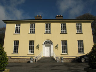
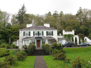
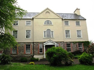
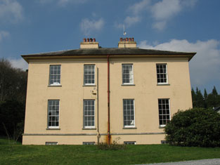
Kilcullen
Houses within 10km of this house
Displaying 37 houses.
Houses within 10km of Kilcullen
Displaying 37 houses.
| House name | Description | |
|---|---|---|
| Aghavrin House | This house was the home of the Crooke family for much of the 19th century, occupied in 1837 by Captain T. E. Crooke and at the time of Griffith's Valuation by William Crooke. The house was valued at £26 and held from John B. Gumbleton. The Irish Tourist Association Survey of the 1940s refers to it as the residence of Mrs. Scott, nee Crooke, by whose family the house was built. It also rather quaintly notes that “During the troubles of 1919-1921, the IRA often billeted themselves on the premises without any special invitation from the owner”. Aghavrin is still extant and occupied. |
|
| Coolalta | This house was the residence of the Reverend Pierce Green PP in 1837. It is named Coolalta Cottage on the first Ordnance Survey map and Coolalta on the later 25-inch edition of the 1890s. Occupied by Frederick Arden, valued at £13+ and held from Thomas Crooke at the time of Griffith's Valuation. A house is still extant at the site. | |
| Oak Grove | Home of the Bowen family, occupied by Mrs Bowen in 1814, by J. Bowen in 1837 and by John Bowen in the early 1850s when it was valued at £28 and held in fee. The National Inventory of Architectural Heritage states that parts of the property were rebuilt c.1930 following the burning of the original house in June 1920. In the early 1940s the Irish Tourist Authority noted that it had been lived in by some years by a well-known actress, "Miss Lilly-Elsie" who was married to Major Ian Bullough. It is now known as Oakpark House. |
|
| Leemount | Leemount was the home of Thomas Coppinger in 1814 and of Thomas Gollock in 1837. In the early 1850s this house was occupied by Thomas H. Broderick, valued at £30, and held from Thomas Gollock. In 1894 Slater refers to it as the residence of Albert Beamish. Leemount is recorded as one of the residences of John Lindsay, eldest son of George Crawford Lindsay of Moorlands, county Down in Walfords (1910). This original house was burnt in March 1921 during the War of Independence when it was the residence of Maria Lindsay, later executed as an informer by the IRA. It was replaced by the existing house. |

|
| Carhue/Carhoo | A Coppinger family home, occupied by John Rye Coppinger in 1814 and 1837 and by Henry J. Coppinger in the early 1850s. Henry J. Coppinger held the property in fee and it was valued at £18. The sale rental of 1856 states that the mansion house had recently been repaired and that Henry T. Coppinger was tenant under the Court of Chancery. A lithograph of the house and demesne is included. Burkes (1904) records George Colthurst (born 1811) of Carhue House. John Good was residing in this house in the mid 1870s. In 1894 Slater refers to it as the seat of John H. Colthurst. Carhoo House is still extant. |
|
| Leades House | "Burke's Irish Family Records" states that the Woodleys bought Leades House in the mid 17th century. F. Woodley occupied the house in 1837 and Francis G. Woodley in the early 1850s. He held the property from the representatives of William Woodley and Winthrop Sealy. Slater notes it as the seat of Captain Woodley in 1894 and the Woodley family still occupied this house in the early 20th century. A house is still extant at the site. |
|
| Nadrid | A house occupied at the beginning of the 19th century by Joseph Woodley, who married Anne Baldwin in 1799 but died a few years later. By 1814 Samuel Galway was residing at Nadrid. In 1837 Henry O'Callaghan was the occupier and he was still resident at the time of Griffith's Valuation. He held the house valued at £42 from the representatives of Abraham Cross. The Irish Tourist Association survey of the 1940s refers to Nadrid as the residence of Captain Matthews. A house still remains at the site. |

|
| Derry | The home of the Gibbs family in the 18th and early 19th centuries. It was occupied by J.B. Gibbs in 1837 and by John Hassett in the early 1850s, when the buildings were valued at £11 and held from the Reverend Robert Gibbs. | |
| Nettleville | The home of the Nettles family in the 19th century, valued at £35 in the 1850s. Occupied by the Reverend Basil Orpin in 1814. This house was still in Nettles occupation in 1906 but is now a ruin. |

|
| Clonmoyle | In 1837 this house was the home of Charles Colthurst, a younger son of John Colthurst and his wife, Jane Bowen. At the time of Griffith's Valuation Jonathon Bruce was the occupier. He held the house valued at £35 from Charles Colthurst. Henry Leader of Clonmoyle, Coachford, owned 2,418 acres in county Cork in the 1870s. The Irish Tourist Association survey of the early 1940s mentions that it was the residence of Mrs.Young, the owner of Clonmoyle Flour Mills and that it had previously been the home of Harry Leader. It is now a ruin. | |
| Dripsey Castle | This house was the home of the descendants of John Colthurst and his wife Jane Bowen from the late 18th to the early 20th century. It is still extant though it was damaged by fire in June 1920. The Irish Tourist Association survey in the early 1940s recounts the boycotting of the family following the Sheehy-Skeffington murder in 1916 and their subsequent departure to live in England. In the early 1940s it was the property of John O'Shaughnessy who also owned Dripsey Woollen Mills. In 2014 it was offered for sale. |

|
| Beechmount | Occupied by Dr Godfrey in 1837 and by Thomas Batten who held the property from Henry Lindsey in the early 1850s. A house is still extant at the site. | |
| Kilberrihert | A house which was the residence of R.E. Crooke in 1837 but was unoccupied in the early 1850s. At that time it was valued at £20+ and Thomas E. Crooke was the lessor. A building is extant at the site. | |
| Mountrivers | The proprietors of this house were John Whiting in 1750, George Whiting in 1814 and N. Whiting in 1837. By the time of Griffith's Valuation Denis Leary was the occupier, holding the property valued at £13+ from the representatives of Nicholas Whiting. The Irish Tourist Authority survey in the early 1940s reported that it was then owned by a farming family named O'Rourke. A house is still extant at the site. | |
| Peake House | Henry Lindsey was resident at Peake in 1814 and his descendant, Catherine Lindsay, still occupied the house in the early 1850s. She held it from Daniel O'Connor and it was valued at £16. A member of the Lindsay family was still residing at Peake in the mid 1870s. A house is still extant at this site. | |
| Hayfield | A house, offices and mill valued at £22+ was occupied by Henry Lindsey at the time of Griffith's Valuation and held from Charles Connell. In the 1940s the Irish Tourist Association survey noted that it was then occupied by the Carroll family and had been built "about 150 years ago". The original house is not extant now. | |
| Meeshal House | In 1837 Lewis describes the work done at Myshell by Dr Barter “whose demesne of 200 acres, formerly an unprofitable waste, has, since 1826, been reclaimed and brought into a state of high cultivation.” The house valued at £36 was occupied by Thomas Kenyon at the time of Griffith's Valuation and held from Henry Lindsey. In the 1940s the Irish Tourist Association survey noted that it was "formerly a Hydro before the enterprise transferred to St. Ann’s in Blarney". The National Inventory of Architectural Heritage suggests that the current house incorporates portions of the original. |
|
| Killinardrish House | Lewis describes this house as a "elegant Italian lodge lately built by R. J. O’Donoghue". It was valued at £38 and held from Sir Augustus Warren. In 1944 the Irish Tourist Association Survey noted that it was the residence of Mr. O'Donovan, manager of the creamery at Lissarda. Killinadrish is still extant. There was also a steward's house in this townland occupied by members of the Crooke family. |
|
| Green Lodge | Occupied by R. Coppinger in 1837 and by Anne Coppinger at the time of Griffith's Valuation and held by her in fee. The buildings were valued at £15.10 shillings. The sale rental of 1868 records the leasing of this property by George Lombard to Thomas Stephen Coppinger in 1789 for 999 years and the leasing of the Coppinger interest to Charles Manning in 1860 for 600 years. The Irish Tourist Association survey notes that it was built by the Coppinger family, "one of whose members turned Protestant to save the estate". It is no longer extant. | |
| Derreen | A Crooke family home in the 19th century, occupied by William Crooke in the early 1850s and held from William Furlong. The buildings were valued at £12.15 shillings. [This may possibly be the house known as Broomhill, a residence of the Cross family. Epenetus Cross of Broomhill made his will in 1776, see http://www.radleysofcork.bigpondhosting.com/My_Homepage_Files/Page2.html].) This house was offered for sale in 2010. |
|
| Shandy Hall | The Crosses were living at Shandy from at least the late 18th century. Lewis records P. Cross as the proprietor of Shandy Hall in 1837 and Philip Cross held the house valued at £33 and 106 acres from Colonel [Mair] at the time of Griffith's Valuation. Philip Cross of Shandy Hall is recorded in 1876. The Irish Tourist Association noted that a stone inscribed with the date 1758 existed at the house and also referred to its being "the home of Phillip Cross who murdered his wife and was hanged in Cork Jail" Shandy Hall is still extant and occupied. |
|
| Nadrid | Daniel Connor held a house in the townland of Nadrid valued at £31+ from the representatives of Abraham Cross. This may be the house known as Riversdale marked on the first Ordnance Map. In 1894 Slater refers to Nadrid House as the residence of William O'Sullivan Galgey. A house still exists at the site. | |
| Classas | A house occupied by H. Minhear in 1837 and by Lewis Gollock at the time of Griffith's Valuation when it was valued at £26 and held from William Crooke. In 1894 Slater notes it as the seat of A. McCall. In the 1940s the Irish Tourist Association survey noted that it was then being run by Mrs. Agnes Leader as a guesthouse "for relatives". It is still extant and occupied. |
|
| Old Town | S. Crooke was residing at Old Town in 1837 and Simon D. Crooke in the early 1850s when the house was valued at £14.10 shillings and held from William Furlong. It is no longer extant. | |
| Rockgrove | A house valued at £18.10 shillings was held by John Good from John Carney at Rockgrove in the early 1850s. John Good is also recorded as resident in this house by Lewis in 1837. | |
| Rockville | The family home of the Radley family in the 18th and early 19th century. Occupied by Cornelius Ahern and held from the representatives of Henry Longfield at the time of Griffith's Valuation. The buildings were valued at £9.15 shillings. | |
| Cottage | Originally a Vize home, later occupied by the Pyne family, J. Pyne was in residence in 1814 and 1837 and the house appears to be unoccupied at the time of Griffith's Valuation, Reverend John Lawless Pine was the immediate lessor. It was valued at £17.15 shillings. | |
| Cronody | In the mid 18th century Smith refers to the seat and improvements of Mr Cross at Coronody. At the time of Griffith's Valuation James Cross occupied a house valued at £10.10 shillings which he held from Viscount Midleton and John H. Colthurst. This would appear to be the house marked Crondybeg on the first Ordnance Survey map. Cronodymore was in ruins. Gillman writes that Cronodymore was inherited from Richard Hawes by the late 17th century marriage of Philip Cross to Mary Ellard, step daughter of Richard Hawes. A house and farm building are still extant at the site. | |
| Ellen Ville | This appears to be the house known as Broomhill which was a Radley residence. The house is named Ellen Ville on the first Ordnance Survey map. At the time of Griffith's Valuation Dr Thomas Godfrey was occupying Ellen Ville, valued at £14.15 shillings and held from William Furlong. | |
| Firmount | A Townsend family home, occupied by Horace Townsend in 1837 and by William Coghlan at the time of Griffith's Valuation. It was then valued at £14.10 shillings and was held from Horatio Townsend. The sale rental of 1877 records a fee farm grant of Firmount from John Crewe Chetwood Townsend to Arthur Chute dated 1871 and a fee farm grant from Arthur Chute to J.C.C. Townsend executed the following year. A house is still extant at the site. | |
| Knockane | A house valued at £14.10 shillings in the early 1850s when it was occupied by Henry Ruby and held from Samuel P. Townsend. The original house is no longer extant. | |
| Garraun | George C. Stawell held this property from Sir George Colthurst at the time of Griffith's Valuation. The buildings were valued at £7.10 shillings. This house was still occupied by the Stawells in the 1870s. A house and farm are still extant at the site. | |
| Rich Hill | A house occupied by Thomas George French at the time of Griffith's Valuation, valued at £20 and held by him in fee. | |
| Deeshart | Denis Fielding held a house, office and mills valued at £28 from John H. Colthurst at the time of Griffith's Valuation. This may be the premises labelled "Carding Mill" on the 1st edition Ordnance Survey map and as "Dripsey Woollen Mills" on the 25-inch edition of the 1890s. Industrial buildings still exist at the site. | |
| Dripsey Lodge | At the time of Griffith's Valuation this property was occupied by Alfred Greer, leasing from Sir William Magny. The house was valued at £26 while the adjacent paper mills had a valuation of £120. It is named as Dripsey House on the 25-inch Ordnance Survey map of the 1890s. The house is no longer extant. | |
| St. Olan's | Rev. William Welland was leasing the property from William Crooke at the time of Griffith's Valuation when it was valued at over £20. It is labelled St. Olan's Rectory on the First Edition Ordnance Survey map and as St.Olan's on the 25-inch edition of the 1890s. In the early 1940s the Irish Tourist Association survey reported that it was occupied by Mr. Devlin, area engineer. The house is still extant and occupied. | |
| Clontead More House | At the time of Griffith's Valuation, Herbert Gillman was leasing a property valued at £14 from Edward Murphy. This house was built after the publication of the 1st edition Ordnance Survey map. The Irish Tourist Association survey refers to "Clontead" as the former residence of the historian, Herbert Webb Gillman,(1832-1898). It is still extant and seems to have become known as Clontead More House. |
|