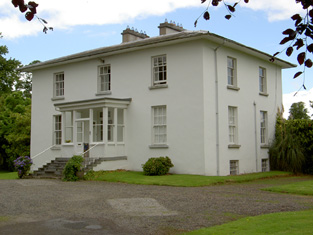
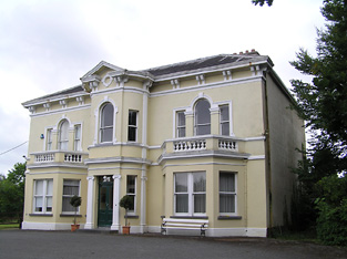
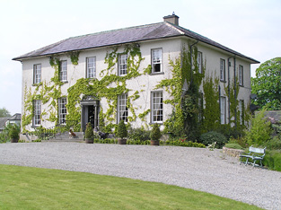
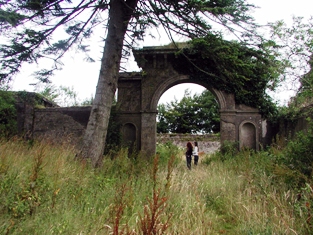
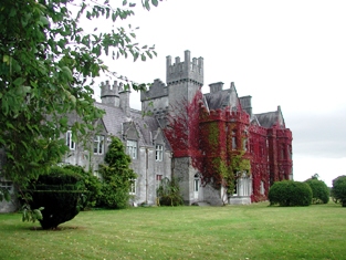
The Cottage
Houses within 15km of this house
Displaying 66 houses.
Houses within 15km of The Cottage
Displaying 66 houses.
| House name | Description | |
|---|---|---|
| Carrick House | The sale rental of 1851 records Walter Herbert holding the mansion house and demesne on a renewal lease dated 1796. This house no longer exists. | |
| Mount Richard | Mount Richard was the residence of John Power in 1837 and in the early 1850s when the buildings were valued at £30.10 shillings and held from the Earl of Bessborough. This house is still in use as a residence. |
|
| Tinvane | This house was the home of the Briscoe family in the 19th century. In 1841 The Ordnance Survey Name Books described it as "handsomely situated...having plantations, gardens, orchard and ornamental grounds". Henry Briscoe was the occupier at the time of Griffith's Valuation when the buildings were valued at £26 and in the 1870s Henry W. Briscoe of Tinvane owned 127 acres. The property was held from the Earl of Bessborough. Now function as a guest house known as Cedarfield House. For an older image of this house, see http://www.waterfordcountyimages.org/exhibit/web/DisplayWAIImage/K0fV5VPbSPSwE/ |
|
| Villa Mantilla Verda | On the outskirts of the town of Carrick on Suir, this house was occupied by Mrs Sophia Manderville in the mid 19th century. She held it from Walter Herbert [nephew of Dorothea Herbert] and the buildings were valued at £16.11 shillings. | |
| Ballycurkeen | The home of James Manderville in the mid 19th century, held from James F. O'Ryan and valued at £19+. Ballycurkeen was still a Mandeville home in the early 1940s when Frank Mandeville was recorded as resident. The Irish Tourist Association surveyor also writes that Ballycurkeen was the residence of John O'Mahony, a Fenian leader in 1848. This house is still a family home. |

|
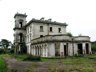
| Anner Castle | Marked on the first Ordnance Survey map as Ballina House, this residence of the Reverend Nicholas Manderville was valued at £46+ and held by him in fee in the early 1850s. Bence Jones writes that Anner Castle was built in the 1860s "incorporating the old square castle of the Manderville family which had up till then been known as Ballinahy". It was destroyed by fire in 1926 and only the front portion was rebuilt. The Mandervilles were still resident in the 20th century. This property was sold in 2013. |
|
| Ballydine | The Mandevilles were situated at Ballydine from the 14th century. Ballydine Castle was sold to the Earl of Clonmel in 1781 and members of the Power family lived there in the first half of the 19th century, William Power in 1814 and James Power in the early 1850s. The Powers and the Mandevilles were related. A lithograph of the house is included in the Power sale rental of 4 November 1853. ''Burke's Irish Family Records'' records Frank Hackett Mandeville (1841-1905) as the last family member to live at Ballydine. He was Member of Parliament for mid Tipperary 1892-1900 and died at Ballydine Castle in 1905. Mary Lyons records the Landy family as resident from 1855-1901. | |
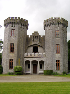
| Carrick Castle | A 16th century house built by the 10th Earl of Ormonde, which was abandoned by the family in the 18th century. Lewis wrote in 1837 “The castle is still a stately building although much of it is in ruins; it was for many years the residence of the Ormonde family, and part of it has been converted into a private residence”. At the time of Griffith's Valuation it was vacant and valued at £19. Taken over by the Office of Public Works in the 20th century and restored as a national monument. Now functions as a museum. |
|
| Anner Ville | Anner Ville was the home of Pierce A. Butler in 1814 but by 1837 was in Riall possession. The Ordnance Survey Name Books describe it as "handsomely situated, having a garden, orchard and ornamental ground attached". At the time of Griffith's Valuation Samuel Riall held the house valued at £23.14 shillings from Barclay Clibburn junior. Anner Ville continued to be a Riall residence in the 1870s and is still a fine home. |
|
| Redmondstown | In 1814 Redmondstown was the residence of J. Parson Ducket and in 1837 of a member of the Quinn family. In the early 1850s R.G. Fitzgerald was the occupier, holding the house valued at £16.15 shillings from the Earl of Glengall. This house is still extant and is located in a wooded area. Thomas Albert Quin of Redmondstown owned 612 acres in the 1870s. | |
| Anner Park | In 1837 Lewis records the extensive flour mills and residence of Barclay Clibborn in the parish of Kilgrant. In 1840 the Ordnance Survey Name Books describe the townland of Twomilebridge as " a demesne, consisting of planted ornamental ground, gardens and orchard". In the mid 19th century Barclay Clibburn occupied a house valued at £22 and held from the Putland/Hulse estate. Joseph Clibburn of Two mile bridge owned 20 acres in the 1870s. William Clibborne was resident in 1906 when the house was valued at £30+. This house is still occupied and well maintained. |
|
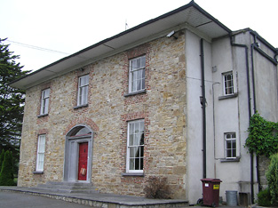
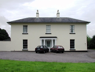
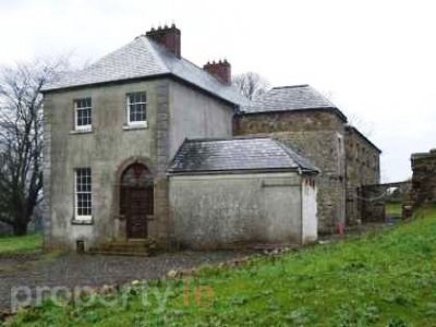
| Kilheffernan/Cottage | Thomas Ryan was the proprietor of Cottage, Clonmel, in 1814 and Lewis records T. Ryan of Cottage, parish of Killaloan. At the time of Griffith's Valuation Patrick Fennelly held the house valued at £10.13 shillings from Thomas Ryan. Altered over the years this house is still in use as a residence. |
|
| Kilmurry Lodge | A house valued at £16.13 shillings was occupied by the Reverend Richard Morrissey in the townland of Ballynamona at the time of Griffith's Valuation. It was held from William P. Barker. Kilmurry Lodge is marked on the first Ordnance Survey map and is described in the Ordnance Survey Name Books as "a lodge, handsomely situated, with a garden, orchard and fir plantation". This house is still in use as a residence. |

|
| Lindville | A house named Lindville is marked on the first Ordnance Survey map in this townland close to the bank of the River Suir. At the time of Griffith's Valuation it was valued at £16+ and occupied by Thomas Lindsey who held it from William Butler. No building is now extant at this site. | |
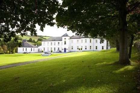
| Newtown Anner | The seat of the Osborne family, held by R.B. Osborne MP in fee in the mid 19th century when the buildings were valued at £56+. Inherited by 12th Duke of St Albans, grandson of R.B. Osborne. Occupied by the Duchess of St Albans in 1906 and still in this family's possession in the early 1940s. The Irish Tourist Association survey states that the Osbornes bought the property from Clonmel Corporation in 1774. The National Inventory of Architectural Heritage dates this house 1829. It continues to be in use as a residence. |
|
| Cregg | The home of a branch of the Lalor family in the 19th century. Thomas E. Lalor is recorded for Creg in 1814 and Lewis writes in 1837 of his handsome residence erected "about ten years since". Cregg was occupied by his son Thomas in the early 1850s. Thomas held the property from the Marquess of Ormonde and the buildings were valued at almost £40. Passed to the Sadlier family of Castleblake, county Tipperary at the end of the 19th century. In 1906 it was valued at £41 and occupied by Annie Sadlier. This house is still a fine residence. |
|
| Ballyknockane | Marked on the first Ordnance Survey map as Ballyknockane Cottage, valued at £21 and occupied by Walter Asper at the time of Griffith's Valuation. He held the property from the Marquess of Ormonde. In 1894 Slater noted it as part of the latter estate. This building no longer exists. | |
| Ballyboe | A house valued at £17+ in the mid 19th century when it was occupied by James O'Donnell and held from Lord Lismore. This house is still a family residence. |

|
| Ballynagrana | Taylor and Skinner's map indicates that this is the location of the house originally known as Wilmar, which was occupied by Nicholson Esq in the 1770s. Wilmar Mill is marked closeby in the townland of Ballyrichard on the first edition Ordnance Survey map. The Ordnance Survey Letters refer to the property as Wilmer House in 1840. Lorenzo Hickie Jephson lived at Wilmar for some time in the early 19th century. Francis Mandeville was resident in 1814. Denis Kennedy occupied a house in Ballynagrana, held from Denis Hayden and valued at £13.14 shillings at the time of Griffith's Valuation. Ellen Hayden of Ballynagrana owned 255 acres in county Tipperary in the 1870s. This house is no longer extant. | |
| Garrangibbon | This house known as South Lodge was occupied by J.B. Elliott in 1814. The Ordnance Survey Name Books describe it as "handsomely situated....with garden plantation and planted ornamental grounds" in 1840. It was occupied by Richard C. Jackson who held the house valued at £14 from the representatives of Mrs R. Hartford in the mid 19th century. Some alterations to the house have taken place in more recent times and it still functions as a country residence. |

|
| Mayfield or Rocket's Castle | The property at Rocketscastle was held in fee by Rev. John T. Medlicott at the time of Griffith's Valuation, when it was valued at £36. In 1906 he was still the owner of the property then valued at £30 10s. Morris states that this property was originally part of the May estate and known as Mayfield . Smith, writing in 1774, refers to Mayfield as "the pleasant seat of Sir James May, formerly called Rockett's Castle" and Wilson also mentions it as his residence in 1786. The original Rockett's Castle was in ruins by the time of the 1st Ordnance Survey and this house was built after that on an adjacent site. The 1943 ITA survey, indicates that the Medlicotts had adapted the old castle building as an engine house at that time. A house is still extant at the site. | |
| Knockane House | In 1850 Thomas Rockett was leasing a property valued at almost £9 from the Medlicott estate.This house had been constructed after the appearance of the 1st edition Ordnance Survey map in 1840. A second adjacent property was leased by James Rockett and valued at almost £8. There is still an extant house at the site. | |
| Springfield (Portlaw) | Robert Shaw was leasing this property from the Medlicott estate in 1850 when it was valued at £39. He was the director of some of the industrial enterprises in Portlaw. Springfield is still extant and occupied. |
|
| Mayfield (Portlaw) | Mayfield was held by William Malcolmson from the Medlicott estate at the time of Griffith's Valuation, when it was valued at £50. Lewis refers to it as the seat of J. Malcolmson in 1837. In 1906 it was the property of William Malcomson and valued at £31. It is now a ruin. |
|
| Woodview House (Portlaw) | Dr. James Martin, MD, was leasing this property from the Malcolmson family at the time of Griffith's Valuation, when it was valued at £25. It is still extant and occupied. |
|
| Milfort/Milford House (Portlaw) | Milfort House was another property held by the Malcomson family in Portlaw. It was part of a complex designed by the well-known architect John Skipton Mullvaney. Milfort was demolished in the mid-twentieth century but some estate architecture survives. |
|
| Mountbolton | Pierce Henebery was leasing this property from Jane Bolton at the time of Griffith's Valuation, when it was valued at £12 15s. In 1786 Wilson states that Mount Bolton was the seat of John Bolton. The original house was not extant by the time the 25-inch Ordnance Survey map was published in the 1890s and the site is now occupied by farm buildings. | |
| Ballyclohy | Leased from the Disney estate by James Moloney in 1850, when it was valued at £11 10s. | |
| Churchtown House (Dysert) | Leased from the Disney estate by James Connolly at the time of Griffith's Valuation, when it was valued at £25. In 1837 Lewis notes Churchtown as " the pleasant residence of John Power". In 1777, Charles Smith refers to it as the seat of Eccles Disney. The house is still extant. It was partially renovated in the early 21st century and in 2010 was offered for sale. |
|
| Coolnamuck Court | At the time of Griffith's Valuation, Coolnamuck was held in fee by James Wall when it was valued at £64.Smith describes it as "the pleasasnt seat of William Wall" in 1777. Bence-Jones noted the house had a curved bow with domed roof and contained a ballroom. Bought by the Sadliers circa 1852. A lithograph of this house is included in both the Wall and Sadlier sale rentals of May 1852 and July 1857. Richard O'Donnell was the tenant at that time. The 1943 ITA survey mentions the existence of this house but it was demolished later in the twentieth century. A folly remains in the former demesne lands. |

|
| Glen Lower (Dysert) | Leased by Patrick Hurley from John Congreve's estate at the time of Griffith's Valuation, when the buildings were valued at £11 10s. This appears to be the property known as Glen Castle House taking its name from castle ruins nearby. A house is still extant at the site. | |
| Glen Lodge (Glen Poer) | Labelled on the first edition Ordnance Survey Map as Glen Lodge and on the later 25-inch map as Glen Poer. Held by James Gallway from James Power at the time of Griffith's Valuation, when the buildings were valued at £19. In 1876 it is given as the address of Capt. Walter Mansfield. The 1943 ITA survey notes it as the residence of Mrs. Monsell [?]. Now in the possession of the Rosminian Order as a retreat house and known as Glencomeragh House. |
|
| Rath (Fenoagh) | In 1850 Jane Bolton was leasing this property to Anne Power when it was valued at £12 15s. A farm still exists at the site. | |
| Ballydavid | In the mid 19th century Patrick Murphy held a house valued at £10 from Thomas Power in the townland of Ballydavid. | |
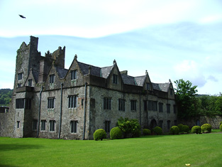
| Curraghmore | The house at Curraghmore is centred on the old medieval tower house of the Le Poer family to which various additions and renovations have been added. Both Smith, writing in 1774 and Wilson, writing in 1786, offer detailed contemporary descriptions of the house and demesne . At the time of Griffith's Valuation, it was valued at £210. In 1906 it was valued at £200. The 1943 ITA survey describes it in detail, stating that it was one of the finest properties in Munster, if not in all of Ireland. It is still extant and occupied by the Le Poer Beresford family. See www.curraghmorehouse.ie for more information. |

|
| Guilcagh House | At the time of Griffith's Valuation, Guilcagh was held in fee by the Beresford estate and valued at £17 10s. In 1906 it was still part of Lord Waterford's estate and valued at £16. It is no longer extant. | |
| Whitestown | Described as a huntsman's house in Griffith's Valuation in 1850, Whitestown was then valued at £14. In 1906 it was still part of Lord Waterford's estate and valued at £11. It is no longer extant. | |
| Milford House | In 1850, Mrs. Anne O'Brien was leasing this property from the Medlicott estate when it was valued at £10 15s. Morris refers to a Rogers family "of Coolroe" in the mid eighteenth century. This house is no longer extant. | |
| Ballyvallikin | In 1850 this property was being leased by John and Margaret Fitzgerald from Lord Waterford's estate when it was valued at £11. It was still part of the Waterford estate in 1906 and valued at £11 5s. Extensive farm buildings still exist at the site. | |
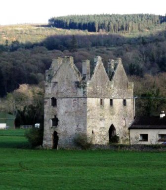
| Tikincor Castle | Tickincor Castle, a fortified house, is described as "in ruins" on the first edition Ordnance Survey map in 1840. Buildings at the site were valued at £7 18s at the time of Griffith's Valuation in the 1850s when they were owned by Ralph B. Osborne and leased to Thomas Prendergast. In 1777 Smith notes that Tickencore was the property of Sir William Osborne. |
|
| Glen House (Kilmeaden) | Thomas Flahavan was leasing Glen House from Lord Waterford's estate in 1850 when it was valued at £11 10s. A house is still extant at the site. | |
| Laherdan House | In 1850, John Whelan was leasing this property from the Beresford estate when it was valued at £11 10s. It is labelled Laherdan House on the 25-inch Ordnance survey map of the 1890s. A house is still extant at the site. | |
| Gurteen Le Poer/Gurteen House | Held in fee by John Power in 1850 when it was valued at over £96. In 1837 Lewis noted Gurteen as the seat of E. Power. Count Edmond de la Poer was the owner in 1894 and 1906 when the house was valued at £87. By the later nineteenth century it had come to be called Gurteen Le Poer, the name by which it is still known. |
|
| Landscape House | John Congreve held Landscape in fee in 1850 when it was valued at almost £20. Lewis also refers to it as a seat of the Congreve family in 1837. However, by 1906 Congreve's buildings at Landscape were only valued at £2. Landscape House is still extant and occupied. |
|
| Ballydurn | Ballydurn was leased by George Moore from the Beresford estate in 1850 when it was valued at £10. An extensive farm exists at this site. [Grid Reference is approximate] | |
| Ballyknock | A house valued at £12 10s which was vacant at the time of Griffith's Valuation . Probably in the possession of Thomas Dooley who was leasing property from the Beresford estate in the area. There is no house visible on the later 25-inch map of the 1890s. | |
| Ballyneal House | Ballyneal was held from the Waterford estate by William Shanahan (David) at the time of Griffith's Valuation, when it was valued at £14 10s. A second house in the townland, leased by William Shanahan (John) was valued at £12 10s [S373150] There is still a house extant at this site. | |
| Ballynevin | James Moore was leasing two properties from Lord Waterford at Ballynevin at the time of Griffith's Valuation. One was valued at £22 and the second [S399178] at £10 10s. Substantial farms still exist at both sites. | |
| Bishopstown (Upperthird) | At the time of Griffith's Valuation, Catherine Hally was leasing this property, valued at £11, from the Trustees of Waterford College. Modern buildings exist at the site now. | |
| Clonea Mill | In 1850 Judith Ryan was leasing this property from the estate of Sir Benjamin Morris Wall, when it was valued at £21, including a mill. It is labelled Corn Mill on the 1st edition Ordnance Survey map but is not marked on the 25-inch map of the 1890s. | |
| Feddans | Reverend John Condon, PP, was leasing this property from the Power estate in 1850 when it was valued at £11. The parochial house is labelled on the 25-inch Ordnance Survey map of the 1890s. A house is still extant at the site. | |
| Glenstown | Leased by Johanna Cormack from Lord Waterford's estate in 1850 when it was valued at almost £14. A farm exists at the site now. | |
| Kilcanavee | In 1850 William Hunt was leasing this property from Lord Waterford's estate when it was valued at £13. A farm exists at the site now. | |
| Oldgrange House | Nicholas O'Neill Power was leasing this property to James Quinn at the time of Griffith's Valuation, when it was valued at £9. Buildings are still extant at the site. | |
| Whitestown | In 1850,Lord Waterford held a property described as a "huntsman's house" in fee at Whitestown. It was valued at £14. Substantial kennels are shown nearby on the 25-inch Ordnance Survey map of the 1890s and this building is still extant. | |
| Whitestown House | David Shanahan was leasing Whitestown House from the Marquis of Waterford's estate in 1850 when it was valued at 16 10s. The original house is now derelict. This may be the property to which Wilson refers in 1786 when he notes it as seat of Mr. Ducket. | |
| Rathgormuck Castle | The buildings in the vicinity of Rathgormuck Castle were valued at £10 in 1850 and leased by Walter Mansfield to Thomas Terry. On the first edition Ordnance Survey map the castle is described as "in ruins". | |
| Graigavalla | Walter Henry Mansfield owned several properties in this townland at the time of Griffith's Valuation. The largest was a mill valued at £12. A property labelled Glenduff Corn & Tuck Mill appears on the First Edition Ordnance Survey map in this townland. It is not visible on the 25-inch edition of the 1890s. Another property in the same townland was leased to Catherine Kirwan with a value of £11. A farm is still extant at this site. | |
| Shanakill (Upperthird) | John Hearne was leasing this property from the Power estate at the time of Griffith's Valuation, when it was valued at £11 10s. Morris states that the Hearns had held an interest in this property since the 1720s. Financial difficulties led to its sale to Mary Anne Quin in 1866. In 1906 it was owned by Anne Ussher Quin and Frances Anne Quin and was valued at £18 10s. This house was also associated with the Labarte family. A house is still extant at the site. | |
| Lyranearla | Held in fee by Henry Pedder at the time of Griffith's Valuation when it was valued at almost £10. In 1906 Helena Pedder owned the property, then valued at almost £6. [Grid Reference is approximate] | |
| Poulboy Mill House | Winifred Daniel was leasing this property from the Osborne estate at the time of Griffith's Valuation, when it was valued at £13 10s. The adjacent mill, valued at £42, was being leased by her to Patrick Corcoran at the same time. By the 1880s the mill is no longer visible. | |
| The Pines (Darrigal) | Alexander Sherlock was leasing this property to Michael Nowlan in 1850 when it was valued at £13 10s. It appears to have become known as The PInes by the end of the nineteenth century. Recorded as the seat of Patrick Power by Leet in 1814. There is still a house at this site. | |
| Ballyglasheen | This house is not marked on the first edition Ordnance Survey map. The Inventory of Irish Architecture dates this house circa 1870. It was occupied in the 1870s by John Barnes. It is still extant and well maintained. |
|
| Ballyneill | Patrick O'Donnell held buildings valued at £13 from Rodolphus Scully at Ballyneill in the mid 19th century. This may be the present house however it looks as if it might date from later in the 19th century. It is situated close to the remains of Ballyneill Castle. |

|
| Knockane Lodge | Hussey de Burgh cites Knockane Lodge as the address of William H.F. Bosanquet in the 1870s. This may the second house noted in the townland of Knockane at the time of Griffith's Valuation, which was being leased by the Rockett family. | |
| Woodlock House (Portlaw) | A house built for the Malcolmson family after Griffith's Valuation, it is labelled Woodlock House on the 25-inch Ordnance Survey map of the 1890s. The National Inventory of Architectural Heritage indicates that it was designed by John Skipton Mulvany. In the twentieth century it became a convent and is still extant and occupied. |
|