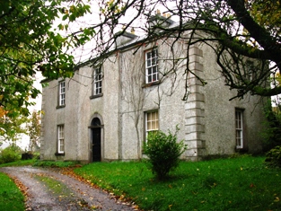
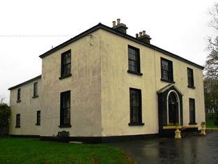
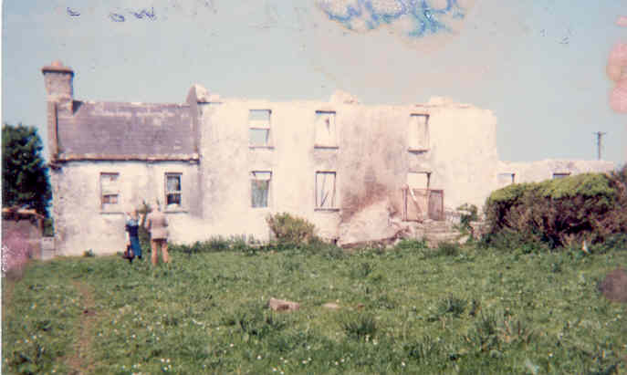
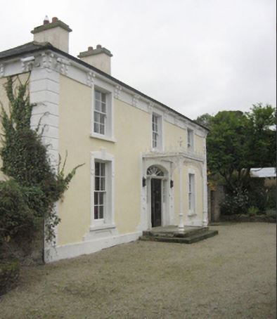
The Lawn
Houses within 15km of this house
Displaying 48 houses.
Houses within 15km of The Lawn
Displaying 48 houses.
| House name | Description | |
|---|---|---|
| Ashbrook | An early 18th century house, it was noted by Wilson as the seat of Mr. Moore in 1786. It was occupied by Michael Costello in 1814 and described as in a dilapidated state at the time of the first Ordnance Survey. The Irish Tourist Association file refers to a two-storey plain featured house with the ruins of a small private chapel closeby, which apparently fell into decay in the early 19th century. Some ruins remain at the site. | |
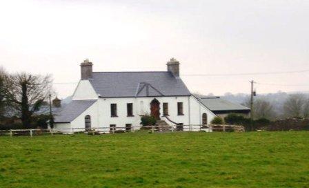
| Greenhills | Greenhills was part of the estate of the Marquess of Sligo until the sale to William Livingstone in 1854 and was let to Joseph Bourke in the early 19th century. It was later occupied by Archibald Stavert who held it from William Livingstone at the time of Griffith's Valuation. It was owned by Matt Fahy in the late 1990s and is still extant. |
|
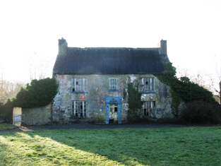
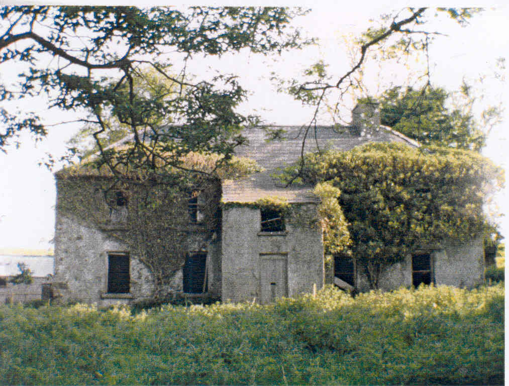
| Elmhall | Built by Gerald Cuff early in the 18th century, it was let to the Jordans of Murrisk in the 1770s and to a branch of the Browne family of Westport from the 1780s until the early 19th century. In 1786 Wilson refers to it as a seat of the Rt.Hon. James Cuffe. In 1837 the 1st edition Ordnance Survey map notes that it was 'in ruins'. The Irish Tourist Association File states that Elmhall is said to have been burnt in 1798. Only some fragments of walls remain at the site. |
|
| Athavallie | The house at Moat was the main residence of the Lynch Blosses in the 18th and the early 19th century. In 1786 Wilson refers to Moat, the seat of Sir Henry L. Blosse. A fire destroyed the original house in 1808. It was rebuilt and is marked on the first Ordnance Survey map as Attavally. The Lynch Blosse family were absentee landlords for most of the 19th century. In 1894 the house was recorded as the seat of Sir Henry Lynch-Blosse. Later the house became a community school run by the St Louis nuns. It is now known as Balla Secondary Schoool. |

|
| Lagaturrin | The house at Lagaturrin was valued at £6 at the time of Griffith's Valuation, when it was occupied by William Fitzmaurice. William R. Falkiner lived here in the early 1860s. It is no longer extant. | |
| Brownhall | In 1786 Wilson refers to Brownehall as the seat of George Browne. Described in the Ordnance Survey Name Books of the 1830s as "a handsome, commodious building" . It was held in fee by James Browne at the time of Griffith's Valuation, when the house was valued at £25. It is no longer extant. | |
| Carrowgowan | From at least 1814 the house was occupied by the Deanes who held it from Colonel McAlpine, who held from John Knox of Castlereagh. The house was described as in good repair, with offices, orchard and garden. Daniel H. Mellet occupied the house at the time of Griffith's Valuation. It is now demolished. | |
| Longfield House | Occupied by Colonel Kelly in 1814 and by Mrs Kelly in the 1830s. A house valued at £4 in this townland in the 1850s was occupied by Andrew Walsh. It is now a ruin. | |
| Bellavary | Charles Goodwin lived in the house in the late 1830s. The Landed Estates' Court rental records that Bellavary House was leased to Standish O'Grady McDermott by William Malley on 10 Feb 1859 for 21 years. It later became a Royal Irish Constabulary barracks and burned down in 1920. | |
| Mount Pleasant | Home of George Mahon in 1814 and of Charles G. Mahon in the 1850s when the house was valued at over £22. It is no longer extant. | |
| Ballinafad | Bence Jones states that the house was built in 1827 and was sold to the African Missionary Brothers circa 1908 by Lieutenant Colonel Llewellyn Blake of Ballinafad and Cloghballymore, county Galway. It is recorded as his seat in 1894. The Irish Tourist Association File states that the house was donated to the African Missionary Brothers by Colonel Blake and that a new wing was added in 1932. For sale in 2012. |
|
| Ballynew House | In the 18th century Ballynew was the home of a branch of the Miller family of Milford, near Kilmaine, county Mayo. In 1777 Robert Miller of Ballynew married a Bridget Young of Harristown, county Roscommon. Ballynew became a Bourke home in the 19th century through a Miller/Bourke marriage. Ballynew is still extant and occupied. |
|
| Ballinvilla | The home of the Kearney family in the 18th and 19th centuries. It was held in fee by William Kearney at the time of Griffith's Valuation when it was valued at £10 10s. It is no longer extant. | |
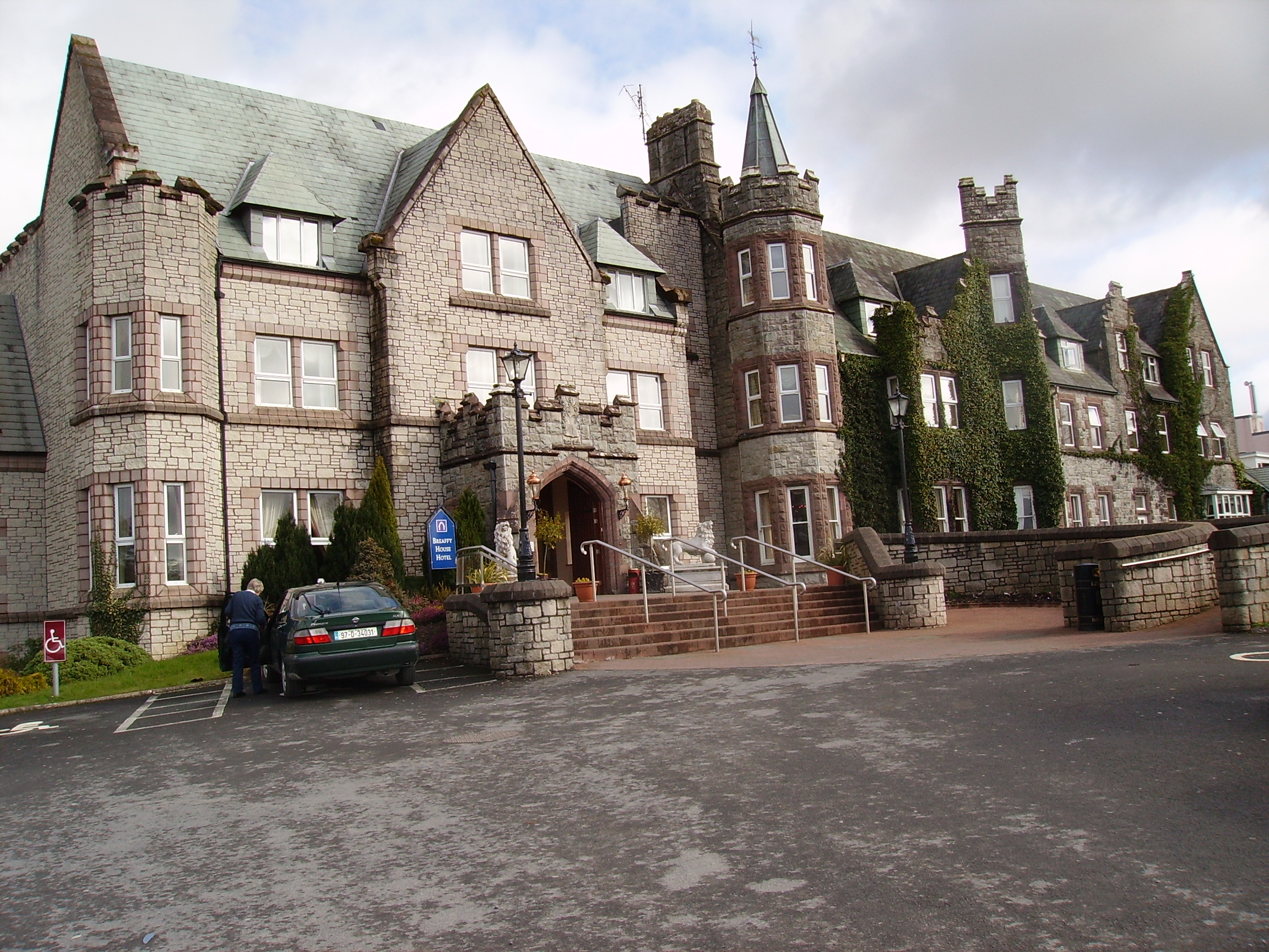
| Breaghwy Lodge | A house known as Breaghwy Lodge was the estate home of the family in the early 19th century. In 1786 Wilson refers to Breafy as the seat of Mr. Browne. This building was later replaced by a large Victorian house which was the residence of D.A Browne in 1894. It now functions as Breaffy House Hotel, |
|
| Bridgemount House (Drum) | The home of the Acton family in the 19th century and the seat of G.H.Acton in 1894. At the time of Griffith's Valuation it was held in fee by George Acton and valued at £10. It was later the home of the Coyne family and is still extant and occupied. |
|
| Carnacon House | Home of the McDonnell family in the early 19th century and probably earlier as local sources suggest General James McDonnell, who fought in the 1798 Rebellion, was born there. In 1844 described by Samuel Nicholson as "neat and comfortable, prettily situated upon the lake and ornamented by thriving plantations". It was purchased by the Hughes family in the 1940s and is still in their possession. |
|
| Castlelucas | A house belonging to the Blakes of Ballinafad, let to Lieutenant Hugh Ryan in 1814 and to Mrs Phibbs in the 1830s who subleased to George Ormsby of the Ballinamore family. At the time of Griffith's Valuation, it was leased by Matthew Phibbs from Mark Blake and valued at £5. It is no longer extant. | |
| Clogher | According to Bence Jones this house was built circa 1798 though Wilson refers to a house at Clogher as the seat of Patrick Lynch in 1786. In 1844 Samuel Nicholson described Clogher House as "amongst the largest and the best in the Country, and appears to be kept in excellent order". Patrick C. Lynch was leasing it from Sir Robert H. Blosse at the time of Griffith's Valuation, when it was valued at £40. It was in the ownership of the Fitzgerald Kenney family at the beginning of the 20th century and is now a ruin. |
|
| Errew | An unoccupied house and offices valued at £11 were held by James Hardiman at the time of Griffith's Valuation. A school and monastery are shown on the 25-inch Ordnance Survey map of this area in the 1890s. These buildings are still extant. | |
| Fisherhill | Occupied by Major Blake in the early 19th century. Fisherhill and the lands of Carheens, were leased by Richard D'Arcy of New Forest, county Galway to Edward Cheevers of Killyan, county Galway on 23 Mar 1858. In 1879 Robert Ireland advertised for sale his interest in Cheevers lease. A. C. Larminie lived here in the late 19th century. Now the home of the McGreal family. |
|
| Fortlawn Cottage | William Mulrooney held this property in fee at the time of Griffith's Valuation when it was valued at £5. It is labelled as Fortlawn Cottage on both the 1st and 25-inch edition Ordnance Survey maps. A house is still extant at the site. | |
| The Grove | At the time of the first Ordnance Survey the house was described as the former residence of Captain Bourke. It became the home of James Faulkner in the late 1860s until his death in 1911. It was used as a nursing home from 1926. In 1993 it was sold and rebuilt as luxury apartments. |
|
| Hawthorn Lodge | Mulloy writes that in 1789 this house was leased by George O'Malley from the Ellison family and that the O'Malleys lived there until the late 19th century. It was generally known as 'Lodge'. The house was sold to the Carson family in 1905. Charles O'Malley and his son, St Clair O'Malley, were agents to the Earls of Lucan. This house appears to be named Tallyhoe, the residence of Cuffe esquire, on the Taylor and Skinner map. Hawthorn Lodge is still extant and has been occupied by descendants of George O'Malley since the 1990s. |
|
| Hazelrock Lodge | Valued at £5 at the time of Griffith's Valuation and held by the Honourable George Frederick Yelverton from Viscount Avonmore. The National Inventory of Architectural Heritage contends that it was built in the early nineteenth century for Barry John Yelverton, third Viscount Avonmore. It is now a ruin. |
|
| Kilboyne | Described at the time of the first Ordnance Survey as a 'good house surrounded by a neat but small demesne'. At the time of Griffith's Valuation it was held in fee by Sir Samuel O'Malley and valued at £12. A modern house exists at the site now. | |
| Kinturk | A residence of the Bourke family in the early 19th century, situated beside Kinturk Castle. In 1786 Wilson refers to it as the seat of Mr. Burke. The townland was in the possession of Rev. H.N. Ormsby at the time of Griffith's Valuation. | |
| Knockmore | Leased by Thomas Ormsby from Lord Kilmaine at the time of Griffith's Valuation, when the property was valued at £13. The ruins of this house were still extant in the 1980s but the house is now demolished and a modern residence erected on the site. The old farm buildings still remain. |
|
| Lakeland | John Ormsby, a younger son of Thomas Ormsby of Ballinamore, lived at Lakeland at the beginning of the 19th century. At the time of Griffith's Valuation, it was leased from Lord Kilmaine by Peter Rutledge Phibbs and valued at £5. It is no longer extant. | |
| Pheasant Hill | A Sheridan home from the late 18th century to the late 19th century. Wilson, writing in 1786, refers to "Dan" as the seat of Mr. Sheridan. By the time of Griffith's Valuation it was held by John Sheridan from the Earl of Lucan's estate with a valuation of £3. It is not shown on the 25-inch map of the 1890s and modern buildings exist in the area now. | |
| Raheens | A house south west of Castlebar, noted by Wilson as the seat of A.N. Browne in 1786. Held by the Browne family from their relatives the Lords Kilmaine. At the time of Griffith's Valuation, it was occupied by Henry Browne and valued at over £16. It is now a ruin. |
|
| Rocklands | A house occupied by various agents to the Earls of Lucan, including Ellison, Davis and Larminie. In 1786 Wilson refers to it as the seat of Mr. Ellison. At the time of Griffith's Valuation, it was occupied by Neal Davis, holding from the Earl of Lucan, and valued at £15. The site appears to be occupied by a larger modern building. | |
| St Audries | An 18th century house on the shore of Saleens Lake on the outskirts of Castlebar, named after the home of the 1st Countess in Somerset, England. St Audries was leased to Owen Lindsey in 1769 and his family maintained an interest in the property and the farm at Drumsheen until the early 19th century. The Reverend Archdeacon Warburton was living in the house in 1814. By the time of the first Ordnance Survey the house was in ruins. | |
| Snugborough | A property leased from the Brownes of Raheens, the O'Malleys built a house here in 1765, costing £900. It was badly damaged in 1798 and was recorded to be in a dilapidated state in the Ordnance Survey Name Books. It is labelled as Snugborough House on the 1st edition Ordnance Survey map of 1838 but is not labelled on the later 25-inch edition and nothing now remains. | |
| Spencer Park | A house occupied by a junior branch of the Burrishoole family descended from Patrick O'Malley. They held the house during the second half of the 18th century and much of the 19th century from the Earls of Lucan. By the time of Griffith's Valuation it was occupied by John C. Larminie. In 1858 Larminie sold his interest in the O'Malley's lease of Spencer Park, which had been renewed on 7 Oct 1842 for three lives or 31 years. The Freeman's Journal reported that it was purchased in trust by Mr. Jordan. The site is now occupied by modern housing. | |
| Thomastown | Thomastown was originally leased by Christopher Bowen to Francis Lambert in 1777. It was the residence of Thomas Valentine Clendining in the first half of the 19th century. The unoccupied house was held by Charles G. Mahon at the time of Griffith's Valuation when it was valued at £30. Some buildings survive at the site. | |
| Rockfield | An early 18th century residence of the FitzGeralds, their first home in the parish of Turlough. In 1786 Wilson refers to this house as Rockfield Lodge, a seat of Charles Lionel Fitzgerald. It is visible but not named on the 1st edition Ordnance Survey map but most of the buildings have disappeared by the publication of the 25-inch map of the 1890s. | |
| Charleville | A late 18th century house, the main residence of the family until 1865. Held in fee by Charles L. Fitzgerald at the time of Griffith's Valuation when the buildings were valued at £20. It is now a ruin. | |
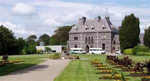
| Turlough Park | Built in 1865 to the design of Sir Thomas Newenham Deane, this Victorian Gothic house was sold to Mayo County Council in 1991 and is now part of the Museum of Country Life. |
|
| Turlough House | Built early in the 18th century this was the main residence of the family for much of the 18th century. In 1786 Wilson refers to Turlough as the seat of Charles Lionel Fitzgerald. It was referred to as Turlough Park though it is not named on the 1st edition Ordnance Survey map and was unoccupied at the time of Griffith's Valuation. It is now a ruin. |
|
| Turlough Lodge/Cottage | Home of the Semple family in the 19th century. At the time of Griffith's Valuation William Semple occupied a house valued at £10, leased from the Fitzgerald estate. It is labelled Turlough Lodge on the 25-inch Ordnance Survey map of the 1890s though it also appears to have been known as Turlough Cottage. It is still extant but derelict. |
|
| Windsor House | In 1786 Wilson referss to Breandrum as the seat of Mr. McDonnell. A house valued at £40 was held by Colonel James McAlpine at Breandrum or Windsor at the time of Griffith's Valuation. The original house has been replaced by a modern building. | |
| Mount Gordon | An 18th century house, occupied in the 1770s by 'Garden' [Gardiner]. Wilson refers to it as the seat of Mr. Garden [Gardiner] in 1786. It was occupied by Mary Boyd at the time of Griffith's Valuation, when the house was valued at £43. It is still extant and occupied. |
|
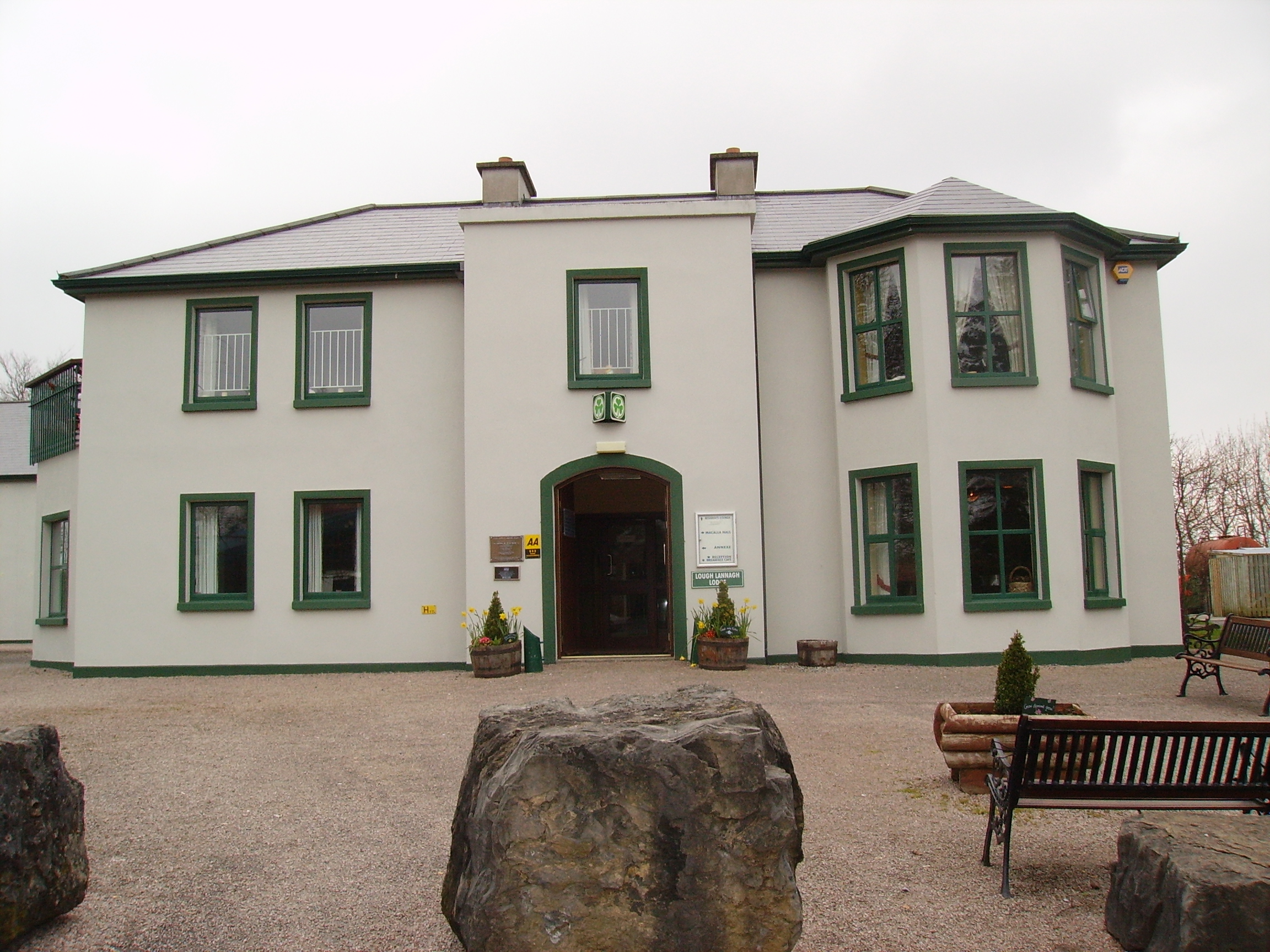
| Creagh's Villa | At the time of Griffith's Valuation, this property appears to be have been leased by Mary Boyd fron the Lucan estate when it was valued at £12. In the 1870s it was the residence of Bernard Peyton. It was destroyed by fire in 1996 and subsequently demolished to make way for the Lough Lannagh holiday complex which includes a building similar to the design of the original house. |
|
| Castleburke | A home of the Bourke family and their descendants. Occupied by Patrick Horan in 1814 and from 1821 James Tuohy was the tenant. The castle was in ruins by the time of the first Ordnance Survey circa 1838. It is now owned by Eamonn de Burca. | |
| Rockstown | Marked on the first edition Ordnance Survey map this house was occupied by William Nally at the time of Griffith's Valuation and held from the Lynch Blosses. The National Inventory of Architectural Heritage notes its connections with P.W. Nally, a member of the Irish Republican Brotherhood and a well-known late nineteenth century athlete influential in the founding of the Gaelic Athletic Association. The house is now a ruin. |
|
| Drumminroe | Malachy Tuohy held a house valued at £8 from George Henry Moore at the time of Griffith's Valuation. Members of the Tuohy family still occupy this house. | |
| Drumineney | David Wilson was leasing this property from the Ecclesiastical Commissioners estate at the time of Griffiths Valuation in the 1850s, when it was valued at £16. The National Inventory of Architectural Heritage suggests that the current house at this site was developed c.1870 from an earlier building. Robert Wilson was also leasing property in this townland at the same time. A house and extensive farm exist at the site. | |
| Tops (Raphoe) | John Wilson was leasing this property from the Ecclesiastical Commissioners estate at the time of Griffiths Valuation in the 1850s, when it was valued at £18. The National Inventory of Architectural Heritage suggests the current house was built c.1852 possibly on the site of an earlier house. Eliza Wilson was also leasing property at this location in the 1850s. |
|