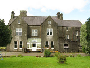
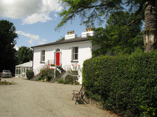
Knockaneady
Houses within 5km of this house
Displaying 13 houses.
Houses within 5km of Knockaneady
Displaying 13 houses.
| House name | Description | |
|---|---|---|
| Warrensbrook | Richard Donovan was leasing this property to Daniel Donovan at the time of Griffith's Valuation, when it was valued at £14. There is still a house at this site, part of a large farm complex. |
|
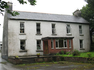
| The Cottage | A house built after the first Ordnance Survey. Thomas Gillman was leasing this property from George Wiseman at the time of Griffith's Valuation, when it was valued at £11 5s, It is still extant and known as Grove House. |
|
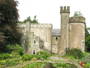
| Kilcaskan Castle | At the time of Griffith's Valuation, William O'Neill Daunt held this property in fee when it was valued at £32. In 1837 Lewis notes that it was held by Daunt and describes it as " a handsome castellated mansion". Both Taylor and Skinner and Wilson refer to it as a seat of the Daunt family in the 1780s. In 1894 Slater referred to it as the seat of Achilles Daunt. In 1906 it was also owned by Achilles Daunt and valued at £12 10s. The Irish Tourist Association Survey of 1944 referred to it as the residence of Miss M.O'Neill-Daunt. It is still extant. |
|
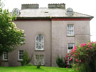
| Ballymoney Glebe House | At the time of Griffith's Valuation, Reverend Robert Meade was leasing this property from the Trinity College estates when it was valued at £23. A slightly different building is labelled "Rectory" on the 25-inch Ordnance Survey map of the 1890s. It is still extent and in use. |
|
| Phale Court | At the time of Griffith's Valuation, Standish Smithwick was leasing this property from William Stanley, when it was valued at almost £8. It is recorded as Phale House on the 1st edition OS Map and as Phale Court on the later 25 inch Map. In 1837, Lewis refers to Phale House as the seat of E.H. Good. In 1914 it was occupied by the Hosford family. In 1786 Wilson refers to it as the seat of John Wade. It is also associated with the Deasy family. |
|
| Roseville | At the time of Griffith's Valuation, Henry Beamish was leasing this property to Bernard Beamish, when it was valued at £16. Henry Beamish was also the owner of a flour mill [W381539] in the same townland, leased to William Norwood, and valued at £150. The mills do not appear on the 25-inch Ordnance Survey map of the 1890s. Roseville is still extant. | |
| Palace Anne | Wilson, writing in 1786, refers to Palace Anne as the seat of Mr. Bernard. Both Leet in 1814 and Lewis in 1837 note Palace Anne as the residence of Arthur B. Bernard. It was held in fee by him in 1851 when it was valued at £30. Lewis describes it as " a stately mansion, beautifully situated". Bence Jones states that it was named in honour of Anne LePoer, wife of Arthur Bernard, who built the house in 1714. The house became dilapidated after the sale in the mid-nineteenth century and much of it has been demolished though one wing still survives. In 1944 the Irish Tourist Association Survey reported that it was then in a possession of Mr Warner who had refurbished this wing as a dwelling. The Survey provides a detailed description of the remainder of the property. |

|
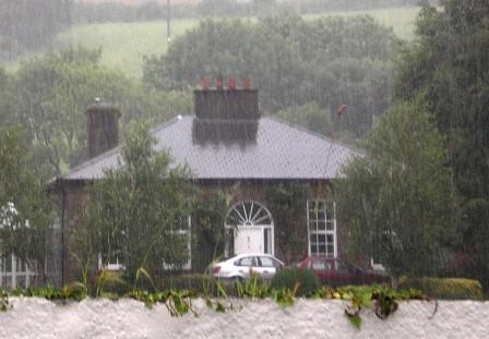
| Enniskean Cottage or Mount Lodge | Noted by Lewis as the residence of Rev. W. Sherrard in 1837 and being leased by him from James Gillman in 1851 when it was valued at £12 10s. Later the residence of Orpen Beamish, MD. It is labelled Enniskean Cottage on the 1st edition Ordnance Survey map but as Mount Lodge on the 25-inch map of the 1890s. It is still extant. It was offered for sale in 2023. |
|
| Mary Ville (Kinneigh) | Leased by Joseph Hosford from the Devonshire estate at the time of Griffith's Valuation, when it was valued at £11 10s. | |
| Gardeville | Noted by Lewis in 1837 as the seat of Rev. W. Hall. Leased by Sarah Hosford from the Devonshire estate in 1851 when it was valued at £13. | |
| Carrigmore House (Kinneigh) | James Lysatt [Lysaght] held a property in fee here, valued at £46, at the time of Griffith's Valuation. Bence Jones states that it was built in 1842 by James Lysaght on the site of an earlier house known as Connorville, which had been purchased by Lysaght from the Connor family. In 1837 Lewis had referred to it as "the deserted and dilapidated mansion of the O'Connors." In 1783 Taylor and Skinner had indicated Connorsville as a seat of the Connor family as had Wilson in 1786. An adjacent smaller house, known as Laurel Hill, was held by Adderley Bernard in 1851. Carrigmore House and 312 acres, the estate of James Lysaght, were advertised for sale in July 1853. A lithograph of the house is included in the sale rental. Lyons indicates that the estate was sold privately to James L. Holmes. Carrigmore and Laurel Hill were offered for sale in the Landed Estates Court in 1876, as part of the sale of the Holmes estate. Donnelly states that it was burnt in October 1920 during the War of Independence when it was the property of James H. Morton. The house is now derelict. | |
| Fort Robert (Kinneigh) | Described by Lewis in I837 as a "handsome residence" then occupied by Mrs. [O'] Connor. In 1851 it was leased by George Fuller from Mary Longfield [O']Connor and valued at £18. By the mid 1860s it was in the possession of Thomas Kingston Sullivan. The sale rental of 1867 records that Fort Robert had been "allowed to get out of repair, but is beautifully situated". It appears to have become ruinous by 1890s. The Irish Tourist Association Survey of 1944 stated that the ruin was the property of Judge Henry Connor and also that the house had been associated with Art [O']Connor, United Irishman. | |
| Manch | Held in fee by Daniel Connor at the time of Griffith's Valuation, when it was valued at £40. Lewis describes it as "an elegant villa four miles from the town, situated on a terrace, and surrounded with a highly cultivated demesne" in 1837. The Irish Tourist Association Survey of 1944 noted that it was then the residence of Circuit Court Judge Henry L. Connor. Bence Jone notes that the house was gutted by fire in 1963 but afterwards rebuilt. Still in the possession of the Conner family in the late 20th century. |

|