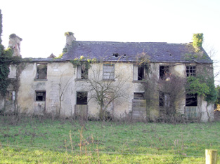
Boskill
Houses within 5km of this house
Displaying 12 houses.
Houses within 5km of Boskill
Displaying 12 houses.
| House name | Description | |
|---|---|---|
| Abington House | Abington House in the townland of Dromeliagh is marked on the first Ordnance Survey map. In 1786 Wilson states "at Abingdon, is a very pleasant seat of Sir Nicholas Lawless". At the time of Griffith's Valuation a house valued at £17 was occupied by Michael Apjohn in this townland. In the 1860s this house was occupied by John Connell Fitzgerald and his wife Margaret (Apjohn). ''The Limerick Chronicle'' of 1 Oct 1872 records the death of Mary Anne Apjohn of Abington House, widow of Michael Apjohn. The property was held from Lord Cloncurry. A ruined house is still extant at the site. |
|
| Eyon | The Ordnance Survey Name Book records this house as costing £500 to build in 1838 when it became the seat of Mr Richard Laffan. The house valued at £12+ at the time of Griffith's Valuation, was occupied by Richard Laffan, a dairy farmer. Laffan held the property from Edward B. Hartopp. ''Burke's Irish Family Records'' records Edward Lloyd of Eyon in the mid 18th century. | |
| Mount St Lawrence | Joseph Hannan held a house valued at £17 and a demesne of 94 acres from Edward B. Hartopp at the time of Griffith's Valuation. The Ordnance Survey Name Books record Joseph Harman as the resident circa 1840. A house is still located at this site. | |
| Mountminnett | Mountminnett was the location of the Minnitt family at the end of the 17th century. This house was the home of a branch of the Gabbett family in the first half of the 19th century. It was occupied by William Gabbett in the early 1850s when the buildings were valued at £11 and the Gabbetts held the property from Sir Richard Bourke. William Gabbett of Mountminnett owned 397 acres in county Limerick in the 1870s. | |
| Caherline | [The seat of the Gabbett family in the 18th and early 19th centuries]. Lewis refers to its occupation by a farmer and Griffith's Valuation records Thomas Barry as resident in the early 1850s when the buildings were valued at £16. The original house is still extant though with some modifications. It is now the home of the O'Grady family. | |
| Highpark | A property in the possession of the Gabbett family from the early 18th century. Described in the Ordnance Survey Name Book as having a "decayed appearance", this three-storied house was built between 1759 and 1789. The house, valued at £10, was vacant at the time of Griffith's Valuation. It is still extant. |

|
| Ballyvorneen | This house is marked on the first edition Ordnance Survey map at the site of a castle. Described as a "dairyman's house" at the time of Griffith's Valuation and held by William and Thomas Gabbett, younger brothers of Joseph Gabbett of High Park, in fee. The buildings were valued at £15. The house no longer exists. |

|
| Caherconlish House | Lewis describes this house in the following terms "Near the town stands Cahirconlish House, a handsome modern residence, erected near the site of the old family mansion, by the proprietor, Major Wm Wilson." The Ordnance Survey Name Book dates this house to about 1789 and it was three storeys high. Wilson, writing in 1786, refers to a residence of Mr. Wilson at Caherconlish. A small drawing of the house is to be found on Map 16 H 32 (13) in the National Library of Ireland. This house was valued at £40 at the time of Griffith's Valuation and was held by Charles Monck Wilson in fee. Daniel Fitzgerald Gabbett, MP, was recorded as the owner in 1906, though he himself had died in 1898. At the time of the Irish Tourist Association survey 1942 Caherconlish House is described as a Creamery. The surveyor writes that a fine Adams ceiling in the house was destroyed by an accidental fire in 1925. Caherconlish is no longer extant. | |
| Lombardstown | The Ordnance Survey Field Name Book states that this house was rebuilt in 1823 by the occupier Thomas O'Brien. It was still occupied by Thomas O'Brien in the early 1850s. The buildings were valued at £11 and the property held from Lady Charlotte Wolfe. | |
| Dromkeen House | Fitzgerald refers to the old mansion of the Burghs as standing opposite the old walls of a church. Lewis refers to Dromkeen as "formerly the residence of the Burgh family" then occupied by the Reverend M. Lloyd, and that "the remains of the ancient mansion show it to have been an extensive and important establishment". A house at this site was occupied by Henry Croker at the time of Griffith's Valuation and valued at £34. It was held from Robert Smithwick. The Ordnance Survey Name Book refers to this house as William's Fort and states that it first belonged to the Burgh family and was rebuilt in 1820. Valued at £17 in 1906 and occupied by Digby H. De Burgh. |

|
| Ballybrood | A house in the village of Ballybrood, the residence of a branch of the Maunsell family in the 18th and early 19th centuries. Occupied by Samuel Maunsell at the time of Griffith's Valuation and held by him in fee. The buildings were valued at £11+. | |
| Cloverfield | In 1786 Wilson mentions a house called Cloverfield three miles beyond Caherconlish as the seat of Mr. Lloyd. A house named Cloverville is marked on the first edition Ordnance Survey map. On later maps a much larger building is marked. At the time of Griffith's Valuation valued at £9.5 shillings was vacant in this townland. Richard Laffan, a dairy farmer, is recorded as the immediate lessor. The National Inventory of Architectural Heritage dates the original building from circa 1830 with later 19th century additions. The house continues to be used as a residence. |

|