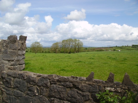
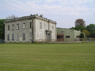
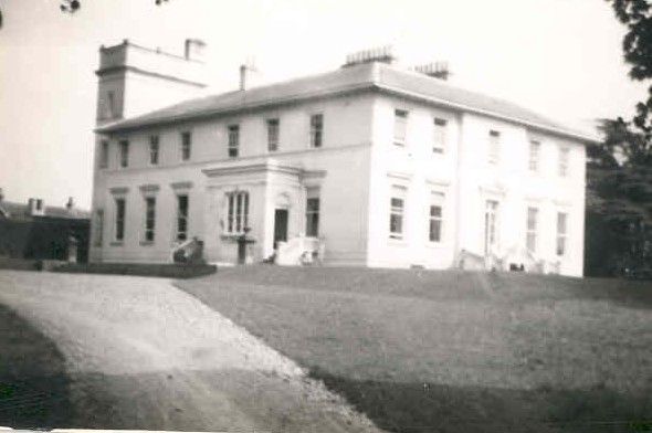
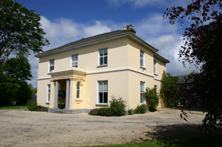
Greenhills
Houses within 10km of this house
Displaying 80 houses.
Houses within 10km of Greenhills
Displaying 80 houses.
| House name | Description | |
|---|---|---|
| Clonmacken | Built in 1700 by Reverend Edmund Palmer according to the Ordnance Survey Field Book, this two-storey house was occupied by Henry D'Esterre in 1814, by Captain Vereker in 1834 and by 1839 was the seat of John Brown Finch. In the early 1850s it was the residence of John Sharp, situated on the Lansdowne estate, it was held from Lawrence Kelly. | |
| Court/Kildimo Court | In 1837 Lewis wrote that Kildimo Court "which is nearly entire was the seat of the Hartstonge family". The Hartstonges appear to have inherited this property from the Widenhams. In 1786 Wilson refers to Court as the seat of Sir Harry Hartstronge and notes that "a bridge is now building at the ferry of Court but the house is in ruins". The property called Court Castle is labelled "in ruins" on the 1st edition Ordnance Survey map. A house labelled "Court" appears in the same townland on both the 1st and 25-edition maps. Buildings are still present at this location. | |
| Summerville | Built in the 1780s by Joseph Massey Harvey, a Quaker merchant, who married Rebecca Fisher and still occupied by him in 1814. Joseph and Rebecca were the parents of William Henry Harvey, a distinguished botanist. At the time of Griffith's Valuation Summerville was valued at £33 and occupied by James T. Fisher who held the property from Eliza Harvey. The house is now an accommodation and conference centre of the Mary Immaculate College for training primary teachers. The college was founded in 1898. |

|
| Maryville | Built in 1790 and located on the Monsell estate the residence of Hugh F. Finch in 1837 and of Mrs Finch at the time of Griffith's Valuation when the buildings were valued at £28. In 1906 Captain G.W. Finch occupied the mansion house at Maryville valued at £35. Still in the ownership of the Finch family at the time of the Irish Tourist Association survey 1943. This property is now known as Maryville stud. |

|
| Ballymurphy | Occupied by Eyre Powell in 1837 and by the Reverend George Peacock in the early 1850s and held from Edward C. Villiers. |
|
| Fort Etna | The home of the Peacock family in the 19th century, although J. Waller O'Grady was resident in 1837. At the time of Griffith's Valuation it was occupied by Mrs Peacocke who held it from Charles Leslie, valued at £30. Occupied by Edmund White in the 1870s Bence Jones records that it later became the home of the Reilly and Peart families. The original house is now a ruin. | |
| Greenmount | Built in 1770, a two storey house, home of the Green family and held from the Peacockes. In 1786 Wilson refers to the seat of Mr. Greene, within half a mile of Patrickswell. which he calls Graig. The buildings were valued at £42 at the time of Griffith's Valuation. Sold by the Greens in 1947. In the 1960s the house was demolished and a large modern house built instead by the Earl of Harrington. |

|
| Jockeyhall | A Blackall residence in the 18th century, by the mid 19th century Jockeyhall was on the Tuthill estate and occupied by Patrick Dundon. This house was included in the sale of the Tomkins estate in 1861 when held by the representatives of George Tuthill. |
|
| Richmond Villa | This house valued at £16 in the mid 19th century was occupied by the Westropp family from at least 1814, although a Mrs Wallace was in residence in 1837. The Reverend Fitzgerald records a Mr William Wallace as resident in the 1820s and that the house was built about 70 years previously. It was situated on the Tomkins estate. | |
| Newborough | A house on the Dunraven estate occupied by the Reverend J. Croker in 1814 and by members of the Wilson family in 1837 and the 1850s when the buildings were valued at £40. |

|
| Duane Ville | The residence of Alexander O'Grady Rose, held by him in fee at the time of Griffith's Valuation when it was valued at £7. It is no longer extant. | |
| Cooper Hill | The residence of James Cooper in 1814 and occupied by Mrs [Honora] Cooper in 1837. Inherited by James Cooper Tuthill circa 1844 who then assumed the surname Cooper. The house was valued at £45 at the time of Griffith's Valuation and in 1906 when it was occupied by James Cooper. It was advertised for sale in ''Country Life'' (28 April 1955), bought by Cement Ltd who ran a model dairy farm on the property for some years. A large dairy enterprise still operates on the property. The house is a ruin. |

|
| Faha | A property that was in the possession of the Tuthill family from the early 18th century, Wilson refers to it as Mr. Tuthill's seat in 1786. Occupied by Christopher Tuthill in 1814 and by his son George in 1837. Held by George Tuthill in fee at the time of Griffith's Valuation when the buildings were valued at £60. Thompson Russell lived at Faha in the second half of the 19th century. Valued at £52 in 1906 and occupied by George Taylor who held it with 308 acres of untenanted land. It is now a ruin. |
|
| Corcamore | A house situated on the Barker estate and occupied by Thomas Gleeson in the mid 19th century and valued at £18. [Grid reference is approximate]. | |
| Cragbeg | A house situated on the estate of Lord Clarina, occupied by Vokes in the 1770s and in 1786. It was leased to the Vandeleur family in the mid 19th century. Major Thomas Vandeleur was the occupier and the buildings were valued at £38. Occupied by Richard Parson in 1814, by G. Vandeleur in 1837 and by William Henry Harkness in the 1870s. Slater notes Lieut-Col. Lionel E. Massey as the owner in 1894. Still extant and occupied. |

|
| Elm Park | The records suggest that this house was built post 1814 and pre 1837 though there may have been an earlier property as Wilson refers to "Elm" as the seat of General Massey in 1786. Bence Jones writes that it was an early 19th century house. It was the home of the Massey family, Barons Clarina, in the 19th century. The buildings were valued at £90 at the time of Griffith's Valuation and in 1906. Bought by Patrick King in 1925 and home of the King family until 1956, now demolished. |

|
| Tervoe | Bence Jones writes that the house was built in 1776 by Colonel W.T. Monsell MP on the site of an earlier house. Wilson refers to it in 1786 as "the pleasant seat of W.T. Monsell". In 1894 Slater notes it as a residence of Lord Emly. A De La Poer grandson of the 1st Baron Emly succeeded to Tervoe in the 20th century and it was demolished in the 1950s. A detailed description of the interior of the house is given by the Irish Tourist Association surveyor in 1943. |

|
| Bettyville | Occupied by John Lee in 1814 and held by his son William Norris Lee in fee at the time of Griffith's Valuation and valued at £11+. Fitzgerald describes Bettyville in the 1820s as a 'handsome thatched cottage' occupied by Captain John Franklin. This house was the home of the Revrend John T.N. Lee and valued at £13 in 1906. | |
| Attyflin | A mid 18th century house, Wilson refers to Atthyflin as the seat of the Westropps in 1786. The house was occupied by Hamilton Jackson at the time of Griffith's Valuation and held from John Westropp. The buildings were valued at £50. In 1943 this house was owned by Mrs A. White, nee Massy Westropp and its contents at this time are described by the Irish Tourist Association surveyor. Home of a branch of the Hewson family in the 20th century. It is still extant. |

|
| Spring Lodge/Springfort | Dickson Esq was occupying a house at Ballybronoghe in the 1770s and in 1786. Spring Lodge was occupied by George Massey at the time of Griffith's Valuation and held from the Court of Chancery. George Massey was possibly the younger brother of the 3rd Lord Clarina. It is labelled Spring Lodge on the 1st edition Ordnance Survey map but as Springfort on the 25-inch edition of the 1890s. It is still extant and occupied. |

|
| Ballyclogh | The home of a branch of the Morony family during the 19th century. Occupied by James Todd in the early 1850s who held the property valued at £38 from the Moronys. An occupied house is still located at this site. |

|
| Ballyclogh Lodge | Ballyclogh House and Lodge are both marked on the first Ordnance Survey map of county Limerick. At the time of Griffith's Valuation John Russell held land in the townland with associated buildings valued at £12 from Michael Furnell. There were also mills in the townland valued at £35. Valued at £10+ in 1906 when occupied by George Furnell, Ballyclogh remained in the possession of the Furnell family until 1973. | |
| Derryknockane | George Gloster held this house in fee at the time of Griffith's Valuation when the buildings were valued at £20. | |
| Lemonfield House | Sometimes spelt Leamonfield, this house was the home of a junior branch of the Bevan family in the first half of the 19th century. Griffith's Valuation records Thomas Bevan as the occupier holding the property from the Reverend William Lloyd. It was valued at £14. ''Burke's Irish Family Records'' refers to Arthur Russell of Lemonfield, sixth son of John Norris Russell of Limerick. He died 1890. The house is no longer extant. | |
| Fort Elizabeth | Occupied by John Cripps in 1814 and the residence of the Reverend John Croker in 1837. William Croker was the occupier at the time of Griffith's Valuation when it was held from the representatives of James O'Sullivan and valued at almost £16. A substantial farm remains at the site. | |
| Monaster House | This house was the home of Michael Furnell in 1803. By 1814 the house on the Vandeleur estate, was leased to John Cantillon Heffernan . At the time of Griffith's Valuation, the buildings at Monaster were valued at £35 and leased by John Cantillon from the Vandeleur estate. In 1943 the Irish Tourist Association surveyor refers to a story concerning ghostly activities and that the house had been "pulled down" a short time previously. Much of the farmyard building complex survives. |
|
| Ballycummin | Roche Castle was a residence of Sir David Roche at the time of Griffith's Valuation held from the Bishop of Limerick and valued at £30. | |
| Cloghacloka | A house valued at £12, in the possession of the representatives of Pat D'Arcy and held from the representatives of Major Peacock, at the time of Griffith's Valuation. Some farm buildings are still extant at the site. | |
| Rockfield | Situated on the estate of Edward C. Villiers, this house was the home of a branch of the Blennerhassett family in the mid 19th century. It was named Rock View on the first Ordnance Survey map. The Ordnance Survey Field Name Book refers to Rockview as a "plain thatched cottage built in 1819". On the later 25-inch map the house is labelled "Rockfield House". Slater, in 1894, refers to it as the seat of R.B. Blennerhassett. In 1906 Rockfield was described as a mansion house and valued at £22. It was occupied by Richard A. Blennerhassett. A house is still extant at the site. | |
| Fedamore | A house known as Fedamore Cottage is marked on the first Ordnance Survey map. By the early 1850s John and Edward Synan were the occupiers of a house valued at £27 in Fedamore townland, which they held from Colonel Wyndham. The property is shown as Fedamore House on the 25-inch map of the 1890s, by which time it was the residence of J.G. Kelly. It is still extant and occupied. | |
| Friarstown (New) | A 2 storey house with offices which was built in 1826 by Vere Hunt on the townland boundary between Friarstown and Friarstown North. It was the residence of Vere Hunt at the time of Griffith's Valuation, held in fee and valued at £20. No house appears to exist at this location now. |
|
| Kilpeacon | Lewis writes that the manor was granted to William King in the reign of James I and that "the late proprietor" had erected a handsome mansion which was now the "property and residence of Cripps Villiers". In his will dated 1704 William King refers to his niece Mary Villiers. The Ordnance Survey Field Name Book states that Kilpeacon House was the property of Edward Villiers, Dublin, and was occupied by Miss Deborah Cripps. Built in 1820 it was a large, commodious building of 2 stories. It was the residence of Edward C. Villiers at the time of Griffith's Valuation, held in fee and valued at £60. Bought by Major George Gavin in the early 1850s from the Villiers and the residence of his son Montiford W. Gavin in the early 20th century. The Irish Tourist Association surveyor writes in 1942 that this house was completed in 1799. The owner was Mrs O'Kelly, her husband having purchased the house in 1927 from the Gavins. This house is still extant and occupied. |
|
| The Grange | The home of the Grady/O'Grady family in the 18th and 19th century. In 1786 Wilson describes it as "the beautiful and well-improved seat of Standish O'Grady". It was inherited by the Crokers in 1861. Occupied by Standish [O'] Grady in 1814 and Henry O'Grady in 1837 and at the time of Griffith's Valuation. The buildings were valued at £77 and the property was held in fee. In 1894 it was noted by Slater as the seat of Captain Edward Croker. This house was described as in very good repair even though it had not been occupied for a number of years preceding the Irish Tourist Association survey of 1942. The house is now a ruin. |
|
| Cahir Guillamore | The seat of the O'Grady family from the mid 18th century acquired through marriage with a member of the Hayes family. Held by the Viscount Guillamores in fee and valued at £50 in the early 1850s. Viscount Guillamore was recorded as the occupier in 1906 when the house was valued at £48. The Irish Tourist Association surveyor in 1942 refers to this house as been unused since 1922 when the estate was divided by the Land Commission. All the fittings has been removed and only the shell of the house remained. The house is now a ruin. |

|
| Dooneen | The Reverend Fitzgerald writes that this house was "lately" built by Villiers Peacocke. The Ordnance Survey Name Books records 1820 as the date of its erection. Villiers Peacocke was still in residence in 1837 and Griffith's Valuation records him holding the property in fee. The buildings were valued at £18. It was included in the sale of the life estate of Eugene Kieran in the Land Judges' Court in April 1890 when the house was described as "a very good dwelling house.....suitable for a gentleman's residence". The sale was adjourned. A house is still extant at the site. | |
| Mount St Lawrence | Joseph Hannan held a house valued at £17 and a demesne of 94 acres from Edward B. Hartopp at the time of Griffith's Valuation. The Ordnance Survey Name Books record Joseph Harman as the resident circa 1840. A house is still located at this site. | |
| Ballynagarde | The seat of the Croker family from early in the 18th century. Bence Jones writes that the house was built in 1774 and that it became a ruin during the 20th century. It was valued at £70 in the mid 19th century and held in fee by John Croker. The seat of H.S. Croker in 1894. By 1906 this house was valued at £119+ and was occupied by Courtenay Croker. The Irish Tourist Association Survey records the occupation of this house by the Defence Forces in 1942. It is now a ruin. |

|
| Coolyhenan House | A house occupied by Michael Shine at the time of Griffith's Valuation and held from the representatives of M. Honan, valued at £28, with a demesne of 343 acres. Though buildings survive at the site they appear to be in a derelict condition. | |
| Edwardstown | Edwardstown was the residence of John Russell in the early 1850s held by him in fee and the buildings were valued at £18+. |

|
| Roxborough | Occupied by William Westropp in 1814 and Lewis refers in 1837 to the ''fine mansion and demesne'' of the Honourable J. P. Vereker. The Ordnance Survey Name Book refers to the rebuilding of Roxborough by Major Vereker in 1832 at the expense of approximately £1200. Viscount Gort held Roxborough in fee at the time of Griffith's Valuation when it was valued at £40. The house was advertised for sale in June 1852 and again in June 1853. Possibly bought by the McMurrays who were certainly resident by 1862. In 1894 Slater refers to it as the seat of A. Crawford. Now a more modern house appears to be located at this site. |
|
| Lickadoon | The Ordnance Survey Field Name Book records the date for the building of this 3 storey house, the seat of George Parsons, as circa 1779 at a cost of about £1000. By the time of Griffith's Valuation John O'Brien was residing at Lickadoon which he held from George Biggs. The buildings were valued at £20. In 1942 this house was the property of Mr William Leahy, a solicitor, and formerly the residence of the the Urquhart Hunts (ITA). | |
| Glen View | John Russell was the occupier of a house at Glen at the time of Griffith's Valuation. He held the property from Miss Abigail Briscoe and the buildings were valued at £15+. Slater also recorded Glenview as the seat of John Russell in 1894. This house is now demolished. |

|
| Kilrush | A house occupied by Daniel Gabbott and held from Tottenham Harvey at the time of Griffith's Valuation. The house was valued at £40 and was surrounded by 3 acres of land. It was situated on the Barrington estate. [Marked as Thorn Ville on the first Ordnance Survey map]. | |
| Williamstown Castle | Lewis refers to Williamstown Castle having been restored by the Messrs Pain, architects. In the early 1850s John Croker is recorded as the occupier, holding the property in fee. The buildings were valued at £33. It is now a ruin. | |
| Rockstown House | A building valued at £18 at the time of Griffith's Valuation, occupied by Chartres Brew Maloney and held from James Kelly. Chartres Brew Molony, second son of Patrick Molony of Cragg married his cousin Alice, daughter of James Barry of Rockstown, in 1841.Rockstown Castle was inherited by James Kelly's grandson, Basil James Kelly, in the 20th century and was left by him to his nephew Derrick Morley in 1945. It is still extant |

|
| Sandville | The home of the Barry family in the 18th and 19th centuries, the house became known as Sandville in the early 19th century. The Ordnance Survey Name Book dates the building 1799. John Barry occupied this house on the Kelly estate at the time of Griffith's Valuation when the buildings were valued at £26. John Grene Barry was resident in the 1870s and 1880s. Buildings are still extant at the site. | |
| Friarstown (Grange) | At the time of Griffith's Valuation this house was held from James Kelly by James H. Barry, the buildings were valued at £12. In 1906 Bazil R. Kelly held about 400 acres of untenanted land and buildings valued at £12 at Friarstown. This house is still extant. |

|
| Ballysheedy | A 3 storey house built circa 1749, occupied by FitzGillon in the late 1770s and noted by Wilson as the seat of Gibbon Fitzgibbon in 1786. It was the residence of Michael Furnell in 1814 and occupied by Gibbon T. Fitzgibbon in the early 1850s, when it was held from Admiral Proby and valued at £22. It was ruinous by the publication of the 25-inch Ordnance Survey map of the 1890s. | |
| Ballymacreese | A residence of the Greene family in the 18th century and noted by Wilson as the seat of Mr. Greene in 1786. The Ordnance Survey Name Books refer to this house as the seat of Mr James Shine, rebuilt in 1829 at a cost of £900. Occupied by James Shine in the early 1850s and held from the representatives of Frederick Lloyd. The buildings were valued at £26. Jeremiah Shine of Ballymacreese owned 79 acres in the county in the 1870s. The house is still extant and well-maintained. |

|
| Rockview | A 2 storey house on the Croker estate, built in 1837 for £400, it was occupied by George Peacock circa 1840 and in the early 1850s when it was valued at almost £12. There is still an extant house at the site. |

|
| Sunville | Described as the seat of Thomas Wallnutt in the Ordnance Survey Field Name Book and built in 1821 for £900. It was occupied by Margaret Wallnutt in the early 1850s and held from William F. Taverner and valued at £24. | |
| Coolraine House | Occupied by John Vereker at the time of Griffith's Valuation, valued at £30 and held from the Marquess of Lansdowne. It was still extant until the 1940s but the site is now occupied by suburban housing. | |
| Moylish | The Ordnance Survey Name Book shows Arthur Gloster as proprietor of this townland circa 1840 and Moylish House is marked on the first Ordnance Survey map. By the time of Griffith's Valuation Moylish valued at £24 was occupied by Lawrence Kelly who held the property from John Judde. Moylish is now the site of the Limerick Institute of Technology. | |
| Shelburne | The National Inventory of Architectural Heritage (buildings of Ireland) states that this was a home of William Petty-FitzMaurice (1737-1805), 2nd Earl of Shelburne and 1st Marquess of Lansdowne. The Ordnance Survey Field Name Book refers to the building of Shelburne in 1837 at a cost of £2,000. Circa 1840 it was the seat of H.N.Seymour. At the time of Griffith's Valuation it was occupied by a representative of Robert Gabbett and held from the Marquess. It was the home of Thompson Russell in 1878 and of Henrietta Rose in 1887. Now located in the grounds of Ardscoil Rís. |
|
| Bellevue | The description in the National Inventory of Architectural Heritage records the building of this house as circa 1820 and that it was the home of the artist Douglas Alexander (1871-1945), one of three brothers who were prominent Quaker merchants in the city of Limerick. At the time of Griffith's Valuation Bellevue valued at £35 was occupied by William Alexander. Another house occupied by James Alexander and valued at £31 stood close by. Both houses were held from the Marquis of Lansdowne. Later this house was the home of the Cleeves family, toffee makers. |

|
| Ardhu | A house built post 1850, the seat of the Rose family at the beginning of the 20th century. Now functions as the Clarion Hotel suites. |
|
| Tivoli | Marked on the first Ordnance Survey map, Tivoli Cottage valued at £48 was occupied by Major Wheeler and held from Sir Matthew Barrington at the time of Griffith's Valuation. Since 1952 it has been the centre of a boys' secondary school known as Villiers School. |

|
| Ashbourne | A 2 storey house located on the Earl of Limerick's estate, this house was the seat of the Honourable Robert O'Brien in the 1830s. It was occupied by Richard Wilson in the early 1850s and held from Eliza Harvey. Garrett Hugh Fitzgerald's interest in the property was advertised for sale in May 1851. By the 1870s it was the home of the Synan family. This house is now demolished. | |
| Strand House | Strand House appears to be the house also known as "Stonetown House" and marked as such on the first Ordnance Survey map. The Ordnance Survey Name Book describes Stonetown House as the seat of Daniel Gabbett and that it was built between 1760 and 1770 by G. Vandeleur at a cost of £1,100. At the time of Griffith's Valuation it was the residence of William Gabbett, valued at £44 and held from Elizabeth Vereker. Part of the original garden now occupied by The Strand Hotel. | |
| Bellefield | Bellefield was the residence of George Furnell at the time of Griffith's Valuation. He held it from William Gabbett and it was valued at £33. William's brother Daniel lived at Bellefield at one time. A Charles A. Marrett is recorded as resident at Belfield, Limerick in 1814. Belfield Park is now the location of the Regional Maternity Hospital. | |
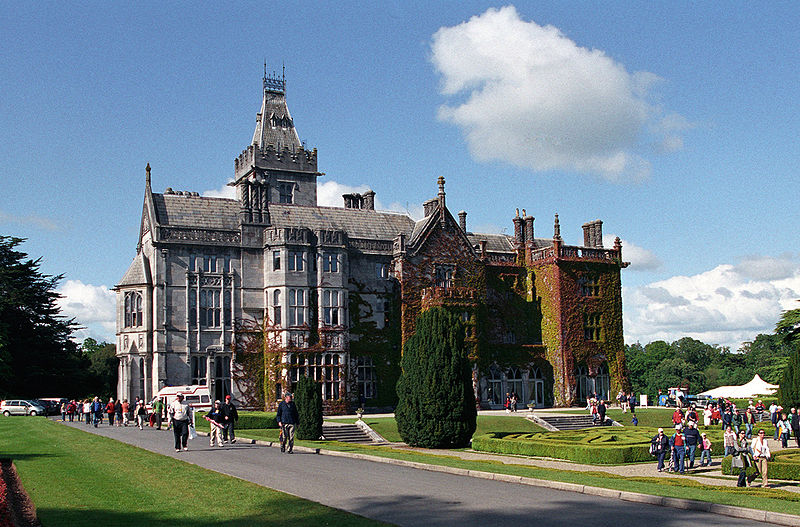
| Adare Manor | Early 18th century house replaced by a Tudor-Revivalist style building in the mid 19th century, the home of the Quin family and Earls of Dunraven. In 1786 Wilson describes the original house as "a very noble structure with fine and extensive demesnes". At the time of Griffith's Valuation valued at £130 and in 1906 the buildings at Adare Manor were valued at £182. Now functions as a hotel. |
|
| Kilgobbin | Occupied by George Fosberry in the early 1850s held from the Earl of Dunraven and valued at £30. An inventory of the furniture at Kilgobbin was compiled in June 1923 for A.P.Pollock. It is still extant. | |
| Mondellihy | Occupied by George Fosberry at the time of Griffith's Valuation, held from the Earl of Dunraven and valued at £15. By the end of the 19th century this house was the home of Peter David Fitzgerald (1855-1935), a younger son of George Fitzgerald 1st Baron Fitzgerald of Valencia and grandson of the Knight of Kerry. |

|
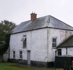
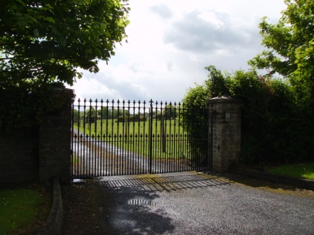
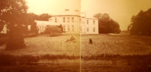
| Rineroe [Fort Union] | The house at this site is labelled Rineroe on the 1st edition Ordnance Survey maps but as Fort Union on the later 25-inch map of the 1890s. It was held by John Christy from the Dunraven estate at the time of Griffith's Valuation and valued at £24. It is still extant and occupied. |
![Photo of Rineroe [Fort Union]](https://landedestates.ie/storage/img/orig/2850.jpg)
|
| Castleroberts | Occupied by Michael Cantlow [Cantillon] in 1814 and by John Heffernan Cantillon at the time of Griffith's Valuation and held from Edward B. Hartopp. The buildings were valued at £13+. A farmyard is visible at the site now. | |
| Carass House | Caherass/Carass House was the seat of the Roche family from the early 19th century. The family had a large flour mill in the townland of Caherass and the house was situated closeby but in the next townland. At the time of Griffith's Valuation Sir David Roche held the house and 235 acres in Ballouragan from Messrs Barrington and Delmege. In 1894 it was the seat of Sir David V. Roche. In 1943 the Irish Tourist Association surveyor wrote that the house was accidentally destroyed by fire "many years ago". | |
| Carass Court | ''Burke's Irish Family Records'' states that Jeffrey Browning purchased Carass Court, from Lord Carbery. Leet records Jeffrey Browning as the proprietor of Carass Park in 1814. Jeffrey/Geoffrey Browning was married to Frances, sister of Sir David Roche, 1st Baronet. By the time of Griffith's Valuation Thomas Wise Browning was the occupier and he held the property, valued at £50, from Sir David Roche. The Brownings were still resident at Carass Court in the 1940s but the house was later demolished. |
|
| Clorane | A house occupied by Henry Hunt in 1814. Lewis describes Clorane as a "fine old house belonging to the Hunt family". By the time of Griffith's Valuation Edward Browning was leasing the house and 280 acres from Sir David Roche. In the 1870s in the possession of Patrick Hartigan. Old farm buildings are still located at the site but the house is a modern structure. |

|
| Croom House | Croom House was the home of the Lyons family in the 18th and 19th centuries. The house of James D. Lyons was valued at £48 in the early 1850s and he had a flour mill valued at £75 closeby. He held the property from John Croker. Described in 1943 by the Irish Tourist Association surveyor as a beautiful mansion on the left bank of the Maigue river, it was then in use as a military post. The house is still extant and occupied. |

|
| Islandmore | Tooreen, located just south of the town of Croom, was the residence of James D. Lyons in 1814 and 1837. By the early 1850s this house, then known as Islandmore, was occupied by Robert Maxwell, valued at £60 and held from Miss Catherine Giles. It later became the home of the Kelly family and Slater refers to it as the seat of John Roche-Kelly in 1894. Colonel Basil Roche Kelly was resident at the time of the Irish Tourist Association survey of 1943. The surveyor wrote that the house was originally Georgian but had suffered many alterations. |
|
| Croom Castle | Originally a Fitzgerald Castle, subsequently granted to the Duke of Richmond who sold it to John Croker in 1721. Reverend Fitzgerald writes that Croker was agent to the Duke. A residence was built with some of the stone from the old castle. Situated on the outskirts of the town of Croom this house was occupied by Samuel A. Dickson in the mid 19th century who held it from the Crokers. The buildings were valued at £30. Sold in the late 1880s to the Lyons family and bought by Michael Corry in 1936. Now functions as self catering accommodation. see http://www.croomcastle.com/history.html |

|
| Abbeyville | A house located on the Finch estate and the home of the White family in the 19th century. Occupied by William White in 1814 and Richard White in 1837 and at the time of Griffith's Valuation when the buildings were valued at £26. Later the home of Henry Ievers, a younger brother of Robert Holmes Ievers, of Castle Ievers. The original house is not extant but a house still exists at the site. |
|
| Carrigeen | John Christy held a house valued at £21 and 513 acres at Carrigeen from the Earl of Dunraven at the time of Griffith's Valuation. A modern farm is extant at the site now. | |
| Ballinacurra House | Marked on the first Ordnance Survey map and situated on the outskirts of Limerick city this house was occupied by Edmund Palmer at the time of Griffith's Valuation when it was valued at £23 and held from Patrick O'Shea. Later the home of Hugh Massy. He died at Ballinacurra in 1881. Now in use as an office. |
|
| Fanningstown Castle | An 18th century house which was the home of the Jackson family. Henry Lee is recorded as resident at Fannings-town in 1814. This house was demolished and a battlemented building was erected in the bawn of the old medieval castle by Hamilton L. Jackson in the 1850s and offered for sale in 1860. Bought by David Vandeleur Roche of nearby Carass in the 1860s. Occupied by James Fitzgerald Bannatyne in 1906 who held the mansion house valued at £31+ and 359 acres of untenated land. The castle now provides self catering accommodation and can be hired as a venue for functions such as weddings. http://www.fanningstowncastle.com/index.htm |

|
| Kilmoyle | A house built by the Boyds, merchants in Limerick city, circa 1845 on the Lansdowne estate and originally known as Westfield. For many years the residence of the Catholic Bishops of Limerick. Sold by the Diocese to Aidan Brooks for development in 2007 for a sum reputed to be > €20 million. |

|
| Friarstown | The National Inventory of Architectural Heritage states that he house was built in 1827 for David Urqhart Hunt and cost £10,000. At the time of Griffith's Valuation the house was occupied by Henry Hunt who held it from the Reverend Richard Maunsell, valued at £35. This property is now known as Friarstown Stud. |

|
| Rosbrien | A home of a branch of the Quin family descended from John Quin, second son of Thady Quin (1645-1726). Wilson, writing in 1786, refers to Rosbrien as the fine seat of Mr. Quin. It is labelled Rossbrien House on both the 1st and 25-inch edition Ordnance Survey maps but is no longer extant. | |
| Cahernarry House | Originally a Cripps residence, occupied by a member of the Crips family in the 1770s and 1780s and by J. Cripps in 1837. By the time of Griffith's Valuation Henry Watson was in residence. The house was valued at £8. It is not visible on the 25-inch Ordnance Survey map of the 1890s. Modern farm buildings occupy the site now. | |
| Singland House | A building labelled Singland House, in the townland of Singland, appears on the 1st edition Ordnance survey map of the 1830s. A smaller property, labelled Singland Cottage, is shown nearby. On the later 25-inch map of the 1890s, the original Singland House is no longer visible and Singland Cottage is named Singland House. It is no longer extant. The original Singland house is probably that referred to by Wilson as the seat of Mr. Dwyer in 1786. |