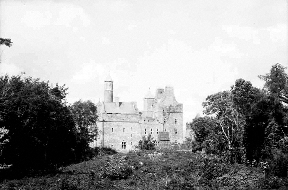
Bunratty Castle
Houses within 10km of this house
Displaying 66 houses.
Houses within 10km of Bunratty Castle
Displaying 66 houses.
| House name | Description | |
|---|---|---|
| Castlecrine | Weir writes that this was an 18th century residence possibly incorporating the 16th century tower. Castlecrine was the home of a branch of the Butler family for most of the 18th and 19th centuries, valued at £45 at the time of Griffith's Valuation, it was demolished in the mid 20th century. |

|
| Castlelake | Home of the Gabbett family in the 19th century, occupied by Robert Gabbett in 1814 and by John Gabbett in 1837 and in the 1850s. They held the property from the Westropp family with whom they intermarried. Home of the Carroll family in the second half of the 20th century, still occupied. | |
| Ieverstown | A house held by John A. Ievers in fee at the time of Griffith's Valuation when the building was valued at £11.10 shillings. Still inhabited it stands close to the road. | |
| Mount Ievers | A house built in the 1730s by Henry Ievers to the design of John Rothery. Wilson refers to it as the seat of Mr. J.A. Ievers in 1786. Occupied by Robert Ievers in 1814 and by W. Ivers in 1837. Eyre Ievers was resident at the time of Griffith's Valuation, holding the property from James Ievers. The Ievers family still live in the house. |

|
| Ballintlea | Weir writes that the original house dates from 1696. Ballintlea was occupied by John Kelly in 1837, who is recorded as holding the property in fee at the time of Griffith's Valuation. The Kellys appear to have bought Ballintlea from the D'Esterres. The Kelly and Kelly Roche families have resided there ever since. Fitzjames Kelly was in possession in 1906. | |
| Cratloe Woods | An 17th century house with a 19th century addition, the Irish home of the Stafford O'Briens and still in the family's possession. On the first edition Ordnance Survey map this house appears to straddle the border of the townlands of Cratloe and Portdrine. The house was held by Augustus Stafford at the time of Griffith's Valuation, valued at £24. In 1894 it was the seat of F.H.Stafford-O'Brien. It is still extant. |
|
| Burtonhill House | Weir writes that this house was probably built by the Carrigaholt Burtons as a sporting lodge. It is marked on the first edition Ordnance Survey map. The Burton Conynghams had a large estate in the parish of Killeely so there can be no doubt that the house was named after them. By the time of Griffith's Valuation it was valued at £11 and Edward H. Goggin was in residence. He held the property from Mrs Taylor. William B. Goggin of Burton Hill married Frances Maria Whitestone in the second half of the 19th century. see http://brew.clients.ch/RichardClare.htm | |
| Summerhill House | Built on the Marquess of Conyngham's estate by the time of the first Ordnance Survey, this house valued at £10 was occupied by John Frost in the mid 19th century and it continued to be the home of the Frosts until the 1970s. A substantial farm still exists at the site. | |
| Meelick House | A house built by the time of the first Ordnance Survey on the Marquess of Conyngham's estate and occupied by William Roche at the time of Griffith's Valuation, when it was valued at £11. This house is no longer extant. | |
| Cratloe House | Another house belonging to the Stafford O'Brien family, held by Augustus Stafford in fee at the time of Griffith's Valuation and valued at £12. Lewis records this house in the parish of Killeely and Cratloe Woods in the parish of Kilfintinan. Leet records Don O'Brien as resident at Cratloe, county Limerick, in 1814. In 1786 Wilson refers to Cratlagh-Hall as a seat of Mr. O'Brien. Possibly either part of the same building complex as Cratloe Woods or the nearby premises labelled Cratloekeel Castle on both the 1st edition and 25-inch Ordnance Survey maps. | |
| Ballysheen | A house on the Vandeleur estate, occupied by the Walton family for most of the 19th century. Occupied by George Perry in 1814. Valued at £10 at the time of Griffith's Valuation it was renovated in the 20th century. Labelled as Walton Lodge on the 25-inch Ordnance Survey map of the 1890s. |
|
| Ballycunneen | Hogan writes that this house was built in 1805 by Thady, son of Thady O'Halloran the diarist, in front of the old Hickey house. Marked on the first Ordnance Survey map this house was occupied by Stephen O'Halloran who held the property from Colonel George Wyndham. It was valued at £15 and had 159 acre demesne. The house is still extant. | |
| Firgrove | Hogan writes that the building of Firgrove was begun by Thomas, son of Thady O'Halloran, the diarist, and completed by John MacMahon of Knockane. John Peter Kelly took over the house from MacMahon. In 1851 Eliza, daughter of John Scott of Firgrove, married George Fosbery of Clorane, county Limerick. The house was occupied by Charles Butler in the mid 19th century who held the property from John Kelly. It was valued at £35. The house was demolished in the 1920s. |

|
| Deerpark | Home of the Daltons for much of the 18th century. Occupied by Simon O'Donnell in 1814 and by Edward Maunsell (son of George of the Ballywilliam, county Limerick family) in 1837 and at the time of Griffith's Valuation, when it was valued at £30. Maunsell held the property from Matthew Canny. Inherited by Maunsell's fifth son Thomas. It was sold to Shannon Development in the 20th century. | |
| Rossmanagher House | A D'Esterre home, occupied by Lieutenant Colonel William O'Brien in 1837 and by Solomon Frost in the mid 19th century, when it was valued at £7. Historians and archaeologists believe that this building, some of which still survives, dates to the sixeenth or seventeenth century. | |
| Rossmanagher Cottage | The house in the townland of Newpark is named Rossmanagher Cottage on the first Ordnance Survey map. This was another D'Esterre home, occupied by Richard K. D'Esterre at the time of Griffith's Valuation, valued at £10 and held from Caleb Powell. The remains of a building are still extant at the site. | |
| Springfield | Weir writes that the Morice family probably built this house which was located on the Wood estate. It is recorded as the residence of Henry Wilson in 1814 and of F. Morice in 1837. Griffith's Valuation records that Francis Morice held the property from George A. Wood in the mid 19th century. The house was valued at £28. This house which was renovated is still inhabited. | |
| Carrigerry | Built in the late 18th century, this house was occupied by John O'Halloran in 1814 and by Major Creagh in 1837. Mary Creagh, who held the property from Francis Macnamara was in residence in the mid 1850s. The house is now a country hotel run by Mr and Mrs N. Ennis see http://www.carrygerryhouse.com/index.html |
|
| Cahirbane | Home of the Creagh family throughout most of the 18th and 19th centuries. It was occupied by Captain James Creagh at the time of Griffith's Valuation when it was valued at £25. The original house was larger than the 20th century construction now in existance. | |
| Lismoyle | This house dates from circa 1841 when it was the residence of T. O'Donoghue. At the time of Griffith's Valuation it was the home of Patrick O'Donoghue who held the property from Mary O'Grady. Occasionly used as a shooting lodge by the O'Grady family and it remained in their possession until the 20th century. | |
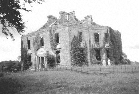
| Carrigoran | An 18th century house the residence of the Fitzgerald family in the 18th and 19th centuries. Griffith's Valuation shows that the house was valued at £45 in the mid 19th century and that it was held by Sir Edward Fitzgerald from Matthew Rosengrave. An earlier house reputedly destroyed by fire in the late 18th century stood nearby. The house was bought by the Sisters of Charity of the Incarnate Word in the 1920s. The house was still in use in the 1940s but was demolished in the 1980s. |
|
| Cappaghlodge | A property in the possession of the Spaight family from the early 18th century. The house named "Lodge" was the residence of Samuel Spaight in 1814. James Kelly held the property from the representatives of Edward Spaight Ferreter at the time of Griffith's Valuation, when the house was valued at £18. It was in the hands of the Court of Chancery at this time. In 1906 the house valued at £11 was in the possession of James Frost. Weir writes that the house is now demolished. | |
| Russell Villa | An early 19th century house built on the Dromoland estate, the home of the Russell family in the 19th and 20th centuries. The building is still extant. | |
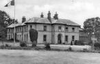
| Bunratty | Built in 1804 for Thomas Studdert, it was a Studdert home throughout the 19th century and for part of the 20th century. The house was used by Shannon Development as their offices for some time and it is now part of the Bunratty Folk Park. | |
| Bunratty Lodge | Originally a Spaight home, inhabited by Richard Dawson and his wife Ellen Studdert. Richard Dawson was the third son of Charles Dawson of Charlesfort, county Wexford and left an only son also named Richard who lived in this house at the time of Griffith's Valuation, holding it from Thomas Studdert. In 1837 Lewis wrote that this house immediately adjoined the village of Bunratty and was the residence of Mrs Paliser. | |
| Clonmoney West | An early 18th century house, built and owned by the Westropps until the 20th century. The O'Donnells were resident at the end of the 18th century. It was leased to Henry White in 1814 and to D. Canny in 1837. Matthew Canny held Clonmoney from John Westropp in the mid 19th century, when the property was valued at £25. The Cannys subleased the property to Michael Macnamara. The executors of Macnamara's will advertised the sale of his interest in Clonmoney in January 1880. The original house is not extant now. |

|
| Woodpark | Weir records the marriage of Michael Dalton and Mary Anne Fitzgerald of Castlekeale in 1761. Woodpark was the residence of M. D'Alton in 1837 and of John Kennedy in the mid 1850s. The house was in ruins in the early 20th century. |
|
| Shannon Grove | Located on the estate of Sir Edward Fitzgerald this house was occupied by John Coffey at the time of Griffith's Valuation. The property was sold to the Hegarty family in the 1920s. It was labelled Shannon Grove on the 1st edition Ordnance Survey map but as Crow Hill on subsequent editions. A house and extensive farm are still extant at the site. | |
| Ballymurtagh | A house on the Miller estate, leased to John Kelly in the mid 19th century, when it was valued at £12. Weir writes that it was demolished due to its proximity to Shannon Airport runway. | |
| Ballycaseymore | An 18th century house close to the entrance to Shannon Airport, it was the home of the Miller/Riggs Miller family. From 1814 it appears to have been leased to the Canny family, John Canny was in residence then and Matthew Canny at the time of Griffith's Valuation. The property was inherited by Thomas John Ryan of Tyrone House, county Tipperary in the 1880s and was sold in 1913. It is now a craft and design centre. |
|
| Knockaun | The home of the McMahon family located on the Miller estate, they farmed 121 acres as a demesne. The residence of Patrick McMahon in 1814. Lewis records Knockhane as the residence of P. McMahon in 1837. The house was valued at £8 in the mid 19th century. | |
| Newmarket House | Home of a branch of the Studdert family in the 19th century. It was described by Lewis in 1837 as the "spacious mansion of C. Studdert". It was occupied by his widow Maria at the time of Griffith's Valuation. She held the property from Lord Inchiquin and it was valued at £25. Sold by the Studderts at the beginning of the 20th century. | |
| Ballycar | Home of the Colpoys family in the 18th and early 19th centuries. Wilson refers to it as the seat of Mr. Colpoys in 1786. It passed by marriage to the O'Callaghan family. The sale rental of 1850 describes Ballycar as a cottage style residence with 'a fine garden attached'. By the time of Griffith's Valuation the house was occupied by Edward Bennett who held the property from the Misses Abbott. At this time it was valued at £18. A house is still extant at the site. | |
| Fenloe House | A red brick two storey 18th century house, home of the Hickman family for the 18th and 19th centuries. Hugh Poole Hickman was the occupier in 1837 and at the time of Griffith's Valuation, when the house was valued at £28. He held the property from William Westby. |
|
| Granaghan | The home of the Hewitt family on the Moloney estate. Mr Tim Donoghoe was the occupier in 1814 The old house is now largely demolished and a new house has been erected on the site. The house valued at £12 was held by Thomas Hewitt from Croasdaile Moloney in the mid 19th century. | |
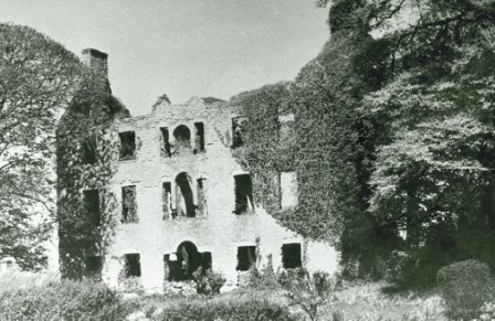
| Rathlaheen House | A pink three storey house, home of a branch of the Vandeleur family in the 18th and early 19th centuries. In 1786 Wilson refers to it as the seat of Boyle Vandeleur. Also occupied by Boyle Vandeleur in 1814 and by John Scott Vandeleur in 1837 according to Lewis. It was the centre of the famous Rathlaheen Co-operative in the early 19th century. Following the bankruptcy of John Scott Vandeleur in the 1830s Pierce Creagh occupied the house holding it from the Vandeleurs. It later became a Stoney home. They were resident in 1906. The house is no longer extant. | |
| Glenwood | Weir records Poole Gabbett in residence in 1810, Basil Davoren occupied the house in 1837 and John Gabbett at the time of Griffith's Valuation. He held it from George Studdert and it was valued at £10. Alice Studdert married General Frederick Maunsell and they lived at Glenwood which passed to their son Robert Maunsell. This house was the scene of an ambush in which eight Black and Tans were killed in 1920. The house no longer exists. | |
| Leamaneigh More | Occupied by Patrick J. Coffey at the time of Griffith's Valuation and held from Sir Edward Fitzgerald. The buildings were valued at £10. During the 1940s this property seems to have been known as Waverley. An extensive farm is extant at the site. | |
| Stonehall | The home of the O'Briens, later Stafford O'Briens, at the beginning of the 18th century and later in the possession of the Fitzgeralds. By the beginning of the 19th century the house was in the hands of the McMahon family. At the time of Griffith's Valuation James McMahon was leasing Stonehall from the Stafford O'Briens, it was valued at less than £3. Later the home of the Whites who intermarried with the McMahons. It is no longer extant. | |
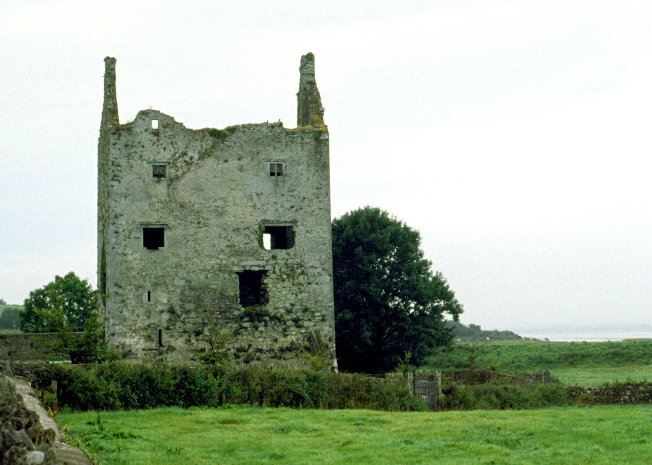
| Clenagh Castle | Home of the McMahons in the 18th century, Lewis refers to the ruined tower which was "once the residence of the McMahons". |
|
| Bunkers Hill | A mid 19th century house, the home of James Forost (1827-1907), author of ''The History and Topography of the County of Clare'' (1893), who held the house and 139 acres from Lord George Quin. He was the eldest son of William Frost and his wife Mary Ryan and he married Bedelia daughter of Augustine Moran of Willbrook. He left the house to the Dundon family who sold it to the Ryans circa 1917. Members of the Ryan family still live at Bunkers Hill. | |
| Rockfield | The residence of Edward Fitzgerald in the first half of the 19th century, held by him from Captain Richard Gloster at the time of Griffith's Valuation and valued at over £11. | |
| Cartown | Built in 1763 Cartown was the residence of Mr Baldwin in 1826 and of John Edward Langford in 1837. In the early 1850s Griffith's Valuation records the vacant house as valued at £24, William Sheedy holding the whole townland from General James Caulfeild. By the late 19th century the house was in the possession of the Westropp family. This house is still extant and occupied. |
|
| Mellon | The Westropp family are recorded as "of Mellon" from the early 18th century. Bence Jones dates the present house from circa 1780, the Ordnance Survey Field Name Books from 1812. Inhabited by Mrs Jane Westropp (nee Dawson) in the early 1850s. It was valued at £36. This 3 storied house was still in Westropp possession in the late 20th century. It is now run as a stud. |
|
| Mount Pleasant | The Ordnance Survey Name Books record that this house was built in the mid 18th century by a Mr Star. It was a neat farm house occupied by Mrs Hill in 1837 and by Thomas Hill at the time of Griffith's Valuation. He held the property from Daniel Leahy and the buildings were valued at over £11. This house is still extant and occupied. |
|
| Shannon Grove | Originally the home of the Bury family, Earls of Charleville, overlooking the Shannon estuary. The Ordnance Survey Name Books record this house as four-storied, built in 1709. Bence Jones dates this house from the early 18th century. Lewis writes that Shannon Grove was the old family mansion of the Earls of Charleville and "now the residence of Bolton Waller". Bolton Waller held the property in fee in the early 1850s when the buildings were valued at £43 and the demesne was over 400 acres. Bought by John Sheehy of Askeaton in 1860 and remained in the possession of his descendants until the mid 20th century. The house is still extant and occupied. |
|
| Castletown | The main residence of the Waller family in the 18th and 19th centuries, now demolished. The house was valued at £80 in the early 1850s when it was the residence of the Reverend William Waller. By 1906 its value was reduced to £72.5 shillings and it was occupied by the Reverend John Thomas Waller who was also resident in 1894. The surveyor for the Irish Tourist Association Survey in 1944 refers to the house being recently levelled to the ground. | |
| Bushyisland | This house was the residence of Peter Lowe in 1814 and in 1837. John Peppard MD was the occupier at the time of the first Ordnance Survey and of Griffith's Valuation. He held the property from Bolton Waller and had converted the house into an asylum. | |
| Copsewood | Copsewood Cottage is marked on the first Ordnance Survey map at this site. A much larger house was built in the mid 19th century for Major General Caulfeild. It was valued at £36 at the time of Griffith's Valuation and at £63 in 1906. It remained in the possession of the General's descendants until 1919 when it was bought by the Salesian Fathers who started an agricultural school. It is now a secondary school run by the Salesian Order. |
|
| Summerville | Described by Lewis as an ancient seat of Lord Charleville "now occupied by an agent". In the early 1850s Patrick and Michael O'Donnell were resident and they held the property from General James Caulfeild. | |
| Milltown | The Reverend Champagne was resident at Milltown from at least 1837. He is recorded as the occupier of this house in the early 1850s when he held the house valued at £28 from the Reverend Tyrell Evans. | |
| Ballynolan | This 3 storied house was the seat of the Reverend Thomas Westropp, rector of Ardcanny, built by him [his father?] in 1797. It was occupied by H. Potter esquire in 1837 and by Peter W. Morgan at the time of Griffith's Valuation who held it in fee with a demesne of 98 acres. Valued at £11.10 shillings in 1906 and occupied by Sarah E. M. Westropp. Still extant and occupied. |
|
| Ballynacourty | A house occupied by Thomas Davenport from at least 1837. The Ordnance Survey Field Name Books circa 1840 state that the house was built by John Evans "about 90 years" previously. It was two storeys high. The house was valued at £15 in the early 1850s and was held from Daniel D. Power. The house is still extant and now owned by John Feheney. For more information see www.iverusresearchfoundation.com (See ‘Research Notes’, Ballinacourty House). |
|
| Bolane | Bollane Cottage was occupied by Arundel Hill in 1837. A house at Bolane was the residence of Thomas Hanly in the early 1850s and valued at £16. It was held from Daniel D. Power. A house is still extant at this location and occupied. |
|
| Ballynacarriga | The Ordnance Survey Field Name Books describe this house as "falling into decay", the property of Mr Enright. By 1837 a Mr Dawson was the proprietor of Ballynacarriga House and in the early 1850s it was occupied by Dawson L. Westropp. In 1906 Ballynacarriga valued at £20.10 shillings was occupied by Norris Richard Russell. | |
| Ballynacarriga | Built in 1819 this house was occupied by a member of the Hill family at the time of the Ordnance Survey who was renting the property from Mrs Hurst . Lewis records H. Hurst as resident in 1837 and in the early 1850s Captain Richard Gloster held this house valued at £21 in fee. This house is now known as Rockfield. |

|
| Castlegrey | A house in the possession of the Langford family in the 19th century, the residence of G. Langford in 1837 and of Charles Wiedenham Fosbery in the early 1840s and 1850s. He held the property from Mrs Jane Langford. It was valued at £11. Slater refers to it as the seat of Captain Frederick Verschoyle in 1894. Some buildings are still extant at the site. | |
| Court/Kildimo Court | In 1837 Lewis wrote that Kildimo Court "which is nearly entire was the seat of the Hartstonge family". The Hartstonges appear to have inherited this property from the Widenhams. In 1786 Wilson refers to Court as the seat of Sir Harry Hartstronge and notes that "a bridge is now building at the ferry of Court but the house is in ruins". The property called Court Castle is labelled "in ruins" on the 1st edition Ordnance Survey map. A house labelled "Court" appears in the same townland on both the 1st and 25-edition maps. Buildings are still present at this location. | |
| Brickhill | The home of the Maghlin family in the early 18th century, it passed by marriage to the Blood family. Occupied by the Lysaght family in the mid 18th century. Edward Lysaght, songwriter and lawyer, known as 'Pleasant Ned' was born at Brickhill in 1763. The house is not named on the first Ordnance Survey map and a 20th century house now occupies the site. [Grid reference is approximate]. | |
| Cooper Hill | The residence of James Cooper in 1814 and occupied by Mrs [Honora] Cooper in 1837. Inherited by James Cooper Tuthill circa 1844 who then assumed the surname Cooper. The house was valued at £45 at the time of Griffith's Valuation and in 1906 when it was occupied by James Cooper. It was advertised for sale in ''Country Life'' (28 April 1955), bought by Cement Ltd who ran a model dairy farm on the property for some years. A large dairy enterprise still operates on the property. The house is a ruin. |

|
| Corcamore | A house situated on the Barker estate and occupied by Thomas Gleeson in the mid 19th century and valued at £18. [Grid reference is approximate]. | |
| Elm Park | The records suggest that this house was built post 1814 and pre 1837 though there may have been an earlier property as Wilson refers to "Elm" as the seat of General Massey in 1786. Bence Jones writes that it was an early 19th century house. It was the home of the Massey family, Barons Clarina, in the 19th century. The buildings were valued at £90 at the time of Griffith's Valuation and in 1906. Bought by Patrick King in 1925 and home of the King family until 1956, now demolished. |

|
| Tervoe | Bence Jones writes that the house was built in 1776 by Colonel W.T. Monsell MP on the site of an earlier house. Wilson refers to it in 1786 as "the pleasant seat of W.T. Monsell". In 1894 Slater notes it as a residence of Lord Emly. A De La Poer grandson of the 1st Baron Emly succeeded to Tervoe in the 20th century and it was demolished in the 1950s. A detailed description of the interior of the house is given by the Irish Tourist Association surveyor in 1943. |

|
| Dromore Castle | In 1868 the building of Dromore Castle began. It was an elaborate country retreat for the 3rd Earl of Limerick designed by Edward William Godwin. In 1906 this mansion house was valued at £75.10 shillings. The 4th Earl of Limerick did not visit Ireland very much and the castle was sold in 1939. In 1944 the Irish Tourist Association surveyor refers to the castle as the property of Mr M.McMahon, a timber merchant of Limerick, who bought the property in 1941 for a reputed £8,000. By the mid 20th century it had fallen into disrepair and the roof was taken off. Plans to develop the site and to demolish the ruin are current issues discusssed in the local and national press. |
|
| Pass House | In 1786 Wilson writes that Pass House was the seat of Mr. Peacock. By the time of Griffith's Valuation the house was occupied by Solomon Frost, leasing from the Peacock estate and valued at over £5. The property does not appear on the 25-inch Ordnance Survey map of the 1890s. | |
| Feenagh House | Feenagh House is described as "in ruins" on the 1st edition Ordnance Survey map and has almost disappeared by the publication of the 25-inch edition in the 1890s. In 1786 Wilson refers to "Fenagh House" as the seat of Mr. Wilson. By the time of Griffith's Valuation, the townland in which it was situated was the subject of Court of Chancery proceedings. Some fragments of the walls are still visible. |