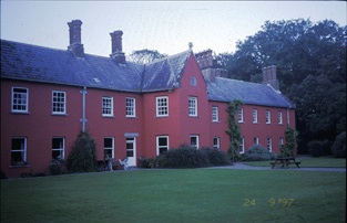
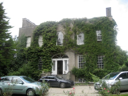
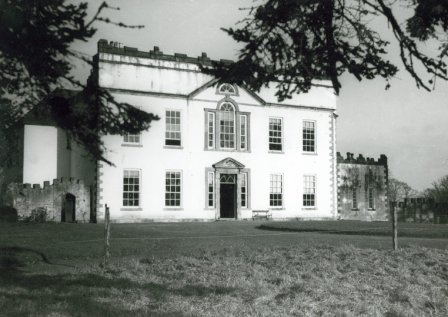
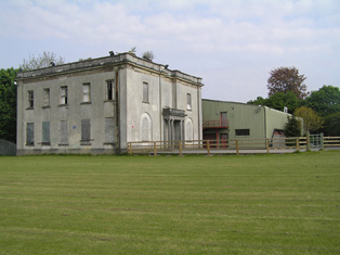
Summerhill House
Houses within 5km of this house
Displaying 24 houses.
Houses within 5km of Summerhill House
Displaying 24 houses.
| House name | Description | |
|---|---|---|
| Cratloe Woods | An 17th century house with a 19th century addition, the Irish home of the Stafford O'Briens and still in the family's possession. On the first edition Ordnance Survey map this house appears to straddle the border of the townlands of Cratloe and Portdrine. The house was held by Augustus Stafford at the time of Griffith's Valuation, valued at £24. In 1894 it was the seat of F.H.Stafford-O'Brien. It is still extant. |
|
| Burtonhill House | Weir writes that this house was probably built by the Carrigaholt Burtons as a sporting lodge. It is marked on the first edition Ordnance Survey map. The Burton Conynghams had a large estate in the parish of Killeely so there can be no doubt that the house was named after them. By the time of Griffith's Valuation it was valued at £11 and Edward H. Goggin was in residence. He held the property from Mrs Taylor. William B. Goggin of Burton Hill married Frances Maria Whitestone in the second half of the 19th century. see http://brew.clients.ch/RichardClare.htm | |
| Meelick House | A house built by the time of the first Ordnance Survey on the Marquess of Conyngham's estate and occupied by William Roche at the time of Griffith's Valuation, when it was valued at £11. This house is no longer extant. | |
| Cratloe House | Another house belonging to the Stafford O'Brien family, held by Augustus Stafford in fee at the time of Griffith's Valuation and valued at £12. Lewis records this house in the parish of Killeely and Cratloe Woods in the parish of Kilfintinan. Leet records Don O'Brien as resident at Cratloe, county Limerick, in 1814. In 1786 Wilson refers to Cratlagh-Hall as a seat of Mr. O'Brien. Possibly either part of the same building complex as Cratloe Woods or the nearby premises labelled Cratloekeel Castle on both the 1st edition and 25-inch Ordnance Survey maps. | |
| Ballycannan | A house held by James Gloster in fee at the time of Griffith's Valuation and valued at £20. This house is marked on the first Ordnance Survey map. | |
| Quinsborough | The original lease of this property was dated 26 September 1712 from the Earl of Thomond to Henry Widenham. The house was built in 1767 by George Quin, son of Valentine Quin and his wife Mary Widenham. Wilson refers to it as the seat of Mr. Quin in 1786. It was the residence of his grandson, Lord George Quin, in 1814. In 1837 Lewis records Quinsborough as the home of Martin Honan, who was elected Lord Mayor of Limerick in 1841. By the mid 19th century Quinsborough was the home of Anne Maria Honan. It was valued at £42 and held in fee. Advertised for sale with 187 acres in November 1868 by Martin Honan Bourke. Modernized in the early 20th century, some of the house contents were auctioned in the [1940s] on the instructions of S.J.K. Roycroft, a director of the Limerick Steamship Company. The house was the residence of the McGoverns in the 1980s. It is still extant. |

|
| White Hall | The residence of Mr White in 1778 when it was known as Quin's pool. In 1786 Wilson refers to it as White-Hall, the seat of Mr. White. The home of Captain Richard Kane in 1837. At the time of Griffith's Valuation occupied by John C. Delmege who held it from the Captain's son, Thomas Kane. It is still extant. |
|
| Castlepark | The original building was a residence of the O'Briens of Thomond. Wilson, writing in 1786 refers to Castle-Park as the seat of Mr. Smith. In 1789 it became Ormsby property and was named Blackland Castle. The home of William Maunsell in 1814. In 1833 it became the property of Christopher Delmege who rebuilt most of it. The Ordnance Survey Field Name Book describes it as "a splendid edifice 4 story high overlooking the Shannon and estimated at £2,000." The house was valued at £55 in the early 1850s and Christopher Delmege held it from the Marquess of Lansdowne. It was the seat of James O'Grady Delmege in 1894. Occupied by James Lyons, Limerick city coroner in the late 20th century, the house was gutted by fire in 2001 and for sale in 2007 for 40 million euro (Irish Independent 20 Dec 2007). Caste Park remains derelict. |
|
| Clonmacken | Built in 1700 by Reverend Edmund Palmer according to the Ordnance Survey Field Book, this two-storey house was occupied by Henry D'Esterre in 1814, by Captain Vereker in 1834 and by 1839 was the seat of John Brown Finch. In the early 1850s it was the residence of John Sharp, situated on the Lansdowne estate, it was held from Lawrence Kelly. | |
| Cooper Hill | The residence of James Cooper in 1814 and occupied by Mrs [Honora] Cooper in 1837. Inherited by James Cooper Tuthill circa 1844 who then assumed the surname Cooper. The house was valued at £45 at the time of Griffith's Valuation and in 1906 when it was occupied by James Cooper. It was advertised for sale in ''Country Life'' (28 April 1955), bought by Cement Ltd who ran a model dairy farm on the property for some years. A large dairy enterprise still operates on the property. The house is a ruin. |

|
| Tervoe | Bence Jones writes that the house was built in 1776 by Colonel W.T. Monsell MP on the site of an earlier house. Wilson refers to it in 1786 as "the pleasant seat of W.T. Monsell". In 1894 Slater notes it as a residence of Lord Emly. A De La Poer grandson of the 1st Baron Emly succeeded to Tervoe in the 20th century and it was demolished in the 1950s. A detailed description of the interior of the house is given by the Irish Tourist Association surveyor in 1943. |

|
| Kilrush | A house occupied by Daniel Gabbott and held from Tottenham Harvey at the time of Griffith's Valuation. The house was valued at £40 and was surrounded by 3 acres of land. It was situated on the Barrington estate. [Marked as Thorn Ville on the first Ordnance Survey map]. | |
| Sunville | Described as the seat of Thomas Wallnutt in the Ordnance Survey Field Name Book and built in 1821 for £900. It was occupied by Margaret Wallnutt in the early 1850s and held from William F. Taverner and valued at £24. | |
| Coolraine House | Occupied by John Vereker at the time of Griffith's Valuation, valued at £30 and held from the Marquess of Lansdowne. It was still extant until the 1940s but the site is now occupied by suburban housing. | |
| Moylish | The Ordnance Survey Name Book shows Arthur Gloster as proprietor of this townland circa 1840 and Moylish House is marked on the first Ordnance Survey map. By the time of Griffith's Valuation Moylish valued at £24 was occupied by Lawrence Kelly who held the property from John Judde. Moylish is now the site of the Limerick Institute of Technology. | |
| Shelburne | The National Inventory of Architectural Heritage (buildings of Ireland) states that this was a home of William Petty-FitzMaurice (1737-1805), 2nd Earl of Shelburne and 1st Marquess of Lansdowne. The Ordnance Survey Field Name Book refers to the building of Shelburne in 1837 at a cost of £2,000. Circa 1840 it was the seat of H.N.Seymour. At the time of Griffith's Valuation it was occupied by a representative of Robert Gabbett and held from the Marquess. It was the home of Thompson Russell in 1878 and of Henrietta Rose in 1887. Now located in the grounds of Ardscoil Rís. |
|
| Bellevue | The description in the National Inventory of Architectural Heritage records the building of this house as circa 1820 and that it was the home of the artist Douglas Alexander (1871-1945), one of three brothers who were prominent Quaker merchants in the city of Limerick. At the time of Griffith's Valuation Bellevue valued at £35 was occupied by William Alexander. Another house occupied by James Alexander and valued at £31 stood close by. Both houses were held from the Marquis of Lansdowne. Later this house was the home of the Cleeves family, toffee makers. |

|
| Ardhu | A house built post 1850, the seat of the Rose family at the beginning of the 20th century. Now functions as the Clarion Hotel suites. |
|
| Tivoli | Marked on the first Ordnance Survey map, Tivoli Cottage valued at £48 was occupied by Major Wheeler and held from Sir Matthew Barrington at the time of Griffith's Valuation. Since 1952 it has been the centre of a boys' secondary school known as Villiers School. |

|
| Ashbourne | A 2 storey house located on the Earl of Limerick's estate, this house was the seat of the Honourable Robert O'Brien in the 1830s. It was occupied by Richard Wilson in the early 1850s and held from Eliza Harvey. Garrett Hugh Fitzgerald's interest in the property was advertised for sale in May 1851. By the 1870s it was the home of the Synan family. This house is now demolished. | |
| Strand House | Strand House appears to be the house also known as "Stonetown House" and marked as such on the first Ordnance Survey map. The Ordnance Survey Name Book describes Stonetown House as the seat of Daniel Gabbett and that it was built between 1760 and 1770 by G. Vandeleur at a cost of £1,100. At the time of Griffith's Valuation it was the residence of William Gabbett, valued at £44 and held from Elizabeth Vereker. Part of the original garden now occupied by The Strand Hotel. | |
| Bellefield | Bellefield was the residence of George Furnell at the time of Griffith's Valuation. He held it from William Gabbett and it was valued at £33. William's brother Daniel lived at Bellefield at one time. A Charles A. Marrett is recorded as resident at Belfield, Limerick in 1814. Belfield Park is now the location of the Regional Maternity Hospital. | |
| Kilmoyle | A house built by the Boyds, merchants in Limerick city, circa 1845 on the Lansdowne estate and originally known as Westfield. For many years the residence of the Catholic Bishops of Limerick. Sold by the Diocese to Aidan Brooks for development in 2007 for a sum reputed to be > €20 million. |

|
| Pass House | In 1786 Wilson writes that Pass House was the seat of Mr. Peacock. By the time of Griffith's Valuation the house was occupied by Solomon Frost, leasing from the Peacock estate and valued at over £5. The property does not appear on the 25-inch Ordnance Survey map of the 1890s. |