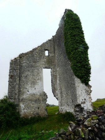
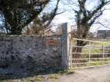
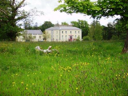
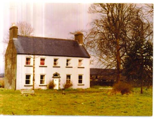
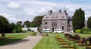
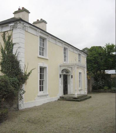
Longfield House
Houses within 15km of this house
Displaying 61 houses.
Houses within 15km of Longfield House
Displaying 61 houses.
| House name | Description | |
|---|---|---|
| Ashbrook | An early 18th century house, it was noted by Wilson as the seat of Mr. Moore in 1786. It was occupied by Michael Costello in 1814 and described as in a dilapidated state at the time of the first Ordnance Survey. The Irish Tourist Association file refers to a two-storey plain featured house with the ruins of a small private chapel closeby, which apparently fell into decay in the early 19th century. Some ruins remain at the site. | |
| Elmhall | Built by Gerald Cuff early in the 18th century, it was let to the Jordans of Murrisk in the 1770s and to a branch of the Browne family of Westport from the 1780s until the early 19th century. In 1786 Wilson refers to it as a seat of the Rt.Hon. James Cuffe. In 1837 the 1st edition Ordnance Survey map notes that it was 'in ruins'. The Irish Tourist Association File states that Elmhall is said to have been burnt in 1798. Only some fragments of walls remain at the site. |
|
| Athavallie | The house at Moat was the main residence of the Lynch Blosses in the 18th and the early 19th century. In 1786 Wilson refers to Moat, the seat of Sir Henry L. Blosse. A fire destroyed the original house in 1808. It was rebuilt and is marked on the first Ordnance Survey map as Attavally. The Lynch Blosse family were absentee landlords for most of the 19th century. In 1894 the house was recorded as the seat of Sir Henry Lynch-Blosse. Later the house became a community school run by the St Louis nuns. It is now known as Balla Secondary Schoool. |

|
| Carrowgowan | From at least 1814 the house was occupied by the Deanes who held it from Colonel McAlpine, who held from John Knox of Castlereagh. The house was described as in good repair, with offices, orchard and garden. Daniel H. Mellet occupied the house at the time of Griffith's Valuation. It is now demolished. | |
| Oldcastle | Built by the McJordans of Ballylahan in the late 18th century. Slater refers to it as the seat of John Bolingbroke in 1846. There are modern buildings at the site now. |
|
| Brabazon Park | Built by George Brabazon in 1777. In 1786 Wilson refers to it as "the fine seat of George Brabazon with beautiful demesnes".Slater refers to it as the seat of George Rutledge in 1846. It was held in fee by Captain Hugh Brabazon at the time of Griffith's Valuation, when it was valued at £30. Sold by the Congested District Board to the Sisters of Mercy circa 1920s, who ran a domestic economy school there for many years. It was demolished in the later twentieth century to make way for the building of a health care facility. Part of the demesne is now Swinford Golf Course and Community Sports Facility. |
|
| Dove Hall | This house is labelled Dove Hall on the 1st edition Ordnance Survey map. A larger house, named Belgarrow House, is shown at the site on the 25-inch edition of the 1890s. It was occupied by Courtney Strogen and his descendants during the 19th century, held on lease from the Evans family. Occupied by John A. Knox in 1906. Belgarrow is now a ruin. | |
| Thornhill | Home of Charles Burke Jordan in the 19th century. At the time of Griffith's Valuation, he was leasing this property to James Jordan when it was valued at £5. The building labelled Thornhill on the 1st edition Ordnance Survey map is not the same as that on the later 25-inch edition published in the 1890s. The latter is no longer extant but some buildings remain at the original site. | |
| Listrisnan House | This house was described as in 'good repair' at the time of the first Ordnance Survey in the 1830s. At the time of Griffith's Valuation, Joseph Jordan was leasing buildings valued at £2 in the townland of Listrisnan from Myles Jordan. A building still remains at the site. | |
| Barleyhill | In 1786 Wilson noted Barleyhill as the seat of Mr. McManus. Ruane dates the house from about 1748 with alterations in the 1770s and 1790s. He states that the house and 170 acres were occupied by George Harkin at the time of Griffith's Valuation, however the Valuation records Bernard McManus as the occupier of the house valued at £15. Quinn records that Bernard McManus had gone to live at Brownstown in 1856. The Aitken family have lived at Barleyhill for over a hundred years. |
|
| Bellavary | Charles Goodwin lived in the house in the late 1830s. The Landed Estates' Court rental records that Bellavary House was leased to Standish O'Grady McDermott by William Malley on 10 Feb 1859 for 21 years. It later became a Royal Irish Constabulary barracks and burned down in 1920. | |
| Moorbrook | In 1786 Wilson refers to "Moore-field" as the seat of Mr. Moore. Leet's Directory records 'Moorfield' as an 'unoccupied seat' in 1814. The house appears, however, to have become known as Moorbrook as it is thus labelled on the Ordnance Survey maps. Henry Wills held Moorbrook at the time of the sale in 1854. At the time of Griffith's Valuation, it is described as a "herd's house" and occupied by Francis O'Grady. It is labelled as "in ruins" on the 25-inch Ordnance survey map of the 1890s. A modern house has been constructed near the site. | |
| Cloongee | Originally a Moore home which was sold by Harloe Phibbs Baker to the McDermotts who lived there until the 20th century. At the time of Griffith's Valuation it was held in fee by Owen McDermott and valued at £7. The National Inventory of Architectural Heritage notes Cloongee as a rare survivor of a late-seventeenth century house in county Mayo. It is still extant and occupied. |

|
| Faheens | An O'Donnell residence in the 1830s. No house with a substantial valuation exists in the townland by the time of Griffith's Valuation. | |
| Newcastle | Newcastle was the home of Andrew Clarke O'Malley, son of George O'Malley of Spencer Park. Following the death of Andrew's son, Owen Bingham Manners O'Malley, in 1886, Newcastle became the property of his sister, Elizabeth Brewster. Count Manus O'Donel, a Major General in the Austrian Service, lived at Newcastle in the late 18th century. In 1786 Wilson refers to it as the seat of General O'Donnell. Occupied by David Ruttledge in 1814 and by Jacob Beckett at the beginning of the 20th century. Only a portion of the original building is now extant. |
|
| Ballinamore | This house was the home of the Ormsby family in the 18th and 19th centuries. It was held in fee by Anthony Ormsby at the time of Griffith's Valuation, when it was valued at £40. In 1786 Wilson refers to it as " the beautiful seat of Thomas Ormsby". In 1938 the Ormsbys sold Ballinamore to a Scottish order of nuns, the Order of St John, who used the house as a school. The building was donated to Western Care in the 1970s. It now functions as a nursing home. |
|
| Mullaghawny | Charles 'Sturgeon' (Strogen) was resident at Mullaghawny when Leet's Directory was compiled in 1814 and the Ordnance Survey Name Books refer to the dilapidated state of a mansion house in the townland of Mullaghawny belonging to Charles Strogen. Only a small portion of the buildings are visible on the 25-inch Ordnance Survey map of the 1890s. | |
| Killedan | The seat of the Taaffe family and later the home of the McManuses, a well known medical family of whom Emily McManus, Matron of Guy's Hospital, London, was a member. |
|
| Oxford | The home of members of the Joyce family in the late 18th and early 19th centuries, later held by the Tuohys in fee. In 1786 Wilson refers to it as the seat of "Mr. Joice". The house and over 740 acres held in fee by Martin Joyes were advertised for sale in the ''The Telegraph'' [Connaught Telegraph] of 13 July 1831. The original house is now a ruin. |
|
| Ballylahan | A property held by Pat McLaughlin from Sir William H Palmer in the early 19th century and by the Atkinsons at the time of Griffith's Valuation. Quinn writes that it was repossessed at the time of the expiration of their lease. It was a ruin by the publication of the 25-inch Ordnance Survey map of the 1890s. | |
| Wood Park | This was the earlier house on this estate, shown as Woodpark on the 1st edition Ordnance Survey map of 1838. It was lived in by the Anderson family in the 1830s and 1840s. At the time of Griffith's Valuation it was held in fee by Thomas Jones and valued at £6. A house diminished in size but still labelled Wood Park is shown on the 25-inch map of the 1890s. This property does not appear to be extant now. [Charles Coyne also lived at Massbrook in the mid 19th century. See also under Massbrook] | |
| Rinagry Cottage/Rinagry House | The residence of a junior branch of the Gortnaraby family, described at the time of the first Ordnance Survey as "a neat thatched cottage built in 1807". Rinagry was leased by Edward S. Perry from John Ormsby at the time of Griffith's Valuation, when it was valued at more than £10. An enlarged building is labelled Rinagry House on the 25-inch Ordnance Survey map of the 1890s. It is no longer extant. | |
| Coolcronaun | Coolcronan House was built by Edmond Pery at the time of his marriage to Sarah Jane Knox Gore in the mid-nineteenth century. The family owned the property until the 1950s. The Irish Tourist Association File states that it was erected in 1860 by the Knox Gores. It was extensively renovated in the late 1990s and is still extant and available as holiday accommodation. See http://www.coolcronan.com. |
|
| Ballynew House | In the 18th century Ballynew was the home of a branch of the Miller family of Milford, near Kilmaine, county Mayo. In 1777 Robert Miller of Ballynew married a Bridget Young of Harristown, county Roscommon. Ballynew became a Bourke home in the 19th century through a Miller/Bourke marriage. Ballynew is still extant and occupied. |
|
| Ballinvilla | The home of the Kearney family in the 18th and 19th centuries. It was held in fee by William Kearney at the time of Griffith's Valuation when it was valued at £10 10s. It is no longer extant. | |
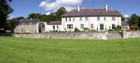
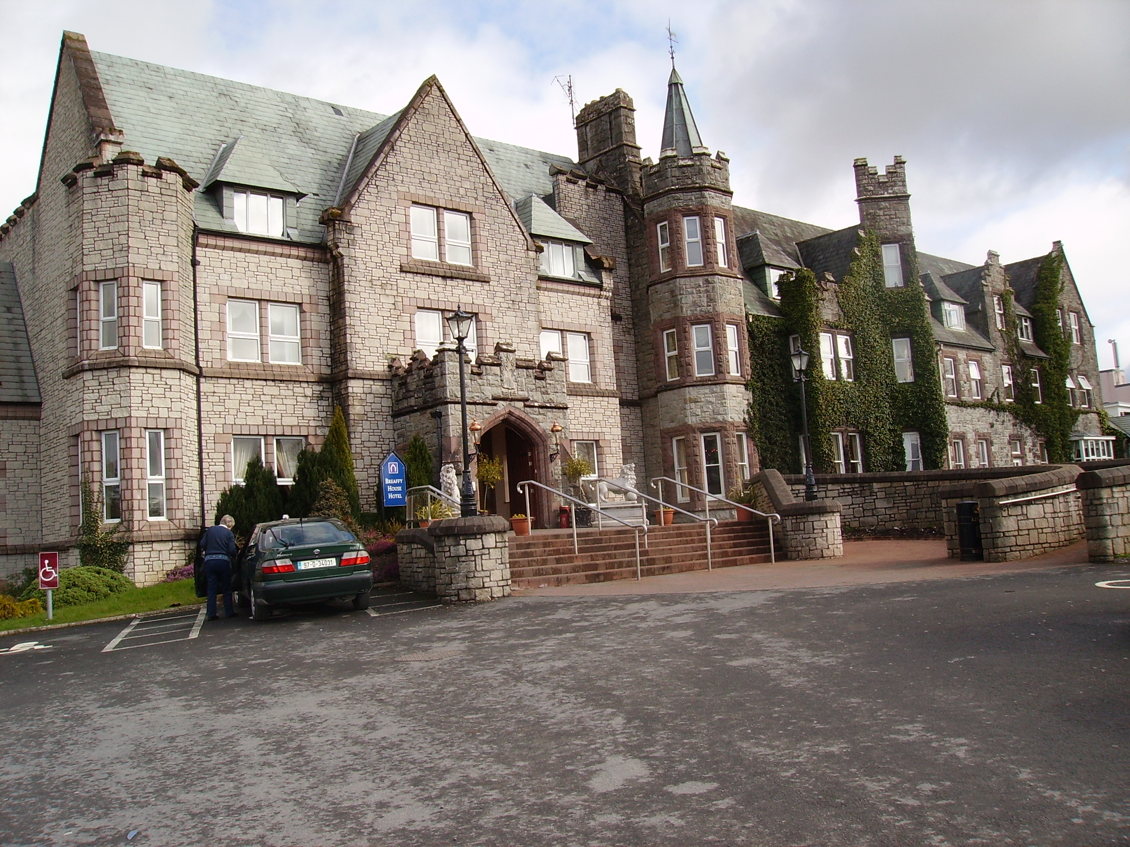
| Breaghwy Lodge | A house known as Breaghwy Lodge was the estate home of the family in the early 19th century. In 1786 Wilson refers to Breafy as the seat of Mr. Browne. This building was later replaced by a large Victorian house which was the residence of D.A Browne in 1894. It now functions as Breaffy House Hotel, |
|
| Fisherhill | Occupied by Major Blake in the early 19th century. Fisherhill and the lands of Carheens, were leased by Richard D'Arcy of New Forest, county Galway to Edward Cheevers of Killyan, county Galway on 23 Mar 1858. In 1879 Robert Ireland advertised for sale his interest in Cheevers lease. A. C. Larminie lived here in the late 19th century. Now the home of the McGreal family. |
|
| The Grove | At the time of the first Ordnance Survey the house was described as the former residence of Captain Bourke. It became the home of James Faulkner in the late 1860s until his death in 1911. It was used as a nursing home from 1926. In 1993 it was sold and rebuilt as luxury apartments. |
|
| Hawthorn Lodge | Mulloy writes that in 1789 this house was leased by George O'Malley from the Ellison family and that the O'Malleys lived there until the late 19th century. It was generally known as 'Lodge'. The house was sold to the Carson family in 1905. Charles O'Malley and his son, St Clair O'Malley, were agents to the Earls of Lucan. This house appears to be named Tallyhoe, the residence of Cuffe esquire, on the Taylor and Skinner map. Hawthorn Lodge is still extant and has been occupied by descendants of George O'Malley since the 1990s. |
|
| Knockmore | Leased by Thomas Ormsby from Lord Kilmaine at the time of Griffith's Valuation, when the property was valued at £13. The ruins of this house were still extant in the 1980s but the house is now demolished and a modern residence erected on the site. The old farm buildings still remain. |
|
| Lakeland | John Ormsby, a younger son of Thomas Ormsby of Ballinamore, lived at Lakeland at the beginning of the 19th century. At the time of Griffith's Valuation, it was leased from Lord Kilmaine by Peter Rutledge Phibbs and valued at £5. It is no longer extant. | |
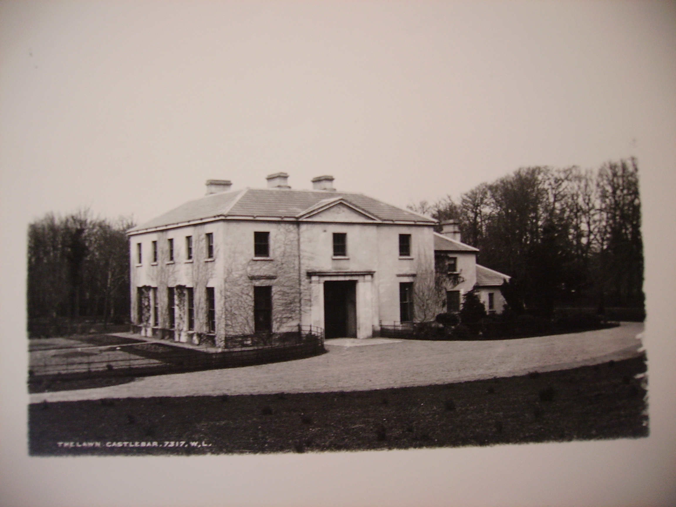
| The Lawn | Castlebar House was burnt in 1798. When resident in Castlebar in the 19th century the Earls of Lucan lived in the lodge known as 'The Lawn', described in the Ordnance Survey Name Books as the residence of St Clair O'Malley, who was agent to the Earls of Lucan in the 1830s. Castlebar House is referred to as the seat of the Earls of Lucan in 1894. This building is now part of a school complex. |
|
| Rocklands | A house occupied by various agents to the Earls of Lucan, including Ellison, Davis and Larminie. In 1786 Wilson refers to it as the seat of Mr. Ellison. At the time of Griffith's Valuation, it was occupied by Neal Davis, holding from the Earl of Lucan, and valued at £15. The site appears to be occupied by a larger modern building. | |
| St Audries | An 18th century house on the shore of Saleens Lake on the outskirts of Castlebar, named after the home of the 1st Countess in Somerset, England. St Audries was leased to Owen Lindsey in 1769 and his family maintained an interest in the property and the farm at Drumsheen until the early 19th century. The Reverend Archdeacon Warburton was living in the house in 1814. By the time of the first Ordnance Survey the house was in ruins. | |
| Snugborough | A property leased from the Brownes of Raheens, the O'Malleys built a house here in 1765, costing £900. It was badly damaged in 1798 and was recorded to be in a dilapidated state in the Ordnance Survey Name Books. It is labelled as Snugborough House on the 1st edition Ordnance Survey map of 1838 but is not labelled on the later 25-inch edition and nothing now remains. | |
| Spencer Park | A house occupied by a junior branch of the Burrishoole family descended from Patrick O'Malley. They held the house during the second half of the 18th century and much of the 19th century from the Earls of Lucan. By the time of Griffith's Valuation it was occupied by John C. Larminie. In 1858 Larminie sold his interest in the O'Malley's lease of Spencer Park, which had been renewed on 7 Oct 1842 for three lives or 31 years. The Freeman's Journal reported that it was purchased in trust by Mr. Jordan. The site is now occupied by modern housing. | |
| Rockfield | An early 18th century residence of the FitzGeralds, their first home in the parish of Turlough. In 1786 Wilson refers to this house as Rockfield Lodge, a seat of Charles Lionel Fitzgerald. It is visible but not named on the 1st edition Ordnance Survey map but most of the buildings have disappeared by the publication of the 25-inch map of the 1890s. | |
| Charleville | A late 18th century house, the main residence of the family until 1865. Held in fee by Charles L. Fitzgerald at the time of Griffith's Valuation when the buildings were valued at £20. It is now a ruin. | |
| Turlough Park | Built in 1865 to the design of Sir Thomas Newenham Deane, this Victorian Gothic house was sold to Mayo County Council in 1991 and is now part of the Museum of Country Life. |
|
| Turlough House | Built early in the 18th century this was the main residence of the family for much of the 18th century. In 1786 Wilson refers to Turlough as the seat of Charles Lionel Fitzgerald. It was referred to as Turlough Park though it is not named on the 1st edition Ordnance Survey map and was unoccupied at the time of Griffith's Valuation. It is now a ruin. |
|
| Turlough Lodge/Cottage | Home of the Semple family in the 19th century. At the time of Griffith's Valuation William Semple occupied a house valued at £10, leased from the Fitzgerald estate. It is labelled Turlough Lodge on the 25-inch Ordnance Survey map of the 1890s though it also appears to have been known as Turlough Cottage. It is still extant but derelict. |
|
| Windsor House | In 1786 Wilson referss to Breandrum as the seat of Mr. McDonnell. A house valued at £40 was held by Colonel James McAlpine at Breandrum or Windsor at the time of Griffith's Valuation. The original house has been replaced by a modern building. | |
| Mount Gordon | An 18th century house, occupied in the 1770s by 'Garden' [Gardiner]. Wilson refers to it as the seat of Mr. Garden [Gardiner] in 1786. It was occupied by Mary Boyd at the time of Griffith's Valuation, when the house was valued at £43. It is still extant and occupied. |
|
| Creggagh | The house valued at £6 was held by John Fair at the time of Griffith's Valuation but was unoccupied. In 1894 Slater noted it as the seat of Major D.R. Fair. It was occupied in the early decades of the twentieth century but is now a ruin surrounded by forestry. |
|
| Liscottle | Home of the Horkan family in the second half of the 19th century. It was leased by George "Harkan" from Robert Ruttledge at the time of Griffith's Valuation when the house was valued at £2. It is labelled Liscottle House on the 25-inch Ordnance Survey map of the 1890s. Liscottle is no longer extant. | |
| Massbrook | The Irish Tourist Association file makes it clear that there were two houses at Massbrook, both in good condition in the 1940s. One was of French design erected in the 1890s by Colonel Johnston, the then owner of the estate. There was also an older and smaller house, see under Woodpark. D.15166 in the National Archives refers to the house and demesne of Massbrook in 1868. Described by Bence Jones as a late Victorian house, the seat of the Walsh family. In the early 1990s Mrs Mary Robinson, former President of Ireland, purchased the house known as Massbrook, formerly owned by Denis Ferranti. | |
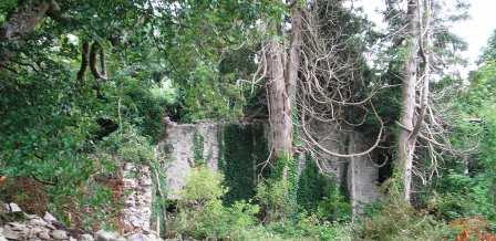
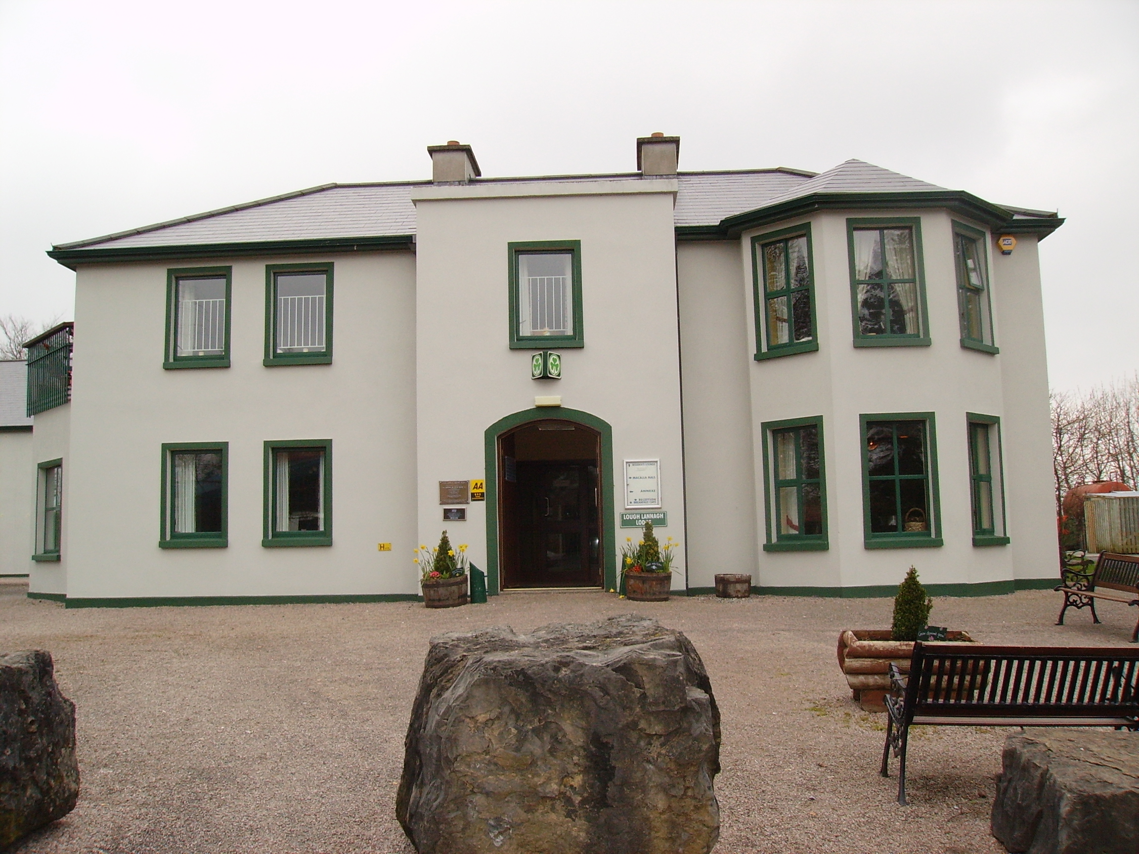
| Creagh's Villa | At the time of Griffith's Valuation, this property appears to be have been leased by Mary Boyd fron the Lucan estate when it was valued at £12. In the 1870s it was the residence of Bernard Peyton. It was destroyed by fire in 1996 and subsequently demolished to make way for the Lough Lannagh holiday complex which includes a building similar to the design of the original house. |
|
| Rockstown | Marked on the first edition Ordnance Survey map this house was occupied by William Nally at the time of Griffith's Valuation and held from the Lynch Blosses. The National Inventory of Architectural Heritage notes its connections with P.W. Nally, a member of the Irish Republican Brotherhood and a well-known late nineteenth century athlete influential in the founding of the Gaelic Athletic Association. The house is now a ruin. |
|
| Coolaghy Lower | Reverend George Hanson was leasing this property from the Abercorn estate at the time of Griffiths Valuation in the 1850s, when it was valued at £12. A substantial farm exists at the site. | |
| Galdonagh Upper | Charles Watson was leasing this property from the Abercorn estate at the time of Griffiths Valuation in the 1850s, when it was valued at £12. A hose and farm buildings are still extant at the site. | |
| Tullyrap | Alexander Finlay was leasing this property from the Abercorn estate at the time of Griffiths Valuation in the 1850s, when it was valued at £25 and had an adjacent mill. A substantial farm still occupies the site. | |
| Foyle View | Alexander Porter was leasing this property from the Abercorn estate at the time of Griffiths Valuation in the 1850s, when it was valued at £10. A farm still exists at the site. | |
| Tullyowen | Eliza Jane Campbell was leasing this property from the Abercorn estate at the time of Griffiths Valuation in the 1850s, when it was valued at £12. In 1786 Wilson noted it as a seat of a Mr Thomson. It does not appear to be extant now. | |
| Whitehill (Raphoe North) | James Browne was leasing this property from the Abercorn estate at the time of Griffiths Valuation in the 1850s, when it was valued at £11. A house is still extant at the site. | |
| Drumenan | James Alexander was leasing this property from the Abercorn estate at the time of Griffiths Valuation in the 1850s, when it was valued at £12. A house and farm are still extant at the site. | |
| Ardagh (Raphoe North) | Andrew Rolleston was leasing this property from the Abercorn estate at the time of Griffiths Valuation in the 1850s, when it was valued at £11. | |
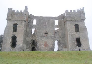
| Raphoe Bishop's Palace | William Ker was leasing this property from the Ecclesiastical Commissioners estate at the time of Griffiths Valuation in the 1850s, when the buildings were valued at £45. The Bishop's Palace was destroyed by fire in 1838 and has remained a ruin ever since. |
|
| Drumineney | David Wilson was leasing this property from the Ecclesiastical Commissioners estate at the time of Griffiths Valuation in the 1850s, when it was valued at £16. The National Inventory of Architectural Heritage suggests that the current house at this site was developed c.1870 from an earlier building. Robert Wilson was also leasing property in this townland at the same time. A house and extensive farm exist at the site. | |
| Tops (Raphoe) | John Wilson was leasing this property from the Ecclesiastical Commissioners estate at the time of Griffiths Valuation in the 1850s, when it was valued at £18. The National Inventory of Architectural Heritage suggests the current house was built c.1852 possibly on the site of an earlier house. Eliza Wilson was also leasing property at this location in the 1850s. |
|
| Coolaghy (Raphoe) | William Hamilton was leasing this property from Reverend Lord Edward Chichester's estate at the time of Griffiths Valuation in the 1850s, when it was valued at £20. It appears to have been associated with the Hamilton family for much of the nineteenth and early twentieth centuries. It is still extant and occupied. |
|
| Altaskin Lodge | Robert Rankin was leasing this property from the Ecclesiastical Commissioners estate at the time of Griffiths Valuation in the 1850s, when it was valued at £16. |