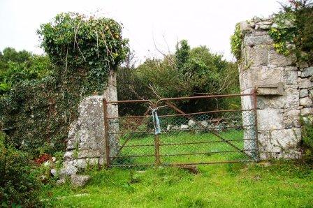
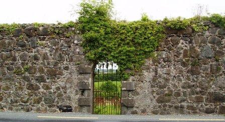
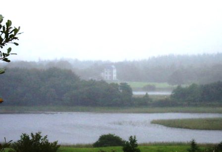
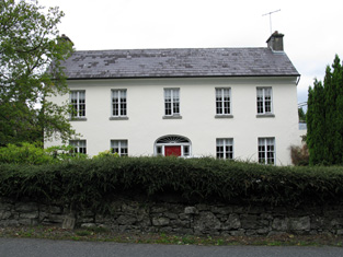
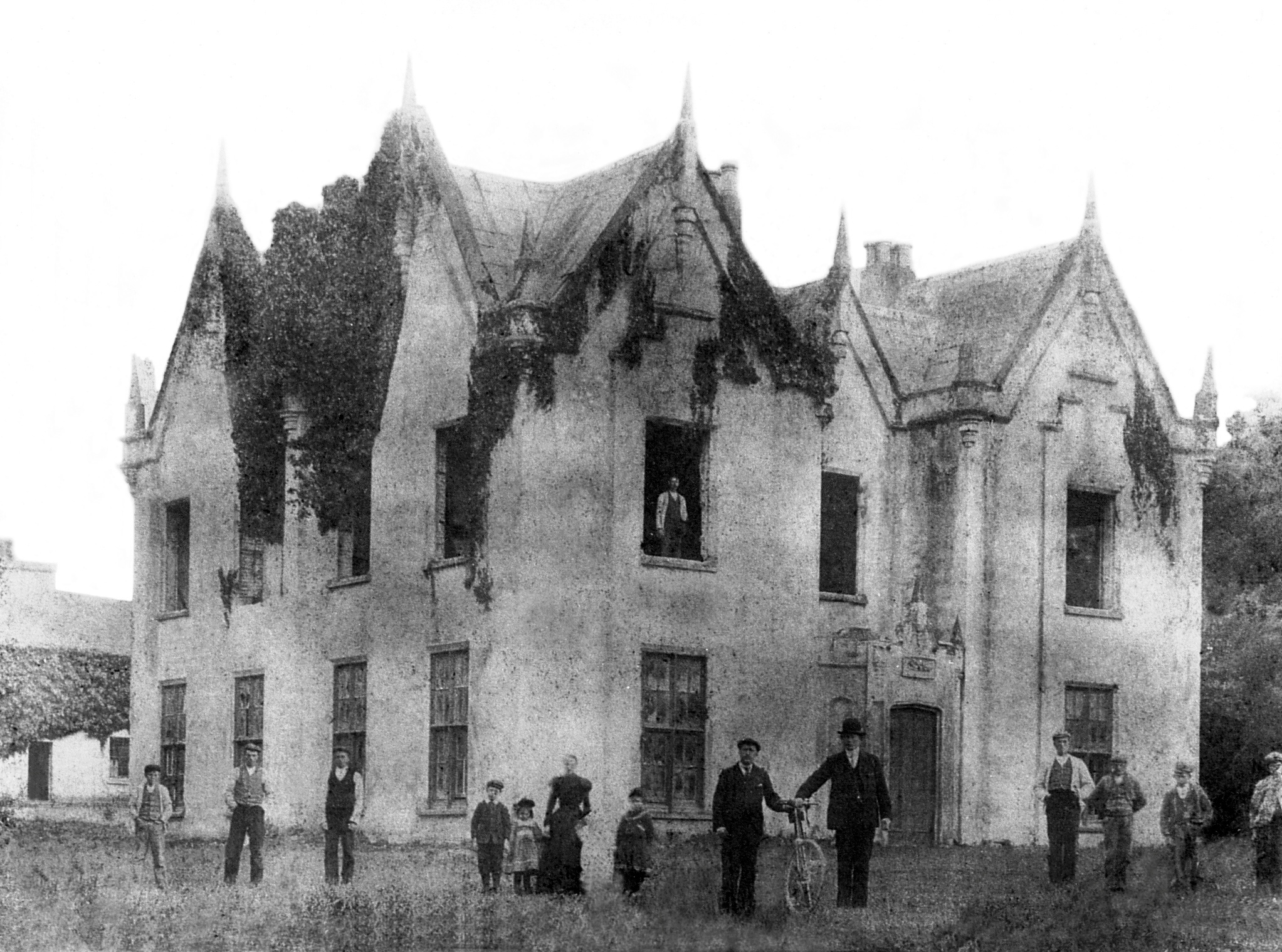
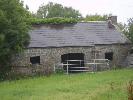
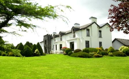
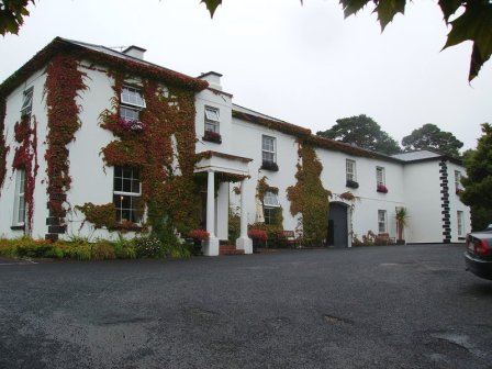
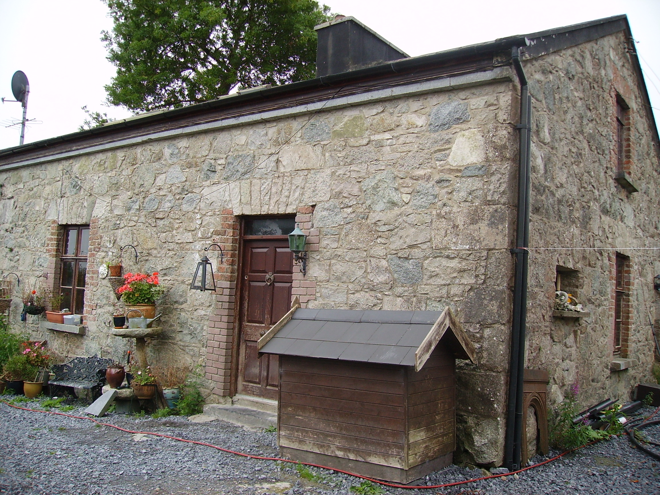
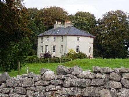
Drimcong
Houses within 15km of this house
Displaying 57 houses.
Houses within 15km of Drimcong
Displaying 57 houses.
| House name | Description | |
|---|---|---|
| Mervue/Merview | Built circa 1777 by the Joyces. In 1786 Wilson refers to a house near Galway as the seat of Dr. "Joice". The house was sold by them to Royal Tara China in 1953. This company occupied the building for over 50 years, closing down at the end of 2003, though the shop premises still operates from this building. A fire badly damaged the original building in 1957. |

|
| Furbogh House | At the time of Griffith's Valution, Andrew Blake held this property in fee when it was valued at £34. Furbough was demolished in the later twentieth century. The remains of the walled garden are still visible. |
|
| Corcullen/Kirkullen House | The house valued at £21 was vacant at the time of Griffith's Valuation. Michael D. Browne was the immediate lessor. It is shown as a considerably enlarged structure on the 25-inch map of the 1890s. Buildings are still extant at the site. | |
| Manor House [Spiddle House] | The house at this site is named Spiddle House on the 1st edition Ordnance Survey map. A much larger house, labelled Manor House, is shown on the 25-inch map of the 1890s. The house was held in fee by Thomas Bunbury at the time of Griffith's Valuation and was valued at £15. Modern buildings are extant at the site now. | |
| Danesfield | At the time of Griffith's Valuation, George E. Burke was leasing Danesfield to Henry Daly when it was valued at over £23. The house is demolished, however the yard bell holder and the remains of the walled garden are still visible. |
|
| Corrib View | The home of the Doig family in the Oughterard area, occupied by George Cottingham in 1855 who held it from John Doig. The house is now run as a B&B. http://www.galwaybandb.net/ |

|
| Ross | In 1786 Wilson refers to Ross as the seat of Mr. Martin, It was held in fee by James Martin at the time of Griffith's Valuation, when it was valued at £20. On the shore of Ross Lake, the childhood home of the author, Violet Florence Martin is now open to the public for part of the year. Home of Claude Chevasse in the 20th century and later restored by the McLaughlin family, who reside there. |
|
| Clareville House | Built in the mid 18th century by Robert Martin of Dangan, it was used as a winter residence by the Martins of Dangan and Ballynahinch Castle. Occupied by Richard Martin at the time of Griffith's Valuation and held from the Law Life Assurance Society when it was valued at £20. Clareville is still extant and occupied. In 2013 it was offered for sale. |
|
| Knockbane | Occupied by Anthony O'Flaherty at the time of Griffith's Valuation and valued at £33. The house no longer exists but extensive farm buildings are still visible. The property is still owned by descendents of Anthony O'Flaherty. |
|
| Lemonfield | In 1786 Wilson writes that Lemonfield was the seat of Sir John O'Flaherty. George O'Flahertie was occupying the property at Lemonfield, at the time of Griffith's Valuation when it was valued at £20. The house is no longer extant. |
|
| Ardvarna | Occupied by A. Ross in 1837, John Scully at the time of Griffith's Valuation when it was valued at £16 and by Edward Jackson Fitzsimons in the 1860s. There is still an extant house at this site. |
|
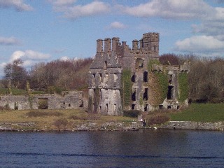
| Lenaboy Castle | This property was held in fee by James O'Hara at the time of Griffith's Valuation when it was valued at £40. In 1786 Wilson refers to a house at Galway which was the seat of Geoffrey O'Hara. Bence Jones describes the house as Tudor Gothic, early to mid 19th century, while the National Inventory of Architectural Heritage notes that the current building is dated 1859. It is now a Health Services facility. |
|
| Portacarron | In 1786 Wilson refers to "Portacairn" as the seat of Mr. French. At the time of Griffith's Valuation, there is no house with a substantial valuation in this townland, then in the possession of Marianne Nolan. There is no visible sign of the house now, some walls and parts of the stable yard remain. |
|
| Seamount Lodge | The Clanmorris family had a residence in the Salthill area of Galway at Pollnarooma East parish of Rahoon, leased from Richard Sloper. It was valued at £21 at the time of Griffith's Valuation. A house named Seamount Lodge is marked on the first Ordnance Survey map in this townland. Seamount was the home of Sebastian Nolan of the Ballinderry family in the late 19th century. It was in use as a nursing home in the twentieth century before being demolished to make way for the housing estate of the same name. | |
| Barna | Wilson refers to Barna as the seat of Mr. Lynch in 1786. Nicholas Lynch held this property in fee at the time of Griffith's Valuation,when it was valued at £20. It was the seat of Marcus Lynch in 1894 and the family were still resident in the early 20th century. The house is still extant surrounded by an apartment development. |
|
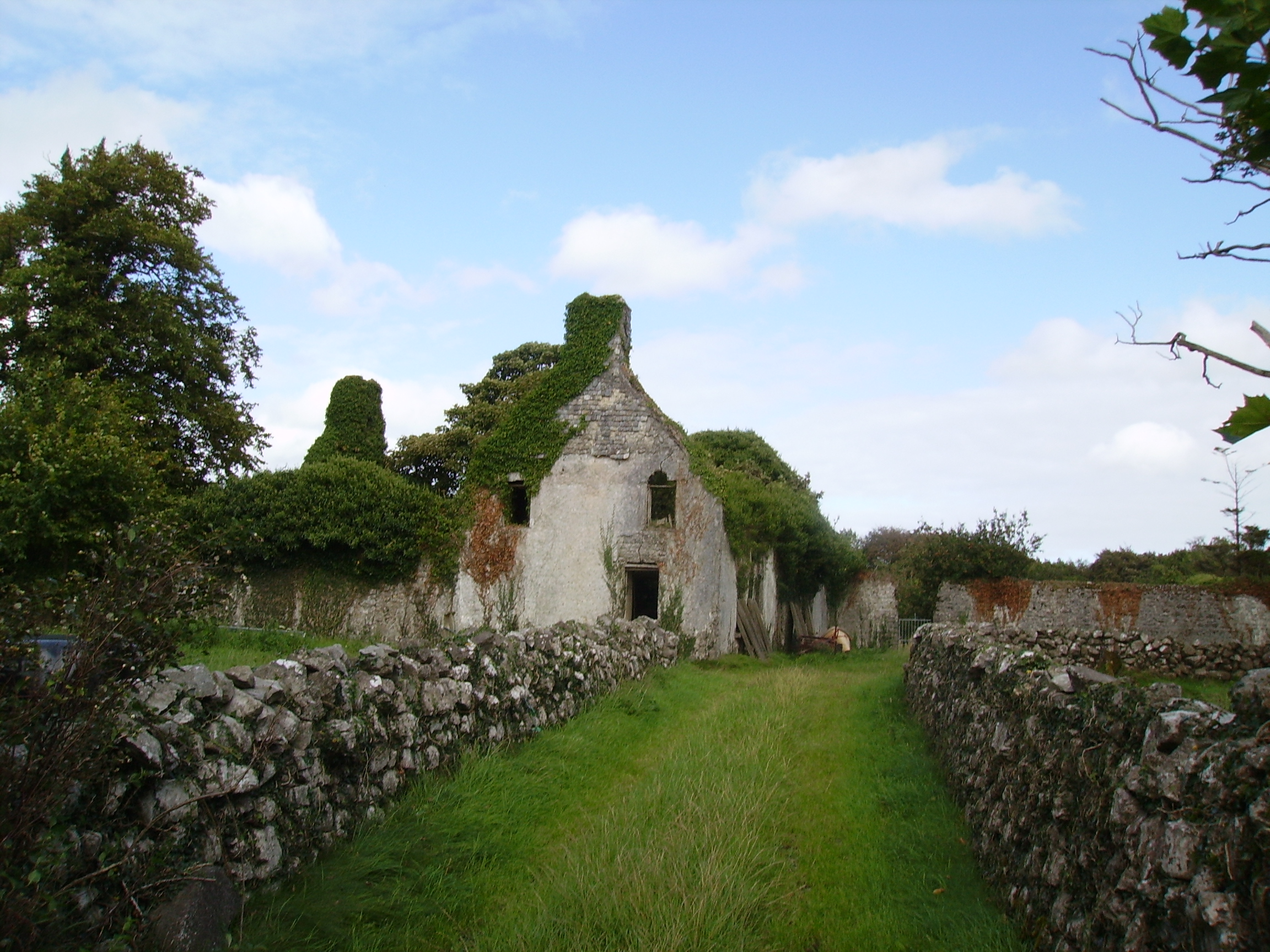
| Menlo/Menlough Castle | A 17th century tower house with substantial additions. In 1786 Wilson refers to it as the seat of Sir Thomas Blake. Menlo Castle was occupied by Thomas Blake at the time of Griffith's Valuation when it was valued at £30. It continued to be the home of the Blake family until the house was burnt by an accidental fire in 1910 and has been a ruin ever since. |
|
| Glenlo | A house called Kentville was occupied by the Martin family in the late 18th century though Wilson mentions a Mr. Irwin living there in 1786. By 1824 Thomas Redington was occupying Glenlo, which became the home of Thomas Blake in the mid 19th century and of the Palmers in the late 19th century. Now functions as a hotel. |
|
| Riverview | At the time of Griffith's Valuation held by James Browne in fee and valued at £14. It is described as "in ruins" on the 25-inch Ordnance Survey map of the 1890s. | |
| Brownville | This house was originally known as Eyreville and was leased by the Martins to the Eyres in the latter half of the 18th century. Wilson refers to it as the seat of Mr. Eyre in 1786. In 1808 it was sold to James Valentine Browne and the name of the house was changed to Brownville. In the later 19th century it was the home of Dr McCormack, the Bishop of Galway. Portions of the original house may have been incorporated into out-buildings at the rear of the site. | |
| Woodstock | In 1786 Wilson refers to Woodstock as the seat of R. Shaw. The home of Stephen Blake in 1814, it later became the home of the Comyn family. The house was burnt down in June 1877 and never rebuilt. The family mainly resided in France afterwards. | |
| Killeen | Originally known as New Park, Killeen House was bought by Peter S. Comyn from the Martins in 1849 and it became his main residence. He died in 1866 and left the house to his niece Rose Comyn. It is still extant and was run as a luxury guesthouse until 2008. |
|
| Renmore House | The residence of Patrick Marcus Lynch and his descendants on the outskirts of Galway from the early 19th century, leased from the Governors of the Erasmus Smith Schools. It was valued at £35 at the time of Griffith's Valuation. The house was sold circa 1924 and became a tuberculosis sanitorium. It is now part of a Health Service facility. |
|
| Wellpark | In 1786 Wilson refers to Wellpark as the seat of Mr. French. It became a residence of the MacNamara family early in the 19th century. In 1855 occupied by Martin Morris and by George Morris in the 1870s. The home of the Moffett family in the early 20th century. Frances Moffett wrote the book ''I also am of Ireland'' published by the British Broadcasting Corporation, London, 1985. The house, which was in a derelict condition, was demolished in 2007. | |
| Bushy Park | In 1786 Wilson refer to Bushy Park as the seat of Mr. Burke. Occupied by Edward McDonnell in 1814. Two generations of the Martins lived in this house in the 19th century. At the time of Griffith's Valuation, it was occupied by Robert J. Martin and was valued at £12. It is still extant and occupied. |
|
| Newcastle | In 1786 Wilson refers to Newcastle as the seat of Thomas Browne. In the nineteenth century a Persse residence close to their distillery at Nun's Island and their milling operations. Newcastle House was the home of Henry Stratford Persse in the early 19th century. It was later acquired by University College, Galway but was demolished in the early 1970s to make way for new buildings. | |
| Dangan House | In 1786 Wilson writes that "Dangin" was the seat of Richard Martin, "beautifully situated on the banks of the fine river Corrib". Occupied by George Symmes in 1814. The Ordnance Survey Books describe it as "a 3 storey house belonging to the proprietor of the townland, Thomas Redington". It remained the home of the Redington family for most of the 19th century. The house labelled Dangan House on the 1st edition Ordnance Survey map is located very close to the bank of the River Corrib (M283277). By the 1890s it has moved to a site in closer to the centre of the townland. It is now occupied by the Cunningham family who run a garden centre at the same location. A property known as "Dangan Cottage" was located nearby (M280274) but is described as "in ruins" on the 25-inch Ordnance map of the 1890s. Kinmonth states that this property was leased by American artists, including J. Lizzie Cloud, in the 1870s. | |
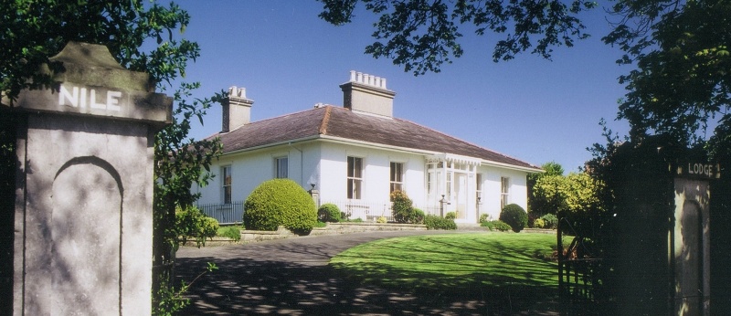
| Nile Lodge | Nile Lodge is associated with the O'Hara family though at the time of Griffith's Valuation, it was leased by Edward C. Burke from Mark Lynch and valued at £35. It is still extant and occupied. |
|
| Killaguile House | Built by James E. Jackson post Griffith's Valuation and possibly following his marriage in 1863. The house now functions as a hotel, known as Ross Lake House Hotel. |
|
| Claran House | The home of the Browne family in the 19th century. It was occupied by Arthur Dillon Browne in the early 20th century. |
|
| Ower | In 1786, Wilson refers to "Aur" as the seat of Mr. Burke. The Ordnance Survey Name Books record John Burke as the owner in the 1830s. At the time of Griffith's Valuation, Joseph Burke held this property in fee when it was valued at £13. It was leased to Colonel Beddington in the 1920s and is now a ruin. |
|
| Winterfield House | Described in the 1830s as a neat 2 storied house, the home of Captain Butler. It was held in fee by John Butler at the time of Griffith's Valuation, when it was valued at £15. It is no longer extant. | |
| Rahoon House | In 1786 Wilson refers to Rahoon as the seat of Mr. French. In the early 19th century it was a Bodkin house, occupied by Roderick O'Connor at the time of the first Ordnance survey. It was held in fee by Thomas C. Dickson at the time of Grifith's Valuation and valued at £27. This house was bought by Kennedy O'Brien in the early 1870s and remained in his family's possession until the 1930s. Buildings are still extant at the site. |
|
| Letter Lodge | Reputed to have been a hunting lodge of the Martins of Ross, this herd's house was occupied by William Poe in the 1850s, who held the property from James O'Hara. David Walsh was the tenant of Letter in 1890. In the late 20th century the home of Richard Ward, wildlife artist and still a private residence. |
|
| Srue | Occupied by Chris O'Flaherty in 1814 and marked on the first Ordnance Survey map 1838 in a triangle of land near the shore of Lough Corrib. Possibly built as a steward's or agent's house. It was listed as a herd's house by the time of Griffith's Valuation when it was held by the Law Life Assurance Society in fee. Remnants of the garden walls and of the farm buildings still remain. |
|
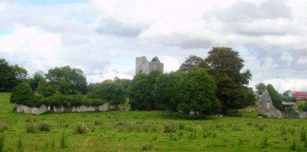
| Annaghkeen | The castle was in ruins by the late 1830s. | |
| Kilroe | The Hanley family were living at Kilroe in the early 19th century and it was the residence of John J. Gunning in the latter half of the 19th century. He had a mill closeby at Inish. |
|
| Clydagh | Built in the early 1820s close to the shore of Lough Corrib, a residence of the Lynch Stauntons until the early 20th century and still occupied. IN 1894 Slater noted it as a seat of B. O'Neill Power. |
|
| Gortrevagh | A village is marked at Gortrevagh on the first Ordnance Survey map but on the revised edition of 1898-1899 the village is gone and a substanial building is marked instead. This may have been the residence of Edmund O'Flaherty. Some older buildings are included in what is now the golf club complex. | |
| Annaghdown | A house at this site on the First Edition Ordnance map is labelled Annaghdown House. The current house was built in 1868 by the Blake family It is still occupied and well maintained. |
|
| Ballinduff Lodge | A Skerrett home in the 18th and 19th centuries. It is labelled Ballinduff Lodge on the Ordnance Survey maps though the 25-inch edition of the 1890s notes that it was in ruins by then. At the time of Griffith's Valuation John Skerrett held the lands in fee when the house was only valued at £2. The old castle stands close by the house ruins. |
|
| Headford Castle | Richard J. Mansergh St George built Headford Castle in the early 19th century. In 1836 Robert Graham referred to an Elizabethan house 'just built', the architect was George Papworth. At the time of Griffith's Valuation it was held in fee by Richard M. St. George and valued at almost £46. Slater noted it as the seat of Thomas McDonagh in 1894. It burnt down in 1906. |
|
| Moycullen Lodge | Home of the French family in the 18th century. Wilson refers to it as the seat of Mr. French "situated on the side of a small lake". The Ordnance Survey Name Books mention it as the residence of Peter Lynch in the 1830s. It was leased by James Darcy or Thomas Fitzgerald from Lord Campbell's estate at the time of Griffith's Valuation when it was valued at £1+. A more substantial house was afterwards constructed at the site and is labelled Moycullen Lodge on the 25-inch map of the 1890s. It is no longer extant. | |
| Ballynalacka Lodge | In the sale rental of 1852 there is reference to the erection of a shooting lodge at Ballynalacka by the 'late proprietor' and a building named Ballynalacka Lodge appears in this townland on the 1st edition Ordnance Survey Map. It is labelled as "in ruins" on the 25-inch Ordnance Survey map of the 1890s. | |
| Rocklawn | The OS Name Books give the name of this house as Rockland and state that it was the residence of the Browne family though they claim that the townland of Pollaghrevagh was the property of Lord Clanmorris. At the time of Griffith's Valuation it was occupied by James French and was valued at £12. By 1906 it was owned by Richard French. Rocklawn House is no longer extant. It is described as "in ruins" on the 1933 printing of the 6" OS sheet for Galway. |
|
| Mount Vernon | The 1882 sale notice for the Burke estate mentions that Mount Vernon cost over £5000 to build a short time before. | |
| Woodpark | Described in the sale rental of 1879 as "a good house, with stables, a walled garden, walled orchard and a park around the house which stands on an elevated site affording a fine view of lake scenery". Peter Newell was occupying the house, then valued at £4, at the time of Griffith's Valuation. It is now a ruin. |
|
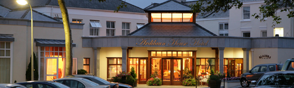
| Glenarde | Town house of the Persse family, built in the mid 19th century, bought by the Bolands of Bolands biscuits in the 1920s and since the early 1960s has functioned as the Ardilaun House Hotel. |
|
| Carrownacroagh | Home of William Skerrett in the 1830s. By the time of Griffith's Valuation, the townland was in the possession of Dominick O'Flaherty but there was no house with a valuation greater than £2. |
|
| Killeen House & Killeen Castle (Oranmore) | In 1814 Killeen Castle is recorded as the home of Marcus Blake. By the time of Griffith's Valuation it was used by the Cullinane family who lived at Killeen House nearby. The latter property was valued at £10 at the time of Griffith's Valuation. The castle and its adjacent buildings afterwards fell into ruin but was restored in the later twentieth century and is now occupied once again. Killeen House was demolished in the twentieth century. | |
| Carrickmore House (Furbo) | A house built on land owned by Andrew Blake at the time of Grifith's Valuation. The National Inventory of Architectural Heritage suggests it was built c.1860. It was renovated in recent times. |
|
| Marino Cottage | This house, labelled Marino Cottage on the First Edition Ordnance Survey map,was vacant at the time of Griffith's Valuation, when it was part of the estate of Andrew Blake. It had a valuation of over £23 at that time. The house no longer exists, having been replaced in the twentieth century by the Connemara Coast Hotel complex. | |
| Kingston House (Galway) | Richard N. Somerville was the owner of over 70 acres in the county of the town of Galway in the 1870s. He was the owner of Kingston House at the time of Griffith's Valuation, when it was valued at £14 and was unoccupied. By the 1890s it was occupied by a religious order. | |
| Albano Cottage | At the time of Griffith's Valuation, Rev. Peter Daly was leasing this property from James Browne when the buildings were valued at £9. It is still extant and occupied. | |
| Spiddle House | The 1st edition Ordnance Survey map shows a house known as Bohoona Lodge on a site adjacent to the present Spiddle House. The latter property appears on the 25-inch map of the 1890s. At the time of Griffith's Valuation, John Farrer was leasing a property in this townland from Martin Morris. It was valued at £8. The house has recently been restored. |

|
| Carrowbrowne Castle | In 1786 Wilson refers to Carrowbrowne as the seat of Mr. Blake. This may refer to Walter Blake as family history records suggest some of his children were born at Carrowbrowne. The castle is shown and labelled on the 1st edition Ordnance Survey map of 1842. The townland is part of Lord Oranmore and Browne's estate at the time of Griffith's Valuation. By the time of the 25-inch edition of the 1890s it is shown as "in ruins". Some ruins still remain at the site. | |
| Angliham | In 1786 Wilson refers to "Anglngiham" as the seat of Mr. Bateman. The Ordnance Survey Name Books indicate that the townland of Angliham or Gortacallow, in the parish of Oranmore, was the property of Thomas Bateman of Altavilla, Rathkeale, county Limerick. The description mentions that the townland contained the ruins of an old building " formerly the residence of Mr. Bateman's ancestor". | |
| Fort Eyre | At the time of Griffith's Valuation a property here, owned by Reverend E. Maunsell, was being leased by Richard A.H. Kirwan and was valued at £42. The house is labelled Fort Eyre on the 1st edition Ordnance Survey map. It is still extant. |
|