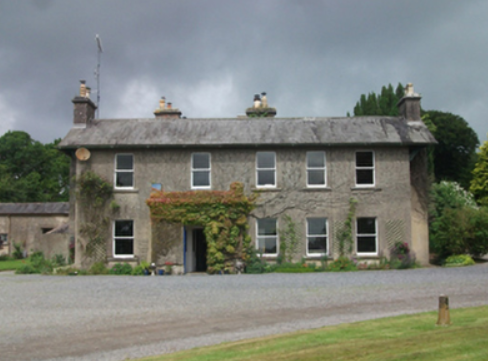
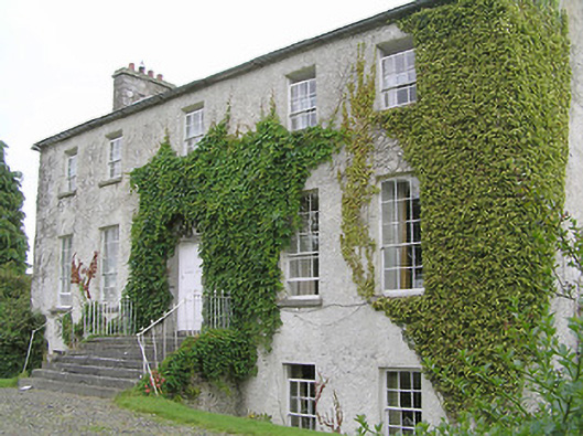
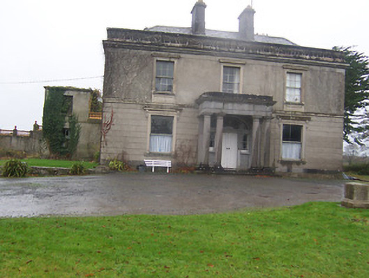
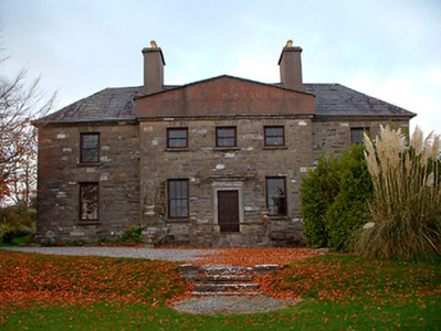
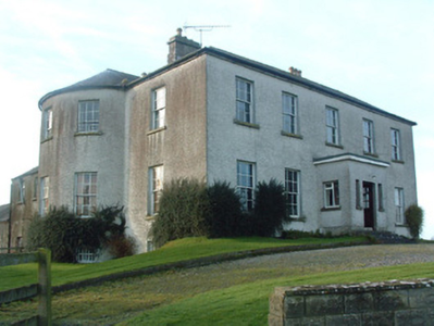
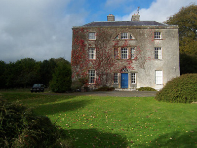
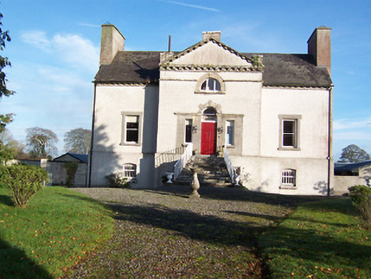
Turbotstown [Turbotstown House]
Houses within 15km of this house
Displaying 86 houses.
Houses within 15km of Turbotstown [Turbotstown House]
Displaying 86 houses.
| House name | Description | |
|---|---|---|
| Bracklagh | The house faced Bracklagh Lough, very close to the border between counties Cavan and Longford. It is marked on the first edition six inch Ordnance Survey map (publ. 1837). In the mid-19th century it was inhabited by Captain Mark Ker and held from the Ecclesiastical Commissioners. The rateable valuation was £15. Home of Matthew William Webb and family in 1901. A building is still extant on this site. | |
| Arley Cottage | A graphic of Arley Cottage ‘belonging to Colonel Barry’ in the National Library is dated circa 1820s, see http://catalogue.nli.ie/Record/vtls000550550. The Farnham Papers also refer to Arley Cottage in 1822. Lewis records Arley as the property of Lord Farnham and it was occupied by the Hon Somerset Maxwell in the mid-1840s and by the Hon Richard Maxwell in the mid-1850s when it had a rateable valuation of £20. The Hon. Henry Maxwell was the occupier in 1906. This building is no longer extant. | |
| The Cottage | This house is located close to Lough Sheelin and on the roadside. In the mid-19th century it was valued at £12, occupied by James Sneyd and held from Andrew Booth Bell. In 1906, the townland of Bellsgrove was in the occupation of Matthew William Webb and The Cottage had a rateable valuation of £7. It appears to be still extant. | |
| Kilnahard House | Described by the National Inventory of Architectural Heritage as a castellated country house built circa 1820. Kilnahard is situated on the shore of Lough Sheelin. In the mid-19th century it was occupied by Tuite Dalton, who held the property from Andrew Bell. The buildings had a rateable valuation of £18. This house is still a residence. | |
| Crover House | This house is located on the shore of Lough Sheelin and in the mid-19th century was valued at £21.5.0. for rates. It was occupied by Thomas Cummins and held from Lord Farnham’s son, the Hon Somerset Mawell. By 1876 Robert John Cuming was resident at Crover. He owned 1,118 acres in the county. In 1901 Julia Cuming, a widow, and her daughter Kate were still resident. This house became a hotel in 1957. http://www.croverhousehotel.ie/History | |
| Woodlawn | A two storey house, close to the shore of Lough Sheelin, built about 1800 and still occupied. It was vacant at the time of Griffith’s Valuation but held by William Mahaffey from the Hon S. Maxwell and valued at £16.10.0. |

|
| Hollywell | Located on the Farnham estate and known as Tara Cottage on the first edition Ordnance Survey map (publ. 1837) and as Hollywell on the 25 inch map. An engraving in the National Library appears to be this house Hollywell Cottage and dates it to at least 1820, see https://catalogue.nli.ie/Record/vtls000152344. Occupied by the Reverend Henry Cottingham at the time of Griffith’s Valuation. Valued for rates at £14 the house was held from Mark Woods. The Reverend H. Cottingham held a townland in each of the parishes of Annagh and Urney at the time of Griffith’s Valuation. His representatives owned 381 acres in 1876. A building reduced in size continues to occupy this site. | |
| Summerville (Cavan) | Another house located on the west shore of Lough Sheelin. In 1814 James H. Cottingham was the proprietor of Summerville, Mount Nugent. The house was unoccupied at the time of Griffith’s Valuation but in the possession of William Webb. It was valued at £15.10.0. for rates. It was much reduced in size by the time the 25 inch map was compiled. A building still occupies the site. | |
| Bob's Grove/Farren Connell | The Nugent home known as Bob’s Grove dates from the mid-18th century. It was later known as Farren Connell possibly after alterations were made in the mid-19th century. In 1814, Oliver Nugent was resident at Bob’s Grove. In 1837, Lewis records Christopher E.J. Nugent as proprietor. At the time of Griffith’s Valuation Christopher’s representatives held the property in fee. It was valued at £24 for rates. Emily Nugent, a widow, was resident in 1901 and her son Colonel Oliver Nugent and his wife in 1911. Farren Connell continues to be the home of this family. |
|
| Dungummin House | Dungummin House with a very small demesne is named on the first edition six inch Ordnance Survey map (publ. 1837). In 1814 Leet records John Ingham of Dungimmon, Mount Nugent. Joseph Lynch was the occupier recorded in Griffith’s Valuation. He held the property, described as a herd’s house and valued at £12.10.0., from Thomas Whitney. Michael Palles Lynch of Dungimon, county Cavan and of Coola, county Westmeath, sixth son of Joseph Lynch of Roebuck House, county Cavan, is recorded in Walford’s 1910. | |
| Lisnabrin | This house, located on the outskirts of Mount Nugent, was built after the first edition six inch Ordnance Survey map (publ. 1837) was compiled. John Love was the occupant in the 1850s, holding the property, valued at £13, from the Most Reverend J.G. Beresford. A Lynch family home at the beginning of the 20th century and still a residence. |
|
| Roebuck | Roebuck was a Lynch home from at least the early 19th century when Edward Lynch was recorded as resident in 1814. Lewis records W. Reilly as the proprietor of Roebuck. In the 1850s Joseph Lynch was the occupant recorded in Griffith’s Valuation, when the buildings were valued at £15 and held from the Representatives of William O’Reilly Adams. By 1906, Henry Galligan was occupying this 'mansion' house valued at £15 for rates and 365 acres of untenanted land. | |
| Dalystown House | Francis Tuite was leasing this property from the Thornton estate at the time of Griffiths Valuation, when it was valued at over £10. In the 1870s it was recorded as the address of Laurence Reynolds. This property is labelled Rockfield House on the 1st edition Ordnance Survey map but as Dalystown House on the 25-inch map of the early 20th century. In 1906 it was still in the ownership of Laurence Reynolds and valued at almost £23. The National Built Heritage Service suggests 1820 as a building date for the surviving farmyard complex. Dalystown House has been demolished. |
|
| Castle Nugent | At the time of Griffiths Valuation in the 1850s, William Webb was leasing this property from Arthur Kingston, when it was valued at £18. It was also recorded by Lewis as the seat of W. Webb in 1837. IN 1814 Leet referred to it as the residence of John West. The National Built Heritage Service suggests it was built c.1775. It is still extant but disused. |
|
| Fernsborough | Thomas Gosselin was leasing this property from William Shirley Ball’s estate at the time of Griffiths Valuation when it was valued at £25. In 1837 Lewis noted “Fernsboro” as the seat of A. Burrows. It was also recorded as the seat of Alexander Burrowes by Leet in 1814. Fernsborough is no longer extant. Hussey de Burgh noted Thomas Gosselin as the proprietor of almost 300 acres in County Longford in the 1870s. | |
| Moorhill House | At the time of Griffiths Valuation in the 1850s, John Simpson was leasing this property from Major Blackall’s estate, when it was valued at £26. It is still extant. |

|
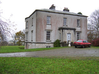
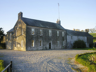
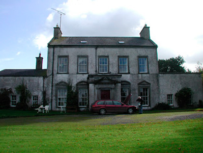
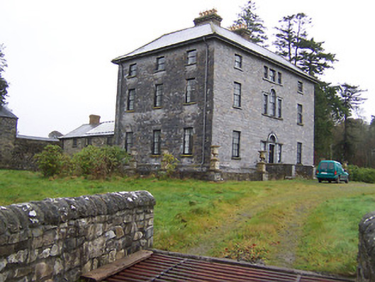
| Coolamber Manor [Cloonshannagh] | At the time of Griffiths Valuation in the early 1850s, Coolamber was held in fee by Major Blackall, when it was valued at £75. It is labelled "Cloonshannagh House" on the 1st edition OS Map but as "Coolamber Manor" on the later editions. The National Built Heritage Service suggests it was built c.1830 and significantly extended c.1880. It is still extant, having previously functioned as a rehabilitation facility. Extensive estate architecture also survives. |
![Photo of Coolamber Manor [Cloonshannagh]](https://landedestates.ie/storage/img/orig/3355.png)
|
| Lisryan | James Ennis was leasing this property from the Blackall estate at the time of Griffiths Valuation in the early 1850s, when it was valued at over £20. It is not labelled on any edition of the Ordnance Survey map, though a much-expanded building is shown on the 25-inch edition. The site is now occupied by a modern house. | |
| Moneyhoolaghan House | Benjamin Lloyd was leasing Moneyhoolaghan from the Blackall estate at the time of Griffiths Valuation in the early 1850s, when it was valued at £16. The National Built Heritage Service suggests the current house was built c.1880. It is still extant. |
|
| Coolamber | Philip O’Reilly was leasing this property from the Blackall estate at the time of Griffiths Valuation, when it was valued at almost £23. The property was associated with the Blackall family by whom, according to O'Brien, it was built c.1830. Later in the nineteenth century it came into the possession of the O’Reilly family. Towards the end of World War II it was, for a time, the home of Prince Ernest, Duke of Saxony. Since the early 21st century, it has been undergoing restoration and now serves as venue for occasional gardening courses. |
|
| Mossvale | The Ordnance Survey Name books of the 1830s noted Mossvale as the seat of J. Barber. At the time of Griffiths Valuation. in the early 1850s, it was being leased from the Hamilton estate by William Lewis, when it was valued at £20. It was later demolished but the stables and other estate architecture survives. |
|
| New Grove (Longford) | John Hynds was leasing this property from the Hamilton estate at the time of Griffiths Valuation in the 1850s, when it was valued at over £11. In 1837 Lewis referred to it as the seat of R. J. Hinds. It is now a ruin. In the 1870s, John Hinds of New Grove was recorded as the owner of over 240 acres in County Longford. |
|
| Clonwhelan | Richard White held this property in fee at the time of Griffiths Valuation when it was valued at £15. In 1814 Leet referred to it as the residence of Miss Godley. James Bond was the occupier at the time of the initial valuation in 1839 when it was valued at £12. It is still extant |
|
| Fernmount (Granard) | John B. Kirk was leasing this property from Richard Greville’s estate at the time of Griffiths Valuation in the 1850s, when it was valued at over £10. It is not named on the 6” OS map but a more substantial house is labelled Fernmount on the 25” map of the early 20th century. It is still extant. | |
| Higginstown House (Granard) | At the time of Griffiths Valuation in the early 1850s, Francis Tuite was leasing this property from Richard Greville’s estate when it was valued at £15. It is labelled Higginstown House on the 25” edition OS map of the early 20th century. The site is now occupied by large farm buildings. {Francis Tuite and his family are buried in the Church of Ireland church yard in Granard, see https://www.igp-web.com/IGPArchives/ire/longford/cemeteries/granard.htm ] | |
| Killasona House | Killasona House was occupied by Owen McCormack at the time of Griffiths Valuation in the early 1850s when it was valued at £10. It was leased from Richard Greville’s estate. McCormick was recorded as the owner of over 400 acres in County Longford in the 1870s. In 1906 it was owned by Richard Davoron and valued at over £17. It is still extant but disused. |

|
| Kilmore House (Westmeath) | At the time of Griffiths Valuation, Kilmore House was leased by Reverend Francis Kane from Reverend William Bowles and was valued at £10. The house is not visible on the 1st edition OS map but is labelled Kilmore House on the 25-inch edition. It is still extant and part of a farming enterprise. Lewis noted that the living of Kilmore was in the patronage of Fulke Greville in 1837. Reverend Francis Kane was afterwards rector of the parish of Fenagh, County Leitrim, from 1869 until his death in 1882. He had previously been vicar in the parish of Russagh, nearby to Street, County Westmeath, 1848-1855. | |
| Creevy House (Longford) | George Dobbyn was leasing this property from the Maude estate at the time of Griffiths Valuation in the early 1850s when it was valued at £20. It is still extant. |

|
| Toneen Lodge | At the time of Griffiths Valuation in the early 1850s, Nathaniel Callwell held this property in fee when it was valued at £25. A house labelled Toneen lodge is shown on the 1st edition Ordnance survey map at N343782. It is described as a small house in the Ordnance Survey Name Books. The current house, situated a short distance away, is labelled Toneen Lodge on the 25-inch edition of the early 20th century and is still extant. |

|
| Baronstown | Baronstown was a large mansion in an extensive demesne on the western shore of Lough Iron, as shown on the first OS map, with many features such as a temple, summer house etc. Described by the National Built Heritage Service as an important late eighteenth-century Palladian villa with two storey wings, it was associated with the Malone Family/Lord Sunderlin. Taylor and Skinner noted it as a Malone property in 1777. Lord Sunderlin was resident in 1814. Following the death of Richard Malone in 1837 his sister Alicia who had married Henry O’Connor of Mount Pleasant, King’s County (Offaly) succeeded to the Baronstown and Shinglis estates. O’Brien writes that the building was burnt twice and rebuilt. The first time in 1889 and the second time in 1903 when it was replaced by a large Tudor villa to designs by James Franklin Fuller. In 1906 it was valued at £70 and was occupied by Colonel John R Malone who held it with 943 acres of untenanted land. Demolished by the Land Commission in the 1920s, it is now a greenfield site. |
|
| Tristernagh House | Described as an imposing and dramatic ruin with an interesting and varied history Tristernagh was originally an important Augustinian Abbey, founded c. 1200 by Geoffrey de Costentin (boi). After the dissolution of the monasteries and abbeys it was granted to the Piers Family, Elizabethan settlers. In 1783 Sir William Pigot Piers turned part of the building into a residence, which is named as Tristernagh House on the first edition OS map. It was unoccupied in 1814. A new house/cottage was built to the north of the abbey in the early nineteenth-century which is marked on the first edition OS map (N332 616). It is not clear which of these houses Lewis is referring to as the seat of Sir John Piers Bt in 1837. The 25 inch map of the early 20th century named this later building as Tristeragh House, while the original Tristeragh House at the abbey site was a ruin. Woods writes that the ‘late J Eivers Esq, J.P., lived for years in the cottage built by the late Sir John Piers’ while the mansion built by Sir Pigot William Piers in 1783 was ‘a crumbling ruin’. At the time of Griffith’s Valuation (publ. 1854) James Evers was recorded as the occupant of a house at Tristernagh valued at £10 held from Hamilton Geale. Shepherd Patrick Garry with family members was living here in 1901 and 1911. They held the house from Colonel John R Malone. The house is still extant. |
|
| Rockfield/Cromlyn | A house known as Rockfield (N295657) is named on the first edition OS map at the southern end of Glen Lough. The lands and house were leased to John Crawford by Sir Peter Nugent in 1795. Matthew Crawford was resident in 1814. A later house a short distance to the east was built by the Crawfords in the late 1840s according to the sale rental of 2 December 1862, ‘The house, which is a spacious and well-built mansion erected within the last fifteen years at an expense of upwards of £2,000 … The house contains on the basement-story nine rooms, including kitchen, wine-cellar, scullery etc with every accommodation for servants. There are on the first floor four large reception-rooms, one dressing room, two pantries, bath-room etc. On the second floor, seven commodious and well-proportioned sleeping apartments besides bathrooms etc.’ This house was originally known as Rockfield and was valued at £36 at the time of Griffith’s Valuation (publ. 1854) when occupied by Matthew Crawford. The name of the house may have been changed to ‘Cromlyn’ when it was purchased by Charles John Battersby of Ballinalack in 1862. It is named as Cromlyn on the 25 inch map (circa 1914). The house remained in the possession of the Battersby family well into the 20th century. |
|
| Ardglass House | This house was rebuilt in the style of an Italianate Villa post Griffith’s Valuation, possibly incorporating the fabric of an earlier house on the same site. The original Ardglass House was the home of a Major A. P. Bond in 1837. Valued at £13.15 at the time of Griffith’s Valuation (publ. 1854), it was occupied by the representatives of A P Bond who held it in fee. The present house was in the ownership of William Perry Bond JP, in the 1880s. The house has had various owners in the 20th century and was for sale in 2017, see https://www.businesspost.ie/article/high-class-at-ardglass-co-westmeath/ | |
| Newpark Lodge | Newpark Lodge named on both the first edition OS map and the 25 inch map. Occupied by James Auchmuty JP in 1837 and at the time of Griffith’s Valuation (publ. 1854) when he held the house valued at £10 from the representative of A P Boyd. Now a modern building located at the site situated on the main road from Mullingar to Edgeworthstown. Newpark Lodge was for sale in 2021. | |
| Daramona House | The National Built Heritage Service suggests this house was built c.1850 by the Wilson family. In later times there was also an observatory at the site. At the time of Griffiths Valuation, it was held in fee by William Wilson and valued at over £28. In 1906 it was owned by John Wilson and valued at almost £73. It is still extant though apparently not in use. |
|
| Coolure | Coolure was held in fee by Sir Richard Pakenham at the time of Griffiths Valuation in the early 1850s when it was valued at £84. The National Built Heritage Service suggests it was built c.1775 with a later extension in the 1820s. It was likely built for Captain (later Admiral) Thomas Pakenham on his marriage to Louisa Staples, who were the parents of Sir Richard Pakenham. In 1906 it was part of the estate of Hugh P. Wilson and valued at £24. Coolure is still extant and occupied. Its extensive stable block was located in the neighbouring townland of Lispopple and was valued at £9 at the time of Griiffiths Valuation. |
|
| Newtown House (Fore) | This house was enlarged after the publication of the 1st edition Ordnance Survey map in the 1830s. Elizabeth Ferrally was leasing the property from the Pakenham estate at the time of Griffiths Valuation in the early 1850s when it was valued at £9. The Valuation Office books of 1838 also noted her as the owner when the house had a valuation of almost £6. A house is still extant at the site. | |
| Tullynally Castle | The National Built Heritage Service suggests the bulk of Tullynally Castle was built c.1730 but may incorporate the fabric of a house built for Henry Pakenham in the mid-C17. It had a number of phases of construction throughout its long history. Formerly known as Pakenham Hall, it has been the seat of the Pakenham family for over 350 years. At the time of Griffiths Valuation in the mid-1850s it was valued at £200 and had the same valuation in 1906. It is still extant and occupied by the Pakenham family. |
|
| Tromra House | Tromra was being leased by Wiilliam Riggs from the Pakenham estate at the time of Griffiths Valuation in the early 1850s when it was valued at £13. The Valuation Office Books of 1839 indicate Mrs. Mary Anne Riggs was occupying a property valued at £10 at that time. Tromra is still extant and occupied. |
|
| Wilson's Hospital | Wilson's Hospital School erected on the summit of a hill, was founded by a trust set up by Andrew Wilson of Piersfield [Piercefield]. The National Built Heritage Service records that Wilson stated in his will of 1724 that in the event of there being no direct male heirs to his estate that it, and all its profits, be transferred to the Church of Ireland hierarchy and used to build a hospital for aged Protestant men and a school for poor Protestant boys. This was the case by 1743 and the school was completed in 1761. ‘Wilson's Hospital is one of the finest and most sophisticated mid-Georgian buildings constructed outside of Dublin. Its design has been attributed John Pentland, a noted architect of his day, and it is built in the style of a Palladian country house’ (boi). It is a seven-bay two-storey building which was valued at £90 at the time of Griffith’s Valuation (publ. 1854) and continues to function as a secondary co-educational boarding school today. | |
| Lackan | Lackan house is marked but not named on the first edition OS map. It was a two-storey, three-bay house, the home of the Delamare family, long associated with the Multyfarnham area. The Taylor and Skinner maps of the late 1770s include reference to Delamar at Lacken. In 1837 Lackan was the seat of Mrs Delamere. It was unoccupied at the time of Griffith’s Valuation (publ. 1854) when valued at £17. The immediate lessor was Patrick J Murphy. A number of Delemere families were still resident in the townland in 1901. This house has been demolished. | |
| Clanhugh | Named on the first edition OS map as Clanhugh Lodge overlooking Lough Owel, later rebuilt as shown on the 25 inch map when it is named Clonhugh. The earlier house Clanhugh Lodge was the residence of the Earl of Granard in 1814 and in 1837 described as a lodge belonging to Lord Forbes. Valued at £12 the building was occupied by James Lugden who held it from the Earl at the time of Griffith’s Valuation (publ. 1854). The present five-bay two-storey Italianate country house, was built in 1867, to the design of William Caldbeck (1824-1872), for Colonel F.S. Greville, later Lord Greville, who purchased much of the Forbes lands in this area in 1859. Francis Nulty of Kells was the builder. Occupied by the Harvey-Kelly and Beirne families in the 20th century. | |
| Rathbennett House | Rathbennett House, formerly known as Farra House, originally functioned as Bunbrosna Charter School. Built c.1758 with a bequest from the will of the Rev. William Wilson, the nephew and heir of Andrew Wilson, the benefactor of Wilson's Hospital. Farra Charter School is recorded by Lewis in 1837 and was still recorded as a charter school with offices at the time of Griffith’s Valuation (publ. 1854) when the building was valued at £30. It was held by the trustees of Wilson’s Hospital in fee. Sometime later it became a private residence. Occupied by Thomas Cartret Foster in 1901 and 1911, this house remains a family home. |
|
| Ballinacloon | Ballynaclonagh, named on the first edition OS map as Ballynaclonagh and on the 25 inch map as Ballinacloon and extended. No longer extant, demolished c 1930. Complex of single and two-storey outbuildings on L-shaped plan survive. Ballynaclonagh was the residence of Edward Murphy in 1814 and P. E. Murphy in 1837. Griffith’s Valuation (publ. 1854) records Patrick E Murphy as the occupier holding the property valued at £33.5 in fee. Patrick Delamere, coachman to Captain Murphy, was resident with his wife in 1901. Valued at £45.5 in 1906 and in the possession of Captain Laurence Murphy. The Delameres had three children by 1911 and were resident holding the property from Mrs Sarah Murphy. | |
| Donore House | Donore overlooking Lough Derravaragh, named on the first edition OS map. The Nugents were settled here from the 16th century. Donore House was a three-storey late 18th century Georgian block. James Nugent of Donore was created a baronet in 1768. When his brother Peter the second baronet died in 1797, Donore passed to the family of their sister Catherine who had married Pierce Fitzgerald of Baltinoran. They had two sons Thomas who inherited Donore and Lattin who inherited Soho House. In 1831 Thomas’ son Percy Fitzgerald Nugent was created a baronet and was MP for Westmeath 1847-1852. He was resident at the time of Griffith’s Valuation (publ. 1854) when the house was valued at £80. The Nugents were still resident in the early 20th century. O’Brien writes that the house was given to the Franciscan Community of Multyfarnham from whom it was purchased by the Land Commission. The house fell into disrepair and was demolished in the 1960s. | |
| Monintown/Mornington | Monintown or Mornington House, straddles the border between the parishes of Mutlyfarnham and Stonehall as shown on the first edition six inch OS and the 25 inch maps as Moninton. The original two-storey house was built in the mid-18th century and was the home of the Daly family. It was the seat of Owen Daly in 1837 and Edward Daly held it in fee at the time of Griffith’s Valuation (publ. 1854). It was valued at £7.10, while a building he held in the parish of Stonehall was valued at £8. In the late 19th century a five-bay two-storey house was built to the front of the original house by the O’Hara family who acquired the property in 1858. In 1906 the house was valued at £43.13 and was in the possession of Patrick O’Hara. Still in the ownership of the O’Haras, who run it as a guest house. |
|
| Soho (Multyfarnham) | Soho, an early 19th century three-bay two-storey house, is named on the first edition OS map. Inherited by Lattin Fitzgerald, a younger son of Catherine Nugent of Donore and her husband Pierce Fitzgerald, who occupied the house in 1814. At the time of Griffith’s Valuation (publ. 1854) it was the residence of Peter Nugent Fitzgerald, valued at £15.15 and held from Sir Percy Nugent of Donore. The house was occupied by Mrs Margaret Fitzgerald’s gardener Edward Fay in 1901 and by Colonel Edward Irwin and family in 1911. Soho is still a family home. |
|
| Woodland | Woodland overlooking Lough Owel, named on the first edition OS map and 25 inch map, still extant but now known as Ardilaun House. Lewis records W Moxton, agent to Lord Forbes, as the occupant in 1837 and at the time of Griffith’s Valuation (publ. 1854) Edward Maxton was resident holding the property valued at £14 from Lord Forbes. In 1901 occupied by race horse trainer Alexander Pilkington and his wife and by the Brabazon family, horse trainers in 1911. | |
| Ballynagall | Ballynagall, a six-bay two-storey Regency style house, built in the early 19th century for James Gibbons at the cost of £30,000 (Lewis) and was reputedly built using the fabric of an existing castle on site, known as Castle Reynell (boi). Reynell of Castle Reynell is recorded on the Taylor and Skinner maps of the late 1770s. The interior plasterwork was executed by George Stapleton, son of the stuccadore Michael Stapleton. The Smyth Papers in the National Library contain letters to James Gibbons from John Robinson and Francis Johnston relating to the building of Ballynagall, 1810-1815 (Mss 18,926-18,927). Ballynagall remained in the possession of the Gibbons family until 1846 when ownership passed to James Middleton Berry, nephew of James Gibbons. At the time of Griffith’s Valuation (publ. 1854) the buildings were valued at £110 and held by JWM Berry in fee. Inherited by Thomas James Smyth of the Drumcree family in 1855, it remained in Smyth ownership until sold in 1963 (O’Brien). It is now a ruin. |
|
| Mount Murray | Mount Murray House is situated facing the western shore of Lough Owel and is named on both the first edition OS and 25 inch maps. The Murray family have been resident here since the mid-17th century and remain in residence today. The present house is a five-bay two-storey over basement country house, built about 1780 and remodelled c.1820 with the addition of a semi-circular bow to the southeast façade (boi). It was built by Alexander Murray in the late eighteenth-century to replace an earlier Murray house or castle close to the same site. Occupied by Alexander Murray in 1814 and 1837 and by Henry Murray at the time of Griffith’s Valuation (publ. 1854) who held the house valued at £46 in fee. William Murray was resident in 1906. |
|
| Martinstown | Martinstown is marked on the first edition OS map but is named on the later 25 inch map. It was built c.1820, on a L-shaped plan with two-storey return to the rear (boi). John Kerr held most of this townland from Thomas R Evans at this time and occupied the house valued at £12. Other Kerr family members occupied houses valued at £7 and £8.10. |
|
| Kilmaglish | Kilmaglish House not built at time of first edition OS map but is marked on the 25 inch map. At the time of Griffith’s Valuation (publ. 1854) it was valued at £17, occupied by William Levinge and held from Sir Richard Levinge. Occupied by Thomas Robinson, a farmer and his son William in 1901 and 1911. It is still extant surrounded by large farmyard. | |
| Knockdrin Castle | A Gothic Revival castle built about 1815; it is not recorded by Leet. Located east of Lough Owel and north of Lough Drin, this castle was built by Sir Richard Levinge (1785-1848) 6th Bt to replace High Park, the Levinges’ old family home and was designed, most probably, by James Shiel. It was valued at £100 in 1906. The Castle remained the home of the Levinge family until the mid-20th century when it was sold. It is now the home of the Prondzyunski family. |
|
| Drumcree | Drumcree House was a seven-bay two-storey over basement Palladian country house, built in the mid-18th century for a branch of the Smyth family. In 1814 William Smyth was resident. By 1837 his son Robert occupied the house and Griffith’s Valuation (publ. 1854) records Robert Smyth holding the house in fee. It was valued at £60. By the early 20th century Henry Maxwell Smyth had inherited the property. He was there in 1906 when the valuation had increased to £75. O’Brien writes that the house was abandoned after the death of H M Smyth in 1961 and is now an ivy clad ruin. |
|
| Glananea/Ralphsdale | Glananea House, formerly Ralphsdale, as it is named on the first edition OS map, with laid out gardens immediately to the back of the house. This two-storey six-bay late 18th century house was built to the design of Samuel Wooley for Ralph Smyth, second son of William Smyth of Drumcree. Ralph’s son William Thomas inhabited the house in 1814 and was succeeded by his son another Ralph, who was resident in 1837 when Lewis recorded that his demesne is ‘entered by a beautiful gate’, which is now at Rosmead. At the time of Griffith’s Valuation (publ. 1854) the house was valued at £50 when occupied by William Edward Smyth who held it from Robert Smyth (of Drumcree). The Smyth family were resident in 1901 but a caretaker occupied the house in 1911. Glananea remains a private residence. |
|
| Ballyknock House | Ballyknock House, Derrynagarragh, is marked on the first edition OS map at a road junction and named on the 25 inch map and appears to be extant. In 1814 Ballyknock was the residence of Richard McCormick. At the time of Griffith’s Valuation (publ. 1854) it was valued at £16.10, occupied by Catherine McCormick and held from Richard McCormick. It appears to have been located on the Berry estate. | |
| Gartlandstown House | Gartlandstown House, located at the south eastern toe of Lough Derravargh, is a five-bay two-storey house, built about 1830 (boi) or perhaps replacing an earlier house as Garlandstown, Castlepollard, was the seat of Sterne Tighe in 1814. By 1837 J Murray was resident here and James Murray is recorded as the occupant at the time of Griffith’s Valuation (publ. 1854) when the house was valued at £10 and held from James W M Berry. O’Brien writes that Michael Hope was resident in 1869 and in the mid-1870s the representatives of Michael Hope held 487 acres at Gartlandstown. Members of the Hope family was still in occupation at the time of the 1901 and 1911 censuses. |
|
| Clondalever House | Clondalever House is marked on the first edition OS map, but expanded and named on the 25 inch map. At the time of Griffith’s Valuation (publ. 1854) it was valued at £14, occupied by Edward Hope, who held it from George W Mansell or Maunsell (Oakley Park). A house is still located on this site. | |
| Kinturk House | Kinturk House, located just south of Castlepollard, is a five-bay three-storey over basement country house, built about 1760, remodelled and extended in 1821 for William Dutton Pollard (1789-1839) by Charles Robert Cockerell (1788-1863). It was valued at £90 in 1906. The house remained in the possession of the Pollard/Pollard Urquhart family until the mid-1930s when it was sold to the Congregation of the Sacred Hearts of Jesus and Mary who, in turn, sold it on to the Midland Health Board in 1971. |

|
| Streamstown House | Streamstown House, located on the eastern shore of Lough Derravargh, is a five-bay two-storey house, built about 1800. At the time of Griffith’s Valuation (publ. 1854) it was occupied by Thaddeus Lynch, valued at £11 and held from Benjamin Chapman. Michael Hope, JP and farmer, and family were resident here in 1901 and his widow Eliza and family in 1911. |
|
| Barbavilla | Barbavilla House is shown on the first edition OS map as situated in a large demesne with laid out gardens close to the house. It is a nine-bay two-storey over basement house, originally built by William Smyth in 1730. Smyth named the house after his wife Barbara Ingoldsby. The house was later altered by his grandson William Smyth in 1790. In the mid-19th century the house was valued at £72 and held in fee by William B Smyth. In 1906 William Lyster Smyth was the occupant when the buildings were valued at £58.5 and held with 434 acres of untenanted land. The Smyths sold Barbavilla in 1955. The house is now surrounded by large buildings relating to the production of artisan products for Barbavilla Dairy. |
|
| Benison Lodge | Benison Lodge, west of Lough Lene, is named on both the first edition six inch and 25 inch OS maps. O’Brien describes it as a late 18th century, five-bay, two-storey house, probably by the O’Reilly family, one of whom was shot dead in the house in 1803 by the coachman. In 1814 Thomas H Smyth lived here and the Rev T Smyth in 1837. By the time of Griffith’s Valuation (publ. 1854) John Henry Roper was occupying the house, valued at £30 and held from William P Urquhart of Castlepollard. In the 1870s Henry J Roper of Benison Lodge owned 447 acres. In the early 20th century Richard O’Neill and family were living in a first class house in this townland. The house is now a ruin. | |
| Sallymount House | Sallymount House is a three-bay two-storey house with dormer attic, dating from the early 19th century. It was the home of the Rotheram family for much of the 19th and 20th centuries. The Rotherams acquired it from the Nugent family. G S Rotheram was resident in 1837 and Griffith’s Valuation (publ. 1854) records George Rothram as the occupant holding the house valued at £35 from Priscilla Nugent. Members of the Rotheram family owned 560 acres in the 1870s. The estate was acquired by the Land Commission in the early 1960s and the house became derelict but has been restored recently. | |
| Gillardstown | Gillardstown is named on both the first edition six inch and 25 inch OS maps. A Mrs Scully was living at Gillerstown, Castlepollard, in 1814. At the time of Griffith’s Valuation (publ. 1854) Thomas Webb occupied the house, valued at £25 and held from Robert A Ellis. The house was the home of William Evans, a Civil Engineer and Law Agent, and his family in 1901 and of William Hardy, a farmer and his wife in 1911. The house is now the centre of a farming complex. | |
| Hilltown | Hilltown House, built in front of the ruins of a castle, is a three-bay three-storey over basement Palladian country house, built about 1780, possibly by William Webb. It was the home of William Webb in 1814 and in 1837. Valued at £26 at the time of Griffith’s Valuation (publ. 1854) it was occupied by George Webb and held from Lady Oranmore [and Browne]. Members of the Webb family were still resident in the early 20th century and O’Brien writes that the estate was acquired by the Land Commission. The house is still a private residence. |
|
| Loughpark | Lough Park House, situated on the shores of Lough Lene to the south east of Castlepollard, this five-bay two-storey house, built about 1790 was home to the Evans family for much of the 19th century. N Evans was resident in 1837 and Michael Evans at the time of Griffith’s Valuation (publ. 1854). He held the house valued at £20 from William P Urquhart of Castlepollard. Thomas Pender, farmer and family lived here in 1901 and Samuel R Sutton, farmer and family in 1911. The property remains a family home. |
|
| Lough Bawn | Lough Bawn House, Carrick, a two-storey, four-bay house built c 1840s as it is not marked on the first edition OS map. It was the home of the Battersby family. George Battersby held it in fee at the time of Griffith’s Valuation (publ. 1854) when the building was valued at £28.5. John Radcliff Battersby, JP and farmer, and family were resident at the beginning of the 20th century and the house remains in the possession of Battersby descendants, see https://landedfamilies.blogspot.com/2021/06/459-battersby-of-bobsville-lakefield.html |

|
| Cummerstown House | Cummerstown House, a two-storey, three-bay house, not built at the time of the first edition OS map but named on the 25 inch. Occupied by Laurence Levey at the time of Griffith’s Valuation (publ. 1854) when the building was valued at £10.10 and held from the trustees of Wilson’s Hospital. Home of farmer Samuel O’Neill and family at the beginning of the 20th century, now the address of Cummerstown Farm Aviation Ltd. | |
| Glenidan | Glenidan House is named on both the first edition six inch and 25 inch OS maps. Stephen Moore lived at Glenidan in 1814. Lewis records it as the residence of Blandford. Robert McCormick held Glenidan, valued at £10.10 from Patrick E Murphy at the time of Griffith’s Valuation (publ. 1854). This house appears to be still extant. | |
| Cartroncar House | Richard Taylor was leasing this property from Thomas Bond’s estate at the time of Griffiths Valuation, when it was valued at £25. In 1835 James Bond was recorded by the valuers as the occupier and the house had a valuation of £32. The Ordnance Survey Name Books note the existence of the house and demesne of Cartroncar in the townland, 'the seat of J.W. Bond'. It is still extant but disused. |
|
| Tully (Granard) | A steward’s house owned by Willougby Bond was located at Tully and valued at £15 at the time of Griffiths Valuation in the 1850s. The National Inventory of Architectural Heritage suggests this site had a long history dating back to an O'Farrell castle in the 17th century and later occupied by Newcomen and Wilson families before becoming part of the Bond estate. The Ordnance Survey Name Books mention that it was part of Major Bond's demesne with 'much old timber about the place'. Buildings still exist at this site. | |
| Gore Port [Derrymacegan] | In the 1850s Captain Alexander Walker was leasing this property from the Gore estate when it was valued at £15. It is labelled Derrymacegan on the 1st edition OS map but as Gore Port on subsequent editions. The National Inventory of Architectural Heritage suggests the earlier part of the property dates from the mid 18th century and the later part from the early 19th century. O'Brien suggests that it was Captain Walker who built the later building, c.1835. Sir Samuel Walker, Lord Chancellor of Ireland, 1892-95, was born at Gort Port in 1832. The house is still extant. | |
| Annis Grove | This property was valued at almost £10 at the time of Griffiths Valuation in the early 1850s when it was leased by Patrick Lynch from the Gore estate. O'Brien states that it was occupied by the Lynch family from at least the early nineteenth until the last quarter of the twentieth century. He indicates that it was originally known as Money, from the townland in which it is situated. It is now a ruin. | |
| Tullystown | At the time of Griffiths Valuation in the early 1850s James McCullagh was leasing this property from the Duke of Buckingham’s estate when it was valued at £11. It was still in the McCullough family in 1906 with the same valuation. O'Brien records that Tullystown was damaged by fire in 2013 and gives an account of the various buildings that have existed at this site. |
|
| Carlanstown | At the time of Griffiths Valuation Wiilliam McCullogh was leasing this property from the Duke of Buckingham’s estate when it was valued at £13. It is located close to the site of Carlanstown Castle and labelled Carlanstown House on the 25-inch Ordnance survey map. O'Brien suggests it was built c,1830. Both he and the National Inventory of Architectural Heritage provide extensive details of its associations with older structures at the site and the connections with the Nugent family. Carlanstown is still extant and occupied. |

|
| Gaulstown House (Fore) | The National Inventory of Architectural Heritage suggests this house was built about 1730. At the time of Griffiths Valuation it was occupied by Andrew Mulligan, leasing from Hubert de Burgh’s estate, when it was valued at £21. It had previously been the seat of the Lill family who had succeeded to de Burgh property and adopted that surname. The house is labelled Gaulstown on the 25-inch Ordnance Survey map. It is still extant. |
|
| Castletown Cottage | At the time of Griffiths Valuation this property was held in fee by Samuel Reynell when it was valued at almost £8. O'Brien suggests that the original property was built c.1840. The National Inventory of Architectural Heritage indicates it was extended in the mid C19. The Valuation Office books of 1841 noted a house valued at almost £7 in this townland, then occupied by James Campbell. The house is labelled Castletown Cottage on the 25-inch edition OS map of the early C20. It is still extant and in use. |
|
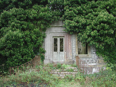
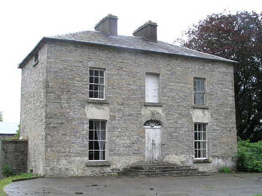
| Lickbla House [ Rockbrook](Fore) | Thomas Fagan was leasing this property from James Fallon at the time of Griffiths Valuation in the early 1850s when it was valued at almost £19 and included a mill. In 1906 it was the property of Patrick J. Fagan and valued at almost £21. The National Inventory of Architectural Heritage suggests that it dates from c.1800 but with later modifications. It is labelled Rockbrook on the 1st edition OS map but as Lickbla House on later editions and is still extant and occupied. |
](https://landedestates.ie/storage/img/orig/3618.png)
|
| Newcastle (Fore) | Walter Keating was occupying Newcastle at the time of Griffiths Valuation in the early 1850s when it was leased from the Urquhart estate and valued at £19. In 1839 the Valuation Office Books indicate that George Keating was the occupier with a valuation of £23. It is still extant. | |
| Derrya | At the time of Griffiths Valuation in the early 1850s William Pollard Urquhart was leasing a herd’s house at this location from the estate of Richard Pakenham, when it was valued at almost £11. The Valuation Office books of 1839 noted the owner as Captain William Pakenham and the valuation was £12. The Untenanted Demesnes survey of 1906 indicates it belonged to Hugh P. Wilson and was valued at over £10. The building is still extant but derelict. | |
| Lakeview House (Fore) | John Smith was leasing this property from Reverend Thomas Smith at the time of Griffiths Valuation when it was valued at £15. The Valuation Office books of 1838 state that the house then held by Reverend Thomas Smith was valued at £16. It is still extant and in use. | |
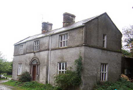
| Mayne Glebe [Mayne Rectory] | Mayne Rectory was leased by Reverend William Eames from the estate of Reverend Thomas Smith at the time of Griffiths Valuation when it was valued at £8. In 1839, the Valuation Office books recorded that it was occupied by Reverend Richard Handy and had a valuation of almost £9. The National Inventory of Architectural Heritage suggests it was built c.1812. It is still extant and in use. |
![Photo of Mayne Glebe [Mayne Rectory]](https://landedestates.ie/storage/img/orig/3615.png)
|
| Newpass | Griffiths Valuation notes the owners of Newpass as Elizabeth Westby and the representatives of Sir. G. Fetherson. Elizabeth Westby was the wife of William Westby and the daughter of George B. Whitney of Newpass. The house was unoccupied in the early 1850s and valued at £35. The National Inventory of Architectural Heritage suggests it was built c.1775 by the Whitney family, probably on the site of an earlier house. Taylor and Skinner noted it as a Whitney property in 1777. O'Brien states that Colonel Whitney first purchased the Newpass estate in 1670. In 1906 it was owned by Major E. Henry Fetherston Whitney and valued at £43. It is still extant. The estate also owned property in the nearby village of Rathowen. |
|
| Kildevin | Moses Sproule was leasing this property from William H. Little at the time of Griffiths Valuation in the early 1850s, when it was valued at £36. O'Brien states that a name plaque at the property indicates the building of the house by Robert Sproule in 1833. It was the residence of the Sproule family until the later part of the 19th century when it was acquired by Meredith Johnston and by the Tyndall family. It is still extant and has been offered for sale on a number of occasions since 2000. |
|
| Kilmore House (Moygoish) | At the time of Griffiths Valuation, Kilmore House was leased by Reverend Francis Kane from Reverend William Bowles and was valued at £10. The house is not visible on the 1st edition OS map but is labelled Kilmore House on the 25-inch edition. It is still extant and part of a farming enterprise. Reverend Francis Kane was afterwards rector of the parish of Fenagh, County Leitrim, from 1869 until his death in 1882. He had previously been vicar in the parish of Russagh, nearby to Street, County Westmeath, 1848-1855. | |
| Millbrook (Granard) | Patrick Flynn was leasing this house and milling complex from the Greville estate at the time of Griffiths Valuation in the early 1850s, when it was valued at over £13. |