Drumkeen
Houses within 10km of this house
Displaying 42 houses.
Houses within 10km of Drumkeen
Displaying 42 houses.
| House name | Description | |
|---|---|---|
| Nixon Lodge/Griffith Lodge | A mid-18th century house, named Nixon Lodge on the first edition 6 inch Ordnance Survey map (publ. 1837). It was the home of the Reverend Andrew Nixon and his wife Marianne French of Frenchpark, county Roscommon, in the 18th century. Their son Humphrey had eight children. Nixon Lodge was later known as Griffith Lodge and Griffith’s Valuation records Dorothea Griffith as the occupant. She held the property in fee and the buildings were valued at £16.10.0. Occupied by the Smith family at the beginning of the 20th century. Somewhat reduced in size this house is still extant and occupied. | |
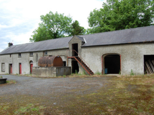
| Cloverhill | This three storey mansion was built in the early years of the 19th century to the design of Francis Johnston. Attached to the rear was an earlier two storey house dating from 1758. In 1814 Cloverhill was the home of James Saunderson. The Ordnance Survey Field Name Book describes Cloverhill as ‘a neat dwelling house with portico of the Ionic order, is in the centre of the townland, in good order, well planted about good orchards, gardens etc’. Griffith’s Valuation records Mary. A. Saunderson as the occupier holding the property in fee. It had a rateable valuation of £40. Cloverhill passed to the Winter family through the marriage in 1826 of Lucy, daughter of James Sanderson, to Samuel Winter of Agher, county Meath. Their third son, Samuel Winter, born 1834, inherited Cloverhill. He died in 1905 and Cloverhill passed to his nephew, John James Purdon, who died unmarried in 1933. The house was sold in the late 1950s by J.J. Purdon’s nephew, Major John Nugent Purdon. It is now an ivy clad ruin. |

|
| Cullies House | Cullies House had a rateable valuation of £35 at the time of Griffith’s Valuation and was occupied by Nathaniel Montgomery and held from Edward K. Tenison. The entrance gates, lodge and outbuildings have become part of the St Patrick’s College complex. This house was demolished circa 1980 (National Inventory of Architectural Heritage]. |
|
| Moynehall House | Moynehall was originally the home of the Moores. In 1847 Moynehall, the house and 12 acres, was been offered for lease by the Court of Chancery in the matter of Catherine Bell, a minor and heiress in law of Robert Bell, a lunatic, dated 15 February 1847 (Anglo-Celt). Griffith’s Valuation records the house as vacant and the Reverend Anthony Adams as the immediate lessor. Moynehall, the property of the Reverend Anthony Adams, was advertised for sale in the Encumbered Estates Court on 28 May 1857. In 1876, Moynehall belonged to John Fay. It is still extant. | |
| Annagh House | Annagh, situated close to Annagh Lough, was the home of Robert Baker in 1814. Occupied and held in fee by Captain John O’Reilly in the mid-19th century, the house is now demolished. | |
| Nahillah House | Nahillah House was built in the mid-19th century for the Jones family. Griffith’s Valuation records the buildings valued at £16 and held by the representatives of John C. Jones in fee. Home of David Fielding Jones in 1862 (Thom’s Directory), the house became the home of the Cole family in the 20th century and is still extant. | |
| Prospect House (Cavan) | The National Inventory of Architectural Heritage dates the building of this house to about 1770. Slater’s Directory records John Thompson of Prospect House in 1846. At the time of Griffith’s Valuation this house was vacant but held by Mary A. Sanderson of Cloverhill. This house is now a ruin. |
|
| Ballyhaise | Ballyhaise built for Colonel Brockhill Newburgh, design attributed to Richard Castle but more likely Sir Edward Lovett Pearce, early 18th century. About 1800 sold to Williamm Humphrys who added two storey wings to the building. Lewis describes the house in 1837 as ‘a spacious mansion, with an elevated front curiously ornamented with arches’. It was the seat of William Humphrys. In the 1850s the buildings had a rateable valuation of £110. Since 1905, Ballyhaise has been an agricultural college. |
|
| Clonervy | In 1814, Clonervy was the home of Richard Blackwood. Located on the estate of Earl Annesley it was vacant at the time of Griffith’s Valuation when its rateable valuation was recorded as £30. George Graham occupied Clonervy in the 1860s and in 1880 it was the residence of the subsheriff John Maxwell James Townley. The Irish Builder records plans for general repairs to Clonervy House for Patrick Lyons in 1912. A smaller building still occupies this site. | |
| Lisnagowan House | Built as a dower house for the wife of William Humphrys who bought Ballyhaise about 1800. In the-mid 1830s occupied by Mrs Humphreys as stated by Lewis. Griffith’s Valuation records William Humphrys as the occupier, holding the property in fee. Still the home of a member of the Humphrys family in 1901. Richard Weir and his wife occupied the house in 1911 holding it from Nugent W. Humphrys. Damaged by fire in the early 20th century, the building is now a ruin. See http://cvn049.blogspot.ie/2016/03/lisnagowan-house.html for photo. | |
| Kilmainham - The Cottage/Heath Lodge | Lewis refers to Kilmainham as the residence of A. Bell and the house is named as The Cottage on the first edition 6 inch Ordnance Survey map (publ. 1837). By the time of Griffith’s Valuation about 20 years later, Henry Montford was the occupier, holding the property from William Humphrys of Ballyhaise. The building would appear to have been extended by this time as its rateable valuation was £15. The house is named Heath Lodge on the 25 inch map. James Hartley and family were resident at Heath Lodge in 1901 while Hector John Atkinson and his wife Sybil were the occupants in 1911 holding the property from the representatives of James Harley. A building of similar shape still exists at this site. | |
| Ashgrove | The National Inventory of Architectural Heritage refers to this house as ‘a classic Palladian composition’ dating from the mid-18th century. Ashgrove was occupied by John Baker in 1814 who probably gave his name to the nearby Bakers Bridge. By the mid-19th century it was the home of Robert Battersby who held the property in fee. The buildings had a rateable valuation of £20. Ashgrove was the home of Miss Mary Jane Sheridan in 1901 and in 1911. In 1906, it was described as a mansion house with a rateable valuation of £23.10.0. It continues to be a residence. | |
| Lake View House (Drumlane) | Home of Richard J. ‘Hynes’ (Hinds) at the time of Griffith’s Valuation, Lake View House was held in fee and had a rateable valuation of £10. It was built after the first Ordnance Survey of the 1830s and before the primary valuation survey. Henry Hinds in 1901 and Mrs Charlotte E. Hinds in 1911 held a vacant house in Deramfield. Lake View House is presently occupied. |
|
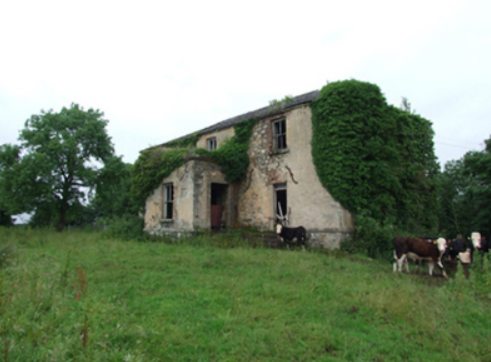
| Lislin House | Lislin House, situated close to the bank of the Annalee River, is named on the first edition six inch Ordnance Survey map (publ. 1837). The building is believed to date from the late 18th century and came into the possession of the Battersby family through marriage. At the time of Griffith’s Valuation Robert Battersby was the occupier and owner. The rateable valuation of the buildings was £6. Home of the James and Agnes Simons at the beginning of the 20th century, now a ruin. | |
| Drumgoon | The houses known as Drumgoon, Lahard, Gartinadress and Lakeville are in close proximity to one another and all at one time were homes of the Young family. Drumgoon is located just east of Lahard. In the mid-19th century it was the residence of James Robinson, who held it from Robert Hutton when it had a rateable valuation of £6.10.0. This house is still extant. | |
| Gartinadress House | In 1814, Charles Veaitch was the resident at Gortin-ardrass. This house is named on the first edition six inch Ordnance Survey map (publ. 1837). Although having advertised Gartinardress for sale in 1850 William Young was the owner and occupier at the time of Griffith’s Valuation when the property was valued at £15 for rates. By the early 20th century the Armstrong family were occupying Gartinardress, although in 1906 William A. K. Young is recorded as occupier of 228 acres of untenanted land and the mansion house. This house is no longer extant and the site is part of a forestry area. A house known as Lakeville was also located in the townland of Gartinardress. Leases in the National Library record Lakeville as the home of Richard Young in the 1820s. It was described as ‘in ruins’ on the 25 inch map. | |
| Lahard | Lahard was the home of the Young family in the 18th and 19th centuries. It is named on the first edition six inch Ordnance Survey map (publ. 1837) which shows a flower garden to the south of the house. Occupied by Cosby Young in 1814 and by John Lough in the 1850s, who held the property from the representatives of Cosby Young. The buildings were valued at £10. Inherited by one of Cosby Young’s daughters, Mrs Mackarness. The railway line was erected to the south west of this house. It is no longer extant. | |
| Castle Hamilton | In the mid-18th century Castle Hamilton came into the possession of the Southwell family through marriage with a Hamilton co-heiress. It remained in Southwell ownership until about the 1840s. Both Leet and Lewis record members of the Southwell family as resident. Lewis describes the house as ‘a spacious mansion surrounded by an extensive and highly embellished demesne’ adjoining the town of Killeshandra. The buildings were valued at £50 in the mid-19th century, by which time James Hamilton was owner and occupier. The Hamiltons were still resident at the time of the censuses of 1901 and 1911. The house was accidentally destroyed by fire in 1911 but a fine farm yard survives. |

|
| Portaliff House | Portaliff House was located on the Castle Hamilton estate, north of Mill Lough and a little south of Killashandra. In the mid-19th century it was occupied by Captain F.H.B. Philips when it was valued at £12 for rates. Portaliff House is listed as a protected structure. | |
| Bellville | The Fleming family were known to be at Bellville from the early 18th century. The house is named on the first edition six inch Ordnance Survey map (publ. 1837) and located facing two forts in a sizable demesne. Belville was the home of A. Fleming in 1814 and of Captain A. Fleming in the 1830s. By the 1850s, the occupant was Jane Kenny who held the property valued at £7 from Major General Fleming. At the beginning of the 20th century Bellville was the home of the Meikle family, originally from Scotland. It is still extant. | |
| Corstruce House | A house located on the outskirts of Bellananagh and near a corn mill. It was situated on part of the Fleming estate and was occupied by William Pollock in the mid-19th century and was in the possession of Thomas Brady in the early 20th century. A modern house now occupies this site. | |
| Lismore Lodge | Built as the agent’s house in the Nesbitts’ Lismore Castle demesne close to the village of Crossdoney. Lismore Lodge is named on the first edition six inch Ordnance Survey map (publ. 1837). It was the home of William Tatlow in the mid-19th century, when the buildings were valued at £20. Occupied by the family of Thomas Cosby Burrowes at the beginning of the 20th century. His mother Mary Anne Burrowes had succeeded to the Lismore estate in 1886 following the death of her brother Alexander Nesbitt. Under boundary changes at the end of the 19th century the location of the Lodge was changed to the townland of Lismore Demesne and it was valued at £32 for rates in 1906. In the mid-20th century it was a Lucas-Clements home. This house is extant but unoccupied. |
|
| Drumcarban | Bence Jones describes Drumcarban as a late 18th century house of 3 storeys and 3 bays. It was the home of the Bell Booth family in the 19th century. George Thomas Bell Booth was resident in the 1830s and 1840s until he was murdered in 1845. Robert Booth Bell was the owner and occupant at the time of Griffith’s Valuation. This house was occupied by Annie Sheridan in 1901, in 1906 by Michael Sheridan when it had a rateable valuation of £22.5.0. and is still extant. | |
| Bingfield | A house built in the mid-18th century by the Venerable Joseph Story, Archdeacon of Kilmore. Occupied by Joseph Story in the mid-19th century, when the buildings were valued at £40. The property was held from Anthony O’Reilly. The Story family were still resident in 1901. Bingfield was sold by Arthur Patrick Story [sometime in mid-20th century, Irish Family Records (1976)]. Many of his siblings went to live in New Zealand. This house is still a fine residence. |

|
| Castle Cosby | Castle Cosby was situated close to a small lough of the same name. A number of other country houses were located in close proximity, such as Lismore. J. Whitethorne was resident at Castle Cosby in the 1830s and 1840s. By the mid-1850s Andrew Smith was the occupant holding the property from John E. Vernon. It was valued at £16. In 1876, Philip Smith of Castlecosby owned 77 acres in co Cavan. He married Delia Mary daughter of Corney Banahan of Renny, Co Roscommon and had a number of sons who became doctors. His third son Frederick Paul married in 1905 Isabella Ann daughter of Edward Smith of Bellamont Forest. Castlecosby was mainly known as Kevit Castle under Smith ownership. The house is now demolished but a gate lodge is still extant. |
|
| Lismore Castle | An early 18th century house, possibly designed by Sir Edward Lovett Pearce (Bence Jones). Named on the first edition six inch Ordnance Survey map (publ. 1837), it was valued at £12 for rates in the mid-1850s. It was a Nesbitt family home until the 1880s when inherited by the Burrowes family and passed from them by marriage to the Lucas Clements in the 1920s. However the house was marked as ‘in ruins’ on the 25 inch map. Bence Jones records that it was later demolished and that the Lucas-Clements resided in the agent’s house nearby Lismore Lodge. | |
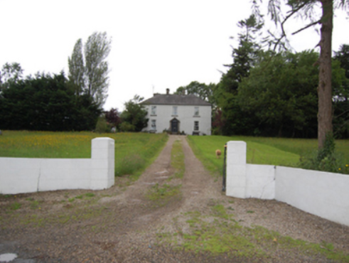
| Rockville (Crossdoney) | Named on the first edition six inch Ordnance Survey map (publ. 1837), Rockville was located on the Nesbitt estate to the north east of Lismore Castle, on the outskirts of Crossdoney. In the 1830s it was the home of John C. Tatlow and in the 1850s of Samuel Moore, when the buildings were valued at £20 for rates. Occupied by Dr John Stirling Greer and his wife in 1901 and held from Thomas Cosby Burrowes. Another medical family named Hallowes was resident in 1911. Apparently still extant and occupied. | |
| Ricehill House | Rice Hill was built in the mid-18th century. It was the home of the Bredin family in the first half of the 19th century. It is named on the first edition six inch Ordnance Survey map (publ. 1837). Described by Mulligan as a ‘classic Georgian gentleman’s farmhouse in a small demesne.’ Occupied by Patrick Finnegan and held from the representatives of Sophia Wright in the 1850s, when the buildings were valued at £3.10.0. It was still the home of the Finnegan family at the beginning of the 20th century and continues to be a residence. |
|
| Drumheel House | A house named on the first edition six inch Ordnance Survey map (publ. 1837) with extensive outbuildings and occupied by R. Bell. Griffith’s Valuation records William Smith as owner and occupier in the 1850s, when the buildings were valued at £23.10.0. A building of different shape now occupies this site. | |
| Kilmore Palace | A house built in the 1830s for Bishop George de la Poer Beresford, designed by William Farrell and resembling Rathkeeny. It replaced an earlier palace on a different site. Its rateable valuation was £100 in the 1850s, the Bishop of Kilmore being owner and occupier. This house continued to be the home of the Bishops of Kilmore until the early 21st century. It is now in private hands and currently for sale (2022), see https://theirishaesthete.com/tag/kilmore/ |

|
| Lisnamandra | Lisnamandra was a Sneyd family home in the 18th century. Frances Arabella Sneyd of Lisnamandra married Archdeacon Joseph Story (died 1767) of nearby Bingfield. One of their daughters Sophia married Robert Burrowes of Stradone House. Their grandson, James Edward Burrowes, was the occupant of Lisnamandra in the 1850s. He held the property valued at £20.10.0. from Earl Annesley. However previous to J.E. Burrowes’ occupation Lisnamandra had been the residence of Mrs Elliott in 1814 and of George Burdett L’Estrange in the 1830s. Hugh Hamilton Moore and his wife lived in Lisnamandra in the early 20th century. He was a barrister and Clerk of the Crown and Peace for county Cavan. | |
| Danesfort | The present house replaced that marked on the first edition six inch Ordnance Survey map (publ. 1837). Danesfort was the home of the Dean of Kilmore and is situated a short distance from Kilmore Cathedral. Mulligan refers to a Deanery House on the site in 1739. Dean Magenis was resident in 1814 and Lord Fitzgerald and Vesey, Dean of Kilmore, in the 1850s. The buildings were valued at £24 for rates. The building is still in use as the home of an ecclesiastic. |
|
| Countenan House | Countenan House on the shore of Countenan Lough is named on the first edition six inch Ordnance Survey map (publ. 1837). It was occupied by Thomas Hartley in the 1850s and held from Robert Burrowes. The rateable valuation was £10.10.0. Home of the Hawe family at the beginning of the 20th century, this house is apparently still attached to a farming enterprise. | |
| Stradone | According to Burke’s Irish Family Records the Burrowes family were resident at Stradone from at least the mid-18th century. The architect J.B. Keane designed the 19th century house for Major Thomas Burrowes in 1828. His son Robert Burrowes was the owner and occupant in the 1850s when the rateable valuation was recorded as £67.10.0. The Burrowes were still in possession of Stradone in the early 20th century until it was burnt in June 1921. The stables and a gate lodge survive. |
|
| Brookvale | Sometime in the early 18th century Alexander Brooke, second son of William Brooke who purchased Drumavanagh from the Saundersons in 1685 (Burke’s), settled at Drumavanagh with his wife Catherine a daughter of Richard Young of Drumgoon. The present house known as Brookvale, was built in 1845 by William Hague, a successful building contractor. It was located on the outskirts of Cavan town near the train station. By the mid-19th century the Reverend Andrew Hogg was resident holding the buildings valued at £24 from William Hague, junior. This house is still a fine residence. It was advertised for sale in 2000 for £500,000 (Irish Times, 8 June 2000). | |
| Arnmore | A building located at this site as marked on the first edition six inch Ordnance Survey map (publ. 1837) was expanded before Griffith’s Valuation. The buildings were in the mid-19th century valued at £38.10.0. and the house, known as Arnmore, was occupied by William A. Moore and held from Earl Annesley. William Armitage Moore of Arnmore was an executor to the will of his nephew, the 4th Earl Annesley, who died in 1874. In 1906, this property was in the possession of Lord Farnham. Today it is the club house of the County Cavan Golf Club. | |
| Earlsvale | A house built circa 1840s on the estate of Earl Annesley and occupied by Captain Francis Meik at the time of Griffith’s Valuation, when the buildings were valued at £18. This may have been the residence of the agent of Earl Annesley. | |
| St Swithin’s Cottage/Drumbar House | St Swithin’s Cottage is named on the first edition six inch Ordnance Survey map (publ. 1837). It was located in the demesne surrounding Farnham House and was later extended by the addition of another block. Abraham Brush, who was the estate agent, lived here in the mid-19th century, when the buildings were valued at £20. By the early 20th century the building was known as Drumbar House. It continues to be a residence. | |
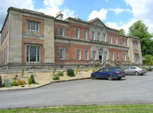
| Farnham Castle | The seat of the Maxwell family, Earls of Farnham, built about the turn of the 18th century for John Maxwell, son of the Bishop of Kilmore, who had purchased the estate from the Waldrons. A library and other alterations designed by James Wyatt were added in the 1780s. In the early 19th century Francis Johnston was employed by the 2nd Earl to rebuild the house. The buildings were valued at £120 in the mid-19th century. The house was remodelled again in the 1960s when dry rot was found to be prevalent and much of the 18th building was demolished. The house remained in the possession of the Maxwell family until the early 21st century. It is now a country house hotel. https://www.farnhamestate.ie/ | |
| Ford Lodge | Located on the Farnham estate just outside Cavan town and close to St Patrick’s Cathedral, Fort Lodge is named on the first edition six inch Ordnance Survey map (publ. 1837). R. Young Reynolds of Fort Lodge, Cavan, was a subscriber to Lewis ‘Topographical Dictionary’. It was occupied by Theophilus Thompson in the mid-19th century and valued at £27 for rates. Home of William Henry Halpin, a solicitor, in the 1930s. | |
| Lisdaran | In the mid-19th century John Moore held a house valued at £12 in the townland of Lisdaran from Lord Farnham. The Moore family were still resident in the early 20th century. | |
| Corravahan House | Built circa 1841 by Rev Marcus Gervais Beresford, later Archbishop of Armagh, close to the site of the former Drung Parsonage. The house served as the parish rectory until 1870 when it was sold to the Rev Charles Leslie, cousin of the Glaslough Leslies. In 1906, it was occupied by Captain C.R. Leslie and had a rateable valuation of£39. It remained a Leslie family home until 1972. Bought by the Elliott family in 2003 who have been renovating the house and gardens. |
|