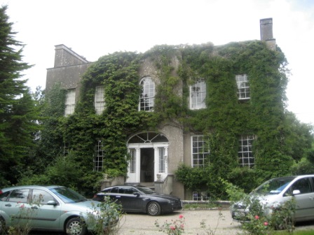
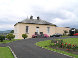
Singland House
Houses within 5km of this house
Displaying 41 houses.
Houses within 5km of Singland House
Displaying 41 houses.
| House name | Description | |
|---|---|---|
| Athlunkard House | Hamilton Jackson held what was described as a steward's house from Colonel George Wyndham at the time of Griffith's Valuation. It was valued at £14. Weir also describes a house known as Clare Cottage in Athlunkard. | |
| Fairy Hill | This house was situated on the Gore estate and was the residence of John McDonnell in the mid 19th century who held the property from Charles William Gore. It was valued at £14. In 1837 it was inhabited by E. Burnard. Although the house became derelict in the early 20th century it was later reconstructed and is still a residence. | |
| Parteen House | At the time of Griffith's Valuation this house valued at £24 was the residence of George Gloster who held it in fee. Weir writes that the house was demolished in the 1920s to make room for the Ardnacrusha hydro-electric dam. | |
| White Hall | The residence of Mr White in 1778 when it was known as Quin's pool. In 1786 Wilson refers to it as White-Hall, the seat of Mr. White. The home of Captain Richard Kane in 1837. At the time of Griffith's Valuation occupied by John C. Delmege who held it from the Captain's son, Thomas Kane. It is still extant. |
|
| Summerville | Built in the 1780s by Joseph Massey Harvey, a Quaker merchant, who married Rebecca Fisher and still occupied by him in 1814. Joseph and Rebecca were the parents of William Henry Harvey, a distinguished botanist. At the time of Griffith's Valuation Summerville was valued at £33 and occupied by James T. Fisher who held the property from Eliza Harvey. The house is now an accommodation and conference centre of the Mary Immaculate College for training primary teachers. The college was founded in 1898. |

|
| Ballyclogh | The home of a branch of the Morony family during the 19th century. Occupied by James Todd in the early 1850s who held the property valued at £38 from the Moronys. An occupied house is still located at this site. |

|
| Ballyclogh Lodge | Ballyclogh House and Lodge are both marked on the first Ordnance Survey map of county Limerick. At the time of Griffith's Valuation John Russell held land in the townland with associated buildings valued at £12 from Michael Furnell. There were also mills in the townland valued at £35. Valued at £10+ in 1906 when occupied by George Furnell, Ballyclogh remained in the possession of the Furnell family until 1973. | |
| Coolyhenan House | A house occupied by Michael Shine at the time of Griffith's Valuation and held from the representatives of M. Honan, valued at £28, with a demesne of 343 acres. Though buildings survive at the site they appear to be in a derelict condition. | |
| Roxborough | Occupied by William Westropp in 1814 and Lewis refers in 1837 to the ''fine mansion and demesne'' of the Honourable J. P. Vereker. The Ordnance Survey Name Book refers to the rebuilding of Roxborough by Major Vereker in 1832 at the expense of approximately £1200. Viscount Gort held Roxborough in fee at the time of Griffith's Valuation when it was valued at £40. The house was advertised for sale in June 1852 and again in June 1853. Possibly bought by the McMurrays who were certainly resident by 1862. In 1894 Slater refers to it as the seat of A. Crawford. Now a more modern house appears to be located at this site. |
|
| Ballyclogh House | The Ordnance Survey Field Name Book refers to the building of this house in 1822 by Henry Rose as a cost of £600. Occupied by P. Cudmore in the 1830s and by Henry Rose at the time of Griffith's Valuation who held the property from the representatives of Samuel Dixon [Dickson]. The buildings were valued at £9+ in the 1850s. Ballyclogh is still extant. |

|
| Kilrush | A house occupied by Daniel Gabbott and held from Tottenham Harvey at the time of Griffith's Valuation. The house was valued at £40 and was surrounded by 3 acres of land. It was situated on the Barrington estate. [Marked as Thorn Ville on the first Ordnance Survey map]. | |
| Mulkear | Built by the Reverend J. Crampton in 1812 at a cost of £3,000. He was still resident in 1837. Occupied by George Gough in the early 1850s, held by him from John Tuthill and valued at £35. Later the home of Samuel Frederick Dickson. Home of Martin Edward Patrick White circa 1900. On the 25-inch edition Ordnance Survey map the house at this site is labelled Woodstown House. An earlier Woodstown House is described as "in ruins" in the adjoining townland of Woodstown on the 1st edition Ordnance Survey Map. In 1786 Wilson refers to a house at "Gran" as the seat of Mr.Gough, which may refer to an earlier house in this area. This property is now part of a health services facility. | |
| Ballysheedy | A 3 storey house built circa 1749, occupied by FitzGillon in the late 1770s and noted by Wilson as the seat of Gibbon Fitzgibbon in 1786. It was the residence of Michael Furnell in 1814 and occupied by Gibbon T. Fitzgibbon in the early 1850s, when it was held from Admiral Proby and valued at £22. It was ruinous by the publication of the 25-inch Ordnance Survey map of the 1890s. | |
| Shannon View | It was valued at £22+ at the time of Griffith's Valuation, occupied by Thomas Kelly and held from Henry O. Seward. Thomas Kelly was an uncle of James Michael Kelly of Rockstown Castle and Cahircon. He married Letitia Roche, a granddaughter of Philip Roche of Shannon View and his wife, Margaret Kelly of Limerick. This house is no longer extant and extensive urban development has taken place in the area. | |
| Milford | Built by George Maunsell, fourth son of Richard Maunsell of Ballywilliam, in the late 18th century. Occupied by the Reverend M. Widenham in the late 1770s, and 1786, by Lord Kiltarton [John Prendergast Smyth became Viscount Gort in 1816] in 1814, by T. Fitzgerald in 1837, by Captain Stackpool circa 1840 and by Henry Allen in the early 1850s, this house was situated on the Maunsell estate. It was valued at £28 at the time of Griffith's Valuation. Referred to as the "splendid residence" of the Dowager Lady Massy in the sale rental of 1868. Tracy writes that the 5th Baron Massy bought it for his mother in 1850 from the Maunsells. Later sold to the Russell family and bought by the religious order, the Little Company of Mary, in 1923. Now part of a nursing home for the terminally ill. |

|
| Plassey | Built by Thomas Maunsell, founder of Maunsells' bank, Limerick, and occupied by him in 1814. Inherited by his daughter Mrs Robert Hedges Eyre Maunsell. Occupied by Reuben Harvey in 1837 and at the time of Griffith's Valuation. Harvey held the property from the trustees of Mrs Hedges Maunsell. The residence of Richard Russell in 1868. Home of John Norris Russell in the 1870s. Bence Jones writes that the present Plassey House is "a rambling two storey Victorian Italianate house built by the Russells". This house is now part of the University of Limerick. |

|
| Shannon Park | The residence of the O'Ferralls from at least 1814 when occupied by Michael O'Ferrall. Michael Richard O'Farrell was the occupier at the time of Griffith's Valuation and the house worth £10+ with 146 acres was located on the Brown estate. | |
| Woodsdown | This house was the home of the Gough family in the late 18th and early 19th centuries. It was occupied by Matthew O'Brien in 1814. The Ordnance Survey Field Name Book states that this house was built by the ancestors of Major Gough and "it is now in ruins". It is marked as "in ruins" on the first Ordnance Survey map. Another house was later built by the Bannatynes and occupied by the Goodbody family in the early 20th century. Now run by the Sisters of Charity as St Vincents Centre for persons with intellectual disabilities. | |
| Sunville | Described as the seat of Thomas Wallnutt in the Ordnance Survey Field Name Book and built in 1821 for £900. It was occupied by Margaret Wallnutt in the early 1850s and held from William F. Taverner and valued at £24. | |
| Moylish | The Ordnance Survey Name Book shows Arthur Gloster as proprietor of this townland circa 1840 and Moylish House is marked on the first Ordnance Survey map. By the time of Griffith's Valuation Moylish valued at £24 was occupied by Lawrence Kelly who held the property from John Judde. Moylish is now the site of the Limerick Institute of Technology. | |
| Corbally House | The Ordnance Survey Name Book records the rebuilding of this house by Poole Gabbet in 1824 at a cost of £1,700. The Gabbets had flour mills closeby. It overlooked the Shannon north of Limerick city and was three storeys high. At the time of Griffith's Valuation it was valued at £35 and was occupied by Thomas Gabbett who held it from Patrick A. Shannon. This house now functions as a nursing home. |
|
| Shelburne | The National Inventory of Architectural Heritage (buildings of Ireland) states that this was a home of William Petty-FitzMaurice (1737-1805), 2nd Earl of Shelburne and 1st Marquess of Lansdowne. The Ordnance Survey Field Name Book refers to the building of Shelburne in 1837 at a cost of £2,000. Circa 1840 it was the seat of H.N.Seymour. At the time of Griffith's Valuation it was occupied by a representative of Robert Gabbett and held from the Marquess. It was the home of Thompson Russell in 1878 and of Henrietta Rose in 1887. Now located in the grounds of Ardscoil Rís. |
|
| Corbally Park | Built in 1824 by Pierce Shannon for £2,500, this three storey house was held by Patrick A. Shannon in fee at the time of Griffith's Valuation when it was valued at £51. St Munchins College is situated at this location now. A lithograph of this house called Corbally House and the toll bridge is included in the 1856 rental. The house was not included in the sale. | |
| Bellevue | The description in the National Inventory of Architectural Heritage records the building of this house as circa 1820 and that it was the home of the artist Douglas Alexander (1871-1945), one of three brothers who were prominent Quaker merchants in the city of Limerick. At the time of Griffith's Valuation Bellevue valued at £35 was occupied by William Alexander. Another house occupied by James Alexander and valued at £31 stood close by. Both houses were held from the Marquis of Lansdowne. Later this house was the home of the Cleeves family, toffee makers. |

|
| Roseneath Cottage | A villa style house built circa 1820, occupied by Robert Rogers in the early 1850s, valued at £27 and held from Patrick A. Shannon. |
|
| River View | A mid 19th century house, marked on the first Ordnance Survey map. At the time of Griffith's Valuation this house valued at £27 was occupied by John Able and held from the Reverend Edward Croker. |
|
| Geraldine Cottage | Dating from the late 18th century, Geraldine Cottage was the home of Pierce Shannon in the early 1850s and held by him from the representatives of William Fitzgerald. It was valued at £27. In April 1858 Geraldine House on 5 acres in the townland of Corbally, the estate of Robert Appleyard Fitzgerald and members of the Tinsley and Leake families, was advertised for sale. John Bouchier was the tenant at the time. Renovated in the early 20th century. |
|
| Ardhu | A house built post 1850, the seat of the Rose family at the beginning of the 20th century. Now functions as the Clarion Hotel suites. |
|
| Tivoli | Marked on the first Ordnance Survey map, Tivoli Cottage valued at £48 was occupied by Major Wheeler and held from Sir Matthew Barrington at the time of Griffith's Valuation. Since 1952 it has been the centre of a boys' secondary school known as Villiers School. |

|
| Ashbourne | A 2 storey house located on the Earl of Limerick's estate, this house was the seat of the Honourable Robert O'Brien in the 1830s. It was occupied by Richard Wilson in the early 1850s and held from Eliza Harvey. Garrett Hugh Fitzgerald's interest in the property was advertised for sale in May 1851. By the 1870s it was the home of the Synan family. This house is now demolished. | |
| Strand House | Strand House appears to be the house also known as "Stonetown House" and marked as such on the first Ordnance Survey map. The Ordnance Survey Name Book describes Stonetown House as the seat of Daniel Gabbett and that it was built between 1760 and 1770 by G. Vandeleur at a cost of £1,100. At the time of Griffith's Valuation it was the residence of William Gabbett, valued at £44 and held from Elizabeth Vereker. Part of the original garden now occupied by The Strand Hotel. | |
| Bellefield | Bellefield was the residence of George Furnell at the time of Griffith's Valuation. He held it from William Gabbett and it was valued at £33. William's brother Daniel lived at Bellefield at one time. A Charles A. Marrett is recorded as resident at Belfield, Limerick in 1814. Belfield Park is now the location of the Regional Maternity Hospital. | |
| Ballinacurra House | Marked on the first Ordnance Survey map and situated on the outskirts of Limerick city this house was occupied by Edmund Palmer at the time of Griffith's Valuation when it was valued at £23 and held from Patrick O'Shea. Later the home of Hugh Massy. He died at Ballinacurra in 1881. Now in use as an office. |
|
| Kilmoyle | A house built by the Boyds, merchants in Limerick city, circa 1845 on the Lansdowne estate and originally known as Westfield. For many years the residence of the Catholic Bishops of Limerick. Sold by the Diocese to Aidan Brooks for development in 2007 for a sum reputed to be > €20 million. |

|
| Prospect House | Occupied by Thomas McNamara at the time of Griffith's Valuation, held from Henry Watson and valued at £22. Described in the sale rental of 1856 as a capital house and office on which over £1,000 had been spent on improvements. The original lease dated 1796 was from Thomas Maunsell to Philip Smith for the lives of members of the Watson family. Henry Watson was the tenant in 1856 and Sir Christopher Arbuthnot Maratt in 1877. | |
| India Villa | Valued at £18 at the time of Griffith's Valuation, India Villa was held on a lease from Patrick A. Shannon to William Phayre and was described in 1856 as "an exclusive modern residence". It is no longer extant. | |
| Albert Villa | Occupied by William Finch at the time of Griffith's Valuation and valued at £31. Described in 1856 as a large mansion house, "erected by the late Mr Shannon" and occupied by John C. Drysdale. By the 1890s this house is labeled "Lanahrone" on the 25-inch Ordnance Survey map. It is no longer extant and a modern housing estate now occupies the site. | |
| Rosbrien | A home of a branch of the Quin family descended from John Quin, second son of Thady Quin (1645-1726). Wilson, writing in 1786, refers to Rosbrien as the fine seat of Mr. Quin. It is labelled Rossbrien House on both the 1st and 25-inch edition Ordnance Survey maps but is no longer extant. | |
| Cahernarry House | Originally a Cripps residence, occupied by a member of the Crips family in the 1770s and 1780s and by J. Cripps in 1837. By the time of Griffith's Valuation Henry Watson was in residence. The house was valued at £8. It is not visible on the 25-inch Ordnance Survey map of the 1890s. Modern farm buildings occupy the site now. | |
| Castle Troy | Home of the Matterson family, proprietors of a bacon factory, in the mid 19th century, when the house was valued at £16.5 shillings and of Colonel Richard Arthur Milton Henn, son of Thomas Rice Henn in the early 20th century. The house is labelled Castletroy House on the 1st edition Ordnance Survey map. On the 25-inch edition of the 1890s, however, another house some distance to the south has this title while the original house is labelled Castletroy. Buildings are still extant at both sites. |

|
| Rivers | In 1786 Wilson refers to Rivers as the seat of Brooke Brasier. Only the remains of a driveway and estate buildings are visible on the 1st edition Ordnance survey map of the 1830s. |