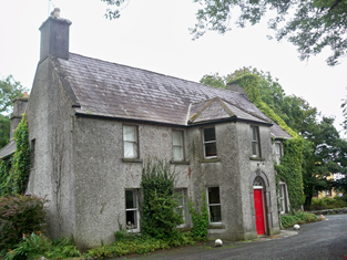
Park
Houses within 5km of this house
Displaying 19 houses.
Houses within 5km of Park
Displaying 19 houses.
| House name | Description | |
|---|---|---|
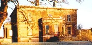
| Castle Ellen | Castle Ellen was built in 1810. It is described as the property of Captain Lambert in the Ordnance Survey Name Books. At the time of Griffith's Valuation it was owned by Walter Lambert and was valued at £21. In 1906 it was owned by the representatives of Peter F. Lambert at which time it was valued at £35. It is still extant and occupied. For more information see www.castleellen.com. For more information on the genealogy of the Lambert family see http://www.familylambert.net/History/index.htm |
|
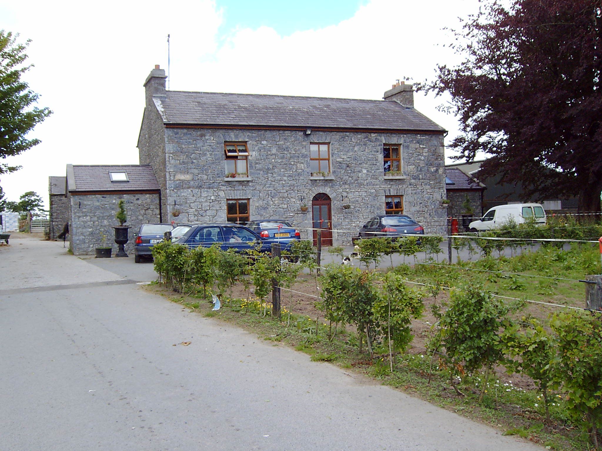
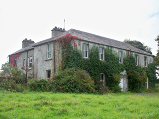
| Mount Browne | The home of the Cullinane family for about the last 200 years and still occupied by them. The house is reputed to be about 300 years old and was undergoing renovation in 2007. The outbuildings are well maintained. |
|
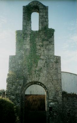
| Castle Lambert | Castle Lambert was built in the later 18th century. At the time of Griffith's Valuation it was owned by Walter Lambert and was valued at £20. It is no longer extant, only the bell tower in the yard remains. |
|
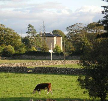
| Moor Park | Occupied by Giles Eyre Lambert at the time of Griffith's Valuation when he was leasing it from Walter Lambert. It was valued at £20. Later the seat of Frank Shawe Taylor who was assassinated nearby in 1920. There is still a large house at Moor Park though the National Inventory of Architectural Heritage indicates that this is not the original house. |
|
| Newford | In 1786, Wilson mentions Newford as the seat of Edward Browne. In 1814 Thomas Tighe is recorded as residing at Newford. Patrick Fitzpatrick of Newford House, Athenry is listed as a subscriber to ''Lewis' Topographical Dictionary'' (1837). The house was later part of the Whaley and Perry estates in the 1850s and was offered for sale in the Encumbered Estates court in 1852. Portion of Newford later bacame incorporated into Mellows Agricultural College farm. The house is no longer extant. | |
| Prospect | Prospect Lodge is recorded as the residence of T. Burke in 1814. At the time of Griffith's Valuation it was leased by Thomas Courtney to John Lopdell. It is still extant and occupied. |
|
| Castleturvin | Francis Bruen was leasing Castleturvin to Reverend Mark Perrin at the time of Griffith's Valuation. The Ordnance Survey Name Books claim that the Turvin family were the proprietors in the 1830s. Castleturvin House is still extant and occupied. The entrance gate indicates that the house dates from 1767. |
|
| St. John's | This house was built later in the nineteenth century. It appears as "St. John's" on the 25-inch Ordnance Survey Map of the 1890s. The Corbishley family occupied St. John's until the early twentieth century when an auction was held on the premises. The property was purchased by the Finn family but members of the Corbishley family remained living in the house for some years afterwards. St. John's remained the property of the Finn family until later in the twentieth century. In 2005 it was sold. Extensive works have since been carried out at the entrance including new gates and railings. | |
| Cullairbaun | Occupied by James Perry at the time of Griffith's Valuation. | |
| Athenry House | Athenry House was built in the late 18th century. In 1837 it was the seat of J. Lopdell. It was offered for sale in the Landed Estates court in November 1876 as part of the estate of Wm. Vesey Fitzgerald Hickman. Part of the original house is no longer extant and construction work has taken place in the area. |
|
| Rockmore or Blakeland Lodge | . This property is named as Blakeland Lodge on the 1st edition OS Map and in the Ordnance Survey Name Books.It appears as Rockmore on the 25-inch map of the 1890s. At the time of Griffith's Valuation it was occupied by William Kelly and valued at £15. In 1906 it was the property of Raymond Kelly and was still valued at £15. It is still extant and has recently been renovated. |
|
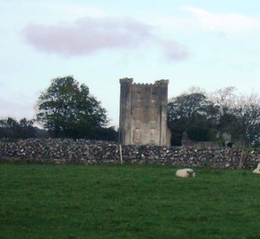
| Belleville | Built in the late 18th and early 19th century. Belleville was held in fee by Thomas Mahon at the time of Griffith's Valuation when it was valued at £30. The only part of the house remaining is the tower. |
|
| Bingarra | Occupied by James Clarke in the mid 1850s, leasing from the Bodkin estate and advertised for sale in Nov 1855. Modern buildings exist at the site now. | |
| Graig Abbey | At the time of Griffith's Valuation, James Clarke was leasing the house at Graig Abbey from the Warburton estate when it was valued at £18. It is still extant and in use. |
|
| Raheen (Athenry) | Raheen House is associated wth the Lopdell family although there was only a herd's house valued at £3 and gate lodges recorded there at the time of Griffith's Valuation. In 1894, however, Slater noted it as the residence of Mrs. Lopdell. Raheen is still extant. |
|
| Boyhill House | Richard Persse was leasing a house valued at £5 from Burton Persse at Boyhill, barony of Athenry at the time of Griffith's Valuation. In 1906 it was still the property of Burton Persse who also held almost 300 acres of untenanted land in the locality. Some ruins and farm buildings still remain at the site. | |
| Gloves (Athenry) | The Ordnance Survey Name Books record Gloves as the residence of Mr. Browne in the 1830s. At the time of Griffith's Valuation Mark Loughnane held the townland of Gloves Middle, barony of Athenry including buildings valued at almost £8. By 1906 Michael J. Monaghan was the owner of this property. Buildings are still extant at the site. | |
| Mulpit House | Mulpit House is shown on the first edition Ordnance Survey map, published in 1842. At the time of Griffith's Valuation, it was being leased from Francis Bruen by Walter Taylor and was valued at £8 10s. The property included a corn mill though this is noted as "in ruins" on the Ordnance Survey map. Mulpit House is still extant and occupied. |
|
| Cossaun or Cussane | In 1786 Wilson refers to Cussane as the seat of Mr. Parker. By the time of the 1st Ordnance Survey the house in Cossaun townland is described as "in ruins". The townland was in the possession of the Mahons of Belleville by the time of Griffith's Valuation in the 1850s. |