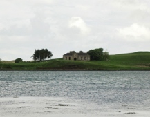
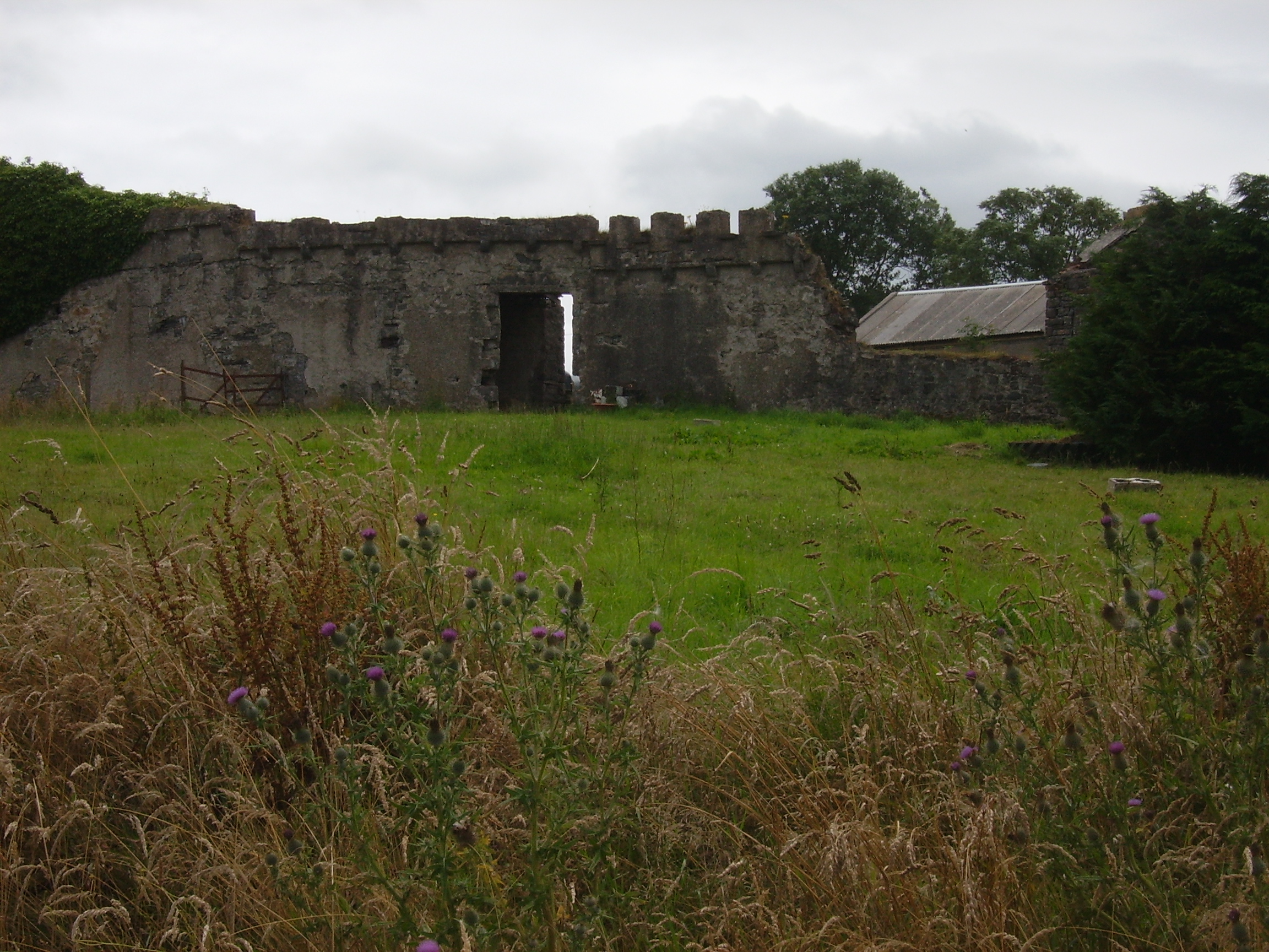
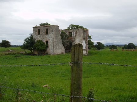
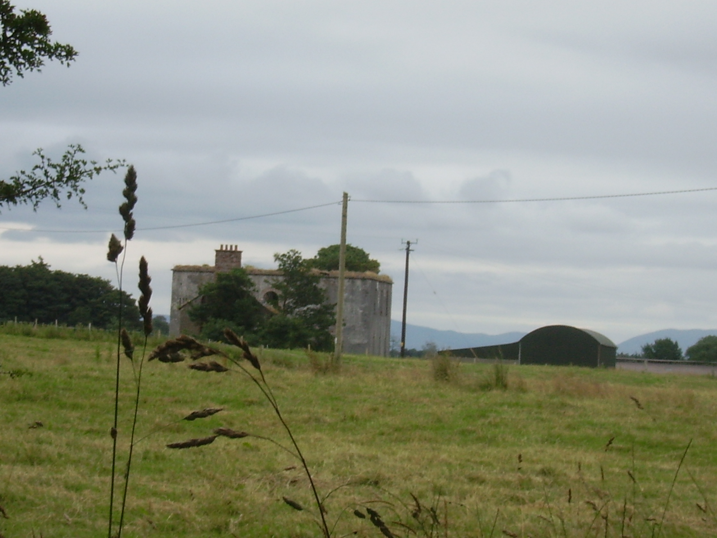
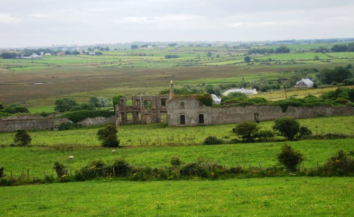
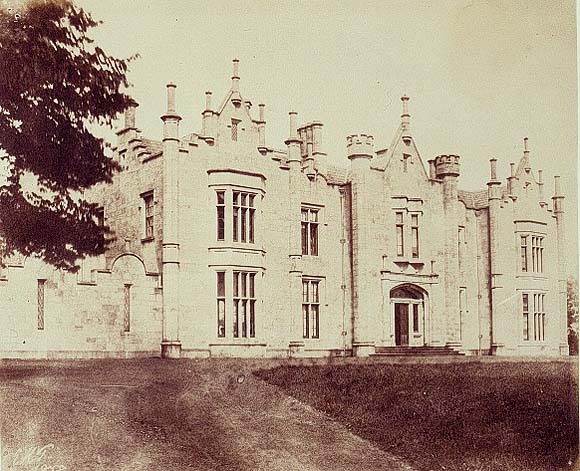
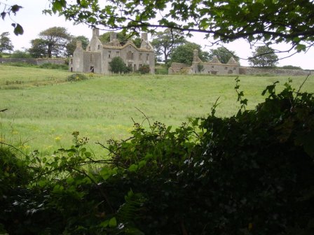
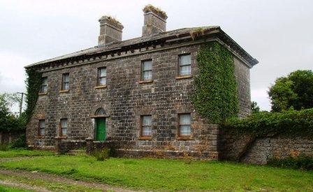
The Lodge
Houses within 10km of this house
Displaying 40 houses.
Houses within 10km of The Lodge
Displaying 40 houses.
| House name | Description | |
|---|---|---|
| Cottlestown | The Kirkwood estate was centred on Cottlestown House. The name seems to have sometimes been known as Castletown and this is how it appears on the First ed. OS sheet but documentary evidence would seem to suggest the estate was also known as Cottlestown. The Buildings of Ireland survey states that it is likely that the present house was added to an earlier, probably eighteenth century structure, which in turn replaced the fortified house on the site. On modern OS sheets the townland is known as Cottlestown. This property later became part of the Boyd estate. |

|
| Moyview | Moyview was part of the Wingfield estate but was let to other families at different times. At the time of Griffith's Valuation, it was being leased by Robert Warren and was valued at £12. There is still an occupied house at this site though McTernan notes that the original house was an eighteent-century single story thatched residence. | |
| Knockroe | Knockroe house was part of the Wingfield estate and at the time of Griffith's Valuation was valued at £12. The property is now part of a farm. The remains of the entrance gates are supported by an iron bedpost! | |
| Scurmore | In 1786 Wilson writes that Scurmore House was the seat of Mr. Nisbett. Later, in the nineteenth century it became a seat of the Wingfields. In the 1830s it is described as undergoing repairs but the family were again occupying it by 1857. The house is recorded as the property of S.L. Lewis in 1906 when it was valued at £37. McTernan states that the house was demolished in the mid twentieth century. A later house now exists at the site but the original outbuildings are still intact. | |
| Kinard Lodge | The Ordnance Survey Name Books record Kinnard Lodge as the property of the Paget family in 1837. It appears that it, like other houses in the area, was used as a summer bathing lodge. At the time of Griffith's Valuation, it was occupied by James Paget and was valued at £9. A second house in the townland was occupied by Henry Simpson, leasing from James Paget, and was valued at £6. Kinard Lodge is still extant and occupied. | |
| Killala Castle | Formerly the residence of the Protestant Bishop of Killala and Achonry, it was occupied by Walter James Bourke and his wife, daughter of the Hon Frederick Cavendish founder of the ''Connaught Telegraph''. The castle was severly damaged by the 'Big Wind' in January 1839. Demolished in the 1950s. | |
| Heathfield | Rev. William Bourke was leasing Heathfield from the Palmer estate at the time of Griffith's Valuation when it was valued at £16. Slater notes Heathfield House as the seat of Major W.H. Bourke in 1894. In 1927 the Bourkes moved to county Meath and the house was sold to the Brices, who owned it until 1932. Some ruins of the original house remain. | |
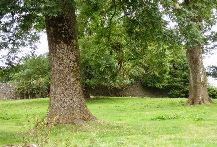
| Crosspatrick | The Ordnance Survey Name Books refer to the building of a house in 1832, the residence of James Knox who held the townland from Mary Boyd. At the time of Griffith's Valuation the house was occupied by William Kirkwood. Some floor tiles, which remain in the present farmyard at Crosspatrick, indicate the site of the house which no longer exists. |
|
| Croftonpark | ||
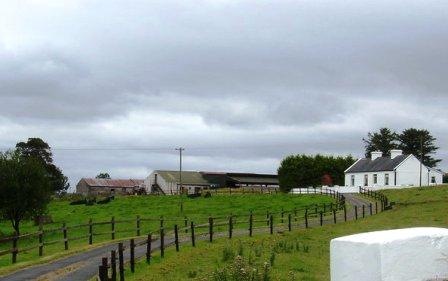
| Ballintober | At the time of Griffith's Valuation, this property was held in fee by Nicholas Handy and valued at £8. The house is no longer extant but it was positioned behind the present house, where the red corrugated roofed building now stands. |
|
| Rosserk | Captain Green resided here in the 1830s. At the time of Griffith's Valuation, Capt Augustus Bolton was occupying a property valued at £10. On the 25-inch Ordnance Survey map of the 1890s a different building, adjacent to a large corn mill and located at G243252, is labelled Rosserk House. Buildings are still extant at this site. | |
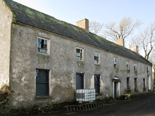
| Croftonpark | Described in the Ordnance Survey Name Books as a 'neat house', built in 1784 and occupied by Hugh Dane [Deane]. Robert Hunter lived there at the time of Griffith's Valuation and Patrick Ruane refers to the recent death of James Hunter, the owner of the house in the early 1990s. The house is still extant but no longer in use. |
|
| Farmhill | Built in 1780 this house became the principal seat of the Gardiner family. It was left by Harriet Gardiner to Susan Pringle who died in 1910. Farmhill then became the parochial house until the 1950s when it was demolished. Only the large walled garden now remains. | |
| Tonroe | Another Gardiner house in the parish of Rathreagh. At the time of the Ordnance Survey in the 1830s it was described as being in bad repair and occupied by a herd. P Ruane described the dilapidated state of the house in the mid 1990s but writes that the setting was very attractive. | |
| Courthill | The house was built in 1768. In 1786 Wilson refers to "Ranadyff" which may be this property, as a seat of Mr. Gardiner. At the time of Griffith's Valuation the occupier was Lacklin Chisholm. Frank Boland had a racing stable at Courthill in the 1940s and trained a horse named 'Lough Conn', who came second in the Aintree Grand National of 1947. |
|
| Springhill | Springhill was occupied by Francis Goodwin in 1814 and by Thomas Goodwin in 1837. By the time of Griffith's Valuation Bartholomew Donohoe was leasing the townland from the Palmer estate but the buildings were only valued at 10s. Springhill is labelled as "in ruins on the 25-inch map of the 1890s and there is no trace of it now. | |
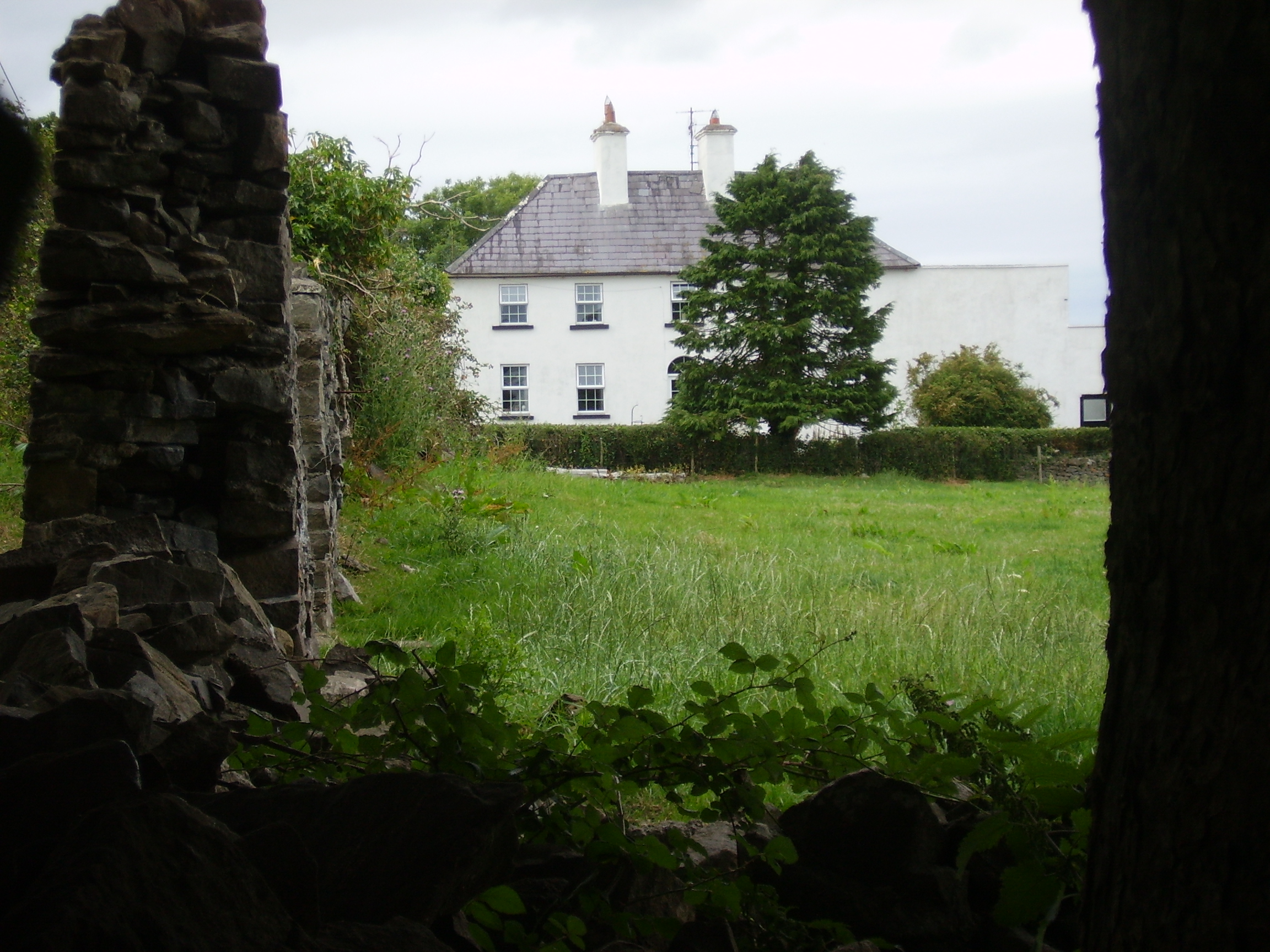
| Broadlands | The home of the Knox Gore family, let to Patrick C Howley in the 1830s. It was leased by John Knox, of the Rappa Castle family, at the time of Griffith's Valuation when the house was valued at £15 10s. . A house is still extant at this site. | |
| Bartragh House | A Kirkwood family home in the 19th century. At the time of Griffith's Valuation, the property was leased by William Hopper from the Kirkwood estate when the buildings were valued at £16. A house is still extant at the site though in a dilapidated state. |
|
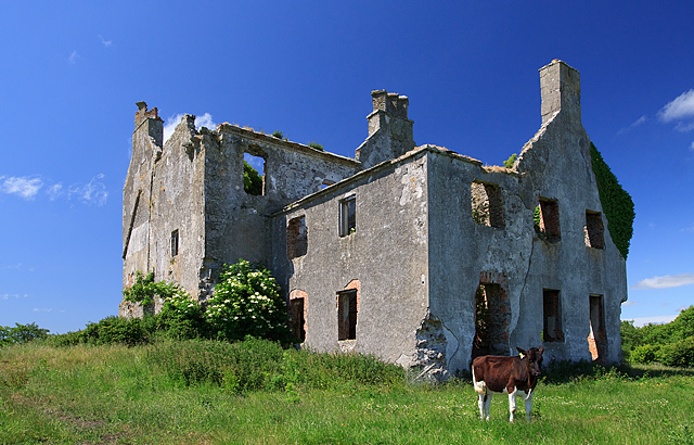
| Castlereagh | Described by Wilson in 1786 as "the fine seat of Mr. Knox" this house was badly damaged in 1798 and a new one subsequently built. There is a lithograph of the house included in the Encumbered Estates' Court sale rental. It was bought by Arthur E. Knox's brother Ernest Knox. In 1894 it was the residence of John V. Knox. The house has been demolished but portions of the walled garden remain. |
|
| Rappa Castle | An old Bourke castle, granted to a Cromwellian soldier named Crofton. It passed into Knox ownership through marriage and was the seat of this influential branch of the Knox family throughout the 18th and 19th centuries. In 1786 Wilson refers to it as "the pleasant seat of Mr. Knox". At the time of Griffith's Valuation it was held in fee by Annesley Knox and valued at £30. Slater notes it as the seat of Captain Annesley Knox in 1894. Occupied by the Knox family until the early 20th century, the house is now a ruin. |
|
| Palmerstown | In 1786 Wilson had noted Palmers Town as the seat of Mr. Palmer. The original Palmer house is marked "in ruins" on the first Ordnance Survey map of the late 1830s. The Irish Tourist Association File states that it was destroyed by fire when the French forces passed by in 1798. In the mid 19th century Henry A Knox, fifth son of Annesley G Knox of Rappa, leased the townland from Sir William Palmer. Knox lived in a house converted from part of the yard buildings of the original house before the mid 1850s. His descendants continue to live there today. |
|
| Netley House | The home of Henry William Knox, fourth son of Francis Knox of Rappa, occupied by Richard Burke at the time of Griffith's Valuation when the house was valued at £30.. The house is now a ruin. |
|
| Greenwoodpark | Built in 1814, the home of Major John Knox, sixth son of Francis Knox of Rappa and sold by his daughter Florence to her cousin, a Knox of Mount Falcon. The Armitages lived at Greenwoodpark in the 20th century but the house is now a ruin. |
|
| Knockglass House/Woodville | Also known as Knockglass House, this residence was situated close to the demesne of Greenwoodpark. At the time of Griffith's Valuation it was leased by John McDonnell from Major Knox when it was valued at £6. It is labelled Knockglass House on the 1st edition Ordnance Survey map but appears to be in ruins by the publication of the 25-inch edition map in the 1890s. | |
| Castle Lackan | Wilson refers to Castle Lackan as" the fine seat" of Sir R. Palmer in 1786. It was occupied by James Cuff, Lord Tyrawley, early in the 19th century and later by his daughter and son-in-law, Jane and Charles Knox. It was held in fee by Colonel Charles Knox at the time of Griffith's Valuation, when it was valued at £50. It is now a ruin. |
|
| Belleek Manor/Abbey | Built in 1831 in the Gothic style. The seat of Maj.-Gen Saunders Knox-Gire in 1894. It was sold in 1940 to the Beckett family who resold it to Mayo County Council. It became a santorium but now functions as the hotel known as Belleek Castle. |
|
| Moyne Abbey | Associated with the Lindsey family in the 17th century it was leased to the Knoxes by James O'Hara, Lord Tyrawley, for 999 years in 1741. The Knoxes built a private residence on to the east end of the friary. At various time the Jones, Palmer and Kirkwood families leased parts of Moyne. Thomas Jones sold his interest in the Landed Estates' Court in 1867. The Ordnance Survey Name Books record that Peter Nolan, agent to Sir William Palmer, lived in a neat cottage in the east of the townland. This may be the property labelled Moyne House on the 25-inch Ordnance Survey map of the 1890s (G228287), the remains of which are still extant. | |
| Belville | An Orme home in the first half of the 19th century. Described in 1942 by the Irish Tourist Association surveyor as a large house near the church at Ballyglass, formerly owned by the Orme family and "purchased some years ago by Mr MacDonald, Kilfian. It has remained unoccupied...", due to a popular belief among the local people that the house was haunted. It is no longer extant. | |
| Summerhill | An 18th century house, home of the Palmer family. Wilson refers to it as the seat of Thomas Palmer in 1786. Blake records that it was leased to John Bourke at the time of the 1798 rebellion. At the time of Griffith's Valuation, it was occupied by Thomas Palmer, leasing from Ernest Knox, and valued at £15. Later sold by the Palmers to the McCormack family who owned it until the 1920s. it is now a ruin. |
|
| Fahy | Built 1796, a former Paget home occupied by Ernest Knox of the Castlereagh family in the late 1830s. Lackland Chisholm was the tenant at Fahy in 1853. The original house is no longer extant. | |
| Ballybroony | An 18th century house, occupied by Fallon in the late 1770s and in 1786. The residence of the Perkins family from the early 19th century. It was held by Arthur Perkins from the Earl of Arran at the time of Griffith's Valuation when it was valued at £17. Lived in until the early 21st century and for sale in 2006. Restoration work was underway in 2010. |
|
| Lissadrone | Described at the time of the first Ordnance Survey as a plain building ornamented with a few trees and shrubs and held on a lease for ever. In the 1850s it was occupied by Matthew Flynn and is now a ruin. | |
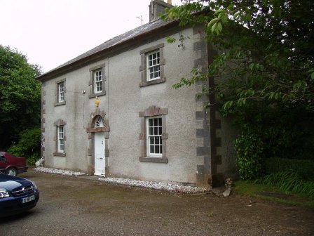
| Smithstown House | Ruane writes that the house was built by the Palmers and became a Royal Irish Constabulary barracks. It was the home of the Pugh family in the 1830s. The only building in the townland at the time of Griffith's Valuation, of more than £2 valuation, was the barracks. Sold in 1988 and now the home of Mrs Loretta Clarke Murray and family. |
|
| Carrowmore | An early 19th century Palmer house, the home of a member of the Palmer family from the late 18th century. Wilson refers to it as the seat of Mr. Palmer in 1786. In the 1850s it was occupied by Captain Arthur Wade and valued at £20. A McCormick home in the 20th century. A house still exists at the site. |
|
| Farragh | An 18th century house on the Palmer estate. Wilson refers to it as a residence of Mr. Palmer in 1786. Leased to the Waldrons in the early 19th century and occupied by Hector Sutherland at the time of Griffith's Valuation when the house was valued at almost £8. The original building is no longer extant. | |
| Orme's Lodge | Robert Orme was the owner of several properties in the village of Enniscrone, Carrowhubbuck South, barony of Tireragh, at the time of Griffith's Valuation. These properties had valuations of between £12 and £20. McTernan notes that one of these was Orme's Lodge which remained in the family until the 1930s. It subsequently became a hotel and was demolished in the 1990s to make way for new house building. |
|
| Rinroe House | Rinroe was leased from the Wingfield estate by John Boyd at the time of Griffith's Valuation, when it was valued at £8. It later became a residence of the Ormsby family, relatives of the Ormsbys of Glen, and remained in that family until the 1960s. Earlier, in 1786, Wilson refers to it as "Bunro, the seat of Mr. Leech". The house is still extant. | |
| Rathfranpark | In 1894 Slater refers to Rathfranpark as the residence of Edmund Knox. At the time of Griffith's Valuation this townland was part of the Palmer estate and leased by Thomas Scott. The house on the property at that time was valued at almost £2. There is still a house at this site. | |
| Rathowen | In 1786 Wilson refers to a house which he calls "Rathrone", a mile and a half West of Killala, which was part of the estate of the Bishop of Killala. At that time it was occupied by James Rogers, though Wilson indicates it was the property of Rev. G. Rogers, Chancellor of Dromore. Most of the townland was in the possession of William Kirkwood, leasing from Harriett Gardiner, at the time of Griffith's Valuation. The house is no longer extant. | |
| Carnisk | John Sproule was leasing this property from Sir James Stewart's estate at the time of Griffiths Valuation in the 1850s, when it was valued at £18. This appears to be the house labelled Carnisk on the 25-inch Ordnance Survey map of the early twentieth century. An earlier house, shown on the 1st edition Ordnance Survey map, was located nearby at C209209. A large farming complex exists at the Carnisk site now. |